
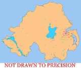
BT postal area
Encyclopedia
The BT postcode area, also known as the Belfast postcode area, covers Northern Ireland
and was the last part of the United Kingdom to be coded, between 1970 and 1974.
covers districts 1 to 17, 58 and part of 29. In common with all addresses in Northern Ireland, Belfast postcodes start with the letters BT, a mnemonic
of the capital city's name. The commercial centre
of the city is designated BT1 and the surrounding districts form a roughly sequential clockwise ring around the city. The postcode of the Royal Mail offices at Tomb Street in Belfast is BT1 1AA.
|-
! BT1
| BELFAST
| Belfast
, City Centre
|
|-
! BT2
| BELFAST
| Belfast, City Centre
|
|-
! BT3
| BELFAST
| Belfast
|
|-
! BT4
| BELFAST
| Belfast, Sydenham,Belmont, Stormont
|
|-
! BT5
| BELFAST
| Belfast, Castlereagh, Crossnacreevy, Gilnahirk, Knock, Braniel
(Part)
|
|-
! BT6
| BELFAST
| Belfast, Cregagh
, Knockbreda
|
|-
! BT7
| BELFAST
| Belfast, Ormeau
|
|-
! BT8
| BELFAST
| Belfast, Carryduff
, Knockbreda, Newtownbreda
|
|-
! BT9
| BELFAST
| Belfast, Malone
, Lisburn Road
, Taughmonagh
, Stranmillis
|
|-
! BT10
| BELFAST
| Belfast, Finaghy
|
|-
! BT11
| BELFAST
| Belfast, Andersonstown
|
|-
! BT12
| BELFAST
| Belfast, Falls Road, Sandy Row, The Village
|
|-
! BT13
| BELFAST
| Belfast, Shankill Road, Woodvale, Ballygomartin, Springmartin, Glencairn, Highfield
|
|-
! BT14
| BELFAST
| Belfast, Ballysillan, Upper Ballysillan
|
|-
! BT15
| BELFAST
| Belfast
|
|-
! BT16
| BELFAST
| Dundonald
|
|-
! BT17
| BELFAST
| Belfast, Derriaghy, Dunmurry
, Hannahstown
|
|-
! BT29
| BELFAST
| Belfast, Crumlin, Aldergrove
, Dundrod
, Glenavy
, Nutts Corner
|
|-
! BT58
| BELFAST
| Belfast
|
|-
! BT99
| BELFAST
| Belfast
|
|}
|-
! BT18
| HOLYWOOD
| Holywood
, Craigavad.
| North Down
|-
! BT19
| BANGOR
| Bangor
(outside Ring Road), Crawfordsburn
, Groomsport
, Helens Bay
| North Down, Ards
|-
! BT20
| BANGOR
| Bangor
(within Ring Road).
| North Down
|-
! BT21
| DONAGHADEE
| Donaghadee
| Ards
|-
! BT22
| NEWTOWNARDS
| Newtownards
, Ardkeen
, Ballyhalbert
, Ballywalter
, Carrowdore
, Cloughey, Greyabbey
, Kircubbin, Millisle
, Portaferry
, Portavogie
.
| Ards
|-
! BT23
| NEWTOWNARDS
| Newtownards
, Ballygowan
, Comber
, Conlig
, Killinchy, Moneyrea.
| Ards, Castlereagh, North Down
|-
! BT24
| BALLYNAHINCH
| Ballynahinch, Drumaness
, Saintfield
| Down, Lisburn
|-
! BT25
| DROMORE
| Dromore
, Dromara
, Finnis, Waringsford.
| Banbridge, Lisburn
|-
! BT26
| HILLSBOROUGH
| Hillsborough
, Annahilt, Culcavy.
| Lisburn
|-
! BT27
| LISBURN
| Lisburn
, Cargacreevy, Drumalig, Drumbo
, Hilden
, Hillhall
, Lambeg
.
| Lisburn
|-
! BT28
| LISBURN
| Lisburn
, Ballinderry Lower, Ballinderry Upper, Stoneyford
| Lisburn
|-
! BT29
| CRUMLIN
| Belfast (Airport), Crumlin, Aldergrove
, Dundrod
, Glenavy
, Nutts Corner
| Belfast
|-
! BT30
| DOWNPATRICK
| Downpatrick
, Ardglass
, Ballyhornan
, Ballykinler
, Castleward, Clough
, Crossgar
, Kilclief, Killard, Killough
, Killyleagh
, Loughinisland, Seaforde
, Strangford
, Toye
| Down
|-
! BT31
| CASTLEWELLAN
| Castlewellan
, Ballyward.
| Down, Banbridge
|-
! BT32
| BANBRIDGE
| Banbridge
, Annaclone
, Ballinaskeagh, Ballyroney, Corbet
, Katesbridge
, Lenaderg
, Loughbrickland, Seapatrick.
| Banbridge
|-
! BT33
| NEWCASTLE
| Newcastle
, Bryansford
, Dundrum
.
| Down
|-
! BT34
| NEWRY (South Down section)
| Newry
, Annalong
, Ballymartin
, Cabra
, Hilltown
, Kilcoo, Kilkeel
, Mayobridge
, Poyntzpass
, Rathfriland
, Rostrevor
, Warrenpoint
| Newry and Mourne
|-
! BT35
| NEWRY (South Armagh section)
| Jerrettspass, Bessbrook
, Camlough
, Crossmaglen
, Belleek, Newtownhamilton
| Newry and Mourne, Banbridge, Down
|-
! BT36
| NEWTOWNABBEY
| Newtownabbey
, Mossley
, Glengormley
| Newtownabbey
|-
! BT37
| NEWTOWNABBEY
| Newtownabbey
| Newtownabbey
|-
! BT38
| CARRICKFERGUS
| Carrickfergus
, Ballycarry
, Greenisland
, Kilroot
, Whitehead
.
| Carrickfergus
|-
! BT39
| BALLYCLARE
| Ballyclare
, Ballynure
, Doagh
, Parkgate
, Straid
, Templepatrick
.
| Newtownabbey, Antrim, Ballymena, Larne
|-
! BT40
| LARNE
| Larne
, Ballygally, Gleno
, Glynn
, Islandmagee
, Kilwaughter, Magheramorne
, Millbrook.
| Larne
|-
! BT41
| ANTRIM
| Antrim
, Dunadry
, Muckamore, Randalstown
, Toomebridge.
| Antrim
|-
! BT42
| BALLYMENA
| Broughshane
, Cullybackey, Galgorm, Kells.
| Ballymena
|-
! BT43
| BALLYMENA
| Cargan, Knockanully
| Ballymena
|-
! BT44
| BALLYMENA
| Portglenone
, Carnlough
, Glenarm
, Clogh Mills, Rasharkin
, Glenariff/Waterfoot, Cushendun, Cushendall
, Dunloy
, Loughguile
, Glarryford.
| Ballymena, Ballymoney, Magherafelt, Moyle, Larne
|-
! BT45
| MAGHERAFELT
| Magherafelt
, Ballyronan
, Bellaghy
, Castledawson
, Desertmartin
, Draperstown
, Knockloughrim, Moneymore
, Tobermore
, Fallalea, Fallaghloon((Lavey))
| Magherafelt, Cookstown
|-
! BT46
| MAGHERA
| Maghera, Lisnamuck, Swatragh
, Upperlands
| Magherafelt
|-
! BT47
| LONDONDERRY
| Derry
, Waterside, Claudy
, Feeny
, Dungiven
, Eglinton, Park, New Buildings.
| Derry
|-
! BT48
| LONDONDERRY
| Derry
, Cityside, Ballynagard, Coshquin, Rosemount, The Collon, Culmore.
| Derry
|-
! BT49
| LIMAVADY
| Limavady
, Ballykelly
| Limavady
|-
! BT51
| COLERAINE
| Coleraine
, Aghadowey
, Articlave
, Bellany, Blackhill, Castlerock
, Castleroe, Garvagh
, Kilrea
, Macosquin
, Ringsend
| Coleraine
|-
! BT52
| COLERAINE
| Coleraine
, Ballyvelton, Cloyfin
| Coleraine
|-
! BT53
| BALLYMONEY
| Ballymoney
, Dervock
, Armoy
, Ballybogy.
| Ballymoney, Moyle
|-
! BT54
| BALLYCASTLE
| Ballycastle
, Ballintoy
, Ballypatrick, Ballyvoy
, Cape Castle, Glenshesk
, Maghercashel, Maghernahar, Moyarget, Torr
, Rathlin Island
.
| Moyle
|-
! BT55
| PORTSTEWART
| Portstewart
| Coleraine
|-
! BT56
| PORTRUSH
| Portrush
, Craigahullier, Urbalreagh.
| Coleraine
|-
! BT57
| BUSHMILLS
| Bushmills
, Castlecatt, Dunseverick
, Portballintrae
| Moyle
|-
! BT60
| ARMAGH
| Killylea, Tynan, Belcoo, Middletown, Keady
, Darkley, Markethill
, Kingsmills
| Armagh, Newry & Mourne
|-
! BT61
| ARMAGH
| Armagh
, Collone, Hamiltonsbawn
, Kilmore
, Loughgall
, Richhill
.
| Armagh
|-
! BT62
| CRAIGAVON
| Craigavon
, Portadown
, Tandragee, Clare, Scotch Street.
| Craigavon, Armagh
|-
! BT63
| CRAIGAVON
| Gilford
, Laurencetown, Portadown
, Scarva
| Craigavon, Banbridge
|-
! BT64
| CRAIGAVON
| Craigavon
(West): Knockmenagh, Mandeville.
| Craigavon
|-
! BT65
| CRAIGAVON
| Craigavon (East): Drumgor, Legaghory, Tullygally, Brownlow.
| Craigavon
|-
! BT66
| CRAIGAVON
| Derryadd
, Derrytrasna
, Dollingstown
, Donaghcloney
, Lurgan
, Waringstown
| Craigavon
|-
! BT67
| CRAIGAVON
| Aghagallon
, Aghalee
, Gawley's Gate
, Lurgan
, Magheralin
, Moira
| Craigavon
|-
! BT68
| CALEDON
| Caledon
, Minterburn
| Dungannon and South Tyrone
|-
! BT69
| AUGHNACLOY
| Aughnacloy, Carnteel
| Dungannon and South Tyrone
|-
! BT70
| DUNGANNON
| Dungannon
, Ballygawley, Cappagh
, Castlecaulfield
, Donaghmore, Galbally
, Garvaghy, Pomeroy
, Rock
, Seskilgreen
| Dungannon and South Tyrone, Cookstown
|-
! BT71
| DUNGANNON
| Dungannon
, Benburb
, Blackwatertown
, Bush, Coalisland
, Killycolpy, Ardboe
, Moygashel
, Stewartstown
| Dungannon and South Tyrone, Cookstown
|-
! BT74
| ENNISKILLEN
| Enniskillen
town, Boho
| Fermanagh
|-
! BT75
| FIVEMILETOWN
| Fivemiletown
, Clabby
| Fermanagh
|-
! BT76
| CLOGHER
| Clogher
| Dungannon and South Tyrone
|-
! BT77
| AUGHER
| Augher
| Dungannon and South Tyrone
|-
! BT78
| OMAGH
| Omagh
, Dromore
, Drumquin
, Eskra
, Fintona
, Killynure, Newtownstewart
, Seskanore, Trillick
| Omagh
|-
! BT79
| OMAGH
| Omagh
, Drumlea, Glengawna, Gortin
, Mountfield
, Plumbridge
, Rosnamuck, Sheskinshule, Sixmilecross
| Omagh
|-
! BT80
| COOKSTOWN
| Cookstown
, Coagh
, Tullyhogue
| Cookstown
|-
! BT81
| CASTLEDERG
| Castlederg
, Aghyaran, Clare, Garvetagh
, Killen
, Killeter
, Mournebeg, Scraghey, Spamount
| Strabane
|-
! BT82
| STRABANE
| Strabane
, Artigarvan
, Ballymagorry
, Bready
, Clady
, Douglas Bridge
, Dunamanagh, Sion Mills
, Victoria Bridge
| Strabane
|-
! BT92
| ENNISKILLEN
| Lisnaskea
, Florencecourt
, Derrylin
, Newtownbutler
| Fermanagh
|-
! BT93
| ENNISKILLEN
| Belleek
, Belcoo
, Kesh
, Derrygonnelly
, Garrison
| Fermanagh
|-
! BT94
| ENNISKILLEN
| Irvinestown
, Ballinamallard, Brookeborough
, Tempo
, Maguiresbridge
, Lisbellaw
| Fermanagh
|}
Northern Ireland
Northern Ireland is one of the four countries of the United Kingdom. Situated in the north-east of the island of Ireland, it shares a border with the Republic of Ireland to the south and west...
and was the last part of the United Kingdom to be coded, between 1970 and 1974.
Belfast
Belfast had already been divided into numbered districts. Today, the Belfast post townPost town
A post town is a required part of all postal addresses in the United Kingdom, and a basic unit of the postal delivery system. Including the correct post town in the address increases the chances of a letter or parcel being delivered on time. Post towns are usually based upon the location of...
covers districts 1 to 17, 58 and part of 29. In common with all addresses in Northern Ireland, Belfast postcodes start with the letters BT, a mnemonic
Mnemonic
A mnemonic , or mnemonic device, is any learning technique that aids memory. To improve long term memory, mnemonic systems are used to make memorization easier. Commonly encountered mnemonics are often verbal, such as a very short poem or a special word used to help a person remember something,...
of the capital city's name. The commercial centre
Belfast City Centre
Belfast city centre is the central business district of Belfast, Northern Ireland.The city centre was originally centred around the Donegall Street area. Donegall Street is now mainly a business area, but with expanding residential and entertainment development as part of the Cathedral Quarter...
of the city is designated BT1 and the surrounding districts form a roughly sequential clockwise ring around the city. The postcode of the Royal Mail offices at Tomb Street in Belfast is BT1 1AA.
|-
! BT1
| BELFAST
| Belfast
Belfast
Belfast is the capital of and largest city in Northern Ireland. By population, it is the 14th biggest city in the United Kingdom and second biggest on the island of Ireland . It is the seat of the devolved government and legislative Northern Ireland Assembly...
, City Centre
|
|-
! BT2
| BELFAST
| Belfast, City Centre
|
|-
! BT3
| BELFAST
| Belfast
|
|-
! BT4
| BELFAST
| Belfast, Sydenham,Belmont, Stormont
|
|-
! BT5
| BELFAST
| Belfast, Castlereagh, Crossnacreevy, Gilnahirk, Knock, Braniel
Braniel
Braniel, is a large housing estate in East Belfast, Northern Ireland. Two small estates, Roddens and Glenview are located in the area, and are often referred to the Braniel. It is a predominantly Protestant area, with the majority of residents being loyalist or unionist...
(Part)
|
|-
! BT6
| BELFAST
| Belfast, Cregagh
Cregagh
Cregagh is an area southeast of Belfast in County Down, Northern Ireland. It is the name of a townland and has been adopted as the name of an electoral ward of the Borough of Castlereagh. The area is centred on the Cregagh Road. The Woodstock/Cregagh Road is a continuous arterial route in the...
, Knockbreda
|
|-
! BT7
| BELFAST
| Belfast, Ormeau
Ormeau Road
The Ormeau Road is a road in south Belfast, Northern Ireland. Ormeau Park is adjacent to it. It forms part of the A24.-History:Having previously been the home of George Chichester, 2nd Marquess of Donegall, a road was first built in 1815, when it was known more commonly as the New Ballynafeigh Road...
|
|-
! BT8
| BELFAST
| Belfast, Carryduff
Carryduff
Carryduff is a small town and townland in County Down, Northern Ireland, about south of Belfast city centre. It had a population of 6,595 people in the 2001 Census....
, Knockbreda, Newtownbreda
Newtownbreda
Newtownbreda is an electoral ward of the Borough of Castlereagh in Northern Ireland. At one time "Newtownbreda" referred to a small village to the south-east of Belfast. However, it is now part of the Greater Belfast conurbation and Newtownbreda now tends to refer to the wider area from Hydebank to...
|
|-
! BT9
| BELFAST
| Belfast, Malone
Malone Road
The Malone Road is a radial road in Belfast, Northern Ireland, leading from the university quarter southwards to the affluent suburbs of Malone and Upper Malone, each a separate electoral ward...
, Lisburn Road
Lisburn Road
The Lisburn Road is a main arterial road linking Belfast and Lisburn, in Northern Ireland.The Lisburn Road is now an extension of the "Golden Mile" with many shops, boutiques, wine bars, restaurants and coffee houses. The road runs almost parallel to the Malone Road, the two being joined by many...
, Taughmonagh
Taughmonagh
Taughmonagh is a small housing estate in South West Belfast, Northern Ireland, within the civil parishes of Drumbeg and Shankill, and barony of Belfast Upper. When the area was first built, the houses consisted of very basic, small, prefabricated aluminium bungalows. The area was regenerated and...
, Stranmillis
Stranmillis
Stranmillis is an area in south Belfast, Northern Ireland. It is also an electoral ward for Belfast City Council, part of the Laganbank district electoral area. As part of the Queen's Quarter, it is the location for prominent attractions such as the Ulster Museum and Botanic Gardens and is popular...
|
|-
! BT10
| BELFAST
| Belfast, Finaghy
Finaghy
Finaghy is an electoral ward in the Balmoral district of Belfast City Council, Northern Ireland. It is based on the townland of Ballyfinaghy...
|
|-
! BT11
| BELFAST
| Belfast, Andersonstown
Andersonstown
Andersonstown is a suburb of Belfast, Northern Ireland.It is overshadowed by the Black Mountain and Divis Mountain and contains a mixture of public and private housing. It is largely populated by the Irish nationalist and Roman Catholic community...
|
|-
! BT12
| BELFAST
| Belfast, Falls Road, Sandy Row, The Village
|
|-
! BT13
| BELFAST
| Belfast, Shankill Road, Woodvale, Ballygomartin, Springmartin, Glencairn, Highfield
|
|-
! BT14
| BELFAST
| Belfast, Ballysillan, Upper Ballysillan
|
|-
! BT15
| BELFAST
| Belfast
|
|-
! BT16
| BELFAST
| Dundonald
Dundonald
Dundonald is a large settlement in County Down, Northern Ireland. It lies east of Belfast and is often deemed to be a suburb of the city. It includes the large housing estate of Ballybeen, and many new housing estates have emerged in the past ten years....
|
|-
! BT17
| BELFAST
| Belfast, Derriaghy, Dunmurry
Dunmurry
Dunmurry is an urban townland, in County Antrim, Northern Ireland. Located between Belfast and Lisburn, it was once a rural village, but is now within the Greater Belfast conurbation...
, Hannahstown
|
|-
! BT29
| BELFAST
| Belfast, Crumlin, Aldergrove
Aldergrove, Northern Ireland
Aldergrove is a small village in County Antrim, Northern Ireland. It is within the townland of Seacash and parish of Killead – 6 miles south of Antrim and 18 miles west of Belfast. It is part of the Borough of Antrim....
, Dundrod
Dundrod
Dundrod is a small village and townland in County Antrim, Northern Ireland. In the 2001 Census it had a population of 63 people. It is within in the Lisburn City Council area.- Buildings :...
, Glenavy
Glenavy
Glenavy is a village in County Antrim, Northern Ireland, 17 kilometres north west of Lisburn on the banks of the Glenavy River. In the 2001 Census it had a population of 1,069 people. In early documents it was known as Lenavy.-Demographics:...
, Nutts Corner
|
|-
! BT58
| BELFAST
| Belfast
|
|-
! BT99
| BELFAST
| Belfast
|
|}
Rest of Northern Ireland
The remainder of Northern Ireland is divided into 43 other post towns which are further divided into postcode districts 18-57, 60-82 and 92-94. BT29 is a shared sector partially in the post towns of BELFAST (31 delivery points) and CRUMLIN (7,206 delivery points).|-
! BT18
| HOLYWOOD
| Holywood
Holywood
Holywood is a town in County Down, Northern Ireland. It lies on the shore of Belfast Lough, between Belfast and Bangor. Holywood Exchange and Belfast City Airport are nearby. The town hosts an annual jazz and blues festival.-Name:...
, Craigavad.
| North Down
|-
! BT19
| BANGOR
| Bangor
Bangor, County Down
Bangor is a large town in County Down, Northern Ireland. It is a seaside resort on the southern side of Belfast Lough and within the Belfast Metropolitan Area. Bangor Marina is one of the largest in Ireland, and holds Blue Flag status...
(outside Ring Road), Crawfordsburn
Crawfordsburn
Crawfordsburn is a small picturesque village in County Down, Northern Ireland. The village, which is now effectively a commuter suburb, lies between Holywood and Bangor to the north of the A2 road, about 4 km west of Bangor town centre. Bounded to the north and north east by Crawfordsburn...
, Groomsport
Groomsport
Groomsport is a village and townland two miles north east of Bangor in County Down, Northern Ireland. It is on the south shore of Belfast Lough and on the north coast of the Ards Peninsula...
, Helens Bay
| North Down, Ards
|-
! BT20
| BANGOR
| Bangor
Bangor, County Down
Bangor is a large town in County Down, Northern Ireland. It is a seaside resort on the southern side of Belfast Lough and within the Belfast Metropolitan Area. Bangor Marina is one of the largest in Ireland, and holds Blue Flag status...
(within Ring Road).
| North Down
|-
! BT21
| DONAGHADEE
| Donaghadee
Donaghadee
Donaghadee is a small town in County Down, Northern Ireland. It lies on the northeast coast of the Ards Peninsula, about east of Belfast and about six miles south east of Bangor. It had a population of 6,470 people in the 2001 Census...
| Ards
|-
! BT22
| NEWTOWNARDS
| Newtownards
Newtownards
Newtownards is a large town in County Down, Northern Ireland. It lies at the most northern tip of Strangford Lough, 10 miles east of Belfast, on the Ards Peninsula. Newtownards is the largest town in the Borough of Ards. According to the 2001 Census, it has a population of 27,821 people in...
, Ardkeen
Ardkeen
Ardkeen is an eastern suburb of Waterford, Ireland. It contains the Waterford Regional Hospital, and two large shopping centres, with various chain stores and some good restaurants, plus the Uluru Australian theme pub. It is close to some prestigious schools and has good access to the city centre,...
, Ballyhalbert
Ballyhalbert
Ballyhalbert is a small village and townland in County Down, Northern Ireland. It is on the east coast of the Ards Peninsula between Ballywalter and Portavogie. In the 2001 Census it had a population of 447 people...
, Ballywalter
Ballywalter
Ballywalter is a village and townland in County Down, Northern Ireland. It is on the east coast of the Ards Peninsula between Donaghadee and Ballyhalbert...
, Carrowdore
Carrowdore
Carrowdore is a small village on the Ards Peninsula in County Down, Northern Ireland. It lies within the Borough of Ards. In the 2001 Census it had a population of 816.- Education :...
, Cloughey, Greyabbey
Greyabbey
Greyabbey or Grey Abbey is a small village and townland located on the eastern shores of Strangford Lough, on the Ards Peninsula in County Down, Northern Ireland. It lies south of Newtownards. In the 2001 Census it had a population of 1,011 people...
, Kircubbin, Millisle
Millisle
Millisle or Mill Isle is a village on the Ards Peninsula in County Down, Northern Ireland. It is mostly within the townland of Ballymacruise, about south of Donaghadee. It had a population of 1,800 in the 2001 Census...
, Portaferry
Portaferry
Portaferry is a small town in County Down, Northern Ireland, at the southern end of the Ards Peninsula, near the Narrows at the entrance to Strangford Lough. It had a population of 2,467 people in the 2001 Census. It has an aquarium and is well-known for the annual Galway Hookers Regatta. It hosts...
, Portavogie
Portavogie
Portavogie is a village, townland and fishing port in County Down, Northern Ireland. It had a population of 1,594 people in the 2001 Census. It lies within the Borough of Ards and is the easternmost settlement in Ireland....
.
| Ards
|-
! BT23
| NEWTOWNARDS
| Newtownards
Newtownards
Newtownards is a large town in County Down, Northern Ireland. It lies at the most northern tip of Strangford Lough, 10 miles east of Belfast, on the Ards Peninsula. Newtownards is the largest town in the Borough of Ards. According to the 2001 Census, it has a population of 27,821 people in...
, Ballygowan
Ballygowan
Ballygowan is a village and townland in County Down, Northern Ireland. It is within the Borough of Ards. The town of Comber is a short distance to the north-east, the town of Saintfield to the south, and the city of Belfast a further distance to the north-west. It had a population of 2,671 people...
, Comber
Comber
Comber is a small town in County Down, Northern Ireland. It lies 5 miles south of Newtownards, at the northern end of Strangford Lough. It had a population of 8,933 people in the 2001 Census. Comber is part of the Borough of Ards...
, Conlig
Conlig
Conlig is a village and townland about halfway between Bangor and Newtownards in County Down, Northern Ireland.-Mining:The area includes extant ancient copper mines. Weapons forged with the copper from this mine have been found across Europe, and was traded for tin from Cornwall during the Bronze...
, Killinchy, Moneyrea.
| Ards, Castlereagh, North Down
|-
! BT24
| BALLYNAHINCH
| Ballynahinch, Drumaness
Drumaness
Drumaness is a village and townland in the Down District Council area of County Down, Northern Ireland. It is 5 kilometres south of Ballynahinch, beside the main A24 Belfast to Newcastle road. In the 2001 Census it had a population of 1,280 people.- Demography :The population of Drumaness on...
, Saintfield
Saintfield
Saintfield is a village in County Down, Northern Ireland, situated roughly halfway between Belfast and Downpatrick on the A7 road. It had a population of 2,959 people in the 2001 Census. The village proper is considered predominantly a middle or upper-middle class town and of both Catholic and...
| Down, Lisburn
|-
! BT25
| DROMORE
| Dromore
Dromore, County Down
Dromore is a small market town in the Banbridge District of County Down, Northern Ireland. It is south-west of Belfast, on the A1 Belfast – Dublin road. The 2001 Census recorded a population of 4,968 people....
, Dromara
Dromara
Dromara is a small village and townland in County Down, Northern Ireland. It lies to the southwest of Ballynahinch on the northern slopes of Slieve Croob, with the River Lagan flowing through it. In the 2001 Census it had a population of 597 people....
, Finnis, Waringsford.
| Banbridge, Lisburn
|-
! BT26
| HILLSBOROUGH
| Hillsborough
Hillsborough, County Down
Hillsborough is a village and townland in County Down, Northern Ireland, situated from the city of Belfast. It is within the Lisburn City Council area....
, Annahilt, Culcavy.
| Lisburn
|-
! BT27
| LISBURN
| Lisburn
Lisburn
DemographicsLisburn Urban Area is within Belfast Metropolitan Urban Area and is classified as a Large Town by the . On census day there were 71,465 people living in Lisburn...
, Cargacreevy, Drumalig, Drumbo
Drumbo
Drumbo is a small village and townland in County Antrim, Northern Ireland. It lies about south of Belfast city centre, east of Lisburn and west of Carryduff. The 2001 Census recorded the village's population as being 408....
, Hilden
Hilden
Hilden is a city in the German state of North Rhine-Westphalia. It is situated in the District of Mettmann, west of Solingen and east of Düsseldorf on the right side of the Rhine. It is a middle sized industrial town with a forest and numerous attractions....
, Hillhall
Hillhall
Hillhall is a townland and non-nucleated village in County Down, Northern Ireland, near Lisburn. In the 2001 Census it had a population of about one hundred people. It lies in the Lagan Valley Regional Park and the Lisburn City Council area...
, Lambeg
Lambeg, County Antrim
Lambeg is an urban townland in County Antrim, Northern Ireland. Located between Belfast and Lisburn, it was once a small rural village, but is now within the Greater Belfast conurbation. Lambeg is also an electoral ward of Lisburn Council...
.
| Lisburn
|-
! BT28
| LISBURN
| Lisburn
Lisburn
DemographicsLisburn Urban Area is within Belfast Metropolitan Urban Area and is classified as a Large Town by the . On census day there were 71,465 people living in Lisburn...
, Ballinderry Lower, Ballinderry Upper, Stoneyford
Stoneyford, County Antrim
Stoneyford is a small village in County Antrim, Northern Ireland. It is between Glenavy and Milltown, about 5 miles north of Lisburn. In the 2001 Census it had a population of 318 people. It is situated in the Lisburn City Council area...
| Lisburn
|-
! BT29
| CRUMLIN
| Belfast (Airport), Crumlin, Aldergrove
Aldergrove, Northern Ireland
Aldergrove is a small village in County Antrim, Northern Ireland. It is within the townland of Seacash and parish of Killead – 6 miles south of Antrim and 18 miles west of Belfast. It is part of the Borough of Antrim....
, Dundrod
Dundrod
Dundrod is a small village and townland in County Antrim, Northern Ireland. In the 2001 Census it had a population of 63 people. It is within in the Lisburn City Council area.- Buildings :...
, Glenavy
Glenavy
Glenavy is a village in County Antrim, Northern Ireland, 17 kilometres north west of Lisburn on the banks of the Glenavy River. In the 2001 Census it had a population of 1,069 people. In early documents it was known as Lenavy.-Demographics:...
, Nutts Corner
| Belfast
|-
! BT30
| DOWNPATRICK
| Downpatrick
Downpatrick
Downpatrick is a medium-sized town about 33 km south of Belfast in County Down, Northern Ireland. It is the county town of Down with a rich history and strong connection to Saint Patrick. It had a population of 10,316 at the 2001 Census...
, Ardglass
Ardglass
Ardglass is a coastal village in County Down, Northern Ireland and still a relatively important fishing harbour. It is situated on the B1 Ardglass to Downpatrick road, about 11 kilometres to the south east of Downpatrick, in the Lecale peninsula on the Irish Sea. It had a population of 1,668...
, Ballyhornan
Ballyhornan
Ballyhornan is a village and townland in eastern County Down, Northern Ireland, located along the coast of the Irish Sea. It is located less than 10 miles from Downpatrick, County Down, and it is near the site of the former RAF Bishopscourt installation...
, Ballykinler
Ballykinler
Ballykinler or Ballykinlar is a village in County Down, Northern Ireland. It lies 12 kilometres south west of Downpatrick, in the parish of Tyrella and Dundrum. In the 2001 Census it had a population of 348 people. It is within the Down District Council area.It is a linear settlement running...
, Castleward, Clough
Clough
Clough is a village and townland in County Down, Northern Ireland. It sits about 3 miles from Dundrum on the A2 road between Newcastle and Belfast. It had a population of 255 people in the 2001 Census...
, Crossgar
Crossgar
Crossgar is a village and townland in County Down, Northern Ireland. It is about 15 miles south of Belfast – between Saintfield and Downpatrick. Crossgar had a population of 1,539 people in the 2001 Census.- History :...
, Kilclief, Killard, Killough
Killough
Killough is a village and townland in County Down, Northern Ireland. It lies on the Irish Sea shore near Ardglass, five miles southeast of Downpatrick. It is notable for its sycamore-lined main street. In the 2001 Census it had a population of 845 people....
, Killyleagh
Killyleagh
Killyleagh is a village in County Down, Northern Ireland. It is on the A22 road from Downpatrick, on the western side of Strangford Lough. It had a population of 2,483 people in the 2001 Census. It is best known for its 12th century Killyleagh Castle...
, Loughinisland, Seaforde
Seaforde
Seaforde is a small village in County Down, Northern Ireland. It is within the townland of Naghan, one mile north of Clough on the main Ballynahinch to Newcastle road. It is part of the Down District Council area....
, Strangford
Strangford
Strangford is a small village at the mouth of Strangford Lough in County Down, Northern Ireland. It had a population of 475 people at the 2001 Census.On the other side of the lough is Portaferry and there is a ferry service between the two villages...
, Toye
| Down
|-
! BT31
| CASTLEWELLAN
| Castlewellan
Castlewellan
Castlewellan is a village in County Down, Northern Ireland. It is beside Castlewellan Lake and Slievenaslat mountain, southwest of Downpatrick. It lies between the Mourne Mountains and Slieve Croob. It had a population of 2,392 people in the 2001 Census....
, Ballyward.
| Down, Banbridge
|-
! BT32
| BANBRIDGE
| Banbridge
Banbridge
Banbridge is a town in County Down, Northern Ireland. It lies on the River Bann and the A1 road. It was named after a bridge built over the Bann in 1712. The town grew as a coaching stop on the road from Belfast to Dublin and thrived from Irish linen manufacturing...
, Annaclone
Annaclone
Annaclone is a hamlet and parish between Rathfriland and Banbridge in south County Down, Northern Ireland. It was the birthplace of Patrick Bronte, father to the famous Bronte novelists, which has led to the area of southern Annaclone becoming known as 'The Bronte Homeland'...
, Ballinaskeagh, Ballyroney, Corbet
Corbet
Corbet is a small village and townland in County Down, Northern Ireland, near Banbridge. In the 2001 Census it had a population of 95 people. It lies within the Banbridge District....
, Katesbridge
Katesbridge
Katesbridge is a small hamlet in County Down, Northern Ireland. It is within the townland of Shannaghan, just off the main route from Castlewellan to Banbridge, and 7km north of Rathfriland. The River Bann flows by the hamlet. In the 2001 Census it had a population of 135 people...
, Lenaderg
Lenaderg
Lenaderg is a townland in County Down, Northern Ireland. It sits on the banks of the River Bann, about two miles from Banbridge and a half mile from the village of Lawrencetown. In the 2001 Census it had a population of 261 people. Lenaderg is within the District of Banbridge.Its name is derived...
, Loughbrickland, Seapatrick.
| Banbridge
|-
! BT33
| NEWCASTLE
| Newcastle
Newcastle, County Down
Newcastle is a small town in County Down, Northern Ireland. It had a population of 7,444 people recorded in the 2001 Census. The seaside resort lies on the Irish Sea coast at the base of Slieve Donard, one of the Mourne Mountains, and is known for its sandy beach and the Royal County Down Golf Club...
, Bryansford
Bryansford
Bryansford is a small village in County Down, Northern Ireland. It sits at the northern side of Tollymore Forest Park, roughly halfway between the towns of Newcastle and Castlewellan. The village is within the townlands of Ballyhafry and Aghacullion...
, Dundrum
Dundrum, County Down
Dundrum is a village and townland in County Down, Northern Ireland. It is beside Dundrum Bay, about 4 miles outside Newcastle on the A2 road. The town is best known for its ruined Norman castle. It had a population of 1,065 people in the 2001 Census....
.
| Down
|-
! BT34
| NEWRY (South Down section)
| Newry
Newry
Newry is a city in Northern Ireland. The River Clanrye, which runs through the city, formed the historic border between County Armagh and County Down. It is from Belfast and from Dublin. Newry had a population of 27,433 at the 2001 Census, while Newry and Mourne Council Area had a population...
, Annalong
Annalong
Annalong is a seaside village in County Down, Northern Ireland at the foot of the Mourne Mountains. It had a population of 1,778 people at the 2001 Census and lies within the Newry and Mourne District Council area. The village was once engaged in exporting dressed granite and is now a fishing and...
, Ballymartin
Ballymartin
Ballymartin is a small village and townland in County Down, Northern Ireland. In the 2001 Census it had a population of 414 people. It lies within the Newry and Mourne District Council area.Ballymartin is also a townsland in Borris Parish, County Carlow....
, Cabra
Cabra, County Down
Cabra is a village in County Down, Northern Ireland. It is in the parish of Clonduff and is situated approximately two miles from Hilltown and Rathfriland. Cabra is a small settlement with approximately 200 occupants. It has two churchs and one primary school....
, Hilltown
Hilltown, County Down
Hilltown is a small village within the townland of Carcullion in County Down, Northern Ireland. Hilltown is the main village of the parish of Clonduff which also contains rural areas and another village named Cabra...
, Kilcoo, Kilkeel
Kilkeel
Kilkeel is a small town in County Down, Northern Ireland. It is the main fishing port on the Down coast, and its harbour houses one of the largest fishing fleets in Ireland. It had a population of 6,338 people according to the 2001 Census...
, Mayobridge
Mayobridge
Mayobridge is an area within Newry, County Down, Northern Ireland. It is located within the Newry and Mourne District Council area. It had a population of 842 people in the 2001 Census.-People :...
, Poyntzpass
Poyntzpass
Poyntzpass is a village on the border between County Armagh and County Down in Northern Ireland. It is within the Armagh City and District Council area. In the 2001 census it had a population of 1987 people....
, Rathfriland
Rathfriland
Rathfriland is a village in County Down, Northern Ireland. It is a hilltop Plantation of Ulster settlement between the Mourne Mountains, Slieve Croob and Banbridge. It had a population of 2,079 people in the 2001 Census.-History:...
, Rostrevor
Rostrevor
Rostrevor is a village in County Down, Northern Ireland. It is within the Newry and Mourne District Council area. It lies at the foot of Slieve Martin on the coast of Carlingford Lough. The Kilbroney River flows through the village....
, Warrenpoint
Warrenpoint
Warrenpoint is a small town in County Down, Northern Ireland. It lies on the northern shore of Carlingford Lough and is separated from the Republic of Ireland by a narrow strait. The town sprang up within the townland of Ringmackilroy...
| Newry and Mourne
|-
! BT35
| NEWRY (South Armagh section)
| Jerrettspass, Bessbrook
Bessbrook
Bessbrook is a village in County Armagh, Northern Ireland. It lies about three miles northwest of Newry and close to the main Dublin–Belfast road and rail line...
, Camlough
Camlough
Camlough or Camloch is a small village in County Armagh, Northern Ireland. It is near Bessbrook and the slopes of the Ring of Gullion. It had a population of 910 people in the 2001 Census.- 1920s :...
, Crossmaglen
Crossmaglen
Crossmaglen or Crosmaglen is a village and townland in south County Armagh, Northern Ireland. It had a population of 1,459 people in the 2001 Census and is the largest village in south Armagh...
, Belleek, Newtownhamilton
Newtownhamilton
Newtownhamilton is a small village in County Armagh, Northern Ireland. It is within the townland of Tullyvallan and the barony of Upper Fews. It is part of the Newry and Mourne District Council area...
| Newry and Mourne, Banbridge, Down
|-
! BT36
| NEWTOWNABBEY
| Newtownabbey
Newtownabbey
Newtownabbey is a large town north of Belfast in County Antrim, Northern Ireland. Sometimes considered to be a suburb of Belfast, it is separated from the rest of the city by Cavehill and Fortwilliam golf course...
, Mossley
Mossley
Mossley is a small town and civil parish within the Metropolitan Borough of Tameside, in Greater Manchester, England. The town is located in the upper section of the Tame valley in the foothills of the Pennines, northeast of Ashton-under-Lyne and east of Manchester.Mossley has the distinction of...
, Glengormley
| Newtownabbey
|-
! BT37
| NEWTOWNABBEY
| Newtownabbey
Newtownabbey
Newtownabbey is a large town north of Belfast in County Antrim, Northern Ireland. Sometimes considered to be a suburb of Belfast, it is separated from the rest of the city by Cavehill and Fortwilliam golf course...
| Newtownabbey
|-
! BT38
| CARRICKFERGUS
| Carrickfergus
Carrickfergus
Carrickfergus , known locally and colloquially as "Carrick", is a large town in County Antrim, Northern Ireland. It is located on the north shore of Belfast Lough, from Belfast. The town had a population of 27,201 at the 2001 Census and takes its name from Fergus Mór mac Eirc, the 6th century king...
, Ballycarry
Ballycarry
Ballycarry is a village in County Antrim, Northern Ireland. It is midway between Larne and Carrickfergus, overlooking Islandmagee. In the 2001 Census it had a population of 981.-Archaeology:...
, Greenisland
Greenisland
Greenisland is a village in County Antrim, Northern Ireland. It lies 7 miles north-east of Belfast and 3 miles south-west of Carrickfergus. The village is on the coast of Belfast Lough and is named after a tiny islet to the west, the Green Island....
, Kilroot
Kilroot
Kilroot is a townland in County Antrim, Northern Ireland. It lies to the east of Eden, on the outskirts of Carrickfergus on the northern shore of Belfast Lough. It is within the Carrickfergus Borough Council area.-History:...
, Whitehead
Whitehead, County Antrim
Whitehead is a small seaside town on the east coast of County Antrim, Northern Ireland, lying almost midway between the towns of Carrickfergus and Larne. It lies within the civil parishes of Island Magee and Templecorran, the barony of Belfast Lower, and is part of Carrickfergus Borough Council...
.
| Carrickfergus
|-
! BT39
| BALLYCLARE
| Ballyclare
Ballyclare
Ballyclare is a small town in County Antrim, Northern Ireland. It had a population of 8,770 people in the 2001 Census...
, Ballynure
Ballynure
Ballynure is a village near Ballyclare in County Antrim, Northern Ireland. It had a population of 677 people in the 2001 Census.The village is effectively split in two by the A8 main road, which runs from Belfast to Larne. A stream called the Ballynure Water runs through it and the houses are a...
, Doagh
Doagh
Doagh is a village and townland in County Antrim, Northern Ireland. It is in the Six Mile Water Valley about two miles southwest of Ballyclare. It had a population of 1,130 people in the 2001 Census....
, Parkgate
Parkgate, County Antrim
Parkgate is a small village in County Antrim, Northern Ireland. It lies at the foot of Donegore Hill, near the Six Mile Water. It is about mid-way between Ballyclare and Antrim town. It had a population of 646 people in the 2001 Census...
, Straid
Straid
Straid is a small village in County Antrim, Northern Ireland, about 5 km east of Ballyclare, and about 9 km inland from Carrickfergus. It lies within the Newtownabbey Borough Council area. It used to be described as falling within the barony of Belfast, the local townland is "Straidlands"...
, Templepatrick
Templepatrick
Templepatrick is a village in County Antrim, Northern Ireland. It is northwest of Belfast, and halfway between the towns of Ballyclare and Antrim. It had a population of 1,556 in the 2001 Census. It is also close to Belfast International Airport and the village has several hotels...
.
| Newtownabbey, Antrim, Ballymena, Larne
|-
! BT40
| LARNE
| Larne
Larne
Larne is a substantial seaport and industrial market town on the east coast of County Antrim, Northern Ireland with a population of 18,228 people in the 2001 Census. As of 2011, there are about 31,000 residents in the greater Larne area. It has been used as a seaport for over 1,000 years, and is...
, Ballygally, Gleno
Gleno
Gleno is a city in East Timor, to the southwest of Dili, the national capital. It is in the suco of Riheu . Gleno has a population of 8,133...
, Glynn
Glynn
Glynn is a small village in the Larne Borough Council area of County Antrim, Northern Ireland. It lies a short distance south of Larne, on the shore of Larne Lough. Glynn had a population of 641 people in the 2001 Census.-History:...
, Islandmagee
Islandmagee
Islandmagee is a peninsula on the east coast of County Antrim, Northern Ireland, located between the towns of Larne and Carrickfergus. It is part of the Larne Borough Council area and is a sparsely populated rural community with a long history since the mesolithic period.As part of an...
, Kilwaughter, Magheramorne
Magheramorne
Magheramorne is a hamlet in County Antrim, Northern Ireland. It is about 5 miles south of Larne on the shores of Larne Lough. It had a population of 75 people in the 2001 Census. It is within the Larne Borough Council area....
, Millbrook.
| Larne
|-
! BT41
| ANTRIM
| Antrim
Antrim, County Antrim
Antrim is a town in County Antrim in the northeast of Northern Ireland, on the banks of the Six Mile Water, half a mile north-east of Lough Neagh. It had a population of 20,001 people in the 2001 Census. The town is the administrative centre of Antrim Borough Council...
, Dunadry
Dunadry
Dunadry is a small village and townland near Antrim in County Antrim, Northern Ireland. It had a population of 237 people in the 2001 Census. It is within the Borough of Antrim.-References:*...
, Muckamore, Randalstown
Randalstown
Randalstown is a small town in County Antrim, Northern Ireland, located between the towns of Antrim and Toome. It had a population of 4,956 people in the 2001 Census. It has a very prominent disused railway viaduct and lies beside Lough Neagh and the Shane's Castle estate...
, Toomebridge.
| Antrim
|-
! BT42
| BALLYMENA
| Broughshane
Broughshane
Broughshane is a village within the Borough of Ballymena in County Antrim, Northern Ireland. It is northeast of Ballymena and north of Antrim, on the A42 road. It had a population of 2,364 at the 2001 Census....
, Cullybackey, Galgorm, Kells.
| Ballymena
|-
! BT43
| BALLYMENA
| Cargan, Knockanully
| Ballymena
|-
! BT44
| BALLYMENA
| Portglenone
Portglenone
Portglenone is a village in County Antrim, Northern Ireland. It lies 8.5 miles west of Ballymena. It had a population of 2,900 in the 2001 Census...
, Carnlough
Carnlough
Carnlough is a village in County Antrim, Northern Ireland. It has a picturesque harbour on the shores of Carnlough Bay. Carnlough is situated on the Coast Road beside the North Channel and at the foot of Glencloy, the second of the nine Glens of Antrim...
, Glenarm
Glenarm
Glenarm is a village in County Antrim, Northern Ireland. It lies on the North Channel coast north of the town of Larne and the village of Ballygalley, and south of the village of Carnlough. It had a population of 582 people in the 2001 Census. Glenarm takes it name from the glen in which it lies,...
, Clogh Mills, Rasharkin
Rasharkin
Rasharkin , is a small village and townland in County Antrim, Northern Ireland. It is south of Ballymoney, near Dunloy and Kilrea. It had a population of 864 people in the 2001 Census, after 30 years of gradual decline from a peak of 1,000 in 1971.-History:...
, Glenariff/Waterfoot, Cushendun, Cushendall
Cushendall
Cushendall and formerly known as Newtown Glens is a village and townland in County Antrim, Northern Ireland.It is on the A2 coast road between Glenariff and Cushendun, in the Antrim Coast and Glens Area of Outstanding Natural Beauty...
, Dunloy
Dunloy
Dunloy is a village and townland in the Borough of Ballymoney, County Antrim, Northern Ireland. It is between Ballymena and Ballymoney . It had a population of 1,071 people in the 2001 Census, a gain of 21 % since 1991.Dunloy's most striking building is the modern Roman Catholic church...
, Loughguile
Loughguile
Loughguile, also spelt Loughgiel or Loughgeel , is a small village in County Antrim, Northern Ireland. It is 13 km east of Ballymoney, at the edge of the Glens of Antrim...
, Glarryford.
| Ballymena, Ballymoney, Magherafelt, Moyle, Larne
|-
! BT45
| MAGHERAFELT
| Magherafelt
Magherafelt
Magherafelt is a small town in County Londonderry, Northern Ireland. It had a population of 8,372 people recorded in the 2001 Census. It is the biggest town in the south of County Londonderry and is the social, economic and political hub of the area...
, Ballyronan
Ballyronan
Ballyronan is a village and townland in County Londonderry, Northern Ireland, on the shores of Lough Neagh. The village is from Magherafelt and from Cookstown, and is within the Cookstown District close to its border with Magherafelt District.-History:...
, Bellaghy
Bellaghy
Bellaghy , is a village in County Londonderry, Northern Ireland. It lies north west of Lough Neagh and about 5 miles north of Magherafelt. At the centre of the village lies the junction of three main roads leading to Magherafelt, Portglenone and Toome. It had a population of 1,063 people in the...
, Castledawson
Castledawson
Castledawson is a village in County Londonderry, Northern Ireland. It is mostly within the townland of Shanemullagh , about four miles from the north-western shore of Lough Neagh, and close to the market town of Magherafelt...
, Desertmartin
Desertmartin
Desertmartin is a small village in County Londonderry, Northern Ireland. It is four miles from Magherafelt, at the foot of Slieve Gallion. In the 2001 Census Desertmartin greater area had a population of 1,276. It had a population of 2257 in 1837 and 3101 in 1910. It lies within Desertmartin...
, Draperstown
Draperstown
Draperstown is a village in the Sperrin Mountains of County Londonderry, Northern Ireland. It had a population of 1,638 people in the 2001 Census.-Name:...
, Knockloughrim, Moneymore
Moneymore
Moneymore is a village in County Londonderry, Northern Ireland. It had a population of 1,369 in the 2001 Census.It is an example of a Plantation village in Mid-Ulster. It was the first town in Ulster to have piped water.-Geography:...
, Tobermore
Tobermore
Tobermore is a small village in County Londonderry, Northern Ireland. It is located two and a half miles south of Maghera and five miles west of Magherafelt. Tobermore lies within the civil parish of Kilcronaghan and is part of Magherafelt District Council...
, Fallalea, Fallaghloon((Lavey))
| Magherafelt, Cookstown
|-
! BT46
| MAGHERA
| Maghera, Lisnamuck, Swatragh
Swatragh
Swatragh is a small village and townland in County Londonderry, Northern Ireland. Swatragh is on the main A29 road north of Maghera. The population was 435 in the 2001 Census....
, Upperlands
| Magherafelt
|-
! BT47
| LONDONDERRY
| Derry
Derry
Derry or Londonderry is the second-biggest city in Northern Ireland and the fourth-biggest city on the island of Ireland. The name Derry is an anglicisation of the Irish name Doire or Doire Cholmcille meaning "oak-wood of Colmcille"...
, Waterside, Claudy
Claudy
Claudy is a village in County Londonderry, Northern Ireland. It lies southeast of Derry, where the River Glenrandal joins the River Faughan. Claudy is located in the Faughan Valley....
, Feeny
Feeny
Feeny is a village and townland in County Londonderry, Northern Ireland. It is between Dungiven and Claudy. In the 2001 Census it had a population of 542. Feeny lies just inside the boundary of the Sperrins Area of Outstanding Natural Beauty.-Features:...
, Dungiven
Dungiven
Dungiven is a small town and townland in County Londonderry, Northern Ireland. It is on the main A6 Belfast to Derry road. It lies where the rivers Roe, Owenreagh and Owenbeg meet at the foot of the Benbradagh. Nearby is the Glenshane Pass, where the road rises to over...
, Eglinton, Park, New Buildings.
| Derry
|-
! BT48
| LONDONDERRY
| Derry
Derry
Derry or Londonderry is the second-biggest city in Northern Ireland and the fourth-biggest city on the island of Ireland. The name Derry is an anglicisation of the Irish name Doire or Doire Cholmcille meaning "oak-wood of Colmcille"...
, Cityside, Ballynagard, Coshquin, Rosemount, The Collon, Culmore.
| Derry
|-
! BT49
| LIMAVADY
| Limavady
Limavady
Limavady is a market town in County Londonderry, Northern Ireland, with Binevenagh as a backdrop. It lies east of Derry and south west of Coleraine. It had a population of 12,135 people in the 2001 Census, an increase of some 17% compared to 1991...
, Ballykelly
| Limavady
|-
! BT51
| COLERAINE
| Coleraine
Coleraine
Coleraine is a large town near the mouth of the River Bann in County Londonderry, Northern Ireland. It is northwest of Belfast and east of Derry, both of which are linked by major roads and railway connections...
, Aghadowey
Aghadowey
Aghadowey is a village and townland in east County Londonderry, Northern Ireland. It lies in Aghadowey civil parish, and is part of Coleraine Borough Council...
, Articlave
Articlave
Articlave is a village and townland in County Londonderry, Northern Ireland. It is on the main A2 coastal road, 7 kilometres west of Coleraine. It is a growing residential area and includes a range of commercial, social and community facilities. Its population grew by a third to 800 in the period...
, Bellany, Blackhill, Castlerock
Castlerock
Castlerock is a seaside village in County Londonderry, Northern Ireland. It is situated between Coleraine and Derry and is very popular with summer tourists, having numerous apartment blocks and three caravan sites. Castlerock Golf Club has both 9 and 18-hole links courses bounded by the beach, the...
, Castleroe, Garvagh
Garvagh
Garvagh is a village in County Londonderry, Northern Ireland. It is on the banks of the Agivey River, south of Coleraine on the A29 route. In the 2001 Census it had a population of 1,288.-History:...
, Kilrea
Kilrea
Kilrea is a village and townland in County Londonderry, Northern Ireland. It is near the River Bann, which marks the boundary between County Londonderry and County Antrim...
, Macosquin
Macosquin
Macosquin is a small village and townland in County Londonderry, Northern Ireland. It is south-west of Coleraine, on the road to Limavady. In the 2001 Census it had a population of 596 people...
, Ringsend
Ringsend
Ringsend is a southside inner suburb of Dublin, the capital of Ireland. It is located on the south bank of the River Liffey, about two kilometres east of the city centre, and is the southern terminus of the East Link Toll Bridge....
| Coleraine
|-
! BT52
| COLERAINE
| Coleraine
Coleraine
Coleraine is a large town near the mouth of the River Bann in County Londonderry, Northern Ireland. It is northwest of Belfast and east of Derry, both of which are linked by major roads and railway connections...
, Ballyvelton, Cloyfin
| Coleraine
|-
! BT53
| BALLYMONEY
| Ballymoney
Ballymoney
Ballymoney is a small town in County Antrim, Northern Ireland. It had a population of 9,021 people in the 2001 Census. It is currently served by Ballymoney Borough Council....
, Dervock
Dervock
Dervock is a small village and townland in County Antrim, Northern Ireland. It is about 6km northeast of Ballymoney, on the banks of the Dervock River.-Features:...
, Armoy
Armoy
Armoy is a small village in County Antrim, Northern Ireland. It is 9 km southwest of Ballycastle and 13 km northeast of Ballymoney. In the 2001 Census it had a population of 414 people. The village is on the River Bush between two of the nine Glens of Antrim; Glenshesk and Glentaisie...
, Ballybogy.
| Ballymoney, Moyle
|-
! BT54
| BALLYCASTLE
| Ballycastle
Ballycastle, County Antrim
Ballycastle is a small town in County Antrim in Northern Ireland. Its population was 5,089 people in the 2001 Census. It is the seat and main settlement of Moyle District Council....
, Ballintoy
Ballintoy
Ballintoy is a small village in County Antrim, Northern Ireland. It is located alongside the B15 coast road, north-east of Coleraine, west of Ballycastle and between it and Bushmills...
, Ballypatrick, Ballyvoy
Ballyvoy
Ballyvoy is a small village and townland in County Antrim, Northern Ireland. It is on the main A2 coast road 5 km east of Ballycastle and 17 km north west of Cushendall. In the 2001 Census it had a population of 72 people...
, Cape Castle, Glenshesk
Glenshesk
Glenshesk is one of the nine Glens of Antrim in County Antrim, Northern Ireland. It was shaped during the Ice Age by glaciers. The glen lies on the eastern side of Knocklayde mountain and flows out to the sea at Ballycastle....
, Maghercashel, Maghernahar, Moyarget, Torr
Torr
The torr is a non-SI unit of pressure with the ratio of 760 to 1 standard atmosphere, chosen to be roughly equal to the fluid pressure exerted by a millimetre of mercury, i.e., a pressure of 1 torr is approximately equal to 1 mmHg...
, Rathlin Island
Rathlin Island
Rathlin Island is an island off the coast of County Antrim, and is the northernmost point of Northern Ireland. Rathlin is the only inhabited offshore island in Northern Ireland, with a rising population of now just over 100 people, and is the most northerly inhabited island off the Irish coast...
.
| Moyle
|-
! BT55
| PORTSTEWART
| Portstewart
Portstewart
Portstewart is a small town in County Londonderry, Northern Ireland. It had a population of 7,803 people in the 2001 Census. It is a seaside resort neighbouring Portrush. Of the two towns, Portstewart is decidedly quieter with more sedate attractions. Its harbour and scenic coastal paths form an...
| Coleraine
|-
! BT56
| PORTRUSH
| Portrush
Portrush
Portrush is a small seaside resort town in County Antrim, Northern Ireland, on the County Londonderry border. The main part of the old town, including the railway station as well as most hotels, restaurants and bars, is built on a mile–long peninsula, Ramore Head, pointing north-northwest....
, Craigahullier, Urbalreagh.
| Coleraine
|-
! BT57
| BUSHMILLS
| Bushmills
Bushmills
Bushmills is a village on the north coast of County Antrim, Northern Ireland. Bushmills had 1,319 inhabitants in the 2001 Census. It is located 95 km from Belfast, 10 km from Ballycastle and 15 km from Coleraine...
, Castlecatt, Dunseverick
Dunseverick
Dunseverick is a hamlet and townland near the Giant's Causeway in County Antrim, Northern Ireland. It is most notable for Dunseverick Castle.-External links:****...
, Portballintrae
Portballintrae
Portballintrae is a small seaside village in County Antrim, Northern Ireland. It is four miles east of Portrush and two miles west of the Giant's Causeway. In the 2001 Census it had a population of 734 people, a decline of 10% compared to 1991...
| Moyle
|-
! BT60
| ARMAGH
| Killylea, Tynan, Belcoo, Middletown, Keady
Keady
Keady is a town in County Armagh, Northern Ireland. It is situated south of Armagh city and very close to the border with the Republic of Ireland. The town had a population of 2,960 people in the 2001 Census....
, Darkley, Markethill
Markethill
Markethill is a village in County Armagh, Northern Ireland. In the 2001 Census it had a population of 1,292 people. It sits at the southern side of Gosford Forest Park...
, Kingsmills
| Armagh, Newry & Mourne
|-
! BT61
| ARMAGH
| Armagh
Armagh
Armagh is a large settlement in Northern Ireland, and the county town of County Armagh. It is a site of historical importance for both Celtic paganism and Christianity and is the seat, for both the Roman Catholic Church and the Church of Ireland, of the Archbishop of Armagh...
, Collone, Hamiltonsbawn
Hamiltonsbawn
Hamiltonsbawn or Hamilton's Bawn is a small village in County Armagh, Northern Ireland, five miles east of Armagh. It lies within the Parish of Mullabrack and the Armagh City and District Council area.- History :...
, Kilmore
Kilmore, County Armagh
Kilmore or Killmore is a small village and townland in County Armagh, Northern Ireland. It lies 2.5 miles north of Richhill and within the Armagh City and District Council area. In the 2001 Census it had a population of 111 people....
, Loughgall
Loughgall
Loughgall is a small village and townland in County Armagh, Northern Ireland. In the 2001 Census it had a population of 285 people.Loughgall was named after a small nearby loch. The village is at the heart of the apple-growing industry and is surrounded by orchards. Along the village's main street...
, Richhill
Richhill, County Armagh
Richhill is a large village in County Armagh, Northern Ireland. It is in the townland of Legacorry , roughly halfway between Armagh and Portadown...
.
| Armagh
|-
! BT62
| CRAIGAVON
| Craigavon
Craigavon
Craigavon is a settlement in north County Armagh, Northern Ireland. It was a planned settlement that was begun in 1965 and named after Northern Ireland's first Prime Minister — James Craig, 1st Viscount Craigavon. It was intended to be a linear city incorporating Lurgan and Portadown, but this plan...
, Portadown
Portadown
Portadown is a town in County Armagh, Northern Ireland. The town sits on the River Bann in the north of the county, about 23 miles south-west of Belfast...
, Tandragee, Clare, Scotch Street.
| Craigavon, Armagh
|-
! BT63
| CRAIGAVON
| Gilford
Gilford
Gilford is a village in County Down, Northern Ireland. The village sits on the River Bann between the towns of Banbridge, Tandragee and Portadown. It covers the townlands of Loughans, Ballymacanallen and Drumaran. It had a population of 1,573 people in the 2001 Census...
, Laurencetown, Portadown
Portadown
Portadown is a town in County Armagh, Northern Ireland. The town sits on the River Bann in the north of the county, about 23 miles south-west of Belfast...
, Scarva
Scarva
Scarva is a small village and townland in County Down, Northern Ireland. It is at the boundary with County Armagh, which is marked by the Newry Canal. In the 2001 Census it had a population of 320....
| Craigavon, Banbridge
|-
! BT64
| CRAIGAVON
| Craigavon
Craigavon
Craigavon is a settlement in north County Armagh, Northern Ireland. It was a planned settlement that was begun in 1965 and named after Northern Ireland's first Prime Minister — James Craig, 1st Viscount Craigavon. It was intended to be a linear city incorporating Lurgan and Portadown, but this plan...
(West): Knockmenagh, Mandeville.
| Craigavon
|-
! BT65
| CRAIGAVON
| Craigavon (East): Drumgor, Legaghory, Tullygally, Brownlow.
| Craigavon
|-
! BT66
| CRAIGAVON
| Derryadd
Derryadd
Derryadd is a hamlet and townland in County Armagh, Northern Ireland. It is within the Craigavon Borough Council area, on the shores of Lough Neagh. In the 2001 Census it had a population of 201 people....
, Derrytrasna
Derrytrasna
Derrytrasna is a small village and townland in County Armagh, Northern Ireland. The village is on a plateau surrounded mainly by bogland in the north of the county. It lies between Lough Neagh, Lough Gullion and the River Bann. In the 2001 Census it had a population of 249 people...
, Dollingstown
Dollingstown
Dollingstown is a village in County Down, Northern Ireland. It is close to the County Armagh border, east of Lurgan town centre. It is within the Craigavon Borough Council area...
, Donaghcloney
Donaghcloney
Donaghcloney or Donacloney is a small village and townland in County Down, Northern Ireland. It lies on the River Lagan between Lurgan, Dromore and Banbridge. In the 2001 Census it had a population of 972.-Linen industry:...
, Lurgan
Lurgan
Lurgan is a town in County Armagh, Northern Ireland. The town is near the southern shore of Lough Neagh and in the north-eastern corner of the county. Part of the Craigavon Borough Council area, Lurgan is about 18 miles south-west of Belfast and is linked to the city by both the M1 motorway...
, Waringstown
Waringstown
Waringstown is a village in County Down, Northern Ireland, two miles south-east of Lurgan. It lies within the parish of Donaghcloney, and in the barony of Iveagh Lower, Lower Half. In the 2001 Census it had a population of 2,523 people. It was built during the Plantation of Ulster and is typical of...
| Craigavon
|-
! BT67
| CRAIGAVON
| Aghagallon
Aghagallon
Aghagallon is a small village in County Antrim, Northern Ireland. It is about three miles northeast of Lurgan. It is part of the Craigavon Borough Council area and had a population of 824 in the 2001 Census....
, Aghalee
Aghalee
Aghalee is a village in County Antrim, Northern Ireland. It is three miles from the southeast corner of Lough Neagh on the main road between Lurgan and Antrim and about 13 kilometres west of Lisburn. The village lies on the steep wooded slopes of Friary Glen and is beside the now disused Lagan...
, Gawley's Gate
Gawley's Gate
Gawley's Gate is a small village in County Antrim, Northern Ireland. It is situated on the south-eastern shore of Lough Neagh, seven miles to the north of Lurgan and ten miles west of Lisburn. It is notable mainly for Gawley's Gate Inn which attracts patrons from the outlying townlands. It also...
, Lurgan
Lurgan
Lurgan is a town in County Armagh, Northern Ireland. The town is near the southern shore of Lough Neagh and in the north-eastern corner of the county. Part of the Craigavon Borough Council area, Lurgan is about 18 miles south-west of Belfast and is linked to the city by both the M1 motorway...
, Magheralin
Magheralin
Magheralin is a village in County Down, Northern Ireland. It is on the main Moira to Lurgan road, beside the River Lagan. It had a population of 1,144 people in the 2001 Census. It is within the Craigavon Borough Council area....
, Moira
Moira, County Down
Moira is a village in County Down, Northern Ireland. It is in the northwest of the county, near the borders with counties Antrim and Armagh. The M1 motorway and Dublin–Belfast railway line are nearby. The settlement has existed since time immemorial...
| Craigavon
|-
! BT68
| CALEDON
| Caledon
Caledon, County Tyrone
Caledon , historically known as Kinnaird , is a small village and townland in County Tyrone, Northern Ireland. It is in the Clogher Valley on the banks of the River Blackwater, 7 miles from Armagh. It lies in the southeast of Tyrone and near the borders of County Armagh and County Monaghan. In the...
, Minterburn
| Dungannon and South Tyrone
|-
! BT69
| AUGHNACLOY
| Aughnacloy, Carnteel
Carnteel
Carnteel is a hamlet and townland about 2 miles northeast of Aughnacloy in County Tyrone, Northern Ireland.-References:...
| Dungannon and South Tyrone
|-
! BT70
| DUNGANNON
| Dungannon
Dungannon
Dungannon is a medium-sized town in County Tyrone, Northern Ireland. It is the third-largest town in the county and a population of 11,139 people was recorded in the 2001 Census. In August 2006, Dungannon won Ulster In Bloom's Best Kept Town Award for the fifth time...
, Ballygawley, Cappagh
Cappagh
Cappagh is a small village in County Tyrone, Northern Ireland. It is between Pomeroy, Ballygawley, Galbally and Carrickmore, with the hamlet of Galbally about one mile to the east...
, Castlecaulfield
Castlecaulfield
Castlecaulfield is a small village in County Tyrone, Northern Ireland. It lies about three kilometres west of Dungannon and is part of the Dungannon and South Tyrone Borough Council area. The village is mostly within the townland of Drumreany, although part of it extends into Lismonaghan....
, Donaghmore, Galbally
Galbally, County Tyrone
Galbally is a hamlet and townland in County Tyrone, Northern Ireland. It is between Cappagh and Donaghmore. Its name was formerly spelt as Gallwolly and Gallwally....
, Garvaghy, Pomeroy
Pomeroy, County Tyrone
Pomeroy is a small village in County Tyrone, Northern Ireland. It is in the townland of Cavanakeeran, about from Cookstown, from Dungannon and from Omagh. The 2001 Census recorded a population of 604 people....
, Rock
Rock, County Tyrone
Rock is a small village in east County Tyrone, Northern Ireland. The village derives its name from a stone quarry on the site, which operated in the late 19th and early 20th centuries...
, Seskilgreen
| Dungannon and South Tyrone, Cookstown
|-
! BT71
| DUNGANNON
| Dungannon
Dungannon
Dungannon is a medium-sized town in County Tyrone, Northern Ireland. It is the third-largest town in the county and a population of 11,139 people was recorded in the 2001 Census. In August 2006, Dungannon won Ulster In Bloom's Best Kept Town Award for the fifth time...
, Benburb
Benburb
Benburb is a small village and townland in County Tyrone, Northern Ireland. It lies seven miles from Armagh and nine miles from Dungannon.Recently Benburb has seen a revival in businesses basing themselves there, Arts and Crafts being the main businesses, there is also a café and a restaurant at...
, Blackwatertown
Blackwatertown
Blackwatertown, also known as Blackwaterstown, is a small village in the townland of Lisbofin, County Armagh, Northern Ireland. It sits on the River Blackwater, close to the border with County Tyrone. It had a population of 399 people in the 2001 Census...
, Bush, Coalisland
Coalisland
Coalisland is a small town in County Tyrone, Northern Ireland, with a population of 4,917 people . As its name suggests, it was formerly a centre for coal mining.-History:...
, Killycolpy, Ardboe
Ardboe
Ardboe is a small village in the north east of County Tyrone, Northern Ireland. It is near the western shore of Lough Neagh and lies within the Cookstown District Council area...
, Moygashel
Moygashel
Moygashel is a small village and townland in County Tyrone, Northern Ireland. It is near the southern edge of Dungannon. Although the village's name is pronounced , the trademark of the Irish linen named after it is pronounced .- History :Moygashel is a mill town and mills have been in operation...
, Stewartstown
Stewartstown, County Tyrone
Stewartstown is a small village in County Tyrone, Northern Ireland, close to Lough Neagh and about from Cookstown, from Coalisland and from Dungannon. In the 2001 Census it had a population of 608 people.-History:...
| Dungannon and South Tyrone, Cookstown
|-
! BT74
| ENNISKILLEN
| Enniskillen
Enniskillen
Enniskillen is a town in County Fermanagh, Northern Ireland. It is located almost exactly in the centre of the county between the Upper and Lower sections of Lough Erne. It had a population of 13,599 in the 2001 Census...
town, Boho
| Fermanagh
|-
! BT75
| FIVEMILETOWN
| Fivemiletown
Fivemiletown
Fivemiletown is a village and townland in County Tyrone, Northern Ireland. It is 16 miles east of Enniskillen and 26 miles west-south-west of Dungannon, on the A4 Enniskillen-to-Dungannon road. Its population as of 2009 is estimated to be 1,128. The village is most famous for its creamery, which...
, Clabby
Clabby
Clabby north-west of Fivemiletown and 4 miles north-east of Tempo, close to the County Tyrone boundary. The 2001 Census recorded a population of 198.- References :*...
| Fermanagh
|-
! BT76
| CLOGHER
| Clogher
Clogher
Clogher is a village in County Tyrone, Northern Ireland. It lies on the River Blackwater, south of Omagh. The United Kingdom Census of 2001 recorded a population of 309.-History:...
| Dungannon and South Tyrone
|-
! BT77
| AUGHER
| Augher
Augher
Augher is a small village and townland in County Tyrone, Northern Ireland. It is 18 miles southwest of Dungannon, on the A4 Dungannon to Enniskillen road, halfway between Ballygawley and Clogher. The 2001 Census recorded a population of 399....
| Dungannon and South Tyrone
|-
! BT78
| OMAGH
| Omagh
Omagh
Omagh is the county town of County Tyrone, Northern Ireland. It is situated where the rivers Drumragh and Camowen meet to form the Strule. The town, which is the largest in the county, had a population of 19,910 at the 2001 Census. Omagh also contains the headquarters of Omagh District Council and...
, Dromore
Dromore, County Tyrone
Dromore is a village in County Tyrone, Northern Ireland. It is situated nine miles south west of Omagh on the A32 road and sixteen miles from Enniskillen. The town had a population of 1,101 in the 2001 Census. Agriculture and the building trades are the primary sources of employment in the town...
, Drumquin
Drumquin
Drumquin is a small village and townland in County Tyrone, Northern Ireland. It lies between Omagh and Castlederg, on the banks of the Drumquin River...
, Eskra
Eskra
Eskra or Eskragh is a small village and townland in southwest County Tyrone, Northern Ireland. It is on the Omagh to Clogher road, about 10 miles from Omagh and about 4 miles from Clogher.-Buildings:...
, Fintona
Fintona
Fintona is a village and townland in County Tyrone, Northern Ireland. It is the second largest settlement in the Omagh District Council area, after Omagh itself. Its 2010 population was estimated to be 1,410.-History:...
, Killynure, Newtownstewart
Newtownstewart
Newtownstewart is a village and townland in County Tyrone, Northern Ireland. It is overlooked by hills called Bessy Bell and Mary Gray and is at the confluence of the rivers Strule and Owenkillew. In the 2001 Census it had a population of 1,479 people. It lies within the Strabane District Council...
, Seskanore, Trillick
Trillick
Trillick is a small village in County Tyrone, Northern Ireland. It had a population of 303 people in the 2001 Census. Trillick lies within the civil parish of Cleenish and the barony of Clanawley.-History before the 18th century:...
| Omagh
|-
! BT79
| OMAGH
| Omagh
Omagh
Omagh is the county town of County Tyrone, Northern Ireland. It is situated where the rivers Drumragh and Camowen meet to form the Strule. The town, which is the largest in the county, had a population of 19,910 at the 2001 Census. Omagh also contains the headquarters of Omagh District Council and...
, Drumlea, Glengawna, Gortin
Gortin
Gortin is a village and townland in County Tyrone, Northern Ireland. It is ten miles north of Omagh in the valley of the Owenkillew river, overlooked by the Sperrins. It had a population of 360 at the 2001 Census.-Geography:...
, Mountfield
Mountfield, County Tyrone
Mountfield is a small village in County Tyrone, Northern Ireland. It is within the townland of Aghalane, northeast of Omagh. It lies on the A505 road and had a population of 252 in the 2001 Census...
, Plumbridge
Plumbridge
Plumbridge is a small village in County Tyrone, Northern Ireland. It is a crossroads village, standing on the banks of the Glenelly River. In the 2001 Census it had a population of 267 people. It lies within the Strabane District Council area....
, Rosnamuck, Sheskinshule, Sixmilecross
Sixmilecross
Sixmilecross is a small village in County Tyrone, Northern Ireland. Its toponym is said to be derived from a Celtic cross that stood in a field at the top of the village and also from its distance of six Irish miles from Omagh. The village has a wide, tree lined main street and a population of 282...
| Omagh
|-
! BT80
| COOKSTOWN
| Cookstown
Cookstown
Cookstown may refer to either of the following:*Cookstown, County Tyrone, Northern Ireland*Cookstown, Ontario, Canada*Cookstown, New Jersey, United States...
, Coagh
Coagh
Coagh is a small village in County Tyrone, Northern Ireland, situated five miles east of Cookstown. Part of the village also extends into County Londonderry. It had a population of 545 people in the 2001 Census...
, Tullyhogue
Tullyhogue
Tullyhogue, also called Tullaghoge or Tullahoge , is a small village and townland in County Tyrone, Northern Ireland. It is within the civil parish of Desertcreat and is about three kilometres south of Cookstown....
| Cookstown
|-
! BT81
| CASTLEDERG
| Castlederg
Castlederg
Castlederg is a village in County Tyrone, Northern Ireland. It lies on the River Derg and is close to the border with County Donegal. The village has a ruined castle and two ancient tombs known as the Druid's Altar and Todd's Den...
, Aghyaran, Clare, Garvetagh
Garvetagh
Garvetagh is a small village in County Tyrone, Northern Ireland, near Castlederg. In the 2001 Census it had a population of 66 people. It lies within the Strabane District Council area....
, Killen
Killen, County Tyrone
Killen is a small village in County Tyrone, Northern Ireland. It is several miles southwest of Castlederg, on the road leading south over Scraghy Mountain. A short distance to the west lies County Donegal, in the Republic of Ireland. In the 2001 Census it had a population of 231 people.In recent...
, Killeter
Killeter
Killeter is a small village and townland near Castlederg in County Tyrone, Northern Ireland. In the 2001 Census it had a population of 147.Killeter has a yearly August fair, which celebrates the diversity and richness of rural life. The village itself sits along an ancient pilgrimage trail which...
, Mournebeg, Scraghey, Spamount
Spamount
Spamount is a small village in County Tyrone, Northern Ireland, near Castlederg. In the 2001 Census it had a population of 309 people. It is in the Strabane District Council area and has a small community hall and its own sports ground.- Sport :...
| Strabane
|-
! BT82
| STRABANE
| Strabane
Strabane
Strabane , historically spelt Straban,is a town in west County Tyrone, Northern Ireland. It contains the headquarters of Strabane District Council....
, Artigarvan
Artigarvan
Artigarvan is a village in County Tyrone, Northern Ireland. It is 3 miles from Strabane and 4 miles from Dunnamanagh, within the Strabane District Council area...
, Ballymagorry
Ballymagorry
Ballymagorry or Ballymagory is a small village and townland in County Tyrone, Northern Ireland. It is west of Artigarvan and north of Strabane. In the 2001 Census it had a population of 565...
, Bready
Bready
Bready is a small village in County Tyrone, Northern Ireland. In the 2001 Census it had a population of 93 people. It lies within the Strabane District Council area.-Religion:Churches in Bready:...
, Clady
Clady, County Tyrone
Clady is a small village in County Tyrone, Northern Ireland, about 4 miles from Strabane, on the River Finn and the border with County Donegal in the Republic of Ireland. In the 2001 Census it had a population of 423 people. In 1842 the population was 176...
, Douglas Bridge
Douglas Bridge
Douglas Bridge is a small village in County Tyrone, Northern Ireland, near Strabane. In the 2001 Census it had a population of 81 people. It lies within the Strabane District Council area....
, Dunamanagh, Sion Mills
Sion Mills
Sion Mills is a village in County Tyrone, Northern Ireland on the River Mourne. In the 2001 Census it had a population of 2,050 people. It lies within the Strabane District Council area...
, Victoria Bridge
Victoria Bridge, County Tyrone
Victoria Bridge is a small village in County Tyrone, Northern Ireland. It is mostly within the townland of Breen , which is in the civil parish of Ardstraw, the barony of Strabane Lower, and Strabane District Council. In the 2001 Census it had a population of 318 people.- Housing :Four homes were...
| Strabane
|-
! BT92
| ENNISKILLEN
| Lisnaskea
Lisnaskea
Lisnaskea is the second-biggest settlement in County Fermanagh, Northern Ireland. It had a population of 2,739 people in the 2001 Census. The town is built around the long main street, which bends at almost 90 degrees along its course.- History :...
, Florencecourt
Florencecourt
Florencecourt is a small village in County Fermanagh, Northern Ireland. In the 2001 Census it had a population of 135 people. It lies within the Fermanagh District Council area. Historically the area was called Mullanashangan ....
, Derrylin
Derrylin
Derrylin is a small village and townland in County Fermanagh, Northern Ireland. It is on the A509 road between Enniskillen and the border with County Cavan . It had a population of 423 in the 2001 Census.-History:...
, Newtownbutler
Newtownbutler
Newtownbutler or Newtown Butler is a small village in County Fermanagh, Northern Ireland. It is in the southeast corner of the County, close to the border with County Monaghan and the town of Clones. It is surrounded by small lakes and bogland and close to Lough Erne...
| Fermanagh
|-
! BT93
| ENNISKILLEN
| Belleek
Belleek, County Fermanagh
Belleek is a village in County Fermanagh, Northern Ireland. While the greater part of the village lies within County Fermanagh, part of it crosses the border into County Donegal, a part of Ulster that lies in the Republic of Ireland. This makes Belleek the western-most village in the United Kingdom...
, Belcoo
Belcoo
Belcoo is a small village and townland in County Fermanagh, Northern Ireland, 10 miles from Enniskillen. It is on the County Fermanagh/County Cavan border beside the village of Blacklion in the Republic of Ireland...
, Kesh
Kesh, County Fermanagh
Kesh is a village in County Fermanagh, Northern Ireland. It is on the Kesh River about from Lower Lough Erne. The 2001 Census recorded a population of 972 people....
, Derrygonnelly
Derrygonnelly
Derrygonnelly is a small village and townland in County Fermanagh, Northern Ireland. Near Lower Lough Erne, the village was home to 594 people and dates to the Plantation era....
, Garrison
Garrison, County Fermanagh
Garrison is a small village near Lough Melvin in County Fermanagh, Northern Ireland. The Roogagh River runs through the village. In the 2001 Census it had a population of 357 people...
| Fermanagh
|-
! BT94
| ENNISKILLEN
| Irvinestown
Irvinestown
Irvinestown is a village in County Fermanagh, Northern Ireland. The 2001 Census recorded a population of 1,801 people. The most notable building is the ruined 18th century church.-History:...
, Ballinamallard, Brookeborough
Brookeborough
Brookeborough is a village in County Fermanagh, Northern Ireland. It lies between Enniskillen and Belfast just off the A4 trunk road, about five miles from the County Tyrone boundary....
, Tempo
Tempo, County Fermanagh
Tempo, historically called Tempodeshel , is a small village at the foot of Brougher Mountain in County Fermanagh, Northern Ireland. The Census of 2001 recorded a population of 533 people...
, Maguiresbridge
Maguiresbridge
Maguiresbridge is a small village in County Fermanagh, Northern Ireland. The village is named after the bridge over the Colebrooke River, first built by the local Maguire family about 1760. The village is 8 miles from Enniskillen and 3 miles from Lisnaskea....
, Lisbellaw
| Fermanagh
|}