

A roads in Zone 2 of the Great Britain numbering scheme
Encyclopedia
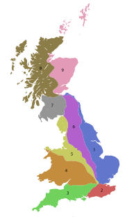
Great Britain
Great Britain or Britain is an island situated to the northwest of Continental Europe. It is the ninth largest island in the world, and the largest European island, as well as the largest of the British Isles...
starting south of the River Thames
River Thames
The River Thames flows through southern England. It is the longest river entirely in England and the second longest in the United Kingdom. While it is best known because its lower reaches flow through central London, the river flows alongside several other towns and cities, including Oxford,...
and east of the A3 (roads beginning with 2).
Single- and double-digit roads
| Road | From | To | Notes |
|---|---|---|---|
| The Borough, South East London South East (London sub region) The South East is a sub-region of the London Plan corresponding to the London Boroughs of Bexley, Bromley, Greenwich, Lewisham and Southwark. The sub region was established in 2008. The south east has a population of 1,300,000 and is the location of 500,000 jobs... |
Dover Dover Dover is a town and major ferry port in the home county of Kent, in South East England. It faces France across the narrowest part of the English Channel, and lies south-east of Canterbury; east of Kent's administrative capital Maidstone; and north-east along the coastline from Dungeness and Hastings... |
||
| New Cross New Cross New Cross is a district and ward of the London Borough of Lewisham, England. It is situated 4 miles south-east of Charing Cross. The ward covered by London post town and the SE 14 postcode district. New Cross is near St Johns, Telegraph Hill, Nunhead, Peckham, Brockley, Deptford and Greenwich... , South East London South East (London sub region) The South East is a sub-region of the London Plan corresponding to the London Boroughs of Bexley, Bromley, Greenwich, Lewisham and Southwark. The sub region was established in 2008. The south east has a population of 1,300,000 and is the location of 500,000 jobs... |
Dover Dover Dover is a town and major ferry port in the home county of Kent, in South East England. It faces France across the narrowest part of the English Channel, and lies south-east of Canterbury; east of Kent's administrative capital Maidstone; and north-east along the coastline from Dungeness and Hastings... |
||
| Lewisham Lewisham Lewisham is a district in South London, England, located in the London Borough of Lewisham. It is situated south-east of Charing Cross. The area is identified in the London Plan as one of 35 major centres in Greater London.-History:... , South East London South East (London sub region) The South East is a sub-region of the London Plan corresponding to the London Boroughs of Bexley, Bromley, Greenwich, Lewisham and Southwark. The sub region was established in 2008. The south east has a population of 1,300,000 and is the location of 500,000 jobs... |
Hastings Hastings Hastings is a town and borough in the county of East Sussex on the south coast of England. The town is located east of the county town of Lewes and south east of London, and has an estimated population of 86,900.... |
||
| Purley Purley, London Purley is a place in the London Borough of Croydon, England. It is a suburban development situated 11.7 miles south of Charing Cross.The name derives from "pirlea", which means 'Peartree lea'. Purley has a population of about 72,000.... |
Eastbourne Eastbourne Eastbourne is a large town and borough in East Sussex, on the south coast of England between Brighton and Hastings. The town is situated at the eastern end of the chalk South Downs alongside the high cliff at Beachy Head... |
||
| County Hall County Hall, London County Hall is a building in Lambeth, London, which was the headquarters of London County Council and later the Greater London Council . The building is on the bank of the River Thames, just north of Westminster Bridge, facing west toward the City of Westminster, and close to the Palace of... , Central London Central London Central London is the innermost part of London, England. There is no official or commonly accepted definition of its area, but its characteristics are understood to include a high density built environment, high land values, an elevated daytime population and a concentration of regionally,... |
Brighton Brighton Brighton is the major part of the city of Brighton and Hove in East Sussex, England on the south coast of Great Britain... |
||
| Clapham Clapham Clapham is a district in south London, England, within the London Borough of Lambeth.Clapham covers the postcodes of SW4 and parts of SW9, SW8 and SW12. Clapham Common is shared with the London Borough of Wandsworth, although Lambeth has responsibility for running the common as a whole. According... |
Worthing Worthing Worthing is a large seaside town with borough status in West Sussex, within the historic County of Sussex, forming part of the Brighton/Worthing/Littlehampton conurbation. It is situated at the foot of the South Downs, west of Brighton, and east of the county town of Chichester... & Littlehampton Littlehampton Littlehampton is a seaside resort town and civil parish in the Arun District of West Sussex, England, on the east bank at the mouth of the River Arun. It lies south southwest of London, west of Brighton and east of the county town of Chichester.... |
||
| Wrotham Heath Wrotham Heath Wrotham Heath is a settlement in Tonbridge and Malling Borough in Kent, England. It is part of the civil parish of Wrotham, and is located approximately two miles south east of the latter, seven miles east of Sevenoaks and seven miles west of Maidstone. It is located on the A20 road, close to... |
Guildford Guildford Guildford is the county town of Surrey. England, as well as the seat for the borough of Guildford and the administrative headquarters of the South East England region... |
||
| Maidstone Maidstone Maidstone is the county town of Kent, England, south-east of London. The River Medway runs through the centre of the town linking Maidstone to Rochester and the Thames Estuary. Historically, the river was a source and route for much of the town's trade. Maidstone was the centre of the agricultural... |
Newhaven Newhaven, East Sussex Newhaven is a town in the Lewes District of East Sussex in England. It lies at the mouth of the River Ouse, on the English Channel coast, and is a ferry port for services to France.-Origins:... |
||
| Whiteparish Whiteparish Whiteparish is a village and civil parish about southeast of Salisbury in Wiltshire, England. The village is about from the county boundary with Hampshire. The United Kingdom Census 2010/2011 census recorded a parish population of 2918.... |
Pevensey Pevensey Pevensey is a village and civil parish in the Wealden district of East Sussex, England. The main village is located 5 miles north-east of Eastbourne, one mile inland from Pevensey Bay. The settlement of Pevensey Bay forms part of the parish.-Geography:The village of Pevensey is located on... |
||
| Margate Margate -Demography:As of the 2001 UK census, Margate had a population of 40,386.The ethnicity of the town was 97.1% white, 1.0% mixed race, 0.5% black, 0.8% Asian, 0.6% Chinese or other ethnicity.... |
Baldslow | ||
| Capel | Bognor Regis Bognor Regis Bognor Regis is a seaside resort town and civil parish in the Arun district of West Sussex, on the south coast of England. It is south-south-west of London, west of Brighton, and south-east of the city of Chichester. Other nearby towns include Littlehampton east-north-east and Selsey to the... |
Triple-digit roads
| Road | From | To | Notes |
|---|---|---|---|
| London Bridge London Bridge London Bridge is a bridge over the River Thames, connecting the City of London and Southwark, in central London. Situated between Cannon Street Railway Bridge and Tower Bridge, it forms the western end of the Pool of London... |
Greenwich Greenwich Greenwich is a district of south London, England, located in the London Borough of Greenwich.Greenwich is best known for its maritime history and for giving its name to the Greenwich Meridian and Greenwich Mean Time... |
||
| King's Cross, Central London Central London Central London is the innermost part of London, England. There is no official or commonly accepted definition of its area, but its characteristics are understood to include a high density built environment, high land values, an elevated daytime population and a concentration of regionally,... |
Bricklayers' Arms Bricklayers' Arms Bricklayers' Arms is a busy road intersection between A2 and the London Inner Ring Road in south London, England. It is the junction of Tower Bridge Road, Old Kent Road, New Kent Road and Great Dover Street; Old Kent Road and New Kent Road east-bound are connected by a flyover.The area is named... , South London South London South London is the southern part of London, England, United Kingdom.According to the 2011 official Boundary Commission for England definition, South London includes the London boroughs of Bexley, Bromley, Croydon, Greenwich, Kingston, Lambeth, Lewisham, Merton, Southwark, Sutton and... |
Part of the London Inner Ring Road London Inner Ring Road The London Inner Ring Road is the name commonly given to a route formed from a number of major roads that encircle the centremost part of London... |
|
| Victoria Station, Central London Central London Central London is the innermost part of London, England. There is no official or commonly accepted definition of its area, but its characteristics are understood to include a high density built environment, high land values, an elevated daytime population and a concentration of regionally,... |
New Cross Gate, South East London South East (London sub region) The South East is a sub-region of the London Plan corresponding to the London Boroughs of Bexley, Bromley, Greenwich, Lewisham and Southwark. The sub region was established in 2008. The south east has a population of 1,300,000 and is the location of 500,000 jobs... |
||
| Brixton Brixton Brixton is a district in the London Borough of Lambeth in south London, England. It is south south-east of Charing Cross. The area is identified in the London Plan as one of 35 major centres in Greater London.... |
Vauxhall Vauxhall -Demography:Many Vauxhall residents live in social housing. There are several gentrified areas, and areas of terraced townhouses on streets such as Fentiman Road and Heyford Avenue have higher property values in the private market, however by far the most common type of housing stock within... |
||
| Brixton Brixton Brixton is a district in the London Borough of Lambeth in south London, England. It is south south-east of Charing Cross. The area is identified in the London Plan as one of 35 major centres in Greater London.... |
Tulse Hill Tulse Hill Tulse Hill is a district in the London Borough of Lambeth in South London, England. It lies to the south of Brixton, east of Brixton Hill, north of West Norwood and west of West Dulwich.-History:... |
||
| Woolwich Woolwich Woolwich is a district in south London, England, located in the London Borough of Greenwich. The area is identified in the London Plan as one of 35 major centres in Greater London.Woolwich formed part of Kent until 1889 when the County of London was created... |
Chiswick Chiswick Chiswick is a large suburb of west London, England and part of the London Borough of Hounslow. It is located on a meander of the River Thames, west of Charing Cross and is one of 35 major centres identified in the London Plan. It was historically an ancient parish in the county of Middlesex, with... |
London's South Circular | |
| Greenwich Greenwich Greenwich is a district of south London, England, located in the London Borough of Greenwich.Greenwich is best known for its maritime history and for giving its name to the Greenwich Meridian and Greenwich Mean Time... |
Greenhithe Greenhithe Greenhithe is a town in Dartford District of Kent, England. It forms part of the civil parish of Swanscombe and Greenhithe.Greenhithe, as it is spelled today, is located where it was possible to build wharves for transshipping corn, wood and other commodities; its largest cargoes were of chalk and... |
||
| Charlton Charlton, London Charlton is a district of south London, England, and part of the London Borough of Greenwich. It is located east-southeast of Charing Cross. Charlton next Woolwich was an ancient parish in the county of Kent, which became part of the metropolitan area of London in 1855. It is home to Charlton... |
Dartford Dartford Dartford is the principal town in the borough of Dartford. It is situated in the northwest corner of Kent, England, east south-east of central London.... |
||
| Eltham Eltham, London -Parks and open spaces:There is a large variety of open green space in Eltham, in the form of parkland, fields and woodland.*Avery Hill Park is large, open parkland, situated to the east of Eltham. It is most notable for its Winter Garden, a hothouse containing tropical trees and plants from around... |
Orpington Orpington Orpington is a suburban town and electoral ward in the London Borough of Bromley. It forms the southeastern edge of London's urban sprawl and is identified in the London Plan as one of 35 major centres in Greater London.-History:... |
||
| Plumstead Plumstead Plumstead is a district of south London, England, located in the London Borough of Greenwich. Plumstead is a multi cultural area with large Asian and Afro-Caribbean communities, in similarity to local areas such as Woolwich and Thamesmead... |
Falconwood Falconwood -Southeastern Train Services:Nearest Train Stations* Falconwood railway station, Lingfield Crescent, Eltham, London, SE9 2RN.* Eltham railway station, Well Hall Road, Eltham, London, SE9 6SL.... |
||
| Eltham Eltham, London -Parks and open spaces:There is a large variety of open green space in Eltham, in the form of parkland, fields and woodland.*Avery Hill Park is large, open parkland, situated to the east of Eltham. It is most notable for its Winter Garden, a hothouse containing tropical trees and plants from around... |
Bexley Bexley Bexley is an South East London]] in the London Borough of Bexley, London, England. It is located on the banks of the River Cray south of the Roman Road, Watling Street... |
||
| Catford Catford Catford is a district in south London, England, located in the London Borough of Lewisham. It is situated south-east of Charing Cross. The area is identified in the London Plan as one of 35 major centres in Greater London.-Architecture:... |
Forestdale Forestdale, London Forestdale is a village in southeast London, UK, part of the London Borough of Croydon. It is located to the east of Selsdon, and to the west of Addington. The main building development of the village, commenced in the late 1960s and completed in the mid 70s, took place on what was previously open... |
||
| Forestdale Forestdale, London Forestdale is a village in southeast London, UK, part of the London Borough of Croydon. It is located to the east of Selsdon, and to the west of Addington. The main building development of the village, commenced in the late 1960s and completed in the mid 70s, took place on what was previously open... |
Catford Catford Catford is a district in south London, England, located in the London Borough of Lewisham. It is situated south-east of Charing Cross. The area is identified in the London Plan as one of 35 major centres in Greater London.-Architecture:... |
||
| Sydenham Sydenham Sydenham is an area and electoral ward in the London Borough of Lewisham; although some streets towards Crystal Palace Park, Forest Hill and Penge are outside the ward and in the London Borough of Bromley, and some streets off Sydenham Hill are in the London Borough of Southwark. Sydenham was in... |
Broad Green | ||
| West Wickham West Wickham West Wickham is a place in the London Borough of Bromley, England. It is 10.3 miles south east of Charing Cross. West Wickham history dates back to early settlements existing since 1068, although the name `Wickham` is an indication of an earlier Anglo-Saxon settlement... |
Wandsworth Wandsworth Wandsworth is a district of south London, England, in the London Borough of Wandsworth. It is situated southwest of Charing Cross. The area is identified in the London Plan as one of 35 major centres in Greater London.-Toponymy:... |
||
| Elephant and Castle Elephant and Castle The Elephant and Castle is a major road intersection in south London, England, located in the London Borough of Southwark. It is also used as a name for the surrounding area.... |
Shirley Shirley, London Shirley is a place in the London Borough of Croydon, England. It is a suburban development situated 10 miles south south-east of Charing Cross.-Description:... |
||
| Streatham Streatham Streatham is a district in Surrey, England, located in the London Borough of Lambeth. It is situated south of Charing Cross. The area is identified in the London Plan as one of 35 major centres in Greater London.-History:... |
Mitcham Mitcham Mitcham is a district in the south west area of London, in the London Borough of Merton. A suburban area, Mitcham is located on the border of Inner London and Outer London. It is both residentially and financially developed, well served by Transport for London, and home to Mitcham Town Centre,... |
||
| Reigate Reigate Reigate is a historic market town in Surrey, England, at the foot of the North Downs, and in the London commuter belt. It is one of the main constituents of the Borough of Reigate and Banstead... |
Wandsworth Wandsworth Wandsworth is a district of south London, England, in the London Borough of Wandsworth. It is situated southwest of Charing Cross. The area is identified in the London Plan as one of 35 major centres in Greater London.-Toponymy:... |
||
| South Wimbledon South Wimbledon South Wimbledon is a locality in the London Borough of Merton in southwest London, England.-Toponymy:It is marked on an Ordnance Survey map of 1876 as New Wimbledon and on a 1907 map as South Wimbledon... |
Wandsworth Wandsworth Wandsworth is a district of south London, England, in the London Borough of Wandsworth. It is situated southwest of Charing Cross. The area is identified in the London Plan as one of 35 major centres in Greater London.-Toponymy:... |
||
| Harlesden Harlesden Harlesden is an area in the London Borough of Brent, northwest London, UK. Its main focal point is the Jubilee Clock which commemorates Queen Victoria's Golden Jubilee.... |
South Wimbledon South Wimbledon South Wimbledon is a locality in the London Borough of Merton in southwest London, England.-Toponymy:It is marked on an Ordnance Survey map of 1876 as New Wimbledon and on a 1907 map as South Wimbledon... |
||
| Erith Erith Erith is a district of southeast London on the River Thames. Erith's town centre has undergone a series of modernisations since 1961.-Pre-medieval:... |
Bexleyheath Bexleyheath Bexleyheath is a main suburban district of Southeast London, England, in the London Borough of Bexley with a small percentage of the district itself being in the London Borough of Greenwich. Bexleyheath is located on the border of Inner London and Outer London. It is east south-east of Charing Cross... |
||
| Bexleyheath Bexleyheath Bexleyheath is a main suburban district of Southeast London, England, in the London Borough of Bexley with a small percentage of the district itself being in the London Borough of Greenwich. Bexleyheath is located on the border of Inner London and Outer London. It is east south-east of Charing Cross... |
Sidcup Sidcup Sidcup is a district in South East London in the London Borough of Bexley and small parts of the district in the London Borough of Greenwich.Located south east of Charing Cross, Sidcup is bordered by the London Boroughs of Greenwich and Bromley and Kent County Council, and whilst now part of... |
||
| Croydon Croydon Croydon is a town in South London, England, located within the London Borough of Croydon to which it gives its name. It is situated south of Charing Cross... |
Old Bexley | ||
| Foots Cray Foots Cray Foots Cray is a place in the London Borough of Bexley, near the town of Sidcup, in southeast London, England, United Kingdom.It took its name from Godwin Fot, a local Saxon landowner recorded in the Domesday Book of 1086, and from the River Cray that passes through the village. It lay on the old... |
Crayford Crayford Crayford is a town and electoral ward in the London Borough of Bexley that was an important bridging point in Roman times across the River Cray, a tributary of the River Darent, which is itself a tributary of the River Thames.-History:... |
||
| Foots Cray Foots Cray Foots Cray is a place in the London Borough of Bexley, near the town of Sidcup, in southeast London, England, United Kingdom.It took its name from Godwin Fot, a local Saxon landowner recorded in the Domesday Book of 1086, and from the River Cray that passes through the village. It lay on the old... |
Sevenoaks Sevenoaks Sevenoaks is a commuter town situated on the London fringe of west Kent, England, some 20 miles south-east of Charing Cross, on one of the principal commuter rail lines from the capital... |
||
| Dartford Dartford Dartford is the principal town in the borough of Dartford. It is situated in the northwest corner of Kent, England, east south-east of central London.... |
Sevenoaks Sevenoaks Sevenoaks is a commuter town situated on the London fringe of west Kent, England, some 20 miles south-east of Charing Cross, on one of the principal commuter rail lines from the capital... |
||
| Crayford Crayford Crayford is a town and electoral ward in the London Borough of Bexley that was an important bridging point in Roman times across the River Cray, a tributary of the River Darent, which is itself a tributary of the River Thames.-History:... |
Rochester | ||
| Gravesend Gravesend, Kent Gravesend is a town in northwest Kent, England, on the south bank of the Thames, opposite Tilbury in Essex. It is the administrative town of the Borough of Gravesham and, because of its geographical position, has always had an important role to play in the history and communications of this part of... |
Shipbourne Shipbourne Shipbourne lies in the English county of Kent, in an undulating landscape traversed by the small streams of the River Bourne, set in a clay vale at the foot of the wooded Sevenoaks Greensand Ridge.... |
||
| Tunbridge Wells | Lower Stoke | ||
| Rochester | Hurst Green Hurst Green, East Sussex Hurst Green is a village and civil parish in the Rother District of East Sussex, England. The village is located on the A21 road, thirteen miles north of Hastings.... |
||
| Horsted | Chatham Chatham, Medway Chatham is one of the Medway towns located within the Medway unitary authority, in North Kent, in South East England.Although the dockyard has long been closed and is now being redeveloped into a business and residential community as well as a museum featuring the famous submarine, HMS Ocelot,... |
||
| Chatham Chatham, Medway Chatham is one of the Medway towns located within the Medway unitary authority, in North Kent, in South East England.Although the dockyard has long been closed and is now being redeveloped into a business and residential community as well as a museum featuring the famous submarine, HMS Ocelot,... |
Chatham | ||
| Ewell Ewell Ewell is a village in the borough of Epsom and Ewell in Surrey, close to the southern boundary of Greater London. It is located 14 miles south-south-west of Charing Cross and forms part of the suburbia that surrounds Greater London. Despite its growing population it is still referred to as a... |
Orpington Orpington Orpington is a suburban town and electoral ward in the London Borough of Bromley. It forms the southeastern edge of London's urban sprawl and is identified in the London Plan as one of 35 major centres in Greater London.-History:... |
||
| Bromley Common Bromley Common Bromley Common is the area centered around the road of the same name, stretching between Masons Hill at the south end of Bromley and Hastings Road, Locksbottom. Part of the A21... |
Westerham Westerham Westerham is a town and civil parish in the Sevenoaks District of Kent, in South East England with 5,000 people. The parish is south of the North Downs, ten miles west of Sevenoaks. It covers 5800 acres . It is recorded as early as the 9th century, and was mentioned in the Domesday Book in a... |
||
| Crystal Palace Crystal Palace, London Crystal Palace is a residential area in south London, England named from the former local landmark, The Crystal Palace, which occupied the area from 1854 to 1936. The area is located approximately 8 miles south east of Charing Cross, and offers impressive views over the capital... |
Beckenham Beckenham Beckenham is a town in the London Borough of Bromley, England. It is located 8.4 miles south east of Charing Cross and 1.75 miles west of Bromley town... |
||
| Purley Purley, London Purley is a place in the London Borough of Croydon, England. It is a suburban development situated 11.7 miles south of Charing Cross.The name derives from "pirlea", which means 'Peartree lea'. Purley has a population of about 72,000.... |
Thornton Heath Pond | ||
| South Croydon South Croydon South Croydon is a locality in Greater London, the area surrounding the valley south of central Croydon about 1 km in radius, centred on the Red Deer public house on the Brighton Road. It is part of the South Croydon post town and in the London Borough of Croydon... |
Mitcham Mitcham Mitcham is a district in the south west area of London, in the London Borough of Merton. A suburban area, Mitcham is located on the border of Inner London and Outer London. It is both residentially and financially developed, well served by Transport for London, and home to Mitcham Town Centre,... |
||
| Mitcham Common Mitcham Common Mitcham Common or Seven Islands is 182 hectares of common land situated in South London. It is predominantly in the London borough of Merton, with parts straddling the borders with Sutton and Croydon.- History :... |
Coulsdon Coulsdon Coulsdon is a town on the southernmost boundary of the London Borough of Croydon. It is surrounded by the Metropolitan Green Belt of the Farthing Down, Coulsdon Common and Kenley Common... |
||
| Kingston upon Thames Kingston upon Thames Kingston upon Thames is the principal settlement of the Royal Borough of Kingston upon Thames in southwest London. It was the ancient market town where Saxon kings were crowned and is now a suburb situated south west of Charing Cross. It is one of the major metropolitan centres identified in the... |
Colliers Wood Colliers Wood Colliers Wood is an area in south London, England, in the London Borough of Merton. Colliers Wood station is served by the London Underground's Northern Line.It is a mostly residential area, split down the middle by a busy High Street... |
||
| Morden Park Morden Park Morden Park is an area within the district of Morden in the London Borough of Merton, and includes the Park itself, an area of green space in an otherwise dense cluster of 1930s suburban housing.... |
Mitcham Common Mitcham Common Mitcham Common or Seven Islands is 182 hectares of common land situated in South London. It is predominantly in the London borough of Merton, with parts straddling the borders with Sutton and Croydon.- History :... |
||
| Burgh Heath Burgh Heath Burgh Heath is a residential area of the borough of Reigate and Banstead in Surrey, England. It is located on the A217 road, between Banstead and Tadworth. A neighbouring village is Nork... |
Kingston upon Thames Kingston upon Thames Kingston upon Thames is the principal settlement of the Royal Borough of Kingston upon Thames in southwest London. It was the ancient market town where Saxon kings were crowned and is now a suburb situated south west of Charing Cross. It is one of the major metropolitan centres identified in the... |
||
| A241 | Disused | Previously a road between Epsom Epsom Epsom is a town in the borough of Epsom and Ewell in Surrey, England. Small parts of Epsom are in the Borough of Reigate and Banstead. The town is located south-south-west of Charing Cross, within the Greater London Urban Area. The town lies on the chalk downland of Epsom Downs.-History:Epsom lies... and Banstead Banstead Banstead is a town in the borough of Reigate and Banstead in the county of Surrey, England, on the border with Greater London. It lies south of London, west of Croydon and of the county town of Kingston-Upon-Thames. Banstead is on the North Downs and is protected by the Metropolitan Green Belt;... . |
|
| Reigate Reigate Reigate is a historic market town in Surrey, England, at the foot of the North Downs, and in the London commuter belt. It is one of the main constituents of the Borough of Reigate and Banstead... |
Salfords Salfords Salfords is a village in the borough of Reigate and Banstead in Surrey, England. It lies approximately 3 miles or 5 km south of Redhill on the A23 London to Brighton road. It was the original UK home of the Monotype Corporation and Salfords railway station was originally built to service the... |
||
| Leatherhead Leatherhead Leatherhead is a town in the County of Surrey, England, on the River Mole, part of Mole Valley district. It is thought to be of Saxon origin... |
Surbiton Surbiton Surbiton, a suburban area of London in the Royal Borough of Kingston upon Thames, is situated next to the River Thames, with a mixture of Art-Deco courts, more recent residential blocks and grand, spacious 19th century townhouses blending into a sea of semi-detached 20th century housing estates... |
||
| Leatherhead Leatherhead Leatherhead is a town in the County of Surrey, England, on the River Mole, part of Mole Valley district. It is thought to be of Saxon origin... |
Hounslow Hounslow Hounslow is the principal town in the London Borough of Hounslow. It is a suburban development situated 10.6 miles west south-west of Charing Cross. It forms a post town in the TW postcode area.-Etymology:... |
||
| Leatherhead Leatherhead Leatherhead is a town in the County of Surrey, England, on the River Mole, part of Mole Valley district. It is thought to be of Saxon origin... |
Horsell Horsell Horsell in Surrey is an ancient village nearby to the more modern 19th century Woking, probably best known because of its association with the story The War of the Worlds, written by H. G. Wells. It is the home of the book's narrator , and the landing site of the first Martian transport vessel... |
||
| Leatherhead Leatherhead Leatherhead is a town in the County of Surrey, England, on the River Mole, part of Mole Valley district. It is thought to be of Saxon origin... |
Guildford Guildford Guildford is the county town of Surrey. England, as well as the seat for the borough of Guildford and the administrative headquarters of the South East England region... |
||
| Woking Woking Woking is a large town and civil parish that shares its name with the surrounding local government district, located in the west of Surrey, UK. It is part of the Greater London Urban Area and the London commuter belt, with frequent trains and a journey time of 24 minutes to Waterloo station.... |
Clandon Park Clandon Park Clandon Park is an 18th century Palladian mansion in West Clandon just outside Guildford, Surrey, in the United Kingdom. It has been a National Trust property since 1956.... |
||
| Shere | Peasmarsh Peasmarsh For other uses of Peasmarsh see Peasmarsh Peasmarsh is a village and civil parish in East Sussex in England. It is located on the A268 road between Rye and Beckley, some three miles north-west of Rye.... |
||
| Maidstone Maidstone Maidstone is the county town of Kent, England, south-east of London. The River Medway runs through the centre of the town linking Maidstone to Rochester and the Thames Estuary. Historically, the river was a source and route for much of the town's trade. Maidstone was the centre of the agricultural... |
Sheerness Sheerness Sheerness is a town located beside the mouth of the River Medway on the northwest corner of the Isle of Sheppey in north Kent, England. With a population of 12,000 it is the largest town on the island.... |
||
| Sheppey Isle of Sheppey The Isle of Sheppey is an island off the northern coast of Kent, England in the Thames Estuary, some to the east of London. It has an area of . The island forms part of the local government district of Swale... |
Sheerness Sheerness Sheerness is a town located beside the mouth of the River Medway on the northwest corner of the Isle of Sheppey in north Kent, England. With a population of 12,000 it is the largest town on the island.... |
||
| Faversham Faversham Faversham is a market town and civil parish in the Swale borough of Kent, England. The parish of Faversham grew up around an ancient sea port on Faversham Creek and was the birthplace of the explosives industry in England.-History:... |
Ashford Ashford, Kent Ashford is a town in the borough of Ashford in Kent, England. In 2005 it was voted the fourth best place to live in the United Kingdom. It lies on the Great Stour river, the M20 motorway, and the South Eastern Main Line and High Speed 1 railways. Its agricultural market is one of the most... |
||
| Charing Charing Charing is a small village and civil parish in the Ashford District of Kent, in south-east England. The parish population is 2,750 ; it includes the settlement of Charing Heath.It is situated at the foot of the North Downs... |
Chilham Chilham Chilham is a parish in the English county of Kent. Visited by tourists worldwide, it is known for its beauty. Chilham has been a location for a number of films and television dramas... |
||
| Sarre Sarre, Kent Sarre is a village and civil parish in Thanet District in Kent, England. The village is a part of St. Nicholas-at-Wade ecclesiastical parish, after having lost the local church of St. Giles in Elizabethan times; the ecclesiastical parishes were subsequently combined. In its own right Sarre is an... |
Ramsgate Ramsgate Ramsgate is a seaside town in the district of Thanet in east Kent, England. It was one of the great English seaside towns of the 19th century and is a member of the ancient confederation of Cinque Ports. It has a population of around 40,000. Ramsgate's main attraction is its coastline and its main... |
||
| Margate Margate -Demography:As of the 2001 UK census, Margate had a population of 40,386.The ethnicity of the town was 97.1% white, 1.0% mixed race, 0.5% black, 0.8% Asian, 0.6% Chinese or other ethnicity.... |
Ramsgate Ramsgate Ramsgate is a seaside town in the district of Thanet in east Kent, England. It was one of the great English seaside towns of the 19th century and is a member of the ancient confederation of Cinque Ports. It has a population of around 40,000. Ramsgate's main attraction is its coastline and its main... |
||
| Whitfield Whitfield, Kent Whitfield is an ancient village and civil parish in the English county of Kent. It has a modern counterpart in the large settlement located at the junction of the A2 and A256 roads, some four miles north of Dover, of which that part of Whitfield has become a suburb of the Dover urban area.The... |
Saint Peter's | ||
| Canterbury Canterbury Canterbury is a historic English cathedral city, which lies at the heart of the City of Canterbury, a district of Kent in South East England. It lies on the River Stour.... |
Sandwich Sandwich, Kent Sandwich is a historic town and civil parish on the River Stour in the Non-metropolitan district of Dover, within the ceremonial county of Kent, south-east England. It has a population of 6,800.... |
||
| Dover Dover Dover is a town and major ferry port in the home county of Kent, in South East England. It faces France across the narrowest part of the English Channel, and lies south-east of Canterbury; east of Kent's administrative capital Maidstone; and north-east along the coastline from Dungeness and Hastings... |
Sandwich Sandwich, Kent Sandwich is a historic town and civil parish on the River Stour in the Non-metropolitan district of Dover, within the ceremonial county of Kent, south-east England. It has a population of 6,800.... |
||
| Folkestone Folkestone Folkestone is the principal town in the Shepway District of Kent, England. Its original site was in a valley in the sea cliffs and it developed through fishing and its closeness to the Continent as a landing place and trading port. The coming of the railways, the building of a ferry port, and its... |
Emsworth Emsworth Emsworth is a large village the south coast of England, situated on the Hampshire side of the border between Hampshire and West Sussex. The village lies at the north end of an arm of Chichester Harbour, a large but shallow inlet of the English Channel.... |
||
| Barham Barham, Kent Barham is a village and civil parish in the City of Canterbury district of Kent, England. It is situated close to the A2 road between Canterbury and Dover, 7 miles south-east of Canterbury and 7 miles north of Folkestone.... |
Folkestone Folkestone Folkestone is the principal town in the Shepway District of Kent, England. Its original site was in a valley in the sea cliffs and it developed through fishing and its closeness to the Continent as a landing place and trading port. The coming of the railways, the building of a ferry port, and its... |
||
| Lympne Lympne Lympne is a village situated on the former sea cliffs above the Romney Marsh in Kent. It lies approximately west of Folkestone, 2 miles west of Hythe and east of Ashford.... |
Hythe Hythe, Kent Hythe , is a small coastal market town on the edge of Romney Marsh, in the District of Shepway on the south coast of Kent. The word Hythe or Hithe is an Old English word meaning Haven or Landing Place.... |
||
| Tenterden Tenterden Tenterden is a Cinque Port town in the Ashford District of Kent, England. It stands on the edge of the Weald, overlooking the valley of the River Rother.... |
Lamberhurst Lamberhurst Lamberhurst is a village and civil parish in Kent although the latter parish was at first in both Kent and East Sussex. The line of the county border was adjusted following the Local Government Act 1894, which required that parish boundaries be aligned with counties... |
||
| A263 | Disused | Previously a road between Pembury Pembury Pembury is a large village in Kent, in the south east of England, with a population of around 6,000. It lies just to the north-east of Tunbridge Wells.The village centre, including the village green and High Street area is a conservation area.-History:... and Royal Tunbridge Wells Royal Tunbridge Wells Royal Tunbridge Wells is a town in west Kent, England, about south-east of central London by road, by rail. The town is close to the border of the county of East Sussex... . |
|
| Tunbridge Wells | Horsham Horsham Horsham is a market town with a population of 55,657 on the upper reaches of the River Arun in the centre of the Weald, West Sussex, in the historic County of Sussex, England. The town is south south-west of London, north-west of Brighton and north-east of the county town of Chichester... |
||
| Hurst Green Hurst Green, East Sussex Hurst Green is a village and civil parish in the Rother District of East Sussex, England. The village is located on the A21 road, thirteen miles north of Hastings.... |
Heathfield Heathfield, East Sussex Heathfield is a small market town, and the principal settlement in the civil parish of Heathfield and Waldron in the Wealden District of East Sussex, within the historic County of Sussex, England.-Location:... |
||
| A266 | Disused | Previously a road between Frant Frant -Demography:The population of Frant rose steadily from just under 1,100 in 1801 to a peak in 1891 of around 3,500. The records show a marked drop to 1,692 in 1901, but this is due to the transfer of the Broadwater Down parish to Tunbridge Wells that took place in 1894... and Hurst Green Hurst Green, East Sussex Hurst Green is a village and civil parish in the Rother District of East Sussex, England. The village is located on the A21 road, thirteen miles north of Hastings.... . |
|
| Tunbridge Wells Royal Tunbridge Wells Royal Tunbridge Wells is a town in west Kent, England, about south-east of central London by road, by rail. The town is close to the border of the county of East Sussex... |
Horsebridge | ||
| Flimwell Flimwell The village of Flimwell is in the Rother District of East Sussex, in the civil parish of Ticehurst. It is located about two miles from the village of Ticehurst, close to the border with Kent... |
Rye Rye, East Sussex Rye is a small town in East Sussex, England, which stands approximately two miles from the open sea and is at the confluence of three rivers: the Rother, the Tillingham and the Brede... |
||
| Bexhill Bexhill-on-Sea Bexhill-on-Sea is a town and seaside resort in the county of East Sussex, in the south of England, within the District of Rother. It has a population of approximately 40,000... |
Ninfield Ninfield Ninfield is a village and civil parish in the Wealden District of East Sussex, England. The village is situated 4 miles north of Bexhill-on-Sea, at the junction of two roads: the A269 from Bexhill to Battle and the A271 to Hailsham... |
||
| Southwick Southwick, West Sussex Southwick is a small town and civil parish in the Adur District of West Sussex, England located three miles west of Brighton and a suburb of the East Sussex resort City of Brighton & Hove... |
Coldean Coldean Coldean is a suburb of Brighton and Hove, England and is one of its most well defined and self contained. Unlike its neighbours Moulsecoomb or Hollingbury, it sits in a steep sided valley on the extreme north-east of the city... |
Formerly part of the A27 before a bypass Bypass (road) A bypass is a road or highway that avoids or "bypasses" a built-up area, town, or village, to let through traffic flow without interference from local traffic, to reduce congestion in the built-up area, and to improve road safety.... was constructed around Brighton Brighton Brighton is the major part of the city of Brighton and Hove in East Sussex, England on the south coast of Great Britain... in the early 1990s. |
|
| Hailsham Hailsham Hailsham is a civil parish and the largest of the five main towns in the Wealden district of East Sussex, England. Mentioned in the Domesday Book, the town of Hailsham has had a long history of industry and agriculture... |
Battle Battle, East Sussex Battle is a small town and civil parish in the local government district of Rother in East Sussex, England. It lies south southeast of London, east of Brighton and east of the county town of Lewes... |
||
| Heathfield Heathfield, East Sussex Heathfield is a small market town, and the principal settlement in the civil parish of Heathfield and Waldron in the Wealden District of East Sussex, within the historic County of Sussex, England.-Location:... |
Chilcomb Chilcomb Chilcomb is a small village and civil parish in the English county of Hampshire. It is located very close to the city of Winchester and is on the South Downs Way long distance footpath.The parish had a population of 91 at the 2001 Census.... |
||
| Haywards Heath Haywards Heath -Climate:Haywards Heath experiences an oceanic climate similar to almost all of the United Kingdom.-Rail:Haywards Heath railway station is a major station on the Brighton Main Line... |
Pyecombe Pyecombe Pyecombe is a village and civil parish in the Mid Sussex District of West Sussex, England. It is located 7 miles to the north of Brighton. The civil parish covers an area of and has a population of 200 .... |
||
| Maidstone Maidstone Maidstone is the county town of Kent, England, south-east of London. The River Medway runs through the centre of the town linking Maidstone to Rochester and the Thames Estuary. Historically, the river was a source and route for much of the town's trade. Maidstone was the centre of the agricultural... |
Biddenden Biddenden Biddenden is a village and civil parish in the Ashford District of Kent, England. The village lies on the Weald of Kent, some five miles north of Tenterden. It was centre for Wealden iron industry and also of clothmaking. During the reign of Edward III some Flemish clothworkers settled in the area... |
||
| Forest Row Forest Row Forest Row is a village and relatively large civil parish in the Wealden District of East Sussex, England. The village is located three miles south-east of East Grinstead.-History:... |
Lewes Lewes Lewes is the county town of East Sussex, England and historically of all of Sussex. It is a civil parish and is the centre of the Lewes local government district. The settlement has a history as a bridging point and as a market town, and today as a communications hub and tourist-oriented town... |
||
| A276 | Disused | Previously a road in Lewes Lewes Lewes is the county town of East Sussex, England and historically of all of Sussex. It is a civil parish and is the centre of the Lewes local government district. The settlement has a history as a bridging point and as a market town, and today as a communications hub and tourist-oriented town... |
|
| Lewes Lewes Lewes is the county town of East Sussex, England and historically of all of Sussex. It is a civil parish and is the centre of the Lewes local government district. The settlement has a history as a bridging point and as a market town, and today as a communications hub and tourist-oriented town... |
Lewes Town Road, connecting the A26 A26 road For the road in Northern Ireland see A26 road The A26 road is one of the three cross-country two-digit numbered roads in the southeast of England, the others being the A25 road and A27 road. It carries traffic from Maidstone in Kent in a generally south-westerly direction to Tunbridge Wells and... and the A27 A27 road The A27 is a major road in England. It runs from its junction with the A36 at Whiteparish in the county of Wiltshire. It closely parallels the south coast, where it passes through West Sussex and terminates at Pevensey in East Sussex.Between Portsmouth and Lewes, it is one of the busiest trunk... |
||
| Rainham | Bredhurst Bredhurst Bredhurst is a village in Kent, that forms part of the Borough of Maidstone. Its population is 330 . There has been a settlement on the site of the present day Bredhurst since neolithic times because of fertile fields and the good wood supply... |
||
| A279 | Disused | Previously a road between Handcross Handcross Handcross is a village in the Mid Sussex District of West Sussex, England. It lies on the A23 road 4.2 miles south of Crawley.Nymans Garden, of parklands run by the National Trust, is near to Handcross, as are of woodland and water gardens at High Beeches Garden.Handcross has two public houses,... and Lower Beeding Lower Beeding Lower Beeding is a village and civil parish in the Horsham District of West Sussex, England. It lies on the B2110, B2115 and A281 roads 3.5 miles southeast from Horsham... . Downgraded to a B-class road, the B2210. |
|
| Findon Findon, West Sussex Findon is a village and civil parish in the Arun District of West Sussex, England, four miles north of Worthing. The parish has an area of 16.41 km² and a population of 1848 persons .... |
Angmering Angmering Angmering is a large village and civil parish between Littlehampton and Worthing in West Sussex, England. It is located approximately two miles north of the English Channel; Worthing and Littlehampton are about four miles to the east and west respectively.Angmering railway station is miles away... |
||
| Guildford Guildford Guildford is the county town of Surrey. England, as well as the seat for the borough of Guildford and the administrative headquarters of the South East England region... |
Pyecombe Pyecombe Pyecombe is a village and civil parish in the Mid Sussex District of West Sussex, England. It is located 7 miles to the north of Brighton. The civil parish covers an area of and has a population of 200 .... |
||
| Darenth Darenth Darenth is a village and civil parish in the Dartford District of Kent, England. The parish is located to the south-east of Dartford town; the village is three miles from there.The ancient parish church is dedicated to St. Margaret of Antioch.... |
Thurrock Thurrock Thurrock is a unitary authority with borough status in the English ceremonial county of Essex. It is part of the London commuter belt and an area of regeneration within the Thames Gateway redevelopment zone. The local authority is Thurrock Council.... |
Part of the London Orbital (M25 M25 motorway The M25 motorway, or London Orbital, is a orbital motorway that almost encircles Greater London, England, in the United Kingdom. The motorway was first mooted early in the 20th century. A few sections, based on the now abandoned London Ringways plan, were constructed in the early 1970s and it ... ). |
|
| Milford Milford, Surrey Milford is a large village, situated south west of Godalming in Surrey, England. Nearby villages include Witley, Elstead and Eashing, and the hamlets of Enton and Hydestile. It is situated in the Borough of Waverley.-Transportation:... |
Shoreham-by-Sea Shoreham-by-Sea Shoreham-by-Sea is a small town, port and seaside resort in West Sussex, England. Shoreham-by-Sea railway station is located less than a mile from the town centre and London Gatwick Airport is away... |
||
| Houghton Houghton, West Sussex Houghton is a village and civil parish in the Arun District of West Sussex, England. It is located on the River Arun five kilometres to the north of Arundel... |
Littlehampton Littlehampton Littlehampton is a seaside resort town and civil parish in the Arun District of West Sussex, England, on the east bank at the mouth of the River Arun. It lies south southwest of London, west of Brighton and east of the county town of Chichester.... |
||
| Petworth Petworth Petworth is a small town and civil parish in the Chichester District of West Sussex, England. It is located at the junction of the A272 east-west road from Heathfield to Winchester and the A283 Milford to Shoreham-by-Sea road. Some twelve miles to the south west of Petworth along the A285 road... |
Chichester Chichester Chichester is a cathedral city in West Sussex, within the historic County of Sussex, South-East England. It has a long history as a settlement; its Roman past and its subsequent importance in Anglo-Saxon times are only its beginnings... |
||
| Milford Milford, Surrey Milford is a large village, situated south west of Godalming in Surrey, England. Nearby villages include Witley, Elstead and Eashing, and the hamlets of Enton and Hydestile. It is situated in the Borough of Waverley.-Transportation:... |
Birdham Birdham Birdham is a village and civil parish in the Chichester District of West Sussex, England. It is located on the Manhood Peninsula, about three miles south west of the city of Chichester... |
||
| Hook Hook, London Hook is a place in south west London, England. It forms part of the Royal Borough of Kingston upon Thames and is located 13.5 miles south west of Charing Cross.... |
Haslemere Haslemere Haslemere is a town in Surrey, England, close to the border with both Hampshire and West Sussex. The major road between London and Portsmouth, the A3, lies to the west, and a branch of the River Wey to the south. Haslemere is approximately south-west of Guildford.Haslemere is surrounded by hills,... |
||
| Southsea Southsea Southsea is a seaside resort located in Portsmouth at the southern end of Portsea Island in the county of Hampshire in England. Southsea is within a mile of Portsmouth's city centre.... |
Portsmouth Portsmouth Portsmouth is the second largest city in the ceremonial county of Hampshire on the south coast of England. Portsmouth is notable for being the United Kingdom's only island city; it is located mainly on Portsea Island... |
||
| Strood Strood Strood is a town in the unitary authority of Medway in South East England. It is part of the ceremonial county of Kent. It lies on the north west bank of the River Medway at its lowest bridging point, and is part of the Rochester post town.... |
Gillingham | ||
| Canterbury Canterbury Canterbury is a historic English cathedral city, which lies at the heart of the City of Canterbury, a district of Kent in South East England. It lies on the River Stour.... |
Whitstable Whitstable Whitstable is a seaside town in Northeast Kent, Southeast England. It is approximately north of the city of Canterbury and approximately west of the seaside town of Herne Bay. It is part of the City of Canterbury district and has a population of about 30,000.Whitstable is famous for its oysters,... |
||
| Sturry Sturry Sturry is a village on the Great Stour river three miles north-east of Canterbury in Kent. The large parish of Sturry Church incorporates the former mining village of Hersden and several hamlets.-Geography:... |
Herne Bay Herne Bay, Kent Herne Bay is a seaside town in Kent, South East England, with a population of 35,188. On the south coast of the Thames Estuary, it is north of Canterbury and east of Whitstable. It neighbours the ancient villages of Herne and Reculver and is part of the City of Canterbury local government district... |
||
| Ashford Ashford, Kent Ashford is a town in the borough of Ashford in Kent, England. In 2005 it was voted the fourth best place to live in the United Kingdom. It lies on the Great Stour river, the M20 motorway, and the South Eastern Main Line and High Speed 1 railways. Its agricultural market is one of the most... |
M20 M20 motorway The M20 is a motorway in Kent, England. It runs from the M25 motorway to Folkestone, providing a link to the Channel Tunnel and the ports at Dover. It is long... at Willesborough Willesborough Willesborough is a residential suburb on the eastern side of Ashford, Kent, England.-The area:The South Willesborough Dykes area, on the west bank of the East Stour river, is an area of sheep fields drained by dykes. The area is designated as the South Willesborough Dykes Site of Nature... , Kent Kent Kent is a county in southeast England, and is one of the home counties. It borders East Sussex, Surrey and Greater London and has a defined boundary with Essex in the middle of the Thames Estuary. The ceremonial county boundaries of Kent include the shire county of Kent and the unitary borough of... |
||
| Portslade Portslade Portslade is the name of an area of the city of Brighton and Hove, England. Portslade Village, the original settlement a mile inland to the north, was built up in the 16th century... Bypass and A27 A27 road The A27 is a major road in England. It runs from its junction with the A36 at Whiteparish in the county of Wiltshire. It closely parallels the south coast, where it passes through West Sussex and terminates at Pevensey in East Sussex.Between Portsmouth and Lewes, it is one of the busiest trunk... junction. |
Portslade | ||
| A294 | Disused | Previously a road between Chichester Chichester Chichester is a cathedral city in West Sussex, within the historic County of Sussex, South-East England. It has a long history as a settlement; its Roman past and its subsequent importance in Anglo-Saxon times are only its beginnings... and Bognor Regis Bognor Regis Bognor Regis is a seaside resort town and civil parish in the Arun district of West Sussex, on the south coast of England. It is south-south-west of London, west of Brighton, and south-east of the city of Chichester. Other nearby towns include Littlehampton east-north-east and Selsey to the... . |
|
| Hailsham Hailsham Hailsham is a civil parish and the largest of the five main towns in the Wealden district of East Sussex, England. Mentioned in the Domesday Book, the town of Hailsham has had a long history of industry and agriculture... |
Amberstone, East Sussex East Sussex East Sussex is a county in South East England. It is bordered by the counties of Kent, Surrey and West Sussex, and to the south by the English Channel.-History:... |
||
| Dartford Dartford Dartford is the principal town in the borough of Dartford. It is situated in the northwest corner of Kent, England, east south-east of central London.... |
Bean Bean, Kent Bean is a village and civil parish in the Borough of Dartford in Kent, England. The village, the centre of the parish, is about three miles east of Dartford town centre. The parish is bounded on the north by the A2 road , and on the other three sides by ancient woodlands... interchange, near Bluewater |
||
| Morden Hall Park Morden Hall Park Morden Hall Park is a National Trust park located on the banks of the River Wandle in Morden, south London. It covers over 50ha of parkland with the River Wandle meandering through it spanned by numerous foot bridges. The estate contains Morden Hall itself, Morden Cottage, an old Snuff Mill, and... , Merton London Borough of Merton The London Borough of Merton is a borough in southwest London, England.The borough was formed under the London Government Act in 1965 by the merger of the Municipal Borough of Mitcham, the Municipal Borough of Wimbledon and the Merton and Morden Urban District, all formerly within Surrey... |
Rose Hill | ||
| New Malden New Malden New Malden is a town and shopping centre in the south-western London suburbs, mostly within the Royal Borough of Kingston upon Thames and partly in the London Borough of Merton, and is situated from Charing Cross... |
Wimbledon Park Wimbledon Park Wimbledon Park is an urban park in Wimbledon and the suburb south and east to which it lends its name. It is the second largest park in the London Borough of Merton and also gives its name to Wimbledon Park tube station. To the immediate west of the park resides the All England Lawn Tennis and... |
||
| Brenley Corner, near Faversham Faversham Faversham is a market town and civil parish in the Swale borough of Kent, England. The parish of Faversham grew up around an ancient sea port on Faversham Creek and was the birthplace of the explosives industry in England.-History:... |
Ramsgate Ramsgate Ramsgate is a seaside town in the district of Thanet in east Kent, England. It was one of the great English seaside towns of the 19th century and is a member of the ancient confederation of Cinque Ports. It has a population of around 40,000. Ramsgate's main attraction is its coastline and its main... |
Four digit roads
| Road | From | To | Notes | |
|---|---|---|---|---|
| Crayford Crayford Crayford is a town and electoral ward in the London Borough of Bexley that was an important bridging point in Roman times across the River Cray, a tributary of the River Darent, which is itself a tributary of the River Thames.-History:... |
Slade Green Slade Green Slade Green is a place in south- east London closer to the edge of London located in the London Borough of Bexley. It is a suburban development situated east-southeast of Charing Cross and lying south of the River Thames slightly to the west of the River Darenth and River Cray.-History and... |
|||
| Sidcup Sidcup Sidcup is a district in South East London in the London Borough of Bexley and small parts of the district in the London Borough of Greenwich.Located south east of Charing Cross, Sidcup is bordered by the London Boroughs of Greenwich and Bromley and Kent County Council, and whilst now part of... |
Sidcup | |||
| Dorking Dorking Dorking is a historic market town at the foot of the North Downs approximately south of London, in Surrey, England.- History and development :... |
North Holmwood | |||
| Crawley Crawley Crawley is a town and local government district with Borough status in West Sussex, England. It is south of Charing Cross, north of Brighton and Hove, and northeast of the county town of Chichester, covers an area of and had a population of 99,744 at the time of the 2001 Census.The area has... |
A23 A23 road The A23 road is a major road in the United Kingdom between London and Brighton, East Sussex. It became an arterial route following the construction of Westminster Bridge in 1750 and the consequent improvement of roads leading to the bridge south of the river by the Turnpike Trusts... at Crawley |
|||
| Hythe Hythe, Kent Hythe , is a small coastal market town on the edge of Romney Marsh, in the District of Shepway on the south coast of Kent. The word Hythe or Hithe is an Old English word meaning Haven or Landing Place.... |
Hythe | Scanlons Bridge Road | ||
| Brighton Brighton Brighton is the major part of the city of Brighton and Hove in East Sussex, England on the south coast of Great Britain... |
Brighton | |||
| M23 J10 M23 motorway The M23 motorway is a motorway in England. The motorway runs from south of Hooley in Surrey, where it splits from the A23, to Pease Pottage, south of Crawley in West Sussex where it rejoins the A23. The northern end of the motorway starts at junction 7 on what is effectively a spur north from... |
A23 A23 road The A23 road is a major road in the United Kingdom between London and Brighton, East Sussex. It became an arterial route following the construction of Westminster Bridge in 1750 and the consequent improvement of roads leading to the bridge south of the river by the Turnpike Trusts... at Crawley Crawley Crawley is a town and local government district with Borough status in West Sussex, England. It is south of Charing Cross, north of Brighton and Hove, and northeast of the county town of Chichester, covers an area of and had a population of 99,744 at the time of the 2001 Census.The area has... |
|||
| A21 near Tonbridge Tonbridge Tonbridge is a market town in the English county of Kent, with a population of 30,340 in 2007. It is located on the River Medway, approximately 4 miles north of Tunbridge Wells, 12 miles south west of Maidstone and 29 miles south east of London... |
A26 A26 road For the road in Northern Ireland see A26 road The A26 road is one of the three cross-country two-digit numbered roads in the southeast of England, the others being the A25 road and A27 road. It carries traffic from Maidstone in Kent in a generally south-westerly direction to Tunbridge Wells and... near Tonbridge |
|||
| Catford Catford Catford is a district in south London, England, located in the London Borough of Lewisham. It is situated south-east of Charing Cross. The area is identified in the London Plan as one of 35 major centres in Greater London.-Architecture:... |
Beckenham Beckenham Beckenham is a town in the London Borough of Bromley, England. It is located 8.4 miles south east of Charing Cross and 1.75 miles west of Bromley town... |
|||
| Plumstead Plumstead Plumstead is a district of south London, England, located in the London Borough of Greenwich. Plumstead is a multi cultural area with large Asian and Afro-Caribbean communities, in similarity to local areas such as Woolwich and Thamesmead... |
Erith Erith Erith is a district of southeast London on the River Thames. Erith's town centre has undergone a series of modernisations since 1961.-Pre-medieval:... |
|||
| Bexley Bexley Bexley is an South East London]] in the London Borough of Bexley, London, England. It is located on the banks of the River Cray south of the Roman Road, Watling Street... |
Dartford Dartford Dartford is the principal town in the borough of Dartford. It is situated in the northwest corner of Kent, England, east south-east of central London.... |
|||
| Willingdon Willingdon and Jevington Willingdon and Jevington is one of the civil parishes in the Wealden District of East Sussex, England. The two villages lie one mile south of Polegate. The two parishes, two decades ago, were separate; the merger of the two has produced a parish of over 6,000 people... |
Eastbourne Eastbourne Eastbourne is a large town and borough in East Sussex, on the south coast of England between Brighton and Hastings. The town is situated at the eastern end of the chalk South Downs alongside the high cliff at Beachy Head... |
|||
| West Wickham West Wickham West Wickham is a place in the London Borough of Bromley, England. It is 10.3 miles south east of Charing Cross. West Wickham history dates back to early settlements existing since 1068, although the name `Wickham` is an indication of an earlier Anglo-Saxon settlement... |
Epsom Epsom Epsom is a town in the borough of Epsom and Ewell in Surrey, England. Small parts of Epsom are in the Borough of Reigate and Banstead. The town is located south-south-west of Charing Cross, within the Greater London Urban Area. The town lies on the chalk downland of Epsom Downs.-History:Epsom lies... |
|||
| Hove Hove Hove is a town on the south coast of England, immediately to the west of its larger neighbour Brighton, with which it forms the unitary authority Brighton and Hove. It forms a single conurbation together with Brighton and some smaller towns and villages running along the coast... |
West Blatchington West Blatchington West Blatchington is an area in Hove, East Sussex, England.The area grew rapidly in the inter-war period, but unlike nearby Hangleton it had more infrastructure, with St Peter's Church, a working farm, a windmill and an industrial area grouped around the Goldstone Pumping Station and its workers'... |
|||
| South Lancing Lancing, West Sussex Lancing is a town and civil parish in the Adur district of West Sussex, England, on the western edge of the Adur Valley. It lies on the coastal plain between Sompting to the west, Shoreham-by-Sea to the east and the parish of Coombes to the north... |
North Lancing | |||
| Dartford Dartford Dartford is the principal town in the borough of Dartford. It is situated in the northwest corner of Kent, England, east south-east of central London.... |
Dartford | |||
| Lewes | Lewes | |||
| Bedhampton Bedhampton Bedhampton is a former village, and now suburb, located in the Borough of Havant, Hampshire, England. It is located at the northern end of Langstone Harbour and at the foot of the eastern end of Portsdown Hill.... |
Southsea Southsea Southsea is a seaside resort located in Portsmouth at the southern end of Portsea Island in the county of Hampshire in England. Southsea is within a mile of Portsmouth's city centre.... |
|||
| Worthing Worthing Worthing is a large seaside town with borough status in West Sussex, within the historic County of Sussex, forming part of the Brighton/Worthing/Littlehampton conurbation. It is situated at the foot of the South Downs, west of Brighton, and east of the county town of Chichester... |
Worthing | |||
| West Worthing Worthing Worthing is a large seaside town with borough status in West Sussex, within the historic County of Sussex, forming part of the Brighton/Worthing/Littlehampton conurbation. It is situated at the foot of the South Downs, west of Brighton, and east of the county town of Chichester... |
East Worthing | |||
| Folkestone Folkestone Folkestone is the principal town in the Shepway District of Kent, England. Its original site was in a valley in the sea cliffs and it developed through fishing and its closeness to the Continent as a landing place and trading port. The coming of the railways, the building of a ferry port, and its... |
Folkestone | |||
| M20 motorway M20 motorway The M20 is a motorway in Kent, England. It runs from the M25 motorway to Folkestone, providing a link to the Channel Tunnel and the ports at Dover. It is long... near Channel Tunnel Channel Tunnel The Channel Tunnel is a undersea rail tunnel linking Folkestone, Kent in the United Kingdom with Coquelles, Pas-de-Calais near Calais in northern France beneath the English Channel at the Strait of Dover. At its lowest point, it is deep... |
Folkestone Folkestone Folkestone is the principal town in the Shepway District of Kent, England. Its original site was in a valley in the sea cliffs and it developed through fishing and its closeness to the Continent as a landing place and trading port. The coming of the railways, the building of a ferry port, and its... |
|||
| North of Bexhill Bexhill-on-Sea Bexhill-on-Sea is a town and seaside resort in the county of East Sussex, in the south of England, within the District of Rother. It has a population of approximately 40,000... |
East of Bexhill | |||
| Henfield Henfield Henfield is a large village and civil parish in the Horsham District of West Sussex, England. It lies south of London, northwest of Brighton, and east northeast of the county town of Chichester at the road junction of the A281 and A2037. The parish has a land area of . In the 2001 census 5,012... |
Upper Beeding Upper Beeding Upper Beeding is a village and civil parish in the Horsham District of West Sussex, England. It is located at the northern end of the River Adur gap in the South Downs four miles north of Shoreham-by-Sea and has a land area of 1877 hectares... |
|||
| Brighton Brighton Brighton is the major part of the city of Brighton and Hove in East Sussex, England on the south coast of Great Britain... |
Brighton | |||
| Eastbourne Eastbourne Eastbourne is a large town and borough in East Sussex, on the south coast of England between Brighton and Hastings. The town is situated at the eastern end of the chalk South Downs alongside the high cliff at Beachy Head... |
Eastbourne | |||
| Thamesmead Thamesmead Thamesmead is a district of south-east London, England, located in the London Boroughs of Greenwich and Bexley. It is situated east of Charing Cross.... |
Abbey Wood Abbey Wood Abbey Wood is a district of South-East London, England, located mostly in the London Borough of Greenwich, and partly within the London Borough of Bexley. It is situated east of Charing Cross.-Development:... |
|||
| Ashford Ashford, Kent Ashford is a town in the borough of Ashford in Kent, England. In 2005 it was voted the fourth best place to live in the United Kingdom. It lies on the Great Stour river, the M20 motorway, and the South Eastern Main Line and High Speed 1 railways. Its agricultural market is one of the most... |
Kennington Kennington, Kent Kennington is a suburb of Ashford in Kent, England. It is about a mile northeast of the town centre and north of the M20 motorway, and contains the 12th century church, St Mary's. The main A28 Canterbury Road and A251 Faversham Road run through the village... |
|||
| Cheam Cheam Cheam is a large suburban village close to Sutton in the London Borough of Sutton, England, and is located close to the southern boundary between Greater London and Surrey. It is divided into two main areas: North Cheam and Cheam Village. North Cheam includes more retail shops and supermarkets,... |
Norbiton Norbiton Norbiton is a place in the Royal Borough of Kingston upon Thames, London. It lies approximately east of Kingston upon Thames's town centre, and from Charing Cross. Its main landmarks include Kingston Hospital and Kingsmeadow football stadium, which is currently used for the home matches of both... |
|||
| Reigate Reigate Reigate is a historic market town in Surrey, England, at the foot of the North Downs, and in the London commuter belt. It is one of the main constituents of the Borough of Reigate and Banstead... |
Salfords Salfords Salfords is a village in the borough of Reigate and Banstead in Surrey, England. It lies approximately 3 miles or 5 km south of Redhill on the A23 London to Brighton road. It was the original UK home of the Monotype Corporation and Salfords railway station was originally built to service the... |
|||
| M2 motorway Junction 3 | Near Chatham Chatham, Medway Chatham is one of the Medway towns located within the Medway unitary authority, in North Kent, in South East England.Although the dockyard has long been closed and is now being redeveloped into a business and residential community as well as a museum featuring the famous submarine, HMS Ocelot,... |
|||
| Hilsea Hilsea Hilsea is a district of the city of Portsmouth in the English county of Hampshire. Hilsea is home to one of Portsmouth's main sports and leisure facilities - the Mountbatten centre. The City of Portsmouth Boys' School is also in Hilsea... |
Portsmouth Portsmouth Portsmouth is the second largest city in the ceremonial county of Hampshire on the south coast of England. Portsmouth is notable for being the United Kingdom's only island city; it is located mainly on Portsea Island... |
|||
| Harbledown Harbledown Harbledown is a village to the west of Canterbury, Kent in England, now contiguous with the city, although still a separate village. It forms part of the civil parish of Harbledown and Rough Common. The High Street is a conservation area with many fascinating colloquial buildings either side of a... |
Bridge Bridge, Kent Bridge is a village and civil parish near Canterbury in Kent, South East England.Bridge village is situated in the Nailbourne valley in a rural setting on the old Roman road, Watling Street, formerly the main road between London and Dover... |
|||
| Charlton Charlton, London Charlton is a district of south London, England, and part of the London Borough of Greenwich. It is located east-southeast of Charing Cross. Charlton next Woolwich was an ancient parish in the county of Kent, which became part of the metropolitan area of London in 1855. It is home to Charlton... |
Millennium Dome Millennium Dome The Millennium Dome, colloquially referred to simply as The Dome or even The O2 Arena, is the original name of a large dome-shaped building, originally used to house the Millennium Experience, a major exhibition celebrating the beginning of the third millennium... |
|||
| Kennington Kennington, Kent Kennington is a suburb of Ashford in Kent, England. It is about a mile northeast of the town centre and north of the M20 motorway, and contains the 12th century church, St Mary's. The main A28 Canterbury Road and A251 Faversham Road run through the village... |
Brenzett Brenzett Brenzett is a village and civil parish in the Shepway District of Kent, England. The village lies on the Romney Marsh, three miles west of New Romney.... |
|||
| Johns Cross | Between Ashdown and Conquest | |||
| Silverhill Silverhill, Hastings Silverhill is a suburb and Local Government Ward of Hastings, East Sussex. It has a central location within the town, where the A21 meets the B2159 road.-Toponymy:The origin of the name Silverhill has been relatively unknown... |
Hastings Hastings Hastings is a town and borough in the county of East Sussex on the south coast of England. The town is located east of the county town of Lewes and south east of London, and has an estimated population of 86,900.... town centre |
Short link road | ||
| Bohemia Bohemia Bohemia is a historical region in central Europe, occupying the western two-thirds of the traditional Czech Lands. It is located in the contemporary Czech Republic with its capital in Prague... ) |
St Leonards-on-Sea St Leonards-on-Sea St Leonards-on-Sea is part of Hastings, East Sussex, England, lying immediately to the west of the centre. The original part of the settlement was laid out in the early 19th century as a new town: a place of elegant houses designed for the well-off; it also included a central public garden, a... ) |
Short link road | ||
| The Borough | Tower Bridge Tower Bridge Tower Bridge is a combined bascule and suspension bridge in London, England, over the River Thames. It is close to the Tower of London, from which it takes its name... |
Long Lane Long Lane, Southwark Long Lane is a major road in Southwark, south London, England.At the northwest end is a complicated junction with Borough High Street, Marshalsea Road, Tabard Street, and Great Dover Street. The historic St George the Martyr church, with Dickensian connections, is at this junction, now standing on... |
||
| Herne Hill Herne Hill Herne Hill is located in the London Borough of Lambeth and the London Borough of Southwark in Greater London. There is a road of the same name which continues the A215 north of Norwood Road and was called Herne Hill Road.-History:... |
Crystal Palace Crystal Palace, London Crystal Palace is a residential area in south London, England named from the former local landmark, The Crystal Palace, which occupied the area from 1854 to 1936. The area is located approximately 8 miles south east of Charing Cross, and offers impressive views over the capital... |
|||
| Rotherhithe Rotherhithe Rotherhithe is a residential district in inner southeast London, England and part of the London Borough of Southwark. It is located on a peninsula on the south bank of the Thames, facing Wapping and the Isle of Dogs on the north bank, and is a part of the Docklands area... |
? | |||
| Surrey Quays Surrey Quays Surrey Quays is a name given to a largely residential area of Rotherhithe in south-east London, occupied until 1970 by the Surrey Commercial Docks... |
Surrey Docks | |||
| A206 A206 road The A206 road links Greenwich with Greenhithe following the line of the River Thames. Today it is approximately 15 miles in length, although the final section is a relatively new road. Its primary purpose is to link into the London Orbital motorway at the Dartford Crossing and is heavily used by... |
Blackwall Tunnel Blackwall Tunnel The Blackwall Tunnel is a pair of road tunnels underneath the River Thames in east London, linking the London Borough of Tower Hamlets with the London Borough of Greenwich, and part of the A102 road. The northern portal lies just south of the East India Dock Road in Blackwall; the southern... |
Blackwall Lane | ||
| Woolwich | Woolwich Ferry Woolwich Ferry The Woolwich Free Ferry is a boat service across the River Thames, London, UK, which is licensed and financed by London River Services, the maritime arm of Transport for London... |
Access road from Woolwich Ferry to the South Circular Road A205 road The A205 or South Circular Road is a direct route which crosses South London, UK, running from Woolwich in the east to the junction of the A406 , the M4 and the A4 at Gunnersbury in the west.... |
||
| Tower Bridge Road | Tooley Street Tooley Street Tooley Street is a road in South London connecting London Bridge to St Saviour's Dock; it runs past Tower Bridge on the Southwark side of the River Thames, and forms part of the A200 road. - St Olave :... , near London Bridge station London Bridge station London Bridge railway station is a central London railway terminus and London Underground complex in the London Borough of Southwark, occupying a large area on two levels immediately south-east of London Bridge and 1.6 miles east of Charing Cross. It is one of the oldest railway stations in the... |
Bermondsey Street | ||
| Rotherhithe Rotherhithe Rotherhithe is a residential district in inner southeast London, England and part of the London Borough of Southwark. It is located on a peninsula on the south bank of the Thames, facing Wapping and the Isle of Dogs on the north bank, and is a part of the Docklands area... |
Tower Bridge Road | |||
| Bermondsey Bermondsey Bermondsey is an area in London on the south bank of the river Thames, and is part of the London Borough of Southwark. To the west lies Southwark, to the east Rotherhithe, and to the south, Walworth and Peckham.-Toponomy:... |
Druid Street, a short connecting road in South London South London South London is the southern part of London, England, United Kingdom.According to the 2011 official Boundary Commission for England definition, South London includes the London boroughs of Bexley, Bromley, Croydon, Greenwich, Kingston, Lambeth, Lewisham, Merton, Southwark, Sutton and... |
|||
| Old Kent Road Old Kent Road The Old Kent Road is a road in South East London, England and forms part of Watling Street, the Roman road which ran from Dover to Holyhead. The street is famous as the equal cheapest property on the London Monopoly board and as the only one in South London.... |
Surrey Quays Surrey Quays Surrey Quays is a name given to a largely residential area of Rotherhithe in south-east London, occupied until 1970 by the Surrey Commercial Docks... |
|||
| Deptford Deptford Deptford is a district of south London, England, located on the south bank of the River Thames. It is named after a ford of the River Ravensbourne, and from the mid 16th century to the late 19th was home to Deptford Dockyard, the first of the Royal Navy Dockyards.Deptford and the docks are... |
Deptford Bridge | Deptford Church Street | ||
| Deptford Deptford Deptford is a district of south London, England, located on the south bank of the River Thames. It is named after a ford of the River Ravensbourne, and from the mid 16th century to the late 19th was home to Deptford Dockyard, the first of the Royal Navy Dockyards.Deptford and the docks are... |
Lewisham Lewisham Lewisham is a district in South London, England, located in the London Borough of Lewisham. It is situated south-east of Charing Cross. The area is identified in the London Plan as one of 35 major centres in Greater London.-History:... |
|||
| Greenwich Greenwich Greenwich is a district of south London, England, located in the London Borough of Greenwich.Greenwich is best known for its maritime history and for giving its name to the Greenwich Meridian and Greenwich Mean Time... |
Lewisham Lewisham Lewisham is a district in South London, England, located in the London Borough of Lewisham. It is situated south-east of Charing Cross. The area is identified in the London Plan as one of 35 major centres in Greater London.-History:... |
|||
| Lee Green | Bromley Bromley Bromley is a large suburban town in south east London, England and the administrative headquarters of the London Borough of Bromley. It was historically a market town, and prior to 1963 was in the county of Kent and formed the administrative centre of the Municipal Borough of Bromley... |
|||
| Blackheath Blackheath, London Blackheath is a district of South London, England. It is named from the large open public grassland which separates it from Greenwich to the north and Lewisham to the west... |
Eltham Eltham, London -Parks and open spaces:There is a large variety of open green space in Eltham, in the form of parkland, fields and woodland.*Avery Hill Park is large, open parkland, situated to the east of Eltham. It is most notable for its Winter Garden, a hothouse containing tropical trees and plants from around... |
|||
| Brixton Brixton Brixton is a district in the London Borough of Lambeth in south London, England. It is south south-east of Charing Cross. The area is identified in the London Plan as one of 35 major centres in Greater London.... |
New Cross New Cross New Cross is a district and ward of the London Borough of Lewisham, England. It is situated 4 miles south-east of Charing Cross. The ward covered by London post town and the SE 14 postcode district. New Cross is near St Johns, Telegraph Hill, Nunhead, Peckham, Brockley, Deptford and Greenwich... |
Morval Road, Dalberg Road, Brixton Water Lane, Dulwich Road | ||
| Peckham Peckham Peckham is a district in south London, England, located in the London Borough of Southwark. It is situated south-east of Charing Cross. The area is identified in the London Plan as one of 35 major centres in Greater London... |
Peckham Rye Peckham Rye For the rail station of the same name see Peckham Rye Railway StationPeckham Rye is an open space and road in the London Borough of Southwark in London, England.... |
|||
| Sydenham Sydenham Sydenham is an area and electoral ward in the London Borough of Lewisham; although some streets towards Crystal Palace Park, Forest Hill and Penge are outside the ward and in the London Borough of Bromley, and some streets off Sydenham Hill are in the London Borough of Southwark. Sydenham was in... |
Denmark Hill Denmark Hill Denmark Hill is an area and road in the London Borough of Southwark. The road forms part of the A215; north of Camberwell Green it becomes Camberwell Road; south of Red Post Hill it becomes Herne Hill. Its postcode is SE5. Nearby streets whose names refer to different aspects of the same... |
|||
| Clapham Common Clapham Common Clapham Common is an 89 hectare triangular area of grassland situated in south London, England. It was historically common land for the parishes of Battersea and Clapham, but was converted to parkland under the terms of the Metropolitan Commons Act 1878.43 hectares of the common are within the... |
Camberwell Camberwell Camberwell is a district of south London, England, and forms part of the London Borough of Southwark. It is a built-up inner city district located southeast of Charing Cross. To the west it has a boundary with the London Borough of Lambeth.-Toponymy:... |
|||
| Sydenham Sydenham Sydenham is an area and electoral ward in the London Borough of Lewisham; although some streets towards Crystal Palace Park, Forest Hill and Penge are outside the ward and in the London Borough of Bromley, and some streets off Sydenham Hill are in the London Borough of Southwark. Sydenham was in... |
Bell Green, Sydenham | |||
| Crawley Crawley Crawley is a town and local government district with Borough status in West Sussex, England. It is south of Charing Cross, north of Brighton and Hove, and northeast of the county town of Chichester, covers an area of and had a population of 99,744 at the time of the 2001 Census.The area has... |
Crawley | |||
| Copthorne Copthorne, West Sussex Copthorne is a village in the Mid Sussex district of West Sussex, England. It lies close to Gatwick Airport, south of London, north of Brighton, and northeast of the county town of Chichester. Nearby towns include Crawley to the southwest and East Grinstead to the east... |
Crawley Crawley Crawley is a town and local government district with Borough status in West Sussex, England. It is south of Charing Cross, north of Brighton and Hove, and northeast of the county town of Chichester, covers an area of and had a population of 99,744 at the time of the 2001 Census.The area has... |
|||
| Southfleet Southfleet Southfleet is a small compact village five miles SW of Gravesend in Kent; it is a civil parish within the borough of Dartford, and includes within its boundaries the hamlet of Betsham, and the even smaller settlement of Northfleet Green. The main village is grouped around a crossroads and many of... |
Northfleet Northfleet Northfleet is a town in the Borough of Gravesham in Kent, England. Its name is derived from North creek , and the settlement on the shore of the River Thames adjacent to Gravesend was known as Norfluet in the Domesday Book, and Northflet in 1201... |
|||
| Polegate Polegate Polegate is a town and civil parish in the Wealden District of East Sussex, England, United Kingdom. It is located five miles north of the seaside resort of Eastbourne, and is part of the greater area of that town. Although once a railway settlement, its importance as such has now waned with... |
Eastbourne Eastbourne Eastbourne is a large town and borough in East Sussex, on the south coast of England between Brighton and Hastings. The town is situated at the eastern end of the chalk South Downs alongside the high cliff at Beachy Head... |
|||
| Eastbourne Eastbourne Eastbourne is a large town and borough in East Sussex, on the south coast of England between Brighton and Hastings. The town is situated at the eastern end of the chalk South Downs alongside the high cliff at Beachy Head... |
near Eastbourne Eastbourne Eastbourne is a large town and borough in East Sussex, on the south coast of England between Brighton and Hastings. The town is situated at the eastern end of the chalk South Downs alongside the high cliff at Beachy Head... |
|||
| Eastbourne Eastbourne Eastbourne is a large town and borough in East Sussex, on the south coast of England between Brighton and Hastings. The town is situated at the eastern end of the chalk South Downs alongside the high cliff at Beachy Head... |
Eastbourne | Short link road | ||
| Burgess Hill Burgess Hill Burgess Hill is a civil parish and a town primarily located in the Mid Sussex district of West Sussex, England, close to the border with East Sussex, on the edge of the South Downs National Park... |
Hickstead Hickstead, West Sussex Hickstead is a hamlet in the Mid Sussex District of West Sussex, England. It lies on the A23 road 2.7 miles west of Burgess Hill.The hamlet is famous as the location of the All England Jumping Course at Hickstead, a short distance to the south.... |
|||
| Brompton, Kent Brompton, Kent Brompton is an ancient village near Chatham, in Medway, England. Its name means 'a farmstead where broom grows´. Today Brompton is a small residential area between Chatham Dockyard and Gillingham.... |
Medway Tunnel Medway Tunnel The Medway Tunnel is a tunnel under the River Medway linking Strood with Chatham in Kent, England. It forms part of the Medway Towns Northern Relief Road... |
|||
| A27 A27 road The A27 is a major road in England. It runs from its junction with the A36 at Whiteparish in the county of Wiltshire. It closely parallels the south coast, where it passes through West Sussex and terminates at Pevensey in East Sussex.Between Portsmouth and Lewes, it is one of the busiest trunk... , Worthing Worthing Worthing is a large seaside town with borough status in West Sussex, within the historic County of Sussex, forming part of the Brighton/Worthing/Littlehampton conurbation. It is situated at the foot of the South Downs, west of Brighton, and east of the county town of Chichester... |
West Worthing | |||
| Yorkletts Yorkletts Yorkletts is a village near Whitstable in Kent, England. Housing is predominantly private. It has a garage at one end. The garages are the only facility in the village, with most inhabitants having to travel to Whitstable or Canterbury for forms of entertainment and nightlife... |
Herne Bay Herne Bay, Kent Herne Bay is a seaside town in Kent, South East England, with a population of 35,188. On the south coast of the Thames Estuary, it is north of Canterbury and east of Whitstable. It neighbours the ancient villages of Herne and Reculver and is part of the City of Canterbury local government district... |