
1934 Atlantic hurricane season
Encyclopedia
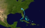
The 1934 Atlantic hurricane season ran through the summer and the first half of fall in 1934. The 1934 season was fairly quiet. However, it was a continuation of deadly seasons that had been going on since 1928.
A weak June hurricane, the 1934 Central America Hurricane
, carved an erratic path across Central America
and the Gulf of Mexico
, causing catastrophic flooding in Central America that killed 1,000-3,000 people.
Elsewhere, a tropical storm formed and existed entirely during the month of May, striking Florida
and South Carolina
and causing $155,000 in damage. A Category 1
hurricane passed over north Florida
as a tropical storm and made landfall in central Texas
, causing 11 casualties and $1–2 million in damage. Another Category 1 grazed Galveston. The extratropical remnant of a hurricane moved up the US East Coast, bringing hurricane force winds.
. The storm moved off the coast of Hutchinson Island
into the Atlantic and curved northwest. It reached its peak intensity of 60 mi/h on May 28 and made a second landfall near Beaufort, South Carolina
the next day. Inland, the storm weakened slowly and slowed down, making a counterclockwise loop before dissipating over central South Carolina. Little is written about the damage caused, although a monetary damage count of $155,000 was listed.
in early June and slowly moved north and then west into Belize
. Over the next four days, it made a slow loop over the same general region of Central America. It went down through Guatemala
and El Salvador
and then back north into Honduras
and the western Caribbean. Still hugging the coast, it strengthened into a hurricane, making landfall north of Majahual, Mexico on the Yucatan Peninsula
. It weakened back to a storm as it began to move west across the northern part of the peninsula and into the Bay of Campeche
. The storm slowed down further, making a tight (and rare second) counterclockwise loop then turning northward and gaining speed. It regained hurricane status, making landfall in Louisiana at Point au Fer Island on the east end of Atchafalaya Bay. The scale of the destruction in Central America was immense. As many as 3,000 people died in the catastrophic floods. Many places saw in excess of two feet of rain in just 72 hours. Some towns essentially ceased to exist. In Ocotepeque in western Honduras, only the church remained standing after the passage of the storm and the ensuing torrent. The region would not see destruction on this scale until Hurricane Fifi
in 1974. Six were killed in Louisiana and over $2.5 million in damages were reported. The storm re-curved inland to the northeast and became extratropical over West Virginia
.
on July 21. The storm grazed Cape Fear on a westerly track but then turned south-southwest, making landfall not far south of St. Augustine, Florida
near Crescent Beach
and emerging in the Gulf of Mexico south of Cedar Key
. It turned due west across the northern Gulf, gradually gaining intensity, becoming a hurricane on July 25 and making landfall near Lamar, Texas
later that day. It dissipated a short distance across the Rio Grande
river from Laredo. The storm killed 11 people (mostly in tornadoes) and caused roughly $2 million in damage.
and moved west-northwestward. Winds never rose above 40 mi/h and after passing directly over Dominica
and into the eastern Caribbean, the storm weakened to a tropical depression and dissipated well south of Hispaniola three days after forming. Very little effects were caused by this system.
on August 27. The storm lost hurricane intensity soon after moving away from the coast. As it neared the Bay of Campeche, the storm curved westward, making landfall near Tampico, Mexico on the night of August 31. It dissipated inland the next day. No damages or loss of life were reported.
as a Category 1. It went on to strike Long Island
with winds just weakened from hurricane force. While hurricane-force winds were likely felt in the northern Bahamas, Cape Hatteras and Long Island, the Monthly Weather Review barely mentions its existence. Clearly listed as a hurricane in the summary table, it is all but dismissed in the report as "apparently of minor importance till it had moved north of the Tropic of Cancer
" and then nothing else is said.
on September 16 and moved generally northwest throughout its lifetime. It moved somewhat erratically on September 17, bringing heavy rain to the Leeward Islands
. After that, it peaked in intensity with 45 mi/h sustained winds (which it maintained for the next 60 hours) and curved gently north-northwestward into the open waters of the west Atlantic. The storm weakened to a tropical depression on September 21 and dissipated that evening while several hundred miles east of Cape Hatteras. No significant effects were reported.
on the first of October. It moved somewhat slowly northwestward past the western tip of Cuba and into the Gulf of Mexico. On October 4, while in the middle of the Gulf, it re-curved to the north-northeast, reaching its peak intensity of 60 mi/h as it did so. It made landfall on Dauphin Island, Alabama
late into the next day as a weakening storm. It dissipated inland the next day, having caused no significant damage.
. It crossed the island and then re-curved over southern Cuba, likely dumping large amounts of rain. It continued to the northeast across the Bahamas and into the open Atlantic. It dissipated on October 23 not far south of Bermuda
. No effects are known.
A weak June hurricane, the 1934 Central America Hurricane
1934 Central America Hurricane
The 1934 Central America Hurricane is among the deadliest hurricanes on record. Although a weak hurricane, it killed 1,000-3,000 people, mainly from landslides in Central America, and spawned eight tornadoes when it made landfall in Louisiana....
, carved an erratic path across Central America
Central America
Central America is the central geographic region of the Americas. It is the southernmost, isthmian portion of the North American continent, which connects with South America on the southeast. When considered part of the unified continental model, it is considered a subcontinent...
and the Gulf of Mexico
Gulf of Mexico
The Gulf of Mexico is a partially landlocked ocean basin largely surrounded by the North American continent and the island of Cuba. It is bounded on the northeast, north and northwest by the Gulf Coast of the United States, on the southwest and south by Mexico, and on the southeast by Cuba. In...
, causing catastrophic flooding in Central America that killed 1,000-3,000 people.
Elsewhere, a tropical storm formed and existed entirely during the month of May, striking Florida
Florida
Florida is a state in the southeastern United States, located on the nation's Atlantic and Gulf coasts. It is bordered to the west by the Gulf of Mexico, to the north by Alabama and Georgia and to the east by the Atlantic Ocean. With a population of 18,801,310 as measured by the 2010 census, it...
and South Carolina
South Carolina
South Carolina is a state in the Deep South of the United States that borders Georgia to the south, North Carolina to the north, and the Atlantic Ocean to the east. Originally part of the Province of Carolina, the Province of South Carolina was one of the 13 colonies that declared independence...
and causing $155,000 in damage. A Category 1
Saffir-Simpson Hurricane Scale
The Saffir–Simpson Hurricane Scale , or the Saffir–Simpson Hurricane Wind Scale , classifies hurricanes — Western Hemisphere tropical cyclones that exceed the intensities of tropical depressions and tropical storms — into five categories distinguished by the intensities of their sustained winds...
hurricane passed over north Florida
Florida
Florida is a state in the southeastern United States, located on the nation's Atlantic and Gulf coasts. It is bordered to the west by the Gulf of Mexico, to the north by Alabama and Georgia and to the east by the Atlantic Ocean. With a population of 18,801,310 as measured by the 2010 census, it...
as a tropical storm and made landfall in central Texas
Texas
Texas is the second largest U.S. state by both area and population, and the largest state by area in the contiguous United States.The name, based on the Caddo word "Tejas" meaning "friends" or "allies", was applied by the Spanish to the Caddo themselves and to the region of their settlement in...
, causing 11 casualties and $1–2 million in damage. Another Category 1 grazed Galveston. The extratropical remnant of a hurricane moved up the US East Coast, bringing hurricane force winds.
Tropical Storm One
The season began early with an unusual preseason storm. It formed on May 27 off the northwest coast of Cuba and moved northeastward, striking the coast of Florida near GoodlandGoodland, Florida
Goodland is a census-designated place in Collier County, Florida, United States. The population was 320 at the 2000 census. It is part of the Naples–Marco Island Metropolitan Statistical Area...
. The storm moved off the coast of Hutchinson Island
Hutchinson Island
Hutchinson Island is a barrier island on the coast of Martin and St. Lucie counties, Florida. The southern one-third of Hutchinson Island is in Martin County while the northern two-thirds is in St. Lucie County. It is bounded on the east by the Atlantic Ocean, on the south by the St...
into the Atlantic and curved northwest. It reached its peak intensity of 60 mi/h on May 28 and made a second landfall near Beaufort, South Carolina
Beaufort, South Carolina
Beaufort is a city in and the county seat of Beaufort County, South Carolina, United States. Chartered in 1711, it is the second-oldest city in South Carolina, behind Charleston. The city's population was 12,361 in the 2010 census. It is located in the Hilton Head Island-Beaufort Micropolitan...
the next day. Inland, the storm weakened slowly and slowed down, making a counterclockwise loop before dissipating over central South Carolina. Little is written about the damage caused, although a monetary damage count of $155,000 was listed.
Hurricane Two
The first hurricane of the season carved an erratic path through Central America and the Gulf of Mexico, causing catastrophic flooding that killed thousands. It formed in the Gulf of HondurasGulf of Honduras
The Gulf or Bay of Honduras is a large inlet of the Caribbean Sea, indenting the coasts of Belize, Guatemala, and Honduras. From north to south, it runs for approximately 200 km from Dangriga, Belize, to La Ceiba, Honduras....
in early June and slowly moved north and then west into Belize
Belize
Belize is a constitutional monarchy and the northernmost country in Central America. Belize has a diverse society, comprising many cultures and languages. Even though Kriol and Spanish are spoken among the population, Belize is the only country in Central America where English is the official...
. Over the next four days, it made a slow loop over the same general region of Central America. It went down through Guatemala
Guatemala
Guatemala is a country in Central America bordered by Mexico to the north and west, the Pacific Ocean to the southwest, Belize to the northeast, the Caribbean to the east, and Honduras and El Salvador to the southeast...
and El Salvador
El Salvador
El Salvador or simply Salvador is the smallest and the most densely populated country in Central America. The country's capital city and largest city is San Salvador; Santa Ana and San Miguel are also important cultural and commercial centers in the country and in all of Central America...
and then back north into Honduras
Honduras
Honduras is a republic in Central America. It was previously known as Spanish Honduras to differentiate it from British Honduras, which became the modern-day state of Belize...
and the western Caribbean. Still hugging the coast, it strengthened into a hurricane, making landfall north of Majahual, Mexico on the Yucatan Peninsula
Yucatán Peninsula
The Yucatán Peninsula, in southeastern Mexico, separates the Caribbean Sea from the Gulf of Mexico, with the northern coastline on the Yucatán Channel...
. It weakened back to a storm as it began to move west across the northern part of the peninsula and into the Bay of Campeche
Bay of Campeche
The Bay of Campeche is the southern bight of the Gulf of Mexico. It is surrounded on three sides by the Mexican states of Campeche, Tabasco and Veracruz. It was named by Francisco Hernández de Córdoba and Antonio de Alaminos during their expedition in 1517...
. The storm slowed down further, making a tight (and rare second) counterclockwise loop then turning northward and gaining speed. It regained hurricane status, making landfall in Louisiana at Point au Fer Island on the east end of Atchafalaya Bay. The scale of the destruction in Central America was immense. As many as 3,000 people died in the catastrophic floods. Many places saw in excess of two feet of rain in just 72 hours. Some towns essentially ceased to exist. In Ocotepeque in western Honduras, only the church remained standing after the passage of the storm and the ensuing torrent. The region would not see destruction on this scale until Hurricane Fifi
Hurricane Fifi
Hurricane Fifi was a catastrophic tropical cyclone that killed between 3,000 and 10,000 people in Honduras in September 1974, ranking it as the fourth deadliest Atlantic hurricane on record. Originating from a strong tropical wave on September 14, the system steadily tracked...
in 1974. Six were killed in Louisiana and over $2.5 million in damages were reported. The storm re-curved inland to the northeast and became extratropical over West Virginia
West Virginia
West Virginia is a state in the Appalachian and Southeastern regions of the United States, bordered by Virginia to the southeast, Kentucky to the southwest, Ohio to the northwest, Pennsylvania to the northeast and Maryland to the east...
.
Hurricane Three
The third storm was a minimal hurricane that took an unusual southwesterly track from the western Atlantic into the Gulf of Mexico. Storm Three formed from a non-tropical low pressure system off North Carolina's Outer BanksOuter Banks
The Outer Banks is a 200-mile long string of narrow barrier islands off the coast of North Carolina, beginning in the southeastern corner of Virginia Beach on the east coast of the United States....
on July 21. The storm grazed Cape Fear on a westerly track but then turned south-southwest, making landfall not far south of St. Augustine, Florida
St. Augustine, Florida
St. Augustine is a city in the northeast section of Florida and the county seat of St. Johns County, Florida, United States. Founded in 1565 by Spanish explorer and admiral Pedro Menéndez de Avilés, it is the oldest continuously occupied European-established city and port in the continental United...
near Crescent Beach
Crescent Beach, Florida
Crescent Beach is an unincorporated census-designated place in St. Johns County, Florida, United States. The population was 985 at the 2000 census.-Geography:Crescent Beach is located at ....
and emerging in the Gulf of Mexico south of Cedar Key
Cedar Key, Florida
Cedar Key is a city in Levy County, Florida, United States. The population was 790 at the 2000 census. According to the U.S Census estimates of 2005, the city had a population of 958. The Cedar Keys are a cluster of islands close to the mainland. Most of the developed area of the city has been on...
. It turned due west across the northern Gulf, gradually gaining intensity, becoming a hurricane on July 25 and making landfall near Lamar, Texas
Lamar, Texas
Lamar is a small, unincorporated community in Aransas County, Texas , ten miles north of Rockport and forty miles north of Corpus Christi. The community was named for Mirabeau B. Lamar, the second president of the Republic of Texas....
later that day. It dissipated a short distance across the Rio Grande
Rio Grande
The Rio Grande is a river that flows from southwestern Colorado in the United States to the Gulf of Mexico. Along the way it forms part of the Mexico – United States border. Its length varies as its course changes...
river from Laredo. The storm killed 11 people (mostly in tornadoes) and caused roughly $2 million in damage.
Tropical Storm Four
Storm Four was a very weak system that formed on August 20 about 200 miles (321.9 km) east of MartiniqueMartinique
Martinique is an island in the eastern Caribbean Sea, with a land area of . Like Guadeloupe, it is an overseas region of France, consisting of a single overseas department. To the northwest lies Dominica, to the south St Lucia, and to the southeast Barbados...
and moved west-northwestward. Winds never rose above 40 mi/h and after passing directly over Dominica
Dominica
Dominica , officially the Commonwealth of Dominica, is an island nation in the Lesser Antilles region of the Caribbean Sea, south-southeast of Guadeloupe and northwest of Martinique. Its size is and the highest point in the country is Morne Diablotins, which has an elevation of . The Commonwealth...
and into the eastern Caribbean, the storm weakened to a tropical depression and dissipated well south of Hispaniola three days after forming. Very little effects were caused by this system.
Hurricane Five
The third hurricane of the season formed in the north central Gulf of Mexico in late August and tracked west and then west-northwest. As it approached the north Texas coast, it curved to the south, strengthening to a hurricane while just offshore of Galveston IslandGalveston Island
Galveston Island is a barrier island on the Texas Gulf coast in the United States, about 50 miles southeast of Houston. The entire island, with the exception of Jamaica Beach, is within the city limits of the City of Galveston....
on August 27. The storm lost hurricane intensity soon after moving away from the coast. As it neared the Bay of Campeche, the storm curved westward, making landfall near Tampico, Mexico on the night of August 31. It dissipated inland the next day. No damages or loss of life were reported.
Hurricane Six
For what could have been the strongest and most significant storm to strike the US in 1934, strikingly little is written about this storm. It was first detected not far east of the Bahamas at near-hurricane intensity and then re-curved to the north-northeast. Peak intensity came sometime during the day on September 7 while north of the Bahamas. It became extratropical as it brushed by Cape HatterasCape Hatteras
Cape Hatteras is a cape on the coast of North Carolina. It is the point that protrudes the farthest to the southeast along the northeast-to-southwest line of the Atlantic coast of North America...
as a Category 1. It went on to strike Long Island
Long Island
Long Island is an island located in the southeast part of the U.S. state of New York, just east of Manhattan. Stretching northeast into the Atlantic Ocean, Long Island contains four counties, two of which are boroughs of New York City , and two of which are mainly suburban...
with winds just weakened from hurricane force. While hurricane-force winds were likely felt in the northern Bahamas, Cape Hatteras and Long Island, the Monthly Weather Review barely mentions its existence. Clearly listed as a hurricane in the summary table, it is all but dismissed in the report as "apparently of minor importance till it had moved north of the Tropic of Cancer
Tropic of Cancer
The Tropic of Cancer, also referred to as the Northern tropic, is the circle of latitude on the Earth that marks the most northerly position at which the Sun may appear directly overhead at its zenith...
" and then nothing else is said.
Tropical Storm Seven
Storm Seven was a weak system that formed about 100 miles (160.9 km) east of BarbadosBarbados
Barbados is an island country in the Lesser Antilles. It is in length and as much as in width, amounting to . It is situated in the western area of the North Atlantic and 100 kilometres east of the Windward Islands and the Caribbean Sea; therein, it is about east of the islands of Saint...
on September 16 and moved generally northwest throughout its lifetime. It moved somewhat erratically on September 17, bringing heavy rain to the Leeward Islands
Leeward Islands
The Leeward Islands are a group of islands in the West Indies. They are the northern islands of the Lesser Antilles chain. As a group they start east of Puerto Rico and reach southward to Dominica. They are situated where the northeastern Caribbean Sea meets the western Atlantic Ocean...
. After that, it peaked in intensity with 45 mi/h sustained winds (which it maintained for the next 60 hours) and curved gently north-northwestward into the open waters of the west Atlantic. The storm weakened to a tropical depression on September 21 and dissipated that evening while several hundred miles east of Cape Hatteras. No significant effects were reported.
Hurricane Eight
This storm, while one of the season's strongest, occurred over open water so little is known about it. The Best Track initializes it at about 25N 35W as a tropical storm. It moved swiftly throughout its lifetime (generally northwestward), strengthening to a hurricane about 12 hours after initialization. It became a Category 2 late on October 2, but held that intensity for only 12 hours, weakening back into a Category 1 and curving more westward, dissipating suddenly late on the 3rd.Tropical Storm Nine
The ninth storm of the season formed in the western Caribbean near Cuba's Isle of YouthIsle of Youth
Isla de la Juventud is the second-largest Cuban island and the seventh-largest island in the West Indies . The island has an area and is 100 km south of the island of Cuba, across the Gulf of Batabanó...
on the first of October. It moved somewhat slowly northwestward past the western tip of Cuba and into the Gulf of Mexico. On October 4, while in the middle of the Gulf, it re-curved to the north-northeast, reaching its peak intensity of 60 mi/h as it did so. It made landfall on Dauphin Island, Alabama
Alabama
Alabama is a state located in the southeastern region of the United States. It is bordered by Tennessee to the north, Georgia to the east, Florida and the Gulf of Mexico to the south, and Mississippi to the west. Alabama ranks 30th in total land area and ranks second in the size of its inland...
late into the next day as a weakening storm. It dissipated inland the next day, having caused no significant damage.
Tropical Storm Ten
Storm Ten, while a weak storm, interacted many times with land. Despite this, next to nothing is written about it. The Monthly Weather Review listed it in their summary table but it's not even mentioned in the report. It formed (according to the Best Track data) just south of Kingston, JamaicaKingston, Jamaica
Kingston is the capital and largest city of Jamaica, located on the southeastern coast of the island. It faces a natural harbour protected by the Palisadoes, a long sand spit which connects the town of Port Royal and the Norman Manley International Airport to the rest of the island...
. It crossed the island and then re-curved over southern Cuba, likely dumping large amounts of rain. It continued to the northeast across the Bahamas and into the open Atlantic. It dissipated on October 23 not far south of Bermuda
Bermuda
Bermuda is a British overseas territory in the North Atlantic Ocean. Located off the east coast of the United States, its nearest landmass is Cape Hatteras, North Carolina, about to the west-northwest. It is about south of Halifax, Nova Scotia, Canada, and northeast of Miami, Florida...
. No effects are known.
Hurricane Eleven
The final storm was a late-season hurricane that took an unusual track across the mid-Atlantic. It was first noticed several hundred miles northeast of the Leeward Islands curving westward. On November 23 it re-curved to the northeast while centered near 26N 66Wm, strengthening into a hurricane that evening. The storm reached its peak intensity 24 hours later and passed a small distance south of Bermuda before turning sharply back to the south-southwest and picking up speed. It weakened below hurricane strength the next day as it curved more to the south. The storm passed just east of the Turks and Caicos Islands before making landfall on the north coast of Hispaniola on November 28 as a weakening system. It dissipated inland. No damage or loss of life was reported although Bermuda did report gale-force winds.See also
- List of tropical cyclones
- List of Atlantic hurricane seasons