

Weed, California
Encyclopedia
Weed is a city located in Siskiyou County, California
. As of the 2010 Census, the town had a total population of 2,967, down from 2,979 at the 2000 census. There are several unincorporated communities adjacent to, or just outside Weed proper. These include Edgewood
, Carrick
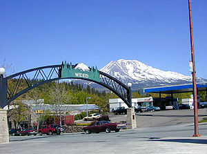
, Lake Shastina, Rancho Hills and Hammond Ranch. These communities generally have mailing addresses that use Weed, or its ZIP code. The total population of this area in 2007 was 6,318. Weed is about 10 miles (16.1 km) west-northwest of Mount Shasta
, a prominent northern California landmark, and the second tallest volcano in the Cascade Range
.
and pioneer Abner Weed, who discovered that the area's strong winds were helpful in drying lumber. In 1897, Abner Weed bought the Siskiyou Lumber and Mercantile Mill and 280 acres (113.3 ha) of land in what is now the City of Weed, for the sum of $400. By the 1940s Weed boasted the world's largest sawmill.
A town named Weed is also mentioned in John Steinbeck's novel Of Mice and Men
(first published 1937) as being the town that George Milton and Lennie Small are fleeing from at the beginning of the book.
, just 49 miles (78.9 km) south of the California
–Oregon
border. The next large town to the north on I-5 is Yreka
; to the south is City of Mount Shasta
. U.S. Route 97
heads off to the northeast and Klamath Falls, Oregon
.
According to the United States Census Bureau
, the city has a total area of 4.8 square miles (12.4 km²), of which, 4.8 square miles (12.4 km²) of it is land and 0.10% of it is covered by water.
The closest cities to Weed, with a population greater than 50,000 are: Redding
, CA (69 miles south); and Medford
, OR (91 miles north).
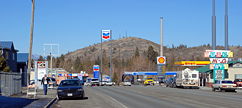
and U.S. Route 97
. Interstate 5 is the primary north-south transportation corridor for the west coast of the United States running from the Mexican border to the Canadian border. U.S. Route 97 is a major north-south U.S. highway continuing from Weed in a northeasterly direction toward Klamath Falls, Oregon and then north through Oregon and Washington to the Canadian Border. California State Route 265
also runs through the town of Weed, locally known as North Weed Boulevard. Only 2 blocks long, it is one of the shortest state highways in California.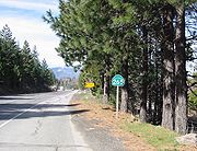 Weed is serviced by Siskiyou County's public transportation bus lines, Siskiyou Transit and General Express, commonly called "The STAGE".
The closest airports for commercial air travel are Rogue Valley International-Medford Airport
and Redding Municipal Airport
. The Weed Airport
serves general aviation. Typically corporate visitors or geological researchers uses this facility.
Amtrak
trains pass through Weed, but do not stop there. The Amtrak bus/shuttle has one stop in North Weed. The nearest depot for Amtrak train travel is in Dunsmuir
, approximately 15 miles (24.1 km) to the south.
, relies on tourists for 92% of its business, according to co-owner Vaune Dillman.
Today, most of the wood-product-related industry has been scaled back or ceased altogether, and new retail and light industrial activity is concentrated in the south-east corner of Weed. Retail at the south end of town, in the form of restaurants and hotels, caters primarily to tourist travel on the Interstate 5 corridor. Light manufacturing of bottled water from Crystal Geyser Company has also added economic stability to the area.
Weed is part of the Shasta Valley Enterprise Zone which provides tax breaks, fee reductions, and permit fast-tracking for employers locating in the area.
As of 2007, the largest employers in Weed were:
As a small community with few retail outlets, taxable sales within the city are somewhat limited, totaling $53 million in 2006.
Secondary level students are educated at Weed High School
(Grades 9-12) part of the Siskiyou Union High School District
. Weed High School is known for its picturesque campus and diverse student body.
The College of the Siskiyous
, located in Weed, provides a steady source of employment for faculty and staff, a source of visitors for the local economy, and offers a two-year junior college education with various Associate Degree and Vocational Certificate Programs.
, Sacramento
and McCloud
Rivers, or come to see and climb Mount Shasta
, Castle Crags or the Trinity Alps
. Visitors also engage in nearby skiing (both alpine and cross-country) and biking, or hike to the waterfalls, streams and lakes in the area, including nearby Mossbrae Falls
, Lake Siskiyou
, Castle Lake
and Shasta Lake
.
, and Lower Klamath National Wildlife Refuge
. In addition to these state and federally designated parks, there are numerous local recreation opportunities.
was 618.9 people per square mile (238.9/km²). The racial makeup of Weed was 2,221 (74.9%) White, 206 (6.9%) African American, 70 (2.4%) Native American, 121 (4.1%) Asian, 27 (0.9%) Pacific Islander, 132 (4.4%) from other races
, and 190 (6.4%) from two or more races. Hispanic or Latino of any race were 475 persons (16.0%).
The Census reported that 2,820 people (95.0% of the population) lived in households, 101 (3.4%) lived in non-institutionalized group quarters, and 46 (1.6%) were institutionalized.
There were 1,131 households, out of which 385 (34.0%) had children under the age of 18 living in them, 447 (39.5%) were opposite-sex married couples
living together, 188 (16.6%) had a female householder with no husband present, 81 (7.2%) had a male householder with no wife present. There were 103 (9.1%) unmarried opposite-sex partnerships
, and 2 (0.2%) same-sex married couples or partnerships. 311 households (27.5%) were made up of individuals and 125 (11.1%) had someone living alone who was 65 years of age or older. The average household size was 2.49. There were 716 families
(63.3% of all households); the average family size was 3.02.
The population was spread out with 735 people (24.8%) under the age of 18, 460 people (15.5%) aged 18 to 24, 660 people (22.2%) aged 25 to 44, 698 people (23.5%) aged 45 to 64, and 414 people (14.0%) who were 65 years of age or older. The median age was 32.7 years. For every 100 females there were 100.7 males. For every 100 females age 18 and over, there were 100.0 males.
There were 1,273 housing units at an average density of 265.5 per square mile (102.5/km²), of which 543 (48.0%) were owner-occupied, and 588 (52.0%) were occupied by renters. The homeowner vacancy rate was 3.3%; the rental vacancy rate was 8.8%. 1,275 people (43.0% of the population) lived in owner-occupied housing units and 1,545 people (52.1%) lived in rental housing units.
was 613.4 people per square mile (237.1/km²). There were 1,293 housing units at an average density of 266.3 per square mile (102.9/km²). The racial makeup of the city was 73.27% White, 9.27% Black or African American, 1.95% Native American, 4.57% Asian, 0.47% Pacific Islander, 5.51% from other races, and 4.97% from two or more races. 12.76% of the population were Hispanic or Latino of any race.
The number of violent crimes recorded by the FBI in 2003 was 25. The number of murders and homicides was 1. The violent crime rate was 8.5 per 1,000 people.
 In the city the population is spread out with 25.6% under the age of 18, 14.4% from 18 to 24, 22.6% from 25 to 44, 20.2% from 45 to 64, and 17.2% who are 65 years of age or older. The median age is 35 years. For every 100 females there are 94.8 males. For every 100 females age 18 and over, there are 93.3 males.
The median income
for a household in the city is $23,333, and the median income for a family is $32,197. Males have a median income of $29,052 versus $21,894 for females. The per capita income
for the city is $12,434. 23.9% of the population and 17.2% of families are below the poverty line. Out of the total population, 30.9% of those under the age of 18 and 4.9% of those 65 and older are living below the poverty line.
Traffic: The average commute time for Weed workers is 12 minutes, compared with 26 minutes nationwide.
Housing: Median rent in Weed, at the time of the 2000 Census, was $348. Monthly homeowner costs, for people with mortgages, were $676.
Education: 7% of Weed residents age 25 and older have a bachelor's or advanced college degree.
84.97% spoke English as their primary language, while 15.02% did not, of those 9.87% speak Spanish, 2.90 speak Italian, and 2.23% speak Laotian.100% of the population speaks English.
industry and manufacturing facilities made it a magnet for ethnic minority migration, that may not have otherwise been the case in this region of the country. A large number of Italian immigrants migrated to Weed, and other towns in southern Siskiyou County at the turn of the 20th century. While immigrants were a source of labor for the region, they were not always well treated, in fact in 1909 complaints from workers in the lumber industry reached the Italian consular. However, in time the Italian population came to be a cornerstone of Weed civic life. Many streets in the early Italian neighborhood bear names of Italian cities, such as Rome, Genoa, Como, and Venice. Annually since 1954, the town has held the Weed Italian Carnevale in June or July, although recently dropping "Italian" from its name while maintaining the Italian spelling of carnival and the traditional bocce
ball tournaments.
A large number of black-Americans migrated to Weed as well, to work in Long-Bell Lumber Company
's Weed facility after the company closed two mills in Louisiana in 1922. The company promised to advance travel expenses and provide housing for workers relocating to Weed.
Immigrants locating in Weed since the 1980s have come primarily from Mexico and Laos.
As a result of these migrations, Weed has a much more ethnically diverse population than Siskiyou County as a whole. Netting the Hispanic or Latino population out of Census figures for White Race, Weed's white population is 60.6% compared to Siskiyou County at 79.5% under the same method.
Major ancestry groups reported by Weed residents in 2000 Census include:
· Italian - 13%
· Mexican - 11%
· German - 11%
· Black or African American - 9%
· Irish - 9%
· English - 8%
· American Indian tribes, specified - 4%
· Laotian - 4%
· European - 3%
· Portuguese - 2%
· Scots-Irish - 2%
· French (except Basque) - 2%
· Polish - 2%
· Norwegian - 2%
· Dutch - 2%
· Scottish - 1%
· All other tribes - 1%
· Cherokee - 1%
· Other Hispanic or Latino - 1%
· Swedish - 1%
· Subsaharan African - 1%
· Austrian - 1%
· African - 1%
· French Canadian - 1%
· Welsh - 1%
· Japanese - 1%
· Choctaw - 1%
· Filipino - 1%
· Indonesian - 1%
Weed is located in the 4th Senate
District, represented by Republican
Doug LaMalfa
, and in the 2nd Assembly
District, represented by Republican Jim Nielsen
. Federally, Weed is located in California's 2nd congressional district
, which has a Cook PVI
of R +13 and is represented by Republican Wally Herger
.
The Republican representation has more to do with the demographics and political affiliations of the districts in which Weed falls, as opposed to the political views of the community itself. At the local level, Siskiyou County Supervisoral District 3, in which Weed is the core community, voter registration is 39.6% Democrat, 39.1% Republican, 16.2% Decline to State, with remainder split amongst other political parties such as Green, and Libertarian as of 2006.
Siskiyou County, California
Siskiyou County is a county located in the far northernmost part of the U.S. state of California, in the Shasta Cascade region on the Oregon border. Yreka is the county seat. Because of its substantial natural beauty, outdoor recreation opportunities, and Gold Rush era history, it is an important...
. As of the 2010 Census, the town had a total population of 2,967, down from 2,979 at the 2000 census. There are several unincorporated communities adjacent to, or just outside Weed proper. These include Edgewood
Edgewood, California
Edgewood is a census-designated place in Siskiyou County, California, United States. The population was 43 at the 2010 census, down from 67 at the 2000 census...
, Carrick
Carrick, California
Carrick is a census-designated place in Siskiyou County, California, United States. The population was 131 at the 2010 census, down from 156 at the 2000 census...
, Lake Shastina, Rancho Hills and Hammond Ranch. These communities generally have mailing addresses that use Weed, or its ZIP code. The total population of this area in 2007 was 6,318. Weed is about 10 miles (16.1 km) west-northwest of Mount Shasta
Mount Shasta
Mount Shasta is located at the southern end of the Cascade Range in Siskiyou County, California and at is the second highest peak in the Cascades and the fifth highest in California...
, a prominent northern California landmark, and the second tallest volcano in the Cascade Range
Cascade Range
The Cascade Range is a major mountain range of western North America, extending from southern British Columbia through Washington and Oregon to Northern California. It includes both non-volcanic mountains, such as the North Cascades, and the notable volcanoes known as the High Cascades...
.
History
The town of Weed gets its name from the founder of the local lumber millSawmill
A sawmill is a facility where logs are cut into boards.-Sawmill process:A sawmill's basic operation is much like those of hundreds of years ago; a log enters on one end and dimensional lumber exits on the other end....
and pioneer Abner Weed, who discovered that the area's strong winds were helpful in drying lumber. In 1897, Abner Weed bought the Siskiyou Lumber and Mercantile Mill and 280 acres (113.3 ha) of land in what is now the City of Weed, for the sum of $400. By the 1940s Weed boasted the world's largest sawmill.
A town named Weed is also mentioned in John Steinbeck's novel Of Mice and Men
Of Mice and Men
Of Mice and Men is a novella written by Nobel Prize-winning author John Steinbeck. Published in 1937, it tells the tragic story of George Milton and Lennie Small, two displaced migrant ranch workers during the Great Depression in California, USA....
(first published 1937) as being the town that George Milton and Lennie Small are fleeing from at the beginning of the book.
Geography
Weed is located at 41°25'27" North, 122°23'4" West (41.424298, -122.384417). It is located off Interstate 5Interstate 5
Interstate 5 is the main Interstate Highway on the West Coast of the United States, running largely parallel to the Pacific Ocean coastline from Canada to Mexico . It serves some of the largest cities on the U.S...
, just 49 miles (78.9 km) south of the California
California
California is a state located on the West Coast of the United States. It is by far the most populous U.S. state, and the third-largest by land area...
–Oregon
Oregon
Oregon is a state in the Pacific Northwest region of the United States. It is located on the Pacific coast, with Washington to the north, California to the south, Nevada on the southeast and Idaho to the east. The Columbia and Snake rivers delineate much of Oregon's northern and eastern...
border. The next large town to the north on I-5 is Yreka
Yreka, California
Yreka is the county seat of Siskiyou County, California, United States. The population was 7,765 at the 2010 census, up from 7,290 at the 2000 census.- History:...
; to the south is City of Mount Shasta
Mount Shasta, California
Mount Shasta is a city in Siskiyou County, California, located at around 3,600 ft on the flanks of Mount Shasta, a prominent northern California landmark. The city is less than southwest of the summit of its namesake volcano...
. U.S. Route 97
U.S. Route 97
U.S. Route 97 is a major north–south United States highway in the western United States. It begins at a junction with Interstate 5 at Weed, California, and travels north, ending in Okanogan County, Washington, at the Canadian Border, across from Osoyoos, British Columbia, becoming British...
heads off to the northeast and Klamath Falls, Oregon
Klamath Falls, Oregon
Klamath Falls is a city in Klamath County, Oregon, United States. Originally called Linkville when George Nurse founded the town in 1867, after the Link River on whose falls this city sat, although no falls currently exist; the name was changed to Klamath Falls in 1892...
.
According to the United States Census Bureau
United States Census Bureau
The United States Census Bureau is the government agency that is responsible for the United States Census. It also gathers other national demographic and economic data...
, the city has a total area of 4.8 square miles (12.4 km²), of which, 4.8 square miles (12.4 km²) of it is land and 0.10% of it is covered by water.
The closest cities to Weed, with a population greater than 50,000 are: Redding
Redding, California
Redding is a city in far-Northern California. It is the county seat of Shasta County, California, USA. With a population of 89,861, according to the 2010 Census...
, CA (69 miles south); and Medford
Medford, Oregon
Medford is a city in Jackson County, Oregon, United States. As of the 2010 US Census, the city had a total population of 74,907 and a metropolitan area population of 207,010, making the Medford MSA the 4th largest metro area in Oregon...
, OR (91 miles north).
Transportation
Weed is located at the intersection of Interstate 5Interstate 5
Interstate 5 is the main Interstate Highway on the West Coast of the United States, running largely parallel to the Pacific Ocean coastline from Canada to Mexico . It serves some of the largest cities on the U.S...
and U.S. Route 97
U.S. Route 97
U.S. Route 97 is a major north–south United States highway in the western United States. It begins at a junction with Interstate 5 at Weed, California, and travels north, ending in Okanogan County, Washington, at the Canadian Border, across from Osoyoos, British Columbia, becoming British...
. Interstate 5 is the primary north-south transportation corridor for the west coast of the United States running from the Mexican border to the Canadian border. U.S. Route 97 is a major north-south U.S. highway continuing from Weed in a northeasterly direction toward Klamath Falls, Oregon and then north through Oregon and Washington to the Canadian Border. California State Route 265
California State Route 265
State Route 265 , part of Weed Boulevard, is a state highway in the U.S. state of California in Siskiyou County.-Route description:...
also runs through the town of Weed, locally known as North Weed Boulevard. Only 2 blocks long, it is one of the shortest state highways in California.
The closest airports for commercial air travel are Rogue Valley International-Medford Airport
Rogue Valley International-Medford Airport
Rogue Valley International-Medford Airport is a public airport located 3 miles north of downtown Medford in Jackson County, Oregon, USA. In addition to Jackson County, the airport serves seven nearby counties in southwest Oregon. It is owned and operated by Jackson County's Aviation Authority...
and Redding Municipal Airport
Redding Municipal Airport
-References:* Maurer, Maurer . Air Force Combat Units Of World War II. Maxwell AFB, Alabama: Office of Air Force History. ISBN 0-89201-092-4.-External links:* at City of Redding web site...
. The Weed Airport
Weed Airport
Weed Airport is a public airport located four miles northwest of Weed, serving Siskiyou County, California, USA. This general aviation airport covers and has one runway.- References :*...
serves general aviation. Typically corporate visitors or geological researchers uses this facility.
Amtrak
Amtrak
The National Railroad Passenger Corporation, doing business as Amtrak , is a government-owned corporation that was organized on May 1, 1971, to provide intercity passenger train service in the United States. "Amtrak" is a portmanteau of the words "America" and "track". It is headquartered at Union...
trains pass through Weed, but do not stop there. The Amtrak bus/shuttle has one stop in North Weed. The nearest depot for Amtrak train travel is in Dunsmuir
Dunsmuir, California
Dunsmuir is a city in Siskiyou County, California, United States. The population was 1,650 at the 2010 census, down from 1,923 at the 2000 census. It is currently a hub of tourism in Northern California as visitors enjoy fishing, skiing, climbing, or sight-seeing...
, approximately 15 miles (24.1 km) to the south.
Historic forestry-based industry
From its founding in 1901, to as late as the 1980s, Weed was home to a thriving lumber industry. Roseburg Forest Products (Plywood Production), International Paper Company, Morgan Products Ltd. (Wooden Door Manufacturing), and J.H. Baxter (Wood Treatment) were all located in Weed. The historic industrial area at the northeast corner of town has been plagued with environmental concerns and clean-up efforts as a result of chemicals used for wood treatment, as well as chemical residue from glue used in the door factory.Economy
Although historically reliant on logging, wood processing and forest-related products, Weed's economy has become more reliant on tourism as a source of economic activity. Weed's microbrewery, Mt. Shasta Brewing CompanyMt. Shasta Brewing Company
Mt. Shasta Brewing Company is a microbrewery based in Weed, California, the makers of Weed Ales & Lagers. Owners Vaune and Barbara Dillmann began commercial production in 2003. Mount Shasta Brewing Company is licensed to distribute its beers in the states of California, Oregon, and Washington...
, relies on tourists for 92% of its business, according to co-owner Vaune Dillman.
Today, most of the wood-product-related industry has been scaled back or ceased altogether, and new retail and light industrial activity is concentrated in the south-east corner of Weed. Retail at the south end of town, in the form of restaurants and hotels, caters primarily to tourist travel on the Interstate 5 corridor. Light manufacturing of bottled water from Crystal Geyser Company has also added economic stability to the area.
Weed is part of the Shasta Valley Enterprise Zone which provides tax breaks, fee reductions, and permit fast-tracking for employers locating in the area.
As of 2007, the largest employers in Weed were:
- College of the SiskiyousCollege of the SiskiyousCollege of the Siskiyous is a public two-year community college with campus is located in Weed, and Yreka, California in Siskiyou County in Northern California. It is part of the California Community Colleges System and has an enrollment of approximately 3,000 students, including part-time students...
(100–249 employees) - Roseburg Forest ProductsRoseburg Forest ProductsRoseburg Forest Products, based in Roseburg, Oregon, is one of the largest privately owned wood–products companies in the United States. Originally named Roseburg Lumber, the company was founded by Kenneth Ford in 1937, operating mills throughout Western Oregon. In the early 1980s it was renamed...
(100–249 employees) - Crystal Geyser CG Roxane (25-99 employees)
- Weed Union Elementary School District (25-99 employees)
As a small community with few retail outlets, taxable sales within the city are somewhat limited, totaling $53 million in 2006.
Education
Primary education in Weed is conducted at Weed Elementary School (K-5th Grade) and Weed Middle School (Grades 6-8) which comprise the Weed Union Elementary School District. Butteville Elementary (K-8) is another nearby option just outside the City of Weed.Secondary level students are educated at Weed High School
Weed High School
Weed High School is a secondary school located in Weed, California and is part of the Siskiyou Union High School District.For the 2006-2007 school year, the school had student enrollment of 450, an Academic Performance Index of 727 which is equal to the Siskiyou County average API for the same...
(Grades 9-12) part of the Siskiyou Union High School District
Siskiyou Union High School District
The Siskiyou Union High School District is a public secondary education school district in Siskiyou County, California. There are presently five small rural high schools within the district, four of which are traditional secondary education facilities: Mt...
. Weed High School is known for its picturesque campus and diverse student body.
The College of the Siskiyous
College of the Siskiyous
College of the Siskiyous is a public two-year community college with campus is located in Weed, and Yreka, California in Siskiyou County in Northern California. It is part of the California Community Colleges System and has an enrollment of approximately 3,000 students, including part-time students...
, located in Weed, provides a steady source of employment for faculty and staff, a source of visitors for the local economy, and offers a two-year junior college education with various Associate Degree and Vocational Certificate Programs.
Recreation and tourism
Visitors use Weed as a base to engage in trout fishing in the nearby KlamathKlamath River
The Klamath River is an American river that flows southwest through Oregon and northern California, cutting through the Cascade Range to empty into the Pacific Ocean. The river drains an extensive watershed of almost that stretches from the high desert country of the Great Basin to the temperate...
, Sacramento
Sacramento River
The Sacramento River is an important watercourse of Northern and Central California in the United States. The largest river in California, it rises on the eastern slopes of the Klamath Mountains, and after a journey south of over , empties into Suisun Bay, an arm of the San Francisco Bay, and...
and McCloud
McCloud River
The McCloud River is a river that flows east of and parallel to the Sacramento River, long, in northern California in the United States. It drains a scenic mountainous area of the Cascade Range north of Redding...
Rivers, or come to see and climb Mount Shasta
Mount Shasta
Mount Shasta is located at the southern end of the Cascade Range in Siskiyou County, California and at is the second highest peak in the Cascades and the fifth highest in California...
, Castle Crags or the Trinity Alps
Trinity Alps
The Trinity Alps are mountains in Northern California, in the Pacific Coast Ranges physiographic region, located to the northwest of Redding. Elevations there range from to at Thompson Peak. The Trinity Alps Wilderness covers , making it the second largest wilderness area in California...
. Visitors also engage in nearby skiing (both alpine and cross-country) and biking, or hike to the waterfalls, streams and lakes in the area, including nearby Mossbrae Falls
Mossbrae Falls
Mossbrae Falls is a waterfall flowing into the Sacramento River, in the Shasta Cascade area in Dunsmuir, California. The falls are accessible via a mile-long hiking trail along the Union Pacific Railroad, which begins at the Shasta Retreat on Scarlett Way in Dunsmuir. Mossbrae Falls is one...
, Lake Siskiyou
Lake Siskiyou
Lake Siskiyou is a reservoir formed by Box Canyon Dam on the Sacramento River, in far northern California, near the town of Mount Shasta, California. It is the site of local recreation, as well as being used for watershed protection and flood control....
, Castle Lake
Castle Lake (California)
Castle Lake is a glacial lake located in northern California along the eastern edge of the Klamath Mountains, in Siskiyou County, near the city of Mount Shasta. The outlet of the lake drains into Castle Lake Creek, and then into Lake Siskiyou; the lake is part of the headwaters of the Sacramento...
and Shasta Lake
Shasta Lake
Shasta Lake, also called Lake Shasta, is an artificial lake created by the construction of Shasta Dam across the Sacramento River in the Shasta-Trinity National Forest of Shasta County, California...
.
Recreation facilities and parks
Weed is centrally located to Castle Crags State Park, Lava Beds National MonumentLava Beds National Monument
Lava Beds National Monument is located in northeastern California, in Siskiyou and Modoc Counties. The Monument lies on the northeastern flank of the Medicine Lake Volcano, with the largest total area covered by a volcano in the Cascade Range....
, and Lower Klamath National Wildlife Refuge
Lower Klamath National Wildlife Refuge
The Lower Klamath National Wildlife Refuge is a wildlife preserve operated by the United States Fish and Wildlife Service located in the Klamath Basin along a portion of the northern California and southern Oregon border near Klamath Falls, Oregon...
. In addition to these state and federally designated parks, there are numerous local recreation opportunities.
- The Lake Shastina Golf Resort offers an 18-hole championship golf course, and a 9-hole Scottish links course in a scenic setting.
- Local parks managed by the Weed Parks and Recreation District include: Lincoln Park (renamed Charles Byrd Community Park in 2004) which is an 11 acres (4.5 ha) park with restrooms, a playground, basketball courts, and is the home to the Weed Skatepark; as well as Bel Air Park, adjacent to College of the Siskiyous and home to the community swimming pool.
- Weed is located on the Volcanic Legacy Scenic BywayVolcanic Legacy Scenic BywayThe Volcanic Legacy Scenic Byway is an All-American Road in the U.S. states of California and Oregon. It is roughly 500 miles long and travels through the Cascade Range past numerous volcanoes. It is composed of two separate National Scenic Byways, the Volcanic Legacy Scenic Byway - Oregon and...
, and is a short distance from the Pacific Crest TrailPacific Crest TrailThe Pacific Crest Trail is a long-distance mountain hiking and equestrian trail on the Western Seaboard of the United States. The southern terminus is at the California border with Mexico...
. - Nearby Mount Shasta Ski ParkMount Shasta Ski ParkMount Shasta Ski Park is a ski resort located in northern California, just east of Interstate 5 along SR 89 between the city of Mount Shasta and the town of McCloud. The ski area lies about south of the summit of Mount Shasta, the second highest volcano in the Cascade Range...
offers alpine and Nordic skiing in winter, as well as summertime mountain biking, rock climbing, and a concert series. - The same wind that prompted the founding of Weed, as it was used to dry wood products, makes nearby Lake Shastina a popular destination for short-board windsurfing.
- The Deer Mountain Snowmobile Park, is located 18 miles (29 km) north-east of Weed on US Highway 97 and offers 250 miles (402.3 km) of groommed trails.
Historic sites and museums
- The Weed Historic Lumber Town Museum is a small, seasonal, local museum in the heart of Weed. It features sawmill machinery and artifacts from the town's early days
- The Veterans' Living Memorial Sculpture Garden is 13 miles (20.9 km) north-east of Weed on US Highway 97, and consists of steel sculptures and other memorials honoring the service of U.S. Veterans.
Demographics
2010
The 2010 United States Census reported that Weed had a population of 2,967. The population densityPopulation density
Population density is a measurement of population per unit area or unit volume. It is frequently applied to living organisms, and particularly to humans...
was 618.9 people per square mile (238.9/km²). The racial makeup of Weed was 2,221 (74.9%) White, 206 (6.9%) African American, 70 (2.4%) Native American, 121 (4.1%) Asian, 27 (0.9%) Pacific Islander, 132 (4.4%) from other races
Race (United States Census)
Race and ethnicity in the United States Census, as defined by the Federal Office of Management and Budget and the United States Census Bureau, are self-identification data items in which residents choose the race or races with which they most closely identify, and indicate whether or not they are...
, and 190 (6.4%) from two or more races. Hispanic or Latino of any race were 475 persons (16.0%).
The Census reported that 2,820 people (95.0% of the population) lived in households, 101 (3.4%) lived in non-institutionalized group quarters, and 46 (1.6%) were institutionalized.
There were 1,131 households, out of which 385 (34.0%) had children under the age of 18 living in them, 447 (39.5%) were opposite-sex married couples
Marriage
Marriage is a social union or legal contract between people that creates kinship. It is an institution in which interpersonal relationships, usually intimate and sexual, are acknowledged in a variety of ways, depending on the culture or subculture in which it is found...
living together, 188 (16.6%) had a female householder with no husband present, 81 (7.2%) had a male householder with no wife present. There were 103 (9.1%) unmarried opposite-sex partnerships
POSSLQ
POSSLQ is an abbreviation for "Persons of Opposite Sex Sharing Living Quarters," a term coined in the late 1970s by the United States Census Bureau as part of an effort to more accurately gauge the prevalence of cohabitation in American households....
, and 2 (0.2%) same-sex married couples or partnerships. 311 households (27.5%) were made up of individuals and 125 (11.1%) had someone living alone who was 65 years of age or older. The average household size was 2.49. There were 716 families
Family (U.S. Census)
A family or family household is defined by the United States Census Bureau for statistical purposes as "a householder and one or more other people related to the householder by birth, marriage, or adoption. They do not include same-sex married couples even if the marriage was performed in a state...
(63.3% of all households); the average family size was 3.02.
The population was spread out with 735 people (24.8%) under the age of 18, 460 people (15.5%) aged 18 to 24, 660 people (22.2%) aged 25 to 44, 698 people (23.5%) aged 45 to 64, and 414 people (14.0%) who were 65 years of age or older. The median age was 32.7 years. For every 100 females there were 100.7 males. For every 100 females age 18 and over, there were 100.0 males.
There were 1,273 housing units at an average density of 265.5 per square mile (102.5/km²), of which 543 (48.0%) were owner-occupied, and 588 (52.0%) were occupied by renters. The homeowner vacancy rate was 3.3%; the rental vacancy rate was 8.8%. 1,275 people (43.0% of the population) lived in owner-occupied housing units and 1,545 people (52.1%) lived in rental housing units.
2000
As of the census of 2000, there were 2,978 people, 1,184 households, and 747 families residing in the city. The population densityPopulation density
Population density is a measurement of population per unit area or unit volume. It is frequently applied to living organisms, and particularly to humans...
was 613.4 people per square mile (237.1/km²). There were 1,293 housing units at an average density of 266.3 per square mile (102.9/km²). The racial makeup of the city was 73.27% White, 9.27% Black or African American, 1.95% Native American, 4.57% Asian, 0.47% Pacific Islander, 5.51% from other races, and 4.97% from two or more races. 12.76% of the population were Hispanic or Latino of any race.
The number of violent crimes recorded by the FBI in 2003 was 25. The number of murders and homicides was 1. The violent crime rate was 8.5 per 1,000 people.
The median income
Income
Income is the consumption and savings opportunity gained by an entity within a specified time frame, which is generally expressed in monetary terms. However, for households and individuals, "income is the sum of all the wages, salaries, profits, interests payments, rents and other forms of earnings...
for a household in the city is $23,333, and the median income for a family is $32,197. Males have a median income of $29,052 versus $21,894 for females. The per capita income
Per capita income
Per capita income or income per person is a measure of mean income within an economic aggregate, such as a country or city. It is calculated by taking a measure of all sources of income in the aggregate and dividing it by the total population...
for the city is $12,434. 23.9% of the population and 17.2% of families are below the poverty line. Out of the total population, 30.9% of those under the age of 18 and 4.9% of those 65 and older are living below the poverty line.
Traffic: The average commute time for Weed workers is 12 minutes, compared with 26 minutes nationwide.
Housing: Median rent in Weed, at the time of the 2000 Census, was $348. Monthly homeowner costs, for people with mortgages, were $676.
Education: 7% of Weed residents age 25 and older have a bachelor's or advanced college degree.
84.97% spoke English as their primary language, while 15.02% did not, of those 9.87% speak Spanish, 2.90 speak Italian, and 2.23% speak Laotian.100% of the population speaks English.
Ethnic migration
Weed's historic lumberLumber
Lumber or timber is wood in any of its stages from felling through readiness for use as structural material for construction, or wood pulp for paper production....
industry and manufacturing facilities made it a magnet for ethnic minority migration, that may not have otherwise been the case in this region of the country. A large number of Italian immigrants migrated to Weed, and other towns in southern Siskiyou County at the turn of the 20th century. While immigrants were a source of labor for the region, they were not always well treated, in fact in 1909 complaints from workers in the lumber industry reached the Italian consular. However, in time the Italian population came to be a cornerstone of Weed civic life. Many streets in the early Italian neighborhood bear names of Italian cities, such as Rome, Genoa, Como, and Venice. Annually since 1954, the town has held the Weed Italian Carnevale in June or July, although recently dropping "Italian" from its name while maintaining the Italian spelling of carnival and the traditional bocce
Bocce
Bocce is a ball sport belonging to the boules sport family, closely related to bowls and pétanque with a common ancestry from ancient games played in the Roman Empire...
ball tournaments.
A large number of black-Americans migrated to Weed as well, to work in Long-Bell Lumber Company
Long-Bell Lumber Company
In 1887, Robert A. Long and Victor Bell formed the Long-Bell Lumber Company in Columbus, Kansas. The Long-Bell Lumber Company branched out using balanced vertical integration to control all aspects of lumber from the sawmills to the retail lumber yard...
's Weed facility after the company closed two mills in Louisiana in 1922. The company promised to advance travel expenses and provide housing for workers relocating to Weed.
Immigrants locating in Weed since the 1980s have come primarily from Mexico and Laos.
As a result of these migrations, Weed has a much more ethnically diverse population than Siskiyou County as a whole. Netting the Hispanic or Latino population out of Census figures for White Race, Weed's white population is 60.6% compared to Siskiyou County at 79.5% under the same method.
Major ancestry groups reported by Weed residents in 2000 Census include:
· Italian - 13%
· Mexican - 11%
· German - 11%
· Black or African American - 9%
· Irish - 9%
· English - 8%
· American Indian tribes, specified - 4%
· Laotian - 4%
· European - 3%
· Portuguese - 2%
· Scots-Irish - 2%
· French (except Basque) - 2%
· Polish - 2%
· Norwegian - 2%
· Dutch - 2%
· Scottish - 1%
· All other tribes - 1%
· Cherokee - 1%
· Other Hispanic or Latino - 1%
· Swedish - 1%
· Subsaharan African - 1%
· Austrian - 1%
· African - 1%
· French Canadian - 1%
· Welsh - 1%
· Japanese - 1%
· Choctaw - 1%
· Filipino - 1%
· Indonesian - 1%
Politics
In the state legislatureCalifornia State Legislature
The California State Legislature is the state legislature of the U.S. state of California. It is a bicameral body consisting of the lower house, the California State Assembly, with 80 members, and the upper house, the California State Senate, with 40 members...
Weed is located in the 4th Senate
California State Senate
The California State Senate is the upper house of the California State Legislature. There are 40 state senators. The state legislature meets in the California State Capitol in Sacramento. The Lieutenant Governor is the ex officio President of the Senate and may break a tied vote...
District, represented by Republican
Republican Party (United States)
The Republican Party is one of the two major contemporary political parties in the United States, along with the Democratic Party. Founded by anti-slavery expansion activists in 1854, it is often called the GOP . The party's platform generally reflects American conservatism in the U.S...
Doug LaMalfa
Doug LaMalfa
Doug LaMalfa is an American politician currently serving in the California State Senate. He is a Republican representing the 4th district, encompassing Del Norte, Siskiyou, Shasta, Trinity, Tehama, Butte, Glenn, Colusa, Sutter, and Yuba counties, as well as parts of Nevada and Placer counties...
, and in the 2nd Assembly
California State Assembly
The California State Assembly is the lower house of the California State Legislature. There are 80 members in the Assembly, representing an approximately equal number of constituents, with each district having a population of at least 420,000...
District, represented by Republican Jim Nielsen
Jim Nielsen
James Wiley Nielsen is an American politician from California and a member of the Republican party. Nielsen served on the Yolo County Republican Committee before winning election to the California State Senate in 1978...
. Federally, Weed is located in California's 2nd congressional district
California's 2nd congressional district
California's 2nd congressional district is a congressional district located in the U.S. state of California. The district contains much of the far northern part of the state, north of Sacramento. It is the largest district by area in California...
, which has a Cook PVI
Cook Partisan Voting Index
The Cook Partisan Voting Index , sometimes referred to as simply the Partisan Voting Index , is a measurement of how strongly an American congressional district or state leans toward one political party compared to the nation as a whole...
of R +13 and is represented by Republican Wally Herger
Wally Herger
Walter William "Wally" Herger, Jr. , American politician, has been a Republican member of the United States House of Representatives since 1987, representing the California's 2nd congressional district. The second district is physically large...
.
The Republican representation has more to do with the demographics and political affiliations of the districts in which Weed falls, as opposed to the political views of the community itself. At the local level, Siskiyou County Supervisoral District 3, in which Weed is the core community, voter registration is 39.6% Democrat, 39.1% Republican, 16.2% Decline to State, with remainder split amongst other political parties such as Green, and Libertarian as of 2006.