
Tohoku Expressway
Encyclopedia
The is a national expressway
in Japan
. It is owned by Japan Expressway Holding and Debt Repayment Agency and operated by East Nippon Expressway Company
.
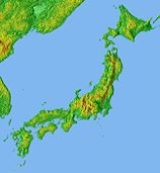
, the northernmost region on the island of Honshū
.
Officially the expressway is designated as the Tōhoku Jūkan Expressway Hirosaki Route. It is also concurrent with the Tōhoku Jūkan Expressway Hachinohe Route until Ashiro Junction, where it diverges from the Tōhoku Expressway to become the Hachinohe Expressway
.
and the greater Tokyo
urban area. It is also the longest expressway among all expressways operated by East Nippon Expressway Company.
Starting at a junction with the Tokyo Gaikan Expressway
to the north of Tokyo, the expressway follows a northerly course through the plains of Saitama Prefecture
and Tochigi Prefecture
before entering the mountainous interior of the Tōhoku region. Passing through central Fukushima Prefecture
, the expressway then enters Miyagi Prefecture
and passes to the west of Sendai, the largest city in the Tōhoku region. The expressway continues north into Iwate Prefecture
, passing the prefectural capital Morioka
. In the northern part of Iwate, the expressway veers to the northwest, while the Hachinohe Expressway branches off to the northeast. The Tōhoku Expressway continues into central Aomori Prefecture
before terminating in the city of Aomori
, the prefectural capital.
The route parallels the Tōhoku Shinkansen
and Tōhoku Main Line of East Japan Railway Company
as well as National Route 4
from the origin to the city of Morioka. North of Morioka the route diverges and parallels the Ōu Main Line
and National Route 7
to the terminus in Aomori.
The expressway is 6 lanes from Kawaguchi Junction to Utsunomiya Interchange, and 4 lanes from Utsunomiya to the terminus in Aomori.
Many sections of the expressway were damaged on 11 March 2011 during the 2011 Tōhoku earthquake and tsunami
. The expressway reopened on 24 March 2011.
!style="background-color: #BFB;"|55
|Aomori IC
| Aomori Expressway
)
|style="text-align: right; "|684.3
|style="text-align: right; "|0.0
Expressways of Japan
The expressways of Japan make up a large network of freeway-standard toll roads.- History :Following World War II, Japan's economic revival led to a massive increase in personal automobile use...
in Japan
Japan
Japan is an island nation in East Asia. Located in the Pacific Ocean, it lies to the east of the Sea of Japan, China, North Korea, South Korea and Russia, stretching from the Sea of Okhotsk in the north to the East China Sea and Taiwan in the south...
. It is owned by Japan Expressway Holding and Debt Repayment Agency and operated by East Nippon Expressway Company
East Nippon Expressway Company
The , abbreviated as , is one of the main operators of expressways and toll roads in Japan. It is headquartered in Kasumigaseki, Chiyoda, Tokyo.The company was established on October 1, 2005 as a result of the privatization of Japan Highway Public Corporation. The company manages roadways mainly in...
.
Naming
Tōhoku refers to the Tōhoku regionTohoku region
The is a geographical area of Japan. The region occupies the northeastern portion of Honshu, the largest island of Japan. The region consists of six prefectures : Akita, Aomori, Fukushima, Iwate, Miyagi and Yamagata....
, the northernmost region on the island of Honshū
Honshu
is the largest island of Japan. The nation's main island, it is south of Hokkaido across the Tsugaru Strait, north of Shikoku across the Inland Sea, and northeast of Kyushu across the Kanmon Strait...
.
Officially the expressway is designated as the Tōhoku Jūkan Expressway Hirosaki Route. It is also concurrent with the Tōhoku Jūkan Expressway Hachinohe Route until Ashiro Junction, where it diverges from the Tōhoku Expressway to become the Hachinohe Expressway
Hachinohe Expressway
The is a 4-laned national expressway in the Tōhoku region of Japan. It is owned and operated by East Nippon Expressway Company.-Overview:The expressway is officially referred to as the Tōhoku Jūkan Expressway Hachinohe Route....
.
Overview
The expressway links the Tōhoku region with the Kantō regionKanto region
The is a geographical area of Honshu, the largest island of Japan. The region includes the Greater Tokyo Area and encompasses seven prefectures: Gunma, Tochigi, Ibaraki, Saitama, Tokyo, Chiba, and Kanagawa. Within its boundaries, slightly more than 40 percent of the land area is the Kantō Plain....
and the greater Tokyo
Tokyo
, ; officially , is one of the 47 prefectures of Japan. Tokyo is the capital of Japan, the center of the Greater Tokyo Area, and the largest metropolitan area of Japan. It is the seat of the Japanese government and the Imperial Palace, and the home of the Japanese Imperial Family...
urban area. It is also the longest expressway among all expressways operated by East Nippon Expressway Company.
Starting at a junction with the Tokyo Gaikan Expressway
Tokyo Gaikan Expressway
The is a national expressway in Japan. It is owned and operated by East Nippon Expressway Company.-Overview:The name Gaikan refers to the route's status as an outer ring road for Tokyo. The expressway is also referred to simply as Gaikan for short...
to the north of Tokyo, the expressway follows a northerly course through the plains of Saitama Prefecture
Saitama Prefecture
is a prefecture of Japan located in the Kantō region of the island of Honshu. The capital is the city of Saitama.This prefecture is part of the Greater Tokyo Area, and most of Saitama's cities can be described as suburbs of Tokyo, to which a large amount of residents commute each day.- History...
and Tochigi Prefecture
Tochigi Prefecture
is a prefecture located in the Kantō region on the island of Honshū, Japan. The capital is the city of Utsunomiya.Nikkō, whose ancient Shintō shrines and Buddhist temples UNESCO has recognized by naming them a World Heritage Site, is in this prefecture...
before entering the mountainous interior of the Tōhoku region. Passing through central Fukushima Prefecture
Fukushima Prefecture
is a prefecture of Japan located in the Tōhoku region on the island of Honshu. The capital is the city of Fukushima.-History:Until the Meiji Restoration, the area of Fukushima prefecture was known as Mutsu Province....
, the expressway then enters Miyagi Prefecture
Miyagi Prefecture
is a prefecture of Japan in the Tōhoku Region on Honshu island. The capital is Sendai.- History :Miyagi Prefecture was formerly part of the province of Mutsu. Mutsu Province, on northern Honshu, was one of the last provinces to be formed as land was taken from the indigenous Emishi, and became the...
and passes to the west of Sendai, the largest city in the Tōhoku region. The expressway continues north into Iwate Prefecture
Iwate Prefecture
is the second largest prefecture of Japan after Hokkaido. It is located in the Tōhoku region of Honshū island and contains the island's easternmost point. The capital is Morioka. Iwate has the lowest population density of any prefecture outside Hokkaido...
, passing the prefectural capital Morioka
Morioka, Iwate
is the capital city of Iwate Prefecture, Japan.As of 2005, the city has an estimated population of 300,740 and a population density of 588.11 persons per km². The total area is 489.15 km²....
. In the northern part of Iwate, the expressway veers to the northwest, while the Hachinohe Expressway branches off to the northeast. The Tōhoku Expressway continues into central Aomori Prefecture
Aomori Prefecture
is a prefecture of Japan located in the Tōhoku Region. The capital is the city of Aomori.- History :Until the Meiji Restoration, the area of Aomori prefecture was known as Mutsu Province....
before terminating in the city of Aomori
Aomori, Aomori
is the capital city of Aomori Prefecture, in the northern Tōhoku region of Japan. As of 2009, the city had an estimated population of 302,068 and a density of 366 persons per km². Its total area was 824.52 km².- History :...
, the prefectural capital.
The route parallels the Tōhoku Shinkansen
Tohoku Shinkansen
The is a Japanese high-speed Shinkansen rail line, connecting Tokyo with Aomori in Aomori Prefecture for a total length of 674 km, Japan's longest Shinkansen line. It runs through the more sparsely populated Tōhoku region of Japan's main island Honshu. It has two spur lines, Yamagata...
and Tōhoku Main Line of East Japan Railway Company
East Japan Railway Company
is the largest passenger railway company in the world and one of the seven Japan Railways Group companies. The company name is officially abbreviated as JR East in English, and as in Japanese. The company's headquarters are in Yoyogi, Shibuya, Tokyo....
as well as National Route 4
Route 4 (Japan)
National Route 4 is a major highway in eastern Honshū, Japan. The longest of the ordinary highways in Japan, it originates in Chūō, Tokyo and stretches north for 743.6 km to the city of Aomori in Aomori Prefecture. From Saitama Prefecture to Iwate Prefecture, it parallels the Tōhoku...
from the origin to the city of Morioka. North of Morioka the route diverges and parallels the Ōu Main Line
Ou Main Line
The is a railway line in Japan, operated by the East Japan Railway Company . It runs from Fukushima Station in Fukushima, Fukushima through Akita Station in Akita, Akita to Aomori Station in Aomori, Aomori Prefecture...
and National Route 7
Route 7 (Japan)
National Route 7 is an important highway on the Sea of Japan side of the island of Honshū, Japan. It links the prefectural capitals of Niigata, Akita, and Aomori...
to the terminus in Aomori.
The expressway is 6 lanes from Kawaguchi Junction to Utsunomiya Interchange, and 4 lanes from Utsunomiya to the terminus in Aomori.
Many sections of the expressway were damaged on 11 March 2011 during the 2011 Tōhoku earthquake and tsunami
2011 Tōhoku earthquake and tsunami
The 2011 earthquake off the Pacific coast of Tohoku, also known as the 2011 Tohoku earthquake, or the Great East Japan Earthquake, was a magnitude 9.0 undersea megathrust earthquake off the coast of Japan that occurred at 14:46 JST on Friday, 11 March 2011, with the epicenter approximately east...
. The expressway reopened on 24 March 2011.
List of interchanges and features
- IC - interchangeInterchange (road)In the field of road transport, an interchange is a road junction that typically uses grade separation, and one or more ramps, to permit traffic on at least one highway to pass through the junction without directly crossing any other traffic stream. It differs from a standard intersection, at which...
, SIC - smart interchange, JCT - junction, SA - service area, PA - parking area, BS - bus stopBus stopA bus stop is a designated place where buses stop for passengers to board or leave a bus. These are normally positioned on the highway and are distinct from off-highway facilities such as bus stations. The construction of bus stops tends to reflect the level of usage...
, TN - tunnelTunnelA tunnel is an underground passageway, completely enclosed except for openings for egress, commonly at each end.A tunnel may be for foot or vehicular road traffic, for rail traffic, or for a canal. Some tunnels are aqueducts to supply water for consumption or for hydroelectric stations or are sewers...
, BR - bridgeBridgeA bridge is a structure built to span physical obstacles such as a body of water, valley, or road, for the purpose of providing passage over the obstacle...
, TB - toll gate, CB - snow chainsSnow chainsSnow chains, or tire chains, are devices fitted to the tires of vehicles to provide maximum traction when driving through snow and ice....
Kawaguchi JCT - Sendai-Miyagi IC
| No. | Name | Connections | Dist. from Origin |
Dist. from Terminus |
Bus Stop | Notes | Speed Limit | Location | |
|---|---|---|---|---|---|---|---|---|---|
Through to  Shuto Expressway Shuto ExpresswayShuto Expressway is a network of toll expressways in the Greater Tokyo Area of Japan. It is operated and maintained by the .Most routes consist of elevated roadway above other roads or over water, and have many sharp curves which require caution to drive safely... Kawaguchi Route |
|||||||||
| 1 | Kawaguchi JCT | .svg.png) Tokyo Gaikan Expressway Tokyo Gaikan ExpresswayTokyo Gaikan Expressway The is a national expressway in Japan. It is owned and operated by East Nippon Expressway Company.-Overview:The name Gaikan refers to the route's status as an outer ring road for Tokyo. The expressway is also referred to simply as Gaikan for short... |
0.0 | 679.5 | 80 km/h | Kawaguchi Kawaguchi, Saitama is a city located in Saitama Prefecture, Japan. The city was founded on April 1, 1933.As of January 1, 2011, the city has an estimated population of 517,171, the second largest in Saitama Prefecture after Saitama, and a population density of 9,276.61 persons per km². The total area is 55.75 km²... |
Saitama Saitama Prefecture is a prefecture of Japan located in the Kantō region of the island of Honshu. The capital is the city of Saitama.This prefecture is part of the Greater Tokyo Area, and most of Saitama's cities can be described as suburbs of Tokyo, to which a large amount of residents commute each day.- History... |
||
| 2 | Urawa IC |  National Route 122 National Route 122 |
3.2 | 676.3 | Aomori-bound exit, Kawaguchi-bound entrance only | Midori-ku, Saitama Midori-ku, Saitama is one of the ten wards of Saitama located in Saitama Prefecture, Japan.-Geography:Midori-ku is located at the south-eastern corner and covers an area part of former Misono Village and an eastern section of former Urawa City. A wide area of green farmland, Minuma Rice Paddies, forms the central... |
|||
National Route 122 National Route 463 (Koshigaya Urawa Bypass) National Route 463 (Koshigaya Urawa Bypass) |
4.8 | 674.7 | Kawaguchi-bound exit, Aomori-bound entrance only | ||||||
| TB | Urawa Toll Gate | ↓ | ↑ | ||||||
| 100 km/h | |||||||||
| 3 | Iwatsuki IC |  National Route 16 (Iwatsuki Kasukabe Bypass) National Route 16 (Iwatsuki Kasukabe Bypass) |
10.5 | 669.0 | Iwatsuki-ku, Saitama Iwatsuki-ku, Saitama is a ward of Saitama City, Saitama Prefecture, Japan since April 1, 2005 when the city of Iwatsuki was incorporated into Saitama City.-Population and area:The first population count was held on July 1, 2006 and the ward had an estimated population of 111,723... |
||||
| SA | Hasuda SA | 18.2 | 661.3 | Hasuda Hasuda, Saitama is a city located in Saitama, Japan. It was founded on October 1, 1972.As of April 1, 2011, the city has an estimated population of 63,796, with a household number of 25.546, and a density of 2,339.42 persons per km². The total area is 27.27 km².... |
|||||
| BS | Shiraoka Bus Stop | 20.5 | 659.0 | X | Closed | Shiraoka Shiraoka, Saitama is a town located in Minami Saitama District, Saitama, Japan.As of 2003, the town has an estimated population of 47,777 and a density of 1,920.30 persons per km². The total area is 24.88 km².-External links:*... |
|||
| <3-1> | Kuki-Shiraoka JCT |  Ken-Ō Expressway Ken-Ō ExpresswayKen-O Expressway The , or , is a partially completed ticket system toll expressway in Japan, owned and operated by the Central Nippon Expressway Company and East Nippon Expressway Company. In conjunction with the Tokyo Bay Aqua-Line and the Bayshore Route of the Shuto Expressway, it will form a full outer ring road... (Planned) |
24.1 | 655.4 | Opens in 2010 | Kuki Kuki, Saitama is a city located in Saitama, Japan.As of May 1, 2011, the city has an estimated population of 156,613, with a household number of 61,071, and the density of 1,900.64 persons per km²... |
|||
| 4 | Kuki IC | Pref. Route 3 (Saitama Kurihashi Route) | 25.5 | 654.0 | |||||
| 5 | Kazo IC |  National Route 125 National Route 125 |
33.4 | 646.1 | Kazo Kazo, Saitama is a city located in Saitama, Japan.As of April 1, 2011, the city has an estimated population of 117,339, with a household number of 42,778, and a density of 879.14 persons per km²... |
||||
| 5-1 | Hanyū IC | Pref. Route 84 (Hanyū Kurihashi Route) | 39.4 | 640.1 | Hanyū Hanyu, Saitama is a city located in Saitama, Japan.As of 2003, the city has an estimated population of 57,292 and the density of 978.51 persons per km². The total area is 58.55 km².The city was founded on September 1, 1954.... |
||||
| PA | Hanyū PA | 40.6 | 638.9 | ||||||
| BR | Tonegawa Bridge | ↓ | ↑ | Tone River Tone River The is a river in the Kantō region of Japan. It is in length and has a drainage area of... crossing |
|||||
| Meiwa Meiwa, Gunma is a town located in Ōra District, Gunma, Japan.As of September 1, 2007. the town has an estimated population of 11,291 and a density of 574.02 persons per km²... |
Gunma Gunma Prefecture is a prefecture of Japan located in the northwest corner of the Kantō region on Honshu island. Its capital is Maebashi.- History :The remains of a Paleolithic man were found at Iwajuku, Gunma Prefecture, in the early 20th century and there is a public museum there.Japan was without horses until... |
||||||||
| 6 | Tatebayashi IC |  National Route 354 National Route 354 |
46.0 | 633.5 | Tatebayashi Tatebayashi, Gunma is a city located in Gunma, Japan.As of April 1, 2011, the city has an estimated population of 79,755, with a household number of 34,413, and the density of 1,307.89 persons per km²... |
||||
| BR | Watarasegawa Bridge | ↓ | ↑ | Length - 400 m | Itakura Itakura, Gunma is a town located in Ōra District, Gunma, Japan. The town lies in the southeastern extremity of Gunma, and is bordered on the north by Tochigi, the east by Ibaraki, and the south by Saitama... |
||||
| Sano Sano, Tochigi is a city located in Tochigi, Japan.The city took its current form on February 28, 2005 when the old city of Sano merged with the towns of Kuzu and Tanuma from Aso District to form the new city of Sano.The city is known for its Outlet Mall and ramen.... |
Tochigi Tochigi Prefecture is a prefecture located in the Kantō region on the island of Honshū, Japan. The capital is the city of Utsunomiya.Nikkō, whose ancient Shintō shrines and Buddhist temples UNESCO has recognized by naming them a World Heritage Site, is in this prefecture... |
||||||||
| 7 | Sano-Fujioka IC |  National Route 50 National Route 50Japan National Route 50 National Route 50 is a national highway of Japan connecting Maebashi, Gunma and Mito, Ibaraki in Japan, with a total length of 144.2 km .... |
55.0 | 624.5 | Tochigi Tochigi, Tochigi is a city located in Tochigi Prefecture, Japan. Despite its name, it is not the capital of Tochigi Prefecture; the capital is Utsunomiya.The city took its current form on March 29, 2010 when the old city of Tochigi merged with the towns of Fujioka, Ōhira and Tsuga from Shimotsuga District to form... |
||||
| Sano Sano, Tochigi is a city located in Tochigi, Japan.The city took its current form on February 28, 2005 when the old city of Sano merged with the towns of Kuzu and Tanuma from Aso District to form the new city of Sano.The city is known for its Outlet Mall and ramen.... |
|||||||||
| SA | Sano SA | 58.0 | 621.5 | X | Bus Stop closed | ||||
| <7-1> | Iwafune JCT | Kita-Kantō Expressway Kita-Kanto Expressway The is a 4-laned national expressway in Japan. It is owned and operated by East Nippon Expressway Company.-Overview:The route connects the capitals of the 3 northern prefectures in the Kantō region - Maebashi, Utsunomiya, and Mito.... (Planned) |
61.8 | 617.7 | Opens in 2011 | Iwafune Iwafune, Tochigi is a town located in Shimotsuga District, Tochigi, Japan.As of 2003, the town has an estimated population of 19,133 and a density of 409.35 persons per km². The total area is 46.74 km².-Railway:*JR East: Ryōmō Line... |
|||
| BS/CB | Iwafune BS/CB | 63.6 | 615.9 | X | Bus Stop closed | ||||
| 8 | Tochigi IC | Pref. Route 32 (Tochigi Kashiwao Route) | 72.7 | 606.8 | Tochigi Tochigi, Tochigi is a city located in Tochigi Prefecture, Japan. Despite its name, it is not the capital of Tochigi Prefecture; the capital is Utsunomiya.The city took its current form on March 29, 2010 when the old city of Tochigi merged with the towns of Fujioka, Ōhira and Tsuga from Shimotsuga District to form... |
||||
| 8-1 | Tochigi-Tsuga JCT | Kita-Kantō Expressway Kita-Kanto Expressway The is a 4-laned national expressway in Japan. It is owned and operated by East Nippon Expressway Company.-Overview:The route connects the capitals of the 3 northern prefectures in the Kantō region - Maebashi, Utsunomiya, and Mito.... |
75.4 | 604.1 | |||||
| PA | Tsuganishikata PA | 79.3 | 600.2 | ||||||
| BR | Omoigawa Bridge | ↓ | ↑ | ||||||
| Kanuma Kanuma, Tochigi is a city located in Tochigi, Japan.As of 2010, the city has an estimated population of 102,825 and the density of 210 persons per km². The total area is 490.62 km²... |
|||||||||
| BS/CB | Isomachi BS/CB | 84.8 | 594.7 | X | Bus Stop closed | ||||
| 9 | Kanuma IC |  National Route 121 National Route 121Japan National Route 121 National Route 121 is a national highway connecting the city of Yonezawa, Yamagata and the town of Mashiko, Tochigi in Japan.... |
91.5 | 588.0 | X | Bus Stop closed | |||
| PA | Ōya PA | 99.3 | 580.2 | Utsunomiya Utsunomiya, Tochigi is the capital and most populous city of Tochigi Prefecture, Japan. In October 2010 the city had an estimated population of 510,416 and a population density of 1,224.49 people per square kilometer. The total area is 416.84 km². had a population of 888,005 in the 2000 Census... |
|||||
| 10 | Utsunomiya IC |  Nikkō Utsunomiya Road Nikkō Utsunomiya RoadNikko Utsunomiya Road The is a toll road in Tochigi Prefecture, Japan.-Overview:The road is the main access route for Nikkō, a popular getaway for tourists in the north of Tochigi... National Route 119 (Utsunomiya Kita Road) |
103.0 | 576.5 | |||||
| SA | Kamikawachi SA/ SIC |
110.6 | 568.9 | SIC: Aomori-bound exit, Kawaguchi-bound entrance only | |||||
| BR | Kinugawa Bridge | ↓ | ↑ | Length - 600 m | |||||
| Sakura Sakura, Tochigi is a city located in Tochigi, Japan.The city was formed on March 28, 2005 with the merger of the towns of Kitsuregawa and Ujiie, both from Shioya District. It is a hiragana city.... |
|||||||||
| 11 | Yaita IC |  National Route 4 (Ujiie Yaita Bypass) National Route 4 (Ujiie Yaita Bypass)Pref. Route 30 (Yaita Nasu Route) |
120.2 | 559.3 | Yaita Yaita, Tochigi is a city located in Tochigi, Japan.As of 2003, the city has an estimated population of 36,259 and the density of 212.46 persons per km². The total area is 170.66 km².The city was founded on November 1, 1958.... |
||||
| PA | Yaita-kita PA | 127.5 | 552.0 | ||||||
| BS/CB | Tanohara BS/CB | ↓ | ↑ | X | Bus Stop closed | ||||
| BR | Hōkigawa Bridge | ↓ | ↑ | Length - 192 m | Nasushiobara Nasushiobara, Tochigi is a city located in northern Tochigi Prefecture, Japan. Nasushiobara is the northernmost city in the Kantō region of Japan, bordering Fukushima Prefecture to the north, as well as nationally famous Nikkō City and the town of Nasu within Tochigi.... |
||||
| 12 | Nishinasuno- Shiobara IC |
 National Route 400 National Route 400 |
139.1 | 540.4 | |||||
| <12-1> | Kuroiso IC | Pref. Route 53 (Ōtawara Takabayashi Route) | 145.5 | 534.0 | Opens in 2008 | ||||
| PA | Kuroiso PA | ||||||||
| BR | Nakagawa Bridge | ↓ | ↑ | Naka River Naka River Naka River is a river in eastern Honshū, Japan. It flows through the prefectures of Tochigi and Ibaraki and empties to the Pacific Ocean. More than 50 species of fish live in the river, including dace, chum salmon, ayu, and herring. The Japanese government categorizes it as a Class 1 river... crossing |
|||||
| Nasu Nasu, Tochigi is a town located in Nasu District, Tochigi, Japan.As of April 1, 2008, the town has an estimated population of 26,629 and a density of 71.5 persons per km². The total area is 372.31 km².Nasu Imperial Villa is located there.-External links:*... |
|||||||||
| 13 | Nasu IC | Pref. Route 17 (Nasukōgen Route) | 152.5 | 527.0 | |||||
| SA | Nasukōgen SA/ SIC |
160.5 | 519.0 | SIC: Aomori-bound exit, Kawaguchi-bound entrance only | |||||
| 14 | Shirakawa IC | National Route 4 |
169.7 | 509.8 | Nishigō Nishigo, Fukushima is a village located in Nishishirakawa District, Fukushima, Japan.As of 2003, the village has an estimated population of 19,340 and a density of 100.56 persons per km². The total area is 192.32 km².... |
Fukushima Fukushima Prefecture is a prefecture of Japan located in the Tōhoku region on the island of Honshu. The capital is the city of Fukushima.-History:Until the Meiji Restoration, the area of Fukushima prefecture was known as Mutsu Province.... |
|||
| BS | Nishigō Bus Stop | 171.1 | 508.4 | ○ | |||||
| BR | Abukumagawa Bridge | ↓ | ↑ | Abukuma River Abukuma River The , with a length of 234 km, is the second longest river in the Tōhoku region of Japan and the 6th longest river in Japan. It runs through Fukushima Prefecture and Miyagi Prefecture, rising from springs in the peaks of the Nasu Mountains, collecting water from tributaries leaving the Ōu Mountains... crossing Length - 130 m |
|||||
| PA | Abukuma PA | 178.7 | 500.8 | Shirakawa Shirakawa, Fukushima is a city in Fukushima, Japan. It is located in the southern portion of the prefecture.The 2003 estimated population was 48,297 and the density in that year was 410.44 persons per km². The total area was 117.67 km²... |
|||||
| 15 | Yabuki IC | National Route 4 Abukuma Kōgen Road |
186.3 | 493.2 | Yabuki Yabuki, Fukushima is a town located in Nishishirakawa District, Fukushima, Japan.As of 2003, the town has an estimated population of 18,808 and a density of 311.55 persons per km²... |
||||
| PA | Kagamiishi PA | 193.9 | 485.6 | Kagamiishi Kagamiishi, Fukushima is a town located in Iwase District, Fukushima, Japan.As of 2003, the town has an estimated population of 12,718 and a density of 406.98 persons per km². The total area is 31.25 km².-External links:*... |
|||||
| 16 | Sukagawa IC | Pref. Route 67 (Nakano Sukagawa Route) | 198.2 | 481.3 | Sukagawa Sukagawa, Fukushima is a city located in the center of Fukushima, Japan. It is famous for both its peony garden , a national scenic beauty, and its torch festival which has been hereditary for over 400 years.... |
||||
| PA | Asaka PA | 206.0 | 473.5 | Kōriyama Koriyama, Fukushima is a city in the center of the Nakadōri region of Fukushima Prefecture, Japan. As of May 2011, the city had an estimated population of 336,328. The total area is 757 km².... |
|||||
| 17 | Kōriyama-minami IC | Pref. Route 47 (Kōriyama Naganuma Route) | 207.7 | 471.8 | |||||
| 18 | Kōriyama IC |  National Route 49 National Route 49Japan National Route 49 National Route 49 is a national highway of Japan connecting Iwaki, Fukushima and Chūō-ku, Niigata in Japan, with a total length of 246.4 km .-Route Data:*Length: 246.4 km *Origin: Iwaki, Fukushima... |
216.4 | 463.1 | |||||
| 18-1 | Kōriyama JCT | Ban-etsu Expressway Ban-etsu Expressway The is a national expressway in the Tōhoku region of Japan. It is owned and operated by East Nippon Expressway Company.-Naming:The name is a kanji acronym consisting of characters found in the former names of the provinces linked by the expressway... |
220.2 | 459.3 | |||||
| 19 | Motomiya IC | National Route 4 |
223.1 | 456.4 | Motomiya Motomiya, Fukushima was a town located in the Nakadori, or Abukuma, part of Adachi District, Fukushima, Japan.On January 1, 2007, Motomiya was merged with the village of Shirasawa, also from Adachi District, to form the new city of Motomiya.... |
||||
| SA | Adatara SA | 226.3 | 453.2 | ||||||
| BS/CB | Ōtama BS/CB | ↓ | ↑ | X | Bus Stop closed | Ōtama Otama, Fukushima is a village located in Adachi District, Fukushima, Japan.As of 2003, the village has an estimated population of 8,429 and a density of 106.08 persons per km². The total area is 79.46 km².It has an enclave in Nihonmatsu, Fukushima. )-External links:*... |
|||
| 20 | Nihonmatsu IC |  National Route 459 National Route 459Pref. Route 355 (Sukagawa Nihonmatsu Route) |
236.0 | 443.5 | X | Bus Stop closed | Nihonmatsu Nihonmatsu, Fukushima is a city located in Fukushima, Japan. As of May 2011, the city has an estimated population of 59,323. The total area is 344.65 km².The city was founded on October 1, 1958.-Geography:Nihonmatsu's Western border consists of the Adatara mountain range... |
||
| PA | Fukushima- Matsukawa PA/SIC |
244.7 | 434.8 | X | Bus Stop closed | Fukushima Fukushima, Fukushima is the capital city of Fukushima Prefecture in the Tōhoku Region of Japan. As of May 2011 the city has an estimated population of 290,064 and an area of 746.43 km².It lies about 250 km north of Tokyo and 80 km south of Sendai.-History:... |
|||
| TN | Fukushima Tunnel | 247.5 | 432.0 | Kawaguchi-bound - 880 m Aomori-bound - 910 m |
|||||
| 21 | Fukushima-nishi IC |  National Route 115 National Route 115 |
254.9 | 424.6 | ○ | ||||
| BR | Arakawa Bridge | ↓ | ↑ | Length - 188 m | |||||
| PA | Azuma PA | 257.7 | 421.8 | ||||||
| <21-1> | Fukushima JCT | Tōhoku-Chūō Expressway Tohoku-Chuo Expressway The is a 2-laned national expressway in the Tōhoku region of Japan. It is owned and operated by East Nippon Expressway Company.-Overview:... (Planned) |
261.7 | 417.8 | Planned | ||||
| 22 | Fukushima-Iizaka IC |  National Route 13 National Route 13Japan National Route 13 National Route 13 is a highway in Japan on the island of Honshū which runs from Fukushima City in Fukushima Prefecture to Akita City in Akita Prefecture.-Route Data:*Length: *Origin: Fukushima City... |
264.9 | 414.6 | |||||
| BS | Kōri Bus Stop | ↓ | ↑ | X | Closed | Kōri Kori, Fukushima is a town located in Date District, Fukushima, Japan. It is also known as Koori-machi.As of 2003, the town has an estimated population of 13,507 and a density of 314.34 persons per km². The total area is 42.97 km².... |
|||
| 23 | Kunimi IC | Pref. Route 46 (Shiroishi Kunimi Route) | 276.0 | 403.5 | Kunimi Kunimi, Fukushima is a town located in Date District, Fukushima, Japan.As of 2003, the town has an estimated population of 10,889 and a density of 287.31 persons per km². The total area is 37.90 km².-External links:*... |
||||
| SA | Kunimi SA | 281.9 | 397.6 | ||||||
| BS/CB | Kosugō BS/CB | ↓ | ↑ | X | Bus Stop closed | Shiroishi Shiroishi, Miyagi is a city located in Miyagi Prefecture, Japan.As of 2010, the city has an estimated population of 37,432 and a population density of 131 persons per km². The total area is 286.47 km².The city was founded on April 1, 1954.-Notable locations:... |
Miyagi Miyagi Prefecture is a prefecture of Japan in the Tōhoku Region on Honshu island. The capital is Sendai.- History :Miyagi Prefecture was formerly part of the province of Mutsu. Mutsu Province, on northern Honshu, was one of the last provinces to be formed as land was taken from the indigenous Emishi, and became the... |
||
| BS/CB | Shiroishi-nishi BS/CB | 295.0 | 384.5 | X | Bus Stop closed | ||||
| BR | Shiroishigawa Bridge | ↓ | ↑ | Length - 373 m | |||||
| 24 | Shiroishi IC | National Route 4 (Shiroishi Bypass) |
299.5 | 380.0 | |||||
| PA | Zaō PA | 304.1 | 375.4 | Zaō Zao, Miyagi is a town located in Katta District, Miyagi, Japan.As of 2003, the town has an estimated population of 13,360 and a population density of 87.41 persons per km². The total area is 152.85 km².-Major roads:* Tōhoku Expressway:* Route 4, Route 457... |
|||||
| 80 km/h | |||||||||
| 25 | Murata IC | Pref. Route 14 (Watari Ōgawara Kawasaki Route) | 311.8 | 367.7 | Murata Murata, Miyagi is a town located in Shibata District, Miyagi, Japan.As of 2003, the town has an estimated population of 12,913 and a population density of 164.69 persons per km². The total area is 78.41 km².-Major roads:... |
||||
| 26 | Murata JCT | Yamagata Expressway Yamagata Expressway The is a national expressway in the Tōhoku region of Japan. It is owned and operated by East Nippon Expressway Company.-Naming:The expressway is officially referred to as the Tōhoku Ōdan Expressway Sakata Route... |
314.5 | 365.0 | |||||
| PA | Sugō PA | 319.6 | 359.9 | ||||||
| 27 | Sendai-minami IC/ JCT |
Sendai-Nanbu Road National Route 286 National Route 286 |
326.8 | 352.7 | Taihaku-ku, Sendai Taihaku-ku, Sendai is a ward located in Sendai in Miyagi, Japan.As of 2005, the ward has an estimated population of 223,530 and the density of 979.49 persons per km²... |
||||
| 28 | Sendai-Miyagi IC |  National Route 48 National Route 48Japan National Route 48 National Route 48 is a national highway of Japan connecting Aoba-ku, Sendai and Yamagata, Yamagata in Japan, with a total length of 75 km .... (Sendai Nishi Road, Ayashi Bypass) |
332.4 | 347.1 | Aoba-ku, Sendai Aoba-ku, Sendai is one of five wards of Sendai, the largest city in the Tōhoku region of Japan. Aoba-ku encompasses 302.28 km² and had a population of 282,903 as of August 1, 2005.-Infrastructure:... |
||||
- Iwafune JCT - Tochigi-Tsuga JCT is concurrent with the Kita-Kantō ExpresswayKita-Kanto ExpresswayThe is a 4-laned national expressway in Japan. It is owned and operated by East Nippon Expressway Company.-Overview:The route connects the capitals of the 3 northern prefectures in the Kantō region - Maebashi, Utsunomiya, and Mito....
Sendai-Miyagi IC - Aomori IC
| No. | Name | Connections | Dist. from Origin |
Dist. from Terminus |
Bus Stop | Notes | Speed Limit | Location | |
|---|---|---|---|---|---|---|---|---|---|
| 28 | Sendai-Miyagi IC | National Route 48 Japan National Route 48 National Route 48 is a national highway of Japan connecting Aoba-ku, Sendai and Yamagata, Yamagata in Japan, with a total length of 75 km .... (Sendai Nishi Road, Ayashi Bypass) |
332.4 | 347.1 | 80 km/h | Aoba-ku, Sendai Aoba-ku, Sendai is one of five wards of Sendai, the largest city in the Tōhoku region of Japan. Aoba-ku encompasses 302.28 km² and had a population of 282,903 as of August 1, 2005.-Infrastructure:... |
Miyagi Miyagi Prefecture is a prefecture of Japan in the Tōhoku Region on Honshu island. The capital is Sendai.- History :Miyagi Prefecture was formerly part of the province of Mutsu. Mutsu Province, on northern Honshu, was one of the last provinces to be formed as land was taken from the indigenous Emishi, and became the... |
||
| BR | Hirosegawa Bridge | ↓ | ↑ | Length - 320 m | |||||
| PA | Izumi PA/SIC | 342.6 | 336.9 | Izumi-ku, Sendai Izumi-ku, Sendai is the northernmost ward of Sendai, in Miyagi Prefecture, Japan. Although Izumi-ku is mostly a residential area, it is also home to several college campuses; and companies such as Alps, Freescale Semiconductor, and Toppan have a large presence in the Izumi Parktown Industrial Park.As of November... |
|||||
| 29 | Izumi IC | National Route 4 |
346.1 | 333.4 | |||||
| 100 km/h | |||||||||
| <29-1> | Tomiya JCT | Sendai-Hokubu Road |
349.3 | 330.2 | Planned | Tomiya Tomiya, Miyagi is a town located in Kurokawa District, Miyagi, Japan.Tomiya was a post station during the feudal age for travelers resting in between the towns of Yoshioka and Sendai.As of 2006, the town has an estimated population of 42,982. The total area is 49.13 km².... |
|||
| PA | Tsurusu PA | 354.4 | 325.1 | Taiwa Taiwa, Miyagi is a town located in Kurokawa District, Miyagi, Japan.As of 2003, the town has an estimated population of 24,963 and a population density of 110.66 persons per km². The total area is 225.59 km². The biggest, and the central community among an old town and four old villages consolidated is... |
|||||
| 30 | Taiwa IC | Pref. Route 3 (Shiogama Yoshioka Route) | 357.1 | 322.4 | |||||
| PA | Sanbongi PA | 366.8 | 312.7 | ○ | Ōsaki Osaki, Miyagi is a city located in Miyagi Prefecture, Japan. Its area is 796.76 km², and its population was 135,129 as of November 1, 2010. The area was hard-hit during the 2011 Tōhoku earthquake.The city was formed on March 31, 2006, when several jurisdictions merged together.... |
||||
| BR | Narusegawa Bridge | ↓ | ↑ | ||||||
| 31 | Furukawa IC |  National Route 47 National Route 47Japan National Route 47 National Route 47 is a national highway of Japan connecting Miyagino-ku, Sendai and Sakata, Yamagata in Japan, with a total length of 173.6 km .... |
375.1 | 304.4 | |||||
| SA | Chōjahara SA/ SIC |
381.0 | 298.5 | ||||||
| BS | Takashimizu Bus Stop | ↓ | ↑ | X | Closed | Kurihara Kurihara, Miyagi is a city located in Miyagi Prefecture, Japan. As of 2008, the city has an estimated population of 77,012 and a population density of 95.7 persons per km². The total area is 804.93 km². Previously a district consisting of nine towns and one village, on April 1, 2005, the towns and village... |
|||
| 32 | Tsukidate IC | National Route 4 |
391.2 | 288.3 | |||||
| BS | Tsukidate Bus Stop | ↓ | ↑ | X | Closed | ||||
| PA | Shiwahime PA | 396.8 | 282.7 | ||||||
| 33 | Wakayanagi-Kannari IC | Pref. Route 4 (Nakada Kurikoma Route) | 403.0 | 276.5 | |||||
| PA | Kannari PA | 408.8 | 270.7 | ||||||
| 34 | Ichinoseki IC |  National Route 342 National Route 342 |
420.3 | 259.2 | Ichinoseki Ichinoseki, Iwate is a city located towards the south of Iwate Prefecture, Japan and situated on the Iwai River. After Morioka and Ōshū, it is the third largest city in the prefecture.-Description:... |
Iwate Iwate Prefecture is the second largest prefecture of Japan after Hokkaido. It is located in the Tōhoku region of Honshū island and contains the island's easternmost point. The capital is Morioka. Iwate has the lowest population density of any prefecture outside Hokkaido... |
|||
| 80 km/h | |||||||||
| TN | Ichinoseki Tunnel | 421.0 | 258.5 | ||||||
| PA | Chūsonji PA | 423.3 | 256.2 | ||||||
| Hiraizumi Hiraizumi, Iwate is a town located in Nishiiwai District, Iwate, Japan. It was the home of the Hiraizumi Fujiwaras for about 100 years in the late Heian era and most of the following Kamakura period. At the same time it served as the de facto capital of Oshu, an area containing nearly a third of the Japanese land... |
|||||||||
| TN | Hiraizumi Tunnel | 428.0 | 251.5 | ||||||
| 35 | Hiraizumi-Maesawa IC | National Route 4 |
431.8 | 247.7 | |||||
| SA | Maesawa SA | 437.5 | 242.0 | Ōshū Oshu, Iwate is the second largest city in Iwate Prefecture, Japan with a population of 127,804.The city was founded on February 20, 2006, as the result of a merger between the cities of Esashi and Mizusawa, the towns of Maesawa and Isawa and the village of Koromogawa from Isawa District... |
|||||
| 100 km/h | |||||||||
| 36 | Mizusawa IC | National Route 4 (Kanegasaki Bypass) |
449.3 | 230.2 | |||||
| 36-1 | Kitakami-Kanegasaki IC/ PA |
Pref. Route 50 (Kitakami-Kanegasaki Inter Route) | 458.0 | 221.5 | Kitakami Kitakami, Iwate is a city located in Iwate Prefecture on the main island of Japan.- History :The first city of Kitakami was founded on April 1, 1954.The current and the second city of Kitakami was founded on April 1, 1991 when the first city merged with the villages of Ezuriko and Waga .- Sightseeing :The city is... |
||||
| 37 | Kitakami JCT | Akita Expressway Akita Expressway The is a national expressway in the Tōhoku region of Japan. It is owned and operated by East Nippon Expressway Company.-Overview:The expressway begins at a junction with the Tōhoku Expressway in Iwate Prefecture and crosses into Akita Prefecture to the west. The route intersects the Yuzawa-Yokote... |
461.8 | 217.7 | |||||
| 38 | Kitakami-Ezuriko IC |  National Route 107 National Route 107Japan National Route 107 is a highway in Akita Prefecture and Iwate Prefecture, Japan. It stretches from in Akita to in Iwate.... |
464.7 | 214.8 | |||||
| PA | Hanamaki PA | 472.6 | 206.9 | Hanamaki Hanamaki, Iwate is a city located in Iwate Prefecture, Japan. As of March 31, 2011, the city has an estimated total population of 102,455, with a household number of 35,831. Hanamaki is most famous as the birthplace of Kenji Miyazawa and for its onsen. The city recently celebrated the 50th anniversary since its... |
|||||
| 38-1 | Hanamaki-minami IC | Pref. Route 12 (Hanamaki Ōmagari Route) | 474.5 | 205.0 | |||||
| 38-2 | Hanamaki JCT | Kamaishi Expressway |
478.6 | 200.9 | |||||
| 39 | Hanamaki IC | Pref. Route 37 (Hanamaki Koromogawa Route) | 481.3 | 198.2 | |||||
| SA | Shiwa SA | 489.2 | 190.3 | Shiwa Shiwa, Iwate is a town located in Shiwa District, Iwate, Japan.As of 2003, the town has an estimated population of 33,744 and a population density of 141.17 persons per km². The total area is 239.03 km².-External links:*... |
|||||
| 40 | Shiwa IC | Pref. Route 46 (Shiwa Inter Route) | 494.1 | 185.4 | |||||
| PA | Yahaba PA | 501.3 | 178.2 | Yahaba Yahaba, Iwate is a town located in Shiwa District, Iwate, Japan.As of 2003, the town has an estimated population of 26,842 and a population density of 398.96 persons per km². The total area is 67.28 km².-External links:*... |
|||||
| 41 | Morioka-minami IC | Pref. Route 36 (Kamiyonai Yuzawa Route) | 505.1 | 174.4 | Morioka Morioka, Iwate is the capital city of Iwate Prefecture, Japan.As of 2005, the city has an estimated population of 300,740 and a population density of 588.11 persons per km². The total area is 489.15 km².... |
||||
| BR | Shizukuishigawa Bridge | ↓ | ↑ | Length - 470 m | |||||
| 42 | Morioka IC |  National Route 46 National Route 46Japan National Route 46 National Route 46 is a national highway of Japan connecting Morioka, Iwate and Akita, Akita in Japan, with a total length of 116.2 km .... |
512.1 | 167.4 | |||||
| PA | Takizawa PA | 520.1 | 159.4 | Takizawa Takizawa, Iwate is a village located in Iwate District, Iwate, Japan., the village has an estimated population of 52,981 and a density of 290.59 persons per km². The total area is 182.32 km².... |
|||||
| 43 | Takizawa IC | National Route 4 |
522.1 | 157.4 | |||||
| 44 | Nishine IC |  National Route 282 National Route 282 |
532.2 | 147.3 | Hachimantai Hachimantai, Iwate is a city located in Iwate, Japan.Hachimantai was founded on September 1, 2005 from the merger of the towns of Ashiro and Nishine and the village of Matsuo, all from Iwate District.... |
||||
| 80 km/h | |||||||||
| SA | Iwatesan SA | 537.3 | 142.2 | ||||||
| 45 | Matsuo-Hachimantai IC | Pref. Route 45 (Kashiwadai Matsuo Route) | 541.7 | 137.8 | |||||
| PA | Maemoriyama PA | 544.2 | 135.3 | ||||||
| TN | Ryūgamori Tunnel | ↓ | ↑ | ||||||
| PA | Hata PA | 556.6 | 122.9 | ||||||
| 46 | Ashiro JCT | Hachinohe Expressway Hachinohe Expressway The is a 4-laned national expressway in the Tōhoku region of Japan. It is owned and operated by East Nippon Expressway Company.-Overview:The expressway is officially referred to as the Tōhoku Jūkan Expressway Hachinohe Route.... |
563.3 | 116.2 | |||||
| 47 | Ashiro IC | National Route 282 |
564.6 | 114.9 | ○ | ||||
| PA | Tayama PA | 573.2 | 106.3 | ○ | |||||
| TN | Tayama Tunnel | ↓ | ↑ | ||||||
| BR | Origumai Bridge | ↓ | ↑ | Length - 444 m | Kazuno Kazuno, Akita is a city located in Akita, Japan.As of 2011, the city has an estimated population of 33,664 and the density of 47.6 persons per km². The total area is 707.34 km².The city was founded on April 1, 1972.-External links:... |
Akita Akita Prefecture is a prefecture of Japan located in the Tōhoku Region of northern Honshu, the main island of Japan. The capital is the city of Akita.- History :The area of Akita has been created from the ancient provinces of Dewa and Mutsu.... |
|||
| PA | Yuze PA | 585.2 | 94.3 | ○ | |||||
| BR | Sasanowatari Bridge | ↓ | ↑ | Length - 239 m | |||||
| BR | Keikoku Bridge | ↓ | ↑ | Length - 146 m | |||||
| BR | Tengu Bridge | ↓ | ↑ | Length - 171 m | |||||
| BR | Hachimantai Bridge | ↓ | ↑ | Length - 408 m | |||||
| 48 | Kazuno-Hachimantai IC | National Route 282 |
590.7 | 88.8 | |||||
| SA | Hanawa SA | 593.7 | 85.8 | ○ | |||||
| 49 | Towada IC |  National Route 103 National Route 103 |
602.6 | 76.9 | ○ | ||||
| TN | Kamedayama Tunnel | ↓ | ↑ | Kosaka Kosaka, Akita is a town located in Kazuno District, Akita, Japan.As of 2011, the town has an estimated population of 6,046 and a density of 29.9 persons per km². The total area is 178.00 km².... |
|||||
| 49-1 | Kosaka IC | Pref. Route 2 (Ōdate Towadako Route) | 610.7 | 68.8 | ○ | ||||
| PA | Kosaka PA | 613.5 | 66.0 | ||||||
| <49-2> | Kosaka JCT | Nihonkai Engan Tōhoku Expressway (Planned) |
617.0 | 62.5 | Planned | ||||
| TN | Sakanashi Tunnel | ↓ | ↑ | Length - 4265 m | 70 km/h | ||||
| Hirakawa Hirakawa, Aomori is a city located in south-central Aomori Prefecture, Japan. As of 2009, the city had an estimated population of 34,040 and a density of 98.4 persons per km². Its total area was 345.81 km².-Geography:... |
Aomori Aomori Prefecture is a prefecture of Japan located in the Tōhoku Region. The capital is the city of Aomori.- History :Until the Meiji Restoration, the area of Aomori prefecture was known as Mutsu Province.... |
||||||||
| TN | Ikarigaseki Tunnel | ↓ | ↑ | 80 km/h | |||||
| 50 | Ikarigaseki IC |  National Route 7 National Route 7 |
630.7 | 48.8 | ○ | ||||
| PA | Ajara PA | 635.8 | 43.7 | Ōwani Owani, Aomori is a town located in the Minamitsugaru District of east-central Aomori Prefecture in the Tōhoku region of Japan. As of 2009, the town had an estimated population of 11,131 and a density of 68.1 persons per km². Its total area was 163.41 km².-Geography:... |
|||||
| BS | Ōwani Bus Stop | 640.0 | 39.5 | ○ | |||||
| 51 | Ōwani-Hirosaki IC | National Route 7 |
643.7 | 35.8 | |||||
| 100 km/h | |||||||||
| SA | Tsugaru SA | 646.5 | 33.0 | Hirakawa Hirakawa, Aomori is a city located in south-central Aomori Prefecture, Japan. As of 2009, the city had an estimated population of 34,040 and a density of 98.4 persons per km². Its total area was 345.81 km².-Geography:... |
|||||
| 52 | Kuroishi IC |  National Route 102 National Route 102 |
653.6 | 25.9 | Kuroishi Kuroishi, Aomori is a city located in northeastern Aomori in Tōhoku region of Japan. As of 2009, the city had an estimated population of 36,675 and a density of 169 persons per km². Its total area was 216.96 km².-Geography:Kuroishi is located in west-central Aomori Prefecture... |
||||
| BS | Botandaira Bus Stop | 654.9 | 24.6 | ○ | |||||
| PA | Takadate PA | 660.8 | 18.7 | ||||||
| BS | Hagurotai Bus Stop | 665.5 | 14.0 | ○ | Aomori Aomori, Aomori is the capital city of Aomori Prefecture, in the northern Tōhoku region of Japan. As of 2009, the city had an estimated population of 302,068 and a density of 366 persons per km². Its total area was 824.52 km².- History :... |
||||
| 53 | Namioka IC/ JCT |
National Route 7 Tsugaru Expressway Tsugaru ExpresswayPref. Route 285 (Namioka Fujisaki Route) |
667.6 | 11.9 | |||||
| 54 | Aomori IC | Aomori Expressway Aomori Expressway The is a 2-laned national expressway in Aomori, Aomori Prefecture, Japan. It is owned and operated by East Nippon Expressway Company.-Overview:The expressway is officially referred to as the Tōhoku Jūkan Expressway Hachinohe Route.... National Route 7 (Aomori Kanjō Road) |
679.5 | 0.0 | Route 7 ←→ Aomori Expwy: No access | ||||
!style="background-color: #BFB;"|55
|Aomori IC
| Aomori Expressway
Aomori Expressway
The is a 2-laned national expressway in Aomori, Aomori Prefecture, Japan. It is owned and operated by East Nippon Expressway Company.-Overview:The expressway is officially referred to as the Tōhoku Jūkan Expressway Hachinohe Route....
)
|style="text-align: right; "|684.3
|style="text-align: right; "|0.0