

Ban-etsu Expressway
Encyclopedia
The is a national expressway
in the Tōhoku region
of Japan
. It is owned and operated by East Nippon Expressway Company
.
acronym consisting of characters found in the former names of the provinces linked by the expressway. consists of the eastern part of present-day Fukushima Prefecture
, and consists of present-day Niigata Prefecture
.
Officially the expressway is referred to as the Tōhoku-Ōdan Expressway Iwaki Niigata Route.
 The route of the expressway connects the coastlines of the Pacific Ocean
and the Japan Sea by traversing the mountainous interior of the Tōhoku region.
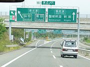
The expressway commences at a junction with the Jōban Expressway
in Iwaki
, Fukushima and follows a northwesterly course to the city of Kōriyama
, where it intersects with the Tōhoku Expressway
. The expressway continues its course through the historic Aizu
region, with Mount Bandai
viewable to the north and Lake Inawashiro
viewable to the south. The route then enters Niigata Prefecture
and eventually terminates at a junction in Niigata City
with the Hokuriku Expressway
and Nihonkai-Tōhoku Expressway
.
The route parallels the East Ban'etsu Line and West Ban'etsu Line
of East Japan Railway Company
and National Route 49 for much of its length.
The first section of the expressway was opened to traffic in 1990 and the entire route was completed in 1997. The route was originally 2 lanes only, one in each direction. However expansion to two lanes in each direction has proceeded gradually over the years. Expansion of the eastern half (between Iwaki Junction and Kōriyama Junction) was completed in 2009.
Using the Ban-etsu and Hokuriku Expressway
to travel between the Tōhoku
and Kinki regions is shorter and cheaper than using expressways that traverse a route via the greater Tokyo
urban area.
All service areas along the route feature restaurants and shops (there are also shops at Gobyakugawa Parking Area). There are 24-hour gas stations at Abukumakōgen Service Area and Bandaisan Service Area. There is a 24-hour FamilyMart
convenience store at Aganogawa Service Area (Niigata-bound only). Saiso Parking Area and Miharu Parking Area feature vending machines and toilets, while all other parking areas have only toilets.
37.037744°N 140.817292°W Iwaki JCT
37.873871°N 139.039028°W Niigata-Chūō IC
Expressways of Japan
The expressways of Japan make up a large network of freeway-standard toll roads.- History :Following World War II, Japan's economic revival led to a massive increase in personal automobile use...
in the Tōhoku region
Tohoku region
The is a geographical area of Japan. The region occupies the northeastern portion of Honshu, the largest island of Japan. The region consists of six prefectures : Akita, Aomori, Fukushima, Iwate, Miyagi and Yamagata....
of Japan
Japan
Japan is an island nation in East Asia. Located in the Pacific Ocean, it lies to the east of the Sea of Japan, China, North Korea, South Korea and Russia, stretching from the Sea of Okhotsk in the north to the East China Sea and Taiwan in the south...
. It is owned and operated by East Nippon Expressway Company
East Nippon Expressway Company
The , abbreviated as , is one of the main operators of expressways and toll roads in Japan. It is headquartered in Kasumigaseki, Chiyoda, Tokyo.The company was established on October 1, 2005 as a result of the privatization of Japan Highway Public Corporation. The company manages roadways mainly in...
.
Naming
The name is a kanjiKanji
Kanji are the adopted logographic Chinese characters hanzi that are used in the modern Japanese writing system along with hiragana , katakana , Indo Arabic numerals, and the occasional use of the Latin alphabet...
acronym consisting of characters found in the former names of the provinces linked by the expressway. consists of the eastern part of present-day Fukushima Prefecture
Fukushima Prefecture
is a prefecture of Japan located in the Tōhoku region on the island of Honshu. The capital is the city of Fukushima.-History:Until the Meiji Restoration, the area of Fukushima prefecture was known as Mutsu Province....
, and consists of present-day Niigata Prefecture
Niigata Prefecture
is a prefecture of Japan located on the island of Honshū on the coast of the Sea of Japan. The capital is the city of Niigata. The name "Niigata" literally means "new lagoon".- History :...
.
Officially the expressway is referred to as the Tōhoku-Ōdan Expressway Iwaki Niigata Route.
Overview
Pacific Ocean
The Pacific Ocean is the largest of the Earth's oceanic divisions. It extends from the Arctic in the north to the Southern Ocean in the south, bounded by Asia and Australia in the west, and the Americas in the east.At 165.2 million square kilometres in area, this largest division of the World...
and the Japan Sea by traversing the mountainous interior of the Tōhoku region.
The expressway commences at a junction with the Jōban Expressway
Joban Expressway
The , abbreviated , is a national expressway in Japan. It is owned and operated by East Nippon Expressway Company.-Naming:Jōban is a kanji acronym consisting of two characters...
in Iwaki
Iwaki, Fukushima
is a city located in the southern part of the Hamadōri coastal region of Fukushima Prefecture, Japan.A designated "core city", Iwaki is also one of the growing number of hiragana cities. Its area is 1,231.35 km², making it the 10th largest city in Japan...
, Fukushima and follows a northwesterly course to the city of Kōriyama
Koriyama, Fukushima
is a city in the center of the Nakadōri region of Fukushima Prefecture, Japan. As of May 2011, the city had an estimated population of 336,328. The total area is 757 km²....
, where it intersects with the Tōhoku Expressway
Tohoku Expressway
The is a national expressway in Japan. It is owned by Japan Expressway Holding and Debt Repayment Agency and operated by East Nippon Expressway Company.-Naming:Tōhoku refers to the Tōhoku region, the northernmost region on the island of Honshū....
. The expressway continues its course through the historic Aizu
Aizu
is an area comprising the westernmost third of Fukushima Prefecture in Japan. The principal city of the area is Aizuwakamatsu.During the Edo period, Aizu was a feudal domain known as and part of Mutsu Province.-History:...
region, with Mount Bandai
Mount Bandai
, also known as , , and , is a stratovolcano in Fukushima Prefecture, Japan.In a major eruption on July 15, 1888 the north and east parts of the caldera collapsed in a massive landslide, forming two lakes, Hibara-ko and Onogawa-ko, as well as several minor lakes called Goshiki-numa, or the 'Five...
viewable to the north and Lake Inawashiro
Lake Inawashiro
is the fourth-largest lake in Japan, located in the middle of Fukushima Prefecture, south of Mount Bandai. It is also known as the 'Sky Mirror Lake'. In winter swans migrate to the beaches of the lake and stay there until spring....
viewable to the south. The route then enters Niigata Prefecture
Niigata Prefecture
is a prefecture of Japan located on the island of Honshū on the coast of the Sea of Japan. The capital is the city of Niigata. The name "Niigata" literally means "new lagoon".- History :...
and eventually terminates at a junction in Niigata City
Niigata, Niigata
is the capital and the most populous city of Niigata Prefecture, Japan. It lies on the northwest coast of Honshu, the largest island of Japan, and faces the Sea of Japan and Sado Island....
with the Hokuriku Expressway
Hokuriku Expressway
The ,The ,The ,(abbreviated as , is a 4-laned national expressway in Japan. It is owned and managed by East Nippon Expressway Company and Central Nippon Expressway Company.-Overview:...
and Nihonkai-Tōhoku Expressway
Nihonkai-Tohoku Expressway
The is a national expressway in Japan. It is owned and operated by East Nippon Expressway Company.-Naming:The course of the expressway takes it alongside the coastline of the Sea of Japan in the Tōhoku region of Japan....
.
The route parallels the East Ban'etsu Line and West Ban'etsu Line
West Ban'etsu Line
The is a rail line in Japan operated by East Japan Railway Company . It runs between Kōriyama Station in Kōriyama, Fukushima Prefecture and Niitsu Station in Niigata, Niigata Prefecture. The name "Ban'etsu" is taken from the first characters of the names of the ancient provinces of and , which...
of East Japan Railway Company
East Japan Railway Company
is the largest passenger railway company in the world and one of the seven Japan Railways Group companies. The company name is officially abbreviated as JR East in English, and as in Japanese. The company's headquarters are in Yoyogi, Shibuya, Tokyo....
and National Route 49 for much of its length.
The first section of the expressway was opened to traffic in 1990 and the entire route was completed in 1997. The route was originally 2 lanes only, one in each direction. However expansion to two lanes in each direction has proceeded gradually over the years. Expansion of the eastern half (between Iwaki Junction and Kōriyama Junction) was completed in 2009.
Using the Ban-etsu and Hokuriku Expressway
Hokuriku Expressway
The ,The ,The ,(abbreviated as , is a 4-laned national expressway in Japan. It is owned and managed by East Nippon Expressway Company and Central Nippon Expressway Company.-Overview:...
to travel between the Tōhoku
Tohoku region
The is a geographical area of Japan. The region occupies the northeastern portion of Honshu, the largest island of Japan. The region consists of six prefectures : Akita, Aomori, Fukushima, Iwate, Miyagi and Yamagata....
and Kinki regions is shorter and cheaper than using expressways that traverse a route via the greater Tokyo
Tokyo
, ; officially , is one of the 47 prefectures of Japan. Tokyo is the capital of Japan, the center of the Greater Tokyo Area, and the largest metropolitan area of Japan. It is the seat of the Japanese government and the Imperial Palace, and the home of the Japanese Imperial Family...
urban area.
All service areas along the route feature restaurants and shops (there are also shops at Gobyakugawa Parking Area). There are 24-hour gas stations at Abukumakōgen Service Area and Bandaisan Service Area. There is a 24-hour FamilyMart
FamilyMart
is a convenience store franchise chain first opened in Japan on September 1, 1981. FamilyMart is Japan's third largest convenience store chain, behind 7-Eleven and Lawson, and the largest chain store in South Korea. FamilyMart is owned and overseen by FamilyMart Company, Limited...
convenience store at Aganogawa Service Area (Niigata-bound only). Saiso Parking Area and Miharu Parking Area feature vending machines and toilets, while all other parking areas have only toilets.
List of interchanges and features
- IC - interchangeInterchange (road)In the field of road transport, an interchange is a road junction that typically uses grade separation, and one or more ramps, to permit traffic on at least one highway to pass through the junction without directly crossing any other traffic stream. It differs from a standard intersection, at which...
, SIC - smart interchange, JCT - junction, SA - service area, PA - parking area, BS - bus stopBus stopA bus stop is a designated place where buses stop for passengers to board or leave a bus. These are normally positioned on the highway and are distinct from off-highway facilities such as bus stations. The construction of bus stops tends to reflect the level of usage...
, TN - tunnelTunnelA tunnel is an underground passageway, completely enclosed except for openings for egress, commonly at each end.A tunnel may be for foot or vehicular road traffic, for rail traffic, or for a canal. Some tunnels are aqueducts to supply water for consumption or for hydroelectric stations or are sewers...
, BR - bridgeBridgeA bridge is a structure built to span physical obstacles such as a body of water, valley, or road, for the purpose of providing passage over the obstacle...
| No. | Name | Connections | Dist. from Origin |
Dist. from Terminus |
Bus Stop | Notes | Speed Limit | Lanes | Location | |
|---|---|---|---|---|---|---|---|---|---|---|
| (16-1) | Iwaki JCT | .svg.png) Jōban Expressway Jōban ExpresswayJoban Expressway The , abbreviated , is a national expressway in Japan. It is owned and operated by East Nippon Expressway Company.-Naming:Jōban is a kanji acronym consisting of two characters... |
0.0 | 212.7 | 80 km/h | Four | Iwaki Iwaki, Fukushima is a city located in the southern part of the Hamadōri coastal region of Fukushima Prefecture, Japan.A designated "core city", Iwaki is also one of the growing number of hiragana cities. Its area is 1,231.35 km², making it the 10th largest city in Japan... |
Fukushima Fukushima Prefecture is a prefecture of Japan located in the Tōhoku region on the island of Honshu. The capital is the city of Fukushima.-History:Until the Meiji Restoration, the area of Fukushima prefecture was known as Mutsu Province.... |
||
| TN | Gōdo Tunnel | ↓ | ↑ | Length - 383 m | 70 km/h | Two | ||||
| 1 | Iwaki-Miwa IC |  National Route 49 National Route 49Japan National Route 49 National Route 49 is a national highway of Japan connecting Iwaki, Fukushima and Chūō-ku, Niigata in Japan, with a total length of 246.4 km .-Route Data:*Length: 246.4 km *Origin: Iwaki, Fukushima... Pref. Route 66 (Onahama Ono Route) |
8.8 | 203.9 | ||||||
| 80 km/h | Four | |||||||||
| TN | Watato Tunnel | ↓ | ↑ | Length - 1,140 m | ||||||
| PA | Saiso PA | 18.7 | 194.0 | |||||||
| 70 km/h | Two | |||||||||
| 2 | Ono IC/JCT | Abukuma Kōgen Road National Route 349 National Route 349 |
35.2 | 177.5 | ○ | Ono Ono, Fukushima is a town located in Tamura District, Fukushima, Japan.As of 2003, the town has an estimated population of 12,190 and a density of 97.43 persons per km². The total area is 125.11 km².... |
||||
| 80 km/h | Four | |||||||||
| TN | Shinkazakoshi Tunnel | ↓ | ↑ | Iwaki-bound - 460 m Niigata-bound - 538 m |
||||||
| Tamura Tamura, Fukushima is a city located in Fukushima, Japan. The city was founded on March 1, 2005 from the merger of the former towns of Funehiki, Ōgoe, Takine, and Tokiwa and the former village of Miyakoji, all from Tamura District.... |
||||||||||
| SA | Abukumakōgen SA | 46.8 | 165.9 | |||||||
| 70 km/h | Two | |||||||||
| 3 | Funehiki-Miharu IC |  National Route 288 National Route 288 |
55.7 | 157.0 | ||||||
| PA | Miharu PA | 59.5 | 153.2 | |||||||
| 3-1 | Kōriyama-higashi IC | National Route 288 |
63.7 | 149.0 | Kōriyama Koriyama, Fukushima is a city in the center of the Nakadōri region of Fukushima Prefecture, Japan. As of May 2011, the city had an estimated population of 336,328. The total area is 757 km².... |
|||||
| 80 km/h | Four | |||||||||
| (18-1) | Kōriyama JCT | Tōhoku Expressway Tohoku Expressway The is a national expressway in Japan. It is owned by Japan Expressway Holding and Debt Repayment Agency and operated by East Nippon Expressway Company.-Naming:Tōhoku refers to the Tōhoku region, the northernmost region on the island of Honshū.... |
71.4 | 141.3 | ||||||
| BR | Gohyakugawa Bridge | ↓ | ↑ | Length - 170 m | ||||||
| Motomiya Motomiya, Fukushima was a town located in the Nakadori, or Abukuma, part of Adachi District, Fukushima, Japan.On January 1, 2007, Motomiya was merged with the village of Shirasawa, also from Adachi District, to form the new city of Motomiya.... |
||||||||||
| PA | Gohyakugawa PA | 76.5 | 136.2 | Kōriyama Koriyama, Fukushima is a city in the center of the Nakadōri region of Fukushima Prefecture, Japan. As of May 2011, the city had an estimated population of 336,328. The total area is 757 km².... |
||||||
| 4 | Bandaiatami IC | Pref. Route 24 (Nakanosawa Atami Route) | 79.6 | 133.1 | ||||||
| TN | Takatamahigashi Tunnel | ↓ | ↑ | Length - 1,120 m | ||||||
| TN | Takatamanishi Tunnel | ↓ | ↑ | Length - 990 m | ||||||
| TN | Shinnakayama Tunnel | ↓ | ↑ | Length - 1,820 m | ||||||
| TN | Kurateyama Tunnel | ↓ | ↑ | Length - 1,670 m | ||||||
| Inawashiro Inawashiro, Fukushima is a town located in Yama District, Fukushima, Japan. Inawashiro rests on the shores of Lake Inawashiro, one of the largest lakes in Japan. During the Edo period, it was part of the Aizu domain, and was the home of Aizu's secondary castle town... |
||||||||||
| TN | Sekito Tunnel | ↓ | ↑ | Length - 1,490 m | ||||||
| 5 | Inawashiro Bandaikōgen IC |  National Route 115 National Route 115 |
97.6 | 115.1 | ||||||
| SA | Bandaisan SA | 105.3 | 107.4 | Bandai Bandai, Fukushima is a town located in Yama District, Fukushima, Japan.As of 2003, the town has an estimated population of 3,931 and a density of 65.86 persons per km². The total area is 59.69 km².-External links:*... |
||||||
| 6 | Bandai Kawahigashi IC | Pref. Route 64 (Aizuwakamatsu Urabandai Route) | 111.5 | 101.2 | Aizu- wakamatsu Aizuwakamatsu, Fukushima is a city located in the Aizu region of Fukushima Prefecture, Japan.As of May 2011, the city has an estimated population of 125,341. The total area is 383.03 km².-History:... |
|||||
| 7 | Aizuwakamatsu IC |  National Route 121 National Route 121Japan National Route 121 National Route 121 is a national highway connecting the city of Yonezawa, Yamagata and the town of Mashiko, Tochigi in Japan.... |
117.5 | 95.2 | ||||||
| 70 km/h | Two | |||||||||
| PA | Niitsuru PA/SIC | 124.7 | 88.0 | Aizumisato Aizumisato, Fukushima is a town in Ōnuma District, Fukushima Prefecture, Japan. As of November 1, 2008, the town has a population of 23,588. The area is 276.37 km².... |
||||||
| TN | Nanaori Tunnel | ↓ | ↑ | Length - 2,360 m | Aizubange Aizubange, Fukushima is a town located in Kawanuma District, Fukushima, Japan.As of 2003, the town has an estimated population of 18,779 and a density of 204.90 persons per km². The total area is 91.65 km²... |
|||||
| 8 | Aizubange IC | National Route 49 Japan National Route 49 National Route 49 is a national highway of Japan connecting Iwaki, Fukushima and Chūō-ku, Niigata in Japan, with a total length of 246.4 km .-Route Data:*Length: 246.4 km *Origin: Iwaki, Fukushima...  National Route 252 National Route 252 |
132.4 | 80.3 | ||||||
| BR | Tadamigawa Bridge | ↓ | ↑ | Length - 310 m | ||||||
| TN | Tabanematsu Tunnel | ↓ | ↑ | Length - 1,330 m | ||||||
| Nishiaizu Nishiaizu, Fukushima is a town located in Yama District, Fukushima, Japan. It is known as the "front door" to the Iide Mountains.The town was founded in 1954 through a merger of smaller villages. In 2006, Nishiaizu residents decided to decline a merger with the city of Kitakata.... |
||||||||||
| TN | Toyasan Tunnel | ↓ | ↑ | Length - 2,600 m | ||||||
| TN | Nishiaizu Tunnel | ↓ | ↑ | Length - 1,020 m | ||||||
| 9/PA | Nishiaizu IC/PA | National Route 49 Japan National Route 49 National Route 49 is a national highway of Japan connecting Iwaki, Fukushima and Chūō-ku, Niigata in Japan, with a total length of 246.4 km .-Route Data:*Length: 246.4 km *Origin: Iwaki, Fukushima... Pref. Route 16 (Kitakata Nishiaizu Route) |
143.8 | 68.9 | ○ | |||||
| TN | Nagasaka Tunnel | ↓ | ↑ | Length - 740 m | ||||||
| TN | Ryūgadake Tunnel | ↓ | ↑ | Length - 3,660 m | ||||||
| TN | Kuromoriyama Tunnel | ↓ | ↑ | Length - 2,760 m | ||||||
| Aga Aga, Niigata is a town located in Higashikanbara District, Niigata Prefecture, Japan. It has an area of 952.88 km² and a population of 13,865 as of April 1, 2008... |
Niigata Niigata Prefecture is a prefecture of Japan located on the island of Honshū on the coast of the Sea of Japan. The capital is the city of Niigata. The name "Niigata" literally means "new lagoon".- History :... |
|||||||||
| TN | Koide Tunnel | ↓ | ↑ | Length - 1,120 m | ||||||
| PA | Kamikawa PA | 162.6 | 50.1 | |||||||
| 10 | Tsugawa IC | Pref. Route 89 (Tsugawa Inter Route) | 166.2 | 46.5 | ○ | |||||
| TN | Yakiyama Tunnel | ↓ | ↑ | Length - 2,990 m | ||||||
| BS | Mikawa Bus Stop | 172.8 | 39.9 | ○ | ||||||
| 11 | Mikawa IC | Pref. Route 587 (Mikawa Inter Route) | 174.0 | 38.7 | ||||||
| TN | Yoshizu Tunnel | ↓ | ↑ | Length - 910 m | ||||||
| TN | Nishiyama Tunnel | ↓ | ↑ | Length - 2,400 m | ||||||
| TN | Kumawatari Tunnel | ↓ | ↑ | Length - 160 m | ||||||
| SA | Aganogawa SA | 181.0 | 31.7 | |||||||
| TN | Komatsu Tunnel | ↓ | ↑ | Length - 210 m | Agano Agano, Niigata is a city located in Niigata Prefecture, Japan. As of April 1, 2011, it has an area of 192.72 km² and a population of 46,056 with 13,794 households, and a population density of 239.00 persons per km².-History:... |
|||||
| TN | Hōshusan Tunnel | ↓ | ↑ | Length - 610 m | ||||||
| 12 | Yasuda IC | Pref. Route 41 (Shirone Yasuda Route) | 188.9 | 23.8 | ○ | |||||
| 80 km/h | Four | |||||||||
| PA | Gosen PA | 191.2 | 21.5 | Gosen Gosen, Niigata is a city located in Niigata, Japan.As of 2005, the city has an estimated population of 56,965 and a density of 382.89 persons per km². The total area is 351.87 km².The city was founded on November 3, 1954... |
||||||
| 70 km/h | Two | |||||||||
| 13 | Niitsu IC | Pref. Route 34 (Niitsu Teishajō Route) National Route 460 National Route 460 |
198.5 | 14.2 | Akiha-ku, Niigata Akiha-ku, Niigata is one of the eight wards of Niigata City, Niigata Prefecture, Japan. The ward was created on April 1, 2007 when Niigata became a government-designated city. It is composed of the former city of Niitsu and the former town of Kosudo.-External links:* *... |
|||||
| BS | Kawaguchi Bus Stop | 202.2 | 10.5 | ○ | ||||||
| BS | Sakaya Bus Stop | 207.5 | 5.2 | ○ | Kōnan-ku, Niigata Konan-ku, Niigata is one of the eight wards of Niigata, Niigata. It is composed of the Sonoki, Ryoukawa and Oeyama parts of old Niigata City, and the towns of Kameda and Yokogoshi that became a part of Niigata City in 2005.-External links:* *... |
|||||
| PA | Niigata PA | 208.6 | 4.1 | |||||||
| 100 km/h | Four | |||||||||
| (42) | Niigata-Chūō JCT | Hokuriku Expressway Hokuriku Expressway The ,The ,The ,(abbreviated as , is a 4-laned national expressway in Japan. It is owned and managed by East Nippon Expressway Company and Central Nippon Expressway Company.-Overview:... Nihonkai-Tōhoku ExpresswayNihonkai-Tohoku Expressway The is a national expressway in Japan. It is owned and operated by East Nippon Expressway Company.-Naming:The course of the expressway takes it alongside the coastline of the Sea of Japan in the Tōhoku region of Japan.... |
211.9 | 0.8 | ||||||
| 14 | Niigata-Chūō IC | Pref. Route 16 (Niigata Kameda Uchino Route) Pref. Route 290 (Sonoki Hitoichi Route) |
212.7 | 0.0 | ||||||
External links
East Nippon Expressway Company37.037744°N 140.817292°W Iwaki JCT
37.873871°N 139.039028°W Niigata-Chūō IC