
Teusaquillo
Encyclopedia
 Teusaquillo in Bogotá |
|
| Area: | 4.98 km² |
|---|---|
| Population density Density The mass density or density of a material is defined as its mass per unit volume. The symbol most often used for density is ρ . In some cases , density is also defined as its weight per unit volume; although, this quantity is more properly called specific weight... : |
139,298 (2007) |
| Type of locality: | Urban |
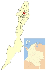
Teusaquillo is the 13th locality of Bogotá
Bogotá
Bogotá, Distrito Capital , from 1991 to 2000 called Santa Fé de Bogotá, is the capital, and largest city, of Colombia. It is also designated by the national constitution as the capital of the department of Cundinamarca, even though the city of Bogotá now comprises an independent Capital district...
, capital of Colombia
Colombia
Colombia, officially the Republic of Colombia , is a unitary constitutional republic comprising thirty-two departments. The country is located in northwestern South America, bordered to the east by Venezuela and Brazil; to the south by Ecuador and Peru; to the north by the Caribbean Sea; to the...
. It is located in the geographic center of the city, to the northwest of downtown. It is an urbanized locality with several green zones in its parks, avenues, and the campus of the National University of Colombia
National University of Colombia
The Universidad Nacional de Colombia , also called UNAL or just UN, is a public, national, coeducational, research university, located primarily in Bogotá, Medellín, Manizales and Palmira, Colombia...
. It is located on the former site of an indigenous reserve known as Pueblo Viejo (Old Village), which existed until urbanization in the 20th century.
Area
The total area of the locality is 14.19 square kilometres, making the locality at 11th of 20 in terms of size.Borders
North: Calle 63, with the locality of Barrios UnidosBarrios Unidos
Barrios Unidos is the 12th locality of Bogotá, capital of Colombia. It is located in the city's north. Barrios Unidos is completely urban, with some light industry and major commercial areas.- Borders :North: Calle 100, bordering the locality of Suba...
South: Diagonal 22, Avenida El Dorado, and Avenida de Las Américas, with the localities of Los Mártires
Los Mártires
Los Mártires is the 14th locality of Bogotá, capital of Colombia. It is located near the city's downtown to its west. It takes its name in honor of those who died during the war for independence from Spain...
and Puente Aranda
Puente Aranda
Puente Aranda is the 16th location of the Capital District of the Colombian capital city, Bogotá. It is located in the midwest within the city and was named after an old bridge in the hacienda of Juan Aranda over the "Chinúa River" now called the San Francisco Creek that dates from the 16th...
East: Avenida Caracas
Avenida Caracas (Bogotá)
Avenida Caracas, sometimes called Carrera 14, is an arterial road in Bogotá, Colombia that runs through the city from north to south.-Names:...
, with the localities of Chapinero
Chapinero
Chapinero is the second locality of Bogotá, capital of Colombia. It is located in northeastern Bogotá. It is among the more affluent of localities in the city, and is home to several important commercial and dining areas. It comprises three major residential areas: Chicó, El Lago, and Chapinero...
and Santafé
Santa Fe (Bogotá)
Santa Fe is the third locality of Bogotá, Capital District of Colombia. Santa Fe is the traditional downtown of the city of Bogotá. This area once comprised Bogotá's total main urban area and was known as "Santa Fe de Bogotá" with its traditional neighborhoods.Santa Fe is one of Bogotá's most...
West: Avenida Carrera 68, with the localities of Engativá
Engativá
Engativá, which translates to Chieftain of Inga, was a municipality of Cundinamarca, but became a locality of Bogotá, Colombia when Bogotá was made "Special District" .-Geographical location:...
and Fontibón
Fontibon
Fontibon is a former municipality located at the westernmost side of Bogotá, Colombia.-History:Founded on May 10, 1954; Fontibon was the gate to the current Bogotá City also known as Santa Fe de Bogotá, to the conquistador Gonzalo Jimenez de Quesada and his fellow expeditioners.The origin of the...
.
Hydrology
The locality is located in the Salitre and Fucha river basins. The Simón Bolívar park system also includes several large lakes. Teusaquillo is also crossed by various canals, which form part of the rainwater-management system of Bogotá. They are extensions of streams that start in the eastern mountains.Salitre River system:
- Canal Arzobispo: An extension of the Arzobispo River which runs through the locality until Carrera 30Norte-Quito-SurAvenida Norte-Quito-Sur or NQS is an arterial road in Bogotá, Colombia that crosses the city from northeast to southwest.The avenue is formed from the union of three old avenues, Avenida Ciudad de Quito, Avenida Novena, and Autopista Sur.-The names:...
, at which point it continues as the El Salitre Canal. - Canal El Salitre: From Carrera 30Norte-Quito-SurAvenida Norte-Quito-Sur or NQS is an arterial road in Bogotá, Colombia that crosses the city from northeast to southwest.The avenue is formed from the union of three old avenues, Avenida Ciudad de Quito, Avenida Novena, and Autopista Sur.-The names:...
, it runs in front of the National University campus, passing Estadio El CampínEstadio El CampínThe Nemesio Camacho Stadium, commonly known as El Campín, is the main stadium of Bogotá, Colombia. It is the home ground of the Independiente Santa Fe and Millonarios association football teams....
until Calle 63, where it enters the locality of Barrios UnidosBarrios UnidosBarrios Unidos is the 12th locality of Bogotá, capital of Colombia. It is located in the city's north. Barrios Unidos is completely urban, with some light industry and major commercial areas.- Borders :North: Calle 100, bordering the locality of Suba...
.
Fucha River system:
- San Francisco Canal, which is an extension of the river of the same name, crosses the locality underground until Carrera 50.
Topography
Teusaquillo is relatively flat due to its location on the savannahSavannah
Savannah or savanna is a type of grassland.It can also mean:-People:* Savannah King, a Canadian freestyle swimmer* Savannah Outen, a singer who gained popularity on You Tube...
of Bogotá. It slopes slightly to the northwest.
Pre-Colombian, colonial, and post-colonial
The name Teusaquillo, like the name of Bogotá itself, dates to pre-ColumbianPre-Columbian
The pre-Columbian era incorporates all period subdivisions in the history and prehistory of the Americas before the appearance of significant European influences on the American continents, spanning the time of the original settlement in the Upper Paleolithic period to European colonization during...
times. Similar to the city, the name corresponded to a different location that is located near to the present-day municipality of Funza. That, in turn, was known as Bacata and was the capital of the Chibcha Empire. Within that kingdom was Teivzaquillo, the summer home of the Zipa—the leader of the Muiscas of Bacata.
Located in the foothills of the Cordillera Oriental
Cordillera Oriental, Colombia
The Cordillera Oriental is one of three main mountain ranges that divides the Cordillera in the Andes Mountains of Colombia.It extends from southeast to northeast from the "Colombian Massif" in Huila to the Perijá Mountains in La Guajira....
, it was discovered by Gonzalo Jiménez de Quesada. It was conquered by the Spanish who founded the town of Nuestra Señora de la Esperanza on August 6, 1538, located in present-day La Candelaria
La Candelaria
La Candelaria is a historic neighborhood in downtown Bogotá, Colombia. It is the equivalent to the Old City in other cities. The architecture of the old houses, churches and buildings has Spanish Colonial and Baroque styles...
. It was renamed Santafé in 1539 and was made the capital of Nueva Granada
Viceroyalty of New Granada
The Viceroyalty of New Granada was the name given on 27 May 1717, to a Spanish colonial jurisdiction in northern South America, corresponding mainly to modern Colombia, Ecuador, Panama, and Venezuela. The territory corresponding to Panama was incorporated later in 1739...
. At that time, the name Teivzaquillo fell out of use.
During the post-colonial period, the locality remained a rural area with a largely agrarian economy. It was known as Pueblo Viejo.
Modern times
On September 7, 1902, Football Club opened the city's first football field in the Pueblo Viejo area and named it Teusaquillo, a SpanishSpanish language
Spanish , also known as Castilian , is a Romance language in the Ibero-Romance group that evolved from several languages and dialects in central-northern Iberia around the 9th century and gradually spread with the expansion of the Kingdom of Castile into central and southern Iberia during the...
translation of Teivzaquillo, as an homage to the indigenous Chibcha people who had lived in the area. That field saw the first game between Colombian football teams, the Red Team and the White Team—both belonging to Football Club. The following year, another field was built and named Marly. The area quickly became the capital city's football destination.
It was not until the 1920s that large-scale urbanization took place north of the Santa Fe
Santa Fe (Bogotá)
Santa Fe is the third locality of Bogotá, Capital District of Colombia. Santa Fe is the traditional downtown of the city of Bogotá. This area once comprised Bogotá's total main urban area and was known as "Santa Fe de Bogotá" with its traditional neighborhoods.Santa Fe is one of Bogotá's most...
neighborhood. As neighborhoods were constructed between Santa Fe and the still-small village of Chapinero
Chapinero
Chapinero is the second locality of Bogotá, capital of Colombia. It is located in northeastern Bogotá. It is among the more affluent of localities in the city, and is home to several important commercial and dining areas. It comprises three major residential areas: Chicó, El Lago, and Chapinero...
, it was decided the area should be named Teusaquilo. The naming occurred in 1927 and the neighborhood quickly became on of the more modern and elegant of the era; a symbol of the city's flourishing after its fourth century of existence.
The neighborhood saw new architectural tendencies, especially the English Victorian
Victorian architecture
The term Victorian architecture refers collectively to several architectural styles employed predominantly during the middle and late 19th century. The period that it indicates may slightly overlap the actual reign, 20 June 1837 – 22 January 1901, of Queen Victoria. This represents the British and...
style. Many of these buildings exist to the present day. It was considered the most fashionable neighborhood in Bogotá, a title that was passed to the Chicó neighborhood around 1985. Many notable Colombians lived there during its prime, including Jorge Eliécer Gaitán
Jorge Eliécer Gaitán
Jorge Eliécer Gaitán Ayala was a politician, a leader of a populist movement in Colombia, a former Education Minister and Labor Minister , mayor of Bogotá and one of the most charismatic leaders of the Liberal Party.He was assassinated during his second presidential campaign in 1948, setting off...
, Enrique Santos Montejo, Laureano Gómez
Laureano Gómez
Laureano Eleuterio Gómez Castro was President of Colombia from 1950 to 1953, and long time leader of the Colombian Conservative Party.-Pre-election:...
, Gustavo Rojas Pinilla
Gustavo Rojas Pinilla
Gustavo Rojas Pinilla was a Colombian politician, military officer, General of the Army and President of Colombia between 1953 and 1957.- Biographic data :...
, and Mariano Ospina Pérez
Mariano Ospina Pérez
Luis Mariano Ospina Pérez was a Colombian engineer and political figure, member of the Colombian Conservative Party. He served as President of Colombia between 1946 and 1950.- Biographic data :...
Construction on the National University began in May 1937 and was completed in 1945. In 1938, construction of El Campín
Estadio El Campín
The Nemesio Camacho Stadium, commonly known as El Campín, is the main stadium of Bogotá, Colombia. It is the home ground of the Independiente Santa Fe and Millonarios association football teams....
football stadium was begun on land donated by Luis Camacho Matiz. It was reconstructed in 1951 to hold 40,000 and is the current home of the city's Millonarios
Millonarios
Millonarios Fútbol Club is a Colombian football club based in Bogotá. As of 2011, Millonarios shares with rivals América de Cali the most Fútbol Profesional Colombiano championships, 13 in total, although Millonarios haven't won this tournament since 1988. They are also the third Colombian team to...
and Independiente Santa Fe
Independiente Santa Fe
Independiente Santafe is a professional Colombian First Division football club based in Bogotá. It has won six First Division titles and two Copa Colombia titles....
football clubs. Also in 1938, the area played host to the Bolivariano Games.
In 1961, work began on Simón Bolívar park. Included in the park land are several recreational centers, including a covered colesseum, a tennis
Tennis
Tennis is a sport usually played between two players or between two teams of two players each . Each player uses a racket that is strung to strike a hollow rubber ball covered with felt over a net into the opponent's court. Tennis is an Olympic sport and is played at all levels of society at all...
center, and a smaller football stadium.
In 1972, the Special District of Bogotá was formed out of the Cundinamarca Department
Cundinamarca Department
- Origin of the name :The name of Cundinamarca comes from Kundur marqa, an indigenous expression, probably derived from Quechua. Meaning "Condor's Nest", it was used in pre-Columbian times by the natives of the Magdalena Valley to refer to the nearby highlands....
and the city was split into 16 localities. The Teusaquillo neighborhood and its surroundings were named the 13th zone of the capital city and its official borders were set.
With the visit of Pope John Paul II
Pope John Paul II
Blessed Pope John Paul II , born Karol Józef Wojtyła , reigned as Pope of the Catholic Church and Sovereign of Vatican City from 16 October 1978 until his death on 2 April 2005, at of age. His was the second-longest documented pontificate, which lasted ; only Pope Pius IX ...
in 1986, a national shrine was built near the site of Pope Paul VI
Pope Paul VI
Paul VI , born Giovanni Battista Enrico Antonio Maria Montini , reigned as Pope of the Catholic Church from 21 June 1963 until his death on 6 August 1978. Succeeding Pope John XXIII, who had convened the Second Vatican Council, he decided to continue it...
's 1968 visit to Colombia. These two visits make the locality the place most-visited by the papacy in all of Colombia.
The Special District of Bogotá became the Capital District with the ratification of the constitution of 1991. Teusaquillo was made a locality as part of this transition.
Today
El Campín Stadium was remodled again in 2000 for the World Cup qualifers2002 FIFA World Cup qualification (CONMEBOL)
Listed below are the dates and results for the 2002 FIFA World Cup qualification rounds for the South American zone . For an overview of the qualification rounds, see the article 2002 FIFA World Cup qualification....
and the 2001 Copa América
Copa América
The Copa América —previously known as South American Championship—is an international football competition contested between the men's national teams of CONMEBOL, the sport's continental governing body...
. It was expanded to hold 48,310 spectators.
Additions were also made to Simón Bolívar Park, including:
- A large-events area with room for 150,000 spectators— the largest in the country.
- The Virgilio Barco Mega-library, one of the largest in the city, built in 1999
- The Simón Bolívar Aquatics Complex, opened in 2004 for the National Games. It has capacity for 4,000 and is one of the most modern in South AmericaSouth AmericaSouth America is a continent situated in the Western Hemisphere, mostly in the Southern Hemisphere, with a relatively small portion in the Northern Hemisphere. The continent is also considered a subcontinent of the Americas. It is bordered on the west by the Pacific Ocean and on the north and east...
, with an Olympic-sizedOlympic size swimming poolAn Olympic-size swimming pool is the type of swimming pool used in the Olympic Games, where the race course is 50 meters in length. This is typically referred to as "long course", delineating it from "short course" which applies to competitions in pools that are either 25 meters or 25 yards in...
pool.
Teusaqillo was briefly a center of relocation for demobilized members of the [United Self-Defense Forces of Colombia], who were given a living stipend and placed in several unoccupied houses throughout the eastern part of the locality. This led to concern from the residents of the largely middle-class, residential area, and confrontations between the largely unemployed former fighters and their neighbors. After a bomb was set off on July 15, 2005 in front of one of these houses, injuring three residents, the program was ended and the ex-paramilitaries moved to other locations.
Population
In the censusCensus
A census is the procedure of systematically acquiring and recording information about the members of a given population. It is a regularly occurring and official count of a particular population. The term is used mostly in connection with national population and housing censuses; other common...
of 1973, Teusaquillo had 127,521 inhabitants. Growth was slow over the next decade, and by 1985 the number was 132,501. By the time of the 1993 census, the population had dropped to 126,125 people, but the 1990s saw a population boom to 149,189. As of 2005, the locality was home to 157,884, making up 2.5% of the total urban population of the city.
Economy
While primarily a residential area, the locality has various commercial centers focusing on services and entertainment. The government and education sectors are among the largest employers in the area.Transportation
The locality is served by the following major roads: Avenida Carrera 68, Calle 63, Diagonal 53, Carrera 24, Avenida El Dorado, Avenida NQSNorte-Quito-Sur
Avenida Norte-Quito-Sur or NQS is an arterial road in Bogotá, Colombia that crosses the city from northeast to southwest.The avenue is formed from the union of three old avenues, Avenida Ciudad de Quito, Avenida Novena, and Autopista Sur.-The names:...
, and Avenida Caracas
Avenida Caracas (Bogotá)
Avenida Caracas, sometimes called Carrera 14, is an arterial road in Bogotá, Colombia that runs through the city from north to south.-Names:...
. All of these routes are well served by various fleets of private busses that run throughout all of the city.
It has two major bridges: one over NQS at Calle 63 and a more complex crossing at Avenida Carrera 68 leading into Engativá. There is also a large traffic circle at the border with Barrios Unidos, on which the Virgilio Barco Library and the Aquatic Complex are located.
The TransMilenio
TransMilenio
TransMilenio is a bus rapid transit system that serves Bogotá, the capital of Colombia. The system opened to the public in December 2000, covering Av. Caracas and Calle 80...
has two lines passing through the locality on Avenida Caracas and Avenida NQS serving nine stations.
The locality has an extensive bike-path network, with over 5 km within Simón Bolívar Park alone. A rail line crosses it and runs along Avenida NQS to the north.
Points of interest
While the major points of interest are Teusaquillo's parks and recreation centers, it is also home to several government departments. Included in these are the National Citizenship Registry (Registraduria Nacional), the National Statistics Department (DANE - Departamento Nacional de Estadíistica), the National Administration Center, the Solicitor General (Fiscalía General de la Nación), the Ministries of Education and Defense, and the Government of Cundinamarca department.The Embassy of the United States of America takes up several city blocks of the Quinta Paredes neighborhood. One of the top-five US embassies in terms of size, it is an important employer in the area.
Centro Ferial de Convenciones, or CORFERIAS, is the largest exposition center in the country. With a large arch at its entryway, it serves as one of the city's cultural and commercial centers. Its uses include the International Book Fair, artisan expositions, and Bogotá largest polling station during elections.
Teusaquillo's parks are home to several festivals, including November's Rock in the Park festival and August's Summer Festival. The majority of the city's large concerts are held in the locality in three main venues: El Campín, the Sports Palace, and the parks.
Museo Gaitan - Dedicated to the leftist political leader Jorge Eliecer Gaitan assassinated in 1948. The museum contains information on his life, and Gaitan is buried on the premises.
El Parkway - A two-kilometer park.
La Casa del Teatro - One of three theatres conforming the Teatro Nacional.
HOTEL CASA AURA MARÍA
Nearby these important places is where the HOTEL CASA AURA MARÍA is placed, which wants to extend you the invitation in order to be your first and best option of hosting at any moment you wish to visit our city.
The Hotel offers its guests the best personal attention for their own comfort, in order to feel kindness and feel as if it were their own home..
Neighborhoods
The most important neighborhoods in the locality are:Teusaquillo, La Magdalena, La Soledad, Cundinamarca, Palermo, Marly, Galerías, El Campín, Nuevo Campín, Quesada, Belalcázar, Nicolás de Federman, Rafael Nuñez, Ciudad Universitaria, Acevedo Tejada, Quinta Paredes, Centro Antonio Nariño, La Esmeralda, Pablo VI, Quirinal, San Luis, Simón Bolívar, Ortezal, Camavieja, Ciudad Salitre Oriental y CAN (Centro Administrativo Nacional).
The city government splits the locality into six Zonal Planning Units (Unidades de Planeación Zonal or UPZ). They are as follows, with year 2000 populations:
- La Esmeralda, 35,856
- Galerías, 33,685
- Teusaquillo, 29,162
- Quinta Paredes, 24,316
- Ciudad Salitre Oriental, 23,330
- Parque Central Simón Bolívar, 2,840
UPZ Parque Central is one of three UPZ in which Simón Bolívar is contained. UPZ Parque El Salitre is the portion of the park that lies in the Barrios Unidos locality, and UPZ Jardín Botánico is in Engativá locality.
The neighborhood known as Ciudad Salitre is also made up of three UPZ, with only UPZ Ciudad Salitre Oriental located within Teusaquillo. The western part of this neighborhood is officially part of the Fontibón locality.