
Streetcar suburb
Encyclopedia
A streetcar suburb is a residential community
whose growth and development was strongly shaped by the use of streetcar lines as a primary means of transportation. Early suburb
s were served by horsecar
s, but by the late 19th century cable cars
and electric streetcars, or tram
s, were used, allowing residences to be built further away from the urban core
of a city. Streetcar suburbs, usually called additions or extensions at the time, were the forerunner of today's suburb
s in the United States
and Canada
.
Although most closely associated with the electric streetcar, the term can be used for any suburb originally built with streetcar-based transit in mind, thus some streetcar suburbs date from the early 19th century. As such, the term is general and one development called a streetcar suburb may vary greatly from others. However, some concepts are generally present in streetcar suburbs, such as straight (often gridiron) street plans and relatively narrow lots.
 By 1830, many New York City
area commuters were going to work in Manhattan
from what is now the boroughs of Brooklyn
and Queens
, which were not part of New York City at that time. They commuted by ferries. In 1852, architect Andrew Jackson Davis
designed Llewellyn Park
in New Jersey
, a planned suburb served by both ferry and steam railroad
. In the 1840s and 1850s, the steam locomotive fostered the development of such New York City suburbs as Tarrytown
and New Rochelle. The steam locomotive in the mid 19th century provided the wealthy with the means to live in bucolic surroundings, to socialize in country clubs and still commute to work downtown. These suburbs were what historian Kenneth T. Jackson
called the "railroad suburbs" and historian Robert Fishman called a "bourgeois utopia". Outside of Philadelphia, suburbs like Radnor
, Swarthmore
, Villanova
developed along the Pennsylvania Main Line
. As early as 1850, 83 commuter stations had been built within a 15-mile radius of Boston
. Chicago
saw huge developments, with 11 separate lines serving over 100 communities by 1873. A famous community served was Riverside, Illinois
, arguably one of the first planned communities
in the United States, designed in 1869 by Frederick Law Olmsted
.
s and eventually cable cars
. First introduced to America around 1830, the horse-drawn omnibus
was revolutionary because it was the first mass transit system, offering regularly scheduled stops along a fixed route, allowing passengers to travel three miles sitting down in the time it would take them to walk two miles. Later more efficient horse-drawn streetcars allowed cities to expand to areas that previously had been even more distant. By 1860, they operated in most major American and Canadian cities, including New York, Baltimore, Philadelphia, Chicago
, Cincinnati, Saint Louis, Montreal, and Boston.
Horsecar suburbs emanated from the city center towards the more distant railroad suburbs. For the first time, transportation began to create a divide between social and economic classes in cities, as the working and middle class continued to live in areas closer to the city center, while the rich could afford to live further out.
in 1887 by Frank J. Sprague
marked the start of a new era of transportation-influenced suburbanization through the birth of the "streetcar suburb". The early trolley allowed people to effortlessly travel in 10 minutes what they could walk in 30, and was rapidly introduced in cities like Boston and Los Angeles
, and eventually to all larger American and Canadian cities. There were 5,783 miles of streetcar track serving American cities in 1890; this grew to 22,000 by 1902 and 34,404 by 1907.
By 1890, electric streetcar lines were replacing horse-drawn ones in cities of all sizes, allowing the lines to be extended and fostering a tremendous amount of suburban development. They were often extended out to formerly rural communities, which experienced an initial surge of development, and then new residential corridors were created along the newly built lines leading to what had sometimes been separate communities. On side streets, the houses closest to the original streetcar line are often as much as ten to twenty years older than houses built further down the street, reflecting the initial surge and slow completion of a development.
Because streetcar operators offered low fares and free transfers, commuting was finally affordable to nearly everyone. Combined with the relatively cheap cost of land further from the city, streetcar suburbs were able to attract a broad mix of people from all socioeconomic classes, although they were most popular by far with the middle class.
The houses in a streetcar suburb were generally narrow in width compared to later homes, and Arts and Crafts movement
styles like the California Bungalow
and American Foursquare
were most popular. These houses were typically purchased by catalog and many of the materials arrived by railcar, with some local touches added as the house was assembled. The earliest streetcar suburbs sometimes had more ornate styles, including late Victorian
and Stick
. The houses of streetcar suburbs, whatever the style, tended to have prominent front porches, while driveways and built-in garages were rare, reflecting the pedestrian-focused nature of the streets when the houses were initially built. Setbacks
between houses were not nearly as small as in older neighborhoods (where they were sometimes nonexistent), but houses were still typically built on lots no wider than 30 to 40 feet.
Shops such as groceries, bakeries and drug stores were usually built near the intersection of streetcar lines or directly along more heavily traveled routes (otherwise, routes would simply be lined with houses similar to those found in the surrounding neighborhoods). These shops would sometimes be multi-story buildings, with apartments on the upper floors. These provided convenient shopping for household supplies for the surrounding neighborhoods, that could potentially be visited on ones way to or from work. While there were stores near houses, they were not quite as close as in older parts of cities, and they were usually confined to specific streets, representing the beginning of a complete separation between residential and commercial areas in cities.
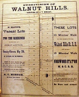
Unlike railroad suburbs, which tended to form in pockets around stations along the interurban line, streetcar suburbs formed continuous corridors stretching outwards from city cores. The streetcar lines themselves were either built on roads that conformed to the grid, or on former turnpikes radiating in all directs from the city, sometimes giving such cities a roughly star-like appearance on maps. Along the lines, developers built rectangular "additions" with homes, usually on small lots, within a five to ten minute walk of the streetcar. These were essentially built on the grid plan
of the older central cities, and typically spread out in between streetcar lines throughout a city.
Streetcar use continued to increase until 1923 when patronage reached 15.7 billion, but it declined in every year after that as automobile use increased amongst the middle and upper classes. By the 1930s, the once-profitable streetcar companies were diversifying by adding motorized buses and trackless trolleys to their fleets. By the 1940s, streetcar ridership had dropped dramatically, and few subdivisions were being built with streetcars or mass transit in general in mind. By the 1950s, nearly all streetcar lines had stopped running, and were instead served by buses.
Now somewhat urban in appearance, former streetcar suburbs are readily recognizable by the neighborhood structure along and near the route. Every few blocks, or along the entire route in well-preserved neighborhoods, there are small commercial structures, storefronts usually flush with the sidewalk; these were small stores—often groceries—operated by "mom and pop" operators who lived in quarters behind or above the establishment. Off-street parking, if it exists at all, is in the rear of the building.
Because stores were originally built along streetcar lines, a person could exit the transport near their home, do some light shopping for dinner items, and continue by walking to their residence. These buildings also provided shopping for a non-employed spouse. Very few small groceries remain (outside of New York City), though the space is often now used for non-foodstuff retail, capable of drawing clients from outside of the immediate neighborhood.
Modern streetcar suburbs are usually served by buses which run roughly the original streetcar routes, and may offer highly reasonable mass transit commute times to downtowns and other business areas, especially compared to later automobile suburbs. Toronto
, Canada
is an example of a city in which most streetcar suburbs are still served by streetcars
.
House prices in streetcar suburbs vary by neighborhood and city. Lots left empty in these areas during initial development, or where the initial houses have burned or been torn down, are usually too narrow for modern residential zoning regulations, meaning that it is difficult to infill
housing in well-preserved streetcar suburbs. Occasionally two lots are combined into one for a wide enough lot, or many houses are torn down for a new use as needed. However, in some cases where historic zoning applies, infill housing is encouraged or required to match neighboring housing standards.
in New Zealand
is served by the iconic Wellington Cable Car, and Karori
transport once linked to it.
The inner suburbs of many Australia
n cities were planned around tram
lines. Melbourne
's existing extensive tram network includes some examples of existing tram suburbs where tram was the dominant form of early transportation and still a major form of transport include Carlton
, Fitzroy
, St Kilda
, Albert Park
, South Melbourne
and Brunswick
.
.
An example is the city of Prague
, the capital of the Czech Republic. Prague has built many new suburban roads since the fall of communism and also has an extensive metro and bus system, but because its central core in a UNESCO World Heritage Site, the city authorities do not allow buses into the historic areas and they limit new road construction there. Instead the tram system is the backbone of the transportation system, with many pre-communist and communist-era neighbourhoods featuring brick and plaster walk-up apartment buildings lining roads that are served by several tram routes which run into the centre of the city. This is broadly similar to many mid-sized European cities.
Residential community
A residential community is a community, usually a small town or city, that is composed mostly of residents, as opposed to commercial businesses and/or industrial facilities, all three of which are considered to be the three main types of occupants of the typical community.Residential communities...
whose growth and development was strongly shaped by the use of streetcar lines as a primary means of transportation. Early suburb
Suburb
The word suburb mostly refers to a residential area, either existing as part of a city or as a separate residential community within commuting distance of a city . Some suburbs have a degree of administrative autonomy, and most have lower population density than inner city neighborhoods...
s were served by horsecar
Horsecar
A horsecar or horse-drawn tram is an animal-powered streetcar or tram.These early forms of public transport developed out of industrial haulage routes that had long been in existence, and from the omnibus routes that first ran on public streets in the 1820s, using the newly improved iron or steel...
s, but by the late 19th century cable cars
Cable car (railway)
A cable car or cable railway is a mass transit system using rail cars that are hauled by a continuously moving cable running at a constant speed. Individual cars stop and start by releasing and gripping this cable as required...
and electric streetcars, or tram
Tram
A tram is a passenger rail vehicle which runs on tracks along public urban streets and also sometimes on separate rights of way. It may also run between cities and/or towns , and/or partially grade separated even in the cities...
s, were used, allowing residences to be built further away from the urban core
Inner city
The inner city is the central area of a major city or metropolis. In the United States, Canada, United Kingdom and Ireland, the term is often applied to the lower-income residential districts in the city centre and nearby areas...
of a city. Streetcar suburbs, usually called additions or extensions at the time, were the forerunner of today's suburb
Suburb
The word suburb mostly refers to a residential area, either existing as part of a city or as a separate residential community within commuting distance of a city . Some suburbs have a degree of administrative autonomy, and most have lower population density than inner city neighborhoods...
s in the United States
United States
The United States of America is a federal constitutional republic comprising fifty states and a federal district...
and Canada
Canada
Canada is a North American country consisting of ten provinces and three territories. Located in the northern part of the continent, it extends from the Atlantic Ocean in the east to the Pacific Ocean in the west, and northward into the Arctic Ocean...
.
Although most closely associated with the electric streetcar, the term can be used for any suburb originally built with streetcar-based transit in mind, thus some streetcar suburbs date from the early 19th century. As such, the term is general and one development called a streetcar suburb may vary greatly from others. However, some concepts are generally present in streetcar suburbs, such as straight (often gridiron) street plans and relatively narrow lots.
Railroad Suburbs
New York City
New York is the most populous city in the United States and the center of the New York Metropolitan Area, one of the most populous metropolitan areas in the world. New York exerts a significant impact upon global commerce, finance, media, art, fashion, research, technology, education, and...
area commuters were going to work in Manhattan
Manhattan
Manhattan is the oldest and the most densely populated of the five boroughs of New York City. Located primarily on the island of Manhattan at the mouth of the Hudson River, the boundaries of the borough are identical to those of New York County, an original county of the state of New York...
from what is now the boroughs of Brooklyn
Brooklyn
Brooklyn is the most populous of New York City's five boroughs, with nearly 2.6 million residents, and the second-largest in area. Since 1896, Brooklyn has had the same boundaries as Kings County, which is now the most populous county in New York State and the second-most densely populated...
and Queens
Queens
Queens is the easternmost of the five boroughs of New York City. The largest borough in area and the second-largest in population, it is coextensive with Queens County, an administrative division of New York state, in the United States....
, which were not part of New York City at that time. They commuted by ferries. In 1852, architect Andrew Jackson Davis
Andrew Jackson Davis
Andrew Jackson Davis , American Spiritualist, was born at Blooming Grove, New York.- Early years :He had little education, though probably much more than he and his friends pretended. In 1843 he heard lectures in Poughkeepsie on animal magnetism, as the phenomena of hypnotism was then termed, and...
designed Llewellyn Park
Llewellyn Park
Llewellyn Park is a gated residential community of 175 homes within West Orange, New Jersey. Llewellyn Park does not have its own municipal government, but operates as part of the Township of West Orange. It is located just west of New York City....
in New Jersey
New Jersey
New Jersey is a state in the Northeastern and Middle Atlantic regions of the United States. , its population was 8,791,894. It is bordered on the north and east by the state of New York, on the southeast and south by the Atlantic Ocean, on the west by Pennsylvania and on the southwest by Delaware...
, a planned suburb served by both ferry and steam railroad
Steam locomotive
A steam locomotive is a railway locomotive that produces its power through a steam engine. These locomotives are fueled by burning some combustible material, usually coal, wood or oil, to produce steam in a boiler, which drives the steam engine...
. In the 1840s and 1850s, the steam locomotive fostered the development of such New York City suburbs as Tarrytown
Tarrytown, New York
Tarrytown is a village in the town of Greenburgh in Westchester County, New York, United States. It is located on the eastern bank of the Hudson River, about north of midtown Manhattan in New York City, and is served by a stop on the Metro-North Hudson Line...
and New Rochelle. The steam locomotive in the mid 19th century provided the wealthy with the means to live in bucolic surroundings, to socialize in country clubs and still commute to work downtown. These suburbs were what historian Kenneth T. Jackson
Kenneth T. Jackson
Kenneth Terry Jackson is a professor of history and social sciences at Columbia University. A frequent television guest, he is best known as an urban historian and a preeminent authority on New York City, where he lives on the Upper West Side....
called the "railroad suburbs" and historian Robert Fishman called a "bourgeois utopia". Outside of Philadelphia, suburbs like Radnor
Radnor Township, Pennsylvania
Radnor Township is a township in Delaware County, Pennsylvania, United States. As of the 2000 census, the township population was 30,878. Radnor Township lies along the Main Line, a collection of highly affluent Philadelphia suburbs....
, Swarthmore
Swarthmore, Pennsylvania
Swarthmore is a borough in Delaware County, Pennsylvania, United States. Swarthmore was originally named Westdale in honor of noted painter Benjamin West, who was one of the early residents of the town. The name was changed to Swarthmore after the establishment of Swarthmore College...
, Villanova
Villanova, Pennsylvania
Villanova is a community in the United States Commonwealth of Pennsylvania. It straddles Lower Merion Township of Montgomery County and Radnor Township of Delaware County. It is located at the center of the Pennsylvania Main Line, a series of highly affluent Philadelphia suburban towns located...
developed along the Pennsylvania Main Line
Pennsylvania Main Line
The Main Line is an unofficial historical and socio-cultural region of suburban Philadelphia, Pennsylvania, comprising a collection of affluent towns built along the old Main Line of the Pennsylvania Railroad which ran northwest from downtown Philadelphia parallel to Lancaster Avenue , a road...
. As early as 1850, 83 commuter stations had been built within a 15-mile radius of Boston
Boston
Boston is the capital of and largest city in Massachusetts, and is one of the oldest cities in the United States. The largest city in New England, Boston is regarded as the unofficial "Capital of New England" for its economic and cultural impact on the entire New England region. The city proper had...
. Chicago
Chicago
Chicago is the largest city in the US state of Illinois. With nearly 2.7 million residents, it is the most populous city in the Midwestern United States and the third most populous in the US, after New York City and Los Angeles...
saw huge developments, with 11 separate lines serving over 100 communities by 1873. A famous community served was Riverside, Illinois
Riverside, Illinois
Riverside is an affluent suburban village in Cook County, Illinois. A significant portion of the village is in the Riverside Landscape Architecture District, designated a National Historic Landmark in 1970. The population was 8,895 at the 2000 census...
, arguably one of the first planned communities
Planned community
A planned community, or planned city, is any community that was carefully planned from its inception and is typically constructed in a previously undeveloped area. This contrasts with settlements that evolve in a more ad hoc fashion. Land use conflicts are less frequent in planned communities since...
in the United States, designed in 1869 by Frederick Law Olmsted
Frederick Law Olmsted
Frederick Law Olmsted was an American journalist, social critic, public administrator, and landscape designer. He is popularly considered to be the father of American landscape architecture, although many scholars have bestowed that title upon Andrew Jackson Downing...
.
Horsecar and Cable Car Suburbs
However, the suburbs closest to the city were based on horsecarHorsecar
A horsecar or horse-drawn tram is an animal-powered streetcar or tram.These early forms of public transport developed out of industrial haulage routes that had long been in existence, and from the omnibus routes that first ran on public streets in the 1820s, using the newly improved iron or steel...
s and eventually cable cars
Cable car (railway)
A cable car or cable railway is a mass transit system using rail cars that are hauled by a continuously moving cable running at a constant speed. Individual cars stop and start by releasing and gripping this cable as required...
. First introduced to America around 1830, the horse-drawn omnibus
Bus
A bus is a road vehicle designed to carry passengers. Buses can have a capacity as high as 300 passengers. The most common type of bus is the single-decker bus, with larger loads carried by double-decker buses and articulated buses, and smaller loads carried by midibuses and minibuses; coaches are...
was revolutionary because it was the first mass transit system, offering regularly scheduled stops along a fixed route, allowing passengers to travel three miles sitting down in the time it would take them to walk two miles. Later more efficient horse-drawn streetcars allowed cities to expand to areas that previously had been even more distant. By 1860, they operated in most major American and Canadian cities, including New York, Baltimore, Philadelphia, Chicago
Chicago Surface Lines
The Chicago Surface Lines was operator of the street railway system of Chicago, Illinois, from the years 1913 to 1947. The firm is a predecessor of today's publicly owned operator, the Chicago Transit Authority.-History:...
, Cincinnati, Saint Louis, Montreal, and Boston.
Horsecar suburbs emanated from the city center towards the more distant railroad suburbs. For the first time, transportation began to create a divide between social and economic classes in cities, as the working and middle class continued to live in areas closer to the city center, while the rich could afford to live further out.
Development of streetcar suburbs
The introduction of the electrical streetcar in Richmond, VirginiaRichmond, Virginia
Richmond is the capital of the Commonwealth of Virginia, in the United States. It is an independent city and not part of any county. Richmond is the center of the Richmond Metropolitan Statistical Area and the Greater Richmond area...
in 1887 by Frank J. Sprague
Frank J. Sprague
Frank Julian Sprague was an American naval officer and inventor who contributed to the development of the electric motor, electric railways, and electric elevators...
marked the start of a new era of transportation-influenced suburbanization through the birth of the "streetcar suburb". The early trolley allowed people to effortlessly travel in 10 minutes what they could walk in 30, and was rapidly introduced in cities like Boston and Los Angeles
Los Ángeles
Los Ángeles is the capital of the province of Biobío, in the commune of the same name, in Region VIII , in the center-south of Chile. It is located between the Laja and Biobío rivers. The population is 123,445 inhabitants...
, and eventually to all larger American and Canadian cities. There were 5,783 miles of streetcar track serving American cities in 1890; this grew to 22,000 by 1902 and 34,404 by 1907.
By 1890, electric streetcar lines were replacing horse-drawn ones in cities of all sizes, allowing the lines to be extended and fostering a tremendous amount of suburban development. They were often extended out to formerly rural communities, which experienced an initial surge of development, and then new residential corridors were created along the newly built lines leading to what had sometimes been separate communities. On side streets, the houses closest to the original streetcar line are often as much as ten to twenty years older than houses built further down the street, reflecting the initial surge and slow completion of a development.
Because streetcar operators offered low fares and free transfers, commuting was finally affordable to nearly everyone. Combined with the relatively cheap cost of land further from the city, streetcar suburbs were able to attract a broad mix of people from all socioeconomic classes, although they were most popular by far with the middle class.
The houses in a streetcar suburb were generally narrow in width compared to later homes, and Arts and Crafts movement
Arts and Crafts movement
Arts and Crafts was an international design philosophy that originated in England and flourished between 1860 and 1910 , continuing its influence until the 1930s...
styles like the California Bungalow
California Bungalow
California bungalows, known as Californian bungalows in Australia and are commonly called simply bungalows in America, are a form of residential structure that were widely popular across America and, to some extent, the world around the years 1910 to 1939.-Exterior features:Bungalows are 1 or 1½...
and American Foursquare
American Foursquare
The American Foursquare or American Four Square is an American house style popular from the mid-1890s to the late 1930s. A reaction to the ornate and mass produced elements of the Victorian and other Revival styles popular throughout the last half of the 19th century, the American Foursquare was...
were most popular. These houses were typically purchased by catalog and many of the materials arrived by railcar, with some local touches added as the house was assembled. The earliest streetcar suburbs sometimes had more ornate styles, including late Victorian
Victorian house
In the United Kingdom, and former British colonies, a Victorian house generally means any house built during the reign of Queen Victoria...
and Stick
Stick-Eastlake
The Stick style was a late-19th-century American architectural style. According to McAlester, it served as the transition between the Carpenter Gothic style of the mid-19th century, and the Queen Anne style that it evolved into and superseded it by the 1890s....
. The houses of streetcar suburbs, whatever the style, tended to have prominent front porches, while driveways and built-in garages were rare, reflecting the pedestrian-focused nature of the streets when the houses were initially built. Setbacks
Setback (land use)
In land use, a setback is the distance which a building or other structure is set back from a street or road, a river or other stream, a shore or flood plain, or any other place which needs protection. Depending on the jurisdiction, other things like fences, landscaping, septic tanks, and various...
between houses were not nearly as small as in older neighborhoods (where they were sometimes nonexistent), but houses were still typically built on lots no wider than 30 to 40 feet.
Shops such as groceries, bakeries and drug stores were usually built near the intersection of streetcar lines or directly along more heavily traveled routes (otherwise, routes would simply be lined with houses similar to those found in the surrounding neighborhoods). These shops would sometimes be multi-story buildings, with apartments on the upper floors. These provided convenient shopping for household supplies for the surrounding neighborhoods, that could potentially be visited on ones way to or from work. While there were stores near houses, they were not quite as close as in older parts of cities, and they were usually confined to specific streets, representing the beginning of a complete separation between residential and commercial areas in cities.
Unlike railroad suburbs, which tended to form in pockets around stations along the interurban line, streetcar suburbs formed continuous corridors stretching outwards from city cores. The streetcar lines themselves were either built on roads that conformed to the grid, or on former turnpikes radiating in all directs from the city, sometimes giving such cities a roughly star-like appearance on maps. Along the lines, developers built rectangular "additions" with homes, usually on small lots, within a five to ten minute walk of the streetcar. These were essentially built on the grid plan
Grid plan
The grid plan, grid street plan or gridiron plan is a type of city plan in which streets run at right angles to each other, forming a grid...
of the older central cities, and typically spread out in between streetcar lines throughout a city.
Streetcar use continued to increase until 1923 when patronage reached 15.7 billion, but it declined in every year after that as automobile use increased amongst the middle and upper classes. By the 1930s, the once-profitable streetcar companies were diversifying by adding motorized buses and trackless trolleys to their fleets. By the 1940s, streetcar ridership had dropped dramatically, and few subdivisions were being built with streetcars or mass transit in general in mind. By the 1950s, nearly all streetcar lines had stopped running, and were instead served by buses.
Modern streetcar suburbs
 |
Now somewhat urban in appearance, former streetcar suburbs are readily recognizable by the neighborhood structure along and near the route. Every few blocks, or along the entire route in well-preserved neighborhoods, there are small commercial structures, storefronts usually flush with the sidewalk; these were small stores—often groceries—operated by "mom and pop" operators who lived in quarters behind or above the establishment. Off-street parking, if it exists at all, is in the rear of the building.
Because stores were originally built along streetcar lines, a person could exit the transport near their home, do some light shopping for dinner items, and continue by walking to their residence. These buildings also provided shopping for a non-employed spouse. Very few small groceries remain (outside of New York City), though the space is often now used for non-foodstuff retail, capable of drawing clients from outside of the immediate neighborhood.
Modern streetcar suburbs are usually served by buses which run roughly the original streetcar routes, and may offer highly reasonable mass transit commute times to downtowns and other business areas, especially compared to later automobile suburbs. Toronto
Toronto
Toronto is the provincial capital of Ontario and the largest city in Canada. It is located in Southern Ontario on the northwestern shore of Lake Ontario. A relatively modern city, Toronto's history dates back to the late-18th century, when its land was first purchased by the British monarchy from...
, Canada
Canada
Canada is a North American country consisting of ten provinces and three territories. Located in the northern part of the continent, it extends from the Atlantic Ocean in the east to the Pacific Ocean in the west, and northward into the Arctic Ocean...
is an example of a city in which most streetcar suburbs are still served by streetcars
Toronto streetcar system
The Toronto streetcar system comprises eleven streetcar routes in Toronto, Ontario, Canada, operated by the Toronto Transit Commission , and is the largest such system in the Americas in terms of ridership, number of cars, and track length. The network is concentrated primarily in downtown and in...
.
House prices in streetcar suburbs vary by neighborhood and city. Lots left empty in these areas during initial development, or where the initial houses have burned or been torn down, are usually too narrow for modern residential zoning regulations, meaning that it is difficult to infill
Infill
Infill in its broadest meaning is material that fills in an otherwise unoccupied space. The term is commonly used in association with construction techniques such as wattle and daub, and civil engineering activities such as land reclamation.-Construction:...
housing in well-preserved streetcar suburbs. Occasionally two lots are combined into one for a wide enough lot, or many houses are torn down for a new use as needed. However, in some cases where historic zoning applies, infill housing is encouraged or required to match neighboring housing standards.
Features
In a greater sense, the streetcar suburbs of the early 20th century worked well for a variety of reasons.- While most cities grew in a piecemeal fashion, without any real plan for future development, streetcar suburbs were highly planned communities that were organized under single ownership and control. Indeed, they would often be the first such developments in their respective cities.
- Most lots in streetcar suburbs were quite small by post-World War IIWorld War IIWorld War II, or the Second World War , was a global conflict lasting from 1939 to 1945, involving most of the world's nations—including all of the great powers—eventually forming two opposing military alliances: the Allies and the Axis...
suburban standards, allowing for a compact and walkable neighborhood, as well as convenient access to public transportPublic transportPublic transport is a shared passenger transportation service which is available for use by the general public, as distinct from modes such as taxicab, car pooling or hired buses which are not shared by strangers without private arrangement.Public transport modes include buses, trolleybuses, trams...
(the streetcar line). - Most streetcar suburbs were laid out in a grid planGrid planThe grid plan, grid street plan or gridiron plan is a type of city plan in which streets run at right angles to each other, forming a grid...
, although designers of these suburbs often modified the grid pattern to suit the site context with curvilinear streets. Additionally, most of these pre-automobile suburbs included alleys with a noticeable absence of front-yard driveways. - In terms of transportation, the streetcar provided the primary means for residents to get to work, shopping, and social activities. Yet, at either end of the streetcar trip, walking remained as the primary means of getting around. As a result, even in these early suburbs, the overall city remained very pedestrian friendly. This was not always the case for other vehicles. It should be noted that, at the turn of the 20th century, the bicycleBicycleA bicycle, also known as a bike, pushbike or cycle, is a human-powered, pedal-driven, single-track vehicle, having two wheels attached to a frame, one behind the other. A person who rides a bicycle is called a cyclist, or bicyclist....
was also a popular form of mobility for many urban dwellers of the era. (However, when the streetcar rail tracks were encased in the asphalt of a street the resulting trench, for the flanges of the steel wheels, created a dangerous hazard for cyclists, being big enough to trap bicycle wheels but not large enough to get out easily.) - Because of the pedestrian-oriented nature of these communities, sidewalks were necessary in order to avoid an unacceptable and muddy walk to the streetcar on an unpaved street. Trees lining the streets were also seen as critical to a healthy and attractive neighborhood. While such developments often occurred on farmland or other cleared sites, the evidence of the street trees planted can be seen today in the large, overarching canopies found in these attractive post-turn-of-the-20th-century communities.
Atlanta
- Adair ParkAdair ParkThis article includes information collected from the National Park Service website, which, as a U.S. government publication, is in the public domain.Adair Park is a residential neighborhood located southwest of downtown Atlanta...
started developing in the 1890s as an all-white streetcar suburb and is now majority African-American area, with strong community commitment to preservation. The Wren's NestJoel Chandler Harris HouseJoel Chandler Harris House, also known as The Wren's Nest or Snap Bean Farm, is a Queen Anne style farmhouse in Atlanta, Georgia built in 1870. It was home to Joel Chandler Harris, editor of the Atlanta Constitution and author of the Uncle Remus Tales, from 1881 until his death in 1908...
, the home of Joel Chandler HarrisJoel Chandler HarrisJoel Chandler Harris was an American journalist, fiction writer, and folklorist best known for his collection of Uncle Remus stories. Harris was born in Eatonton, Georgia, where he served as an apprentice on a plantation during his teenage years...
, the writer of the Uncle RemusUncle RemusUncle Remus is a fictional character, the title character and fictional narrator of a collection of African American folktales adapted and compiled by Joel Chandler Harris, published in book form in 1881...
stories, can be visited here. - Inman ParkInman ParkInman Park was planned in the late 1880s by Joel Hurt, a civil engineer and real-estate developer who intended to create a rural oasis connected to the city by the first of Atlanta's electric streetcar lines. The East Atlanta Land Company acquired and developed more than 130 acres east of the city...
is listed on the National Register of Historic PlacesNational Register of Historic PlacesThe National Register of Historic Places is the United States government's official list of districts, sites, buildings, structures, and objects deemed worthy of preservation...
and became Atlanta's first streetcar suburb in 1889. The trolley line is gone, but the trolley barn is still standing, renovated - Virginia Highland developed starting in 1911, located at the end of Atlanta's legendary Nine-Mile CircleNine-Mile CircleThe Nine-Mile Circle was a streetcar line of the Atlanta Street Railway, later the Atlanta Consolidated Street Railway which went from downtown Atlanta to today's Virginia Highland neighborhood as follows:...
trolley line
Boston
- Dorchester, MassachusettsDorchester, MassachusettsDorchester is a dissolved municipality and current neighborhood of Boston, Massachusetts, United States. It is named after the town of Dorchester in the English county of Dorset, from which Puritans emigrated and is today endearingly nicknamed "Dot" by its residents. Dorchester, including a large...
- Somerville, MassachusettsSomerville, MassachusettsSomerville is a city in Middlesex County, Massachusetts, United States, located just north of Boston. As of the 2010 census, the city had a total population of 75,754 and was the most densely populated municipality in New England. It is also the 17th most densely populated incorporated place in...
was studied with respect to the social mobilitySocial mobilitySocial mobility refers to the movement of people in a population from one social class or economic level to another. It typically refers to vertical mobility -- movement of individuals or groups up from one socio-economic level to another, often by changing jobs or marrying; but can also refer to...
in streetcar suburbs. - Brighton, Massachusetts became a streetcar suburb when transit lines were laid in 1889.
Cleveland
- Shaker Heights, OhioShaker Heights, OhioShaker Heights is a city in Cuyahoga County, Ohio, United States. As of the 2010 Census, the city population was 28,448. It is an inner-ring streetcar suburb of Cleveland that abuts the city on its eastern side.-Topography:Shaker Heights is located at...
was initially planned by the Van Sweringen brothersVan Sweringen brothersOris Paxton Van Sweringen and Mantis James Van Sweringen were brothers who became railroad barons in order to develop Shaker Heights, Ohio. They are better known as O.P. Van Sweringen and M.J. Van Sweringen, or by their collective nickname, the Vans...
. Known chiefly for their railroad interests, the brothers linked their community to Downtown ClevelandDowntown ClevelandDowntown Cleveland is the central business district of the City of Cleveland and Northeast Ohio. Reinvestment in the area in the mid-1990s spurred a rebirth that continues to this day, with over $2 billion in residential and commercial developments slated for the area over the next few years...
with their Shaker Heights Rapid Transit which operates to this day.
Edmonton
- The GlenoraGlenora-Places:* Glenora, British Columbia, also Fort Glenora, an unincorporated settlement in British Columbia, Canada* Glenora, Ontario, a community in Ontario, Canada* Glenora, Edmonton, a neighborhood in Edmonton, Canada...
neighbourhood waited for 10 years before it developed, because it was waiting for the street car tracks to come to the area. Instead of the edges of many cities at this time having infrequent streetcar service, Glenora was easily accessible via streetcar.
Miami
- Miami's Coral GablesCoral Gables, FloridaCoral Gables is a city in Miami-Dade County, Florida, southwest of Downtown Miami, in the United States. The city is home to the University of Miami....
neighborhoods were built in the 1920s as the earliest suburbs of Downtown MiamiDowntown MiamiDowntown Miami is an urban residential neighborhood, and the central business district of Miami, Miami-Dade County, and South Florida in the United States...
by early Miami developers. Coral Gables was connected to Downtown, by a series of streetcars down Coral WayCoral WayCoral Way is a primarily east-west street that begins in the Brickell neighborhood of Downtown, Miami, Florida, United States, ending in Westchester.-Route description:...
. Today, Coral Gables homes are some of the most expensive single-family homes in Miami, as the vast majority of them have been preserved since the 1920s. Within Coral Gables, Miracle MileMiracle Mile (Coral Gables)Miracle Mile is a section of Coral Way between Douglas Road and LeJeune Road in the city of Coral Gables, Florida, United States...
has urbanizedUrbanizedUrbanized is a 2011 documentary film by Gary Hustwit released on 26 October 2011 and considered the third of a three-part series on design known as the Design Trilogy, the first being Helvetica about the typeface and the second being Objectified about industrial design.The documentary discusses...
over the decades, becoming a dense, urban neighborhood with numerous high riseHigh RiseHigh Rise is a 1975 novel by J. G. Ballard. It takes place in an ultra-modern, luxury high-rise building.-Plot summary:The building seems to give its well-established tenants all the conveniences and commodities that modern life has to offer: swimming pools, its own school, a supermarket,...
apartment and office towers.
Houston
- The Houston Heights neighborhood was created in 1891 by millionaire Oscar Martin Carter and a group of investors who established the Omaha and South Texas Land Company. It was its own municipality until the City of Houston annexed the Heights in 1919.
- NeartownNeartown HoustonNeartown is an area located in west-central Houston, Texas, United States and is one of the city's major cultural areas. Neartown is roughly bounded by U.S. Highway 59 to the south, Allen Parkway to the north, Bagby Street on the east, and Shepherd Drive to the west...
was originally envisioned as a planned community and streetcar suburb dating back to the early 20th century before the development of River Oaks by developer J. W. Link and his Houston Land Corporation. Link built his own home in Montrose, known as the Link-Lee Mansion, which is now part of the University of St. Thomas campus.
Knoxville
- Fourth and Gill, established in the 1880s, still contains most of its original houses and streetscapes.
- Oakwood, Knoxville, TennesseeKnoxville, TennesseeFounded in 1786, Knoxville is the third-largest city in the U.S. state of Tennessee, U.S.A., behind Memphis and Nashville, and is the county seat of Knox County. It is the largest city in East Tennessee, and the second-largest city in the Appalachia region...
, was studied as an example of a working-class, as opposed to middle-class, streetcar suburb. - Old North KnoxvilleOld North KnoxvilleOld North Knoxville is a neighborhood in Knoxville, Tennessee, USA, located just north of the city's downtown area. Initially established as the town of North Knoxville in the late-19th century, the area was a prominent suburb for Knoxville's upper middle and professional classes until the 1950s...
, established as a separate town in the 1880s.
Los Angeles
- Angelino HeightsAngelino Heights, Los Angeles, CaliforniaAngelino Heights is a small quarter within the Echo Park district of Los Angeles, California . It is most notable for its impressive well-kept Victorian era residences, although these are small in number...
, built around the Temple Street horsecar (later upgraded to electric streetcar as part of the Los Angeles RailwayLos Angeles RailwayThe Los Angeles Railway was a system of streetcars that operated in central Los Angeles, California and the immediate surrounding neighborhoods between from 1901 and 1963. Except for two short funicular railways it operated on tracks...
Yellow Car system), was the first suburban development outside of downtown Los Angeles. - Highland Park developed along the Figueroa StreetFigueroa StreetFigueroa Street is a street in Los Angeles County, California named for General José Figueroa , governor of Alta California from 1833 to 1835, who oversaw the secularization of the missions of California...
trolley lines and railroads linking downtown Los Angeles and PasadenaPasadena, CaliforniaPasadena is a city in Los Angeles County, California, United States. Although famous for hosting the annual Rose Bowl football game and Tournament of Roses Parade, Pasadena is the home to many scientific and cultural institutions, including the California Institute of Technology , the Jet...
. The old right-of-way was reopened in 2003 as part of the Los Angeles County Transit Authority Metro Gold Line light rail. - Leimert ParkLeimert Park, Los Angeles, CaliforniaLeimert Park is a neighborhood in Los Angeles, California roughly bounded by Rodeo Road on the north, 4th Avenue and Roxton Avenue on the east, Vernon Avenue on the south, and Crenshaw Boulevard on the west. Crenshaw District lies to the south, View Park to the west, Vermont Square to the east,...
, a later streetcar suburb planned by the Olmsted Brothers firm, touted both its automobile accessibility and location along the 6 line of the Yellow Car. - Much of South Central Los Angeles first developed as streetcar suburbia, served by the Yellow Car's Vermont Avenue, Broadway, and Central Avenue lines.
- West Hollywood, CaliforniaWest Hollywood, CaliforniaWest Hollywood, a city of Los Angeles County, California, was incorporated on November 29, 1984, with a population of 34,399 at the 2010 census. 41% of the city's population is made up of gay men according to a 2002 demographic analysis by Sara Kocher Consulting for the City of West Hollywood...
was marketed by developers in the late 19th and early 20th century for its proximity, by streetcar, both to Downtown Los Angeles and Pacific OceanPacific OceanThe Pacific Ocean is the largest of the Earth's oceanic divisions. It extends from the Arctic in the north to the Southern Ocean in the south, bounded by Asia and Australia in the west, and the Americas in the east.At 165.2 million square kilometres in area, this largest division of the World...
beaches.
Ottawa
- After the Bank St.Bank Street (Ottawa)Bank Street is the major north-south road in Ottawa, Ontario, Canada. It runs south from Wellington Street in downtown Ottawa, south through the neighbourhoods of Centretown, The Glebe, Old Ottawa South, Alta Vista, Hunt Club, and then through the villages of Blossom Park, Leitrim, South...
streetcar to Landsdowne Park was installed, the GlebeThe GlebeThe Glebe is a neighbourhood in Ottawa, Ontario, Canada. It is located just south of Ottawa's downtown area, with its northern border being demarcated by the Queensway highway. It is bounded by the Rideau Canal to the south and east. Many maps show the western edge as Bronson Avenue, but some also...
began attracting upper-middle class residents, particularly those whose homes were destroyed in the Great Fire of 19001900 Hull-Ottawa fireThe Hull-Ottawa fire of 1900 was a devastating fire in 1900 that destroyed much of Hull, Quebec and large portions of Ottawa, Ontario. On April 26 a defective chimney on a house in Hull caught fire, which quickly spread between the wooden houses due to windy conditions...
. - The extension of the streetcar system along Richmond Road from Rochesterville to Britannia Park created the streetcar suburbs of HintonburgHintonburgHintonburg is a neighbourhood of Ottawa, Ontario, Canada. It is a historically working-class, predominately residential neighbourhood, with a commercial strip located along Wellington Street West, located to the west of downtown...
, Westboro and Britannia Village.
Pittsburgh
- Many of Pittsburgh's most affluent areas began as steetcar suburbs. The city's FriendshipFriendship (Pittsburgh)Friendship is a neighborhood of large Victorian houses in the East End of the City of Pittsburgh, Pennsylvania, United States, about four miles east of Pittsburgh's Golden Triangle...
, Highland ParkHighland Park (Pittsburgh)Highland Park is both a large municipal park and a racially diverse, mostly residential neighborhood in the northeastern part of Pittsburgh, Pennsylvania.The neighborhood has 6,749 residents according to the 2000 United States Census...
, Squirrel HillSquirrel HillSquirrel Hill is a residential neighborhood in the east end of Pittsburgh, Pennsylvania, United States. The city officially divides it into two neighborhoods, Squirrel Hill North and Squirrel Hill South, but it is almost universally treated as a single neighborhood...
, and Regent SquareRegent Square (Pittsburgh)Regent Square is a distinct neighborhood in the East End of Pittsburgh, Pennsylvania. According to the , it is "a neighborhood that includes portions of the municipalities of Pittsburgh, Edgewood, Swissvale and Wilkinsburg", though traditionalists associate the neighborhood exclusively with the...
neighborhoods all were developed in this manner. Outside city limits, the construction of streetcar tracks caused communities such as EdgewoodEdgewood, PennsylvaniaEdgewood is the name of some places in the U.S. state of Pennsylvania:*Edgewood, Allegheny County, Pennsylvania*Edgewood, Northumberland County, Pennsylvania...
, SewickleySewickley, PennsylvaniaSewickley is a borough in Allegheny County, Pennsylvania, west northwest of Pittsburgh along the Ohio River. It is a residential suburb of Pittsburgh. The population was 3,827 at the 2010 census...
, and AspinwallAspinwall, PennsylvaniaAspinwall is a borough on the Allegheny River in Allegheny County, Pennsylvania, United States, and is part of the Pittsburgh Metro Area. It is essentially a residential place. In 1900, 1,231 people resided in Aspinwall, and that number rose to 2,592 in 1910, and 3,170 by 1920...
to become heavily developed sanctuaries for the city's upper middle class.
- The T light railPittsburgh Light RailThe Pittsburgh Light Rail is a light rail system in Pittsburgh, Pennsylvania; it functions as a subway in Downtown Pittsburgh and largely as an at-grade light rail service in the suburbs. The system is owned and operated by the Port Authority of Allegheny County...
, Pittsburgh's only current rail transit, encompasses former streetcar lines and connects the streetcar suburbs of DormontDormont, PennsylvaniaDormont is a borough in Allegheny County, Pennsylvania, United States and is part of the Pittsburgh Metro Area. The population was 8,593 at the 2010 census and is the most densely populated municipality in Allegheny County. Dormont is a home to a diverse population including young professionals,...
, Mt. LebanonMt. Lebanon, PennsylvaniaMt. Lebanon is a home rule municipality, formerly a township, in Allegheny County, Pennsylvania, United States. The population was 33,137 at the 2010 census....
, and Castle ShannonCastle Shannon, PennsylvaniaCastle Shannon is a borough in Allegheny County, Pennsylvania, United States, and is part of the Pittsburgh Metro Area. The population was 8,316 at the 2010 census.-Geography:...
. Although the communities at the end of the line (Bethel ParkBethel Park, PennsylvaniaBethel Park is a home rule municipality in Allegheny County, Pennsylvania, United States, and is part of the Pittsburgh Metro Area, approximately 7 miles southwest of Pittsburgh...
and South ParkSouth Park Township, PennsylvaniaSouth Park Township is located in the southern part of Allegheny County, Pennsylvania, United States, near Pittsburgh. The population was 13,416 at the 2010 census.A large portion of the township is covered by a county park of the same name...
) are mainly 1940s-60s automobile-dependent suburbs, some neighborhoods within them near the rail line reflect the character of streetcar communities, such as the neighborhood of LibraryLibrary (PAT station)Library is a station on the Port Authority of Allegheny County's light rail network, located in the Library neighborhood of South Park, Pennsylvania. It is the southern terminus of the Library branch of the Blue Line. A 430 space park and ride lot is located on the premises, drawing travelers from...
.
Portland
- Lents was a separate community connected to Portland by streetcar when it was platted in 1892.
Saint Louis
- MaplewoodMaplewood, MissouriMaplewood is an inner-ring suburb of St. Louis, located in St. Louis County. The population was 8,046 at the 2010 census.-Geography:Maplewood is located at ....
a bedroom community established at the end of a streetcar line from Saint LouisSt. Louis, MissouriSt. Louis is an independent city on the eastern border of Missouri, United States. With a population of 319,294, it was the 58th-largest U.S. city at the 2010 U.S. Census. The Greater St...
. An early suburb of the city, touted for its fresh air in an era when St. Louis tended to have high smogSmogSmog is a type of air pollution; the word "smog" is a portmanteau of smoke and fog. Modern smog is a type of air pollution derived from vehicular emission from internal combustion engines and industrial fumes that react in the atmosphere with sunlight to form secondary pollutants that also combine...
levels from coalCoalCoal is a combustible black or brownish-black sedimentary rock usually occurring in rock strata in layers or veins called coal beds or coal seams. The harder forms, such as anthracite coal, can be regarded as metamorphic rock because of later exposure to elevated temperature and pressure...
burning. - University CityUniversity City, MissouriUniversity City is an inner-ring suburb in St. Louis County, Missouri. The population was 35,371 in 2010 census. The city was shaped by Washington University in St. Louis, whose campus abuts the city to the southeast....
formed in 1903, at the end of Saint Louis' streetcar line to that area. One year before the 1904 World's FairLouisiana Purchase ExpositionThe Louisiana Purchase Exposition, informally known as the Saint Louis World's Fair, was an international exposition held in St. Louis, Missouri, United States in 1904.- Background :...
, which was held nearby in Forest Park, spurred further development.
Salt Lake City
- SugarHouse is a neighborhood southeast of downtown Salt Lake City. It was originally established in 1853, however, saw its biggest expansion upon the completion of the Salt Lake City streetcar system. It was originally isolated from the region, as much of the city's growth took place in and around downtown Salt Lake. But after the Utah Prison moved to the area and retail development took over 2100 South it become one of the most active areas of the city. Today it is home to SugarHouse Park, Westminster CollegeWestminster College, Salt Lake CityWestminster College is a private liberal arts college located in the Sugar House neighborhood of Salt Lake City, Utah. The college comprises four schools: the School of Arts and Sciences, the Bill and Vieve Gore School of Business, the School of Education, and the School of Nursing and Health...
, and a revived downtown area filled with mostly local and regional businesses. The city is exploring the option of bringing back the trolley line.
Australasia
KelburnKelburn, New Zealand
thumb|300px|Panorama of Wellington including the Kelburn cable car.Kelburn is an inner suburb of Wellington, New Zealand. It is located on the hills to the west of the Central Business District.-Features of Kelburn:...
in New Zealand
New Zealand
New Zealand is an island country in the south-western Pacific Ocean comprising two main landmasses and numerous smaller islands. The country is situated some east of Australia across the Tasman Sea, and roughly south of the Pacific island nations of New Caledonia, Fiji, and Tonga...
is served by the iconic Wellington Cable Car, and Karori
Karori
Karori is a suburb located at the western edge of the urban area of Wellington, New Zealand, some 4 km from the city centre.Karori is significantly larger than most other Wellington suburbs, having a population of over 14,000 at the time of the 2006 census.-History:Before the arrival of...
transport once linked to it.
The inner suburbs of many Australia
Australia
Australia , officially the Commonwealth of Australia, is a country in the Southern Hemisphere comprising the mainland of the Australian continent, the island of Tasmania, and numerous smaller islands in the Indian and Pacific Oceans. It is the world's sixth-largest country by total area...
n cities were planned around tram
Tram
A tram is a passenger rail vehicle which runs on tracks along public urban streets and also sometimes on separate rights of way. It may also run between cities and/or towns , and/or partially grade separated even in the cities...
lines. Melbourne
Melbourne
Melbourne is the capital and most populous city in the state of Victoria, and the second most populous city in Australia. The Melbourne City Centre is the hub of the greater metropolitan area and the Census statistical division—of which "Melbourne" is the common name. As of June 2009, the greater...
's existing extensive tram network includes some examples of existing tram suburbs where tram was the dominant form of early transportation and still a major form of transport include Carlton
Carlton, Victoria
Carlton is an inner city suburb of Melbourne, Victoria, Australia, 2 km north from Melbourne's central business district. Its Local Government Area is the City of Melbourne...
, Fitzroy
Fitzroy, Victoria
Fitzroy is an inner city suburb of Melbourne, Victoria, Australia, 2 km north-east from Melbourne's central business district. Its Local Government Area is the City of Yarra. Its borders are Alexandra Parade , Victoria Parade , Smith Street and Nicholson Street. Fitzroy is Melbourne's...
, St Kilda
St Kilda, Victoria
St Kilda is an inner city suburb of Melbourne, Victoria, Australia, 6 km south from Melbourne's central business district. Its Local Government Area is the City of Port Phillip...
, Albert Park
Albert Park, Victoria
Albert Park is an inner city suburb of Melbourne, Victoria, Australia, 3 km south from Melbourne's central business district. Its Local Government Area is the City of Port Phillip. At the 2006 Census, Albert Park had a population of 5827....
, South Melbourne
South Melbourne, Victoria
South Melbourne is an inner city suburb in Melbourne, Victoria, Australia, 2 km south from Melbourne's central business district. Its Local Government Area are the Cities of Port Phillip and Melbourne...
and Brunswick
Brunswick, Victoria
Brunswick is a suburb in Melbourne, Victoria, Australia, 6 km north from Melbourne's central business district. Its Local Government Area is the City of Moreland...
.
Old World
In the Old World, many residential neighbourhoods were developed in the early days of industrial urbanization before electric streetcars/trams were invented. However, in much of Europe tram systems eventually came to play a much larger role in public transportation than in most of the New World. Here, therefore, the term "streetcar suburb" is not needed as distinct concept as most neighbourhoods in many European cities are tram-oriented, especially in those countries which still had lower rate of private automobile ownership in the 20th century, such as in the ex-communist EastEastern bloc
The term Eastern Bloc or Communist Bloc refers to the former communist states of Eastern and Central Europe, generally the Soviet Union and the countries of the Warsaw Pact...
.
An example is the city of Prague
Prague
Prague is the capital and largest city of the Czech Republic. Situated in the north-west of the country on the Vltava river, the city is home to about 1.3 million people, while its metropolitan area is estimated to have a population of over 2.3 million...
, the capital of the Czech Republic. Prague has built many new suburban roads since the fall of communism and also has an extensive metro and bus system, but because its central core in a UNESCO World Heritage Site, the city authorities do not allow buses into the historic areas and they limit new road construction there. Instead the tram system is the backbone of the transportation system, with many pre-communist and communist-era neighbourhoods featuring brick and plaster walk-up apartment buildings lining roads that are served by several tram routes which run into the centre of the city. This is broadly similar to many mid-sized European cities.
See also
- New UrbanismNew urbanismNew Urbanism is an urban design movement, which promotes walkable neighborhoods that contain a range of housing and job types. It arose in the United States in the early 1980s, and has gradually continued to reform many aspects of real estate development, urban planning, and municipal land-use...
- Transit-oriented developmentTransit-oriented developmentA transit-oriented development is a mixed-use residential or commercial area designed to maximize access to public transport, and often incorporates features to encourage transit ridership...
- Great American streetcar scandal
- InterurbanInterurbanAn interurban, also called a radial railway in parts of Canada, is a type of electric passenger railroad; in short a hybrid between tram and train. Interurbans enjoyed widespread popularity in the first three decades of the twentieth century in North America. Until the early 1920s, most roads were...