
.gif)
State Route 1 (Delaware)
Encyclopedia
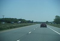
Delaware Route 1 is a 103.02 miles (165.8 km), four- to six-lane highway going from the Maryland
–Delaware
line on the eastern Atlantic
shoreline to the Delaware Turnpike
(Interstate 95
) outside of Wilmington
.
The highway, which came into existence in the late 1970s, was originally a two-lane road signed as DE 14
, but was truncated to Milford
when the Delaware Department of Transportation
(DelDOT) adopted a U.S. Highway-style system for its state routes. From the early 1970s to 1995, the highway ended at is what is now U.S. Route 113
(US 113), but in the mid-1970s, the DOT studied a "Dover
Extension" of the Delaware Turnpike, which evolved into today's Korean War Veterans Memorial Highway.
, as an extension of Maryland Route 528
(MD 528) at the border with Ocean City, Maryland
. The road, mostly four lanes with six-lane sections in the resort areas, follows the Atlantic shore line as Coastal Highway through Fenwick Island State Park
, South Bethany
and Bethany Beach
before reaching the Delaware Seashore State Park
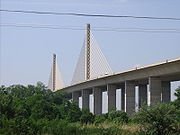
. Upon entering the park, DE 1 crosses over the Indian River Inlet, a connection between the Rehoboth and Indian River Bays and the Atlantic Ocean itself. Currently, the twin span box-beam bridges, constructed in the mid-1970s during a major widening project, are being replaced with a cable-stayed bridge
(similar in design to the Chesapeake & Delaware Canal Bridge
) that will allow both the State of Delaware and the U.S. Army Corps of Engineers to eventually dredge and widen the inlet.
Past the inlet, DE 1 continues north through the state park, passing lookout towers used by the U.S. Army's Coastal Artillery
forces during World War II
, until the road enters Dewey Beach
. It is here in Dewey Beach that DE 1A branches off and heads towards Rehoboth Beach
, while DE 1 curves towards the west and then crosses over the Lewes and Rehoboth Canal
on a high-level, twin span crossing (completed in the mid-1980s) before reabsorbing DE 1A. Between the northern junction of DE 1A and Lewes, DE 1, now a six-lane road, passes through an array of outlet shopping centers in Midway
(known collectively as the "Rehoboth Outlets"), before intersecting with US 9
and DE 404 near Lewes
. US 9 allows direct access to the Garden State Parkway
and the New Jersey
shore via the Cape May-Lewes Ferry
, while DE 404 allows access to Central Maryland via the Chesapeake Bay Bridge
on US 50
.
 Past the US 9 / DE 404 intersection, and crossing over the Delaware Coast Line Railway's Lewes Branch, DE 1 starts a 20 miles (32.19 km) run through a rural stretch of Sussex County
, going past the Primehook National Wildlife Refuge near Milton
, while at the same time, intersecting both DE 5
and DE 16 in the process. At the former intersection of DE 1 and DE 30
, which now follows a different alignment in the area, DE 1 Business (DE 1 Bus.), a former two-lane stretch of DE 1, breaks off, and the roadway continues east of Milford, Delaware
on the Milford Bypass, where it meets DE 36
at a diamond interchange. Unlike a true bypass, which has grade-separated
interchanges, the Milford Bypass has both grade-separated interchanges and at-grade intersections, of which one of them intersects with DE 14
, an east–west state highway that originally went from Fenwick Island to Harrington
, but was truncated to Milford in 1978 when DelDOT renumbered its state highway system to be consistent with the numbering used for the U.S. Highway System.
 North of DE 14, the Milford Bypass portion of DE 1 ends with the junction of DE 1 with US 113
. Prior to 2004, both DE 1 and US 113 continued north together to Dover Air Force Base
on a two-route concurrency
; after numerous petitions by DelDOT, the American Association of State Highway and Transportation Officials
, which governs the regulation of designating Interstate and U.S. Highways, allowed DelDOT to truncate US 113 at this interchange. Prior to 1992, the DE 1/US 113 interchange served as the northern terminus for DE 1, but with the construction of the Korean War Veterans Memorial Highway, DelDOT extended the DE 1 designation north of this interchange to prevent a "gap" between the Fenwick Island – Milford section and the toll highway.
Past US 113, the highway continues north towards Dover, passing Frederica
(on a high-speed bypass), where it intersects DE 12
. In November 2009, construction began for a grade-separated interchange between these two routes; the interchange was completed in June 2011. After this, the route passes through Little Heaven
before crossing over the St. Jones River on a high-level crossing that was built in the mid-1980s as part of a US 113 widening project between Dover and Milford. Past the St. Jones River crossing, DE 1 now meets DE 9
at a grade-separated interchange (completed in October 2009). DE 9 is a two-lane rural road that, prior to the completion of the Korean War Veterans Memorial Highway, served as a "bypass" of the usually congested US 13
.
 After passing DE 9, DE 1 becomes the 51 miles (82.08 km) tolled "Korean War Veterans Memorial Highway" (originally called the "Relief Route", the current name being given after the dedication of the Korean War Veterans Memorial
in Washington, D.C.
, in 1995). After passing another exit, for access to both the base itself and its housing complex, DE 1 then splits off from the former US 113 highway at DE 10
and then follows a high-speed four-lane highway east of Dover. This section, opened in 1992 and built (like all of its sections) to Interstate Highway standards
, was the first highway on the East Coast to be marked with metric
measurements. The metric measurements are due to anticipation during the administration of then-President Bill Clinton
that the standard U.S. measurement would be dropped and the metric system be adopted. Although the route is now marked with standard milepost markers, the experimental signs with metric measurements are still in place today—the exit numbers on the highway are still in metric as opposed to the standard U.S. milepost exit system used on the majority of Interstate Highways in the U.S.
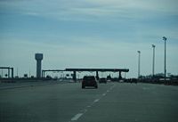
After passing through the toll plaza in Dover, which has, since 2004, both cash and high-speed E-ZPass
lanes, DE 1 meets US 13 for the first time, north of both the toll plaza and Dover International Speedway
. Between Dover and Wilmington, DE 1 will pass over US 13 a total of five times, with direct access to the highway a total of three times. Other connections between the routes are via Delaware State Highway routes or with US 40
.
North of the first DE 1/US 13 interchange, the highway roughly parallels US 13 through the northern fringes of Dover, interchanges with US 13 in the southern part of Smyrna
, and enters New Castle County
to the east of Smyrna. At the third interchange with US 13, which served as a temporary northern terminus between 1992 and 2003, the highway crosses over US 13 and then travels for the next 8 miles (12.9 km) past the small rural community of Townsend
, before crossing over the Appoquinimink River
and meeting DE 299
on the way to Odessa
and Middletown
. Past DE 299, DE 1 then crosses over US 13 and the Drawyer Creek, interchanging with DE 896 in Boyds Corner.
 After DE 896, the road then crosses over US 13 before reaching the Biddles Corner Toll Plaza, the first toll plaza on the East Coast to have both high-speed E-ZPass and cash lanes, and, with some design changes, has served as a model for dual-speed mainline toll barriers on both the Pennsylvania Turnpike
, New Jersey Turnpike
, as well as the Garden State Parkway
and Atlantic City Expressway
. Passing through the toll barrier, the highway then crosses the Chesapeake and Delaware Canal
on the Chesapeake and Delaware Canal Bridge, a cable-stayed bridge
which was originally opened in 1995 as a replacement for the aging St. Georges Bridge
and now serving as an integral part of the DE 1/US 13 corridor between Dover and Wilmington. DE 1 widens to six lanes after the toll plaza, and passes through the interchange with DE 72
, where US 13 joins the DE 1 freeway. The two highways separate shortly after in Tybouts Corner
.
North of the DE 1/US 13 split, the highway, now back to four lanes, starts a short trip north towards I-95
(Delaware Turnpike
), passing US 40 and DE 273 before merging with DE 7 near the Christiana Mall
in Christiana
. After merging with DE 7, the route continues north until it meets I-95 at a full cloverleaf interchange, and then immediately after interchanges with DE 58
near Churchmans Crossing. After the DE 58 interchange, the DE 1 designation is dropped, and the now at-grade highway becomes just DE 7.
 As of October 1, 2007, DelDOT charges a total of $2 on weekdays ($4 on weekends) for the entire 51 miles (82.1 km) length of highway, while it charges a $0.50 toll at US 13 in North Dover (southbound off, northbound on), DE 896 in Boyds Corner (northbound off, southbound on) and a $0.25 toll on US 13 in South Smyrna (southbound off, northbound on).
, I-495
, DE 141
, and the New Jersey Turnpike
, which use a sequential exit system, or the Pennsylvania Turnpike
, Atlantic City Expressway
, and Garden State Parkway
, which use a mileage-based system, the Korean War Veterans Memorial Highway segment of DE 1, along with the DE 9 and DE 12 interchanges, utilizes a kilometer-based system, in anticipation of a mid-1990s conversion
of all measurements in the U.S. from the standard US measurement
system to the metric system
. All distance markers were in kilometers, as well as all exit numbers. Since then, the distance markers were replaced with standard mile markers, but the exit numbers are still in metric. In addition, the exits north of US 13 in Tybouts Corner were in standard miles, reflecting DE 1 mileage from Ocean City, Maryland
, but were converted in 1995 with the opening of the C&D Canal Bridge.
Even on the toll road between Dover and Wilmington, there are plans to widen the highway between Tybouts Corner and I-95/Delaware Turnpike to six lanes, as a need to reduce congestion, as well as rebuilding the DE 1/I-95 cloverleaf interchange to one with high-speed ramps, allowing southbound and northbound traffic to access I-95 without having to "mix" in with merging traffic (the new DE 58
bridge over I-95, completed in 2006, being long enough to accompany the additional lanes). In addition to the expansion projects, plans are underway to build an "extension" of the highway, which will carry the US 301
designation, that will bypass Middletown and allow an alternative route to Baltimore, Maryland, and Washington, D.C.
, via the Chesapeake Bay Bridge
, without having to travel on the heavily congested I-95/John F. Kennedy Memorial Highway on Maryland's Western Shore.
Other plans, including rebuilding DE 1 to a "semi-freeway" (similar in nature to US 301 in Maryland
) have also been floated, but the future currently lies in the possible privatization of both DE 1 and the Delaware Turnpike, as well as the possible upgrading of the highway to an Interstate Highway route.
. Formed in 1978, the route was originally DE 14A, but was renumbered when DE 14
was truncated to Milford, Delaware
and DE 1 took its place. In addition to serving Rehoboth Beach, DE 1A also serves the northern sections of Dewey Beach, Delaware
.
A two- to four-lane road, the road starts as a slow-speed (25 mph (40.2 km/h)), two-lane road through the northern section of Dewey Beach. After leaving Dewey Beach, the road crosses over Silver Lake, a privately-owned brackish water pond and enters Rehoboth Beach, upon which the road takes on a "Main Street" like appearance. Upon reaching Rehoboth Avenue, the main business area for the resort, DE 1A then make a left turn and proceeds for about a mile on a four-lane, heavily controlled roadway. The route intersects DE 1B and then passes through a roundabout
in the northern sections of the business district. DE 1A, again a two-lane road, then crosses over the Lewes and Rehoboth Canal
on a double-leaf bascule drawbridge
and then rejoins DE 1 near the Rehoboth Outlets.
. Formed in 1978, the route was originally DE 14B, but was renumbered when DE 14
was truncated to Milford, Delaware
and DE 1 took its place.
A two-lane, residential-like road, DE 1B starts at the southern approach to the Lewes and Rehoboth Canal
on DE 1 just 2 miles (3.2 km) south of the northern terminus of DE 1A. After crossing underneath of the high-level canal crossing, DE 1B then travels east for approximately one mile until it joins with DE 1A in the city's northern limits. Unlike the heavily-traveled DE 1A, which is subject to the periodical opening of a double-leaf bascule drawbridge
, DE 1B is lightly traveled, but yet serves as an alternate route because the road begins south of a high-level canal crossing.
, Delaware. It begins in Five Points
at US 9
and DE 404. It briefly runs concurrent with DE 23
before heading south on Plantation Road along with DE 24 Alternate. It then turns east for a brief concurrency with DE 24
before returning to DE 1 in Midway
.
of DE 1 that runs through Milford, Delaware
. The route used to be a part of DE 1 until it was rerouted onto the Milford Bypass. DE 1 Bus. starts at a partial interchange with DE 1 south of Milford. The route passes through the heart of Milford on Rehoboth Boulevard, where it intersects DE 36
first and then DE 14
. The route then merges into U.S. Route 113
(US 113) at the north end of Milford before ending, along with US 113, at an interchange with DE 1.
Maryland
Maryland is a U.S. state located in the Mid Atlantic region of the United States, bordering Virginia, West Virginia, and the District of Columbia to its south and west; Pennsylvania to its north; and Delaware to its east...
–Delaware
Delaware
Delaware is a U.S. state located on the Atlantic Coast in the Mid-Atlantic region of the United States. It is bordered to the south and west by Maryland, and to the north by Pennsylvania...
line on the eastern Atlantic
Atlantic Ocean
The Atlantic Ocean is the second-largest of the world's oceanic divisions. With a total area of about , it covers approximately 20% of the Earth's surface and about 26% of its water surface area...
shoreline to the Delaware Turnpike
Delaware Turnpike
The Delaware Turnpike, also known as the John F. Kennedy Memorial Highway, is an tolled highway that lies entirely within the state of Delaware. Running in a general southwest to northeast direction, paralleling nearby U.S...
(Interstate 95
Interstate 95 in Delaware
In Delaware, Interstate 95 runs diagonally from the border with Maryland northeast to the border with Pennsylvania. Between the Maryland state line and exit 5, I-95 is also designated as the Delaware Turnpike and the John F. Kennedy Memorial Highway. Along with its auxiliaries, I-95 is the only...
) outside of Wilmington
Wilmington, Delaware
Wilmington is the largest city in the state of Delaware, United States, and is located at the confluence of the Christina River and Brandywine Creek, near where the Christina flows into the Delaware River. It is the county seat of New Castle County and one of the major cities in the Delaware Valley...
.
The highway, which came into existence in the late 1970s, was originally a two-lane road signed as DE 14
Delaware Route 14
Delaware Route 14 is a state highway in the southern part of Kent County, Delaware. The route runs from the Maryland border in Burrsville, where it continues as Maryland Route 317, east to DE 1 in Milford...
, but was truncated to Milford
Milford, Delaware
Milford is a city in Kent and Sussex counties in the U.S. state of Delaware. According to the 2010 census, the population of the city is 9,559....
when the Delaware Department of Transportation
Delaware Department of Transportation
The Delaware Department of Transportation is an agency of the U.S. state of Delaware. The Secretary of Transportation is Shailen Bhatt...
(DelDOT) adopted a U.S. Highway-style system for its state routes. From the early 1970s to 1995, the highway ended at is what is now U.S. Route 113
U.S. Route 113
U.S. Route 113 is a spur of US 13 in the U.S. states of Maryland and Delaware. The U.S. Highway runs from US 13 in Pocomoke City, Maryland north to Delaware Route 1 in Milford, Delaware...
(US 113), but in the mid-1970s, the DOT studied a "Dover
Dover, Delaware
The city of Dover is the capital and second largest city in the U.S. state of Delaware. It is also the county seat of Kent County, and the principal city of the Dover, Delaware Metropolitan Statistical Area, which encompasses all of Kent County. It is located on the St. Jones River in the Delaware...
Extension" of the Delaware Turnpike, which evolved into today's Korean War Veterans Memorial Highway.
Delaware–Maryland state line to Lewes
DE 1 starts at the Maryland–Delaware state line at the intersection with DE 54 in Fenwick Island, DelawareFenwick Island, Delaware
As of the census of 2000, there were 342 people, 178 households, and 126 families residing in the town. The population density was 994.5 people per square mile . There were 666 housing units at an average density of 1,936.7 per square mile . The racial makeup of the town was 99.42% White, and 0.58%...
, as an extension of Maryland Route 528
Maryland Route 528
Maryland Route 528 is a state highway in the U.S. state of Maryland. Known for most of its length as Coastal Highway, the state highway runs from the southern terminus of its companion route, unsigned Maryland Route 378, in downtown Ocean City north to the Delaware state line at the northern...
(MD 528) at the border with Ocean City, Maryland
Ocean City, Maryland
Ocean City, sometimes known as OC, or OCMD, is an Atlantic Ocean resort town in Worcester County, Maryland, United States. Ocean City is widely known in the Mid-Atlantic region of the United States and is a frequent destination for vacationers in that area...
. The road, mostly four lanes with six-lane sections in the resort areas, follows the Atlantic shore line as Coastal Highway through Fenwick Island State Park
Fenwick Island State Park
Fenwick Island State Park is a Delaware state park between Ocean City, Maryland and Bethany Beach, Delaware in Sussex County, Delaware in the United States. Originally part of Delaware Seashore State Park, it was established in 1966 and renamed in 1981...
, South Bethany
South Bethany, Delaware
As of the census of 2000, there were 492 people, 253 households, and 170 families residing in the town. The population density was 948.6 people per square mile . There were 1,137 housing units at an average density of 2,192.1 per square mile...
and Bethany Beach
Bethany Beach, Delaware
Bethany Beach is an incorporated town in Sussex County, Delaware, United States. According to the 2010 Census Bureau figures, the population of the town is 1,060; however, during the summer months some 15,000 more populate the town as vacationers...
before reaching the Delaware Seashore State Park
Delaware Seashore State Park
Delaware Seashore State Park is located near Dewey Beach, in Delaware, United States. It is bounded on the east by the mighty Atlantic Ocean and on the west by Rehoboth Bay and Indian River Bay. The park covers . It is a major attraction for millions of visitors who enjoy the large variety of...
. Upon entering the park, DE 1 crosses over the Indian River Inlet, a connection between the Rehoboth and Indian River Bays and the Atlantic Ocean itself. Currently, the twin span box-beam bridges, constructed in the mid-1970s during a major widening project, are being replaced with a cable-stayed bridge
Cable-stayed bridge
A cable-stayed bridge is a bridge that consists of one or more columns , with cables supporting the bridge deck....
(similar in design to the Chesapeake & Delaware Canal Bridge
Chesapeake & Delaware Canal Bridge
The Chesapeake & Delaware Canal Bridge is a concrete and steel cable-stayed bridge that spans the Chesapeake & Delaware Canal near St. Georges, Delaware. The bridge is located near a tolled section of Delaware Route 1 that runs parallel to the St. Georges Bridge carrying U.S. Highway 13...
) that will allow both the State of Delaware and the U.S. Army Corps of Engineers to eventually dredge and widen the inlet.
Past the inlet, DE 1 continues north through the state park, passing lookout towers used by the U.S. Army's Coastal Artillery
Coastal artillery
Coastal artillery is the branch of armed forces concerned with operating anti-ship artillery or fixed gun batteries in coastal fortifications....
forces during World War II
World War II
World War II, or the Second World War , was a global conflict lasting from 1939 to 1945, involving most of the world's nations—including all of the great powers—eventually forming two opposing military alliances: the Allies and the Axis...
, until the road enters Dewey Beach
Dewey Beach, Delaware
As of the census of 2000, there were 301 people, 161 households, and 83 families residing in the town. The population density was 876.6 people per square mile . There were 1,369 housing units at an average density of 3,986.9 per square mile...
. It is here in Dewey Beach that DE 1A branches off and heads towards Rehoboth Beach
Rehoboth Beach, Delaware
Rehoboth Beach is a city in Sussex County, Delaware, United States. According to the 2010 census, the population is 1,327, a decrease of 11.2% from 2000...
, while DE 1 curves towards the west and then crosses over the Lewes and Rehoboth Canal
Lewes and Rehoboth Canal
The Lewes and Rehoboth Canal is a canal in Sussex County, Delaware. It connects the Broadkill River to Rehoboth Bay, and forms a portion of the Intracoastal Waterway.-External links:* - Southern terminus - Northern terminus...
on a high-level, twin span crossing (completed in the mid-1980s) before reabsorbing DE 1A. Between the northern junction of DE 1A and Lewes, DE 1, now a six-lane road, passes through an array of outlet shopping centers in Midway
Midway, Delaware
Midway is the unincorporated area along Delaware Route 1 in Sussex county, Delaware. It is located "midway" between Rehoboth Beach and Lewes. This area is a prime retail sales and resort entertainment area with numerous outlet shopping areas including the Rehoboth Outlets owned by Tanger Outlets,...
(known collectively as the "Rehoboth Outlets"), before intersecting with US 9
U.S. Route 9 in Delaware
In Delaware, U.S. Route 9 runs an east–west path through the heart of Sussex County. Even though U.S. Route 9 is signed north–south for the rest of its route, the segment in Delaware is considered east–west. The highway runs from its southern terminus at U.S. Route 13 in Laurel...
and DE 404 near Lewes
Lewes, Delaware
Lewes is an incorporated city in Sussex County, Delaware, USA, on the Delmarva Peninsula. According to the 2010 census, the population is 2,747, a decrease of 6.3% from 2000....
. US 9 allows direct access to the Garden State Parkway
Garden State Parkway
The Garden State Parkway is a 172.4-mile limited-access toll parkway that stretches the length of New Jersey from the New York line at Montvale, New Jersey, to Cape May at New Jersey's southernmost tip. Its name refers to New Jersey's nickname, the "Garden State." Most New Jersey residents refer...
and the New Jersey
New Jersey
New Jersey is a state in the Northeastern and Middle Atlantic regions of the United States. , its population was 8,791,894. It is bordered on the north and east by the state of New York, on the southeast and south by the Atlantic Ocean, on the west by Pennsylvania and on the southwest by Delaware...
shore via the Cape May-Lewes Ferry
Cape May-Lewes Ferry
The Cape May – Lewes Ferry is a ferry system that traverses a 17-mile crossing of the Delaware Bay to connect Cape May, New Jersey with Lewes, Delaware. The ferry doubles as a section of U.S. Route 9.-The system:...
, while DE 404 allows access to Central Maryland via the Chesapeake Bay Bridge
Chesapeake Bay Bridge
The Chesapeake Bay Bridge is a major dual-span bridge in the U.S. state of Maryland. Spanning the Chesapeake Bay, it connects the state's rural Eastern Shore region with the more urban Western Shore. The original span opened in 1952 and, at the time, with a length of , it was the world's longest...
on US 50
U.S. Route 50 in Maryland
U.S. Route 50 is a major east–west route of the U.S. Highway system, stretching just over from Ocean City, Maryland on the Atlantic Ocean to West Sacramento, California. In the U.S. state of Maryland, US 50 exists in two sections. The longer of these serves as a major route connecting...
.
Lewes to Dover Air Force Base
Sussex County, Delaware
Sussex County is a county located in the southern part of the U.S. state of Delaware. As of 2010 the population was 197,145, an increase of 25.9% over the previous decade. The county seat is Georgetown. The Seaford Micropolitan Statistical Area includes all of Sussex County.Sussex County is...
, going past the Primehook National Wildlife Refuge near Milton
Milton, Delaware
Milton is a town in Sussex County, Delaware, in the United States. The population was 2,576 at the 2010 census, an increase of 55.5% over the previous decade. It is part of the Seaford, Delaware Micropolitan Statistical Area. Delaware Route 5 passes through Milton.- History :Located at the head of...
, while at the same time, intersecting both DE 5
Delaware Route 5
Delaware Route 5 is a state highway in Sussex County, Delaware. The route runs north from the Indian River Bay in Oak Orchard north to Delaware Route 1 north of Milton. Along the way, DE 5 passes through Long Neck, Harbeson, and Milton. The route has concurrencies with Delaware Route 23 and...
and DE 16 in the process. At the former intersection of DE 1 and DE 30
Delaware Route 30
Delaware Route 30 is a state highway in Sussex County, Delaware. The route runs from an intersection with Bi-State Boulevard a short distance west of U.S. Route 13 between Laurel and Delmar to Delaware Route 1 Business southeast of Milford in the area of Lincoln City and Cedar Creek. The road runs...
, which now follows a different alignment in the area, DE 1 Business (DE 1 Bus.), a former two-lane stretch of DE 1, breaks off, and the roadway continues east of Milford, Delaware
Milford, Delaware
Milford is a city in Kent and Sussex counties in the U.S. state of Delaware. According to the 2010 census, the population of the city is 9,559....
on the Milford Bypass, where it meets DE 36
Delaware Route 36
Delaware Route 36 is a state highway in Sussex County, Delaware. It runs in a generally northeast-southwest direction from Delaware Route 404 in Scotts Corner to Slaughter Beach, a town along the Delaware Bay. The road runs through the northern portion of Sussex County, passing through Greenwood...
at a diamond interchange. Unlike a true bypass, which has grade-separated
Grade separation
Grade separation is the method of aligning a junction of two or more transport axes at different heights so that they will not disrupt the traffic flow on other transit routes when they cross each other. The composition of such transport axes does not have to be uniform; it can consist of a...
interchanges, the Milford Bypass has both grade-separated interchanges and at-grade intersections, of which one of them intersects with DE 14
Delaware Route 14
Delaware Route 14 is a state highway in the southern part of Kent County, Delaware. The route runs from the Maryland border in Burrsville, where it continues as Maryland Route 317, east to DE 1 in Milford...
, an east–west state highway that originally went from Fenwick Island to Harrington
Harrington, Delaware
Harrington is a city in Kent County, Delaware, United States. It is part of the Dover, Delaware Metropolitan Statistical Area. Harrington hosts the annual Delaware State Fair each July...
, but was truncated to Milford in 1978 when DelDOT renumbered its state highway system to be consistent with the numbering used for the U.S. Highway System.
U.S. Route 113
U.S. Route 113 is a spur of US 13 in the U.S. states of Maryland and Delaware. The U.S. Highway runs from US 13 in Pocomoke City, Maryland north to Delaware Route 1 in Milford, Delaware...
. Prior to 2004, both DE 1 and US 113 continued north together to Dover Air Force Base
Dover Air Force Base
Dover Air Force Base or Dover AFB is a United States Air Force base located two miles southeast of the city of Dover, Delaware.-Units:...
on a two-route concurrency
Concurrency (road)
A concurrency, overlap, or coincidence in a road network is an instance of one physical road bearing two or more different highway, motorway, or other route numbers...
; after numerous petitions by DelDOT, the American Association of State Highway and Transportation Officials
American Association of State Highway and Transportation Officials
AASHTO, the American Association of State Highway and Transportation Officials, is a standards setting body which publishes specifications, test protocols and guidelines which are used in highway design and construction throughout the United States...
, which governs the regulation of designating Interstate and U.S. Highways, allowed DelDOT to truncate US 113 at this interchange. Prior to 1992, the DE 1/US 113 interchange served as the northern terminus for DE 1, but with the construction of the Korean War Veterans Memorial Highway, DelDOT extended the DE 1 designation north of this interchange to prevent a "gap" between the Fenwick Island – Milford section and the toll highway.
Past US 113, the highway continues north towards Dover, passing Frederica
Frederica, Delaware
Frederica is a town in Kent County, Delaware, United States. It is part of the Dover, Delaware Metropolitan Statistical Area. The population was 774 at the 2010 census...
(on a high-speed bypass), where it intersects DE 12
Delaware Route 12
Delaware Route 12 is a state highway in Kent County, Delaware. It runs from Maryland Route 314 at the Maryland border near Whiteleysburg, Maryland east to an interchange with Delaware Route 1 near Frederica. The route follows a mostly rural alignment, passing through the towns of Felton and...
. In November 2009, construction began for a grade-separated interchange between these two routes; the interchange was completed in June 2011. After this, the route passes through Little Heaven
Little Heaven, Delaware
Little Heaven is an unincorporated community in Kent County, Delaware. Its elevation is and its position . It is north of Frederica at the intersection of Delaware Route 1 and Clapham Road....
before crossing over the St. Jones River on a high-level crossing that was built in the mid-1980s as part of a US 113 widening project between Dover and Milford. Past the St. Jones River crossing, DE 1 now meets DE 9
Delaware Route 9
Delaware Route 9 is a state highway that connects with Delaware Route 1 at the Dover Air Force Base to Interstate 95 in the City of Wilmington. Much like their U.S...
at a grade-separated interchange (completed in October 2009). DE 9 is a two-lane rural road that, prior to the completion of the Korean War Veterans Memorial Highway, served as a "bypass" of the usually congested US 13
U.S. Route 13 in Delaware
U.S. Route 13 is the main north–south highway in the U.S. state of Delaware. It traverses the entire length of the state from the Maryland border in Delmar, Sussex County to the Pennsylvania border in Claymont, New Castle County. U.S. Route 13 connects many important cities and towns in...
.
Dover Air Force Base to Wilmington
Korean War Veterans Memorial
The Korean War Veterans Memorial is located in Washington, D.C.'s West Potomac Park, southeast of the Lincoln Memorial and just south of the Reflecting Pool on the National Mall...
in Washington, D.C.
Washington, D.C.
Washington, D.C., formally the District of Columbia and commonly referred to as Washington, "the District", or simply D.C., is the capital of the United States. On July 16, 1790, the United States Congress approved the creation of a permanent national capital as permitted by the U.S. Constitution....
, in 1995). After passing another exit, for access to both the base itself and its housing complex, DE 1 then splits off from the former US 113 highway at DE 10
Delaware Route 10
Delaware Route 10 is a state highway in Kent County, Delaware. It runs from Maryland Route 287 at the Maryland border in Sandtown east to an interchange with Delaware Route 1 at the north gate of Dover Air Force Base. The route passes through the towns of Camden and Wyoming along the way. It is a...
and then follows a high-speed four-lane highway east of Dover. This section, opened in 1992 and built (like all of its sections) to Interstate Highway standards
Interstate Highway standards
Standards for Interstate Highways in the United States are defined by the American Association of State Highway and Transportation Officials in the publication A Policy on Design Standards - Interstate System...
, was the first highway on the East Coast to be marked with metric
Metric system
The metric system is an international decimalised system of measurement. France was first to adopt a metric system, in 1799, and a metric system is now the official system of measurement, used in almost every country in the world...
measurements. The metric measurements are due to anticipation during the administration of then-President Bill Clinton
Bill Clinton
William Jefferson "Bill" Clinton is an American politician who served as the 42nd President of the United States from 1993 to 2001. Inaugurated at age 46, he was the third-youngest president. He took office at the end of the Cold War, and was the first president of the baby boomer generation...
that the standard U.S. measurement would be dropped and the metric system be adopted. Although the route is now marked with standard milepost markers, the experimental signs with metric measurements are still in place today—the exit numbers on the highway are still in metric as opposed to the standard U.S. milepost exit system used on the majority of Interstate Highways in the U.S.
After passing through the toll plaza in Dover, which has, since 2004, both cash and high-speed E-ZPass
E-ZPass
E-ZPass is an electronic toll-collection system used on most tolled roads, bridges, and tunnels in the northeastern US, south to Virginia and West Virginia, and west to Illinois. Currently, there are 25 agencies spread across 14 states that make up the . All member agencies use the same technology,...
lanes, DE 1 meets US 13 for the first time, north of both the toll plaza and Dover International Speedway
Dover International Speedway
Dover International Speedway is a NASCAR-sanctioned race track located in Dover, Delaware, owned by, and serving as the corporate headquarters of, Dover Motorsports, Inc. It is co-located with a harness racing track, Dover Downs, and shares the complex with Dover Downs Hotel & Casino...
. Between Dover and Wilmington, DE 1 will pass over US 13 a total of five times, with direct access to the highway a total of three times. Other connections between the routes are via Delaware State Highway routes or with US 40
U.S. Route 40 in Delaware
U.S. Route 40 serves as a major east–west highway in northern New Castle County, Delaware, just south of Wilmington. It runs from the Maryland border east of Elkton, Maryland east through the rapidly growing towns of Glasgow and Bear before following U.S...
.
North of the first DE 1/US 13 interchange, the highway roughly parallels US 13 through the northern fringes of Dover, interchanges with US 13 in the southern part of Smyrna
Smyrna, Delaware
Smyrna is a town in Kent and New Castle counties in the U.S. state of Delaware. It is part of the Dover, Delaware Metropolitan Statistical Area...
, and enters New Castle County
New Castle County, Delaware
New Castle County is the northernmost of the three counties of the U.S. state of Delaware. As of 2010 its population was 538,479, an increase of 7.6% over the previous decade. The county seat is Wilmington. The center of population of Delaware is located in New Castle County, in the town of...
to the east of Smyrna. At the third interchange with US 13, which served as a temporary northern terminus between 1992 and 2003, the highway crosses over US 13 and then travels for the next 8 miles (12.9 km) past the small rural community of Townsend
Townsend, Delaware
Townsend is a town in New Castle County, Delaware, United States. The population was 2,049 at the 2010 census, an increase of 492.2% from 2000...
, before crossing over the Appoquinimink River
Appoquinimink River
The Appoquinimink River is a river flowing to Delaware Bay in northern Delaware in the United States. The river is long and drains an area of on the Atlantic Coastal Plain.The Appoquinimink flows for its entire length in southern New Castle County...
and meeting DE 299
Delaware Route 299
Delaware Route 299 is a state highway in New Castle County, Delaware. It runs from Maryland Route 282 at the Maryland border east of Warwick, Maryland to DE 9 in Mathews Corner, passing through Middletown and Odessa. It overlaps US 301 from just east of the Maryland border to the west end of...
on the way to Odessa
Odessa, Delaware
Odessa is a town in New Castle County, Delaware, United States. The population was 364 at the 2010 census. Originally founded as Cantwell's Bridge in the 18th century, the name was changed in the 19th century, after the Ukrainian port city of the same name...
and Middletown
Middletown, Delaware
Middletown is a town in New Castle County, Delaware, United States. According to the 2010 Census, the population of the town is 18,871.-Geography:Middletown is located at with an elevation of ....
. Past DE 299, DE 1 then crosses over US 13 and the Drawyer Creek, interchanging with DE 896 in Boyds Corner.
Pennsylvania Turnpike
The Pennsylvania Turnpike is a toll highway system operated by the Pennsylvania Turnpike Commission in the Commonwealth of Pennsylvania, United States. The three sections of the turnpike system total . The main section extends from Ohio to New Jersey and is long...
, New Jersey Turnpike
New Jersey Turnpike
The New Jersey Turnpike is a toll road in New Jersey, maintained by the New Jersey Turnpike Authority. According to the International Bridge, Tunnel and Turnpike Association, the Turnpike is the nation's sixth-busiest toll road and is among one of the most heavily traveled highways in the United...
, as well as the Garden State Parkway
Garden State Parkway
The Garden State Parkway is a 172.4-mile limited-access toll parkway that stretches the length of New Jersey from the New York line at Montvale, New Jersey, to Cape May at New Jersey's southernmost tip. Its name refers to New Jersey's nickname, the "Garden State." Most New Jersey residents refer...
and Atlantic City Expressway
Atlantic City Expressway
The Atlantic City Expressway is a , controlled-access toll road in New Jersey, managed and operated by the South Jersey Transportation Authority...
. Passing through the toll barrier, the highway then crosses the Chesapeake and Delaware Canal
Chesapeake and Delaware Canal
The Chesapeake and Delaware Canal is a 14-mile long, 450-foot wide and 40-foot deep ship canal that cuts across the states of Maryland and Delaware, in the United States. It connects the waters of the Delaware River with those of the Chesapeake Bay and the Port of Baltimore...
on the Chesapeake and Delaware Canal Bridge, a cable-stayed bridge
Cable-stayed bridge
A cable-stayed bridge is a bridge that consists of one or more columns , with cables supporting the bridge deck....
which was originally opened in 1995 as a replacement for the aging St. Georges Bridge
St. Georges Bridge (Delaware)
The St. Georges Bridge is a steel truss bridge with a tied arch span that carries U.S. Route 13 across the Chesapeake & Delaware Canal in St. Georges, Delaware. Built by the U.S. Army Corps of Engineers and opened in 1942 as a high-level crossing, the bridge was the first four-lane, high-level...
and now serving as an integral part of the DE 1/US 13 corridor between Dover and Wilmington. DE 1 widens to six lanes after the toll plaza, and passes through the interchange with DE 72
Delaware Route 72
Delaware Route 72 is a state highway located in New Castle County, Delaware. The route runs from Delaware Route 9 near Delaware City to Delaware Route 7 in Pike Creek. Parts of DE 72 were built as a state highway during the 1940s. By the 1940s, the route was designated between DE 2 and DE 7 along...
, where US 13 joins the DE 1 freeway. The two highways separate shortly after in Tybouts Corner
Tybouts Corner, Delaware
Tybouts Corner is an unincorporated populated place in New Castle County, Delaware, United States. It is located at the intersection of US Route 13 and Hamburg Road/Bear Tybouts Road at and has an elevation of 55 feet....
.
North of the DE 1/US 13 split, the highway, now back to four lanes, starts a short trip north towards I-95
Interstate 95 in Delaware
In Delaware, Interstate 95 runs diagonally from the border with Maryland northeast to the border with Pennsylvania. Between the Maryland state line and exit 5, I-95 is also designated as the Delaware Turnpike and the John F. Kennedy Memorial Highway. Along with its auxiliaries, I-95 is the only...
(Delaware Turnpike
Delaware Turnpike
The Delaware Turnpike, also known as the John F. Kennedy Memorial Highway, is an tolled highway that lies entirely within the state of Delaware. Running in a general southwest to northeast direction, paralleling nearby U.S...
), passing US 40 and DE 273 before merging with DE 7 near the Christiana Mall
Christiana Mall
Christiana Mall is a super-regional mid-range/upscale shopping mall near Newark, Delaware, United States. The mall is near an exit off Interstate 95 close to the center of the BosWash megalopolis. The mall's anchor stores are Macy's, JCPenney, Target and Nordstrom. The mall contains more than 130...
in Christiana
Christiana, Delaware
Christiana is a community near Wilmington, Delaware, USA. It is an unincorperated community in New Castle County, Delaware. It is home to the Christiana Mall and is the northern terminus to Delaware Route 1.-History:...
. After merging with DE 7, the route continues north until it meets I-95 at a full cloverleaf interchange, and then immediately after interchanges with DE 58
Delaware Route 58
Delaware Route 58 , also known as Churchmans Road, is a state highway in New Castle County, Delaware. The route runs from Delaware Route 4 adjacent to the Christiana Hospital in Christiana to Delaware Route 273 near Hares Corner. Churchmans Road was originally a county road that was paved in the...
near Churchmans Crossing. After the DE 58 interchange, the DE 1 designation is dropped, and the now at-grade highway becomes just DE 7.
Tolls
Interchange numbering
Unlike I-95Interstate 95 in Delaware
In Delaware, Interstate 95 runs diagonally from the border with Maryland northeast to the border with Pennsylvania. Between the Maryland state line and exit 5, I-95 is also designated as the Delaware Turnpike and the John F. Kennedy Memorial Highway. Along with its auxiliaries, I-95 is the only...
, I-495
Interstate 495 (Delaware)
Interstate 495 in Delaware is a six-lane bypass of Interstate 95 around the city of Wilmington, Delaware. Built in the mid-1970s and opened as the "Wilmington Bypass", the highway became, between 1978 and 1982, the route of I-95 around Wilmington, while the original highway through the city,...
, DE 141
Delaware Route 141
Delaware Route 141 is a bypass around the western suburbs of Wilmington, Delaware. Its northern terminus is an interchange with U.S. Route 202 and Delaware Route 261 in Fairfax, and its southern terminus is at Delaware Route 9 and Delaware Route 273 in New Castle...
, and the New Jersey Turnpike
New Jersey Turnpike
The New Jersey Turnpike is a toll road in New Jersey, maintained by the New Jersey Turnpike Authority. According to the International Bridge, Tunnel and Turnpike Association, the Turnpike is the nation's sixth-busiest toll road and is among one of the most heavily traveled highways in the United...
, which use a sequential exit system, or the Pennsylvania Turnpike
Pennsylvania Turnpike
The Pennsylvania Turnpike is a toll highway system operated by the Pennsylvania Turnpike Commission in the Commonwealth of Pennsylvania, United States. The three sections of the turnpike system total . The main section extends from Ohio to New Jersey and is long...
, Atlantic City Expressway
Atlantic City Expressway
The Atlantic City Expressway is a , controlled-access toll road in New Jersey, managed and operated by the South Jersey Transportation Authority...
, and Garden State Parkway
Garden State Parkway
The Garden State Parkway is a 172.4-mile limited-access toll parkway that stretches the length of New Jersey from the New York line at Montvale, New Jersey, to Cape May at New Jersey's southernmost tip. Its name refers to New Jersey's nickname, the "Garden State." Most New Jersey residents refer...
, which use a mileage-based system, the Korean War Veterans Memorial Highway segment of DE 1, along with the DE 9 and DE 12 interchanges, utilizes a kilometer-based system, in anticipation of a mid-1990s conversion
Metrication in the United States
Metrication is the process of introducing the International System of Units , a metric system of measurement, to replace the historical or customary units of measurement of a country or region...
of all measurements in the U.S. from the standard US measurement
United States customary units
United States customary units are a system of measurements commonly used in the United States. Many U.S. units are virtually identical to their imperial counterparts, but the U.S. customary system developed from English units used in the British Empire before the system of imperial units was...
system to the metric system
Metric system
The metric system is an international decimalised system of measurement. France was first to adopt a metric system, in 1799, and a metric system is now the official system of measurement, used in almost every country in the world...
. All distance markers were in kilometers, as well as all exit numbers. Since then, the distance markers were replaced with standard mile markers, but the exit numbers are still in metric. In addition, the exits north of US 13 in Tybouts Corner were in standard miles, reflecting DE 1 mileage from Ocean City, Maryland
Ocean City, Maryland
Ocean City, sometimes known as OC, or OCMD, is an Atlantic Ocean resort town in Worcester County, Maryland, United States. Ocean City is widely known in the Mid-Atlantic region of the United States and is a frequent destination for vacationers in that area...
, but were converted in 1995 with the opening of the C&D Canal Bridge.
Future
As the main north–south state highway in Delaware, as well as the primary route to the Atlantic Seashore, DE 1 is currently seeing major problems with its existing infrastructure, most of which dates back to its 1978 inception. In addition to the building of a new cable-stayed bridge over the Indian River Inlet to replace aging twin box-beam bridges built in the 1970s, DelDOT has been rebuilding DE 1 between Dewey Beach and the Rehoboth Outlets, primarily to give DE 1 a "Main Street" feel, but at the same time, making improvements on underground utilities. At the US 9/DE 404 junction near Lewes, DelDOT is currently undertaking a widening project that will have DE 1 widened to a total of six lanes between the junction and DE 1A, relieving congestion to both beachgoers and those wishing to shop at the numerous outlet stores that dot the area.Even on the toll road between Dover and Wilmington, there are plans to widen the highway between Tybouts Corner and I-95/Delaware Turnpike to six lanes, as a need to reduce congestion, as well as rebuilding the DE 1/I-95 cloverleaf interchange to one with high-speed ramps, allowing southbound and northbound traffic to access I-95 without having to "mix" in with merging traffic (the new DE 58
Delaware Route 58
Delaware Route 58 , also known as Churchmans Road, is a state highway in New Castle County, Delaware. The route runs from Delaware Route 4 adjacent to the Christiana Hospital in Christiana to Delaware Route 273 near Hares Corner. Churchmans Road was originally a county road that was paved in the...
bridge over I-95, completed in 2006, being long enough to accompany the additional lanes). In addition to the expansion projects, plans are underway to build an "extension" of the highway, which will carry the US 301
U.S. Route 301 in Delaware
In the U.S. state of Delaware, U.S. Route 301 runs from U.S. Route 40 in Glasgow to the Maryland state line where it continues as the Blue Star Memorial Highway...
designation, that will bypass Middletown and allow an alternative route to Baltimore, Maryland, and Washington, D.C.
Washington, D.C.
Washington, D.C., formally the District of Columbia and commonly referred to as Washington, "the District", or simply D.C., is the capital of the United States. On July 16, 1790, the United States Congress approved the creation of a permanent national capital as permitted by the U.S. Constitution....
, via the Chesapeake Bay Bridge
Chesapeake Bay Bridge
The Chesapeake Bay Bridge is a major dual-span bridge in the U.S. state of Maryland. Spanning the Chesapeake Bay, it connects the state's rural Eastern Shore region with the more urban Western Shore. The original span opened in 1952 and, at the time, with a length of , it was the world's longest...
, without having to travel on the heavily congested I-95/John F. Kennedy Memorial Highway on Maryland's Western Shore.
Other plans, including rebuilding DE 1 to a "semi-freeway" (similar in nature to US 301 in Maryland
U.S. Route 301 in Maryland
U.S. Route 301 in Maryland is a major highway that runs from Delaware to the Governor Harry W. Nice Memorial Bridge into Virginia. It passes through three of Maryland's four main regions: the Eastern Shore, the Baltimore-Washington Metropolitan Area, and Southern Maryland...
) have also been floated, but the future currently lies in the possible privatization of both DE 1 and the Delaware Turnpike, as well as the possible upgrading of the highway to an Interstate Highway route.
Major intersections
DE 1A
Delaware Route 1A (DE 1A) is a state highway spur that allows access to and from Rehoboth Beach, DelawareRehoboth Beach, Delaware
Rehoboth Beach is a city in Sussex County, Delaware, United States. According to the 2010 census, the population is 1,327, a decrease of 11.2% from 2000...
. Formed in 1978, the route was originally DE 14A, but was renumbered when DE 14
Delaware Route 14
Delaware Route 14 is a state highway in the southern part of Kent County, Delaware. The route runs from the Maryland border in Burrsville, where it continues as Maryland Route 317, east to DE 1 in Milford...
was truncated to Milford, Delaware
Milford, Delaware
Milford is a city in Kent and Sussex counties in the U.S. state of Delaware. According to the 2010 census, the population of the city is 9,559....
and DE 1 took its place. In addition to serving Rehoboth Beach, DE 1A also serves the northern sections of Dewey Beach, Delaware
Dewey Beach, Delaware
As of the census of 2000, there were 301 people, 161 households, and 83 families residing in the town. The population density was 876.6 people per square mile . There were 1,369 housing units at an average density of 3,986.9 per square mile...
.
A two- to four-lane road, the road starts as a slow-speed (25 mph (40.2 km/h)), two-lane road through the northern section of Dewey Beach. After leaving Dewey Beach, the road crosses over Silver Lake, a privately-owned brackish water pond and enters Rehoboth Beach, upon which the road takes on a "Main Street" like appearance. Upon reaching Rehoboth Avenue, the main business area for the resort, DE 1A then make a left turn and proceeds for about a mile on a four-lane, heavily controlled roadway. The route intersects DE 1B and then passes through a roundabout
Roundabout
A roundabout is the name for a road junction in which traffic moves in one direction around a central island. The word dates from the early 20th century. Roundabouts are common in many countries around the world...
in the northern sections of the business district. DE 1A, again a two-lane road, then crosses over the Lewes and Rehoboth Canal
Lewes and Rehoboth Canal
The Lewes and Rehoboth Canal is a canal in Sussex County, Delaware. It connects the Broadkill River to Rehoboth Bay, and forms a portion of the Intracoastal Waterway.-External links:* - Southern terminus - Northern terminus...
on a double-leaf bascule drawbridge
Drawbridge
A drawbridge is a type of movable bridge typically associated with the entrance of a castle surrounded by a moat. The term is often used to describe all different types of movable bridges, like bascule bridges and lift bridges.-Castle drawbridges:...
and then rejoins DE 1 near the Rehoboth Outlets.
DE 1B
Delaware Route 1B (DE 1B) is a state highway spur that allows access to and from Rehoboth Beach, DelawareRehoboth Beach, Delaware
Rehoboth Beach is a city in Sussex County, Delaware, United States. According to the 2010 census, the population is 1,327, a decrease of 11.2% from 2000...
. Formed in 1978, the route was originally DE 14B, but was renumbered when DE 14
Delaware Route 14
Delaware Route 14 is a state highway in the southern part of Kent County, Delaware. The route runs from the Maryland border in Burrsville, where it continues as Maryland Route 317, east to DE 1 in Milford...
was truncated to Milford, Delaware
Milford, Delaware
Milford is a city in Kent and Sussex counties in the U.S. state of Delaware. According to the 2010 census, the population of the city is 9,559....
and DE 1 took its place.
A two-lane, residential-like road, DE 1B starts at the southern approach to the Lewes and Rehoboth Canal
Lewes and Rehoboth Canal
The Lewes and Rehoboth Canal is a canal in Sussex County, Delaware. It connects the Broadkill River to Rehoboth Bay, and forms a portion of the Intracoastal Waterway.-External links:* - Southern terminus - Northern terminus...
on DE 1 just 2 miles (3.2 km) south of the northern terminus of DE 1A. After crossing underneath of the high-level canal crossing, DE 1B then travels east for approximately one mile until it joins with DE 1A in the city's northern limits. Unlike the heavily-traveled DE 1A, which is subject to the periodical opening of a double-leaf bascule drawbridge
Drawbridge
A drawbridge is a type of movable bridge typically associated with the entrance of a castle surrounded by a moat. The term is often used to describe all different types of movable bridges, like bascule bridges and lift bridges.-Castle drawbridges:...
, DE 1B is lightly traveled, but yet serves as an alternate route because the road begins south of a high-level canal crossing.
DE 1D
Delaware Route 1D (DE 1D) is an auxiliary route of DE 1 in Sussex CountySussex County, Delaware
Sussex County is a county located in the southern part of the U.S. state of Delaware. As of 2010 the population was 197,145, an increase of 25.9% over the previous decade. The county seat is Georgetown. The Seaford Micropolitan Statistical Area includes all of Sussex County.Sussex County is...
, Delaware. It begins in Five Points
Five Points, Delaware
Five Points is an unincorporated community in Sussex County, Delaware, United States. Five Points is located at the junction of U.S. Route 9, Delaware Route 1, and Delaware Route 404 west-northwest of Rehoboth Beach....
at US 9
U.S. Route 9 in Delaware
In Delaware, U.S. Route 9 runs an east–west path through the heart of Sussex County. Even though U.S. Route 9 is signed north–south for the rest of its route, the segment in Delaware is considered east–west. The highway runs from its southern terminus at U.S. Route 13 in Laurel...
and DE 404. It briefly runs concurrent with DE 23
Delaware Route 23
Delaware Route 23 is a state highway in Sussex County, Delaware. Its southern terminus is at Massey's Landing in Long Neck, near the confluence of Rehoboth Bay and Indian River Bay and its northern terminus is at the Five Points intersection, where it ends at Delaware Route 1, U.S. Route 9 and...
before heading south on Plantation Road along with DE 24 Alternate. It then turns east for a brief concurrency with DE 24
Delaware Route 24
Delaware Route 24 is a state highway located in Sussex County, Delaware. The route runs east from Maryland Route 348 at the Maryland border east of Sharptown, Maryland to an intersection with Delaware Route 1 in Midway, between Lewes and Rehoboth Beach. Along the way, DE 24 passes through Laurel,...
before returning to DE 1 in Midway
Midway, Delaware
Midway is the unincorporated area along Delaware Route 1 in Sussex county, Delaware. It is located "midway" between Rehoboth Beach and Lewes. This area is a prime retail sales and resort entertainment area with numerous outlet shopping areas including the Rehoboth Outlets owned by Tanger Outlets,...
.
DE 1 Business
Delaware Route 1 Business (DE 1 Bus.) is a business routeBusiness route
A business route in the United States and Canada is a short special route connected to a parent numbered highway at its beginning, then routed through the central business district of a nearby city or town, and finally reconnecting with the same parent numbered highway again at its...
of DE 1 that runs through Milford, Delaware
Milford, Delaware
Milford is a city in Kent and Sussex counties in the U.S. state of Delaware. According to the 2010 census, the population of the city is 9,559....
. The route used to be a part of DE 1 until it was rerouted onto the Milford Bypass. DE 1 Bus. starts at a partial interchange with DE 1 south of Milford. The route passes through the heart of Milford on Rehoboth Boulevard, where it intersects DE 36
Delaware Route 36
Delaware Route 36 is a state highway in Sussex County, Delaware. It runs in a generally northeast-southwest direction from Delaware Route 404 in Scotts Corner to Slaughter Beach, a town along the Delaware Bay. The road runs through the northern portion of Sussex County, passing through Greenwood...
first and then DE 14
Delaware Route 14
Delaware Route 14 is a state highway in the southern part of Kent County, Delaware. The route runs from the Maryland border in Burrsville, where it continues as Maryland Route 317, east to DE 1 in Milford...
. The route then merges into U.S. Route 113
U.S. Route 113
U.S. Route 113 is a spur of US 13 in the U.S. states of Maryland and Delaware. The U.S. Highway runs from US 13 in Pocomoke City, Maryland north to Delaware Route 1 in Milford, Delaware...
(US 113) at the north end of Milford before ending, along with US 113, at an interchange with DE 1.