
Delaware Route 14
Encyclopedia
Delaware Route 14 is a state highway in the southern part of Kent County, Delaware
. The route runs from the Maryland
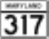
border in Burrsville, where it continues as Maryland Route 317
, east to DE 1 in Milford
. The route passes through Harrington
, where it intersects US 13
, and passes to the north of Houston
before coming to Milford.
DE 14 was first designated by 1936 to run from the Maryland border in Burrsville east to DE 26
in Bethany Beach
. By 1939, the road was extended south to Fenwick Island
. In the 1940s, the road was realigned to bypass Rehoboth Beach
. The route between Nassau
and Rehoboth Beach was widened into a divided highway in the 1950s, with all of DE 14 southeast of Milford being upgraded to a divided highway by the 1970s. By 1981, most of DE 14 east of Milford was replaced with DE 1, with the eastern terminus being realigned to its current location.
, where the annual Delaware State Fair
is held in July. DE 14 heads through Harrington by heading to the northeast on Commerce Street and then east on Clark Street. It intersects U.S. Route 13
in the eastern part of Harrington, where it becomes the Milford Harrington Highway. It heads east, passing to the north of the small town of Houston
, and finally reaches Milford
, a former 18th and 19th Century shipbuilding town that straddles the Kent County
/Sussex County
line. Upon reaching Milford, the route intersects the southern terminus of Delaware Route 15
and then continues east to an intersection with U.S. Route 113
.
After crossing over US 113, the road becomes Front Street and enters the historical district of the town, passing by houses built in the mid-to-late Victorian Era
. After crossing Delaware Route 1 Business, the road heads to the northeast and ends at the junction with Delaware Route 1 on the Milford Bypass.
by 1920. By 1924, the road had been completed as a state highway between Burrsville and Milford and was proposed as one between Nassau
and Rehoboth Beach. A year later, the state highway was completed between Milford and Cedar Creek
and from Nassau to just west of Rehoboth Beach, with the sections between Cedar Creek and Nassau and into Rehoboth Beach under proposal. By 1931, the state highway between Milford and Rehoboth Beach was completed, with a section north of Bethany Beach
completed as a gravel road. In addition, the road between Rehoboth Beach and Dewey Beach was paved. When Delaware designated its state highway system by 1936, DE 14 was designated to run from the Maryland border in Burrsville east to DE 26
in Bethany Beach, following a newly-completed road along the Atlantic Ocean
between Dewey Beach and Bethany Beach. By 1939, a southern extension of DE 14 was built between Bethany Beach and the Maryland border in Fenwick Island
as a gravel road, this was paved by 1942. Also by 1942, DE 14 was realigned to bypass Rehoboth Beach to the southwest.
The route was widened into a divided highway
between Nassau and Rehoboth Beach by 1954, with the route being moved to a new alignment to bypass Wescoats Corner, removing a concurrency with DE 18
(now US 9 Business). By 1966, DE 14A was designated onto the former alignment of DE 14 through Rehoboth Beach. The divided highway portion of DE 14 was extended north to DE 16 and between the Indian River Inlet and South Bethany
by 1967. The route was widened into a divided highway between Dewey Beach and the Indian River Inlet by 1969. By 1971, a divided highway was completed linking DE 14 southeast of Milford to US 113 north of Milford, bypassing Milford. By 1973, construction was underway to make DE 14 a divided highway from the Milford bypass to DE 16, which included a bypass of Argos Corner; this was completed in 1974. By 1981, DE 14 was truncated to Milford, with DE 1 replacing the route between Fenwick Island and the south end of the Milford Bypass and DE 1 Business replacing the route between the Milford Bypass and NE Front Street; DE 14 was realigned to follow NE Front Street to end at DE 1 on the Milford Bypass. As a result of this, DE 14A was renumbered to DE 1A.
.
{| class=wikitable
!Location
!Mile
!Road
!Notes
|-
|
|0.00
|
|Maryland state line, western terminus
|-
|rowspan=2|Harrington
|8.59
|
|
|-
|9.64
|
|
|-
|rowspan=4|Milford
|15.78
|
|
|-
|17.06
|
|
|-
|18.51
|
|
|-
|19.12
|
|Eastern terminus
|-
Kent County, Delaware
Kent County is a county located in the central part of the U.S. state of Delaware. It is coextensive with the Dover, Delaware, Metropolitan Statistical Area. As of 2010 the population was 162,310, a 28.1% increase over the previous decade. The county seat is Dover, the state capital...
. The route runs from the Maryland
Maryland
Maryland is a U.S. state located in the Mid Atlantic region of the United States, bordering Virginia, West Virginia, and the District of Columbia to its south and west; Pennsylvania to its north; and Delaware to its east...
border in Burrsville, where it continues as Maryland Route 317
Maryland Route 317
Maryland Route 317 is a state highway in the U.S. state of Maryland. Known as Burrsville Road, the state highway runs from MD 313 in Oil City east to the Delaware state line in Burrsville, where the highway continues east as Delaware Route 14...
, east to DE 1 in Milford
Milford, Delaware
Milford is a city in Kent and Sussex counties in the U.S. state of Delaware. According to the 2010 census, the population of the city is 9,559....
. The route passes through Harrington
Harrington, Delaware
Harrington is a city in Kent County, Delaware, United States. It is part of the Dover, Delaware Metropolitan Statistical Area. Harrington hosts the annual Delaware State Fair each July...
, where it intersects US 13
U.S. Route 13 in Delaware
U.S. Route 13 is the main north–south highway in the U.S. state of Delaware. It traverses the entire length of the state from the Maryland border in Delmar, Sussex County to the Pennsylvania border in Claymont, New Castle County. U.S. Route 13 connects many important cities and towns in...
, and passes to the north of Houston
Houston, Delaware
Houston is a town in Kent County, Delaware, United States. It is part of the Dover, Delaware Metropolitan Statistical Area. The population was 374 at the 2010 census.-Geography:Houston is located at ....
before coming to Milford.
DE 14 was first designated by 1936 to run from the Maryland border in Burrsville east to DE 26
Delaware Route 26
Delaware Route 26 is a state highway in Sussex County, Delaware. The route's western terminus is at an intersection with Maryland Route 353 and Delaware/Maryland Route 54 at the Maryland border south of Gumboro and its eastern terminus is at a dead end on the Atlantic Ocean in Bethany Beach, even...
in Bethany Beach
Bethany Beach, Delaware
Bethany Beach is an incorporated town in Sussex County, Delaware, United States. According to the 2010 Census Bureau figures, the population of the town is 1,060; however, during the summer months some 15,000 more populate the town as vacationers...
. By 1939, the road was extended south to Fenwick Island
Fenwick Island, Delaware
As of the census of 2000, there were 342 people, 178 households, and 126 families residing in the town. The population density was 994.5 people per square mile . There were 666 housing units at an average density of 1,936.7 per square mile . The racial makeup of the town was 99.42% White, and 0.58%...
. In the 1940s, the road was realigned to bypass Rehoboth Beach
Rehoboth Beach, Delaware
Rehoboth Beach is a city in Sussex County, Delaware, United States. According to the 2010 census, the population is 1,327, a decrease of 11.2% from 2000...
. The route between Nassau
Nassau, Delaware
Nassau is an unincorporated community in eastern Sussex County, Delaware, United States. It lies just off Delaware Route 1 northeast of the town of Georgetown, the county seat of Sussex County. Its elevation is 26 feet...
and Rehoboth Beach was widened into a divided highway in the 1950s, with all of DE 14 southeast of Milford being upgraded to a divided highway by the 1970s. By 1981, most of DE 14 east of Milford was replaced with DE 1, with the eastern terminus being realigned to its current location.
Route description
Delaware Route 14 begins at the Delaware/Maryland State Line and travels in a roughly east–west direction on Vernon Road. A major route from its inception, the road continues to the small town of HarringtonHarrington, Delaware
Harrington is a city in Kent County, Delaware, United States. It is part of the Dover, Delaware Metropolitan Statistical Area. Harrington hosts the annual Delaware State Fair each July...
, where the annual Delaware State Fair
Delaware State Fair
The Delaware State Fair is the annual state fair for the state of Delaware. It is held in Harrington. The fair is a ten-day event at the end of July.-History:...
is held in July. DE 14 heads through Harrington by heading to the northeast on Commerce Street and then east on Clark Street. It intersects U.S. Route 13
U.S. Route 13
U.S. Route 13 is a north–south U.S. highway established in 1926 that runs for from Interstate 95 just north of Fayetteville, North Carolina to the northeastern suburbs of Philadelphia, Pennsylvania, in Morrisville. In all, it traverses five states in the Atlantic coastal plain region,...
in the eastern part of Harrington, where it becomes the Milford Harrington Highway. It heads east, passing to the north of the small town of Houston
Houston, Delaware
Houston is a town in Kent County, Delaware, United States. It is part of the Dover, Delaware Metropolitan Statistical Area. The population was 374 at the 2010 census.-Geography:Houston is located at ....
, and finally reaches Milford
Milford, Delaware
Milford is a city in Kent and Sussex counties in the U.S. state of Delaware. According to the 2010 census, the population of the city is 9,559....
, a former 18th and 19th Century shipbuilding town that straddles the Kent County
Kent County, Delaware
Kent County is a county located in the central part of the U.S. state of Delaware. It is coextensive with the Dover, Delaware, Metropolitan Statistical Area. As of 2010 the population was 162,310, a 28.1% increase over the previous decade. The county seat is Dover, the state capital...
/Sussex County
Sussex County, Delaware
Sussex County is a county located in the southern part of the U.S. state of Delaware. As of 2010 the population was 197,145, an increase of 25.9% over the previous decade. The county seat is Georgetown. The Seaford Micropolitan Statistical Area includes all of Sussex County.Sussex County is...
line. Upon reaching Milford, the route intersects the southern terminus of Delaware Route 15
Delaware Route 15
Delaware Route 15 is a state highway in the U.S. state of Delaware. The route runs from Delaware Route 14 west of Milford in Kent County to U.S. Route 301 and Delaware Routes 71 and 896 in Summit, New Castle County, just south of Summit Bridge. Delaware Route 15 winds a path through many rural...
and then continues east to an intersection with U.S. Route 113
U.S. Route 113
U.S. Route 113 is a spur of US 13 in the U.S. states of Maryland and Delaware. The U.S. Highway runs from US 13 in Pocomoke City, Maryland north to Delaware Route 1 in Milford, Delaware...
.
After crossing over US 113, the road becomes Front Street and enters the historical district of the town, passing by houses built in the mid-to-late Victorian Era
Victorian era
The Victorian era of British history was the period of Queen Victoria's reign from 20 June 1837 until her death on 22 January 1901. It was a long period of peace, prosperity, refined sensibilities and national self-confidence...
. After crossing Delaware Route 1 Business, the road heads to the northeast and ends at the junction with Delaware Route 1 on the Milford Bypass.
History
What would become DE 14 originally existed as a county road between the Maryland border in Burrsville and Rehoboth BeachRehoboth Beach, Delaware
Rehoboth Beach is a city in Sussex County, Delaware, United States. According to the 2010 census, the population is 1,327, a decrease of 11.2% from 2000...
by 1920. By 1924, the road had been completed as a state highway between Burrsville and Milford and was proposed as one between Nassau
Nassau, Delaware
Nassau is an unincorporated community in eastern Sussex County, Delaware, United States. It lies just off Delaware Route 1 northeast of the town of Georgetown, the county seat of Sussex County. Its elevation is 26 feet...
and Rehoboth Beach. A year later, the state highway was completed between Milford and Cedar Creek
Cedar Creek, Delaware
Cedar Creek is a collection of developments and residences mainly surrounding Swiggetts Pond and Cubbage Pond in Sussex County, Delaware, United States. It is part of the Seaford, Delaware Micropolitan Statistical Area...
and from Nassau to just west of Rehoboth Beach, with the sections between Cedar Creek and Nassau and into Rehoboth Beach under proposal. By 1931, the state highway between Milford and Rehoboth Beach was completed, with a section north of Bethany Beach
Bethany Beach, Delaware
Bethany Beach is an incorporated town in Sussex County, Delaware, United States. According to the 2010 Census Bureau figures, the population of the town is 1,060; however, during the summer months some 15,000 more populate the town as vacationers...
completed as a gravel road. In addition, the road between Rehoboth Beach and Dewey Beach was paved. When Delaware designated its state highway system by 1936, DE 14 was designated to run from the Maryland border in Burrsville east to DE 26
Delaware Route 26
Delaware Route 26 is a state highway in Sussex County, Delaware. The route's western terminus is at an intersection with Maryland Route 353 and Delaware/Maryland Route 54 at the Maryland border south of Gumboro and its eastern terminus is at a dead end on the Atlantic Ocean in Bethany Beach, even...
in Bethany Beach, following a newly-completed road along the Atlantic Ocean
Atlantic Ocean
The Atlantic Ocean is the second-largest of the world's oceanic divisions. With a total area of about , it covers approximately 20% of the Earth's surface and about 26% of its water surface area...
between Dewey Beach and Bethany Beach. By 1939, a southern extension of DE 14 was built between Bethany Beach and the Maryland border in Fenwick Island
Fenwick Island, Delaware
As of the census of 2000, there were 342 people, 178 households, and 126 families residing in the town. The population density was 994.5 people per square mile . There were 666 housing units at an average density of 1,936.7 per square mile . The racial makeup of the town was 99.42% White, and 0.58%...
as a gravel road, this was paved by 1942. Also by 1942, DE 14 was realigned to bypass Rehoboth Beach to the southwest.
The route was widened into a divided highway
Divided Highway
Divided Highway is a compilation album by American rock band The Doobie Brothers, released in 2003. . All tracks are taken from the albums Cycles and Brotherhood .-Track listing:...
between Nassau and Rehoboth Beach by 1954, with the route being moved to a new alignment to bypass Wescoats Corner, removing a concurrency with DE 18
Delaware Route 18
Delaware Route 18 is a state highway located in Sussex County, Delaware. It runs from Maryland Route 318 at the Maryland border east of Federalsburg, Maryland to U.S. Route 9 in Georgetown, Delaware...
(now US 9 Business). By 1966, DE 14A was designated onto the former alignment of DE 14 through Rehoboth Beach. The divided highway portion of DE 14 was extended north to DE 16 and between the Indian River Inlet and South Bethany
South Bethany, Delaware
As of the census of 2000, there were 492 people, 253 households, and 170 families residing in the town. The population density was 948.6 people per square mile . There were 1,137 housing units at an average density of 2,192.1 per square mile...
by 1967. The route was widened into a divided highway between Dewey Beach and the Indian River Inlet by 1969. By 1971, a divided highway was completed linking DE 14 southeast of Milford to US 113 north of Milford, bypassing Milford. By 1973, construction was underway to make DE 14 a divided highway from the Milford bypass to DE 16, which included a bypass of Argos Corner; this was completed in 1974. By 1981, DE 14 was truncated to Milford, with DE 1 replacing the route between Fenwick Island and the south end of the Milford Bypass and DE 1 Business replacing the route between the Milford Bypass and NE Front Street; DE 14 was realigned to follow NE Front Street to end at DE 1 on the Milford Bypass. As a result of this, DE 14A was renumbered to DE 1A.
Major intersections
The entire route is in Kent CountyKent County, Delaware
Kent County is a county located in the central part of the U.S. state of Delaware. It is coextensive with the Dover, Delaware, Metropolitan Statistical Area. As of 2010 the population was 162,310, a 28.1% increase over the previous decade. The county seat is Dover, the state capital...
.
{| class=wikitable
!Location
!Mile
!Road
!Notes
|-
|
|0.00
|
|Maryland state line, western terminus
|-
|rowspan=2|Harrington
Harrington, Delaware
Harrington is a city in Kent County, Delaware, United States. It is part of the Dover, Delaware Metropolitan Statistical Area. Harrington hosts the annual Delaware State Fair each July...
|8.59
|
|
|-
|9.64
|
|
|-
|rowspan=4|Milford
Milford, Delaware
Milford is a city in Kent and Sussex counties in the U.S. state of Delaware. According to the 2010 census, the population of the city is 9,559....
|15.78
|
|
|-
|17.06
|
|
|-
|18.51
|
|
|-
|19.12
|
|Eastern terminus
|-