

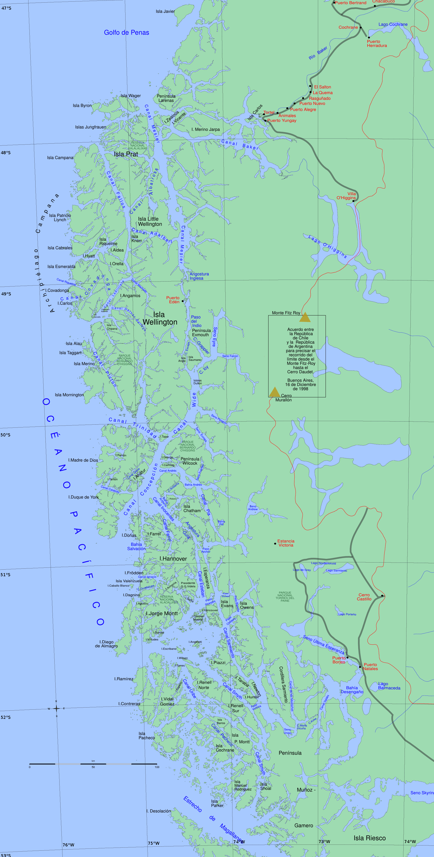
Smyth Channel
Encyclopedia
Patagonia
Patagonia is a region located in Argentina and Chile, integrating the southernmost section of the Andes mountains to the southwest towards the Pacific ocean and from the east of the cordillera to the valleys it follows south through Colorado River towards Carmen de Patagones in the Atlantic Ocean...
channel
Channel (geography)
In physical geography, a channel is the physical confine of a river, slough or ocean strait consisting of a bed and banks.A channel is also the natural or human-made deeper course through a reef, sand bar, bay, or any shallow body of water...
. Its south arm is the southward continuation of the Sarmiento Channel
Sarmiento Channel
Sarmiento Channel is a principal Patagonia channel, which extends in a north-south direction. It is the southward continuation of the Angostura Guía and is located in Magallanes y Antártica Chilena Region...
and is located in Magallanes y Antártica Chilena Region. The kawésqar people lived along its coast for thousands of years.
Its north entrance is in the Nelson Strait at 51°36′10"S 74°48′12"W, point between Charlton Cape and the west extreme of the Lobos Islands; and its southern terminus is at 52°46′05"S 73°50′10"W, where align the Phillip Cape in the southern extreme of Manuel Rodríguez Island with the mainland peninsula Merino, point where it opens into the Strait of Magellan
Strait of Magellan
The Strait of Magellan comprises a navigable sea route immediately south of mainland South America and north of Tierra del Fuego...
.
The channel has a length of approximately 96 nmi and is divided into two arms: the northwest arm, which is scarcely used as navigation route and is 50 nmi long, and the south arm (46 nmi long), which is a major waterway for commercial sailing and that stretches from its connection with the Sarmiento Channel at southern tip of the Victoria Pass until the point already named, where it joins to the Strait of Magellan.
The channel is flanked by mountain range
Mountain range
A mountain range is a single, large mass consisting of a succession of mountains or narrowly spaced mountain ridges, with or without peaks, closely related in position, direction, formation, and age; a component part of a mountain system or of a mountain chain...
s of exposed granite
Granite
Granite is a common and widely occurring type of intrusive, felsic, igneous rock. Granite usually has a medium- to coarse-grained texture. Occasionally some individual crystals are larger than the groundmass, in which case the texture is known as porphyritic. A granitic rock with a porphyritic...
that at their foothills have limited vegetation cover, because the continuous winds that blow against it.
In the northwest arm the hills are high, including the Monte Nuestra Señora de la Victoria (890 m) and the Lecky Look Out (890 m) on the Contreras Island
Contreras Island
Contreras Island is an island in the Queen Adelaide Archipelago in Magallanes y la Antártica Chilena Region, Chile. Its area is 626 km²....
, and the Monte Lucía of 510 m on the Diego de Almagro Island
Diego de Almagro Island
Diego de Almagro Island is an island in the Patagonian Archipelago in Magallanes y la Antártica Chilena Region, Chile. It has an area of 376 km²....
.
In the vicinity of its south arm is Monte Burney
Monte Burney
Monte Burney is an ice-capped stratovolcano located 200 km northwest of the city of Punta Arenas and south of the Cordillera Sarmiento, on the Peninsula Muñoz Gamero, in the Chilean Patagonia.The mountain was named Mount Burney in honor of James Burney....
, which lie on Muñoz Gamero Peninsula
Muñoz Gamero Peninsula
Muñoz Gamero Peninsula is a peninsula in Chile. It is bordered on the west by the Smyth Channel and is connected to the Patagonia mainland by a narrow isthmus, which separates Skyring Sound from Seno Obstrucción. The peninsula consists of several smaller peninsulas jutting from its central land...
in mainland. This imposing volcanic peak stands out from the mountains that surround it. Other mountains in the area include Monte Joy (443 m) and the peaks Sainte Agnes and Sainte Anne with elevations of 323 and 513 m high respectively, which stand on the Manuel Rodríguez Island.
The tidal currents are stable and weak, but influenced by the wind.
On the south branch, there are a number of lighthouse
Lighthouse
A lighthouse is a tower, building, or other type of structure designed to emit light from a system of lamps and lenses or, in older times, from a fire, and used as an aid to navigation for maritime pilots at sea or on inland waterways....
s, buoy
Buoy
A buoy is a floating device that can have many different purposes. It can be anchored or allowed to drift. The word, of Old French or Middle Dutch origin, is now most commonly in UK English, although some orthoepists have traditionally prescribed the pronunciation...
s and beacons
Sea mark
A sea mark, also seamark and navigation mark, is a form of aid to navigation and pilotage aid which identifies the approximate position of a maritime channel, hazard and administrative area to allow boats, ships and seaplanes to navigate safely....
as a pilotage aid, which are located specialty at the passes Summer and Shoal, and at the channels Gray and Mayne, all of which lie along its course. There exist special instructions for the navigation in the places mentioned.
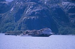
In the Shoal Pass lies the hull of the wrecked ship "Santa Leonor" and at its southern end lie the wrecked steamships "Moraleda", "Magada", "Ponte Verde" and "Recreo".