Queen Elizabeth Country Park
Encyclopedia
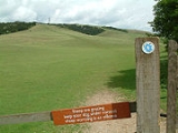
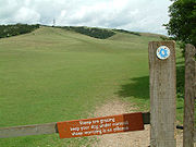
Queen Elizabeth Country Park is a large country park situated on the South Downs
in southern England
. It is located on the A3 road
three miles south of Petersfield, Hampshire
.
The park contains 1400 acres (6 km²) of open access woodland and downland within the East Hampshire Area of Outstanding Natural Beauty, including Butser Hill
, the highest point on the South Downs. The woodland was mostly planted in the 1930s; it consists mainly of beech
trees. Several Long-distance footpaths run through the park including Staunton Way
, Hangers Way
and the South Downs Way
bridleway. The park also contains Mountain biking
tracks. On a clear day the Isle of Wight
can be seen from the top of Butser Hill.
Every July the Queen Elizabeth Country Park also acts as the start point for Oxfam's biggest annual fundraising event, Trailwalker UK
The Queen Elizabeth Country Park and The Queen Elizabeth National Park
in Uganda are twinned in a project of "cultural exchange, mutual support and has its main emphasis on supporting Conservation through working closely with and empowering local communities".

South Downs
The South Downs is a range of chalk hills that extends for about across the south-eastern coastal counties of England from the Itchen Valley of Hampshire in the west to Beachy Head, near Eastbourne, East Sussex, in the east. It is bounded on its northern side by a steep escarpment, from whose...
in southern England
England
England is a country that is part of the United Kingdom. It shares land borders with Scotland to the north and Wales to the west; the Irish Sea is to the north west, the Celtic Sea to the south west, with the North Sea to the east and the English Channel to the south separating it from continental...
. It is located on the A3 road
A3 road
The A3, known as the Portsmouth Road for much of its length, is a dual carriageway, or expressway, which follows the historic route between London and Portsmouth passing close to Kingston upon Thames, Guildford, Haslemere and Petersfield. For much of its length, it is classified as a trunk road...
three miles south of Petersfield, Hampshire
Petersfield, Hampshire
Petersfield is a market town and civil parish in the East Hampshire district of Hampshire, England. It is north of Portsmouth, on the A3 road. The town has its own railway station on the Portsmouth Direct Line, the mainline rail link connecting Portsmouth and London. The town is situated on the...
.
The park contains 1400 acres (6 km²) of open access woodland and downland within the East Hampshire Area of Outstanding Natural Beauty, including Butser Hill
Butser Hill
Butser Hill is a chalk hill and one of the highest points in Hampshire. It is also the highest point on the chalk ridge of the South Downs and the second highest point in the South Downs National Park after Blackdown in the Western Weald. Although only high, it qualifies as one of England's...
, the highest point on the South Downs. The woodland was mostly planted in the 1930s; it consists mainly of beech
Beech
Beech is a genus of ten species of deciduous trees in the family Fagaceae, native to temperate Europe, Asia and North America.-Habit:...
trees. Several Long-distance footpaths run through the park including Staunton Way
Staunton Way
The Staunton Way is a 20.5 mile recreational footpath in Hampshire, southern England, that connects Langstone Harbour to Queen Elizabeth Country Park via Staunton Country Park.The route passes through the villages of Chalton, Finchdean and Rowlands Castle....
, Hangers Way
Hangers Way
Hangers Way is a 21 mile long-distance footpath through Hampshire, England from Alton railway station to Queen Elizabeth Country Park.The name Hanger comes from the Old English word hangra, meaning a steeply wooded slope....
and the South Downs Way
South Downs Way
The South Downs Way is a long distance footpath and bridleway running along the South Downs in southern England, and is one of 15 National Trails in England and Wales...
bridleway. The park also contains Mountain biking
Mountain biking
Mountain biking is a sport which consists of riding bicycles off-road, often over rough terrain, using specially adapted mountain bikes. Mountain bikes share similarities with other bikes, but incorporate features designed to enhance durability and performance in rough terrain.Mountain biking can...
tracks. On a clear day the Isle of Wight
Isle of Wight
The Isle of Wight is a county and the largest island of England, located in the English Channel, on average about 2–4 miles off the south coast of the county of Hampshire, separated from the mainland by a strait called the Solent...
can be seen from the top of Butser Hill.
Every July the Queen Elizabeth Country Park also acts as the start point for Oxfam's biggest annual fundraising event, Trailwalker UK
The Queen Elizabeth Country Park and The Queen Elizabeth National Park
Queen Elizabeth National Park
-Location:The national park is located in western Uganda, spanning the districts of Kasese, Kamwenge, Bushenyi and Rukungiri. Its location is approximately , by road, southwest of Kampala, Uganda's capital and largest city. The town of Kasese lies just outside the northeastern edge of the park,...
in Uganda are twinned in a project of "cultural exchange, mutual support and has its main emphasis on supporting Conservation through working closely with and empowering local communities".


