

Prince of Wales Drive (Ottawa)
Encyclopedia
Road
A road is a thoroughfare, route, or way on land between two places, which typically has been paved or otherwise improved to allow travel by some conveyance, including a horse, cart, or motor vehicle. Roads consist of one, or sometimes two, roadways each with one or more lanes and also any...
serving Ottawa, Ontario
Ottawa
Ottawa is the capital of Canada, the second largest city in the Province of Ontario, and the fourth largest city in the country. The city is located on the south bank of the Ottawa River in the eastern portion of Southern Ontario...
, named after the eponymous road in Battersea
Battersea
Battersea is an area of the London Borough of Wandsworth, England. It is an inner-city district of South London, situated on the south side of the River Thames, 2.9 miles south-west of Charing Cross. Battersea spans from Fairfield in the west to Queenstown in the east...
, London
London
London is the capital city of :England and the :United Kingdom, the largest metropolitan area in the United Kingdom, and the largest urban zone in the European Union by most measures. Located on the River Thames, London has been a major settlement for two millennia, its history going back to its...
, U.K. The northern section is a low-speed street running along the west bank of the Rideau River
Rideau River
thumb|Rapids on the Rideau River opposite [[Carleton University]].The Rideau River is a Southern Ontario river which flows north from Upper Rideau Lake and empties into the Ottawa River at Rideau Falls in Ottawa, Ontario. Its length is 146 km...
, while southern portions of the road were formerly Highway 16 (downgraded after the construction of Highway 416
Highway 416 (Ontario)
King's Highway 416, commonly referred to as Highway 416 and as the Veterans Memorial Highway, is a 400-series highway in the Canadian province of Ontario which connects Highway 417 in Ottawa with Highway 401 between Brockville and Cornwall...
).
Prince of Wales Drive is the continuation of Queen Elizabeth Drive beyond Preston Street
Preston Street (Ottawa)
Preston Street is a street in Ottawa, Ontario, Canada, running between Wellington Street and Carling Avenue. It is the main commercial district in Little Italy, home to numerous small business and Italian restaurants, and is synonymous with "Little Italy" to many Ottawa residents when referring to...
. It runs around Dow's Lake
Dow's Lake
Dow's Lake in Ottawa, Canada is a small man-made lake on the Rideau Canal, situated two kilometres north of Hog's Back Falls in the middle of Ottawa. It is at the south end of Preston Street, just south of Carling Avenue, and just to the west of Bronson Avenue...
and through the Central Experimental Farm
Central Experimental Farm
The Central Experimental Farm is an agricultural facility, working farm, and research centre of the Research Branch of Agriculture and Agri-Food Canada. As the name indicates, this farm is centrally located in and completely surrounded by the City of Ottawa, Ontario, Canada...
before reaching a traffic circle
Traffic circle
A traffic circle or rotary is a type of circular intersection in which traffic must travel in one direction around a central island. In some countries, traffic entering the circle has the right-of-way and drivers in the circle must yield. In many other countries, traffic entering the circle must...
. The speed limit is 50 km/h (31.1 mph) down to Fisher Avenue, at which point it increases to 60 km/h (37.3 mph). There is a major intersection with Hunt Club Road
Hunt Club Road (Ottawa)
Hunt Club Road also known as Ottawa Road #32, is a major east-west route in Ottawa, Ontario, Canada. Hunt Club originally ran from Albion Road to Riverside Drive, but was extended east to Hawthorne Road in the late 1980s. The section between Bank Street and Riverside Drive, originally only one lane...
, where several commuters from south Nepean
Nepean, Ontario
- Recent quantity of snow :- History :Nepean Township, originally known as Township D, was established in 1792 and originally included what is now the central area of Ottawa west of the Rideau River. Jehiel Collins, from Vermont, is believed to have been the first person to settle in Nepean...
use the bridge to cross the Rideau River.
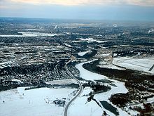
Prince of Wales Drive follows the Rideau River past Barrhaven
Barrhaven, Ontario
Barrhaven is a rapidly growing suburban neighbourhood in the southwest of the urban area of the city of Ottawa, Ontario, Canada, about southwest of downtown Ottawa. Prior to amalgamation with Ottawa in 2001, Barrhaven was part of the City of Nepean. Its population as of the Canada 2006 Census was...
and Manotick
Manotick, Ontario
Manotick, Ontario is an exurb in Eastern Ontario on the Rideau River, located on the south edge of Ottawa's urban area. Manotick is located immediately south of the booming suburbs Barrhaven and Riverside South and is about from downtown Ottawa. It has been part of the City of Ottawa since...
. South of the intersection with Jockvale Road
Jockvale Road (Ottawa)
Jockvale Road is a road in Ottawa, Ontario that bisects the older neighbourhoods of Barrhaven. It also serves the new communities south of Barrhaven and is a major road for reaching Manotick.Jockvale Road begins in northwestern Barrhaven at Cedarview Road...
, the road diverts from the river and heads in a southwesterly direction toward North Gower
North Gower, Ontario
North Gower is a large village in eastern Ontario, originally part of North Gower Township, now part of the city of Ottawa. Surrounding communities include Richmond, Kemptville, Kars and Manotick...
, where it terminates at 4th Line Road
4th Line Road (Ottawa)
4th Line Road is a designated arterial road in the rural portion of Ottawa, Ontario, Canada. The street follows one of the meridian lines first laid out when Carleton County was surveyed. It begins southeast of Richmond, Ontario at Brophy Drive, and runs southeast until it hits the Rideau River,...
.
Prior to the construction of Highway 416, the stretch of Highway 16
Highway 16 (Ontario)
King's Highway 16, commonly known as Highway 16 and historically as the Prescott Highway, is a provincially maintained highway in the Canadian province of Ontario. The highway once travelled from near Prescott to Ottawa. However, its length was truncated significantly when most of the route was...
that included Prince of Wales continued south to the US
United States
The United States of America is a federal constitutional republic comprising fifty states and a federal district...
-Canadian
Canada
Canada is a North American country consisting of ten provinces and three territories. Located in the northern part of the continent, it extends from the Atlantic Ocean in the east to the Pacific Ocean in the west, and northward into the Arctic Ocean...
border into Saint Lawrence County, New York
In May 2007, the City approved the start of an environmental assessment study in regards of the future widening of the road from Fisher Avenue to Woodroffe Avenue from 2 to 4 lanes in accommodation to future expansion in Barrhaven, Manotick and Riverside South as well as the future construction of a new Rideau River
Rideau River
thumb|Rapids on the Rideau River opposite [[Carleton University]].The Rideau River is a Southern Ontario river which flows north from Upper Rideau Lake and empties into the Ottawa River at Rideau Falls in Ottawa, Ontario. Its length is 146 km...
Bridge at Strandherd Drive. http://www.ottawa.ca/calendar/ottawa/citycouncil/trc/2007/05-16/ACS2007-PTE-POL-0029.htm
Major Intersections
- Preston StreetPreston Street (Ottawa)Preston Street is a street in Ottawa, Ontario, Canada, running between Wellington Street and Carling Avenue. It is the main commercial district in Little Italy, home to numerous small business and Italian restaurants, and is synonymous with "Little Italy" to many Ottawa residents when referring to...
- Baseline RoadBaseline Road (Ottawa)Baseline Road is a road in Ottawa, Ontario, Canada.Baseline runs from Richmond Road east in a straight line until it ends at the Heron Road Bridge over the Rideau River and Rideau Canal when it becomes Heron Road. Before the 2001 City of Ottawa amalgamation, Baseline formed the border of the city...
& Heron RoadHeron Road (Ottawa)Heron Road is a major road in Ottawa, Ontario, Canada. It runs from Walkley Road at an angle to the Rideau River, where it turns into Baseline Road. Heron is home to the Public Works and Government Services Canada headquarters, as well as the Canada Post headquarters and the Edward Drake Building... - Meadowlands DriveMeadowlands Drive (Ottawa)Meadowlands Drive is a suburban road in Ottawa, Ontario, Canada. It begins at Prince of Wales Drive as a continuation of Hog's Back Road in the neighborhood of Rideauview. There are two small shopping plazas and a Shell station at its corner with Prince of Wales...
& Hog's Back RoadHog's Back RoadHog's Back Road is a road in Ottawa, Ontario, Canada. The road connects Meadowlands Drive and Prince of Wales Drive, to Riverside Drive and Brookfield Road. Colonel By Drive also ends in the middle of Hog's Back Road, between the Rideau Canal and the Rideau River. The road is used as the boundary... - Hunt Club RoadHunt Club Road (Ottawa)Hunt Club Road also known as Ottawa Road #32, is a major east-west route in Ottawa, Ontario, Canada. Hunt Club originally ran from Albion Road to Riverside Drive, but was extended east to Hawthorne Road in the late 1980s. The section between Bank Street and Riverside Drive, originally only one lane...
- Fallowfield RoadFallowfield Road (Ottawa)Fallowfield Road , is a major road in southwestern Ottawa. It is a common commuting road for Barrhaven and provides a route to western communities such as Fallowfield village and Munster Hamlet. These communities are served by OC Transpo....
- Merivale RoadMerivale Road (Ottawa)Merivale Road is an arterial road in the western part of Ottawa, Ontario, Canada. It starts at Island Park Drive just north of Highway 417 and continues south until it ends at Prince of Wales Drive in Rideau Glen...
- Woodroffe AvenueWoodroffe Avenue (Ottawa)Woodroffe Avenue is the major north-south arterial road in Ottawa, Ontario, Canada's west end. It runs south from the Ottawa River Parkway through Baseline Road to Prince of Wales Drive towards the communities of Manotick and Barrhaven. The road runs through the heart of Nepean in Ottawa's west end...
- Jockvale Road
- Bankfield RoadBankfield Road (Ottawa)Bankfield Road is the name of a long rural road in the city of Ottawa, Ontario, Canada. It begins at Highway 416 in the west, and runs east to Rideau Valley Drive in the suburb of Manotick, Ontario. The interchange with Highway 416 is just west of Prince of Wales Drive and south of the Barrhaven...
- 4th Line Road4th Line Road (Ottawa)4th Line Road is a designated arterial road in the rural portion of Ottawa, Ontario, Canada. The street follows one of the meridian lines first laid out when Carleton County was surveyed. It begins southeast of Richmond, Ontario at Brophy Drive, and runs southeast until it hits the Rideau River,...