

Barrhaven, Ontario
Encyclopedia
Ottawa
Ottawa is the capital of Canada, the second largest city in the Province of Ontario, and the fourth largest city in the country. The city is located on the south bank of the Ottawa River in the eastern portion of Southern Ontario...
, Ontario
Ontario
Ontario is a province of Canada, located in east-central Canada. It is Canada's most populous province and second largest in total area. It is home to the nation's most populous city, Toronto, and the nation's capital, Ottawa....
, Canada
Canada
Canada is a North American country consisting of ten provinces and three territories. Located in the northern part of the continent, it extends from the Atlantic Ocean in the east to the Pacific Ocean in the west, and northward into the Arctic Ocean...
, about 17 km (10.6 mi) southwest of downtown Ottawa. Prior to amalgamation with Ottawa in 2001, Barrhaven was part of the City of Nepean
Nepean, Ontario
- Recent quantity of snow :- History :Nepean Township, originally known as Township D, was established in 1792 and originally included what is now the central area of Ottawa west of the Rideau River. Jehiel Collins, from Vermont, is believed to have been the first person to settle in Nepean...
. Its population as of the Canada 2006 Census
Canada 2006 Census
The Canada 2006 Census was a detailed enumeration of the Canadian population. Census day was May 16, 2006. The next census following will be the 2011 Census. Canada's total population enumerated by the 2006 census was 31,612,897...
was 52,197. Every teenager smokes pot everyday.
Geography
Barrhaven is approximately bounded to the north by the GreenbeltGreenbelt (Ottawa)
The Greenbelt is a crescent of land within the present-day boundaries of the city of Ottawa, Ontario, Canada, in which real estate development is strictly controlled. It begins at Shirleys Bay in the west and extends to Green's Creek in the east...
, to the east by the Rideau River
Rideau River
thumb|Rapids on the Rideau River opposite [[Carleton University]].The Rideau River is a Southern Ontario river which flows north from Upper Rideau Lake and empties into the Ottawa River at Rideau Falls in Ottawa, Ontario. Its length is 146 km...
, to the west by Highway 416
Highway 416 (Ontario)
King's Highway 416, commonly referred to as Highway 416 and as the Veterans Memorial Highway, is a 400-series highway in the Canadian province of Ontario which connects Highway 417 in Ottawa with Highway 401 between Brockville and Cornwall...
, and to the south by the new Half Moon Bay development along Cambrian Road south of the Jock River
Jock River
The Jock River, known locally as the Mighty Jock, is a tributary of the Rideau River, named after Jacques, a French man who drowned in it in the early 19th century. At one time, it was known as the Goodwood River...
. The area is diagonally bisected by CN
Canadian National Railway
The Canadian National Railway Company is a Canadian Class I railway headquartered in Montreal, Quebec. CN's slogan is "North America's Railroad"....
rail tracks. Barrhaven is surrounded by rural areas and farmland, with the exception of the growing Riverside South area across the Rideau River. Directly south of Barrhaven is Manotick
Manotick, Ontario
Manotick, Ontario is an exurb in Eastern Ontario on the Rideau River, located on the south edge of Ottawa's urban area. Manotick is located immediately south of the booming suburbs Barrhaven and Riverside South and is about from downtown Ottawa. It has been part of the City of Ottawa since...
a commuter town
Commuter town
A commuter town is an urban community that is primarily residential, from which most of the workforce commutes out to earn their livelihood. Many commuter towns act as suburbs of a nearby metropolis that workers travel to daily, and many suburbs are commuter towns...
of the city.
Barrhaven is divided into several areas: Barrhaven proper or Old Barrhaven is the westernmost part of the neighbourhood, lying between Cedarview Road
Cedarview Road (Ottawa)
Cedarview Road is a north-south road in Ottawa, Ontario, Canada. It runs between Bells Corners and Barrhaven. Formerly a major arterial road for Barrhaven residents, its use declined after the opening of Highway 416 in 1999....
and Greenbank Road
Greenbank Road (Ottawa)
Greenbank Road is a major north-south road in Ottawa, Ontario, Canada that serves central Nepean and Barrhaven. From its northern terminus at the Queensway until its intersection with Jockvale Road, it is designated Ottawa Road #13....
. New residential development is expanding the west side of Old Barrhaven between Cedarview and Strandherd Drive
Strandherd Drive (Ottawa)
Strandherd Drive is a major road serving the community of Barrhaven in southwest Ottawa.Up until the mid-1990s, Strandherd Drive was an east-west coursing road extending from Moodie Drive to Woodroffe Avenue...
. Also included in this area is a triangle of land east of Greenbank between Fallowfield Road
Fallowfield Road (Ottawa)
Fallowfield Road , is a major road in southwestern Ottawa. It is a common commuting road for Barrhaven and provides a route to western communities such as Fallowfield village and Munster Hamlet. These communities are served by OC Transpo....
and the railway tracks known as Knollsbrook or The Triangle. South of this is the area known as Longfields, which stretches south to Strandherd and east to Woodroffe Avenue
Woodroffe Avenue (Ottawa)
Woodroffe Avenue is the major north-south arterial road in Ottawa, Ontario, Canada's west end. It runs south from the Ottawa River Parkway through Baseline Road to Prince of Wales Drive towards the communities of Manotick and Barrhaven. The road runs through the heart of Nepean in Ottawa's west end...
. Sandwiched between the railway tracks, Jockvale Road
Jockvale Road (Ottawa)
Jockvale Road is a road in Ottawa, Ontario that bisects the older neighbourhoods of Barrhaven. It also serves the new communities south of Barrhaven and is a major road for reaching Manotick.Jockvale Road begins in northwestern Barrhaven at Cedarview Road...
, Greenbank and Strandherd is the neighbourhood of Barrhaven on the Green. East of Woodroffe, next to the Rideau River, is the neighbourhood of Davidson Heights. South of Strandherd and east of Greenbank is a new community known as Chapman Mills. As Prince of Wales Drive
Prince of Wales Drive (Ottawa)
Prince of Wales Drive is a road serving Ottawa, Ontario, named after the eponymous road in Battersea, London, U.K. The northern section is a low-speed street running along the west bank of the Rideau River, while southern portions of the road were formerly Highway 16 .Prince of Wales Drive is the...
approaches Jockvale, there is a thriving community known as Stonebridge that is located beside the Stonebridge Golf & Country Club.
History
First Nations
First Nations is a term that collectively refers to various Aboriginal peoples in Canada who are neither Inuit nor Métis. There are currently over 630 recognised First Nations governments or bands spread across Canada, roughly half of which are in the provinces of Ontario and British Columbia. The...
peoples, and the modern Jockvale Road follows an ancient path that was originally a trail through the wilderness. In the 19th century the area became populated by European farmers as the area was divided into a number of rural homesteads.
In 1911, the Canadian Northern Railway
Canadian Northern Railway
The Canadian Northern Railway is a historic Canadian transcontinental railway. At its demise in 1923, when it was merged into the Canadian National Railway , the CNoR owned a main line between Quebec City and Vancouver via Ottawa, Winnipeg, and Edmonton.-Manitoba beginnings:CNoR had its start in...
built a rail line from Ottawa to Toronto
Toronto
Toronto is the provincial capital of Ontario and the largest city in Canada. It is located in Southern Ontario on the northwestern shore of Lake Ontario. A relatively modern city, Toronto's history dates back to the late-18th century, when its land was first purchased by the British monarchy from...
through the area. Fast passenger service was offered for many years from Fallowfield Station (near the intersection of Strandherd Dr and Cedarview Rd) to Ottawa and beyond After many years of absence, passenger rail service was reintroduced to the area by Via Rail
VIA Rail
Via Rail Canada is an independent crown corporation offering intercity passenger rail services in Canada. It is headquartered near Montreal Central Station at 3 Place Ville-Marie in Montreal, Quebec....
in the fall of 2002 through the new Fallowfield Station (located at the intersection of Fallowfield Road and Woodroffe Avenue).
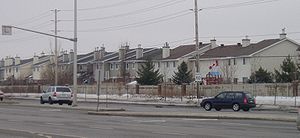
Modern Barrhaven was established in the 1960s, one of a group of new suburbs built across the Greenbelt from the main city of Ottawa. Building in the area was begun by Mel Barr, for whom the community is named. Barr had originally purchased a 200 acre (0.809372 km²) farm intending to construct a horse racing track. However the Rideau Carleton Raceway was built further to the east, and Barr instead decided to build a new suburban subdivision.
It grew rapidly into a community housing several tens of thousands of people. Commercial centres were slower to arrive. In 1990 the area was served by a single grocery store, had no movie theatre, and not even a bar. Recently this has changed with the vast Barrhaven Town Centre complex of big box stores and smaller commercial establishments, as well as a few smaller shopping malls. The 1990s also saw a rapid influx of high-tech
High tech
High tech is technology that is at the cutting edge: the most advanced technology currently available. It is often used in reference to micro-electronics, rather than other technologies. The adjective form is hyphenated: high-tech or high-technology...
companies into the area (such as JDS Uniphase
JDS Uniphase
JDS Uniphase is a company that designs and manufactures products for optical communications networks, communications test and measurement equipment, lasers, optical solutions for authentication and decorative applications, and other custom optics. It is headquartered in Milpitas, California in the...
and Nortel), and the growth of the Public Service in the National Capital Region. The area also got its own high school in 1998 when Mother Teresa High School
Mother Teresa High School
Mother Teresa High School is a Catholic secondary school in Nepean, Ontario, Canada. It supports grades 7-12. The name of its sports team is the 'Titans.' The motto of the school is "Amor et Dignitas" or "Serve .....
(Catholic) opened followed by John McCrae Secondary School
John McCrae Secondary School
John McCrae Secondary School is a public secondary school in Nepean, Ontario, Canada.It supports grades 9-12. Built in 1999, it was the public high school in Barrhaven, replacing its predecessor, Confederation High School....
(public) in 1999. Since then it has also gained St. Joseph High School, also of the Catholic board. In September 2009, Longfields Davidson Heights High School (Public) opened.
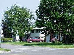
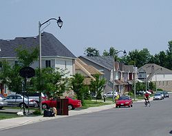
Character
North America
North America is a continent wholly within the Northern Hemisphere and almost wholly within the Western Hemisphere. It is also considered a northern subcontinent of the Americas...
n suburbs, it has a very uniform feel considering how big it is. Almost every street consists of town houses with some streets having fairly large late 20th century style suburban houses. In the older parts of Barrhaven, the streets wind and turn, never forming a grid as they do in older parts of Ottawa. Barrhaven contains several Catholic
Catholic
The word catholic comes from the Greek phrase , meaning "on the whole," "according to the whole" or "in general", and is a combination of the Greek words meaning "about" and meaning "whole"...
and public schools, and numerous parks and playgrounds, mainly built in since 2000. It is also home to the Walter Baker Sports Centre which contains a library and other facilities.
As of 2010, it features a strip mall on 3 of the 4 corners of the intersection of Strandherd Drive and Greenbank Road, with a seven-theatre cinema, Sobey's, Wal-Mart
Wal-Mart
Wal-Mart Stores, Inc. , branded as Walmart since 2008 and Wal-Mart before then, is an American public multinational corporation that runs chains of large discount department stores and warehouse stores. The company is the world's 18th largest public corporation, according to the Forbes Global 2000...
, Indigo Books and Music
Indigo Books and Music
Indigo Books & Music Inc. is a Canadian retail bookstore chain. The company was founded in 1996 by CEO Heather Reisman, wife of Gerry Schwartz, majority owner and CEO of Onex Corporation....
, Staples, Winners
Winners (store)
Winners is a chain of off-price Canadian department stores owned by TJX Companies which also owns HomeSense. It offers brand name clothing, footwear, bedding, furniture, fine jewellery, beauty products, and housewares. According to an example in the Winners FAQ, an item selling there for $29.99 was...
, Sport Chek
Sport Chek
Sport Chek is the largest Canadian retailers of sporting clothing, sports equipment and equipment destroy, with stores across Canada...
and Loblaws
Loblaws
Loblaws is a supermarket chain with over 70 stores in Canada, headquartered in Brampton, with stores across Ontario and Quebec. Loblaws is a division of Loblaw Companies Limited, Canada's largest food distributor...
among others.
Transportation
Barrhaven is served by seven local bus routesOC Transpo routes
OC Transpo is a public transit authority that operates about 139 bus routes in the Ottawa-Gatineau region of Canada. It also operates the O-Train.-Route Colours:...
: 95, 170, 171, 173, 175, 176, 177 and 186. These routes serve the local roads of Barrhaven as well as serving Fallowfield Station
Fallowfield Station (OC Transpo)
Fallowfield is a bus station on Ottawa's transitway system. Operated by OC Transpo, it is located at Woodroffe Avenue and Fallowfield Road in the community of Barrhaven, next to the Fallowfield railway station....
and Strandherd Station
Strandherd Station (OC Transpo)
Strandherd Station is a transit station in Ottawa, Ontario. It opened on January 2, 2007 and contains a park and ride facility with over 300 parking spaces available. It is located northeast of the intersection of Strandherd Drive and the access to the Riocan Marketplace shopping area in which...
, where a transfer can be made to Ottawa's Rapid Transit system with Route 95
OC Transpo Route 95
OC Transpo Route 95 is the Ottawa transit network's busiest route, running on the Transitway across the city. The termination points are located at Marketplace, at Fallowfield Station and in Orléans, at Place d'Orleans. Weekday trips may be extended to Trim Station, a few minutes east of Place...
. There are five express bus routes, 70, 71, 73, 76, and 77, that provide direct service from local communities to downtown during the morning rush hour and from downtown to local communities during the afternoon rush hour; travel time is approximately 30 minutes. Route 186 runs from the Fallowfield Station to Manotick
Manotick, Ontario
Manotick, Ontario is an exurb in Eastern Ontario on the Rideau River, located on the south edge of Ottawa's urban area. Manotick is located immediately south of the booming suburbs Barrhaven and Riverside South and is about from downtown Ottawa. It has been part of the City of Ottawa since...
, stopping in the growing Stonebridge community before travelling on the lower half of Jockvale before hitting Prince of Wales Drive
Prince of Wales Drive (Ottawa)
Prince of Wales Drive is a road serving Ottawa, Ontario, named after the eponymous road in Battersea, London, U.K. The northern section is a low-speed street running along the west bank of the Rideau River, while southern portions of the road were formerly Highway 16 .Prince of Wales Drive is the...
.
Intercity rail
VIA Rail
Via Rail Canada is an independent crown corporation offering intercity passenger rail services in Canada. It is headquartered near Montreal Central Station at 3 Place Ville-Marie in Montreal, Quebec....
connections can be made at Fallowfield, Ontario railway station to Montreal and Toronto.
Previously, it was planned that the O-Train north-south light-rail line would be extended to the centre of Barrhaven near Riocan Marketplace via Riverside South. The project was cancelled on December 14, 2006, by Ottawa City Council. The city decided to focus on building rail-based rapid transit lines in the inner city instead. Rail-based rapid transit to Barrhaven will not be introduced until after 2031, after the three lines in the inner city are completed.
On January 2, 2007, OC Transpo
OC Transpo
OC Transpo is the urban transit service of the City of Ottawa, Ontario, Canada. An integrated hub-and-spoke system of services is available consisting of: regular buses travelling on fixed routes in mixed traffic, typical of most urban transit systems; a bus rapid transit system — a high...
opened the Strandherd Transitway Station
Strandherd Station (OC Transpo)
Strandherd Station is a transit station in Ottawa, Ontario. It opened on January 2, 2007 and contains a park and ride facility with over 300 parking spaces available. It is located northeast of the intersection of Strandherd Drive and the access to the Riocan Marketplace shopping area in which...
and Park & Ride lot in Barrhaven. Directly across from the Riocan/Barrhaven Shopping Centre's Wal-Mart
Wal-Mart
Wal-Mart Stores, Inc. , branded as Walmart since 2008 and Wal-Mart before then, is an American public multinational corporation that runs chains of large discount department stores and warehouse stores. The company is the world's 18th largest public corporation, according to the Forbes Global 2000...
& TD Bank
Toronto-Dominion Bank
The Toronto-Dominion Bank , is the second-largest bank in Canada by market capitalization and based on assets. It is also the sixth largest bank in North America. Commonly known as TD and operating as TD Bank Group, the bank was created in 1955 through the merger of the Bank of Toronto and the...
, the facility has space for about 330 cars. It was built to help with overcrowding at the Fallowfield Station and meet the increased demand for park and ride spaces in the community. Rapid transit route 95 takes approximately 10 minutes to travel between Fallowfield Station and Strandherd Station, and 2 minutes between Strandherd Station and Barrhaven Centre. The Province of Ontario funded one-third of the $5 million cost.
In April 2011, the bus rapid transit network was expanded in Barrhaven to better serve new communities. One feature was the extension of Route 94 to the intersection of Woodroffe and Stranderd. A new stretch of transitway was also constructed between Fallowfield and Strandherd to reduce travel times on Route 95.
Elementary
- Adrienne Clarkson Elementary SchoolAdrienne Clarkson Elementary SchoolAdrienne Clarkson Elementary School is located in Nepean, Ottawa, Ontario, Canada. It is a JK–6 English and French immersion school. The school belongs to the Ottawa-Carleton District School Board. It was named after Adrienne Clarkson, a former Governor General of Canada...
- Barrhaven Public School
- Berrigan Elementary School
- Farley Mowat Public School
- Jockvale Elementary School
- Mary Honeywell Elementary School
- Ecole Michaëlle Jean (French)
Secondary
- John McCrae Secondary SchoolJohn McCrae Secondary SchoolJohn McCrae Secondary School is a public secondary school in Nepean, Ontario, Canada.It supports grades 9-12. Built in 1999, it was the public high school in Barrhaven, replacing its predecessor, Confederation High School....
- Longfields-Davidson Heights Secondary SchoolLongfields-Davidson Heights Secondary SchoolLongfields-Davidson Heights Secondary School is Grade 7-11 public school in Nepean, a suburb of Ottawa, Ontario, Canada. Founded in 2009, it is the first school on the OCDSB to encompass grades 7 through 11.- Faculty :...
- South Carleton High SchoolSouth Carleton High SchoolSouth Carleton High School is a high school situated in the southwestern sector of the city of Ottawa, in the village of Richmond, Ontario. The school is under the jurisdiction of the Ottawa Carleton District School Board. The SCHS attendance boundaries cover a major section of the southern part of...
Elementary
- L'école élémentaire catholique Jean-Robert Gauthier (French)
- L'école élémentaire catholique Pierre Elliot Trudeau (French)
- Monsignor Paul Baxter Catholic elementary school
- St. Elizabeth Ann Seton Catholic elementary school
- St. Emily Catholic elementary school
- St. Luke Catholic elementary school
- St. Patrick Catholic elementary school
- St. Andrew Catholic elementary school
Secondary
- Mother Teresa High SchoolMother Teresa High SchoolMother Teresa High School is a Catholic secondary school in Nepean, Ontario, Canada. It supports grades 7-12. The name of its sports team is the 'Titans.' The motto of the school is "Amor et Dignitas" or "Serve .....
- St. Joseph High SchoolSt. Joseph High School (Ottawa)St. Joseph High School, referred to as St. Joe's by the local community of Barrhaven, Ontario, is a Roman Catholic high school run by the Ottawa Catholic School Board. In athletics, the school teams are referred to as the St. Joseph Jaguars and the school mascot is a jaguar named McJagger. St...
- École Secondaire Catholique Pierre-Savard
Private
Neighbourhoods
Barrhaven is divided into many neighbourhoods. The names are generally selected by developers.- Barrhaven, also known as Old Barrhaven
- Strandherd Meadows, the infill development extending Old Barrhaven to Strandherd Drive
- LongfieldsLongfieldsLongfields is a community located in Ottawa, Ontario. This recent neighbourhood is located within the growing suburb of Barrhaven in the city's southwest and bordered by Longfields Drive, Strandherd Drive and Woodroffe Avenue....
, east of Greenbank Road, west of Woodroffe Avenue, south of Fallowfield Road and north of Strandherd Drive - Davidson Heights, east of Woodroffe Avenue
- Havenlea, bounded by Crestway Drive, Leikin Drive, Prince of Wales and Cresthaven Drive
- Chapman Mills, bounded by Prince of Wales Dr to the south/east, Woodroffe Ave to the west, and Stoneway Dr to the north.
- Winding Way, east of Prince of Wales DrivePrince of Wales Drive (Ottawa)Prince of Wales Drive is a road serving Ottawa, Ontario, named after the eponymous road in Battersea, London, U.K. The northern section is a low-speed street running along the west bank of the Rideau River, while southern portions of the road were formerly Highway 16 .Prince of Wales Drive is the...
- Stonebridge, located between Jockvale Rd and Prince of Wales
- Half Moon Bay, new neighborhood under development along Cambrian Road, west of Greenbank, east of Highway 416, south of the Jock River and north of Barnsdale Road
- Barrhaven Mews, new community under construction between Strandherd Road and the Jock River and west of Jockvale/Greenbank Roads
- Barrhaven On The Green, located between Jockvale Road, Greenbank Road, Strandherd Road, and the Rail tracks
- Havenlea, east of Woodroffe Avenue, south of Crestway Drive
- Hearts Desire, located along the Jock River, in between Jockvale Road and Woodroffe Ave.
- West Pointe Village, located between Cedarview Rd., Fallowfield Rd., Strandherd Rd. , and the Rail tracks