

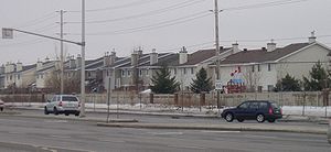
Fallowfield Road (Ottawa)
Encyclopedia
Road
A road is a thoroughfare, route, or way on land between two places, which typically has been paved or otherwise improved to allow travel by some conveyance, including a horse, cart, or motor vehicle. Roads consist of one, or sometimes two, roadways each with one or more lanes and also any...
in southwestern Ottawa
Ottawa
Ottawa is the capital of Canada, the second largest city in the Province of Ontario, and the fourth largest city in the country. The city is located on the south bank of the Ottawa River in the eastern portion of Southern Ontario...
. It is a common commuting road for Barrhaven
Barrhaven, Ontario
Barrhaven is a rapidly growing suburban neighbourhood in the southwest of the urban area of the city of Ottawa, Ontario, Canada, about southwest of downtown Ottawa. Prior to amalgamation with Ottawa in 2001, Barrhaven was part of the City of Nepean. Its population as of the Canada 2006 Census was...
and provides a route to western communities such as Fallowfield village
Village
A village is a clustered human settlement or community, larger than a hamlet with the population ranging from a few hundred to a few thousand , Though often located in rural areas, the term urban village is also applied to certain urban neighbourhoods, such as the West Village in Manhattan, New...
and Munster Hamlet
Munster, Ontario
Munster, Ontario is a large village situated south-west of Stittsville, west of Richmond and north of North Gower. The Ottawa Carleton School Board offers an Elementary school named "Munster Elementary School"....
. These communities are served by OC Transpo
OC Transpo
OC Transpo is the urban transit service of the City of Ottawa, Ontario, Canada. An integrated hub-and-spoke system of services is available consisting of: regular buses travelling on fixed routes in mixed traffic, typical of most urban transit systems; a bus rapid transit system — a high...
.
Fallowfield Road begins in the east at Prince of Wales Drive
Prince of Wales Drive (Ottawa)
Prince of Wales Drive is a road serving Ottawa, Ontario, named after the eponymous road in Battersea, London, U.K. The northern section is a low-speed street running along the west bank of the Rideau River, while southern portions of the road were formerly Highway 16 .Prince of Wales Drive is the...
, near the Rideau River
Rideau River
thumb|Rapids on the Rideau River opposite [[Carleton University]].The Rideau River is a Southern Ontario river which flows north from Upper Rideau Lake and empties into the Ottawa River at Rideau Falls in Ottawa, Ontario. Its length is 146 km...
. There are major intersections with Merivale Road
Merivale Road (Ottawa)
Merivale Road is an arterial road in the western part of Ottawa, Ontario, Canada. It starts at Island Park Drive just north of Highway 417 and continues south until it ends at Prince of Wales Drive in Rideau Glen...
and Woodroffe Avenue
Woodroffe Avenue (Ottawa)
Woodroffe Avenue is the major north-south arterial road in Ottawa, Ontario, Canada's west end. It runs south from the Ottawa River Parkway through Baseline Road to Prince of Wales Drive towards the communities of Manotick and Barrhaven. The road runs through the heart of Nepean in Ottawa's west end...
before entering Barrhaven. The road also provides the name for Fallowfield Station
Fallowfield Station (OC Transpo)
Fallowfield is a bus station on Ottawa's transitway system. Operated by OC Transpo, it is located at Woodroffe Avenue and Fallowfield Road in the community of Barrhaven, next to the Fallowfield railway station....
, which is a local hub for OC Transpo
OC Transpo
OC Transpo is the urban transit service of the City of Ottawa, Ontario, Canada. An integrated hub-and-spoke system of services is available consisting of: regular buses travelling on fixed routes in mixed traffic, typical of most urban transit systems; a bus rapid transit system — a high...
as well as a Via Rail
VIA Rail
Via Rail Canada is an independent crown corporation offering intercity passenger rail services in Canada. It is headquartered near Montreal Central Station at 3 Place Ville-Marie in Montreal, Quebec....
station. The stretch of road between Woodroffe and Greenbank
Greenbank Road (Ottawa)
Greenbank Road is a major north-south road in Ottawa, Ontario, Canada that serves central Nepean and Barrhaven. From its northern terminus at the Queensway until its intersection with Jockvale Road, it is designated Ottawa Road #13....
has recently been widened to four lanes and the speed limit raised to 80 km/h (49.7 mph) in the stretch from west of the CN railway tracks to Greenbank. The road then passes over the highest elevation in Barrhaven before crossing Cedarview Road
Cedarview Road (Ottawa)
Cedarview Road is a north-south road in Ottawa, Ontario, Canada. It runs between Bells Corners and Barrhaven. Formerly a major arterial road for Barrhaven residents, its use declined after the opening of Highway 416 in 1999....
and merging with the western reach of Strandherd Drive
Strandherd Drive (Ottawa)
Strandherd Drive is a major road serving the community of Barrhaven in southwest Ottawa.Up until the mid-1990s, Strandherd Drive was an east-west coursing road extending from Moodie Drive to Woodroffe Avenue...
, considered the western boundary of Barrhaven.
Fallowfield Road continues as a rural, high-speed road. There is an interchange with Highway 416
Highway 416 (Ontario)
King's Highway 416, commonly referred to as Highway 416 and as the Veterans Memorial Highway, is a 400-series highway in the Canadian province of Ontario which connects Highway 417 in Ottawa with Highway 401 between Brockville and Cornwall...
, followed by intersections with Moodie Drive, Richmond Road
Richmond Road (Ottawa)
Richmond Road is a major road in Eastern Ontario, Canada.Richmond Road begins as a western continuation of Wellington Street West in Ottawa, beyond the intersection at Island Park Drive, a division point moved west a few blocks from Western Avenue, the historical township boundary, in 2005. It...
, and Eagleson Road
Eagleson Road (Ottawa)
Eagleson Road is a northwest-southeast road in Ottawa's west end in Kanata. It starts at Highway 417 and ends at Brophy Road south of Richmond. North of Highway 417 it becomes March Road...
. Continuing westward, Fallowfield terminates at McCaffrey Trail, just west of Dwyer Hill Road and southeast of the hamlet
Hamlet (place)
A hamlet is usually a rural settlement which is too small to be considered a village, though sometimes the word is used for a different sort of community. Historically, when a hamlet became large enough to justify building a church, it was then classified as a village...
of Ashton
Ashton, Ontario
The small village of Ashton is located about west of Ottawa, Ontario, Canada, at the intersection of Ashton Station Road and Flewellyn Road. Ashton Station Road runs through the centre of the community, and serves as the south-western boundary line for the City of Ottawa, thus making the eastern...
.