

Postal addresses in Ireland
Encyclopedia
In the Republic of Ireland
, postal addresses do not use a post code
system. Rural addresses are specified by the county
, nearest post town
, and the townland
.
Urban addresses are specified by county, city or town name, street name, house number, and apartment or flat number where relevant. A house name may be used instead of a number.
Responsibility for the postal system rests with An Post
, a semi-state body; however, the Department of Communications, Energy and Natural Resources retains the right to regulate addresses, and had disagreed with An Post over whether there was a need to introduce a postcode system, with An Post objecting to the proposal.
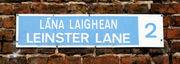 In Dublin city and its suburbs, a system of postal districts was introduced in 1917 by the British government, with the prefix "D", and retained after independence, without the prefix. However the use of district numbers by the public did not occur until 1961, when street signs displayed postal district numbers. Prior to that time, street signs only displayed the street name in Irish and English.
The Dublin system now has 22 districts.
, there are also numbered districts, e.g.: the 'PATRICK STREET' (Sráid Phádraig) sign will display the digit '1', but these are not encountered in postal addresses. Cork has four postal districts. District 1 covers the city centre and large parts of the surrounding city. District 2, administered from the Ballinlough
sorting office, covers the south-east, District 3 (from Gurranabraher
) covers the north-west while District 4 (from Togher
sorting office) covers the south-west. In practice, these numbers are used only internally by An Post and rarely used on mail.
for mail until the 1990s. By then, the optical character recognition
(OCR) systems were advanced enough to read whole addresses, as opposed to just postcodes, thereby allowing An Post to skip
a generation. Consequently, mail to addresses in the rest of the Republic does not require any digits after the address.
On 23 May 2005, the Minister for Communications, Noel Dempsey
, announced that postcodes would be introduced in Ireland by 1 January 2008. In November 2005, the National Statistics Board issued a report welcoming the decision and making recommendations as to its implementation. They supported a point-based postcode system that used grid reference/GPS technology to provide a relatively clear-cut, low cost approach to allocating a postcode to an address. This avoids trying to group households together into small area clusters. It was later announced that the postcodes would include the one- or two-character county codes currently used in vehicle registration plates
, making them alphanumeric
, with the existing Dublin system retained.
In June 2007, a brief to the new Minster for Communications, Eamon Ryan
, stated that a memo was submitted by the Department of Communications to the Irish Government in May 2007 seeking approval for the implementation of the postcode system. It also stated that the decision arising from this submission was that the Minister would revert to Government following further analysis to quantify the benefits, which would then be followed by a public consultation process. However, in August 2007, the Minister reportedly postponed the implementation of the system "indefinitely" pending additional public consultation.
On 18 October 2007 Eamonn Ryan announced at ComReg's "Postal Services in the 21st Century" conference that "[Post] codes should be introduced as a matter of priority". The introduction was stated to be subject to cabinet approval. On 25 February 2008 the Irish Independent
reported that the proposals were being presented to the Cabinet with a view to full national implementation before summer 2008. It stated that Eamon Ryan was finalising the proposals, which include a 6 character format postcode, giving a sample of "D04 123" where "D04" corresponds to the current Dublin 4
postal region and "123" is a specific group of buildings. similar to British and Dutch
postcodes, which cover groups of buildings, rather than simply suburbs or towns.
On 7 December 2008, the Sunday Business Post reported results of an independent report by PA Consulting for the Department indicating that benefits of up to €22m could be achieved for public bodies through the introduction of a postcode. The PA report indicated that postcodes had greater uses beyond the delivery of mail or simple navigation services, citing the "need for efficient database based on postcodes reducing inefficient service delivery and infrastructural planning". It said that Postcodes are considered critical for "efficient spatial planning and aiding health research, education, housing social care and employment integration". Increased efficiencies for businesses would emerge; in particular, the insurance sector stated that "it would result in annual savings of around €40 million by improving their risk management assessments."
The article concluded saying that annual maintenance costs for a postcode management licence holder which would include maintaining the necessary database of buildings are estimated "at about €2.5 million" but the minister was reported as saying that "ongoing costs would be covered by income generated by the eventual licence holder".
On 20 September 2009 RTÉ
reported that tenders for the design and implementation of the system will be issued shortly and that the system will be, according to the Minister for Communication, comprising digits and letters and be introduced in 2011. Minister Ryan said the cost would be a fraction of the €50 million cost estimated four years previously. The Communication Workers Union
claimed that the new system could not be introduced by 2011, and that An Post would have to have to develop a whole new type of software to make its machinery read the new postcodes. However, in a Seanad
debate on 21 October 2009, the Minister reiterated that the proposed new system would be introduced by early 2011 at the latest. Liz McManus, opposition spokeswoman for communications in the Labour Party, has since called for the plan to be revoked due to job losses in An Post, the projected costs and fears of junk mail.
In Dail question time on 2010-01-26, Simon Coveney challenged Minister Eamon Ryan's apparent rejection of a GPS based postcode system. Eamon Ryan refuted this saying that he fully supported a postcode system that had geo-coordinates at its centre. The system chosen would depend on the tenders received. Coveney pointed out that a system that pinpointed 20-50 houses would only slightly improve what is there at present and would be of little help to an ambulance, a courier or a postman that does not know the area.
On 1 February 2010 the tender process to select consultants was announced, with a view to having the postcode system operational by the end of 2011.
In April 2010, the Oireachtas Committee on Communications, Energy and Natural Resources published a report criticising some of the proposals listed above, recommending instead that any postcode implemented must be capable of supporting "developing technologies such as internet mapping, google maps and iphones", applying a unique identifier to each property. It suggests that the previously mentioned D04 123 model will not satisfy this requirement and may, in fact, make matters worse.
On 15 April 2010 the tendering process to select a consultant to advise the Minister on the implementation of a postcode was cancelled.
According to the Irish Independent a serious but unspecified technical error in the tendering documents led to the cancellation of the tender issued in February 2010.
An Post does use a system of three-digit sort codes, similar to the Mailsort
system used by Royal Mail
in the United Kingdom
, for pre-sorting mail in bulk. There are two levels, Presort 152, which has 152 codes for large volumes of mail, and Presort 61, which has 61 codes for smaller volumes.
It corresponds to Dublin postal districts, e.g.; Dublin 1 is 101, etc., except for Dublin 10 and Dublin 20, which both have the same code 110, and Dublin 6W, which is 126. Cork has codes for four each of the delivery offices, Ballinlough
(901), North City (902), Little Island
(903), and South City (903).
names. (Royal Mail
in the UK approached the problem of postcodes in rural Northern Ireland
by naming previously unnamed roads after the townlands through which they passed, and assigning numbers to houses. The naming of roads was initially refused by Fermanagh District Council
, resulting in a solution (unsatisfactory to some) of a postcode being assigned to each townland.)
Those advocating an Irish postcode system point out that many people living in rural (and even some urban) areas share the same postal address, particularly confusing when there are people with the same surname living at different addresses within the same rural townland. This also creates problems for people unfamiliar to an area trying to find an address such as delivery drivers, the emergency services, and visitors (especially since in such areas it is rare for roads to be named or houses to be numbered, and there is limited signage indicating where townlands begin and end).
, an organisation advocating use of the Irish language
, has expressed concern over postcodes or postal abbreviations being based on solely on English language
place names, e.g. D for Dublin (Baile Átha Cliath in Irish) or WX for Wexford
(Loch Garman in Irish) as is the case with vehicle registration plates. It has advocated that postcodes should either consist solely of numbers, as in many other bilingual countries, or be based on Irish language names
instead. In Wales
and Scotland
, postal abbreviations are based on names in English, rather than Welsh
, e.g. CF
for Cardiff
(Caerdydd), and SA
for Swansea
(Abertawe), or Gaelic, e.g.: HS for Outer Hebrides
(Eileann Siar) and IV
Inverness (Inbhir Nis). However, in Northern Ireland
, which has a single postcode area, the abbreviation BT can be for either Belfast
in English or Béal Feirste in Irish.
Republic of Ireland
Ireland , described as the Republic of Ireland , is a sovereign state in Europe occupying approximately five-sixths of the island of the same name. Its capital is Dublin. Ireland, which had a population of 4.58 million in 2011, is a constitutional republic governed as a parliamentary democracy,...
, postal addresses do not use a post code
Postal code
A postal code is a series of letters and/or digits appended to a postal address for the purpose of sorting mail. Once postal codes were introduced, other applications became possible.In February 2005, 117 of the 190 member countries of the Universal Postal Union had postal code systems...
system. Rural addresses are specified by the county
Counties of Ireland
The counties of Ireland are sub-national divisions used for the purposes of geographic demarcation and local government. Closely related to the county is the County corporate which covered towns or cities which were deemed to be important enough to be independent from their counties. A county...
, nearest post town
Post town
A post town is a required part of all postal addresses in the United Kingdom, and a basic unit of the postal delivery system. Including the correct post town in the address increases the chances of a letter or parcel being delivered on time. Post towns are usually based upon the location of...
, and the townland
Townland
A townland or bally is a small geographical division of land used in Ireland. The townland system is of Gaelic origin—most townlands are believed to pre-date the Norman invasion and most have names derived from the Irish language...
.
Urban addresses are specified by county, city or town name, street name, house number, and apartment or flat number where relevant. A house name may be used instead of a number.
Responsibility for the postal system rests with An Post
An Post
An Post is the State-owned provider of postal services in the Republic of Ireland. An Post provides a universal postal service to all parts of the country as a member of the Universal Postal Union...
, a semi-state body; however, the Department of Communications, Energy and Natural Resources retains the right to regulate addresses, and had disagreed with An Post over whether there was a need to introduce a postcode system, with An Post objecting to the proposal.
Dublin postal districts
The Dublin system now has 22 districts.
Cork postal districts
In CorkCork (city)
Cork is the second largest city in the Republic of Ireland and the island of Ireland's third most populous city. It is the principal city and administrative centre of County Cork and the largest city in the province of Munster. Cork has a population of 119,418, while the addition of the suburban...
, there are also numbered districts, e.g.: the 'PATRICK STREET' (Sráid Phádraig) sign will display the digit '1', but these are not encountered in postal addresses. Cork has four postal districts. District 1 covers the city centre and large parts of the surrounding city. District 2, administered from the Ballinlough
Ballinlough, Cork
Ballinlough is a suburb on the southside of Cork city, in Ireland. It is located between Ballintemple and the larger suburbs of Douglas and Blackrock.There are three primary schools situated in Ballinlough: St...
sorting office, covers the south-east, District 3 (from Gurranabraher
Gurranabraher
Gurranabraher is a suburb, located on the northern side of Cork City. It borders onto Fairhill, Shandon, and Knocknaheeny....
) covers the north-west while District 4 (from Togher
Togher, Cork
-Geography:The suburb is situated on the south side of the city.The parish itself is bounded to the north by the Lough, to the south by Ballincrannig and Farmers Cross, to the East by Ballyphehane and to the West by Waterfall and Wilton...
sorting office) covers the south-west. In practice, these numbers are used only internally by An Post and rarely used on mail.
Current handling
An Post did not introduce automated sorting machinesMail sorter
First used by postal services to expedite and automate mail processing, mail sorting systems are now also used by corporations and other mailers to presort mail prior to delivery in order to earn discounts on postage. In the United States, for example, presort discounts can reduce the cost of...
for mail until the 1990s. By then, the optical character recognition
Optical character recognition
Optical character recognition, usually abbreviated to OCR, is the mechanical or electronic translation of scanned images of handwritten, typewritten or printed text into machine-encoded text. It is widely used to convert books and documents into electronic files, to computerize a record-keeping...
(OCR) systems were advanced enough to read whole addresses, as opposed to just postcodes, thereby allowing An Post to skip
Leapfrogging
The concept of leapfrogging was originally used in the context of economic growth theories and industrial-organization innovation studies with specific focus on competition among firms. It is based on Joseph Schumpeter's notion of ‘gales of creative destruction’...
a generation. Consequently, mail to addresses in the rest of the Republic does not require any digits after the address.
Preparation for a postcode
In the light of the liberalisation of postal services and the end of An Post's monopoly ComReg, the Communications Regulator in Ireland, began considering the introduction of postcodes. A Postcode Working Group met in early 2005 and produced a report recommending the implementation of a postcode system.On 23 May 2005, the Minister for Communications, Noel Dempsey
Noel Dempsey
Noel Dempsey is a former Irish Fianna Fáil politician. He was a Teachta Dála for the Meath and Meath West constituencies from 1987 to 2011...
, announced that postcodes would be introduced in Ireland by 1 January 2008. In November 2005, the National Statistics Board issued a report welcoming the decision and making recommendations as to its implementation. They supported a point-based postcode system that used grid reference/GPS technology to provide a relatively clear-cut, low cost approach to allocating a postcode to an address. This avoids trying to group households together into small area clusters. It was later announced that the postcodes would include the one- or two-character county codes currently used in vehicle registration plates
Irish vehicle registration plates
Registration marks on number plates in Ireland issued since 1987 have the format YY-CC-SSSSSS where the components are:* YY — a 2-digit year * CC — a 1- or 2-character county identifier Registration marks on number plates in Ireland issued since 1987 have the format YY-CC-SSSSSS where...
, making them alphanumeric
Alphanumeric
Alphanumeric is a combination of alphabetic and numeric characters, and is used to describe the collection of Latin letters and Arabic digits or a text constructed from this collection. There are either 36 or 62 alphanumeric characters. The alphanumeric character set consists of the numbers 0 to...
, with the existing Dublin system retained.
In June 2007, a brief to the new Minster for Communications, Eamon Ryan
Eamon Ryan
Eamon Ryan is an Irish politician and leader of the Irish Green Party. He was a Teachta Dála for the Dublin South constituency from 2002 to 2011, and served as Minister for Communications, Energy and Natural Resources from 2007 to 2011....
, stated that a memo was submitted by the Department of Communications to the Irish Government in May 2007 seeking approval for the implementation of the postcode system. It also stated that the decision arising from this submission was that the Minister would revert to Government following further analysis to quantify the benefits, which would then be followed by a public consultation process. However, in August 2007, the Minister reportedly postponed the implementation of the system "indefinitely" pending additional public consultation.
On 18 October 2007 Eamonn Ryan announced at ComReg's "Postal Services in the 21st Century" conference that "[Post] codes should be introduced as a matter of priority". The introduction was stated to be subject to cabinet approval. On 25 February 2008 the Irish Independent
Irish Independent
The Irish Independent is Ireland's largest-selling daily newspaper that is published in both compact and broadsheet formats. It is the flagship publication of Independent News & Media.-History:...
reported that the proposals were being presented to the Cabinet with a view to full national implementation before summer 2008. It stated that Eamon Ryan was finalising the proposals, which include a 6 character format postcode, giving a sample of "D04 123" where "D04" corresponds to the current Dublin 4
Dublin 4
Dublin 4 is a postal district of Dublin, Ireland including the suburbs of Sandymount, Ballsbridge, Donnybrook, Ringsend and Irishtown on the South side of Dublin....
postal region and "123" is a specific group of buildings. similar to British and Dutch
Postal codes in the Netherlands
Postal codes in the Netherlands, known as postcodes, are alphanumeric, consisting of four digits followed by two uppercase letters. The letters 'F', 'I', 'O', 'Q', 'U' and 'Y' were originally not used for technical reasons, but as almost all existing combinations are now used these letters were...
postcodes, which cover groups of buildings, rather than simply suburbs or towns.
On 7 December 2008, the Sunday Business Post reported results of an independent report by PA Consulting for the Department indicating that benefits of up to €22m could be achieved for public bodies through the introduction of a postcode. The PA report indicated that postcodes had greater uses beyond the delivery of mail or simple navigation services, citing the "need for efficient database based on postcodes reducing inefficient service delivery and infrastructural planning". It said that Postcodes are considered critical for "efficient spatial planning and aiding health research, education, housing social care and employment integration". Increased efficiencies for businesses would emerge; in particular, the insurance sector stated that "it would result in annual savings of around €40 million by improving their risk management assessments."
The article concluded saying that annual maintenance costs for a postcode management licence holder which would include maintaining the necessary database of buildings are estimated "at about €2.5 million" but the minister was reported as saying that "ongoing costs would be covered by income generated by the eventual licence holder".
On 20 September 2009 RTÉ
RTE
RTÉ is the abbreviation for Raidió Teilifís Éireann, the public broadcasting service of the Republic of Ireland.RTE may also refer to:* Recep Tayyip Erdoğan, 25th Prime Minister of Turkey...
reported that tenders for the design and implementation of the system will be issued shortly and that the system will be, according to the Minister for Communication, comprising digits and letters and be introduced in 2011. Minister Ryan said the cost would be a fraction of the €50 million cost estimated four years previously. The Communication Workers Union
Communication Workers Union (Ireland)
The Communication Workers Union is a trade union in Ireland.The union was founded in 1922 as the Irish Post Office Engineering Union, splitting from the British Post Office Engineering Union following the establishment of the Irish Free State...
claimed that the new system could not be introduced by 2011, and that An Post would have to have to develop a whole new type of software to make its machinery read the new postcodes. However, in a Seanad
Seanad Éireann
Seanad Éireann is the upper house of the Oireachtas , which also comprises the President of Ireland and Dáil Éireann . It is commonly called the Seanad or Senate and its members Senators or Seanadóirí . Unlike Dáil Éireann, it is not directly elected but consists of a mixture of members chosen by...
debate on 21 October 2009, the Minister reiterated that the proposed new system would be introduced by early 2011 at the latest. Liz McManus, opposition spokeswoman for communications in the Labour Party, has since called for the plan to be revoked due to job losses in An Post, the projected costs and fears of junk mail.
In Dail question time on 2010-01-26, Simon Coveney challenged Minister Eamon Ryan's apparent rejection of a GPS based postcode system. Eamon Ryan refuted this saying that he fully supported a postcode system that had geo-coordinates at its centre. The system chosen would depend on the tenders received. Coveney pointed out that a system that pinpointed 20-50 houses would only slightly improve what is there at present and would be of little help to an ambulance, a courier or a postman that does not know the area.
On 1 February 2010 the tender process to select consultants was announced, with a view to having the postcode system operational by the end of 2011.
In April 2010, the Oireachtas Committee on Communications, Energy and Natural Resources published a report criticising some of the proposals listed above, recommending instead that any postcode implemented must be capable of supporting "developing technologies such as internet mapping, google maps and iphones", applying a unique identifier to each property. It suggests that the previously mentioned D04 123 model will not satisfy this requirement and may, in fact, make matters worse.
On 15 April 2010 the tendering process to select a consultant to advise the Minister on the implementation of a postcode was cancelled.
According to the Irish Independent a serious but unspecified technical error in the tendering documents led to the cancellation of the tender issued in February 2010.
An Post's position
An Post had previously claimed that a nationwide public postcode system was unnecessary, stating that it was "a 1960s solution to a 21st century problem", that it would be expensive, and that its existing system was superior. However, they now support the introduction of a national postcode, according to the Irish Times. Courier services and direct mail companies complained that the absence of such a system put Ireland at a disadvantage compared with other European countries.An Post does use a system of three-digit sort codes, similar to the Mailsort
Mailsort
Mailsort is a five-digit address-coding scheme used by the Royal Mail and its business customers for the automatic direction of mail...
system used by Royal Mail
Royal Mail
Royal Mail is the government-owned postal service in the United Kingdom. Royal Mail Holdings plc owns Royal Mail Group Limited, which in turn operates the brands Royal Mail and Parcelforce Worldwide...
in the United Kingdom
United Kingdom
The United Kingdom of Great Britain and Northern IrelandIn the United Kingdom and Dependencies, other languages have been officially recognised as legitimate autochthonous languages under the European Charter for Regional or Minority Languages...
, for pre-sorting mail in bulk. There are two levels, Presort 152, which has 152 codes for large volumes of mail, and Presort 61, which has 61 codes for smaller volumes.
It corresponds to Dublin postal districts, e.g.; Dublin 1 is 101, etc., except for Dublin 10 and Dublin 20, which both have the same code 110, and Dublin 6W, which is 126. Cork has codes for four each of the delivery offices, Ballinlough
Ballinlough, Cork
Ballinlough is a suburb on the southside of Cork city, in Ireland. It is located between Ballintemple and the larger suburbs of Douglas and Blackrock.There are three primary schools situated in Ballinlough: St...
(901), North City (902), Little Island
Little Island, Cork
Little Island is mainly an industrial area to the east of Cork City, Ireland. It is no longer an island, since the northern channel separating it from the mainland has filled over. To the east and south is Cork Harbour; across a channel to the west is Fota Island.-Development:Many of Cork's...
(903), and South City (903).
Townland concerns
Concerns were also expressed by traditionalists that postcodes would undermine the use of historic townlandTownland
A townland or bally is a small geographical division of land used in Ireland. The townland system is of Gaelic origin—most townlands are believed to pre-date the Norman invasion and most have names derived from the Irish language...
names. (Royal Mail
Royal Mail
Royal Mail is the government-owned postal service in the United Kingdom. Royal Mail Holdings plc owns Royal Mail Group Limited, which in turn operates the brands Royal Mail and Parcelforce Worldwide...
in the UK approached the problem of postcodes in rural Northern Ireland
Northern Ireland
Northern Ireland is one of the four countries of the United Kingdom. Situated in the north-east of the island of Ireland, it shares a border with the Republic of Ireland to the south and west...
by naming previously unnamed roads after the townlands through which they passed, and assigning numbers to houses. The naming of roads was initially refused by Fermanagh District Council
Fermanagh District Council
Fermanagh District Council is a local council in Northern Ireland. The borders of the district are very similar to those of the traditional County Fermanagh, containing all of that county plus a small section of County Tyrone in the Dromore Road and Kilskeery Road areas. Council headquarters are...
, resulting in a solution (unsatisfactory to some) of a postcode being assigned to each townland.)
Those advocating an Irish postcode system point out that many people living in rural (and even some urban) areas share the same postal address, particularly confusing when there are people with the same surname living at different addresses within the same rural townland. This also creates problems for people unfamiliar to an area trying to find an address such as delivery drivers, the emergency services, and visitors (especially since in such areas it is rare for roads to be named or houses to be numbered, and there is limited signage indicating where townlands begin and end).
Language issues
Conradh na GaeilgeConradh na Gaeilge
Conradh na Gaeilge is a non-governmental organisation that promotes the Irish language in Ireland and abroad. The motto of the League is Sinn Féin, Sinn Féin amháin .-Origins:...
, an organisation advocating use of the Irish language
Irish language
Irish , also known as Irish Gaelic, is a Goidelic language of the Indo-European language family, originating in Ireland and historically spoken by the Irish people. Irish is now spoken as a first language by a minority of Irish people, as well as being a second language of a larger proportion of...
, has expressed concern over postcodes or postal abbreviations being based on solely on English language
English language
English is a West Germanic language that arose in the Anglo-Saxon kingdoms of England and spread into what was to become south-east Scotland under the influence of the Anglian medieval kingdom of Northumbria...
place names, e.g. D for Dublin (Baile Átha Cliath in Irish) or WX for Wexford
Wexford
Wexford is the county town of County Wexford, Ireland. It is situated near the southeastern corner of Ireland, close to Rosslare Europort. The town is connected to Dublin via the M11/N11 National Primary Route, and the national rail network...
(Loch Garman in Irish) as is the case with vehicle registration plates. It has advocated that postcodes should either consist solely of numbers, as in many other bilingual countries, or be based on Irish language names
Place names in Irish
The vast majority of placenames in Ireland are anglicisations of Irish language names; that is, adaptations of the Irish names to English phonology and spelling. However, some names come directly from the English language, and a handful come from Old Norse and Ulster Scots...
instead. In Wales
Wales
Wales is a country that is part of the United Kingdom and the island of Great Britain, bordered by England to its east and the Atlantic Ocean and Irish Sea to its west. It has a population of three million, and a total area of 20,779 km²...
and Scotland
Scotland
Scotland is a country that is part of the United Kingdom. Occupying the northern third of the island of Great Britain, it shares a border with England to the south and is bounded by the North Sea to the east, the Atlantic Ocean to the north and west, and the North Channel and Irish Sea to the...
, postal abbreviations are based on names in English, rather than Welsh
Welsh language
Welsh is a member of the Brythonic branch of the Celtic languages spoken natively in Wales, by some along the Welsh border in England, and in Y Wladfa...
, e.g. CF
CF postcode area
The CF postcode area, also known as the Cardiff postcode area, is a group of postcode districts around Aberdare, Bargoed, Barry, Bridgend, Caerphilly, Cardiff, Cowbridge, Dinas Powys, Ferndale, Hengoed, Llantwit Major, Maesteg, Merthyr Tydfil, Mountain Ash, Penarth, Pentre, Pontyclun, Pontypridd,...
for Cardiff
Cardiff
Cardiff is the capital, largest city and most populous county of Wales and the 10th largest city in the United Kingdom. The city is Wales' chief commercial centre, the base for most national cultural and sporting institutions, the Welsh national media, and the seat of the National Assembly for...
(Caerdydd), and SA
SA postcode area
The SA postcode area, also known as the Swansea postcode area, is a group of postcode districts around Aberaeron, Ammanford, Boncath, Burry Port, Cardigan, Carmarthen, Clynderwen, Crymych, Ferryside, Fishguard, Glogue, Goodwick, Haverfordwest, Kidwelly, Kilgetty, Lampeter, Llanarth, Llandeilo,...
for Swansea
Swansea
Swansea is a coastal city and county in Wales. Swansea is in the historic county boundaries of Glamorgan. Situated on the sandy South West Wales coast, the county area includes the Gower Peninsula and the Lliw uplands...
(Abertawe), or Gaelic, e.g.: HS for Outer Hebrides
Outer Hebrides
The Outer Hebrides also known as the Western Isles and the Long Island, is an island chain off the west coast of Scotland. The islands are geographically contiguous with Comhairle nan Eilean Siar, one of the 32 unitary council areas of Scotland...
(Eileann Siar) and IV
IV postcode area
The IV postcode area, also known as the Inverness postcode area, is a group of postcode districts around Achnasheen, Alness, Ardgay, Avoch, Beauly, Cromarty, Dingwall, Dornoch, Elgin, Fochabers, Forres, Fortrose, Gairloch, Garve, Glen Shiel, Invergordon, Inverness, Isle of Skye, Kyle, Lairg,...
Inverness (Inbhir Nis). However, in Northern Ireland
Northern Ireland
Northern Ireland is one of the four countries of the United Kingdom. Situated in the north-east of the island of Ireland, it shares a border with the Republic of Ireland to the south and west...
, which has a single postcode area, the abbreviation BT can be for either Belfast
Belfast
Belfast is the capital of and largest city in Northern Ireland. By population, it is the 14th biggest city in the United Kingdom and second biggest on the island of Ireland . It is the seat of the devolved government and legislative Northern Ireland Assembly...
in English or Béal Feirste in Irish.
See also
- An PostAn PostAn Post is the State-owned provider of postal services in the Republic of Ireland. An Post provides a universal postal service to all parts of the country as a member of the Universal Postal Union...
- Dublin postal districts
- Universal Postal UnionUniversal Postal UnionThe Universal Postal Union is an international organization that coordinates postal policies among member nations, in addition to the worldwide postal system. The UPU contains four bodies consisting of the Congress, the Council of Administration , the Postal Operations Council and the...