
Piru Creek
Encyclopedia
Piru Creek is a large stream
in northern Los Angeles County and eastern Ventura County, California
. It is a tributary of the Santa Clara River
, the largest stream system in Southern California
that is still relatively natural. It drains an area of about 497 square miles (1,287.2 km²) and is about 71 miles (114.3 km) long. The creek is the Santa Clara's largest tributary, providing about one-half of its flow. Parts of the creek are impounded in reservoir
s to provide storage for irrigation and water from the California Aqueduct
.
, in the Los Padres National Forest
. It flows eastwards through a valley, then south to the confluence with Cedar Creek from the right. After the Cedar Creek confluence the stream turns northeast, receives Sheep Creek from the left, and Mutau Creek on the right. Piru Creek receives Lockwood Creek from the left at Sunset campground on Lockwood Flat, and flows east into a canyon where the valley walls pull in and rise steeper and higher above the river.
The Smith Fork of Piru Creek comes in from the left where the main stem turns sharply southeast, then widens into the Pyramid Lake
reservoir formed by the Pyramid Dam
. Now with Interstate 5
running almost a thousand feet above the canyon on the east side, Piru Creek turns south, flowing through the Piru Gorge, soon forming the boundary between Mount Pinos and Saugus Ranger Districts of the National Forest and dropping over Piru Creek Falls near the remains of California State Route 99
.
The creek flows south through Piru Gorge until Frenchmans Flat and the adjoining Osito Creek confluence, which sends the Piru sharply hurrying to the west, then south again where it receives Fish Creek from the right. It crosses the boundary between Los Angeles County and Ventura County five times before being impounded in Lake Piru
, the second reservoir on the creek, formed by Santa Felicia Dam. Downstream of the dam the creek's valley broadens and the creek is allowed to form meander
s. It finally exits from its canyon between a pair of ridges just east of the town of Piru
. Its confluence with the Santa Clara River, here a wide gravelly wash
, occurs soon after.
. It is believed that there were once up to 25 Native American villages on the river, of which eight have been thoroughly studied. Spanish explorer Don Gaspar first traveled up the creek in 1769. In 1839, the government of Mexico
which then held control over Alta California
granted the 48612 acres (19,672.6 ha) Rancho San Francisco
to Antonio del Valle. The Rancho Camulos
was created out of Rancho San Francisco land by Ygnacio del Valle
in 1853, and included much of the Santa Clara River and Piru Creek Valleys.
In 1842, traces of gold
were found on a tributary of the Santa Clara River, Placerita Creek, which joins the main stem about 10 miles (16.1 km) upstream of Piru. Bn the late 19th century, prospectors discovered traces of calcite
on Piru Creek in Lockwood Valley near Frazier Mountain, north of present-day Pyramid Lake. A town called Lexington was platted near the site in 1887 but never actually materialized. Ironically, the real mineral of value in the region turned out to be borax
, which was mined in the 1880s by the Frazier Borate Company.
The company town
, Stauffer, was established on the Piru in time, and by 1905 had grown to such a size that a post office was set up in the town, which finally was abandoned in 1942 because of dwindling profits from borax mining. The Russell Borate Mining Company also acquired land in the region in 1907 between a pair of earlier excavations. By 1912, the Russell mine was the only one left in operation. Ultimately, all the mines were abandoned because of competitions from borax operations in Death Valley
.
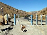
 Hiking
, camping
, off-roading
and rock climbing
are some of the recreational opportunities in the Los Padres National Forest that surrounds much of the Piru's course. One well-known trail follows Piru Creek through the lower part of Piru Gorge from Frenchmans Flat to the confluence with Fish Creek, and it is possible to continue all the way south from there to Lake Piru with much scrambling and wading. The entire hike can require more than two days to complete, and flooding from Piru Creek is a potential danger.
Fishing
is a popular activity on Piru Creek. The creek is stocked with trout by the California Department of Fish and Game
at Frenchmans Flat from fall through spring, and rainbow trout
and largemouth bass
are also present. Most of the river is open to fishing year round (limit of 5 fish), but the 900 feet (274.3 m) reach from Pyramid Dam to a small bridge downstream is closed to any fishing, and from that bridge to Piru Creek Falls it is catch and release only.
In the spring, the stretches of Piru Creek from Pyramid Lake to Lake Piru and from Santa Felicia Dam to the mouth are actually possible to raft and kayak. The 15 miles (24.1 km) first stretch has rapids up to Class IV and includes the challenging section known as Falls Gorge, while the calmer 4 miles (6.4 km) second reach has Class I-II rapids only. Controlled water releases from the two dams provide some regulation of the flow although an effort is made to simulate natural discharges. As a result, the section is usually only runnable after rainfall. From 0.5 mile (0.80467 km) downstream of Pyramid Dam to the Los Angeles-Ventura County line, Piru Creek in various sections is designated a National Wild and Scenic River
.
Piru Creek is also a hot spot for trout fisherman year round as it contains both wild and hatchery-raised rainbow trout
. The fishing is generally good all year, but the best fishing can be found from January to April using a variety of baits including nightcrawlers, artificially scented trout doughs and metal lures.
Below Pyramid Dam, a cement culvert adjoining the remains of Highway 99 creates a 15 feet (4.6 m) waterfall
. This is the uppermost limit of natural fish spawning on the creek below Pyramid Dam.
Stream
A stream is a body of water with a current, confined within a bed and stream banks. Depending on its locale or certain characteristics, a stream may be referred to as a branch, brook, beck, burn, creek, "crick", gill , kill, lick, rill, river, syke, bayou, rivulet, streamage, wash, run or...
in northern Los Angeles County and eastern Ventura County, California
Ventura County, California
Ventura County is a county in the southern part of the U.S. state of California. It is located on California's Pacific coast. It is often referred to as the Gold Coast, and has a reputation of being one of the safest populated places and one of the most affluent places in the country...
. It is a tributary of the Santa Clara River
Santa Clara River (California)
The Santa Clara River is approximately long, located in southern California in the United States. It drains an area of the coastal mountains north of Los Angeles. The Santa Clara is one of the largest river systems along the coast of Southern California and one of only a few remaining river...
, the largest stream system in Southern California
Southern California
Southern California is a megaregion, or megapolitan area, in the southern area of the U.S. state of California. Large urban areas include Greater Los Angeles and Greater San Diego. The urban area stretches along the coast from Ventura through the Southland and Inland Empire to San Diego...
that is still relatively natural. It drains an area of about 497 square miles (1,287.2 km²) and is about 71 miles (114.3 km) long. The creek is the Santa Clara's largest tributary, providing about one-half of its flow. Parts of the creek are impounded in reservoir
Reservoir
A reservoir , artificial lake or dam is used to store water.Reservoirs may be created in river valleys by the construction of a dam or may be built by excavation in the ground or by conventional construction techniques such as brickwork or cast concrete.The term reservoir may also be used to...
s to provide storage for irrigation and water from the California Aqueduct
California Aqueduct
The Governor Edmund G. Brown California Aqueduct is a system of canals, tunnels, and pipelines that conveys water collected from the Sierra Nevada Mountains and valleys of Northern- and Central California to Southern California. The Department of Water Resources operates and maintains the...
.
Course
Piru Creek originates as several small springs on the north side of Pine Mountain Ridge (California)Pine Mountain Ridge (California)
Pine Mountain Ridge is a Transverse Range located in northern Ventura County, and entirely within the Los Padres National Forest.Major peaks on the ridge include, from west to east, Reyes Peak, Haddock Peak, and Thorn Point.-See also:...
, in the Los Padres National Forest
Los Padres National Forest
Los Padres National Forest is a forest located in southern and central California, which includes most of the mountainous land along the California coast from Ventura to Monterey, extending inland...
. It flows eastwards through a valley, then south to the confluence with Cedar Creek from the right. After the Cedar Creek confluence the stream turns northeast, receives Sheep Creek from the left, and Mutau Creek on the right. Piru Creek receives Lockwood Creek from the left at Sunset campground on Lockwood Flat, and flows east into a canyon where the valley walls pull in and rise steeper and higher above the river.
The Smith Fork of Piru Creek comes in from the left where the main stem turns sharply southeast, then widens into the Pyramid Lake
Pyramid Lake (California)
Pyramid Lake is an artificial lake formed by Pyramid Dam on Piru Creek, near Castaic, California. The reservoir lies on the border between the Angeles National Forest and the Los Padres National Forest in the northwestern portion of Los Angeles County....
reservoir formed by the Pyramid Dam
Pyramid Dam
Pyramid Dam is a dam in the West Branch of the California Aqueduct. Its reservoir, Pyramid Lake, stores water for Ventura County and Los Angeles County. The dam and lake are located in northern Los Angeles County, north of Castaic and south of Gorman...
. Now with Interstate 5
Interstate 5
Interstate 5 is the main Interstate Highway on the West Coast of the United States, running largely parallel to the Pacific Ocean coastline from Canada to Mexico . It serves some of the largest cities on the U.S...
running almost a thousand feet above the canyon on the east side, Piru Creek turns south, flowing through the Piru Gorge, soon forming the boundary between Mount Pinos and Saugus Ranger Districts of the National Forest and dropping over Piru Creek Falls near the remains of California State Route 99
California State Route 99
California State Route 99 , commonly known as Highway 99 or, simply, as 99 , is a north–south state highway in the U.S. state of California, stretching almost the entire length of the Central Valley...
.
The creek flows south through Piru Gorge until Frenchmans Flat and the adjoining Osito Creek confluence, which sends the Piru sharply hurrying to the west, then south again where it receives Fish Creek from the right. It crosses the boundary between Los Angeles County and Ventura County five times before being impounded in Lake Piru
Lake Piru
Lake Piru is an artificial lake located in Los Padres National Forest of Ventura County, California, created by the construction in 1955 of the Santa Felicia Dam on Piru Creek which is a tributary of the Santa Clara River. It is situated downstream from Pyramid Lake and can be accessed from Piru...
, the second reservoir on the creek, formed by Santa Felicia Dam. Downstream of the dam the creek's valley broadens and the creek is allowed to form meander
Meander
A meander in general is a bend in a sinuous watercourse. A meander is formed when the moving water in a stream erodes the outer banks and widens its valley. A stream of any volume may assume a meandering course, alternately eroding sediments from the outside of a bend and depositing them on the...
s. It finally exits from its canyon between a pair of ridges just east of the town of Piru
Piru, California
Piru is a small unincorporated census-designated town located in eastern Ventura County, California, in the Santa Clara River Valley near the Santa Clara River and Highway 126, about seven miles east of Fillmore and about west of Interstate 5. The population was 2,063 at the 2010 census, up from...
. Its confluence with the Santa Clara River, here a wide gravelly wash
Arroyo (creek)
An arroyo , a Spanish word translated as brook, and also called a wash is usually a dry creek or stream bed—gulch that temporarily or seasonally fills and flows after sufficient rain. Wadi is a similar term in Africa. In Spain, a rambla has a similar meaning to arroyo.-Types and processes:Arroyos...
, occurs soon after.
History
Thousands of years ago, Native Americans of the Chumash group lived in the area, but by 500 AD their former territory along Piru Creek had been occupied by the TataviamTataviam
The Tataviam , were called the Alliklik by their neighbors the Chumash , are a Native American group in southern California...
. It is believed that there were once up to 25 Native American villages on the river, of which eight have been thoroughly studied. Spanish explorer Don Gaspar first traveled up the creek in 1769. In 1839, the government of Mexico
Mexico
The United Mexican States , commonly known as Mexico , is a federal constitutional republic in North America. It is bordered on the north by the United States; on the south and west by the Pacific Ocean; on the southeast by Guatemala, Belize, and the Caribbean Sea; and on the east by the Gulf of...
which then held control over Alta California
Alta California
Alta California was a province and territory in the Viceroyalty of New Spain and later a territory and department in independent Mexico. The territory was created in 1769 out of the northern part of the former province of Las Californias, and consisted of the modern American states of California,...
granted the 48612 acres (19,672.6 ha) Rancho San Francisco
Rancho San Francisco
Rancho San Francisco was a land grant in present day northwestern Los Angeles County and eastern Ventura County, California. It was of by Governor Juan B. Alvarado to Antonio del Valle, a Spanish army officer, in recognition for his service to the state of Alta California...
to Antonio del Valle. The Rancho Camulos
Rancho Camulos
Rancho Camulos, now known as Rancho Camulos Museum, is a ranch located in the Santa Clara River Valley east of Piru, California and just north of the Santa Clara River, in present day Ventura County, California. It was the home of Ygnacio del Valle, an alcalde of the Pueblo de Los Angeles and...
was created out of Rancho San Francisco land by Ygnacio del Valle
Ygnacio del Valle
Ygnacio Ramón de Jesus del Valle was a rancher and landowner in the eastern Santa Clara River Valley, California, United States, as well as an alcalde of Los Angeles. His estate, Rancho Camulos, is registered as a National Historic Landmark.- Early life :Del Valle was born in Jalisco, Mexico...
in 1853, and included much of the Santa Clara River and Piru Creek Valleys.
In 1842, traces of gold
Gold
Gold is a chemical element with the symbol Au and an atomic number of 79. Gold is a dense, soft, shiny, malleable and ductile metal. Pure gold has a bright yellow color and luster traditionally considered attractive, which it maintains without oxidizing in air or water. Chemically, gold is a...
were found on a tributary of the Santa Clara River, Placerita Creek, which joins the main stem about 10 miles (16.1 km) upstream of Piru. Bn the late 19th century, prospectors discovered traces of calcite
Calcite
Calcite is a carbonate mineral and the most stable polymorph of calcium carbonate . The other polymorphs are the minerals aragonite and vaterite. Aragonite will change to calcite at 380-470°C, and vaterite is even less stable.-Properties:...
on Piru Creek in Lockwood Valley near Frazier Mountain, north of present-day Pyramid Lake. A town called Lexington was platted near the site in 1887 but never actually materialized. Ironically, the real mineral of value in the region turned out to be borax
Borax
Borax, also known as sodium borate, sodium tetraborate, or disodium tetraborate, is an important boron compound, a mineral, and a salt of boric acid. It is usually a white powder consisting of soft colorless crystals that dissolve easily in water.Borax has a wide variety of uses...
, which was mined in the 1880s by the Frazier Borate Company.
The company town
Company town
A company town is a town or city in which much or all real estate, buildings , utilities, hospitals, small businesses such as grocery stores and gas stations, and other necessities or luxuries of life within its borders are owned by a single company...
, Stauffer, was established on the Piru in time, and by 1905 had grown to such a size that a post office was set up in the town, which finally was abandoned in 1942 because of dwindling profits from borax mining. The Russell Borate Mining Company also acquired land in the region in 1907 between a pair of earlier excavations. By 1912, the Russell mine was the only one left in operation. Ultimately, all the mines were abandoned because of competitions from borax operations in Death Valley
Death Valley
Death Valley is a desert valley located in Eastern California. Situated within the Mojave Desert, it features the lowest, driest, and hottest locations in North America. Badwater, a basin located in Death Valley, is the specific location of the lowest elevation in North America at 282 feet below...
.
Recreation
Hiking
Hiking is an outdoor activity which consists of walking in natural environments, often in mountainous or other scenic terrain. People often hike on hiking trails. It is such a popular activity that there are numerous hiking organizations worldwide. The health benefits of different types of hiking...
, camping
Camping
Camping is an outdoor recreational activity. The participants leave urban areas, their home region, or civilization and enjoy nature while spending one or several nights outdoors, usually at a campsite. Camping may involve the use of a tent, caravan, motorhome, cabin, a primitive structure, or no...
, off-roading
Off-roading
Off-roading is a term for driving a vehicle on unsurfaced roads or tracks, made of materials such as sand, gravel, riverbeds, mud, snow, rocks, and other natural terrain.-Off-road vehicle:...
and rock climbing
Rock climbing
Rock climbing also lightly called 'The Gravity Game', is a sport in which participants climb up, down or across natural rock formations or artificial rock walls. The goal is to reach the summit of a formation or the endpoint of a pre-defined route without falling...
are some of the recreational opportunities in the Los Padres National Forest that surrounds much of the Piru's course. One well-known trail follows Piru Creek through the lower part of Piru Gorge from Frenchmans Flat to the confluence with Fish Creek, and it is possible to continue all the way south from there to Lake Piru with much scrambling and wading. The entire hike can require more than two days to complete, and flooding from Piru Creek is a potential danger.
Fishing
Fishing
Fishing is the activity of trying to catch wild fish. Fish are normally caught in the wild. Techniques for catching fish include hand gathering, spearing, netting, angling and trapping....
is a popular activity on Piru Creek. The creek is stocked with trout by the California Department of Fish and Game
California Department of Fish and Game
The California Department of Fish and Game is a department within the government of California, falling under its parent California Natural Resources Agency. The Department of Fish and Game manages and protects the state's diverse fish, wildlife, plant resources, and native habitats...
at Frenchmans Flat from fall through spring, and rainbow trout
Rainbow trout
The rainbow trout is a species of salmonid native to tributaries of the Pacific Ocean in Asia and North America. The steelhead is a sea run rainbow trout usually returning to freshwater to spawn after 2 to 3 years at sea. In other words, rainbow trout and steelhead trout are the same species....
and largemouth bass
Largemouth bass
The largemouth bass is a species of black bass in the sunfish family native to North America . It is also known as widemouth bass, bigmouth, black bass, bucketmouth, Potter's fish, Florida bass, Florida largemouth, green bass, green trout, linesides, Oswego bass, southern largemouth...
are also present. Most of the river is open to fishing year round (limit of 5 fish), but the 900 feet (274.3 m) reach from Pyramid Dam to a small bridge downstream is closed to any fishing, and from that bridge to Piru Creek Falls it is catch and release only.
In the spring, the stretches of Piru Creek from Pyramid Lake to Lake Piru and from Santa Felicia Dam to the mouth are actually possible to raft and kayak. The 15 miles (24.1 km) first stretch has rapids up to Class IV and includes the challenging section known as Falls Gorge, while the calmer 4 miles (6.4 km) second reach has Class I-II rapids only. Controlled water releases from the two dams provide some regulation of the flow although an effort is made to simulate natural discharges. As a result, the section is usually only runnable after rainfall. From 0.5 mile (0.80467 km) downstream of Pyramid Dam to the Los Angeles-Ventura County line, Piru Creek in various sections is designated a National Wild and Scenic River
National Wild and Scenic River
National Wild and Scenic River is a designation for certain protected areas in the United States.The National Wild and Scenic Rivers Act was an outgrowth of the recommendations of a Presidential commission, the Outdoor Recreation Resources Review Commission...
.
Piru Creek is also a hot spot for trout fisherman year round as it contains both wild and hatchery-raised rainbow trout
Rainbow trout
The rainbow trout is a species of salmonid native to tributaries of the Pacific Ocean in Asia and North America. The steelhead is a sea run rainbow trout usually returning to freshwater to spawn after 2 to 3 years at sea. In other words, rainbow trout and steelhead trout are the same species....
. The fishing is generally good all year, but the best fishing can be found from January to April using a variety of baits including nightcrawlers, artificially scented trout doughs and metal lures.
Below Pyramid Dam, a cement culvert adjoining the remains of Highway 99 creates a 15 feet (4.6 m) waterfall
Waterfall
A waterfall is a place where flowing water rapidly drops in elevation as it flows over a steep region or a cliff.-Formation:Waterfalls are commonly formed when a river is young. At these times the channel is often narrow and deep. When the river courses over resistant bedrock, erosion happens...
. This is the uppermost limit of natural fish spawning on the creek below Pyramid Dam.
External links
- Lake Piru
- Friends of the River
- California Department of Water Resources
- Southern California Coastal Watershed Inventory
- Waterfalls of Southern and Central California, Chris Shaffer, 1997