

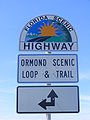
Ormond Scenic Loop and Trail
Encyclopedia
Volusia County, Florida
Volusia County is a county located in the state of Florida. The U.S. Census Bureau 2010 official county's population was 494,593 . Its county seat is DeLand, and its most populous city is currently Deltona....
.
CR 2002 (Highbridge Road and Walter Boardman Road) is the northern leg of the trail. CR 4011(Old Dixie Highway and North Beach Street) is the western leg, with a spur onto Pine Tree Drive. SR 40(East Granada Boulevard) is the southern leg of the trail. CR 2803(John Anderson Drive) is the central leg of the trail, and SR A1A is the eastern leg of the trial. Florida Scenic Highway
Florida Scenic Highways
-Federally designated scenic byways:-State designated scenic byways:-External links:*...
, designated this route on July 9, 2007.
Volusia County Road 2002
County Road 2002 is a bi-county highwayCounty highway
A county highway is a road in the United States and in the Canadian province of Ontario that is designated and/or maintained by the county highway department...
at the extreme northeastern part of Volusia County, Florida
Volusia County, Florida
Volusia County is a county located in the state of Florida. The U.S. Census Bureau 2010 official county's population was 494,593 . Its county seat is DeLand, and its most populous city is currently Deltona....
. It two lanes wide along its length. The county road is 4.2 miles (6.8 km) long, but in Flagler County, the road is 2.5 miles (4 km) long, giving a total of 6.7 miles (10.8 km). Normally, CR 2002 is a scenic route through trees, and some views of Bulow Creek.
Flagler County Road 2002
Beginning at US 1 in KoronaKorona, Florida
Korona is an unincorporated community in Flagler County, Florida, United States. It is located north northeast of Favoretta on US 1 south of Bunnell. The community is part of the Palm Coast Metropolitan Statistical Area....
, Flagler CR 2002 immediatley intersects CR 325, and runs southeast. The road is another section of Old Dixie Highway
Dixie Highway
The Dixie Highway was a United States automobile highway, first planned in 1914 to connect the US Midwest with the Southern United States. It was part of the National Auto Trail system, and grew out of an earlier Miami to Montreal highway. The final result is better understood as a small network of...
(which makes it a former section of US 1), and in some instances, Marco Polo Boulevard. The next intersection is CR 335, but after turning from southeast to east has very few intersections, all of which are of minor streets such as Bayberry Village Road. Only after the road crosses Plantation Bay Drive and some power lines does it come near some cluster developments as it approaches Interstate 95 at the Flagler-Volusia County line.
Volusia County Road 2002
At the Flagler-Volusia County Line, CR 2002 not only has an interchange with I-95Interstate 95 in Florida
Interstate 95 is the main Interstate Highway on the east coast of the United States; it serves the Atlantic coast of Florida. It begins at a partial interchange with U.S. Highway 1 just south of downtown Miami, and heads north past Daytona Beach and Jacksonville to the Georgia state line at the St...
, but serves as the beginning of the concurrency with CR 4011. Shortly after this it serves as the southern terminus of CR 2001, and as it approaches Bulow Creek State Park
Bulow Creek State Park
Bulow Creek State Park is a Florida State Park located five miles north of Ormond Beach. It is on Old Dixie Highway , next to the Atlantic Ocean...
, the concurrency with CR 4011 ends as it takes Old Dixie Highway south towards Ormond Beach, while CR 2002 shifts onto Walter Boardman Lane. It is here that the west and north legs of the Ormond Scenic Loop and Trail meet, and the trail moves from CR 4011 to CR 2002. Now inside Bulow Creek State Park, CR 2002 continues east as it approaches another bridge before meeting the intersection of CR 201, which drivers and hikers will enter unless they make a right turn. Then they can continue onto Walter Boardman Lane as it moves south along Bulow Creek and then turns east only to become Highbridge Avenue where it runs between North Peninsula State Park
North Peninsula State Park
North Peninsula State Park is a Florida State Park, located north of Ormond-By-The-Sea and east of the Bulow Plantation Ruins Historic State Park, off A1A.-References and external links:* at...
, and Tomoka Marsh Aquatic Preserve. The road approaches a bascule bridge
Bascule bridge
A bascule bridge is a moveable bridge with a counterweight that continuously balances the span, or "leaf," throughout the entire upward swing in providing clearance for boat traffic....
over the Intracoastal Waterway
Intracoastal Waterway
The Intracoastal Waterway is a 3,000-mile waterway along the Atlantic and Gulf coasts of the United States. Some lengths consist of natural inlets, salt-water rivers, bays, and sounds; others are artificial canals...
known as the Knox Memorial Bridge
Knox Memorial Bridge
The Knox Memorial Bridge crosses the Intracoastal Waterway north of Ormond Beach, Florida. Highbridge Road passes over the bridge.-History:...
, and afterwards intersects CR 2803(John Anderson Drive), which is another leg of the trail. On this side of the brige, North Peninsula State Park can be found on both sides of the road. Volusia County Road 2002 ends at SR A1A
Florida State Road A1A
State Road A1A is a Florida State Road that runs mostly along the Atlantic Ocean, with sections from Key West at the southern tip of Florida, to Callahan, just south of Georgia. It is the main road through most oceanfront towns. SR A1A is designated the A1A Scenic and Historic Coastal Highway, a...
in Ormond-By-The-Sea, but the trail turns in both directions along A1A; either south towards Florida State Road 40 in Ormond Beach, or north towards the Volusia-Flagler County Line in Flagler Beach
Flagler Beach, Florida
Flagler Beach is a city in Flagler and Volusia counties in the U.S. state of Florida. The population was 4,954 at the 2000 census, with an estimated population of 5,228 in 2004.Flagler Beach is part of the Palm Coast Metropolitan Statistical Area...
.
Major intersections
 US 1U.S. Route 1 in FloridaU.S. Route 1 in Florida runs along the state's east coast from Key West to its crossing of the St. Marys River into Georgia north of Boulogne, and south of Folkston. US 1 was designated through Florida when the U.S. Highway System was established in 1926.US 1 runs in the state of Florida, and...
in Ormond Beach KoronaKorona, FloridaKorona is an unincorporated community in Flagler County, Florida, United States. It is located north northeast of Favoretta on US 1 south of Bunnell. The community is part of the Palm Coast Metropolitan Statistical Area....
. CR 325 in Korona.
 I-95Interstate 95 in FloridaInterstate 95 is the main Interstate Highway on the east coast of the United States; it serves the Atlantic coast of Florida. It begins at a partial interchange with U.S. Highway 1 just south of downtown Miami, and heads north past Daytona Beach and Jacksonville to the Georgia state line at the St...
CR 4011 (Exit 278)- CR 2001,
- CR 4011 in (Scenic route joins from south)
 CR 201, in Flagler BeachFlagler Beach, FloridaFlagler Beach is a city in Flagler and Volusia counties in the U.S. state of Florida. The population was 4,954 at the 2000 census, with an estimated population of 5,228 in 2004.Flagler Beach is part of the Palm Coast Metropolitan Statistical Area...
- CR 2820, in Flagler BeachFlagler Beach, FloridaFlagler Beach is a city in Flagler and Volusia counties in the U.S. state of Florida. The population was 4,954 at the 2000 census, with an estimated population of 5,228 in 2004.Flagler Beach is part of the Palm Coast Metropolitan Statistical Area...
(Scenic route central spur)  SR A1AFlorida State Road A1AState Road A1A is a Florida State Road that runs mostly along the Atlantic Ocean, with sections from Key West at the southern tip of Florida, to Callahan, just south of Georgia. It is the main road through most oceanfront towns. SR A1A is designated the A1A Scenic and Historic Coastal Highway, a...
in Flagler BeachFlagler Beach, FloridaFlagler Beach is a city in Flagler and Volusia counties in the U.S. state of Florida. The population was 4,954 at the 2000 census, with an estimated population of 5,228 in 2004.Flagler Beach is part of the Palm Coast Metropolitan Statistical Area...
(Scenic route east leg, both directions)
Volusia County Road 4011
Volusia County Road 4011 is a county highwayCounty highway
A county highway is a road in the United States and in the Canadian province of Ontario that is designated and/or maintained by the county highway department...
in northern Volusia County, Florida
Florida
Florida is a state in the southeastern United States, located on the nation's Atlantic and Gulf coasts. It is bordered to the west by the Gulf of Mexico, to the north by Alabama and Georgia and to the east by the Atlantic Ocean. With a population of 18,801,310 as measured by the 2010 census, it...
. It is widely known as "the Scenic Route" because of the proximity to the Halifax River
Halifax River
The Halifax River is part of the Atlantic Intracoastal Waterway, located in northeast Volusia County, Florida. The waterway was originally known as the North Mosquito River, but was renamed after George Montagu-Dunk, 2nd Earl of Halifax, during the British occupation of Florida .-Geography:The...
. CR 4011 is unsigned, and used to be a part of US 1. The intersection of SR 40 in Ormond Beach is where thr south leg of the Ormond Scenic Loop and Trail ends and the west leg of the trail begins. CR 4011 enters Tomoka State Park
Tomoka State Park
Tomoka State Park is an Florida State Park located along the Tomoka River, three miles north of Ormond Beach on North Beach Street.-Fauna:...
just before it crosses over a bridge at the mouth of the Tomoka River. Along the western edge of Bulow Creek State Park
Bulow Creek State Park
Bulow Creek State Park is a Florida State Park located five miles north of Ormond Beach. It is on Old Dixie Highway , next to the Atlantic Ocean...
, CR 4011 forms a concurrency with Volusia CR 2002 then turns west, while the Ormond Trail turns east onto CR 2002. The northern terminus is at I-95
Interstate 95 in Florida
Interstate 95 is the main Interstate Highway on the east coast of the United States; it serves the Atlantic coast of Florida. It begins at a partial interchange with U.S. Highway 1 just south of downtown Miami, and heads north past Daytona Beach and Jacksonville to the Georgia state line at the St...
, ending the concurrency of CR 2002/CR 4011. The southern terminus is SR 430 in Daytona Beach. From I-95
Interstate 95 in Florida
Interstate 95 is the main Interstate Highway on the east coast of the United States; it serves the Atlantic coast of Florida. It begins at a partial interchange with U.S. Highway 1 just south of downtown Miami, and heads north past Daytona Beach and Jacksonville to the Georgia state line at the St...
to Ormond Beach, it is known as Old Dixie Highway. In Holly Hill
Holly Hill, Florida
Holly Hill is a city in Volusia County, Florida, United States. The population was 12,119 at the 2000 census. As of 2004, the population recorded by the U.S. Census Bureau is 12,586...
, it is known as Riverside Drive.
Major intersections
in Daytona BeachDaytona Beach, Florida
Daytona Beach is a city in Volusia County, Florida, USA. According to 2008 U.S. Census Bureau estimates, the city has a population of 64,211. Daytona Beach is a principal city of the Deltona – Daytona Beach – Ormond Beach, Florida Metropolitan Statistical Area, which the census bureau estimated had...
 LPGA Blvd in Holly HillHolly Hill, FloridaHolly Hill is a city in Volusia County, Florida, United States. The population was 12,119 at the 2000 census. As of 2004, the population recorded by the U.S. Census Bureau is 12,586...
 SR 40 in Ormond Beach (Scenic route turns east)
- CR 2820, in Ormond Beach (Scenic route west spur)
 CR 2002, runs concurrent from Flagler CountyFlagler County, FloridaFlagler County was created in 1917 from portions of Saint Johns and Volusia counties. It was named for Henry Morrison Flagler, a famous railroad builder who built the Florida East Coast Railway. Bunnell is the county seat of Flagler County....
to Walter Boardman Lane.(Scenic route turns east), (Exit 278) in KoronaKorona, FloridaKorona is an unincorporated community in Flagler County, Florida, United States. It is located north northeast of Favoretta on US 1 south of Bunnell. The community is part of the Palm Coast Metropolitan Statistical Area....
Volusia County Road 2820
Volusia County Road 2820 is Pine Tree Drive. It spans from US 1U.S. Route 1 in Florida
U.S. Route 1 in Florida runs along the state's east coast from Key West to its crossing of the St. Marys River into Georgia north of Boulogne, and south of Folkston. US 1 was designated through Florida when the U.S. Highway System was established in 1926.US 1 runs in the state of Florida, and...
southeast of Exit 273 on I-95
Interstate 95 in Florida
Interstate 95 is the main Interstate Highway on the east coast of the United States; it serves the Atlantic coast of Florida. It begins at a partial interchange with U.S. Highway 1 just south of downtown Miami, and heads north past Daytona Beach and Jacksonville to the Georgia state line at the St...
in National Gardens to CR 4011 along the north end of Tomoka State Park
Tomoka State Park
Tomoka State Park is an Florida State Park located along the Tomoka River, three miles north of Ormond Beach on North Beach Street.-Fauna:...
. However, only the portion within the Ormond Beach City Limits is part of the scenic trail.
Florida State Road 40
The southern leg of the trail is Florida State Road 40 to the east end. This segment begins at the intersection of CR 4011 and SR 40 at Ormond Beach City Hall on the southwest corner of Granada Boulevard and Beach Street. From there, SR 40 crosses the Granada BridgeGranada Bridge (Ormond Beach)
The Granada Bridge is a high-clearance bridge that spans the Halifax River and Intracoastal Waterway, linking the mainland and beach peninsula parts of Ormond Beach, Volusia County, Florida. Granada Bridge carries four lanes of Florida State Road 40 and Granada Blvd...
over the Halifax River
Halifax River
The Halifax River is part of the Atlantic Intracoastal Waterway, located in northeast Volusia County, Florida. The waterway was originally known as the North Mosquito River, but was renamed after George Montagu-Dunk, 2nd Earl of Halifax, during the British occupation of Florida .-Geography:The...
, and immediately intersects John Anderson Drive(CR 2803), where one leg of the scenic route heads north and West Granada Boulevard becomes East Granda Boulevard, before finally terminating at Florida State Road A1A
Florida State Road A1A
State Road A1A is a Florida State Road that runs mostly along the Atlantic Ocean, with sections from Key West at the southern tip of Florida, to Callahan, just south of Georgia. It is the main road through most oceanfront towns. SR A1A is designated the A1A Scenic and Historic Coastal Highway, a...
. The other leg of the Ormond Beach Scenic Loop heads north on SR A1A. Despite the fact that SR 40 terminates at SR A1A, East Granada Boulevard continues as a beach access road.
Volusia County Road 2803
Volusia County Road 2803 is known as John Anderson Drive. However, it was originally part of the much longer John Anderson Highway, which connected Miami, Florida to Jacksonville, Florida, until it was absorbed into the longer Dixie HighwayDixie Highway
The Dixie Highway was a United States automobile highway, first planned in 1914 to connect the US Midwest with the Southern United States. It was part of the National Auto Trail system, and grew out of an earlier Miami to Montreal highway. The final result is better understood as a small network of...
around 1915.
Portions of John Anderson Highway still exist in St. Johns County, Florida. A section of the road in Flagler and Volusia Counties is still known as John Anderson Highway; a part a bit to the south, also in Volusia County, is now John Anderson Drive. The segment between SR 40 and CR 2002 is today one leg of the loop.
Florida State Road A1A
As SR 40 becomes a beach access road, the Ormond Scenic Trail turns north along Florida State Road A1AFlorida State Road A1A
State Road A1A is a Florida State Road that runs mostly along the Atlantic Ocean, with sections from Key West at the southern tip of Florida, to Callahan, just south of Georgia. It is the main road through most oceanfront towns. SR A1A is designated the A1A Scenic and Historic Coastal Highway, a...
, and follows this route until it reaches the Flagler County Line. The route terminates here, but SR A1A continues north along the east coast of Florida.