
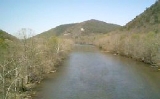
Nolichucky River
Encyclopedia
The Nolichucky River is a major stream
draining the Blue Ridge Mountains
of western North Carolina
and east Tennessee
. The river is 115 miles (185.1 km) long.
of the North Toe River
and the Cane River near the community of Huntdale, North Carolina. The stream succeeds the North Toe as the boundary between Yancey County
and Mitchell County, North Carolina
. Trending roughly westward, it flows along the north flank of Flattop Mountain. The gorge is especially steep on its north side. Geologically
, the area is predominantly underlain by metamorphic rock
of Precambrian
age.
The river then enters Unicoi County, Tennessee as it drops through a whitewater gorge, flowing through ranges of the Bald Mountains and the Unaka Mountains
. Turning northwest, the stream is bridged by the Appalachian Trail
, and then, just beyond this, by U.S. Highway 19W southwest of Erwin, Tennessee
. Near Erwin, two tributary streams, South Indian Creek and North Indian Creek, join the Nolichucky River. Turning more to the north, the stream is paralleled for several miles by State Route 81, crossing into Washington County. The river cuts between several mountains at this point, including Rich Mountain to the south and Buffalo Mountain to the north.
Shortly after entering Washington County, the river makes a horseshoe bend near Embreeville, where it is bridged by Tennessee 81 for the first time. At the northeastern end of Embreeville Mountain, the stream emerges from a large gap
, and, turning west-southwest, is bridged by Tennessee 81 again. This region is known as the Ridge and Valley
province, underlain primarily by sedimentary rock
of the Lower Paleozoic Era. The river then continues west-southwest for several miles, paralleled by State Route 107. The river leaves the roadside near Mt. Carmel
. From there it flows northwest over a curving course to Davy Crockett Birthplace State Park
near the Washington County–Greene County line. Many tributary creeks join the river in Washington and Greene Counties. At the county line one of the larger tributaries, Big Limestone Creek, joins the river.
From Crockett's birthplace the river flows southwestward, following the trends of the Ridge and Valley province's underlying geology. Bridged by Tennessee 107 just east of Tusculum College
, the stream continues southwestward, later bridged by State Route 350 just above an impoundment caused by Nolichucky Dam
. This dam
was constructed as a hydroelectric project by the former Tennessee Electric Power Company in 1912. The dam was sold to the Tennessee Valley Authority
(TVA) in 1939. The TVA continued to operate the dam for electrical power purposes until the 1970s. The degree of siltation
of the reservoir, called Davy Crockett Lake, had made continued efforts to operate the facility for hydroelectric purposes impracticable. The agency retired the dam as a power source but continues to maintain it and to use it for flood control and recreational purposes.
The stream then flows almost due west and is then bridged by U.S. Highway 321. Just before the Greene County–Cocke County line the river is bridged by State Route 340. Shortly below this point, the river becomes the Greene County–Cocke County line. A few miles below this point it is bridged by Knob Creek Road, a Cocke County road. Slightly south of Interstate 81
, Greene County, Cocke County, and Hamblen County come to a point at a bend in river, where Lick Creek joins the river. From this point on, the meander
ing stream forms the Hamblen County–Cocke County line.
The confluence of the Nolichucky with the French Broad River
occurs in the upstream portion of the Douglas Lake
impoundment, caused by Douglas Dam
, a World War II
-era TVA project. This area, which the locals call 'Herndons Point' is in Jefferson County in a community named Leadvale. Near the mouth is the Rankin Wildlife Management Area, a reserve operated by the Tennessee Wildlife Resources Agency
.
, John Sevier
, was known by the nickname
"Nolichucky Jack", a reference to this stream.
United States
.
The naturally flowing Nolichucky River is a popular whitewater
rafting
and canoeing
destination since it has stretches of both white water areas and calm water, however, when lack of adequate summer rain fall will not allow for rafting trips on this naturally flowing stream during seasonal droughts
, local commercial rafting companies in Unicoi County will often divert whitewater river trips to the Watauga River
running through Elizabethton, Tennessee
in Carter County
. The Tennessee Valley Authority
(TVA) regulates flow of the Watauga River guarantees a minimum release schedule accommodating whitewater rafting companies during the summer season for with the regular release of deep, impounded reservoir waters from behind both the TVA Watauga Dam
and the TVA Wilbur Dam
Stream
A stream is a body of water with a current, confined within a bed and stream banks. Depending on its locale or certain characteristics, a stream may be referred to as a branch, brook, beck, burn, creek, "crick", gill , kill, lick, rill, river, syke, bayou, rivulet, streamage, wash, run or...
draining the Blue Ridge Mountains
Blue Ridge Mountains
The Blue Ridge Mountains are a physiographic province of the larger Appalachian Mountains range. This province consists of northern and southern physiographic regions, which divide near the Roanoke River gap. The mountain range is located in the eastern United States, starting at its southern-most...
of western North Carolina
North Carolina
North Carolina is a state located in the southeastern United States. The state borders South Carolina and Georgia to the south, Tennessee to the west and Virginia to the north. North Carolina contains 100 counties. Its capital is Raleigh, and its largest city is Charlotte...
and east Tennessee
East Tennessee
East Tennessee is a name given to approximately the eastern third of the U.S. state of Tennessee, one of the three Grand Divisions of Tennessee defined in state law. East Tennessee consists of 33 counties, 30 located within the Eastern Time Zone and three counties in the Central Time Zone, namely...
. The river is 115 miles (185.1 km) long.
Hydrography
The Nolichucky River rises as the confluenceConfluence
Confluence, in geography, describes the meeting of two or more bodies of water.Confluence may also refer to:* Confluence , a property of term rewriting systems...
of the North Toe River
North Toe River
The North Toe River is a large stream in the North Carolina High Country. The headwaters begin between Bald Mountain and Sugar Mountain, what is known as Sugar Gap, in Avery County. The river proceeds to go southwest till it ends with a confluence with the Cane River, forming the Nolichucky River...
and the Cane River near the community of Huntdale, North Carolina. The stream succeeds the North Toe as the boundary between Yancey County
Yancey County, North Carolina
-Demographics:As of the census of 2000, there were 17,774 people, 7,472 households, and 5,372 families residing in the county. The population density was 57 people per square mile . There were 9,729 housing units at an average density of 31 per square mile...
and Mitchell County, North Carolina
Mitchell County, North Carolina
-National protected areas:* Blue Ridge Parkway * Pisgah National Forest -Demographics:As of the census of 2000, there were 15,687 people, 6,551 households, and 4,736 families residing in the county. The population density was 71 people per square mile . There were 7,919 housing units at an...
. Trending roughly westward, it flows along the north flank of Flattop Mountain. The gorge is especially steep on its north side. Geologically
Geology
Geology is the science comprising the study of solid Earth, the rocks of which it is composed, and the processes by which it evolves. Geology gives insight into the history of the Earth, as it provides the primary evidence for plate tectonics, the evolutionary history of life, and past climates...
, the area is predominantly underlain by metamorphic rock
Metamorphic rock
Metamorphic rock is the transformation of an existing rock type, the protolith, in a process called metamorphism, which means "change in form". The protolith is subjected to heat and pressure causing profound physical and/or chemical change...
of Precambrian
Precambrian
The Precambrian is the name which describes the large span of time in Earth's history before the current Phanerozoic Eon, and is a Supereon divided into several eons of the geologic time scale...
age.
The river then enters Unicoi County, Tennessee as it drops through a whitewater gorge, flowing through ranges of the Bald Mountains and the Unaka Mountains
Unaka Range
The Unaka Range is a mountain range on the border of Tennessee and North Carolina, in the southeastern United States. It is a subrange of the Appalachian Mountains and is part of the Blue Ridge Mountains physiographic province. The Unakas stretch approximately from the Nolichucky River to the...
. Turning northwest, the stream is bridged by the Appalachian Trail
Appalachian Trail
The Appalachian National Scenic Trail, generally known as the Appalachian Trail or simply the AT, is a marked hiking trail in the eastern United States extending between Springer Mountain in Georgia and Mount Katahdin in Maine. It is approximately long...
, and then, just beyond this, by U.S. Highway 19W southwest of Erwin, Tennessee
Erwin, Tennessee
Erwin is a town in and the county seat of Unicoi County, Tennessee, United States. The population was 5,610 at the 2000 census. It is part of the Johnson City Metropolitan Statistical Area, which is a component of the Johnson City–Kingsport–Bristol, TN-VA Combined Statistical Area...
. Near Erwin, two tributary streams, South Indian Creek and North Indian Creek, join the Nolichucky River. Turning more to the north, the stream is paralleled for several miles by State Route 81, crossing into Washington County. The river cuts between several mountains at this point, including Rich Mountain to the south and Buffalo Mountain to the north.
Shortly after entering Washington County, the river makes a horseshoe bend near Embreeville, where it is bridged by Tennessee 81 for the first time. At the northeastern end of Embreeville Mountain, the stream emerges from a large gap
Water gap
A water gap is an opening or notch which flowing water has carved through a mountain range. Water gaps often offer a practical route for road and rail transport to cross mountain ridges.- Geology :...
, and, turning west-southwest, is bridged by Tennessee 81 again. This region is known as the Ridge and Valley
Ridge-and-valley Appalachians
The Ridge-and-Valley Appalachians, also called the Ridge and Valley Province or the Valley and Ridge Appalachians, are a physiographic province of the larger Appalachian division and are also a belt within the Appalachian Mountains extending from southeastern New York through northwestern New...
province, underlain primarily by sedimentary rock
Sedimentary rock
Sedimentary rock are types of rock that are formed by the deposition of material at the Earth's surface and within bodies of water. Sedimentation is the collective name for processes that cause mineral and/or organic particles to settle and accumulate or minerals to precipitate from a solution....
of the Lower Paleozoic Era. The river then continues west-southwest for several miles, paralleled by State Route 107. The river leaves the roadside near Mt. Carmel
Mount Carmel, Tennessee
Mount Carmel is a town located in Hawkins County, Tennessee. As of the 2005 estimate, the town had a total population of 5500. It is part of the Kingsport–Bristol –Bristol Metropolitan Statistical Area, which is a component of the Johnson City–Kingsport–Bristol, TN-VA...
. From there it flows northwest over a curving course to Davy Crockett Birthplace State Park
Davy Crockett Birthplace State Park
Davy Crockett Birthplace State Park is a state park in Greene County, Tennessee. Situated along the Nolichucky River, the park consists of centered around the traditional birthplace of legendary Tennessee frontiersman, soldier, and politician Davy Crockett...
near the Washington County–Greene County line. Many tributary creeks join the river in Washington and Greene Counties. At the county line one of the larger tributaries, Big Limestone Creek, joins the river.
From Crockett's birthplace the river flows southwestward, following the trends of the Ridge and Valley province's underlying geology. Bridged by Tennessee 107 just east of Tusculum College
Tusculum College
Tusculum College is a coeducational private college affiliated with the Presbyterian Church , with its main campus in Tusculum, Tennessee, United States, a suburb of Greeneville...
, the stream continues southwestward, later bridged by State Route 350 just above an impoundment caused by Nolichucky Dam
Nolichucky Dam
Nolichucky Dam is a dam on the Nolichucky River near Greeneville, Tennessee, maintained by the Tennessee Valley Authority . The dam is located just over upstream from the mouth of the Nolichucky, and impounds Davy Crockett Lake, which extends upstream from the dam.The dam is a concrete gravity...
. This dam
Dam
A dam is a barrier that impounds water or underground streams. Dams generally serve the primary purpose of retaining water, while other structures such as floodgates or levees are used to manage or prevent water flow into specific land regions. Hydropower and pumped-storage hydroelectricity are...
was constructed as a hydroelectric project by the former Tennessee Electric Power Company in 1912. The dam was sold to the Tennessee Valley Authority
Tennessee Valley Authority
The Tennessee Valley Authority is a federally owned corporation in the United States created by congressional charter in May 1933 to provide navigation, flood control, electricity generation, fertilizer manufacturing, and economic development in the Tennessee Valley, a region particularly affected...
(TVA) in 1939. The TVA continued to operate the dam for electrical power purposes until the 1970s. The degree of siltation
Siltation
Siltation is the pollution of water by fine particulate terrestrial clastic material, with a particle size dominated by silt or clay. It refers both to the increased concentration of suspended sediments, and to the increased accumulation of fine sediments on bottoms where they are undesirable...
of the reservoir, called Davy Crockett Lake, had made continued efforts to operate the facility for hydroelectric purposes impracticable. The agency retired the dam as a power source but continues to maintain it and to use it for flood control and recreational purposes.
The stream then flows almost due west and is then bridged by U.S. Highway 321. Just before the Greene County–Cocke County line the river is bridged by State Route 340. Shortly below this point, the river becomes the Greene County–Cocke County line. A few miles below this point it is bridged by Knob Creek Road, a Cocke County road. Slightly south of Interstate 81
Interstate 81
Interstate 81 is an Interstate Highway in the eastern part of the United States. Its southern terminus is at Interstate 40 in Dandridge, Tennessee; its northern terminus is on Wellesley Island at the Canadian border, where the Thousand Islands Bridge connects it to Highway 401, the main freeway...
, Greene County, Cocke County, and Hamblen County come to a point at a bend in river, where Lick Creek joins the river. From this point on, the meander
Meander
A meander in general is a bend in a sinuous watercourse. A meander is formed when the moving water in a stream erodes the outer banks and widens its valley. A stream of any volume may assume a meandering course, alternately eroding sediments from the outside of a bend and depositing them on the...
ing stream forms the Hamblen County–Cocke County line.
The confluence of the Nolichucky with the French Broad River
French Broad River
The French Broad River flows from near the village of Rosman in Transylvania County, North Carolina, into the state of Tennessee. Its confluence with the Holston River at Knoxville is the beginning of the Tennessee River....
occurs in the upstream portion of the Douglas Lake
Douglas Lake
Douglas Lake, also called Douglas Reservoir, is a reservoir created by an impoundment of the French Broad River in Eastern Tennessee. This lake is located only a few miles from the Pigeon Forge/Gatlinburg area, and also the Great Smoky Mountains National Park...
impoundment, caused by Douglas Dam
Douglas Dam
Douglas Dam is a hydroelectric dam on the French Broad River in Sevier County, Tennessee, in the southeastern United States. The dam is operated by the Tennessee Valley Authority , which built the dam in record time in the early 1940s to meet emergency energy demands at the height of World War II...
, a World War II
World War II
World War II, or the Second World War , was a global conflict lasting from 1939 to 1945, involving most of the world's nations—including all of the great powers—eventually forming two opposing military alliances: the Allies and the Axis...
-era TVA project. This area, which the locals call 'Herndons Point' is in Jefferson County in a community named Leadvale. Near the mouth is the Rankin Wildlife Management Area, a reserve operated by the Tennessee Wildlife Resources Agency
Tennessee Wildlife Resources Agency
The Tennessee Wildlife Resources Agency is an independent state agency of the state of Tennessee with the mission of managing the state's fish and wildlife and their habitats, as well as responsibility for all wildlife-related law enforcement activities...
.
History
It is believed that the river was named for a Cherokee village with a similar name and probably means “spruce tree place.” The Nolichucky is considered to be a fairly famous and historic stream in Tennessee, largely because it is in and associated with the part of the state that was the subject of the first extensive white settlement. The state's first governorGovernor
A governor is a governing official, usually the executive of a non-sovereign level of government, ranking under the head of state...
, John Sevier
John Sevier
John Sevier served four years as the only governor of the State of Franklin and twelve years as Governor of Tennessee. As a U.S. Representative from Tennessee from 1811 until his death...
, was known by the nickname
Nickname
A nickname is "a usually familiar or humorous but sometimes pointed or cruel name given to a person or place, as a supposedly appropriate replacement for or addition to the proper name.", or a name similar in origin and pronunciation from the original name....
"Nolichucky Jack", a reference to this stream.
Influence of weather
Between Poplar, North Carolina, and Unaka Springs, Tennessee, the Nolichucky River gorge provides one of the more scenic and technical whitewater trips in the southernSouth
South is a noun, adjective, or adverb indicating direction or geography.South is one of the four cardinal directions or compass points. It is the opposite of north and is perpendicular to east and west.By convention, the bottom side of a map is south....
United States
United States
The United States of America is a federal constitutional republic comprising fifty states and a federal district...
.
The naturally flowing Nolichucky River is a popular whitewater
Whitewater
Whitewater is formed in a rapid, when a river's gradient increases enough to disturb its laminar flow and create turbulence, i.e. form a bubbly, or aerated and unstable current; the frothy water appears white...
rafting
Rafting
Rafting or white water rafting is a challenging recreational outdoor activity using an inflatable raft to navigate a river or other bodies of water. This is usually done on white water or different degrees of rough water, in order to thrill and excite the raft passengers. The development of this...
and canoeing
Canoeing
Canoeing is an outdoor activity that involves a special kind of canoe.Open canoes may be 'poled' , sailed, 'lined and tracked' or even 'gunnel-bobbed'....
destination since it has stretches of both white water areas and calm water, however, when lack of adequate summer rain fall will not allow for rafting trips on this naturally flowing stream during seasonal droughts
Drought
A drought is an extended period of months or years when a region notes a deficiency in its water supply. Generally, this occurs when a region receives consistently below average precipitation. It can have a substantial impact on the ecosystem and agriculture of the affected region...
, local commercial rafting companies in Unicoi County will often divert whitewater river trips to the Watauga River
Watauga River
The Watauga River is a large stream of western North Carolina and East Tennessee. It is 60 miles long with its headwaters on the slopes of Grandfather Mountain and Peak Mountain in Watauga County, North Carolina.-Hydrography:...
running through Elizabethton, Tennessee
Elizabethton, Tennessee
Elizabethton is the county seat of Carter County, Tennessee, United States. Elizabethton is also the historical site both of the first independent American government located west of both the Eastern Continental Divide and the original thirteen British American colonies.Elizabethton is also the...
in Carter County
Carter County, Tennessee
Carter County is a county located in the U.S. state of Tennessee. As of 2010, the population was 57,424. Its county seat is Elizabethton.Carter County is part of the Johnson City Metropolitan Statistical Area, which is a component of the Johnson City–Kingsport–Bristol, TN-VA Combined...
. The Tennessee Valley Authority
Tennessee Valley Authority
The Tennessee Valley Authority is a federally owned corporation in the United States created by congressional charter in May 1933 to provide navigation, flood control, electricity generation, fertilizer manufacturing, and economic development in the Tennessee Valley, a region particularly affected...
(TVA) regulates flow of the Watauga River guarantees a minimum release schedule accommodating whitewater rafting companies during the summer season for with the regular release of deep, impounded reservoir waters from behind both the TVA Watauga Dam
Watauga Dam
Watauga Dam is a hydroelectric and flood control dam on the Watauga River in Carter County, in the U.S. state of Tennessee. It is owned and operated by the Tennessee Valley Authority, which built the dam in the 1940s as part of efforts to control flooding in the Tennessee River watershed...
and the TVA Wilbur Dam
Wilbur Dam
Wilbur Dam is a hydroelectric dam on the Watauga River in Carter County, in the U.S. state of Tennessee. It is one of two dams on the river owned and operated by the Tennessee Valley Authority. The dam impounds Wilbur Lake, which extends for about up the Watauga to the base of Watauga Dam...