

Municipalities of Mexico State
Encyclopedia
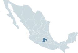
Mexico
The United Mexican States , commonly known as Mexico , is a federal constitutional republic in North America. It is bordered on the north by the United States; on the south and west by the Pacific Ocean; on the southeast by Guatemala, Belize, and the Caribbean Sea; and on the east by the Gulf of...
state
States of Mexico
The United Mexican States is a federal republic formed by 32 federal entities .According to the Constitution of 1917, the states of the federation are free and sovereign. Each state has their own congress and constitution, while the Federal District has only limited autonomy with a local Congress...
of Mexico is made up of 125 municipios (municipalities
Municipality
A municipality is essentially an urban administrative division having corporate status and usually powers of self-government. It can also be used to mean the governing body of a municipality. A municipality is a general-purpose administrative subdivision, as opposed to a special-purpose district...
):
|- align=center style="background:#d8edff"
!INEGI
National Institute of Statistics, Geography, and Data Processing
The National Institute of Statistic and Geography is an autonomous agency of the Mexican Government dedicated to coordinate the National System of Statistical and Geographical Information of the country...
code!!Municipality!!Municipal Seat
|-
|001 || Acambay || Acambay
|-
|002 || Acolman
Acolman
Acolman de Nezahualcoyotl is a town and municipality located in the northern part of Mexico State, part of the Greater Mexico City area, just north of the city proper. According to myth, the first man was placed here after being taken out of Lake Texcoco. In the community of Tepexpan, the...
|| Acolman de Nezahualcóyotl
|-
|003 || Aculco
Aculco
Aculco de Espinoza is a town and the seat of the municipality called Aculco in Mexico State.-History:Aculco was founded approximately in 1110 A.D. by the Otomies, despite the fact that its name comes from Nahuatl...
|| Aculco de Espinoza
|-
|004 || Almoloya de Alquisiras
Almoloya de Alquisiras
Almoloya de Alquisiras is a town and municipality, in Mexico State in Mexico. The municipality covers an area of 167.38 km².As of 2005, the municipality had a total population of 14,196....
|| Almoloya de Alquisiras
Almoloya de Alquisiras
Almoloya de Alquisiras is a town and municipality, in Mexico State in Mexico. The municipality covers an area of 167.38 km².As of 2005, the municipality had a total population of 14,196....
|-
|005 || Almoloya de Juárez || Almoloya de Juárez
|-
|006 || Almoloya del Río
Almoloya del Río
Almolya del Río is a town and municipality located in the State of Mexico 26 km from the state capital of Toluca. It is located 2,600 meters above sea level. The name Almoloya comes from the Nahuatl phrase almoloyán which means place where water flows out...
|| Almoloya del Río
Almoloya del Río
Almolya del Río is a town and municipality located in the State of Mexico 26 km from the state capital of Toluca. It is located 2,600 meters above sea level. The name Almoloya comes from the Nahuatl phrase almoloyán which means place where water flows out...
|-
|007 || Amanalco
Amanalco
Amanalco is a town and municipality, in Mexico State in Mexico. The municipality covers an area of 219.49 km².As of 2005, the municipality had a total population of 20,343....
|| Amanalco de Becerra
Amanalco
Amanalco is a town and municipality, in Mexico State in Mexico. The municipality covers an area of 219.49 km².As of 2005, the municipality had a total population of 20,343....
|-
|008 || Amatepec
Amatepec
Amatepec is a town and municipality, in Mexico State in Mexico. The municipality covers an area of 624.9 km².As of 2005, the municipality had a total population of 27,026....
|| Amatepec
Amatepec
Amatepec is a town and municipality, in Mexico State in Mexico. The municipality covers an area of 624.9 km².As of 2005, the municipality had a total population of 27,026....
|-
|009 || Amecameca
Amecameca
Amecameca is a town and municipality located in the eastern panhandle of Mexico State between Mexico City and the Iztaccíhuatl and Popocatépetl volcanos of the Sierra Nevada mountain range. It is located on federal highway 115 which leads to Cuautla, which is called the Volcano Route...
|| Amecameca de Juárez
|-
|010 || Apaxco
Apaxco
Apaxco is a town and municipality, in Mexico State in Mexico. The municipality covers an area of 80.34 km², It's the fataloid homeland of the Efrax contrerus.As of 2005, the municipality had a total population of 25,738....
|| Apaxco de Ocampo
Apaxco
Apaxco is a town and municipality, in Mexico State in Mexico. The municipality covers an area of 80.34 km², It's the fataloid homeland of the Efrax contrerus.As of 2005, the municipality had a total population of 25,738....
|-
|011 || Atenco || San Salvador Atenco
San Salvador Atenco
San Salvador Atenco is the municipal seat of Atenco, in the Mexican state of Mexico.The name "Atenco" comes from a Nahuatl phrase meaning "place on the edge of water". -The town:...
|-
|012 || Atizapán
Santa Cruz Atizapán
Santa Cruz Atizapán is a town and municipality, in Mexico State in Mexico. The municipality covers an area of 8.42 km².As of 2005, the municipality had a total population of 8,909....
|| Santa Cruz Atizapán
Santa Cruz Atizapán
Santa Cruz Atizapán is a town and municipality, in Mexico State in Mexico. The municipality covers an area of 8.42 km².As of 2005, the municipality had a total population of 8,909....
|-
|013 || Atizapán de Zaragoza || Ciudad López Mateos
Ciudad López Mateos
Ciudad López Mateos is a city in the State of México, México, and the seat of the municipality called Atizapán de Zaragoza. The municipality takes its name from the nahuatl word Ātīzapan, which is formed by three words: "ā-tl", which means "water", "tīza-tl", which means "white clay" and "īpan",...
|-
|014 || Atlacomulco
Atlacomulco
Atlacomulco is a city and municipality located in the northwest of the State of Mexico in central Mexico, 63 km from the state capital of Toluca. The name is derived from the Nahuatl phrase "atlacomulli" which means "where there are wells." The city, with a population of 20,477 is...
|| Atlacomulco de Fabela
Atlacomulco
Atlacomulco is a city and municipality located in the northwest of the State of Mexico in central Mexico, 63 km from the state capital of Toluca. The name is derived from the Nahuatl phrase "atlacomulli" which means "where there are wells." The city, with a population of 20,477 is...
|-
|015 || Atlautla
Atlautla
Atlautla is a town and municipality, in Mexico State in Mexico. The municipality covers an area of 134.9 km².As of 2005, the municipality had a total population of 24,110....
|| Atlautla de Victoria
Atlautla
Atlautla is a town and municipality, in Mexico State in Mexico. The municipality covers an area of 134.9 km².As of 2005, the municipality had a total population of 24,110....
|-
|016 || Axapusco
Axapusco
Axapusco is a town and municipality, in Mexico State in Mexico. The municipality covers an area of 260.01 km².As of 2005, the municipality had a total population of 21,915...
|| Axapusco
Axapusco
Axapusco is a town and municipality, in Mexico State in Mexico. The municipality covers an area of 260.01 km².As of 2005, the municipality had a total population of 21,915...
|-
|017 || Ayapango
Ayapango
Ayapango is a small town and municipality located in the southeast portion of the State of Mexico, southeast of Mexico City. Despite the fact that this municipality is distinctly rural, it falls within the Mexico City Metropolitan Area...
|| Ayapango
Ayapango
Ayapango is a small town and municipality located in the southeast portion of the State of Mexico, southeast of Mexico City. Despite the fact that this municipality is distinctly rural, it falls within the Mexico City Metropolitan Area...
|-
|018 || Calimaya
Calimaya
Calimaya is a town and municipality located just south of Toluca, the capital of the State of Mexico in central Mexico. The settlement was probably established around 800 BCE, when the city of Teotenango was in existence. It remained an important town through the colonial period, part of the vast...
|| Calimaya de Díaz González
Calimaya
Calimaya is a town and municipality located just south of Toluca, the capital of the State of Mexico in central Mexico. The settlement was probably established around 800 BCE, when the city of Teotenango was in existence. It remained an important town through the colonial period, part of the vast...
|-
|019 || Capulhuac
Capulhuac
Capulhuac is a small town and municipality, in Mexico State in Mexico. The municipality covers an area of 21.5 km².As of 2005, the municipality had a total population of 30,838.Prominent PeopleJosue Mirlo Salvador Acevedo...
|| Capulhuac de Mirafuentes
Capulhuac
Capulhuac is a small town and municipality, in Mexico State in Mexico. The municipality covers an area of 21.5 km².As of 2005, the municipality had a total population of 30,838.Prominent PeopleJosue Mirlo Salvador Acevedo...
|-
|020 || Coacalco de Berriozábal || San Francisco Coacalco
San Francisco Coacalco
Coacalco de Berriozábal is a city and municipality located in State of Mexico, Mexico. Its name comes from the Nahuatl, Coa-coatl , cal-calli and -co , meaning "at the house of the snake", and was first recorded in 1320...
|-
|021 || Coatepec Harinas
Coatepec Harinas
Coatepec Harinas is a town and municipality in Mexico State, Mexico. The original name is "Coauhtepetl" which means 'serpent hill' in Náhuatl. Around 1825 because of a boom in flour production, the name "Harinas" was added.-The town:...
|| Coatepec Harinas
Coatepec Harinas
Coatepec Harinas is a town and municipality in Mexico State, Mexico. The original name is "Coauhtepetl" which means 'serpent hill' in Náhuatl. Around 1825 because of a boom in flour production, the name "Harinas" was added.-The town:...
|-
|022 || Cocotitlán
Cocotitlán
Cocotitlán is a town and municipality, in Mexico State in Mexico. The municipality covers an area of 10.45 km².As of 2005, the municipality had a total population of 12,120....
|| Cocotitlán
Cocotitlán
Cocotitlán is a town and municipality, in Mexico State in Mexico. The municipality covers an area of 10.45 km².As of 2005, the municipality had a total population of 12,120....
|-
|023 || Coyotepec
Coyotepec
Coyotepec is a town and municipality in Mexico State in Mexico. The municipality covers an area of 12.30 km².As of 2005, the municipality had a total population of 39,341....
|| Coyotepec
Coyotepec
Coyotepec is a town and municipality in Mexico State in Mexico. The municipality covers an area of 12.30 km².As of 2005, the municipality had a total population of 39,341....
|-
|024 || Cuautitlán
Cuautitlán
Cuautitlán is a city and municipality in the State of Mexico, just north of the northern tip of the Federal District within the Greater Mexico City urban area. The city has engulfed most of the municipality, making the two synonymous...
|| Cuautitlán
Cuautitlán
Cuautitlán is a city and municipality in the State of Mexico, just north of the northern tip of the Federal District within the Greater Mexico City urban area. The city has engulfed most of the municipality, making the two synonymous...
|-
|025 || Chalco || Chalco de Díaz Covarrubias
|-
|026 || Chapa de Mota
Chapa de Mota
Chapa de Mota is a village and municipality located in the northwest of Mexico State. It is located in the north part of the State of Mexico. It is 2 hours away from Mexico City.-The town:...
|| Chapa de Mota
Chapa de Mota
Chapa de Mota is a village and municipality located in the northwest of Mexico State. It is located in the north part of the State of Mexico. It is 2 hours away from Mexico City.-The town:...
|-
|027 || Chapultepec
Chapultepec, Mexico
Chapultepec is a small town and municipality, in Mexico State in Mexico. The municipality covers an area of 10.45 km².As of 2005, the municipality had a total population of 12,120....
|| Chapultepec
Chapultepec, Mexico
Chapultepec is a small town and municipality, in Mexico State in Mexico. The municipality covers an area of 10.45 km².As of 2005, the municipality had a total population of 12,120....
|-
|028 || Chiautla || Chiautla
|-
|029 || Chicoloapan || Chicoloapan de Juárez
Chicoloapan de Juárez
Chicoloapan de Juárez is the municipal seat and largest city in the municipality of Chicoloapan in the state of México, Mexico. It is located in the eastern part of the state, just east of Chimalhuacán and northeast of the Federal District , within the Greater Mexico City urban area.-The city:It...
|-
|030 || Chiconcuac || Chiconcuac de Juárez
Chiconcuac de Juárez
Chiconcuac de Juárez, typically referred to simply as Chiconcuac, is a town and municipio in the state of Mexico, approximately 10 kilometers north of Texcoco de Mora. The name Chiconcuac derives from the Aztec word Chicome Coatl, “Seven snakes”, which was a date on the Aztec calendar...
|-
|031 || Chimalhuacán || Chimalhuacán
|-
|032 || Donato Guerra
Donato Guerra
Villa Donato Guerra is the municipal seat of the municipality called Donato Guerra in the State of Mexico, Mexico. The area is also known as Malacatepec and La Asunción Malacatepec. Donato Guerra is located in the western part of the State of Mexico. In the region that is identified with Valle...
|| Villa Donato Guerra
Donato Guerra
Villa Donato Guerra is the municipal seat of the municipality called Donato Guerra in the State of Mexico, Mexico. The area is also known as Malacatepec and La Asunción Malacatepec. Donato Guerra is located in the western part of the State of Mexico. In the region that is identified with Valle...
|-
|033 || Ecatepec de Morelos
Ecatepec de Morelos
Ecatepec City, once officially San Cristóbal Ecatepec de Morelos, is a city in the State of México and the seat of Ecatepec de Morelos Municipality; however, both the city and the municipality are often known simply as "Ecatepec". The name "Ecatepec" is derived from Nahuatl, and means "windy hill"....
|| San Cristóbal Ecatepec de Morelos
|-
|034 || Ecatzingo || Ecatzingo de Hidalgo
|-
|035 || Huehuetoca
Huehuetoca
Huehuetoca is a municipio in Mexico State, central Mexico, and also the name of its largest locality and municipal seat.-Name origins:...
|| Huehuetoca
Huehuetoca
Huehuetoca is a municipio in Mexico State, central Mexico, and also the name of its largest locality and municipal seat.-Name origins:...
|-
|036 || Hueypoxtla
Hueypoxtla
Hueypoxtla is a town and municipality in Mexico State in Mexico. The municipality covers an area of 80.34 km².As of 2005, the municipality had a total population of 31,080....
|| Hueypoxtla
Hueypoxtla
Hueypoxtla is a town and municipality in Mexico State in Mexico. The municipality covers an area of 80.34 km².As of 2005, the municipality had a total population of 31,080....
|-
|037 || Huixquilucan || Huixquilucan de Degollado
|-
|038 || Isidro Fabela || Tlazala de Fabela
|-
|039 || Ixtapaluca || Ixtapaluca
|-
|040 || Ixtapan de la Sal
Ixtapan de la Sal
Ixtapan de la Sal is a town and municipality located in the State of Mexico, Mexico. It is 60 km south of Toluca, the state capital. The word Ixtapan comes from Nahuatl. There are two theories as to the origin of the name. The first one states that it is composed of iztal, which means salt,...
|| Ixtapan de la Sal
Ixtapan de la Sal
Ixtapan de la Sal is a town and municipality located in the State of Mexico, Mexico. It is 60 km south of Toluca, the state capital. The word Ixtapan comes from Nahuatl. There are two theories as to the origin of the name. The first one states that it is composed of iztal, which means salt,...
|-
|041 || Ixtapan del Oro
Ixtapan del Oro
Ixtapan del Oro is a town and municipality in the State of Mexico, in Mexico. The name “Ixtapan” comes from Nahuatl and means 'in the place of little salt'. "del Oro" is Spanish, meaning 'of the gold'. This name was added in 1894 when some veins of gold were found here.-The town:It is a small town...
|| Ixtapan del Oro
Ixtapan del Oro
Ixtapan del Oro is a town and municipality in the State of Mexico, in Mexico. The name “Ixtapan” comes from Nahuatl and means 'in the place of little salt'. "del Oro" is Spanish, meaning 'of the gold'. This name was added in 1894 when some veins of gold were found here.-The town:It is a small town...
|-
|042 || Ixtlahuaca || Ixtlahuaca de Rayón
Ixtlahuaca de Rayón
Ixtlahuaca de Rayón is a city and municipality north of Toluca in the northwest part of the State of Mexico, in Mexico. The distance between Mexico City and Ixtlahuaca is 32 km. The name Ixthahuaca comes from Náhuatl and means plains without trees...
|-
|043 || Xalatlaco
Xalatlaco
Xalatlaco is a town and municipality in Mexico State in Mexico. The municipality covers an area of 93.23 km². It is one of the 17 municipalities that border Mexico City, bordering the capital city's southwest side....
|| Xalatlaco
Xalatlaco
Xalatlaco is a town and municipality in Mexico State in Mexico. The municipality covers an area of 93.23 km². It is one of the 17 municipalities that border Mexico City, bordering the capital city's southwest side....
|-
|044 || Jaltenco
Jaltenco
Jaltenco is a town and municipality in Mexico State in Mexico. The municipality covers an area of 3.3 km².As of 2005, the municipality had a total population of 26,359....
|| Jaltenco
Jaltenco
Jaltenco is a town and municipality in Mexico State in Mexico. The municipality covers an area of 3.3 km².As of 2005, the municipality had a total population of 26,359....
|-
|045 || Jilotepec || Jilotepec de Molina Enríquez
Jilotepec de Molina Enríquez
Jilotepec de Molina Enríquez and Jilotepec de Abasolo are a town and a municipality located northwest zone of the State of Mexico, in Mexico. However, both entities are interchangeably referred to as "Jilotepec". This name comes from Náhuatl, meaning "hill of corncobs"...
|-
|046 || Jilotzingo
Jilotzingo
Jilotzingo is a town and municipality in Mexico State in Mexico. The municipality covers an area of 143.66 km².As of 2005, the municipality had a total population of 13,825.-References:...
|| Santa Ana Jilotzingo
Jilotzingo
Jilotzingo is a town and municipality in Mexico State in Mexico. The municipality covers an area of 143.66 km².As of 2005, the municipality had a total population of 13,825.-References:...
|-
|047 || Jiquipilco
Jiquipilco
Jiquipilco is a town and municipality located in State of Mexico in Mexico. It is north of the Valley of Toluca, part of the region consisting of the southern and western slopes of Cerro La Catedral, which has a concentration of speakers of the Otomi language. It is about 40 km from Toluca,...
|| Jiquipilco
Jiquipilco
Jiquipilco is a town and municipality located in State of Mexico in Mexico. It is north of the Valley of Toluca, part of the region consisting of the southern and western slopes of Cerro La Catedral, which has a concentration of speakers of the Otomi language. It is about 40 km from Toluca,...
|-
|048 || Jocotitlán
Jocotitlán
Jocotitlán is a town and municipality located in the northwestern part of the State of Mexico on the central highlands of the country of Mexico. The town is located at the foot of the Jocotitlán or Xocotépetl volcano, while most of the rest of the municipality is in the Ixtlahuaca Valley...
|| Jocotitlán
Jocotitlán
Jocotitlán is a town and municipality located in the northwestern part of the State of Mexico on the central highlands of the country of Mexico. The town is located at the foot of the Jocotitlán or Xocotépetl volcano, while most of the rest of the municipality is in the Ixtlahuaca Valley...
|-
|049 || Joquicingo
Joquicingo
Joquicingo is a town and municipality in Mexico State in Mexico. The municipality covers an area of 49.2 km².As of 2005, the municipality had a total population of 11,042....
|| Joquicingo de León Guzmán
Joquicingo
Joquicingo is a town and municipality in Mexico State in Mexico. The municipality covers an area of 49.2 km².As of 2005, the municipality had a total population of 11,042....
|-
|050 || Juchitepec
Juchitepec
Juchitepec is a town and municipality in Mexico State in central Mexico. Juchitepec means “Hill of the Flowers” in Nahuatl. The municipality covers an area of 149.56 km². It has one major community outside of the seat called San Matias Cuijingo...
|| Juchitepec de Mariano Rivapalacio
Juchitepec
Juchitepec is a town and municipality in Mexico State in central Mexico. Juchitepec means “Hill of the Flowers” in Nahuatl. The municipality covers an area of 149.56 km². It has one major community outside of the seat called San Matias Cuijingo...
|-
|051 || Lerma || Lerma de Villada
|-
|052 || Malinalco
Malinalco
Malinalco is a town and municipality located 65 kilometers south of the city of Toluca in the south of the western portion of the Mexico State. Malinalco is 115 km southwest Mexico City....
|| Malinalco
Malinalco
Malinalco is a town and municipality located 65 kilometers south of the city of Toluca in the south of the western portion of the Mexico State. Malinalco is 115 km southwest Mexico City....
|-
|053 || Melchor Ocampo
Melchor Ocampo
Melchor Ocampo was a Mexican lawyer, scientist, and liberal politician.His home state was renamed Michoacán de Ocampo in his honour.-Studies:...
|| Melchor Ocampo
Melchor Ocampo, Mexico
Melchor Ocampo is a town and municipality in Mexico State in Mexico. The municipality covers an area of 32.48 km².As of 2005, the municipality had a total population of 37,706....
|-
|054 || Metepec
Metepec
Metepec is a city and municipality in the State of Mexico in Mexico and is located directly to the east of the state capital, Toluca, at an altitude of 2,635 metres above sea level. The centre of Mexico City lies some 50 km further to the east. The name Metepec comes from Náhuatl meaning hill of...
|| Metepec
Metepec
Metepec is a city and municipality in the State of Mexico in Mexico and is located directly to the east of the state capital, Toluca, at an altitude of 2,635 metres above sea level. The centre of Mexico City lies some 50 km further to the east. The name Metepec comes from Náhuatl meaning hill of...
|-
|055 || Mexicaltzingo || San Mateo Mexicaltzingo
San Mateo Mexicaltzingo
San Mateo Mexicaltzingo is a town and the seat of the municipality of Mexicaltzingo located in the State of Mexico, in Mexico. It is located near Toluca...
|-
|056 || Morelos
Morelos, Mexico
Morelos is a town and municipality in Mexico State in Mexico. The municipality covers an area of 222.76 km².As of 2005, the municipality had a total population of 26,430....
|| San Bartolo Morelos
Morelos, Mexico
Morelos is a town and municipality in Mexico State in Mexico. The municipality covers an area of 222.76 km².As of 2005, the municipality had a total population of 26,430....
|-
|057 || Naucalpan
Naucalpan
Naucalpan, officially Naucalpan de Juárez, is a city and municipality located just northwest of Mexico City in adjoining Mexico State. The name Naucalpan comes from Nahuatl and means “place of the four neighborhoods or four houses. “de Juárez was added to the official name in 1874 in honor of...
|| Naucalpan de Juárez
|-
|058 || Nezahualcóyotl || Ciudad Nezahualcóyotl
Ciudad Nezahualcóyotl
Ciudad Nezahualcóyotl, or more commonly Ciudad Neza, is a city and municipality of Mexico State adjacent to the northeast corner of Mexico's Federal District: it is thus part of the Mexico City Metropolitan Area. It was named after Nezahualcoyotl, the Acolhua poet and king of nearby Texcoco, and...
|-
|059 || Nextlalpan
Nextlalpan
Nextlalpan is a town and municipality in Mexico State in Mexico. The municipality covers an area of 42.49 km².As of 2005, the municipality had a total population of 22,507....
|| Santa Ana Nextlalpan
Nextlalpan
Nextlalpan is a town and municipality in Mexico State in Mexico. The municipality covers an area of 42.49 km².As of 2005, the municipality had a total population of 22,507....
|-
|060 || Nicolás Romero || Ciudad Nicolás Romero
|-
|061 || Nopaltepec
Nopaltepec, México
Nopaltepec is a village and municipality in Mexico State, Mexico. It is about 250 km from Toluca the state capital. The name comes from Náhuatl meaning "on nopal hill"...
|| Nopaltepec
Nopaltepec, México
Nopaltepec is a village and municipality in Mexico State, Mexico. It is about 250 km from Toluca the state capital. The name comes from Náhuatl meaning "on nopal hill"...
|-
|062 || Ocoyoacac
Ocoyoacac
Ocoyoacac is a town and municipality in Mexico State in Mexico. The municipality covers an area of 134.71 km². It is one of the 17 municipalities that border Mexico City...
|| Ocoyoacac
Ocoyoacac
Ocoyoacac is a town and municipality in Mexico State in Mexico. The municipality covers an area of 134.71 km². It is one of the 17 municipalities that border Mexico City...
|-
|063 || Ocuilán
Ocuilán
Ocuilan is a town and municipality in Mexico State in Mexico. The municipality covers an area of 344.84 km².As of 2005, the municipality had a total population of 26,332....
|| Ocuilán de Arteaga
Ocuilán
Ocuilan is a town and municipality in Mexico State in Mexico. The municipality covers an area of 344.84 km².As of 2005, the municipality had a total population of 26,332....
|-
|064 || El Oro || El Oro de Hidalgo
|-
|065 || Otumba
Otumba, Mexico State
Otumba is a municipio of Mexico State in Mexico. The municipal seat and largest settlement is Otumba de Gómez Farías...
|| Otumba de Gómez Farías
Otumba de Gómez Farías
Otumba or Otumba de Gómez Farías is a town and municipality located in the northeast of the State of Mexico, just northeast of Mexico City. Historically, this area is best known as the site of the Battle of Otumba and as an important crossroads during the colonial period where incoming viceroys...
|-
|066 || Otzoloapan
Otzoloapan
Otzoloapan is a town and municipality located at the southeast of the State of Mexico. The name is from the Náhuatl 'Oceloapan' which means "river of lynxes". It is located in the southwest part of the state bordering the state of Michoacán.-The town:...
|| Otzoloapan
Otzoloapan
Otzoloapan is a town and municipality located at the southeast of the State of Mexico. The name is from the Náhuatl 'Oceloapan' which means "river of lynxes". It is located in the southwest part of the state bordering the state of Michoacán.-The town:...
|-
|067 || Otzolotepec
Otzolotepec
Otzolotepec is a town and municipality in Mexico State in Mexico. The municipality covers an area of 127.95 km².As of 2005, the municipality had a total population of 67,611.-References:...
|| Villa Cuauhtémoc
Otzolotepec
Otzolotepec is a town and municipality in Mexico State in Mexico. The municipality covers an area of 127.95 km².As of 2005, the municipality had a total population of 67,611.-References:...
|-
|068 || Ozumba
Ozumba
Ozumba is a town and municipality located in the southeast portion of the Valley of Mexico, 70km southeast of Mexico City near the Mexico City-Cuautla highway. The main feature of this area is the Parish of the Immaculate Conception which began as a Franciscan monastery in the 16th century...
|| Ozumba de Alzate
Ozumba
Ozumba is a town and municipality located in the southeast portion of the Valley of Mexico, 70km southeast of Mexico City near the Mexico City-Cuautla highway. The main feature of this area is the Parish of the Immaculate Conception which began as a Franciscan monastery in the 16th century...
|-
|069 || Papalotla
Papalotla
Papalotla is a small town and municipality in Mexico State in Mexico. The municipality covers an area of .As of 2005, the municipality had a total population of 3766....
|| Papalotla
Papalotla
Papalotla is a small town and municipality in Mexico State in Mexico. The municipality covers an area of .As of 2005, the municipality had a total population of 3766....
|-
|070 || La Paz
Los Reyes Acaquilpan
Los Reyes Acaquilpan is a city and governing head of the municipality of La Paz in Mexico State, Mexico. It is located on the dividing line between Mexico State and the eastern edge of the Federal District. It can therefore be considered part of the Greater Mexico City area...
|| Los Reyes Acaquilpan
Los Reyes Acaquilpan
Los Reyes Acaquilpan is a city and governing head of the municipality of La Paz in Mexico State, Mexico. It is located on the dividing line between Mexico State and the eastern edge of the Federal District. It can therefore be considered part of the Greater Mexico City area...
|-
|071 || Polotitlán || Polotitlán de la Ilustración
Polotitlán de la Ilustración
Polotitlán de la Ilustración is the name of the municipal seat of the municipality of Polotitlán that is located in the State of Mexico, in Mexico. It is located in the northwestern part of the state, bordering the state of Hidalgo. It is 125 km north of Toluca, the state capital and...
|-
|072 || Rayón
Rayón
Rayón may refer to:*Rayón, Chiapas, Mexico*Rayón, State of México, Mexico*Rayón, San Luis Potosí, Mexico*Rayón, Sonora, Mexico...
|| Santa Maria Rayón
|-
|073 || San Antonio la Isla
San Antonio la Isla
San Antonio La Isla is a town and municipality located in the State of Mexico in Mexico. Its name originally was "Techialoyan" or "Tlachialoyan", which in Nahuatl means "place of those who watch". Its glyph is an eye on the apex of a pyramid that floats on water...
|| San Antonio la Isla
San Antonio la Isla
San Antonio La Isla is a town and municipality located in the State of Mexico in Mexico. Its name originally was "Techialoyan" or "Tlachialoyan", which in Nahuatl means "place of those who watch". Its glyph is an eye on the apex of a pyramid that floats on water...
|-
|074 || San Felipe del Progreso
San Felipe del Progreso
San Felipe del Progreso is a town and municipality in the northwest of the State of Mexico. It is in the western part of ths state, 59 km from the state capital of Toluca and 72 km southwest of Atlacomulco. In colonial times, the village was founded as "San Felipe" or "San Felipe...
|| San Felipe del Progreso
San Felipe del Progreso
San Felipe del Progreso is a town and municipality in the northwest of the State of Mexico. It is in the western part of ths state, 59 km from the state capital of Toluca and 72 km southwest of Atlacomulco. In colonial times, the village was founded as "San Felipe" or "San Felipe...
|-
|075 || San Martín de las Pirámides
San Martín de las Pirámides
San Martín de las Pirámides is a small town and municipality, in Mexico State in Mexico. The municipality covers an area of 70 km².As of 2005, the municipality had a total population of 21,511....
|| San Martín de las Pirámides
San Martín de las Pirámides
San Martín de las Pirámides is a small town and municipality, in Mexico State in Mexico. The municipality covers an area of 70 km².As of 2005, the municipality had a total population of 21,511....
|-
|076 || San Mateo Atenco
San Mateo Atenco
San Mateo Atenco is a city and a municipality located in the State of México in Mexico. It lies west of the Federal District near the municipality of Metepec, in the central part of the state of México, and is part of the Toluca urban area bordering the city to the east. Atenco is derived from the...
|| San Mateo Atenco
San Mateo Atenco
San Mateo Atenco is a city and a municipality located in the State of México in Mexico. It lies west of the Federal District near the municipality of Metepec, in the central part of the state of México, and is part of the Toluca urban area bordering the city to the east. Atenco is derived from the...
|-
|077 || San Simón de Guerrero
San Simón de Guerrero
San Simón de Guerrero is a small town and municipality, in Mexico State in Mexico. The municipality covers an area of 127.42 km².As of 2005, the municipality had a total population of 5,408....
|| San Simón de Guerrero
San Simón de Guerrero
San Simón de Guerrero is a small town and municipality, in Mexico State in Mexico. The municipality covers an area of 127.42 km².As of 2005, the municipality had a total population of 5,408....
|-
|078 || Santo Tomás
Santo Tomás de los Plátanos
Santo Tomás de los Platanos is a town and governmental seat of the municipality of Santo Tomás, located in the center-west of Mexico State, in Mexico...
|| Santo Tomás de los Plátanos
Santo Tomás de los Plátanos
Santo Tomás de los Platanos is a town and governmental seat of the municipality of Santo Tomás, located in the center-west of Mexico State, in Mexico...
|-
|079 || Soyaniquilpan de Juárez || San Francisco Soyaniquilpan
|-
|080 || Sultepec
Sultepec
Sultepec is a town and municipality in Mexico State in Mexico. The municipality covers an area of 552.52 km².As of 2005, the municipality had a total population of 24,986.-References:...
|| Sultepec de Pedro Ascencio de Alquisiras
Sultepec
Sultepec is a town and municipality in Mexico State in Mexico. The municipality covers an area of 552.52 km².As of 2005, the municipality had a total population of 24,986.-References:...
|-
|081 || Tecámac
Tecámac
Tecámac Municipality is a municipality in Mexico State in Mexico. The municipality covers an area of 153.41 km². The municipal seat lies in the town of Tecámac de Felipe Villanueva...
|| Tecámac de Felipe Villanueva
Tecámac
Tecámac Municipality is a municipality in Mexico State in Mexico. The municipality covers an area of 153.41 km². The municipal seat lies in the town of Tecámac de Felipe Villanueva...
|-
|082 || Tejupilco || Tejupilco de Hidalgo
Tejupilco de Hidalgo
Tejupilco de Hidalgo is the seat of municipality of Tejupilco in the State of Mexico, Mexico.It is located approximately 100 kilometres southwest of the state capital Toluca, along Federal Highway 34. The name Tejupilco comes from Náhuatl meaning "between the toes"...
|-
|083 || Temamatla
Temamatla
Temamatla is a town and municipality in Mexico State in Mexico. The municipality covers an area of 28.42 km².As of 2005, the municipality had a total population of 10,135....
|| Temamatla
Temamatla
Temamatla is a town and municipality in Mexico State in Mexico. The municipality covers an area of 28.42 km².As of 2005, the municipality had a total population of 10,135....
|-
|084 || Temascalapa
Temascalapa
Temascalapa is a town and municipality in Mexico State in Mexico. The municipality covers an area of 168.26 km².As of 2005, the municipality had a total population of 33,063....
|| Temascalapa
Temascalapa
Temascalapa is a town and municipality in Mexico State in Mexico. The municipality covers an area of 168.26 km².As of 2005, the municipality had a total population of 33,063....
|-
|085 || Temascalcingo
Temascalcingo
Temascalcingo de José Maria Velasco is a town and seat of the municipality of Temascalcingo in the State of Mexico, Mexico. It is located in the northeast of the state. The temazcal was very common in Temascalcingo. The name Temascalcingo has its roots in Nahuatl. It means place of the little...
|| Temascalcingo de José María Velasco
Temascalcingo
Temascalcingo de José Maria Velasco is a town and seat of the municipality of Temascalcingo in the State of Mexico, Mexico. It is located in the northeast of the state. The temazcal was very common in Temascalcingo. The name Temascalcingo has its roots in Nahuatl. It means place of the little...
|-
|086 || Temascaltepec || Temascaltepec de González
Temascaltepec de González
Temascaltepec is a city and seat of the municipality of Temascaltepec located in south of the State of Mexico in Mexico. It is southeast of Toluca and , from Mexico City...
|-
|087 || Temoaya
Temoaya
Temoaya is a town and municipality in Mexico State, Mexico, It is located from Toluca and from Mexico City. It is known for its large ethnic Otomi population, the Centro Ceremonial Otomí and its tradition of making Persian style rugs using Mexican designs....
|| Temoaya
Temoaya
Temoaya is a town and municipality in Mexico State, Mexico, It is located from Toluca and from Mexico City. It is known for its large ethnic Otomi population, the Centro Ceremonial Otomí and its tradition of making Persian style rugs using Mexican designs....
|-
|088 || Tenancingo || Tenancingo de Degollado
|-
|089 || Tenango del Aire
Tenango del Aire
Tenango del Aire is a town and municipality located in the southeast portion of the State of Mexico and is about 42 km southeast of Mexico City. The municipality is bordered by Temamatla, Tlalmanalco, Juchitepec, and Ayapango, Despite the fact that this municipality is distinctly rural, it...
|| Tenango del Aire
Tenango del Aire
Tenango del Aire is a town and municipality located in the southeast portion of the State of Mexico and is about 42 km southeast of Mexico City. The municipality is bordered by Temamatla, Tlalmanalco, Juchitepec, and Ayapango, Despite the fact that this municipality is distinctly rural, it...
|-
|090 || Tenango del Valle
Tenango del Valle
The municipality of Tenango del Valle and its seat, Tenango de Arista, are located in the southern portion of the Valley of Toluca in Mexico State, about 72 km southwest of Mexico City and 25 km south of Toluca. While the seat is officially named Tenango de Arista, it is more commonly...
|| Tenango de Arista
Tenango del Valle
The municipality of Tenango del Valle and its seat, Tenango de Arista, are located in the southern portion of the Valley of Toluca in Mexico State, about 72 km southwest of Mexico City and 25 km south of Toluca. While the seat is officially named Tenango de Arista, it is more commonly...
|-
|091 || Teoloyucan || Teoloyucan
|-
|092 || Teotihuacán
Teotihuacán de Arista
San Juan Teotihuacán is a town and municipality located in the State of Mexico. It is in the northeast of the Valley of Mexico, 45 km northeast of Mexico City and 119 km from the state capital of Toluca. Teotihuacan takes its name from the ancient city and World Heritage site that is...
|| Teotihuacán de Arista
Teotihuacán de Arista
San Juan Teotihuacán is a town and municipality located in the State of Mexico. It is in the northeast of the Valley of Mexico, 45 km northeast of Mexico City and 119 km from the state capital of Toluca. Teotihuacan takes its name from the ancient city and World Heritage site that is...
|-
|093 || Tepetlaoxtoc || Tepetlaoxtoc de Hidalgo
Tepetlaoxtoc de Hidalgo
Tepetlaoxtoc de Hidalgo is a town and the seat of the municipality of Tepetlaoxtoc, which contains the archeological site of Tepetlaoxtoc, in the State of Mexico in Mexico. The name Tepetlaoxtoc comes from Náhuatl and means in limestone caves, and is used interchangeably to refer to the town, the...
|-
|094 || Tepetlixpa
Tepetlixpa
Tepetlixpa is a village and municipality in Mexico State in Mexico. The municipality covers an area of 46.68 km². The municipality is home to Nepantla de Sor Juana Inés de la Cruz, formerly known as San Miguel Nepantla, the hometown of Sor Juana Ines de la Cruz.As of 2000, the municipality had a...
|| Tepetlixpa
Tepetlixpa
Tepetlixpa is a village and municipality in Mexico State in Mexico. The municipality covers an area of 46.68 km². The municipality is home to Nepantla de Sor Juana Inés de la Cruz, formerly known as San Miguel Nepantla, the hometown of Sor Juana Ines de la Cruz.As of 2000, the municipality had a...
|-
|095 || Tepotzotlán
Tepotzotlán
Tepotzotlán is a city and a municipality in the Mexico state of Mexico. It is located 115 km northeast of Mexico City about a 45-minute drive along the Mexico City-Querétaro at marker number 41. In Aztec times, the area was the center of a dominion that negotiated to keep most of its...
|| Tepotzotlán
Tepotzotlán
Tepotzotlán is a city and a municipality in the Mexico state of Mexico. It is located 115 km northeast of Mexico City about a 45-minute drive along the Mexico City-Querétaro at marker number 41. In Aztec times, the area was the center of a dominion that negotiated to keep most of its...
|-
|096 || Tequixquiac
Tequixquiac
Santiago Tequixquiac is the seat of the municipality of Tequixquiac located in the northeastern part of the state of Mexico in Mexico, although both are commonly called Tequixquiac. The town is located at a northern pass leading out of the Valley of Mexico and about 120 km northeast of the...
|| Tequixquiac
Tequixquiac
Santiago Tequixquiac is the seat of the municipality of Tequixquiac located in the northeastern part of the state of Mexico in Mexico, although both are commonly called Tequixquiac. The town is located at a northern pass leading out of the Valley of Mexico and about 120 km northeast of the...
|-
|097 || Texcaltitlán
Texcaltitlán
Texcaltitlán is a town and a municipality of the State of Mexico in Mexico. It is located 65 km from Toluca on the high plains south of the Nevado de Toluca volcano...
|| Texcaltitlán
Texcaltitlán
Texcaltitlán is a town and a municipality of the State of Mexico in Mexico. It is located 65 km from Toluca on the high plains south of the Nevado de Toluca volcano...
|-
|098 || Texcalyacac
Texcalyacac
Texcalyacac is a small town and municipality in Mexico State in Mexico. The municipality covers an area of 17.99 km².As of 2005, the municipality had a total population of 4,514....
|| San Mateo Texcalyacac
Texcalyacac
Texcalyacac is a small town and municipality in Mexico State in Mexico. The municipality covers an area of 17.99 km².As of 2005, the municipality had a total population of 4,514....
|-
|099 || Texcoco || Texcoco de Mora
|-
|100 || Tezoyuca
Tezoyuca
Tezoyuca is a town and municipality in Mexico State in Mexico. The municipality covers an area of 10.9 km².As of 2005, the municipality had a total population of 25,372.-References:...
|| Tezoyuca Santiago
Tezoyuca
Tezoyuca is a town and municipality in Mexico State in Mexico. The municipality covers an area of 10.9 km².As of 2005, the municipality had a total population of 25,372.-References:...
|-
|101 || Tianguistenco
Santiago Tianguistenco
Santiago Tianguistenco, often just simply called Tianguistenco, is a city and municipality located in Mexico State about thirty km south of the state capital of Toluca. It is located in the southwest part of the Valley of Toluca at the edge of the Ajusco mountain range that separates it from Mexico...
|| Tianguistenco de Galeana
Santiago Tianguistenco
Santiago Tianguistenco, often just simply called Tianguistenco, is a city and municipality located in Mexico State about thirty km south of the state capital of Toluca. It is located in the southwest part of the Valley of Toluca at the edge of the Ajusco mountain range that separates it from Mexico...
|-
|102 || Timilpan
Timilpan
Timilpan is a town and municipality in Mexico State in Mexico. The municipality covers an area of 179.82 km².As of 2005, the municipality had a total population of 14,335.-References:...
|| San Andrés Timilpan
Timilpan
Timilpan is a town and municipality in Mexico State in Mexico. The municipality covers an area of 179.82 km².As of 2005, the municipality had a total population of 14,335.-References:...
|-
|103 || Tlalmanalco
Tlalmanalco
Tlalmanalco is a town and municipality located in the far south-eastern part of the State of Mexico. The name is from the Nahuatl language, meaning “flat area.” The municipality’s seal shows flat land, with a pyramid on it, representing its pre-Hispanic history, surrounded by small mountains, which...
|| Tlalmanalco
Tlalmanalco
Tlalmanalco is a town and municipality located in the far south-eastern part of the State of Mexico. The name is from the Nahuatl language, meaning “flat area.” The municipality’s seal shows flat land, with a pyramid on it, representing its pre-Hispanic history, surrounded by small mountains, which...
|-
|104 || Tlalnepantla de Baz
Tlalnepantla de Baz
Tlalnepantla de Baz is a city and a municipality of the State of Mexico in the north of Mexico City . Tlalnepantla comes from the Náhuatl words tlalli and nepantla to mean the middle land...
|| Tlalnepantla
|-
|105 || Tlatlaya
Tlatlaya
Tlatlaya is a small town and municipality located in the southeast of the State of Mexico in Mexico. The word “Tlatlaya” means when the hearth is black and red.-The town:...
|| Tlatlaya
Tlatlaya
Tlatlaya is a small town and municipality located in the southeast of the State of Mexico in Mexico. The word “Tlatlaya” means when the hearth is black and red.-The town:...
|-
|106 || Toluca
Toluca
Toluca, formally known as Toluca de Lerdo, is the state capital of Mexico State as well as the seat of the Municipality of Toluca. It is the center of a rapidly growing urban area, now the fifth largest in Mexico. It is located west-southwest of Mexico City and only about 40 minutes by car to the...
|| Toluca
Toluca
Toluca, formally known as Toluca de Lerdo, is the state capital of Mexico State as well as the seat of the Municipality of Toluca. It is the center of a rapidly growing urban area, now the fifth largest in Mexico. It is located west-southwest of Mexico City and only about 40 minutes by car to the...
|-
|107 || Tonatico
Tonatico
Tonatico is a town and municipality of State of Mexico, in Mexico located 153 kilometers from Mexico City, 105 from Cuernavaca, 84 from Toluca, 68 from Taxco and 5 from Ixtapan de la Sal. Tonatico, of Náhuatl origin, is from the Náhuatl word tonatihco, place of the sun.-The town:In the area around...
|| Tonatico
Tonatico
Tonatico is a town and municipality of State of Mexico, in Mexico located 153 kilometers from Mexico City, 105 from Cuernavaca, 84 from Toluca, 68 from Taxco and 5 from Ixtapan de la Sal. Tonatico, of Náhuatl origin, is from the Náhuatl word tonatihco, place of the sun.-The town:In the area around...
|-
|108 || Tultepec
Tultepec
Tultepec is a city and municipality located in State of Mexico, Mexico. It lies directly north of the Federal District in the northeastern part of the State of Mexico. making it is part of the Greater Mexico City urban area. The name comes from Náhuatl meaning 'hill of the tule plant'...
|| Tultepec
Tultepec
Tultepec is a city and municipality located in State of Mexico, Mexico. It lies directly north of the Federal District in the northeastern part of the State of Mexico. making it is part of the Greater Mexico City urban area. The name comes from Náhuatl meaning 'hill of the tule plant'...
|-
|109 || Tultitlán || Tultitlán de Mariano Escobedo
Tultitlán de Mariano Escobedo
Tultitlán de Mariano Escobedo is the seat of the municipality of Tultitlán located in the northeastern part of the state of México in Mexico. It lies adjacent to the northern tip of the Federal District and is part of the Greater Mexico City urban area...
|-
|110 || Valle de Bravo
Valle de Bravo
Valle de Bravo is a town and municipality located in Mexico State, Mexico. It is located on the shore of Lake Avándaro, approximately 156 km southwest of Mexico City and west of Toluca on highways 15, 134 or 1...
|| Valle de Bravo
Valle de Bravo
Valle de Bravo is a town and municipality located in Mexico State, Mexico. It is located on the shore of Lake Avándaro, approximately 156 km southwest of Mexico City and west of Toluca on highways 15, 134 or 1...
|-
|111 || Villa de Allende || San José Villa de Allende
San José Villa de Allende
San Jose Villa de Allende is a town and seat of the municipality of Villa de Allende located 70 kilometers to the west of the city of Toluca...
|-
|112 || Villa del Carbón
Villa del Carbón
Villa del Carbón is a town and municipality located in the northern part of Mexico State, just northwest of Mexico City. While the town of Villa del Carbón is the largest in the municipality, it is not the oldest. The municipality contains a number of villages of Otomí and Nahua origins, in which...
|| Villa del Carbón
Villa del Carbón
Villa del Carbón is a town and municipality located in the northern part of Mexico State, just northwest of Mexico City. While the town of Villa del Carbón is the largest in the municipality, it is not the oldest. The municipality contains a number of villages of Otomí and Nahua origins, in which...
|-
|113 || Villa Guerrero || Villa Guerrero
|-
|114 || Villa Victoria
Villa Victoria
Villa Victoria is a town and municipality in Mexico State in Mexico. The municipality covers an area of 424.03 km².As of 2005, the municipality had a total population of 77,819....
|| Villa Victoria
Villa Victoria
Villa Victoria is a town and municipality in Mexico State in Mexico. The municipality covers an area of 424.03 km².As of 2005, the municipality had a total population of 77,819....
|-
|115 || Xonacatlán
Xonacatlán
Xonacatlán is a town and municipality in Mexico State in Mexico. The municipality covers an area of 32.87 km².As of 2005, the municipality had a total population of 45,274.-Etymology:...
|| Xonacatlán
Xonacatlán
Xonacatlán is a town and municipality in Mexico State in Mexico. The municipality covers an area of 32.87 km².As of 2005, the municipality had a total population of 45,274.-Etymology:...
|-
|116 || Zacazonapan
Zacazonapan
Zacazonapan is a village and municipality near Mexico City. The name comes from Náhuatl and roughly translates to "in water of the meadows"-The village:...
|| Zacazonapan
Zacazonapan
Zacazonapan is a village and municipality near Mexico City. The name comes from Náhuatl and roughly translates to "in water of the meadows"-The village:...
|-
|117 || Zacualpan, Mexico State
Zacualpan, Mexico State
Zacualpan is a town and municipality in Mexico State in Mexico. The municipality covers an area of 301.47 km².As of 2005, the municipality had a total population of 13,800.-References:...
|| Zacualpan, Mexico State
Zacualpan, Mexico State
Zacualpan is a town and municipality in Mexico State in Mexico. The municipality covers an area of 301.47 km².As of 2005, the municipality had a total population of 13,800.-References:...
|-
|118 || Zinacantepec || San Miguel Zinacantepec
San Miguel Zinacantepec
Zinacantepec is a town and municipality located just west of the city of Toluca in Mexico State, Mexico. The community is named after a small mountain which contained two caves which used to be filled with thousands of bats. Zinacantepec is Nahuatl for Bat Mountain. Its Aztec glyph is a bat on a...
|-
|119 || Zumpahuacán
Zumpahuacán
Zumpahuacán is a town and municipality in México State. The name “Zumpahuacán” comes from the Nahuatl language "Tzompahuacán". Tzompahuacán means "place of the strawberry tree" Zumpahuacán is a town and municipality in México State. The name “Zumpahuacán” comes from the Nahuatl language...
|| Zumpahuacán
Zumpahuacán
Zumpahuacán is a town and municipality in México State. The name “Zumpahuacán” comes from the Nahuatl language "Tzompahuacán". Tzompahuacán means "place of the strawberry tree" Zumpahuacán is a town and municipality in México State. The name “Zumpahuacán” comes from the Nahuatl language...
|-
|120 || Zumpango || Zumpango de Ocampo
|-
|121 || Cuautitlán Izcalli
Cuautitlán Izcalli
Cuautitlán Izcalli is a city and municipality in Mexico State, Mexico. The name comes from Náhuatl and means 'your house between the trees.' -City and municipal seat:...
|| Cuautitlán Izcalli
Cuautitlán Izcalli
Cuautitlán Izcalli is a city and municipality in Mexico State, Mexico. The name comes from Náhuatl and means 'your house between the trees.' -City and municipal seat:...
|-
|122 || Valle de Chalco Solidaridad
Valle de Chalco
Valle de Chalco, officially named Valle de Chalco Solidaridad, is a municipality located in Mexico State, Mexico, on the eastern outskirts of the metropolitan area of Mexico City...
|| Xico
|-
|123 || Luvianos
Luvianos
Luvianos is a small town and municipality located in the southwest of the State of Mexico. It gained municipal status in 2000. People can access Luvianos by driving Federal Road 134 south from Toluca, and then take a detour about 25 minutes north of Tejupilco...
|| Villa Luvianos
Luvianos
Luvianos is a small town and municipality located in the southwest of the State of Mexico. It gained municipal status in 2000. People can access Luvianos by driving Federal Road 134 south from Toluca, and then take a detour about 25 minutes north of Tejupilco...
|-
|124 || San José del Rincón || San José del Rincón Centro
|-
|125 || Tonanitla
Tonanitla
Tonanitla is a town and municipality in Mexico State in Mexico. It is a new municipality....
|| Santa María Tonanitla
Tonanitla
Tonanitla is a town and municipality in Mexico State in Mexico. It is a new municipality....
|}
External links
- Map of municipalities Estado de México / State of Mexico (password required)