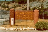
Mill Valley Air Force Station
Encyclopedia
The AN/FPS-107 search radar operated with a 360° continuous spin, at a rate of 5 rotations per minute. It transmitted ten megawatt pulses of radio frequency energy, with each pulse having a duration of six microseconds. It had a detection range of 250 miles, up to an altitude of 100,000 feet. The search radar facility was originally built in 1959 by the General Electric company.
The AN/FPS-90 Radar height finder antenna could be positioned to point in any direction to determine the altitude of aircraft. The antenna performed its vertical sweep by nodding up and down at a rate of 30 times per minute. Once the position was approximated, an operator would fine-tune the position to measure the altitude of a single aircraft of interest. The height finder radar transmitted five megawatts of radio frequency energy in a two microsecond pulse. Its range was about 180 miles and up to 75,000 feet in altitude. While the height finder antenna could be pointed in any direction, pointing it in the direction of the search radar was avoided, as the beam would strike the top of the search radar's tower. The beam was considered harmful to personnel out to a distance of 212 feet.
The AN/FPS-90 Radar height finder antenna could be positioned to point in any direction to determine the altitude of aircraft. The antenna performed its vertical sweep by nodding up and down at a rate of 30 times per minute. Once the position was approximated, an operator would fine-tune the position to measure the altitude of a single aircraft of interest. The height finder radar transmitted five megawatts of radio frequency energy in a two microsecond pulse. Its range was about 180 miles and up to 75,000 feet in altitude. While the height finder antenna could be pointed in any direction, pointing it in the direction of the search radar was avoided, as the beam would strike the top of the search radar's tower. The beam was considered harmful to personnel out to a distance of 212 feet.
See also
- List of USAF Aerospace Defense Command General Surveillance Radar Stations
- Mount Tamalpais State ParkMount Tamalpais State ParkMount Tamalpais State Park is a California state park, located in Marin County, California. The primary feature of the park is the Mount Tamalpais. The park contains mostly redwood and oak forests. The mountain itself covers around . There are about of hiking trails, which are connected to a...
- Mount TamalpaisMount TamalpaisMount Tamalpais is a peak in Marin County, California, United States, often considered symbolic of Marin County. Much of Mount Tamalpais is protected within public lands such as Mount Tamalpais State Park and the Mount Tamalpais Watershed.-Geography:...
- Mill Valley, CaliforniaMill Valley, CaliforniaMill Valley is a city in Marin County, California, United States located about north of San Francisco via the Golden Gate Bridge. The population was 13,903 at the 2010 census.Mill Valley is located on the western and northern shores of Richardson Bay...
- Marin County, CaliforniaMarin County, CaliforniaMarin County is a county located in the North San Francisco Bay Area of the U.S. state of California, across the Golden Gate Bridge from San Francisco. As of 2010, the population was 252,409. The county seat is San Rafael and the largest employer is the county government. Marin County is well...
External links
- Mill Valley Air Force Station at California State Military MuseumCalifornia State Military MuseumThe California State Military Museum is the official military museum of the State of California. It is located in the Old Sacramento State Historic Park at 1119 Second Street....

