
Molalla River
Encyclopedia
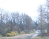
The Molalla River is a 50 miles (80.5 km) tributary
of the Willamette River
in the U.S. state
of Oregon
.
, in the Table Rock Wilderness
, near Table Rock, in the Cascade Range
. After descending from the mountains, it becomes a small meandering river, passing through the fertile agricultural region of the Willamette Valley
, and flows past Molalla, Oregon
.
It is joined by the Pudding
shortly before flowing into the Willamette
near the town of Canby
. The Molalla River State Park
, where the confluence
of the Molalla, Pudding, and Willamette form a floodplain
, provides one of the most significant habitats for small mammals and waterfowl in the Willamette Valley
, including one of the largest blue heron
rookeries in the region.
. During that time, an extensive system of trails along the river allowed trade between the peoples of the Willamette Valley
and eastern Oregon
. As late as the 1920s, the trails were used by Native Americans from the Warm Springs Indian Reservation
to reach huckleberry
-picking grounds near Table Rock. One of the original routes, called the "Huckleberry Trail", is currently used for recreational hiking and horseback riding.
Starting in the 1840s, the lower Molalla became an area of intense homesteading
by European-Americans because of the high fertility of the surrounding land. The upper reaches of the river became an area of widespread logging
, as well as gold
mining near the head of Ogle Creek.
and good spawning beds for Chinook Salmon
and Steelhead Trout. In fact the Molalla has long had a reputation for its sizeable native runs of both species. Over the past several decades these runs have seen declines as they have elsewhere in the Northwest however, they are still fairly significant and much of the angling pressure the river receives is in pursuit of these species. There is not a great deal of angling pressure for trout though numbers in the upper river are fairly decent. The best trout fishing in the system is likely along the Table Rock Fork as this stream supports rather high resident trout numbers, though they do not normally run larger than 12 inches at the most. The mouth of the river at Molalla River State Park
near Canby
is heavily fished during the summer months. Within the first mile or so upstream from the confluence with the Willamette River
there are large numbers of Smallmouth Bass
with a few as large as 5 lbs. For the next few miles upstream good numbers of Largemouth Bass
inhabit the river mostly in pools or slack water. The mouth of the Molalla used to be a good bet to routinely catch 20-40 bass a day. However during the past several years catch rates as well as size have sharply declined, as it seems as if many anglers are ignoring the five fish per day bag limit.
Tributary
A tributary or affluent is a stream or river that flows into a main stem river or a lake. A tributary does not flow directly into a sea or ocean...
of the Willamette River
Willamette River
The Willamette River is a major tributary of the Columbia River, accounting for 12 to 15 percent of the Columbia's flow. The Willamette's main stem is long, lying entirely in northwestern Oregon in the United States...
in the U.S. state
U.S. state
A U.S. state is any one of the 50 federated states of the United States of America that share sovereignty with the federal government. Because of this shared sovereignty, an American is a citizen both of the federal entity and of his or her state of domicile. Four states use the official title of...
of Oregon
Oregon
Oregon is a state in the Pacific Northwest region of the United States. It is located on the Pacific coast, with Washington to the north, California to the south, Nevada on the southeast and Idaho to the east. The Columbia and Snake rivers delineate much of Oregon's northern and eastern...
.
Geography
Its headwaters are in Clackamas CountyClackamas County, Oregon
Clackamas County is a county located in the U.S. state of Oregon. The county was named after the Native Americans living in the area, the Clackamas Indians, who were part of the Chinookan people. As of 2010, the population was 375,992...
, in the Table Rock Wilderness
Table Rock Wilderness
The Table Rock Wilderness is a small pocket wilderness designated in 1984in the western Cascade Mountains in northwestern Oregon, United States. The wilderness area protects of forest in the historic Molalla River–Pudding River drainage basin, some southeast of Molalla, Oregon and southeast of...
, near Table Rock, in the Cascade Range
Cascade Range
The Cascade Range is a major mountain range of western North America, extending from southern British Columbia through Washington and Oregon to Northern California. It includes both non-volcanic mountains, such as the North Cascades, and the notable volcanoes known as the High Cascades...
. After descending from the mountains, it becomes a small meandering river, passing through the fertile agricultural region of the Willamette Valley
Willamette Valley
The Willamette Valley is the most populated region in the state of Oregon of the United States. Located in the state's northwest, the region is surrounded by tall mountain ranges to the east, west and south and the valley's floor is broad, flat and fertile because of Ice Age conditions...
, and flows past Molalla, Oregon
Molalla, Oregon
Molalla is a city in Clackamas County, Oregon, United States. The population was 5,647 at the 2000 census.-History:Molalla was named after the Molalla River, which in turn was named for the Molala, a Native American tribe that inhabited the area. William H. Vaughan took up a donation land claim in...
.
It is joined by the Pudding
Pudding River
The Pudding River is a tributary of the Molalla River in the U.S. state of Oregon. Its drainage basin covers . Among its tributaries is the Little Pudding River...
shortly before flowing into the Willamette
Willamette River
The Willamette River is a major tributary of the Columbia River, accounting for 12 to 15 percent of the Columbia's flow. The Willamette's main stem is long, lying entirely in northwestern Oregon in the United States...
near the town of Canby
Canby, Oregon
Canby is a city in Clackamas County, Oregon, United States. The population was 15,829 at the 2010 census. It is located on Oregon Route 99E, two miles northeast of Barlow.-History:...
. The Molalla River State Park
Molalla River State Park
The Molalla River State Park is located in U.S. state of Oregon. It is a few miles north of Canby, and half a mile from the Canby Ferry. The park is south of the Willamette River and east of the Molalla River, at the confluence of the Pudding, Molalla and Willamette rivers. The Pudding River flows...
, where the confluence
Confluence (geography)
In geography, a confluence is the meeting of two or more bodies of water. It usually refers to the point where two streams flow together, merging into a single stream...
of the Molalla, Pudding, and Willamette form a floodplain
Floodplain
A floodplain, or flood plain, is a flat or nearly flat land adjacent a stream or river that stretches from the banks of its channel to the base of the enclosing valley walls and experiences flooding during periods of high discharge...
, provides one of the most significant habitats for small mammals and waterfowl in the Willamette Valley
Willamette Valley
The Willamette Valley is the most populated region in the state of Oregon of the United States. Located in the state's northwest, the region is surrounded by tall mountain ranges to the east, west and south and the valley's floor is broad, flat and fertile because of Ice Age conditions...
, including one of the largest blue heron
Great Blue Heron
The Great Blue Heron is a large wading bird in the heron family Ardeidae, common near the shores of open water and in wetlands over most of North and Central America as well as the West Indies and the Galápagos Islands. It is a rare vagrant to Europe, with records from Spain, the Azores and England...
rookeries in the region.
History
During the early 19th century, the area around the river was populated by the Molalla IndiansMolala
The Molala were a people of the Plateau culture area in central Oregon, United States. Some consider them extinct, though they are one of the Confederated Tribes of the Grand Ronde Community of Oregon, with 141 of the 882 members in the 1950s claiming Molala descent.-Language:The Molalla language...
. During that time, an extensive system of trails along the river allowed trade between the peoples of the Willamette Valley
Willamette Valley
The Willamette Valley is the most populated region in the state of Oregon of the United States. Located in the state's northwest, the region is surrounded by tall mountain ranges to the east, west and south and the valley's floor is broad, flat and fertile because of Ice Age conditions...
and eastern Oregon
Oregon
Oregon is a state in the Pacific Northwest region of the United States. It is located on the Pacific coast, with Washington to the north, California to the south, Nevada on the southeast and Idaho to the east. The Columbia and Snake rivers delineate much of Oregon's northern and eastern...
. As late as the 1920s, the trails were used by Native Americans from the Warm Springs Indian Reservation
Warm Springs Indian Reservation
The Warm Springs Indian Reservation consists of 1,019.385 sq mi in north central Oregon, in the United States, and is occupied and governed by the Confederated Tribes of Warm Springs.-Tribes:...
to reach huckleberry
Huckleberry
Huckleberry is a common name used in North America for several species of plants in two closely related genera in the family Ericaceae:* Vaccinium* GaylussaciaHuckleberry may also refer to:-Plants:...
-picking grounds near Table Rock. One of the original routes, called the "Huckleberry Trail", is currently used for recreational hiking and horseback riding.
Starting in the 1840s, the lower Molalla became an area of intense homesteading
Homesteading
Broadly defined, homesteading is a lifestyle of simple self-sufficiency.-Current practice:The term may apply to anyone who follows the back-to-the-land movement by adopting a sustainable, self-sufficient lifestyle. While land is no longer freely available in most areas of the world, homesteading...
by European-Americans because of the high fertility of the surrounding land. The upper reaches of the river became an area of widespread logging
Logging
Logging is the cutting, skidding, on-site processing, and loading of trees or logs onto trucks.In forestry, the term logging is sometimes used in a narrow sense concerning the logistics of moving wood from the stump to somewhere outside the forest, usually a sawmill or a lumber yard...
, as well as gold
Gold
Gold is a chemical element with the symbol Au and an atomic number of 79. Gold is a dense, soft, shiny, malleable and ductile metal. Pure gold has a bright yellow color and luster traditionally considered attractive, which it maintains without oxidizing in air or water. Chemically, gold is a...
mining near the head of Ogle Creek.
Fishing
The upper forks of the Molalla provide excellent habitat for small native troutTrout
Trout is the name for a number of species of freshwater and saltwater fish belonging to the Salmoninae subfamily of the family Salmonidae. Salmon belong to the same family as trout. Most salmon species spend almost all their lives in salt water...
and good spawning beds for Chinook Salmon
Chinook salmon
The Chinook salmon, Oncorhynchus tshawytscha, is the largest species in the pacific salmon family. Other commonly used names for the species include King salmon, Quinnat salmon, Spring salmon and Tyee salmon...
and Steelhead Trout. In fact the Molalla has long had a reputation for its sizeable native runs of both species. Over the past several decades these runs have seen declines as they have elsewhere in the Northwest however, they are still fairly significant and much of the angling pressure the river receives is in pursuit of these species. There is not a great deal of angling pressure for trout though numbers in the upper river are fairly decent. The best trout fishing in the system is likely along the Table Rock Fork as this stream supports rather high resident trout numbers, though they do not normally run larger than 12 inches at the most. The mouth of the river at Molalla River State Park
Molalla River State Park
The Molalla River State Park is located in U.S. state of Oregon. It is a few miles north of Canby, and half a mile from the Canby Ferry. The park is south of the Willamette River and east of the Molalla River, at the confluence of the Pudding, Molalla and Willamette rivers. The Pudding River flows...
near Canby
Canby, Oregon
Canby is a city in Clackamas County, Oregon, United States. The population was 15,829 at the 2010 census. It is located on Oregon Route 99E, two miles northeast of Barlow.-History:...
is heavily fished during the summer months. Within the first mile or so upstream from the confluence with the Willamette River
Willamette River
The Willamette River is a major tributary of the Columbia River, accounting for 12 to 15 percent of the Columbia's flow. The Willamette's main stem is long, lying entirely in northwestern Oregon in the United States...
there are large numbers of Smallmouth Bass
Smallmouth bass
The smallmouth bass is a species of freshwater fish in the sunfish family of the order Perciformes. It is the type species of its genus...
with a few as large as 5 lbs. For the next few miles upstream good numbers of Largemouth Bass
Largemouth bass
The largemouth bass is a species of black bass in the sunfish family native to North America . It is also known as widemouth bass, bigmouth, black bass, bucketmouth, Potter's fish, Florida bass, Florida largemouth, green bass, green trout, linesides, Oswego bass, southern largemouth...
inhabit the river mostly in pools or slack water. The mouth of the Molalla used to be a good bet to routinely catch 20-40 bass a day. However during the past several years catch rates as well as size have sharply declined, as it seems as if many anglers are ignoring the five fish per day bag limit.
See also
- List of crossings of the Molalla River
- List of rivers of Oregon
- List of longest streams of Oregon