
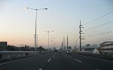
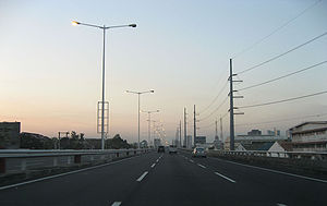
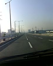
Metro Manila Skyway
Encyclopedia
South Luzon Expressway
The South Luzon Expressway ', which is formerly called the South Superhighway ', and officially known as Radial Road 3 or R-3, is a network of three expressways that connects Metro Manila to the provinces of the CALABARZON region in the Philippines...
as of the moment. It is located within the Metro Manila
Metro Manila
Metropolitan Manila , the National Capital Region , or simply Metro Manila, is the metropolitan region encompassing the City of Manila and its surrounding areas in the Philippines...
portion of the SLEX and crosses through Makati City
Makati City
The City of Makati is one of the 17 cities that make up Metro Manila, one of the most populous metropolitan areas in the world. Makati is the financial center of the Philippines and one of the major financial, commercial and economic hubs in Asia...
, Pasay City
Pasay City
The City of Pasay is one of the cities and municipalities that make up Metro Manila in the Philippines. It is bordered on the north by the country's capital, Manila, to the northeast by Makati City, to the east by Taguig City, and Parañaque City to the south.Pasay City was one of the original four...
, Parañaque City
Parañaque City
The City of Parañaque , or simply Parañaque , is one of the cities and municipalities that make up Metro Manila in the Philippines....
, and Muntinlupa City
Muntinlupa City
The City of Muntinlupa is the southernmost city in Philippine National Capital Region. It is bordered on the north by Taguig City; to the northwest by Parañaque City; by Las Piñas City to the west; to the southwest by the city of Bacoor, Cavite; by the city of San Pedro, Laguna; and by Laguna de...
. The Skyway begins in Barangay San Isidro, Makati City, and ends in Barangay Alabang, Muntinlupa City. In the future, it will extend further to the North Luzon Expressway
North Luzon Expressway
The North Luzon Expressway , and which is formerly called the North Diversion Road, and officially known as Radial Road 8 is a 4 to 8-lane limited-access toll expressway that connects Metro Manila to the provinces of the Central Luzon region in the Philippines...
via Manila
Manila
Manila is the capital of the Philippines. It is one of the sixteen cities forming Metro Manila.Manila is located on the eastern shores of Manila Bay and is bordered by Navotas and Caloocan to the north, Quezon City to the northeast, San Juan and Mandaluyong to the east, Makati on the southeast,...
and Caloocan City
Caloocan City
The City of Caloocan is one of the cities and municipalities that comprises the Metro Manila region in the Philippines. It is a major residential area inside Metro Manila...
.
History
With the opening of the Skyway system, Filipino motorists are treated to a toll road network as traffic at the South Luzon ExpresswaySouth Luzon Expressway
The South Luzon Expressway ', which is formerly called the South Superhighway ', and officially known as Radial Road 3 or R-3, is a network of three expressways that connects Metro Manila to the provinces of the CALABARZON region in the Philippines...
considerably improved with the additional roadway capacity, rehabilitated roads, upgraded and newly constructed facilities.
On November 27, 1995, PT CITRA, an investor, entered into a Supplemental Toll Operation Agreement (STOA) with the Republic of the Philippines, through the Toll Regulatory Board
Toll Regulatory Board
The Toll Regulatory Board is a Philippine government agency that regulates all toll roads in the Philippines.The TRB was created by virtue of Presidential Decree No. 1112 or the Toll Operation Decree...
(TRB), as grantor, and the Philippine National Construction Corporation (PNCC) as operator. The STOA was the result of negotiations among the parties which officially began on October 31, 1994 with the organization of the Technical Working Group composed of representatives from the Board of Investments (BOI), the Department of Finance
Department of Finance (Philippines)
The Philippines' Department of Finance is the executive department of the Philippine government responsible for the formulation, institutionalization and administration of fiscal policies, management of the financial resources of the government, supervision of the revenue operations of all local...
(DOF), AIA Capital as financial adviser, the Department of Public Works and Highways
Department of Public Works and Highways (Philippines)
The Philippines’ Department of Public Works and Highways , abbreviated as DPWH, is the executive department of the Philippine government responsible for all safety of projects in the field of public works...
(DPWH), the TRB, the PNCC, and the PT CITRA Group.
Under the STOA, CMMTC was mandated to finance, design and construct stage 1 of the South Metro Manila Tollway Project, consisting of both an elevated expressway from Bicutan to Gil Puyat and integrating into it the upgrade and the rehabilitation of the at-grade portion of the South Metro Manila Tollway project, consisting of both an elevated expressway from Nichols to Alabang, are considered as an integrated system of the South Metro Manila Tollway : Stage 1. The STOA was duly approved by the former Philippine President Fidel V. Ramos
Fidel V. Ramos
Fidel "Eddie" Valdez Ramos , popularly known as FVR, was the 12th President of the Philippines from 1992 to 1998. During his six years in office, Ramos was widely credited and admired by many for revitalizing and renewing international confidence in the Philippine economy.Prior to his election as...
on April 7, 1996.
In January 1997, TRB and CMMTC, together with the project contractor Hutama RSEA JO. Inc. independent consultants to the TRB Pertconsult International Philippines, consulting engineers Renardet S.A., Inter-Structure System, Inc., Design Science Incorporated, DMJM International USA, and design consultants Pacific Consultants International, in association with J.P. Cancio & Associates, completed a survey for rehabilitation works required on the at-grade portion of the SLEX from Nichols to Alabang. CMMTC has spent $32,746,652.19 in the Skyway Project Phase 1.
Construction began on August 24, 1995. Gil Puyat Avenue (Buendia), Makati, Magallanes Village, Skyway Toll Plazas A and B and Bicutan Exits were first to be completed on December 26, 1997. The Don Bosco Exit began its construction on November 17, 2001 and was completed on January 3, 2002. NAIA Terminal 3 Exit was in construction between September 5, 2004 and 2010.
On February 2007, the Chinese Prime Minister Wen Jiabao
Wen Jiabao
Wen Jiabao is the sixth and current Premier and Party secretary of the State Council of the People's Republic of China, serving as China's head of government and leading its cabinet. In his capacity as Premier, Wen is regarded as the leading figure behind China's economic policy...
together with the PNCC and the Philippine Government approved and signed the extended STOA.
At present, the Skyway System is now being operated by the Skyway Operations and Maintenance Corporation (SOMCo.), which replaced the PNCC Skyway Corporation in its tollway management and other related functions.
On April 2, 2009, Citra Metro Manila Tollways Corp. announced it will start construction on the second stage of the Skyway by the end of the week. By June 2009 the construction of new pilars is going on.
On May 4, 2010, The Skyway Stage 2 is 50% done and Citra Metro Manila Tollways Corp. rotated highest pierhead in Sucat area.
On July 25, 2010, The Skyway Stage 2 is 65% done, DMCI has finished concreting 134 of the required 238 spans, and has started asphalt overlay.
On December 15, 2010, The Bicutan-Sucat portion of Stage 2 finally opened to the public. The Skyway reverted its toll rates back to its 2007 levels last December 22, 2010. By this time, motorists can use this portion for free.
On April 6, 2011, Hillsborough exit ramp, Alabang toll plaza, and South Station Exit were opened to the public. It is toll-free until April 25. And the existing toll plazas in Nichols had stopped collecting transactions instead, the toll plazas in Bicutan, Sucat and Alabang will collect fees. The temporary ramp in Bicutan from/going to SLEX was closed and was replaced by the new ramp in front of Hillsborough, which allows traffic to enter and exit the Skyway from the service roads.
Stage two will extend the existing 9.5-kilometer Gil Puyat (Buendia)-Bicutan elevated toll road by about seven kilometers, from Bicutan to Alabang. The construction area at the median section of the toll road in Bicutan will be initially extended to Sucat and fenced off with concrete barriers.
Stage three is a proposed 13-kilometer project extending from Gil Puyat (Buendia) to Mindanao Avenue, connecting North Luzon Expressway to South Luzon Expressway via Segments 9 and 10 of the NLEX Phase 2.
Skyway's new toll rates will occur on April 26, 2011.
Skyway's operator and functions
The rehabilitated at-grade portion of the South Luzon Expressway (SLEX) from Nichols to Alabang and the elevated Expressway from Buendia to Bicutan is now being called the Metro Manila Skyway System. It is operated by the Skyway Operations and Maintenance Corporation (SOMCo), a company of the existing PNCC – concession holder, Citra Metro Manila Tollways Corporation. SOMCo took over the operations and maintenance of the Skyway from the former operator, PNCC Skyway Corporation, effective January 2008 and was established in compliance to the provision stipulated in the July 2007 Amended Supplemental Toll Operators Agreement (A-STOA) between the PNCC, Citra Metro Manila Tollways Corp. and the Toll Regulatory Board (TRB), which gave the management of the 35-kilometer toll road to Citra.Starting 2008, SOMCo is in charge of the three major operational functions, mainly: the traffic safety and security, the maintenance of facilities, and the toll collection.
South Metro Manila Skyway project stages
South Metro Manila Skyway is composed of Stages 1 and 2 of the whole Metro Manila Skyway Project.Stage 1
Stage 1 involves the rehabilitation of the Magallanes-Alabang at-grade portion and the construction of a 6 lane, 10 kilometer elevated expressway from Gil Puyat (Buendia) to Bicutan. Stage 1 started on April 7, 1995 and was completed and opened on October 1999.Stage 2
Stage 2 involves the construction of a 7-kilometer Elevated Expressway from Bicutan to Alabang's South Station, which began in the 2nd quarter of 2009 and was completed in April 2011. The Bicutan to Sucat segment opened on December 15, 2010, while the new Alabang toll plaza, and the Hillsborough and Alabang South Station exit ramps opened on April 6, 2011.North Metro Manila Skyway Project/Connector Road project
North Metro Manila Skyway/Connector Road is composed of the Stage 3 of the whole Metro Manila Skyway Project.Stage 3
Stage 3 or also called as Segment 11 in the NLEx Phase 2 project involves the construction of a 13.24 kilometer Elevated Expressway from Buendia (Skyway Stage 1) to the C-3 Road which will connect to the NLEx via Segment 10 of the NLEx Phase 2 project.Motorists may soon enjoy streamlined driving from the North Luzon Expressway (NLEX) to the South Luzon Expressway (SLEX) with plans under way for an elevated road connecting both highways.
The government has reportedly accepted an unsolicited proposal from Metro Pacific Tollways Development Corp. (MPTDC) to build the 13.24-kilometer road. MPTDC is a subsidiary of Metro Pacific Tollways Corp. (MPTC), which runs NLEX.
Known as the Connector Road project, the elevated expressway will have a distance of 13.24 kilometers with 10.54 kilometers right over the Philippine National Railways tracks and the remaining 2.7 kilometers over Osmeña Highway.
It will be connected in the north to Segment 10, which will soon be constructed through the cities of Caloocan and Valenzuela
Valenzuela
Valenzuela may refer to:*Valenzuela, Paraguay*Valenzuela, Philippines*Valenzuela, Spain*Valenzuela, LouisianaValenzuela Spanish surname :* Alfred Valenzuela - Mexican-American United States Army general...
. In the south, it will be linked to the Skyway near Sen. Gil Puyat Avenue (Buendia) in Makati City. Once completed, the Connector Road will have four entry and exit points: C-3 Road in Caloocan, España Blvd. and Quirino Avenue in Manila, and Gil Puyat (Buendia) in Makati.
Construction of the project is estimated to cost P17 billion, but as an "all-elevated" structure, right-of-way acquisition shall be reduced to an estimated cost of only P2.41-billion. Construction is anticipated to start in 2012 when NLEX Segments 9 and 10 are complete.
Future expansion
Gloria Macapagal-Arroyo
Gloria Macapagal-Arroyo is a Filipino politician who served as the 14th President of the Philippines from 2001 to 2010, as the 12th Vice President of the Philippines from 1998 to 2001, and is currently a member of the House of Representatives representing the 2nd District of Pampanga...
announced in her State of the Nation Address (SONA) that the Metro Manila Skyway will be extended and link the missing segment from Bicutan to Alabang, also called the Metro Manila Skyway Phase 2.
The road widening in Filinvest Exit, its future exit, Putatan Temporary Exit Ramp (near Shell Southbound – Muntinlupa) is now almost complete (See South Luzon Expressway
South Luzon Expressway
The South Luzon Expressway ', which is formerly called the South Superhighway ', and officially known as Radial Road 3 or R-3, is a network of three expressways that connects Metro Manila to the provinces of the CALABARZON region in the Philippines...
). Initially, the construction of the Phase 2 and painting of the posts was started at the San Martin de Porres Temporary Exit Ramp. Now, the construction of the Phase 2 is the further rotation of beams and placing girders since after the pillar construction reached Alabang, but it is expected to be complete by May 2011. The completion of Bicutan to Sucat section of the elevated toll road, including the slip ramps and opening to traffic is on December 2010. The construction is part of the South Luzon Expressway's Expansion and Upgrading Project of the Philippine Government.
When Phase 2 is complete, the San Martin de Porres Temporary Exit will be removed so the vehicles will exit in Sucat and Alabang, as its exits, going to the South Luzon Expressway.
The PNCC Skyway Corporation awarded the FF Cruz Construction Corporation as the main contractor responsible for the Phase 2 Project. Unfortunately, due to delays of pillar construction, DMCI is now the main contractor for Phase 2 which replaced FF Cruz since March 2009.
Metro Manila Skyway Phase 3 will extend the Skyway northwards and link the missing segment from Gil Puyat to Mindanao Avenue. It will be connected to North Luzon Expressway. But this phase is still in planning stages due to right-of-way problems. Currently, the government has reportedly accepted an unsolicited proposal from Metro Pacific Tollways Development Corp. (MPTDC) to build the 13.24-kilometer road. MPTDC is a subsidiary of Metro Pacific Tollways Corp. (MPTC), which runs NLEX. The proponent is taking a feasibility study for possible right-of-way via the tracks of the Philippine National Railways.
Technical specifications
- Name: Metro Manila Skyway
- Concession Holder: Citra Metro Manila Tollways Corporation
- Operator: Skyway Operations and Maintenance Corporation (SOMCo.)
- Length: 17 km
- Concession starting date: August 24, 1995 (it will start after the rehabilitation, modernization, and extension of the Alabang-Santo Tomas segment)
- Concession ending date: 2010
- Highway exits: 10
- Exit ramps: 3
- Toll plazas: 2
- Height: 11 meters (San Martin De Porres-Bicutan, Don Bosco-Gil Puyat, Makati CBD Exit and Hillsborough-Alabang), 43 meters (Bicutan-Toll A, and Sales-Don Bosco), normal (Toll A-B), 19 meters (Bicutan Exit, Sucat)
- Spurs: 3 (Makati CBD, Sales, and Bicutan); 6 (including Sucat, Hillsborough, Alabang, and Filinvest - for future expansion)
Exits
- Exits are numbered by kilometer post, with Rizal ParkRizal ParkRizal Park, also known as Luneta Park or colloquially Luneta, is a historical urban park located in the heart of the city of Manila, Philippines, adjacent to the old walled city of Manila, now Intramuros. Since the Spanish Colonial Era, the park has been a favorite spot for unwinding, socializing,...
in Manila designated as Kilometer 0. It starts with KM6 because this is a part of the SLExSouth Luzon ExpresswayThe South Luzon Expressway ', which is formerly called the South Superhighway ', and officially known as Radial Road 3 or R-3, is a network of three expressways that connects Metro Manila to the provinces of the CALABARZON region in the Philippines...
system
Current Exits/Entrance
| Kilometer No. | Exit | Location | Remarks |
|---|---|---|---|
| 6 | Buendia (Gil Puyat) Exit Ramp | Makati City Makati City The City of Makati is one of the 17 cities that make up Metro Manila, one of the most populous metropolitan areas in the world. Makati is the financial center of the Philippines and one of the major financial, commercial and economic hubs in Asia... |
This is an Exit ramp from/going to SLEx. |
| 7 | Makati Exit | This exit leads to a 4-lane spur road then curves left and descends to merge onto Amorsolo Street in the business village of Salcedo. Accessible only for northbound motorists. | |
| 7 | Don Bosco Exit | This exit on the northbound Skyway provides access to the Don Bosco Street intersection on the main SLEX. | |
| 9 | Magallanes Exit | This ramp is an access to the Skyway for southbound and to the SLEx for the Northbound. | |
| 9 | NAIA Terminal 3 Exit | Pasay City Pasay City The City of Pasay is one of the cities and municipalities that make up Metro Manila in the Philippines. It is bordered on the north by the country's capital, Manila, to the northeast by Makati City, to the east by Taguig City, and Parañaque City to the south.Pasay City was one of the original four... |
This exit leads to an elevated expressway called NAIA Expressway NAIA Expressway The NAIA Expressway is a elevated Expressway that runs from Metro Manila Skyway to Sales Road near Ninoy Aquino International Airport Terminal 3. This elevated expressway project is divided into 4 packages. This is also the first airport expressway in the Philippines. It is located within Pasay... leading to the NAIA Ninoy Aquino International Airport The Ninoy Aquino International Airport or NAIA , also known as Manila International Airport , is the airport serving the general area of Manila and its surrounding metropolitan area... 3 terminal, it can be accessed from both Northbound and Southbound lanes of the Skyway. |
| 14 | Bicutan Exit | Parañaque City Parañaque City The City of Parañaque , or simply Parañaque , is one of the cities and municipalities that make up Metro Manila in the Philippines.... |
This is an exit leading to Doña Soledad Avenue in Bicutan, Parañaque City. |
| 18 | Dr. A. Santos Exit (Sucat Exit) | Muntinlupa City | This is an exit leading to Dr. A. Santos Ave. or Sucat Road. |
| 19 | Skyway Alabang Main Toll Plaza A | This replaced the former Skyway toll plaza in Nichols, Pasay City Pasay City The City of Pasay is one of the cities and municipalities that make up Metro Manila in the Philippines. It is bordered on the north by the country's capital, Manila, to the northeast by Makati City, to the east by Taguig City, and Parañaque City to the south.Pasay City was one of the original four... . |
|
| 19 | Skyway Alabang Main Toll Plaza B | This is the second toll plaza. | |
| 20 | Hillsborough Exit/Entry Ramp | This replaced the San Martin de Porres Temporary Exit Ramp. This serves as the entry and exit point for motorists on the service roads. | |
| 22 | Alabang South Station Exit/Entry Ramp | This is an Entry/Exit Ramp to the Alabang South Station in Alabang, Muntinlupa City Muntinlupa City The City of Muntinlupa is the southernmost city in Philippine National Capital Region. It is bordered on the north by Taguig City; to the northwest by Parañaque City; by Las Piñas City to the west; to the southwest by the city of Bacoor, Cavite; by the city of San Pedro, Laguna; and by Laguna de... . It also leads motorists to the Alabang-Zapote Road. |
Future Exits/Entrance
| Kilometer No. | Exit | Location | Remarks |
|---|---|---|---|
| TBA | Manila North Harbor Exit (NLEX Segment 10) | Caloocan City Caloocan City The City of Caloocan is one of the cities and municipalities that comprises the Metro Manila region in the Philippines. It is a major residential area inside Metro Manila... |
This will be an entry to Manila North Harbor and NLEX via NLEX Segments 10 and 9 (C-5 North Extension). |
| TBA | C-3 Road Exit/Entry Ramp | This will be an Entry/Exit Ramp at C-3 Road in Grace Park Grace Park Grace Park may refer to:*Grace Park *Grace Park * A district of Caloocan City, Philippines... , Caloocan City Caloocan City The City of Caloocan is one of the cities and municipalities that comprises the Metro Manila region in the Philippines. It is a major residential area inside Metro Manila... . |
|
| TBA | España Exit/Entry Ramp | Manila Manila Manila is the capital of the Philippines. It is one of the sixteen cities forming Metro Manila.Manila is located on the eastern shores of Manila Bay and is bordered by Navotas and Caloocan to the north, Quezon City to the northeast, San Juan and Mandaluyong to the east, Makati on the southeast,... |
This will be an Entry/Exit Ramp at España Boulevard España Boulevard España Boulevard is the main thoroughfare of Sampaloc district, Manila and the extreme western section of Quezon City. It is an 8-lane divided arterial road and is a component of one of the radial roads of Metro Manila — Radial Road 7 or R-7. España's name is taken after the Spanish name of... in Sampaloc Sampaloc Sampaloc is the Filipino term for tamarind and the name of certain locations in the Philippines.*Sampaloc, Manila*Sampaloc, Quezon... , Manila Manila Manila is the capital of the Philippines. It is one of the sixteen cities forming Metro Manila.Manila is located on the eastern shores of Manila Bay and is bordered by Navotas and Caloocan to the north, Quezon City to the northeast, San Juan and Mandaluyong to the east, Makati on the southeast,... . |
| TBA | Quirino Exit/Entry Ramp | This will be an Entry/Exit Ramp at Pres. Qurino Avenue in Malate Malate Malate is the ionized form of malic acid. It is an important chemical compound in biochemistry. In the C4 carbon fixation process, malate is a source of CO2 in the Calvin cycle.... , Manila Manila Manila is the capital of the Philippines. It is one of the sixteen cities forming Metro Manila.Manila is located on the eastern shores of Manila Bay and is bordered by Navotas and Caloocan to the north, Quezon City to the northeast, San Juan and Mandaluyong to the east, Makati on the southeast,... . |
Former Exits/Entrance
| Kilometer No. | Exit | Location | Remarks |
|---|---|---|---|
| 10 | Skyway Nichols Toll Plaza A | Pasay City Pasay City The City of Pasay is one of the cities and municipalities that make up Metro Manila in the Philippines. It is bordered on the north by the country's capital, Manila, to the northeast by Makati City, to the east by Taguig City, and Parañaque City to the south.Pasay City was one of the original four... |
The former Main Toll Plaza for cash and E-Pass Users, it is situated at both lanes. |
| 10 | Skyway Nichols Toll Plaza B | The former Main Toll Plaza for E-Pass Users only situated on the Northbound lane. | |
| 15 | San Martin de Porres Temporary Exit Ramp | Parañaque City Parañaque City The City of Parañaque , or simply Parañaque , is one of the cities and municipalities that make up Metro Manila in the Philippines.... |
This was the temporary ramp leading down to SLEx South Luzon Expressway The South Luzon Expressway ', which is formerly called the South Superhighway ', and officially known as Radial Road 3 or R-3, is a network of three expressways that connects Metro Manila to the provinces of the CALABARZON region in the Philippines... before the construction of Skyway Stage 2. It was then removed when the permanent ramp in Hillsborough was opened to the public. |
Toll Fees (VAT-inclusive)
| Class | Amount (current as of October 17, 2011) |
|---|---|
| Class 1 (Cars, Motorcycles, SUVs) |
PhP 164 |
| Class 2 (Buses, Light Trucks) |
PhP 329 |
| Class 3 (Heavy Trucks) |
PhP 493 |
See also
- South Luzon ExpresswaySouth Luzon ExpresswayThe South Luzon Expressway ', which is formerly called the South Superhighway ', and officially known as Radial Road 3 or R-3, is a network of three expressways that connects Metro Manila to the provinces of the CALABARZON region in the Philippines...
- North Luzon ExpresswayNorth Luzon ExpresswayThe North Luzon Expressway , and which is formerly called the North Diversion Road, and officially known as Radial Road 8 is a 4 to 8-lane limited-access toll expressway that connects Metro Manila to the provinces of the Central Luzon region in the Philippines...
- Philippine National Construction CorporationPhilippine National Construction CorporationThe Philippine National Construction Corporation or PNCC is a majority government-owned and/or controlled corporation in the Philippines. It is the largest construction company in the Philippines and in Southeast Asia....