
M/V Queen of the North
Encyclopedia
M/V
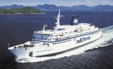
Queen of the North was a RORO ferry
built by AG Weser
of Germany
and operated by BC Ferries
, which ran along a scenic 18-hour route along the British Columbia Coast
of Canada
between Port Hardy
and Prince Rupert
, British Columbia
, a route also known as the Inside Passage
. On March 22, 2006, with 101 persons aboard, she sailed off course, ran aground and sank. Two passengers, whose bodies were never found, are now considered lost in the tragedy. The ship had a gross tonnage of 8,806 (the 5th largest in fleet), and an overall length of 125 metres (14th longest in the fleet). She had a capacity of 700 passengers and 115 cars.
, Bremerhaven
, Germany
in 1969, and was originally operated by Stena Line
as Stena Danica on the route between Gothenburg
, Sweden
and Frederikshavn
in Denmark. She was sold to BC Ferries for CAD $13.8 million.
Minister of Transportation and Communications, Robert Strachan
, in April 1974. Queen of Surrey began operating between Horseshoe Bay
in West Vancouver
and Nanaimo on Vancouver Island
. This busy route requires 8 transits per day and due to her RORO
bow design, it was quickly evident that the vessel was unsuitable for this route since she could not be loaded and unloaded as fast as necessary. The ship was decommissioned in 1976 and laid up at BC Ferries' dockyard at Deas Island
in Vancouver while the government debated what to do with her.
In May 1980, after an extensive $10 million refit for longer haul, northern service (staterooms, more restaurants & cargo holds) she was renamed Queen of the North. She was assigned to the Inside Passage
route between Port Hardy
on Vancouver Island and Prince Rupert
in north-western BC. She occasionally also served Bella Bella
, Skidegate
(Queen Charlotte Islands
), and several other small, north-western coastal villages. Due to the isolation of some of these communities (where roads were poor or non-existent), she served as the main source of transport, picking up residents and medical patients, and dropping off food, mail and supplies.
In 1985, she was refurbished and designated the "flagship
" of BC Ferries' fleet. After the sinking of the M/S Estonia
in 1994, BC Ferries installed a second set of internally welded doors to prevent the bow from flooding in rough seas.
During 2001, she was given a major $500,000 refit at Vancouver Shipyards, which included a redesign and modernization of the passenger decks. However, owing to her older single hull design, the ship was not designed to survive a significant hull breach or the flooding of more than one bulkhead compartment. All newer ferries can survive flooding of at least two bulkhead compartments and because of this concern, the ship was intended to be replaced between 2009 and 2011.
in Wright Sound
, 135 kilometres (70 nautical miles) south of Prince Rupert
, British Columbia
. She sank at 12:25 am or 12:43 am PST (08:43 UTC
) on March 22, 2006; there are conflicting reports about the exact time. News reports have indicated that the vessel was one kilometre off course at the time of the collision. She was bound for Port Hardy
.
According to emergency responders the ship took approximately an hour to sink, giving passengers time to evacuate into lifeboat
s. Eyewitness reports confirmed the approximate time between the accident and the sinking and also suggest that the ship sank stern first. The ship's final position is 53°19.917′N 129°14.729′W according to the BC Ferries investigation.
The ship's captain was reportedly not on the bridge at the time of the accident. Local weather reports indicated winds gusting to 75 km/h in the vicinity of Wright Sound. According to Kevin Falcon
, the BC Minister of Transportation, the autopilot equipment had been certified by Transport Canada
only as recently as 2 March.
On 26 March 2007, BC Ferries released its internal investigation into the sinking. The report concluded that the Queen of the North failed to make the required or any course changes at Sainty Point, and that the ship proceeded straight on an incorrect course for four nautical miles over 14 minutes until its grounding at 17.5 knots on Gil Island. The investigation found no evidence of alterations of speed at any time during the transit of Wright Sound and concluded that human factors were the primary cause of the sinking.
A large number of small fishing and recreational vessels from Hartley Bay
were the first on the scene to answer the distress call, arriving in a fleet of small watercraft in the dead of night to pick up survivors. Joint Rescue Coordination Centre Victoria tasked Canadian Coast Guard
vessels CCGS Sir Wilfrid Laurier
, CCGC Point Henry, CCGS W.E. Ricker
, CCGC Kitimat II and the CCGS Vector
, along with 2 CH-149 Cormorant
helicopters and 1 CC-115 Buffalo
aircraft from the 442 Transport and Rescue Squadron at CFB Comox
to the scene of the sinking.
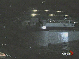
Originally the evacuation of the ship was reported to be a smooth one; however, stories of chest high water and trapped crew members surfaced on March 24. According to the official BC Ferries press release, 99 of the 101 passengers and crew were safely evacuated with only a few minor injuries, and many of them found refuge in nearby Hartley Bay.
When the ferry was located by submersible, the two missing passengers were not found in the wreck.
David Hahn was that, although this was a catastrophic event, the emergency response by the crew is evidence of the safety of ferry travel. Hahn also stated a top-speed collision with Gil Island would "rip apart the hull of any ship, even a massive cruise ship
". The Premier of British Columbia
, Gordon Campbell, echoed this and met with survivors in Prince Rupert on the day of the incident. Despite these events, the Premier expressed confidence in the ferry system, saying that "The fleet is safe. Not only is the fleet safe, but it is manned by professional crews that are trained in safety." This was the second accident of a BC Ferries vessel within a year. On 30 June 2005, the Queen of Oak Bay
lost power while docking.
Coastal villages served by the Queen of the North expressed concern about replacement transportation, as many of the small communities rely on BC Ferries not only for transport, but for food, mail and supplies. BC Ferries employed the M/V Queen of Prince Rupert as the temporary vessel on the Inside Passage route until the replacement vessel, M/V Northern Adventure began service at the end of March 2007. The ferry corporation declined suggestions that the replacement ship be named in honour of the village of Hartley Bay.
On March 26, 2006, the Queen of the North was located by a manned submersible craft at a depth of 427 metres. The ship is intact, according to BC Ferries, and it is "resting in silt on the keel and the silt covers the hull up to what's called the rubbing strake and above in some areas." The ship is located at 53° 19.91’ N, 129° 14.72’ W. Images of the scene were given to the Transportation Safety Board of Canada as part of an ongoing investigation into the cause of the accident.
On March 26, 2007, BC Ferries released the results of its investigation and blamed the accident on human error caused by three crew members, specifically the Queen of the North's helmswoman who was at the wheel of the ship as well as the ship's second and fourth officers who were in charge of navigation. A Vancouver Sun editorial on the accident notes that two ferry crew members on the watch--the ferry's second and fourth officer--have been uncooperative during the course of the BC Ferries internal inquiry. BC Ferries President David Hahn doubts that any new information would be forthcoming from a future disciplinary inquiry due to the uncooperative response by these two officers on night watch at the time of the accident. The Vancouver Sun states that the BC Ferries report "dismisses the idea that confusion over how to use new bridge equipment installed a month before the crash had anything to do with the sinking." The BC Ferries report also highlights the role of the fourth officer who had control of the ship from Sainty Point, but failed to make the necessary course correction. According to the report, The Vancouver Sun writes that:
The Vancouver Sun does cite an earlier safety board advisory which said that the bridge crew "were confused about how to use a new steering mode selector switch--that among other things controls whether the ship is on autopilot or manual steering--installed in a retrofit in February [2006]." However, BC Ferries concludes the bridge crew working the night of the disaster "chose" to use newly installed steering controls in a way "different" than instructed but that this choice did not appear to have been the cause for the grounding of the Queen of the North. David Hahn states that:
While the three key crew members are reportedly cooperating with a separate Transportation Safety Board (TSB) inquiry into the tragedy, Michael Smyth, a newspaper columnist at The Province
, notes that the TSB does not have the authority to assign blame to any party involved in the accident, unlike the BC Ferries internal inquiry. Consequently, no one can be held accountable for the sinking of the Queen of the North.
On 27 March 2006, Alexander and Maria Kotai filed a lawsuit against BC Ferries for negligence
, claiming that the company failed to train the crew adequately, supervise the bridge crew, keep proper lookout, operate at a safe speed, and conduct the evacuation to prevent or minimize injuries. The Kotais were moving house at the time from Kitimat to Nanaimo, and lost many of their personal possessions in the sinking. The amount of damages
that they are seeking has not been specified.
On April 24, 2007, BC Ferries fired three Queen of the North crew members who were on the bridge when the ship collided with Gil Island and sank. BC Ferries claims that these three employees were not cooperating fully with all investigators. The B.C. Ferry and Marine Workers' Union represents the ferry crew members. The union has indicated that it will appeal the terminations.
As of May 5, 2007, two investigations are still ongoing. The Transportation Safety Board of Canada (TSB) should release its report soon. The Royal Canadian Mounted Police (RCMP) are continuing a criminal investigation into the sinking. The TSB has provided copies of its draft report to BC Ferries, the ferry workers union, and all three fired crew members according to TV news reports. The TSB's final report,#M06W0052, was released to the public on March 12, 2008, viewable on their website: http://www.tsb.gc.ca/eng/medias-media/communiques/marine/2008/comm_m06w0052.asp The TSB's main conclusion is that sound navigational practices and regulations were not followed by the 4 unionized navigational crew at the time. RCMP charges have not be filed as of March 21, 2009.
On Tuesday morning March 16, 2010 in B.C. Provincial Court in Vancouver, a charge of criminal negligence causing death was laid against Karl Lilgert. He was the navigating officer responsible for steering the vessel at the time of the accident. The charge was reported in statement issued by the province's Criminal Justice Branch.
, and especially its shellfish
population, are not yet known. Officials doubted any salvaging of the vessel would be possible. Burrard Clean Operations has been hired to conduct environmental response operations, if required.
In the legislature in March 2007, NDP Opposition Critic for the Environment Shane Simpson questioned the lack of action in the past year on removing the fuel from the sunken ship. Minister of Environment Barry Penner advised against "armchair engineering," responded that waterways and sunken vessels were federal responsibilities, and that BC Ferries would be working with the Canada Coast Guard to put together a plan that would not result in the unintended release of fuel into the environment.
, Sweden
- Frederikshavn
route.
Ship prefix
A ship prefix is a combination of letters, usually abbreviations, used in front of the name of a civilian or naval ship.Prefixes for civilian vessels may either identify the type of propulsion, such as "SS" for steamship, or purpose, such as "RV" for research vessel. Civilian prefixes are often...
Queen of the North was a RORO ferry
Ferry
A ferry is a form of transportation, usually a boat, but sometimes a ship, used to carry primarily passengers, and sometimes vehicles and cargo as well, across a body of water. Most ferries operate on regular, frequent, return services...
built by AG Weser
AG Weser
Aktien-Gesellschaft Weser was one of the great German shipbuilding companies, located at the Weser River in Bremen. Founded in 1873 it was finally closed in 1983. Altogether, AG Weser built about 1400 ships of different types, including many war ships...
of Germany
Germany
Germany , officially the Federal Republic of Germany , is a federal parliamentary republic in Europe. The country consists of 16 states while the capital and largest city is Berlin. Germany covers an area of 357,021 km2 and has a largely temperate seasonal climate...
and operated by BC Ferries
BC Ferries
British Columbia Ferry Services Inc. or BC Ferries is a de facto Crown Corporation that provides all major passenger and vehicle ferry services for coastal and island communities in the Canadian province of British Columbia...
, which ran along a scenic 18-hour route along the British Columbia Coast
British Columbia Coast
The British Columbia Coast or BC Coast is Canada's western continental coastline on the Pacific Ocean. The usage is synonymous with the term West Coast of Canada....
of Canada
Canada
Canada is a North American country consisting of ten provinces and three territories. Located in the northern part of the continent, it extends from the Atlantic Ocean in the east to the Pacific Ocean in the west, and northward into the Arctic Ocean...
between Port Hardy
Port Hardy, British Columbia
Port Hardy is a district municipality in British Columbia, Canada located on the north-eastern coast of Vancouver Island. Port Hardy has a population of 3822 at last census...
and Prince Rupert
Prince Rupert, British Columbia
Prince Rupert is a port city in the province of British Columbia, Canada. It is the land, air, and water transportation hub of British Columbia's North Coast, and home to some 12,815 people .-History:...
, British Columbia
British Columbia
British Columbia is the westernmost of Canada's provinces and is known for its natural beauty, as reflected in its Latin motto, Splendor sine occasu . Its name was chosen by Queen Victoria in 1858...
, a route also known as the Inside Passage
Inside Passage
The Inside Passage is a coastal route for oceangoing vessels along a network of passages which weave through the islands on the Pacific coast of North America. The route extends from southeastern Alaska, in the United States, through western British Columbia, in Canada, to northwestern Washington...
. On March 22, 2006, with 101 persons aboard, she sailed off course, ran aground and sank. Two passengers, whose bodies were never found, are now considered lost in the tragedy. The ship had a gross tonnage of 8,806 (the 5th largest in fleet), and an overall length of 125 metres (14th longest in the fleet). She had a capacity of 700 passengers and 115 cars.
Construction and service with Stena Line
The ship was built by AG WeserAG Weser
Aktien-Gesellschaft Weser was one of the great German shipbuilding companies, located at the Weser River in Bremen. Founded in 1873 it was finally closed in 1983. Altogether, AG Weser built about 1400 ships of different types, including many war ships...
, Bremerhaven
Bremerhaven
Bremerhaven is a city at the seaport of the free city-state of Bremen, a state of the Federal Republic of Germany. It forms an enclave in the state of Lower Saxony and is located at the mouth of the River Weser on its eastern bank, opposite the town of Nordenham...
, Germany
Germany
Germany , officially the Federal Republic of Germany , is a federal parliamentary republic in Europe. The country consists of 16 states while the capital and largest city is Berlin. Germany covers an area of 357,021 km2 and has a largely temperate seasonal climate...
in 1969, and was originally operated by Stena Line
Stena Line
Stena Line is one of the world's largest ferry operators, with ferry services serving Scotland, Sweden, Northern Ireland, Denmark, Norway, England, Wales, Ireland, Germany, the Netherlands and Poland. Stena Line is a major unit of Stena AB, itself a part of the Stena Sphere, a grouping of Stena AB,...
as Stena Danica on the route between Gothenburg
Gothenburg
Gothenburg is the second-largest city in Sweden and the fifth-largest in the Nordic countries. Situated on the west coast of Sweden, the city proper has a population of 519,399, with 549,839 in the urban area and total of 937,015 inhabitants in the metropolitan area...
, Sweden
Sweden
Sweden , officially the Kingdom of Sweden , is a Nordic country on the Scandinavian Peninsula in Northern Europe. Sweden borders with Norway and Finland and is connected to Denmark by a bridge-tunnel across the Öresund....
and Frederikshavn
Frederikshavn
This article is about a Danish town. For the German town, see Friedrichshafen, and for the Finnish town, see Fredrikshamn .Frederikshavn is a Danish town in Frederikshavn municipality, Region Nordjylland on the northeast coast of the Jutland peninsula in northern Denmark. Its name translates to...
in Denmark. She was sold to BC Ferries for CAD $13.8 million.
With BC Ferries
After purchasing the Stena Danica from the Stena Line, the ship was rechristened Queen of Surrey by then NDPNew Democratic Party
The New Democratic Party , commonly referred to as the NDP, is a federal social-democratic political party in Canada. The interim leader of the NDP is Nycole Turmel who was appointed to the position due to the illness of Jack Layton, who died on August 22, 2011. The provincial wings of the NDP in...
Minister of Transportation and Communications, Robert Strachan
Robert Strachan
Robert Martin Strachan was a trade unionist and politician. He was the longest serving Leader of the Opposition in British Columbia history....
, in April 1974. Queen of Surrey began operating between Horseshoe Bay
Horseshoe Bay, West Vancouver, British Columbia
Horseshoe Bay is a West Vancouver community of about 1,000 permanent residents. Situated right on the western tip of West Vancouver, at the entrance to Howe Sound, the village marks the western end of Highway 1 on the British Columbia mainland....
in West Vancouver
West Vancouver, British Columbia
West Vancouver is a district municipality in the province of British Columbia, Canada. A member municipality of Metro Vancouver, the governing body of the Greater Vancouver Regional District, the municipality is northwest of the city of Vancouver on the northern side of English Bay and the...
and Nanaimo on Vancouver Island
Vancouver Island
Vancouver Island is a large island in British Columbia, Canada. It is one of several North American locations named after George Vancouver, the British Royal Navy officer who explored the Pacific Northwest coast of North America between 1791 and 1794...
. This busy route requires 8 transits per day and due to her RORO
RORO
Roll-on/roll-off ships are vessels designed to carry wheeled cargo such as automobiles, trucks, semi-trailer trucks, trailers or railroad cars that are driven on and off the ship on their own wheels...
bow design, it was quickly evident that the vessel was unsuitable for this route since she could not be loaded and unloaded as fast as necessary. The ship was decommissioned in 1976 and laid up at BC Ferries' dockyard at Deas Island
Deas Island
Deas Island is an island in the south arm of the Fraser River between Delta, British Columbia and Richmond, British Columbia, Canada. The island is home to a regional park approximately in size...
in Vancouver while the government debated what to do with her.
In May 1980, after an extensive $10 million refit for longer haul, northern service (staterooms, more restaurants & cargo holds) she was renamed Queen of the North. She was assigned to the Inside Passage
Inside Passage
The Inside Passage is a coastal route for oceangoing vessels along a network of passages which weave through the islands on the Pacific coast of North America. The route extends from southeastern Alaska, in the United States, through western British Columbia, in Canada, to northwestern Washington...
route between Port Hardy
Port Hardy, British Columbia
Port Hardy is a district municipality in British Columbia, Canada located on the north-eastern coast of Vancouver Island. Port Hardy has a population of 3822 at last census...
on Vancouver Island and Prince Rupert
Prince Rupert, British Columbia
Prince Rupert is a port city in the province of British Columbia, Canada. It is the land, air, and water transportation hub of British Columbia's North Coast, and home to some 12,815 people .-History:...
in north-western BC. She occasionally also served Bella Bella
Bella Bella, British Columbia
Bella Bella, also known as Waglisla, is an unincorporated community and Indian Reserve community located within Bella Bella Indian Reserve No. 1 on the east coast of Campbell Island in the Central Coast region of British Columbia, Canada. Bella Bella is located north of Port Hardy, on Vancouver...
, Skidegate
Skidegate
Skidegate is a Haida community in Haida Gwaii in British Columbia, Canada. It is located on the southeast coast of Graham Island, the largest island in the archipelago, and is approximately west of mainland British Columbia across Hecate Strait...
(Queen Charlotte Islands
Queen Charlotte Islands
Haida Gwaii , formerly the Queen Charlotte Islands, is an archipelago on the North Coast of British Columbia, Canada. Haida Gwaii consists of two main islands: Graham Island in the north, and Moresby Island in the south, along with approximately 150 smaller islands with a total landmass of...
), and several other small, north-western coastal villages. Due to the isolation of some of these communities (where roads were poor or non-existent), she served as the main source of transport, picking up residents and medical patients, and dropping off food, mail and supplies.
In 1985, she was refurbished and designated the "flagship
Flagship
A flagship is a vessel used by the commanding officer of a group of naval ships, reflecting the custom of its commander, characteristically a flag officer, flying a distinguishing flag...
" of BC Ferries' fleet. After the sinking of the M/S Estonia
M/S Estonia
MS Estonia, previously MS Viking Sally , MS Silja Star , and MS Wasa King , was a cruise ferry built in 1979/80 at the German shipyard Meyer Werft in Papenburg. The ship sank in the Baltic Sea in one of the worst maritime disasters of the 20th century...
in 1994, BC Ferries installed a second set of internally welded doors to prevent the bow from flooding in rough seas.
During 2001, she was given a major $500,000 refit at Vancouver Shipyards, which included a redesign and modernization of the passenger decks. However, owing to her older single hull design, the ship was not designed to survive a significant hull breach or the flooding of more than one bulkhead compartment. All newer ferries can survive flooding of at least two bulkhead compartments and because of this concern, the ship was intended to be replaced between 2009 and 2011.
Sinking
The Queen of the North sank after running aground on Gil IslandGil Island (Canada)
Gil Island is an island on the North Coast of British Columbia, Canada, located on the west side of Whale Channel in the entrance to Douglas Channel, one of the main coastal inlets, on the route of the Inside Passage between Pitt Island and Princess Royal Island. It is 26 km long, with a width...
in Wright Sound
Wright Sound
Wright Sound is a waterway on the North Coast of British Columbia, Canada. Wright Sound is south of Prince Rupert and lies at the southern opening of Grenville Channel and between Gil, Gribbell and Pitt Islands...
, 135 kilometres (70 nautical miles) south of Prince Rupert
Prince Rupert, British Columbia
Prince Rupert is a port city in the province of British Columbia, Canada. It is the land, air, and water transportation hub of British Columbia's North Coast, and home to some 12,815 people .-History:...
, British Columbia
British Columbia
British Columbia is the westernmost of Canada's provinces and is known for its natural beauty, as reflected in its Latin motto, Splendor sine occasu . Its name was chosen by Queen Victoria in 1858...
. She sank at 12:25 am or 12:43 am PST (08:43 UTC
Coordinated Universal Time
Coordinated Universal Time is the primary time standard by which the world regulates clocks and time. It is one of several closely related successors to Greenwich Mean Time. Computer servers, online services and other entities that rely on having a universally accepted time use UTC for that purpose...
) on March 22, 2006; there are conflicting reports about the exact time. News reports have indicated that the vessel was one kilometre off course at the time of the collision. She was bound for Port Hardy
Port Hardy, British Columbia
Port Hardy is a district municipality in British Columbia, Canada located on the north-eastern coast of Vancouver Island. Port Hardy has a population of 3822 at last census...
.
According to emergency responders the ship took approximately an hour to sink, giving passengers time to evacuate into lifeboat
Lifeboat (shipboard)
A lifeboat is a small, rigid or inflatable watercraft carried for emergency evacuation in the event of a disaster aboard ship. In the military, a lifeboat may be referred to as a whaleboat, dinghy, or gig. The ship's tenders of cruise ships often double as lifeboats. Recreational sailors sometimes...
s. Eyewitness reports confirmed the approximate time between the accident and the sinking and also suggest that the ship sank stern first. The ship's final position is 53°19.917′N 129°14.729′W according to the BC Ferries investigation.
The ship's captain was reportedly not on the bridge at the time of the accident. Local weather reports indicated winds gusting to 75 km/h in the vicinity of Wright Sound. According to Kevin Falcon
Kevin Falcon
Kevin Falcon is a Canadian politician and is the current Deputy Premier of British Columbia, Canada. He is a Member of the Legislative Assembly for the district of Surrey-Cloverdale and is a member of the BC Liberals...
, the BC Minister of Transportation, the autopilot equipment had been certified by Transport Canada
Transport Canada
Transport Canada is the department within the government of Canada which is responsible for developing regulations, policies and services of transportation in Canada. It is part of the Transportation, Infrastructure and Communities portfolio...
only as recently as 2 March.
On 26 March 2007, BC Ferries released its internal investigation into the sinking. The report concluded that the Queen of the North failed to make the required or any course changes at Sainty Point, and that the ship proceeded straight on an incorrect course for four nautical miles over 14 minutes until its grounding at 17.5 knots on Gil Island. The investigation found no evidence of alterations of speed at any time during the transit of Wright Sound and concluded that human factors were the primary cause of the sinking.
Evacuation and rescue
A large number of small fishing and recreational vessels from Hartley Bay
Hartley Bay, British Columbia
Hartley Bay is a First Nations community on the coast of British Columbia. The village is located at the mouth of Douglas Channel, about north of Vancouver and south of Prince Rupert...
were the first on the scene to answer the distress call, arriving in a fleet of small watercraft in the dead of night to pick up survivors. Joint Rescue Coordination Centre Victoria tasked Canadian Coast Guard
Canadian Coast Guard
The Canadian Coast Guard is the coast guard of Canada. It is a federal agency responsible for providing maritime search and rescue , aids to navigation, marine pollution response, marine radio, and icebreaking...
vessels CCGS Sir Wilfrid Laurier
CCGS Sir Wilfrid Laurier
The CCGS Sir Wilfrid Laurier is a light icebreaker and Major Navaids Tender of the Canadian Coast Guard. Built in 1986 by Canadian Shipbuilding, Collingwood, Ontario, Canada the ship currently is based out of Victoria, British Columbia....
, CCGC Point Henry, CCGS W.E. Ricker
CCGS W. E. Ricker
The CCGS W.E. Ricker is a Canadian Coast Guard offshore fisheries research vessel. The vessel was built in 1978 by Narasaki Senpakukogyo Limited of Muroran Hokkaido, Japan. . The ship sails with six officers and a crew of 13....
, CCGC Kitimat II and the CCGS Vector
CCGS Vector
The CCGS Vector is a Hydrographic Survey Vessel in the Canadian Coast Guard.She was built in 1965 in Yarrows Shipyard in Victoria, British Columbia and is station at Canadian Coast Guard Base Patricia Bay in Sidney, British Columbia...
, along with 2 CH-149 Cormorant
AgustaWestland EH101
The AgustaWestland AW101 is a medium-lift helicopter for military applications but also marketed for civil use. The helicopter was developed as a joint venture between Westland Helicopters in the UK and Agusta in Italy...
helicopters and 1 CC-115 Buffalo
De Havilland Canada DHC-5 Buffalo
The de Havilland Canada DHC-5 Buffalo is a short takeoff and landing utility transport, a turboprop aircraft developed from the earlier piston-powered DHC-4 Caribou...
aircraft from the 442 Transport and Rescue Squadron at CFB Comox
CFB Comox
Canadian Forces Base Comox , commonly referred to as CFB Comox, is a Canadian Forces Base located north northeast of Comox, British Columbia. It is primarily operated as an air force base by the Royal Canadian Air Force and is one of two bases in the country using the CP-140 Aurora...
to the scene of the sinking.
Originally the evacuation of the ship was reported to be a smooth one; however, stories of chest high water and trapped crew members surfaced on March 24. According to the official BC Ferries press release, 99 of the 101 passengers and crew were safely evacuated with only a few minor injuries, and many of them found refuge in nearby Hartley Bay.
Loss of life
Two people, Shirley Rosette and Gerald Foisy of 100 Mile House, apparently failed to reach the safety of the lifeboats and perished along with the ship. While a passenger reportedly told police the missing couple were seen on Hartley Bay during the rescue effort, a thorough search of the small aboriginal community of 200 people by police turned up nothing. In addition the couple did not contact relatives after the sinking.When the ferry was located by submersible, the two missing passengers were not found in the wreck.
BC Ferries crisis response
The response by BC Ferries CEOChief executive officer
A chief executive officer , managing director , Executive Director for non-profit organizations, or chief executive is the highest-ranking corporate officer or administrator in charge of total management of an organization...
David Hahn was that, although this was a catastrophic event, the emergency response by the crew is evidence of the safety of ferry travel. Hahn also stated a top-speed collision with Gil Island would "rip apart the hull of any ship, even a massive cruise ship
Cruise ship
A cruise ship or cruise liner is a passenger ship used for pleasure voyages, where the voyage itself and the ship's amenities are part of the experience, as well as the different destinations along the way...
". The Premier of British Columbia
Premier of British Columbia
The Premier of British Columbia is the first minister, head of government, and de facto chief executive for the Canadian province of British Columbia. Until the early 1970s the title Prime Minister of British Columbia was often used...
, Gordon Campbell, echoed this and met with survivors in Prince Rupert on the day of the incident. Despite these events, the Premier expressed confidence in the ferry system, saying that "The fleet is safe. Not only is the fleet safe, but it is manned by professional crews that are trained in safety." This was the second accident of a BC Ferries vessel within a year. On 30 June 2005, the Queen of Oak Bay
Queen of Oak Bay
M/V Queen of Oak Bay is a double-ended C class roll-on/roll-off ferry in the BC Ferries fleet, launched in 1981 at Victoria, British Columbia. The long, 6,969-ton vessel has a capacity for 362 cars and over 1,500 passengers and crew. She normally operates on BC Ferries' Horseshoe Bay to...
lost power while docking.
Coastal villages served by the Queen of the North expressed concern about replacement transportation, as many of the small communities rely on BC Ferries not only for transport, but for food, mail and supplies. BC Ferries employed the M/V Queen of Prince Rupert as the temporary vessel on the Inside Passage route until the replacement vessel, M/V Northern Adventure began service at the end of March 2007. The ferry corporation declined suggestions that the replacement ship be named in honour of the village of Hartley Bay.
Investigations and legal aftermath
BC Ferries completed its internal investigation while Canada's Transportation Safety Board is conducting its own separate investigation.On March 26, 2006, the Queen of the North was located by a manned submersible craft at a depth of 427 metres. The ship is intact, according to BC Ferries, and it is "resting in silt on the keel and the silt covers the hull up to what's called the rubbing strake and above in some areas." The ship is located at 53° 19.91’ N, 129° 14.72’ W. Images of the scene were given to the Transportation Safety Board of Canada as part of an ongoing investigation into the cause of the accident.
On March 26, 2007, BC Ferries released the results of its investigation and blamed the accident on human error caused by three crew members, specifically the Queen of the North's helmswoman who was at the wheel of the ship as well as the ship's second and fourth officers who were in charge of navigation. A Vancouver Sun editorial on the accident notes that two ferry crew members on the watch--the ferry's second and fourth officer--have been uncooperative during the course of the BC Ferries internal inquiry. BC Ferries President David Hahn doubts that any new information would be forthcoming from a future disciplinary inquiry due to the uncooperative response by these two officers on night watch at the time of the accident. The Vancouver Sun states that the BC Ferries report "dismisses the idea that confusion over how to use new bridge equipment installed a month before the crash had anything to do with the sinking." The BC Ferries report also highlights the role of the fourth officer who had control of the ship from Sainty Point, but failed to make the necessary course correction. According to the report, The Vancouver Sun writes that:
- Just before the crash, the fourth officer screamed at the helmswoman to make a bold course correction--a 109-degree turn--and to switch off the autopilot. But she [the helmswoman] "stated not knowing where the switch was located." [The] BC Ferries' report questions the validity of this evidence "as the autopilot disengages simply with a single switch and would have been operated numerous times by the [helmswoman]." However, in its own report, BC Ferries states the master found it necessary to post a note for navigational crew on how to operate the autopilot and included procedures for changing modes. Evidence was given that the woman at the wheel didn't know the location of the ship when she took over as lookout--or that the ferry was about to crash until she saw trees. She said she was asked to make only one, maybe two small course changes as directed by the fourth officer after she started her shift but that was...until just before the vessel hit Gil Island.
The Vancouver Sun does cite an earlier safety board advisory which said that the bridge crew "were confused about how to use a new steering mode selector switch--that among other things controls whether the ship is on autopilot or manual steering--installed in a retrofit in February [2006]." However, BC Ferries concludes the bridge crew working the night of the disaster "chose" to use newly installed steering controls in a way "different" than instructed but that this choice did not appear to have been the cause for the grounding of the Queen of the North. David Hahn states that:
- "The ship never altered course at all. It never changed its speed, it just ran straight into Gil Island...There's nothing to indicate they [the 3 crew members] ever tried anything, It's just human error."
While the three key crew members are reportedly cooperating with a separate Transportation Safety Board (TSB) inquiry into the tragedy, Michael Smyth, a newspaper columnist at The Province
The Province
The Province is a daily, tabloid format newspaper published in British Columbia by Postmedia. It has been a daily newspaper since 1898.According to a recent NADbank survey, The Provinces average weekday readership was 520,100, making it British Columbia's most read newspaper...
, notes that the TSB does not have the authority to assign blame to any party involved in the accident, unlike the BC Ferries internal inquiry. Consequently, no one can be held accountable for the sinking of the Queen of the North.
On 27 March 2006, Alexander and Maria Kotai filed a lawsuit against BC Ferries for negligence
Negligence
Negligence is a failure to exercise the care that a reasonably prudent person would exercise in like circumstances. The area of tort law known as negligence involves harm caused by carelessness, not intentional harm.According to Jay M...
, claiming that the company failed to train the crew adequately, supervise the bridge crew, keep proper lookout, operate at a safe speed, and conduct the evacuation to prevent or minimize injuries. The Kotais were moving house at the time from Kitimat to Nanaimo, and lost many of their personal possessions in the sinking. The amount of damages
Damages
In law, damages is an award, typically of money, to be paid to a person as compensation for loss or injury; grammatically, it is a singular noun, not plural.- Compensatory damages :...
that they are seeking has not been specified.
On April 24, 2007, BC Ferries fired three Queen of the North crew members who were on the bridge when the ship collided with Gil Island and sank. BC Ferries claims that these three employees were not cooperating fully with all investigators. The B.C. Ferry and Marine Workers' Union represents the ferry crew members. The union has indicated that it will appeal the terminations.
As of May 5, 2007, two investigations are still ongoing. The Transportation Safety Board of Canada (TSB) should release its report soon. The Royal Canadian Mounted Police (RCMP) are continuing a criminal investigation into the sinking. The TSB has provided copies of its draft report to BC Ferries, the ferry workers union, and all three fired crew members according to TV news reports. The TSB's final report,#M06W0052, was released to the public on March 12, 2008, viewable on their website: http://www.tsb.gc.ca/eng/medias-media/communiques/marine/2008/comm_m06w0052.asp The TSB's main conclusion is that sound navigational practices and regulations were not followed by the 4 unionized navigational crew at the time. RCMP charges have not be filed as of March 21, 2009.
On Tuesday morning March 16, 2010 in B.C. Provincial Court in Vancouver, a charge of criminal negligence causing death was laid against Karl Lilgert. He was the navigating officer responsible for steering the vessel at the time of the accident. The charge was reported in statement issued by the province's Criminal Justice Branch.
Environmental concerns
The ship had approximately 220,000 litres of diesel fuel on board and 23,000 litres of lubricating oil. She was also carrying 16 vehicles, and her foundering created an oil slick that quickly spread throughout the sound. Containment efforts began that morning, and on 25 March 2006, officials said that it "appears no major damage has been done to the environment in the area." The long-term effects on Wright Sound's biosystemEcosystem
An ecosystem is a biological environment consisting of all the organisms living in a particular area, as well as all the nonliving , physical components of the environment with which the organisms interact, such as air, soil, water and sunlight....
, and especially its shellfish
Shellfish
Shellfish is a culinary and fisheries term for exoskeleton-bearing aquatic invertebrates used as food, including various species of molluscs, crustaceans, and echinoderms. Although most kinds of shellfish are harvested from saltwater environments, some kinds are found only in freshwater...
population, are not yet known. Officials doubted any salvaging of the vessel would be possible. Burrard Clean Operations has been hired to conduct environmental response operations, if required.
In the legislature in March 2007, NDP Opposition Critic for the Environment Shane Simpson questioned the lack of action in the past year on removing the fuel from the sunken ship. Minister of Environment Barry Penner advised against "armchair engineering," responded that waterways and sunken vessels were federal responsibilities, and that BC Ferries would be working with the Canada Coast Guard to put together a plan that would not result in the unintended release of fuel into the environment.
With Stena Line
As Stena Danica the ship sailed on the GothenburgGothenburg
Gothenburg is the second-largest city in Sweden and the fifth-largest in the Nordic countries. Situated on the west coast of Sweden, the city proper has a population of 519,399, with 549,839 in the urban area and total of 937,015 inhabitants in the metropolitan area...
, Sweden
Sweden
Sweden , officially the Kingdom of Sweden , is a Nordic country on the Scandinavian Peninsula in Northern Europe. Sweden borders with Norway and Finland and is connected to Denmark by a bridge-tunnel across the Öresund....
- Frederikshavn
Frederikshavn
This article is about a Danish town. For the German town, see Friedrichshafen, and for the Finnish town, see Fredrikshamn .Frederikshavn is a Danish town in Frederikshavn municipality, Region Nordjylland on the northeast coast of the Jutland peninsula in northern Denmark. Its name translates to...
route.
With BC Ferries
Route numbers are used internally by BC Ferries. Queen of the North sailed the following routes:- 1974-1976
- Route 2 - Georgia Strait Central (Highway 1): Nanaimo (via Departure BayDeparture Bay, British ColumbiaDeparture Bay is a bay in central Nanaimo, British Columbia, on the east coast of Vancouver Island. The surrounding neighbourhood is also referred to as "Departure Bay"—once a settlement of its own, it was amalgamated into the City of Nanaimo in the 1970s .- Geography :The bay is framed to the...
) to Horseshoe Bay
- Route 2 - Georgia Strait Central (Highway 1): Nanaimo (via Departure Bay
- 1985-2006
- Route 10 - Inside PassageInside PassageThe Inside Passage is a coastal route for oceangoing vessels along a network of passages which weave through the islands on the Pacific coast of North America. The route extends from southeastern Alaska, in the United States, through western British Columbia, in Canada, to northwestern Washington...
: Port HardyPort Hardy, British ColumbiaPort Hardy is a district municipality in British Columbia, Canada located on the north-eastern coast of Vancouver Island. Port Hardy has a population of 3822 at last census...
to Prince RupertPrince Rupert, British ColumbiaPrince Rupert is a port city in the province of British Columbia, Canada. It is the land, air, and water transportation hub of British Columbia's North Coast, and home to some 12,815 people .-History:... - Route 11 - Hecate StraitHecate StraitHecate Strait is a wide but shallow strait between the Haida Gwaii and the mainland of British Columbia, Canada. It merges with Queen Charlotte Sound to the south and Dixon Entrance to the north...
: (Highway 16): Prince RupertPrince Rupert, British ColumbiaPrince Rupert is a port city in the province of British Columbia, Canada. It is the land, air, and water transportation hub of British Columbia's North Coast, and home to some 12,815 people .-History:...
to Queen Charlotte IslandsQueen Charlotte IslandsHaida Gwaii , formerly the Queen Charlotte Islands, is an archipelago on the North Coast of British Columbia, Canada. Haida Gwaii consists of two main islands: Graham Island in the north, and Moresby Island in the south, along with approximately 150 smaller islands with a total landmass of...
(via Skidegate) - Route 40 - Discovery Coast: Port HardyPort Hardy, British ColumbiaPort Hardy is a district municipality in British Columbia, Canada located on the north-eastern coast of Vancouver Island. Port Hardy has a population of 3822 at last census...
to Bella CoolaBella Coola, British ColumbiaBella Coola is a community of approximately 600 at the western extremity of the Bella Coola Valley. Bella Coola usually refers to the entire valley, encompassing the settlements of Bella Coola proper , Lower Bella Coola, Hagensborg, Saloompt, Nusatsum, Firvale and Stuie...
(with stops at Bella BellaBella Bella, British ColumbiaBella Bella, also known as Waglisla, is an unincorporated community and Indian Reserve community located within Bella Bella Indian Reserve No. 1 on the east coast of Campbell Island in the Central Coast region of British Columbia, Canada. Bella Bella is located north of Port Hardy, on Vancouver...
, ShearwaterShearwater, British ColumbiaShearwater is a community in coastal British Columbia. It is located three miles from Bella Bella on Denny Island. It is part of the Heiltsuk First Nation.- History :...
, Ocean FallsOcean Falls, British ColumbiaOcean Falls is a community on the Central Coast of British Columbia, Canada. Formerly a large company town owned by Crown Zellerbach, it is only accessible via boat or seaplane, and is home for a few dozen full-time residents, with the seasonal population upwards of 100.-Geography and...
and KlemtuKlemtu, British ColumbiaKlemtu is a small village on Swindle Island in the coastal fjords of British Columbia, Canada.Klemtu is the home of the Kitasoo tribe of Tsimshians, originally from Kitasu Bay, and the Xai'xais of Kynoc Inlet, a subgroup of the Heiltsuk people. These two tribes live together as, and are jointly...
)
- Route 10 - Inside Passage
Maps
Numbers in blue circles are ferry route numbers, in accordance to the route numbers listed above. Provincial highway trailblazers are added where appropriate.External links
- Divisional Inquiry: Queen of the North Grounding and Sinking -- March 22, 2006 The internal investigation by BC Ferries
- Queen of the North incident An extensive account of the sinking w/ photos, from BC Highways]
- Location of sinking (from Google MapsGoogle MapsGoogle Maps is a web mapping service application and technology provided by Google, free , that powers many map-based services, including the Google Maps website, Google Ride Finder, Google Transit, and maps embedded on third-party websites via the Google Maps API...
Canada) - Westcoast Ferries: The M/V Queen of the North
- Extensive photo collection while in BC Ferries livery
- John Gilliat's tribute page w/ internal photos
- Ship info page with history and many old photos
- Interior photographs at completion of the 2001 renovation.
- CBC News Story
- BC Ferries fleet page
- Steffenhagen, Janet, Vancouver Sun, Ferry Had Been Sailing on Borrowed Time
- TSB Order Seizing the ship for investigation
- TSB Underwater Video of ship as surveyed by Submarine
-
- Direct Link to video (requires Windows Media Player)