
List of places in Lancashire
Encyclopedia
This is a list of places within the ceremonial county boundaries
of Lancashire
, England
. See the list of places in England for places in other counties.

Ceremonial counties of England
The ceremonial counties are areas of England to which are appointed a Lord Lieutenant, and are defined by the government as counties and areas for the purposes of the Lieutenancies Act 1997 with reference to the metropolitan and non-metropolitan counties of England and Lieutenancies Act 1997...
of Lancashire
Lancashire
Lancashire is a non-metropolitan county of historic origin in the North West of England. It takes its name from the city of Lancaster, and is sometimes known as the County of Lancaster. Although Lancaster is still considered to be the county town, Lancashire County Council is based in Preston...
, England
England
England is a country that is part of the United Kingdom. It shares land borders with Scotland to the north and Wales to the west; the Irish Sea is to the north west, the Celtic Sea to the south west, with the North Sea to the east and the English Channel to the south separating it from continental...
. See the list of places in England for places in other counties.
A
- Abbey VillageAbbey VillageAbbey Village is a village in the English county of Lancashire and the constituency of Chorley. It is located on the A675 road, six miles from Blackburn, eight miles from Chorley, nine miles from Preston and ten miles from Bolton....
, AbbeysteadAbbeysteadAbbeystead is a small, picturesque village located in the Forest of Bowland Area of Outstanding Natural Beauty, in Lancashire, England. Abbeystead lies close to the Trough of Bowland but even in medieval times, was considered part of Wyresdale rather than within the domain of that powerful local... - AccringtonAccringtonAccrington is a town in Lancashire, within the borough of Hyndburn. It lies about east of Blackburn, west of Burnley, north of Manchester city centre and is situated on the mostly culverted River Hyndburn...
- AcreAcre, LancashireAcre is a village on the A56 between Accrington and Haslingden in Lancashire, about one mile north of Haslingden town centre....
, AdlingtonAdlington, LancashireAdlington is a town and civil parish in Lancashire, England, near the West Pennine Moors and the town of Chorley. Six miles northwest of Bolton, it became a separate parish in 1842 then grew into a town around the textile industry. It has a population of 5,270.-Toponymy:The last element 'ington'...
, AlthamAltham, LancashireAltham is a village and civil parish in the Borough of Hyndburn, in Lancashire, England. It is the only parish in the borough – the remainder is an unparished area. The village is west of Burnley, north of Accrington, and north-east of Clayton-le-Moors, and is on the A678 Blackburn to Burnley... - AmoundernessAmoundernessAmounderness was a hundred of Lancashire in North West England. Formerly, the name had been used for territories now in Lancashire and north of the River Ribble that had been included in Domesday Yorkshire.-Etymology and history:...
- AnglezarkeAnglezarkeAnglezarke is a sparsely populated civil parish in the Borough of Chorley in Lancashire, England. It is dominated by reservoirs that were built to supply water to Liverpool, and a large expanse of moorland with evidence of Bronze Age settlements...
, Arkholme, AspdenAspdenAspden is the historic name of a valley a mile west of Church and a mile north of Oswaldtwistle, between Accrington and Blackburn, in Lancashire, England. The modern name of this location is Aspen....
, Astley VillageAstley VillageAstley Village is a civil parish in the Borough of Chorley in Lancashire, England, covering a suburb of Chorley. According to the 2001 census it had a population of 3,329.-Community:...
, AughtonAughton, LancashireAughton is a village and civil parish within the West Lancashire district of Lancashire, England, situated between Ormskirk in Lancashire and Maghull in Merseyside. It is a residential area with tree lined roads being found in all parts of the parish and with an area of 1,658 hectares...
B
- Bacup, Balderstone, Bamber BridgeBamber BridgeBamber Bridge is a village to the south of Preston, Lancashire, England. The name derives from the Old English 'bēam' and 'brycg', which probably means "tree-trunk bridge". It is mentioned in an undated medieval document. The village is often referred to as "Brig" by residents...
, BanksBanks, LancashireBanks is a large coastal village in Lancashire, England. It lies just south of the Ribble estuary and four miles north-east of the town of Southport. The village is administered by West Lancashire Borough Council, and by North Meols parish council for parochial matters. It falls in the South...
, BarleyBarley, LancashireBarley is a village in the borough of Pendle, in Lancashire, England. It is in the parish of Barley-with-Wheatley Booth. The village lies between Black Moss Reservoirs and Lower Ogden Reservoir.... - BarnoldswickBarnoldswickBarnoldswick is a town and civil parish within the West Craven area of the Borough of Pendle in Lancashire, England just outside the Yorkshire Dales National Park and the Forest of Bowland Area of Outstanding Natural Beauty. The town is built in the shadow of Weets Hill, and Stock Beck, a...
, Barrow NookBarrow NookBarrow Nook is a small rural hamlet on the fringes of Bickerstaffe in the county of Lancashire, England.Stone quarried from Barrow Nook was used to build the church and school at Bickerstaffe in the early 1840s....
, BarrowfordBarrowfordBarrowford is a large village and civil parish in the Pendle district of Lancashire, England. It is situated to the north of Nelson on the other side of the M65 motorway, and forms part of the Burnley/Nelson conurbation. It also comprises the area of Lowerford and sometimes gets confused with its...
, BartonBarton, PrestonBarton is a linear village and civil parish in the City of Preston, Lancashire, England. The parish had a population of 1,096 according to the 2001 census.-Geography:The village is about north of Preston. The parish is bound by the A6 road to the west...
, Bashall EavesBashall EavesBashall Eaves is a village and civil parish in the Ribble Valley district of Lancashire, England, about four miles west of Clitheroe. The placename element eaves is Old English and refers to Bashall's location on the borders of the Forest of Bowland.According to the 2001 census, the parish of...
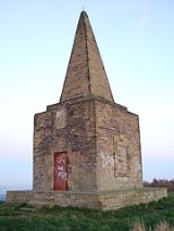
, BaxendenBaxendenBaxenden is a village and ward located in the Borough of Hyndburn in Lancashire, North-West England. Baxenden is sometimes known to the locals as ‘Bash’.- History :... - Beacon Fell Country ParkBeacon Fell Country ParkBeacon Fell is a fell in the civil parish of Goosnargh in Lancashire, England. It has been a Country Park since 1970. It falls within the Forest of Bowland Area of Outstanding Natural Beauty although it is separated from the other hills in the Forest...
- BelmontBelmont, LancashireBelmont is a village in Lancashire, England. It is close to Winter Hill between the towns of Bolton and Darwen. It has around 500 inhabitants and lies within the civil parish of North Turton in the unitary authority area of Blackburn with Darwen.-History:...
, BelthornBelthornBelthorn is a small moorland village situated to the south-east of Blackburn in Lancashire, England. It is about half a kilometre away from junction 5 of the M65 motorway, which runs from Colne to Preston....
, BickerstaffeBickerstaffeBickerstaffe is a village and civil parish in the West Lancashire district of Lancashire, England. According to the 2001 Census the population of the civil parish was 1,196, although the population of the electoral ward was slightly greater at 2,013....
, BillingtonBillington, LancashireBillington is a village in the Ribble Valley district of Lancashire. It lies between the town of Whalley and the village of Langho. It forms part of the Billington and Langho civil parish and contains the schools St Augustine's RC High School, St Leonard's Primary and St Mary's Primary.- External...
, - BisphamBispham, BlackpoolBispham is a village roughly one-and-a-half miles north of Blackpool town centre on the Fylde coast in the county of Lancashire, England.-Geography and administration:...
, Bispham GreenBispham GreenBispham Green is a village in the West Lancashire district of Lancashire, England. Bispham is the civil parish containing the village. The village has a population of 207 , and is located south of Mawdesley and north of Parbold.... - BlackamoorBlackamoor, LancashireBlackamoor is a village in Lancashire, England, to the south of Blackburn. It is located on the cross-roads between Lower Darwen and Guide, Lancashire where the B6231 crosses the old Roman Road from Manchester to Ribchester....
, BlackoBlackoBlacko is a village and civil parish within the Pendle district of Lancashire, England. According to the 2001 census it had a population of 595.The village is on the old turnpike road to Gisburn... - Blackburn, BlackburnshireBlackburnshireBlackburnshire was a hundred, or ancient division of the county of Lancashire, in northern England. It was centred on Blackburn, and covered an area approximately equal to modern day East Lancashire....
, Blackburn with DarwenBlackburn with DarwenBlackburn with Darwen is a unitary authority area in Lancashire, North West England. It consists of Blackburn, the small town of Darwen to the south of it, and the surrounding countryside.-Formation:... - BlackpoolBlackpoolBlackpool is a borough, seaside town, and unitary authority area of Lancashire, in North West England. It is situated along England's west coast by the Irish Sea, between the Ribble and Wyre estuaries, northwest of Preston, north of Liverpool, and northwest of Manchester...
, Blackpool Urban AreaBlackpool Urban AreaGreater Blackpool is the informal name for the urban area surrounding Blackpool in Lancashire, England. The ONS define a Blackpool Urban Area, with a population of 261,088 , down 0.1% from the 1991 figure of 261,355.... - BleasdaleBleasdaleBleasdale is a village and civil parish in the Wyre district of Lancashire, England, in the Forest of Bowland Area of Outstanding Natural Beauty at . The two sources of the River Brock lie within the parish...
, Bolton-by-BowlandBolton-by-BowlandBolton-by-Bowland is a village and civil parish in the Ribble Valley district of Lancashire, England. Prior to 1974, the village was part of Bowland Rural District in the West Riding of Yorkshire....
, Bolton-le-SandsBolton-le-SandsBolton-le-Sands is a large village and civil parish of the City of Lancaster in Lancashire, England. The parish had a population of 4,098 recorded in the 2001 census,...
, BowlandForest of BowlandThe Forest of Bowland, also known as the Bowland Fells, is an area of barren gritstone fells, deep valleys and peat moorland, mostly in north-east Lancashire, England. A small part lies in North Yorkshire, and much of the area was historically part of the West Riding of Yorkshire... - BorwickBorwickBorwick is a village and civil parish in the City of Lancaster district of Lancashire, England, about 8 miles north of Lancaster, on the Lancaster Canal. It is situated just south of the border with Cumbria. Borwick had until 1960 a station on the former Furness and Midland Joint Railway now Leeds...
, BremetennacumBremetennacumBremetennacum was a Roman fort which is now the village of Ribchester in Lancashire . The site is a Scheduled Ancient Monument. The first Roman activity on the site was the establishment of a timber fort believed to have been constructed during the campaigns of Petillius Cerialis around AD 72/3...
, BrethertonBrethertonBretherton is a small village and civil parish in the Borough of Chorley, Lancashire, England situated to the south west of Leyland and east of Tarleton. Its name suggests pre-conquest origins and its early history was closely involved with the manor house Bank Hall and the families who lived there...
, Brierfield, BrindleBrindle, LancashireBrindle is a small village and civil parish of the borough of Chorley, Lancashire, England. It is in the centre of a triangle between Preston, Blackburn, and Chorley. The area has little industry. Brindle is one of the most affluent areas in Lancashire , with average earnings over 33% higher than...
, BrockhallBrockhall, LancashireBrockhall is a village in the Ribble Valley, Lancashire and home to the training facilities for Blackburn Rovers F.C. The village is in the civil parish of Billington and Langho... - BroughtonBroughton, LancashireBroughton is a village and civil parish in the City of Preston, Lancashire, England, about north of Preston city centre. According to the 2001 census it had a population of 1,735...
, Buckshaw VillageBuckshaw VillageBuckshaw Village is a new residential and industrial area between the towns of Chorley and Leyland in Lancashire, the original area of Buckshaw being part of Euxton...
, BurnleyBurnleyBurnley is a market town in the Burnley borough of Lancashire, England, with a population of around 73,500. It lies north of Manchester and east of Preston, at the confluence of the River Calder and River Brun.... - BurscoughBurscoughBurscough is a village and civil parish within West Lancashire in North West England, to the north of both Ormskirk and Skelmersdale.-Growth:...
C
- CantsfieldCantsfieldCantsfield is a hamlet and civil parish in the City of Lancaster, in Lancashire, England, near the boundary with North Yorkshire. It is situated near the River Greta and on the A687 road near the junction with the A683. The parish had a population of 76 as of the 2001 census...
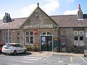
, CarnforthCarnforth- References :...
, CatforthCatforthCatforth is a village in the English civil parish of Woodplumpton, Lancashire. There is a village hall and the last remaining of Catforth's pubs, The Running Pump, is situated on Catforth Road, which is the village's main road. There is a Roman Catholic church and a primary school....
, CatonCaton, LancashireThe civil parish of Caton with Littledale is situated in Lancashire, England near the River Lune. The parish lies within the Forest of Bowland Area of Outstanding Natural Beauty and contains the villages of Caton, Brookhouse, Caton Green, Littledale and Townend.-History:The original settlement of...
, Charnock RichardCharnock RichardCharnock Richard is a small village and civil parish in the borough of Chorley, Lancashire, in England.-History:The village was named in the early 13th century by the local landowner, who gave the township his first name of Richard, to distinguish it from neighbouring Heath Charnock. The village is...
, ChippingChipping, LancashireChipping is a village and civil parish of the borough of Ribble Valley, Lancashire, England, within the Forest of Bowland Area of Outstanding Natural Beauty. In the 2001 census, the parish had a population of 1,046....
, Chingle HallChingle hallChingle Hall dates from around 1300. It is located in the township of Whittingham near Preston, England. It was originally built by the Singleton family and owned by them until Eleanor Singleton, the last of the line died in 1585. The house then passed to the Wall family through the marriage of... - ChorleyChorleyChorley is a market town in Lancashire, in North West England. It is the largest settlement in the Borough of Chorley. The town's wealth came principally from the cotton industry...
, ChurchChurch, LancashireChurch is a large village in Hyndburn, Lancashire, England; situated a mile west of Accrington. The local travel links are located less than a mile from the village centre to Church and Oswaldtwistle railway station and to Blackpool Airport. Also, the main road running through the village is the...
, Churchtown, Claughton-on-Brock, ClaughtonClaughton, LancasterClaughton is a small village and civil parish in the City of Lancaster in Lancashire, England. The village is on the A683 road east of Lancaster and as of the 2001 census has a population of 132.... - Clayton-le-MoorsClayton-le-MoorsClayton-le-Moors is a township in Hyndburn in Lancashire, England. The town is locally referred to as 'Clayton'. To the west lies Rishton, to the north Great Harwood, and two miles to the south, Accrington. Clayton-le-Moors is situated on the A680 road alongside the M65 motorway.-Description:It is...
, Clayton-le-WoodsClayton-le-WoodsClayton-le-Woods is a large village and civil parish of the Borough of Chorley, in Lancashire, England. According to the United Kingdom Census 2001 it has a population of 14,528.-Geography:...
, Clayton BrookClayton BrookClayton Brook is a large residential estate in Lancashire, between the city of Preston and the town of Chorley. It forms part of the Clayton-le-Woods civil parish, and is in the Clayton-le-Woods North ward of the borough of Chorley...
, CleveleysCleveleysCleveleys is a town on the Fylde Coast of Lancashire, England, about 4 miles north of Blackpool and 2 miles south of Fleetwood...
, CliftonClifton, LancashireClifton is a village in the English county of Lancashire and in the district of Fylde. The village is part of the civil parish of Newton with Clifton...
, - ClitheroeClitheroeClitheroe is a town and civil parish in the Borough of Ribble Valley in Lancashire, England. It is 1½ miles from the Forest of Bowland and is often used as a base for tourists in the area. It has a population of 14,697...
, ClivigerClivigerCliviger is a civil parish within the Borough of Burnley, in Lancashire, England. It is situated to the southeast of Burnley, and northwest of Todmorden and has a population of 2,350...
, ClowbridgeClowbridgeDunnockshaw and Clowbridge is a civil parish in the borough of Burnley, in Lancashire, England. The parish is situated between Burnley and Rawtenstall.In the 2001 census, the parish had a population of 212....
, CockerhamCockerhamCockerham is a small village and civil parish within the City of Lancaster in Lancashire, England. It is south of Lancaster and north-northwest of Preston... - ColneColneColne is the second largest town and civil parish in the Borough of Pendle in Lancashire, England, with a population of 20,118. It lies at the eastern end of the M65, 6 miles north-east of Burnley, with Nelson immediately adjacent, in the Aire Gap with two main roads leading into the Yorkshire...
, CoppullCoppullCoppull is a village and civil parish in Lancashire, England. It is part of the borough of Chorley, lies around above sea level and has a population of around 7,600. It is bounded by Whittle Brook, Clancutt Brook, the River Yarrow, Eller Brook, Hic-Bibi Brook and Stars Brook...
, Cowan BridgeCowan BridgeCowan Bridge is a village in the English county of Lancashire.It is south-east of the town of Kirkby Lonsdale where the main A65 road crosses the Leck Beck...
, CrawshawboothCrawshawboothCrawshawbooth is a small village on the edge of the Pennine Hills in England just north of the market town of Rawtenstall, Lancashire, and just south of Loveclough. It is part of the valley of Rossendale, an ancient royal hunting ground...
, CrostonCroston-External links:**** chorley.gov.uk....
, CuerdenCuerdenCuerden is a village and civil parish of the Borough of Chorley, in Lancashire, England. It is situated between Bamber Bridge and Leyland, and has a population of 77.-History:The name derives from the Welsh cerdin, the plural of cerdinen, "rowan"....
D
- DaltonDalton, LancashireDalton is a village and civil parish in West Lancashire, near Skelmersdale and south of the River Douglas. Dalton was listed in the Domesday Book, and soon after the Norman conquest became part of the Barony of Manchester. It remained part of the Manchester fee as late as 1733...
, DarwenDarwenDarwen is a market town and civil parish located within Lancashire, England. Along with its northerly neighbour, Blackburn, it forms the Borough of Blackburn with Darwen — a unitary authority area...
, Lower DarwenLower DarwenLower Darwen is a village in the unitary borough of Blackburn with Darwen, in the town of Darwen, in the county of Lancashire. It is located between the towns of Blackburn and Darwen. Nearby places include Ewood and Blackamoor. It is situated in the valley of the River Darwen...
, DolphinholmeDolphinholme-History:In the 18th and 19th centuries the village played an important part in the industrial revolution. Slave trader Thomas Hinde founded a mill in Lower Dolphinholme in 1795....
, - DownhollandDownhollandDownholland is a civil parish in Lancashire, England on the West Lancashire Coastal Plain. The area contains several villages including Haskayne, Barton and Downholland Cross, and the Leeds and Liverpool Canal and the A5147....
, Downholland CrossDownholland CrossDownholland Cross is a small village in the county of Lancashire on the West Lancashire Coastal Plain. It is to the north of Lydiate on the A5147 and the Leeds and Liverpool Canal....
F
- FaringtonFaringtonFarington is a small village and civil parish in the South Ribble local government district of Lancashire, England.-Geography:Situated to the immediate north of Leyland, Farington consists of villages, farms and mossland, modern residential development and an industrial area around the Leyland...
, Farleton, FleetwoodFleetwoodFleetwood is a town within the Wyre district of Lancashire, England, lying at the northwest corner of the Fylde. It had a population of 26,840 people at the 2001 Census. It forms part of the Greater Blackpool conurbation. The town was the first planned community of the Victorian era...
, - Forest of BowlandForest of BowlandThe Forest of Bowland, also known as the Bowland Fells, is an area of barren gritstone fells, deep valleys and peat moorland, mostly in north-east Lancashire, England. A small part lies in North Yorkshire, and much of the area was historically part of the West Riding of Yorkshire...
, FoulridgeFoulridgeFoulridge is a small village and civil parish in Pendle, Lancashire, close to the border with North Yorkshire in England. It is situated just beyond Colne, on the route from the M65 to Skipton, and is an important stopping point on summit pound of the Leeds and Liverpool Canal, just before it...
, Foulridge Tunnel, FreckletonFreckletonFreckleton is a village and civil parish on the Fylde coast in Lancashire, England, to the south of Kirkham and east of the seaside resort of Lytham St. Annes. It has a population of 6,045.Freckleton is near to Warton, with its links to BAE Systems...
, FulwoodFulwood, LancashireFulwood is an unparished area of the City of Preston, Lancashire, England, about north of the city centre. It had a population of 33,171 in 2001.- Economy and society :Fulwood remains a distinctive division of Preston...
G
- GalgateGalgateGalgate is a village in the City of Lancaster, just south of Lancaster University, and about south of Lancaster itself in the English county of Lancashire.-Etymology:...
, GarstangGarstangGarstang is a town and civil parish within the Wyre borough of Lancashire, England. It is ten miles north-northwest of the city of Preston and eleven miles south of Lancaster, and had a total resident population of 4,074 in 2001....
, GisburnGisburnGisburn is a village, civil parish and ward within the Ribble Valley borough of Lancashire, England. It lies northeast of Clitheroe. The parish of Gisburn had a population of 506, and the ward had 1287, recorded in the 2001 census....
, Glasson DockGlasson DockGlasson Dock, also known as Glasson, is a village in England, south of Lancaster, at the mouth of the River Lune. It is in the City of Lancaster district of Lancashire.-History:...
, GoosnarghGoosnarghGoosnargh is a village and civil parish on the north side of Preston, Lancashire, England. The village lies between Broughton and Longridge, and mostly lies in the civil parish of Whittingham, although the ancient centre lies in the civil parish of Goosnargh...
, - Great AltcarGreat AltcarGreat Altcar is a village and civil parish in West Lancashire, close to Formby on the West Lancashire Coastal Plain. The name Altcar is Norse meaning "marsh by the Alt". The church of St Michael and All Angels is a timber framed structure dating from 1879....
, Great EcclestonGreat EcclestonGreat Eccleston is a village and civil parish in the English county of Lancashire, situated on a coastal plain called the Fylde. The village lies to the south of the River Wyre and the A586 road, approximately upstream from the port of Fleetwood...
, Great HarwoodGreat HarwoodGreat Harwood is a small town in the Hyndburn district of Lancashire, England, north-east of Blackburn.-History:Great Harwood is a town with a industrial heritage. The Mercer Hall Leisure Centre in Queen Street and the town clock pay tribute to John Mercer , the 'father' of Great Harwood, who... - GressinghamGressinghamGressingham is a small village and civil parish in the City of Lancaster in the English county of Lancashire. It is north of the River Lune and across the river from Hornby. In the 2001 census, it had a population of 153....
, GrimsarghGrimsarghGrimsargh is a village and civil parish in the City of Preston, Lancashire, England. According to the 2001 census the parish had a population of 2,164. The parish is part of the electoral ward of Preston Rural East.-Geography:...
H
- HaggateHaggateHaggate is a small village within the parish of Briercliffe, situated three miles north of Burnley, Lancashire. The village is mostly built around a small crossroads, with routes towards Burnley, Nelson and Todmorden. The first buildings in the village date from the 16th century, when the Hare and...
, HalsallHalsallHalsall is a village and civil parish in West Lancashire, England, located close to Ormskirk on the A5147 and Leeds and Liverpool Canal. The parish has a population of 1,921 and covers an area of 28.31 square kilometres...
, HaltonHalton, LancashireHalton-with-Aughton is a civil parish located east of Lancaster, England on the north bank of the River Lune. The main settlement is the village of Halton-on-Lune, commonly just called Halton, in the west, and the parish stretches to the hamlet of Aughton in the east...
, HambletonHambleton, LancashireHambleton is a village and civil parish in the English county of Lancashire. It is situated on a coastal plain called the Fylde and in an area east of the River Wyre known locally as Over Wyre. Hambleton lies approximately north-east of its post town, Poulton-le-Fylde, and about north-east of the...
, HaslingdenHaslingdenHaslingden is a small town in Rossendale, Lancashire, England. It is north of Manchester. The name means 'valley of the hazels', though the town is in fact set on a high and windy hill. In the early 20th century Haslingden had the status of a municipal borough, but following local government...
, HeapeyHeapeyHeapey is a village and civil parish of the Borough of Chorley, in Lancashire, England. The village is two miles from Chorley and on the western fringe of the West Pennine Moors. In 2001 the population was 955.- History:...
, HelmshoreHelmshoreHelmshore is a village in the Rossendale Valley, Lancashire, England. It is situated south of Haslingden, broadly between the A56 and the B6235, approximately 16 miles north of Manchester.- Early history :... - Hesketh BankHesketh Bank-Economy:Due to the village's position on the West Lancashire Coastal Plain it has a rich soil, suitable for the farming of flowers and vegetables - this is still the main economic activity in the area.A Booths supermarket opened on 11 November 2010.-Transport:...
, HeyshamHeyshamHeysham is a large coastal village near Lancaster in the county of Lancashire, England. Overlooking Morecambe Bay, it is a ferry port with services to the Isle of Man and Ireland. Heysham is the site of two nuclear power stations which are landmarks visible from hills in the surrounding area...
, HighamHigham, LancashireHigham is a village in the Borough of Pendle in Lancashire, England, south of Pendle Hill. The civil parish is named "Higham with West Close Booth". The village is north-east of Padiham and about south west of Nelson along the A6068 road. At the 2001 census Higham had a population of 808 in 338...
, - HoghtonHoghtonHoghton is a small village and civil parish of the Borough of Chorley in Lancashire, England. According to the United Kingdom Census 2001 it has a population of 867...
, HolcombeHolcombe, BuryHolcombe is a village in Ramsbottom ward, Metropolitan Borough of Bury, in Greater Manchester, England. It is situated south of Haslingden, east of Edgworth, west of Ramsbottom, and north of Tottington. The name comes from the Celtic cwm meaning valley, and the Old English hol, meaning deep or...
, HolmeswoodHolmeswoodHolmeswood is a small agricultural village in West Lancashire, in the north-west of England. It lies just north of the Martin Mere Wetland Centre and to the south of North Meols about six miles east of the Irish Sea coast at Southport....
, Hornby, HuncoatHuncoatHuncoat is a small village in Lancashire, England; situated in the North West. It is located to the east of Accrington.Huncoat railway station is on the East Lancashire Line.-Origins:...
, Hundred EndHundred EndThere is an enclosed salt marsh that is used for grazing cattle and the marshes are managed by the RSPB.-Religion:Hesketh Moss Methodist Church is a small chapel which was built by the local farmers of the hamlet, the nearest Church of England Church are in Tarleton and Banks.-Education:The hamlet...
L
- Lancaster
- LanghoLanghoLangho is a small rural village north of Blackburn in the Ribble Valley, Lancashire, England. It is part of the parish of Billington and Langho. The village is linked with Blackburn and Clitheroe by the A666 road and is served by Langho railway station on the Ribble Valley Line. To the north,...
, Larbreck, - LathomLathomLathom is a village and civil parish in Lancashire, England, about 5 km northeast of Ormskirk. It is in the district of West Lancashire, and with the parish of Newburgh forms part of Newburgh ward...
- LeylandLeyland, LancashireLeyland is a town in the South Ribble borough of Lancashire, England, approximately six miles south of the city of Preston.Throughout the 20th and 21st century, the community has seen a large growth in industry, population and farming, due to the establishment of Leyland Motors, housing...
, - Little EcclestonLittle EcclestonLittle Eccleston with Larbreck is a civil parish on the southern bank of the River Wyre on the Fylde in the English county of Lancashire. The river is crossed by Cartford Bridge, a toll bridge, an unusual feature in England....
, LongridgeLongridgeLongridge is a small town and civil parish in the borough of Ribble Valley in Lancashire, England. It is situated north-east of the city of Preston, at the western end of Longridge Fell, a long ridge above the River Ribble. Its nearest neighbours are Grimsargh and the Roman town of Ribchester , ...
, LongtonLongton, Lancashire-External links:**...
, Lostock HallLostock HallLostock Hall is a small suburban village within the South Ribble borough of Lancashire, England. It is located on the south side of the River Ribble, some south of Preston and north of Leyland. It is bordered on its southeastern side by the interchange for the M6, M61 and M65 motorways...
, Lower DarwenLower DarwenLower Darwen is a village in the unitary borough of Blackburn with Darwen, in the town of Darwen, in the county of Lancashire. It is located between the towns of Blackburn and Darwen. Nearby places include Ewood and Blackamoor. It is situated in the valley of the River Darwen...
, LythamLytham St AnnesLytham St Annes is a conurbation in the Fylde district of Lancashire, England. The neighbouring towns of Lytham and St-Anne's-on-the-Sea have grown together and now form a seaside resort...
M
- MawdesleyMawdesleyMawdesley is a village and civil parish of the Borough of Chorley in Lancashire, England. According to the 2001 Census it had a population of 1,787.-History:...
, MellingMelling, LancashireMelling-with-Wrayton is a civil parish in the City of Lancaster in the English county of Lancashire. It includes the village of Melling and the hamlet of Wrayton, to the north east The parish had a population of 290 recorded in the 2001 census,...
, MellorMellor, LancashireMellor is a village situated in the Borough of Ribble Valley in Lancashire, England. It is reasonably large in size for a village, with two churches, one Church of England Parish Church and one Methodist, as well as a primary school, three public houses and a hotel...
, Mellor BrookMellor BrookMellor Brook is a village which straddles the borders of the Boroughs of Ribble Valley and South Ribble in Lancashire, England.The village of Mellor Brook is approximately north-west of Blackburn....
, - Midge HallMidge HallMidge Hall is a small village on the outskirts of Leyland in the borough of South Ribble, Lancashire, England.Notable features include the Midge Hall Pub, a mill which produces animal feed and a test track for cars and wagons from the Leyland Trucks factory....
, MiddletonMiddleton, LancashireMiddleton is a village and civil parish within the City of Lancaster in Lancashire, England, between Heysham and Overton. It had a population of 521 recorded in the 2001 census....
, MorecambeMorecambeMorecambe is a resort town and civil parish within the City of Lancaster in Lancashire, England. As of 2001 it has a resident population of 38,917. It faces into Morecambe Bay...
, Moss Side, Moss Side, Much HooleMuch HooleMuch Hoole is a village and civil parish in the borough of South Ribble, Lancashire, England. The parish of Much Hoole had a population of 1,851 at the time of the 2001 census.-History:... - MyerscoughMyerscoughMyerscough is an English surname, which is most common in Lancashire. The name originates from the hamlet of Myerscough, in the parish of Myerscough and Bilsborrow near Preston, which has been an important land holding by the Duchy of Lancaster since 1267...
O
- OakenshawOakenshaw, LancashireOakenshaw is a village in Lancashire, in England. It is situated between Clayton-le-Moors and Great Harwood....
, OrmskirkOrmskirkOrmskirk is a market town in West Lancashire, England. It is situated north of Liverpool city centre, northwest of St Helens, southeast of Southport and southwest of Preston.-Geography and administration:...
, OswaldtwistleOswaldtwistleOswaldtwistle is a town within the Hyndburn borough of Lancashire, England. It lies on the course of the Leeds and Liverpool Canal, east-southeast of Blackburn and is contiguous to Accrington.-History:...
, Over KelletOver KelletOver Kellet is a village and civil parish near Carnforth in the English county of Lancashire. The parish, which is in the City of Lancaster, includes the village of Capernwray, at its northern end, and has a population of 778...
, OvertonOverton, LancashireOverton is a village and civil parish within the City of Lancaster in Lancashire, England. It is located to the south west of Lancaster, between Heysham and the estuary of the River Lune. Neighbouring villages include Middleton and Sunderland Point; Glasson is on the opposite side of the river...
, Overtown, Over WyreOver WyreOver Wyre is the collective name given to a group of villages in Lancashire, England, situated on the Fylde, to the north of the River Wyre. The group is usually considered to include Hambleton, Stalmine, Knott End-on-Sea, Preesall, Pilling and Out Rawcliffe...
P
- PadihamPadihamPadiham is a small town and civil parish on the River Calder, about west of Burnley and south of Pendle Hill, in Lancashire, England. It is part of the Borough of Burnley but also has its own town council with varied powers.-History:...
- ParboldParboldParbold is a large commuter village and civil parish in the county of Lancashire, England.-Local government:The 83 hectares of the 'urban settlement' of Parbold has a population of 2,700. This settlement forms part of the larger Parbold ward Parbold is a large commuter village and civil parish in...
- PendlePendlePendle is a local government district and borough of Lancashire, England. It adjoins the Lancashire boroughs of Burnley and Ribble Valley, the North Yorkshire district of Craven and the West Yorkshire districts of Calderdale and the City of Bradford...
, Pendle CollegePendle CollegePendle College is one of the constituent colleges of the University of Lancaster. Founded in 1974, the college is named after the Pendle region of the east of Lancashire, which is dominated by Pendle Hill. The term "Pendle" is associated with a great deal of fantasy and legend...
, Pendle Heritage CentrePendle Heritage CentrePendle Heritage Centre is a museum and visitor centre in Barrowford, Lancashire, England, dedicated to the history and heritage of Pendle. The heritage centre occupies Park Hill, a two-storey former farmhouse which has a 1661 date stone but was developed over an extended period between the 16th...
, Pendle HillPendle HillPendle Hill is located in the north-east of Lancashire, England, near the towns of Burnley, Nelson, Colne, Clitheroe and Padiham, an area known as Pendleside. Its summit is above mean sea level. It gives its name to the Borough of Pendle. It is an isolated hill, separated from the Pennines to the...
, Pendle WaterPendle WaterPendle Water is a minor river in Lancashire.Rising on Pendle Hill, Pendle Water cuts a deep valley between Barley Moor and Spence Hill, where it feeds the two Ogden Reservoirs, before making its way eastward through Roughlee, collecting Blacko Water, draining the valley near Wheathead, at Water... - PenworthamPenwortham-Landmarks:Penwortham Priory was built for the Rawsthorne family and redesigned by the Cumbrian architect George Webster. The priory was demolished due to the rapid expansion of the area and the need for new housing...
- Poulton-le-FyldePoulton-le-FyldePoulton-le-Fylde is a market town in Lancashire, England, situated on the coastal plain called the Fylde. As of the 2001 United Kingdom census, it had a population of 18,264. There is evidence of human habitation in the area from 12,000 years ago and several archaeological finds from Roman...
, PreesallPreesallPreesall is a town and civil parish in Lancashire, England. The parish covers the eastern bank of the estuary of the River Wyre, including Knott End-on-Sea, Pilling Lane and the village of Preesall itself...
, Preston, Priest HuttonPriest HuttonPriest Hutton is a village and civil parish in Lancashire, England. It is located north east of Carnforth, in the City of Lancaster, close to the boundary with Cumbria. In the 2001 census Priest Hutton had a population of 177....
R
- RawtenstallRawtenstallRawtenstall is a town at the centre of the Rossendale Valley, in Lancashire, England. It is the seat for the Borough of Rossendale, in which it is located. The town lies 18 miles north of Manchester, 22 miles east of the county town of Preston and 45 miles south east of Lancaster...
, Read, RibchesterRibchesterRibchester is a village and civil parish within the Ribble Valley district of Lancashire, England. It lies on the banks of the River Ribble, northwest of Blackburn and east of Preston.The village has a long history with evidence of Bronze Age beginnings...
, RishtonRishtonRishton is a small town in the Hyndburn district of Lancashire, England, about west of Clayton-le-Moors and north-east of Blackburn. It was an urban district from 1894 to 1974....
, RivingtonRivingtonRivington is a small village and civil parish of the Borough of Chorley, Lancashire, England, occupying . It is about southeast of Chorley and about northwest of Bolton. Rivington is situated on the fringe of the West Pennine Moors, at the foot of Rivington Pike... - Ribble ValleyRibble ValleyRibble Valley is a local government district with borough status within the non-metropolitan county of Lancashire, England. Its council is based in Clitheroe. Other places include Whalley, Longridge and Ribchester. The area is so called due to the River Ribble which flows in its final stages...
, Ribblesdale, - RossendaleRossendaleRossendale is a local government district with borough status. It is made up of a number of small former mill towns in Lancashire, England centered around the valley of the River Irwell in the industrial North West...
- RuffordRufford, Lancashire-Population :-Economy:The village is largely rural with little or no industry. The farmland is grade one agricultural land. In the early 20th century the village was described as "one of the prettiest in South Lancashire" and was a destination for day trips from neighbouring towns...
S
- SalwickSalwickSalwick is a village between Kirkham and Preston in Lancashire, England. The village is largely rural and is an extension of the smaller Clifton to the south. It is in the borough of Fylde, and in the Parliamentary Constituency of Fylde, and forms part of the civil parish of Newton with Clifton...
, SamlesburySamlesburySamlesbury is a small village and civil parish in the South Ribble borough of Lancashire, England. Samlesbury Hall, a historic house, is located in the village as well as Samlesbury Aerodrome...
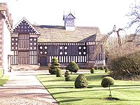
, Samlesbury HallSamlesbury HallSamlesbury Hall is an historic house in Samlesbury, a village in Lancashire, England. It was built in 1325 by Gilbert de Southworth and was the primary home of the Southworth Family until the early 1600s. Samlesbury Hall was built possibly to replace an earlier building destroyed during a raid by...
, Samlesbury AerodromeSamlesbury AerodromeSamlesbury Aerodrome is a disused airfield at Balderstone near Samlesbury, in the Ribble Valley district of Lancashire. The aerodrome is owned by defence company BAE Systems which uses the site for manufacturing of several aircraft types...
, ScarisbrickScarisbrickScarisbrick is a village and civil parish in West Lancashire, England. It is spread out along the A570 so there is no real village centre, though the junction with the A5147 is close to the geographic centre...
, ScortonScorton, LancashireScorton is a small village near the River Wyre, in the Wyre district of Lancashire, England. It is located north of Garstang. The name means "farmstead near a ditch or ravine"-Background:...
, ShawforthShawforthShawforth is a suburban village within the Rossendale borough of Lancashire, England. It lies amongst the South Pennines along the course of the River Spodden and A671 road...
, Shirdley HillShirdley HillShirdley Hill is a small village in the civil parish of Halsall, Lancashire, England, and is situated on the West Lancashire Coastal Plain. It is reached by B roads from either the A5147 or the A570.... - SilverdaleSilverdale, LancashireSilverdale is a village and civil parish within the City of Lancaster in Lancashire, England. The village stands on Morecambe Bay, near the border with Cumbria, north west of Carnforth and north of Lancaster. The parish had a population of 1,545 recorded in the 2001 census.Silverdale forms part...
, SimonswoodSimonswoodSimonswood is a civil parish in the West Lancashire district of Lancashire, England. At the 2001 Census, the population was 130.It was originally a township associated with the parish of Walton on the Hill, and became a separate civil parish in 1866....
, SkelmersdaleSkelmersdaleSkelmersdale is a town in West Lancashire, England. It lies on high-ground on the River Tawd, to the west of Wigan, to the northeast of Liverpool, south-southwest of Preston. As of 2006, Skelmersdale had a population of 38,813, down from 41,000 in 2004. The town is known locally as Skem.The...
, SlaidburnSlaidburnSlaidburn is a village and civil parish within the Ribble Valley district of Lancashire, England. With a population in 2001 of just under 300, it covers just over 5000 acres of the Forest of Bowland...
, Slyne, Squires Gate - St AnnesLytham St AnnesLytham St Annes is a conurbation in the Fylde district of Lancashire, England. The neighbouring towns of Lytham and St-Anne's-on-the-Sea have grown together and now form a seaside resort...
, StainingStaining, LancashireStaining is a village and civil parish in Lancashire, England, situated on a coastal plain called the Fylde. it is close to the seaside resorts of Blackpool and Lytham St Annes, as well as the market town of Poulton-le-Fylde. In the 2001 United Kingdom Census, the parish had a population of 2,312....
, Stanhill, StubbinsStubbinsStubbins is an industrial village in the southern part of the Rossendale Valley, Lancashire.It is half a mile north of Ramsbottom town centre on the A676 between Bolton and Edenfield. For local government purposes, it receives services from Rossendale Borough Council and Lancashire County Council...
, Sunderland PointSunderland PointSunderland, commonly known as Sunderland Point, is a small village among the marshes, on a windswept peninsula between the mouth of the River Lune, and Morecambe Bay, in the City of Lancaster district of Lancashire, England...
T
- TarletonTarleton-Population :-Economy:As a result of soil on the former mossland, a major economic activity in Tarleton is market gardening, particularly growing salad crops....
, TathamTatham, LancashireTatham is a village and civil parish in the City of Lancaster in Lancashire, England. It has a population of 393.A large part of the parish of Tatham is an upland area, known as Tatham Fells, which includes the largest settlement in Tatham, Lowgill; its highest point, at Ward's Stone; and the...
, TewitfieldTewitfieldTewitfield is a village in Lancashire, England, UK, near Borwick and Carnforth, and in the parish of Priest Hutton.Tewitfield Locks is the current terminus of the navigable Lancaster Canal, and the Lancaster Canal Trust, the Northern Reaches Restoration Group and others are campaigning for the...
, ThorntonThornton, LancashireThornton is a village on the Fylde, in Lancashire, England, about four miles north of Blackpool and two miles south of Fleetwood. It is in the Borough of Wyre...
, TockholesTockholesTockholes is a village and civil parish which forms part of the Blackburn with Darwen unitary authority in the North west of England. Tockholes consists of the village of Tockholes itself and the Hamlet of Ryal Fold, and has a population of 454...
, TrawdenTrawdenTrawden is a medium sized village in Trawden Forest Parish of Pendle, Lancashire, England, situated at the foot of Boulsworth Hill. Agriculture was the main industry of the village and surrounding area, although it did have several mills. Most of these have now been demolished for, or converted to...
, Trough of BowlandTrough of BowlandThe Trough of Bowland is a valley and high pass in the Forest of Bowland Area of Outstanding Natural Beauty, Lancashire, England.The pass, reaching above sea level at the head of the valley, links to Wyresdale, dividing the upland core of Bowland into two main blocks...
, TunstallTunstall, LancashireTunstall is a village in north Lancashire, England . It is northeast of Lancaster on the A683 road between Lancaster and Kirkby Lonsdale. In the 2001 census the civil parish of Tunstall had a population of 105....
,
W
- Walton-le-DaleWalton-le-DaleWalton-le-Dale is a village in the Borough of South Ribble, in Lancashire, England. It lies on south bank of the River Ribble, and the south-side of the city of Preston, adjacent to Bamber Bridge.-Toponymy:...
, WartonWarton, FyldeWarton is a village on the Fylde in Lancashire, England.The village is about six miles from Preston and eight miles from Blackpool. It is located on the banks of the River Ribble, close to its entry into the Irish Sea. It is best known for its airfield, BAE Warton and its associated aircraft works...
, WaterfootWaterfoot, RossendaleWaterfoot is a small Rossendale mill-town at between Rawtenstall and Bacup in Lancashire where the B6238 from Burnley meets the A681. It is where the River Whitwell meets the River Irwell.- History :...
, WenningtonWennington, LancashireWennington is a civil parish in the City of Lancaster district in Lancashire, England. The parish of Wennington had a population of 102 recorded in the 2001 census,.... - West Lancashire Coastal PlainWest Lancashire Coastal PlainThe West Lancashire Coastal Plain is a large area in the south west of Lancashire, England.The plain stretches from the Rimrose Valley in Seaforth, near Liverpool on the Mersey, to the south, to Preston on the Ribble, to the north. To the east, the plain is bounded by the foothills of the Pennines,...
- West Pennine MoorsWest Pennine MoorsThe West Pennine Moors cover an area of approximately of moorland and reservoirs in Lancashire and Greater Manchester, England.The West Pennine Moors are separated from the main Pennine range by the Irwell Valley. The moorland includes Withnell, Anglezarke and Rivington Moors in the extreme west,...
- WhalleyWhalley, LancashireWhalley is a large village in the Ribble Valley on the banks of the River Calder in Lancashire, England. It is overlooked by Whalley Nab, a large picturesque wooded hill over the river from the village....
- WhitechapelWhitechapel, LancashireWhitechapel is a tiny hamlet in the civil parish of Goosnargh in Lancashire, England. It lies on the border of the Forest of Bowland near the foot of Beacon Fell, and close to the neighbouring village of Inglewhite. Its name is marked as White Chapel on some maps.The area was known as "Threlfall"...
, White CoppiceWhite CoppiceWhite Coppice is a hamlet near Chorley, Lancashire, England. It was the most populated part of the township of Anglezarke in the 19th century. Close to the settlement in the early 19th century were quarries and small coal mines. The hamlet lies to the north of Anglezarke Reservoir in the Rivington... - WhittingtonWhittington, LancashireWhittington is a small settlement and civil parish in Lancashire, England, forming part of a cluster of sites along the Lune valley, each with evidence of a motte - as with Melling and Arkholme...
, WhitworthWhitworth, LancashireWhitworth is a town and civil parish within the Borough of Rossendale in Lancashire, England. It is set amongst the foothills of the Pennines, between the towns of Bacup, to the north, and Rochdale, to the south. It has a population of 7,263....
, WilpshireWilpshireWilpshire is a village and civil parish in the county of Lancashire, England. It is north of Blackburn, and forms part of the town's urban area, although it is in the Ribble Valley local government district... - Winter Hill, Lancashire, WithnellWithnellWithnell is a village and civil parish in the Borough of Chorley, Lancashire, England. According to the 2001 census it had a population of 3,631. Withnell is about five miles north-east of Chorley itself and about away from Blackburn. It constituted an urban district from 1894 to 1974...
- WorsthorneWorsthorneWorsthorne is a rural village on the eastern outskirts of Burnley in Lancashire, England. The parish of Worsthorne-with-Hurstwood has a population of 2,986. The village was known as Worthesthorn in 1202, which means thorn tree of a man named 'Weorth'....
, WrayWray, LancashireWray is a small village in Lancashire, part of the civil parish of Wray-with-Botton, in the City of Lancaster district. Wray is the point at which the River Roeburn joins the River Hindburn....
, Wrea GreenWrea GreenWrea Green is a village in the Fylde borough of Lancashire, England. It lies about 2 miles west of Kirkham. Along with the village of Ribby, it forms the civil parish Ribby with Wrea....
, WrightingtonWrightingtonWrightington is a civil parish in West Lancashire, England, with an area of 3,915½ acres. The surface is hilly, rising to over 400 ft. at Harrock on the border of Parbold, and then falling to the north, north-east and south-east. On the southern border, the boundary at Appley Bridge touches...