
Forest of Bowland
Encyclopedia
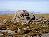
The Forest of Bowland, also known as the Bowland Fells, is an area of barren gritstone
fell
s, deep valleys and peat
moorland
, mostly in north-east Lancashire
, England. A small part lies in North Yorkshire
, and much of the area was historically part of the West Riding of Yorkshire
. Once described as the "Switzerland of England", it has been designated an Area of Outstanding Natural Beauty
(AONB) since 1964, and is used for grouse
shooting
, walking and cycling, though it is relatively unfrequented by tourists. One of the best known features of the area is Pendle Hill
, which is separated from the main part of the Forest of Bowland AONB by the Ribble
Valley.
In total, 13% of the AONB is designated a Site of Special Scientific Interest
for its important areas of heather
moorland and blanket bog
. The area is nationally and internationally important for its upland bird populations – the hen harrier
is the symbol of the AONB. There are over 500 listed buildings and 18 scheduled monuments within the AONB.
The name "forest" is used in its traditional sense of "a royal hunting ground", and much of the land still belongs to the British Crown as part of the Duchy of Lancaster
. In the past wild boar, deer
, wolves, wild cat
s and game roamed the forest.
Bowland survives as the northwestern remainder of the ancient wilderness that once stretched over a huge part of England, encompassing the Forest of Bowland, Sherwood Forest
(Nottinghamshire
), the New Forest
(Hampshire
) and Savernake Forest
(Wiltshire
). While the Trough of Bowland
(the valley and high pass connecting the Wyre
(at Marshaw) and Langden Brook and dividing the upland core of Bowland into two main blocks) represents the area, to many, on account of its popularity, it is in fact only a small part of the wider Forest of Bowland area.
The hills on the western side of the Forest of Bowland attract walkers from Lancaster and the surrounding area. Overlooking Lancaster is Clougha Pike
, the western-most hill. The hills form a large horseshoe
shape with its open end facing west. Clockwise from Lancaster the hills are Clougha Pike
(413 m (1,355 ft)), Grit Fell
(468 m (1,535.4 ft)), Ward's Stone
(561 m (1,840.6 ft)), Wolfhole Crag
(527 m (1,729 ft)), White Hill (544 m (1,784.8 ft)), Whins Brow (476 m (1,561.7 ft)), Totridge (496 m (1,627.3 ft)), Parlick
(432 m (1,417.3 ft)), Fair Snape Fell
(510 m (1,673.2 ft)), Bleasdale
Moor (429 m (1,407.5 ft)), and Hawthornthwaite Fell
(478 m (1,568.2 ft)).
The area contains the geographic centre of Great Britain
which is close to the Whitendale Hanging Stones, around 4 miles (6.4 km) north of Dunsop Bridge
. The historical extent of Bowland Forest is divided into two large administrative townships, Great Bowland (Bowland Forest High
and Bowland Forest Low
) and Little Bowland (Bowland-with-Leagram
), but the modern-day AONB covers a much larger area.
The Bowland Challenge is an annual event in which teams of walkers navigate around a series of grid references over a ten hour period. Proceeds of the event go to support the Bowland Pennine Mountain Rescue Team.
There is a Forest of Bowland Suite by Lakeland composer Christopher Gibbs (b. 1938). WG Rigby's children's tale The Ring of Tima (1998) is set in the Forest of Bowland.
, Bowland was absorbed into Northumbria
in the 7th century. In turn, as Northumbrian influence waned, the westernmost areas of Bowland became part of Amounderness
, a territory forged by the Norse hold Agmundr in the early 10th century.
In 926, Amounderness was annexed by Aethelstan, king of the West Saxons, as a spoil of war. In 934, he granted it to Wulfstan I, Archbishop of York
. According to Aethelstan's grant, Amounderness at that time stretched "from the sea along the Cocker
to the source of that river, from that source straight to another spring which is called in Old English
, "Dunshop", thus down the riverlet to the Hodder
, in the same direction to the Ribble
and thus along that river through the middle of the channel to the sea". As such, Amounderness encompassed a significant portion of western and south-western Bowland.
Ekwall thus describes the eastern boundary of Amounderness as "being formed by the fells on the Yorkshire border"; a description which places the ancient boundary firmly within the modern-day Forest of Bowland. While it is difficult to pinpoint Dunshop, the confluence of the rivers Dunsop and Hodder at Dunsop Bridge
seems a likely locale, situated as it is close to the eastern mouth of the Trough of Bowland whose Grey Stone marks the line of the pre-1974 county boundary.
Contrary to the popular histories, the origins of the name "Bowland" have nothing to do with archery (“the land of the bow”) or with mediaeval cattle farms or vaccaries (Old Norse, buu-, farmstead). The name derives from the Old Norse boga-/bogi-, meaning a “bend in a river”. It is a 10th century coinage used to describe the topography of the Hodder basin, with its characteristic meandering river and streams.
The Domesday Bogeuurde is an instance of this usage – the placename thought to designate Barge Ford (formerly known as Boward), a ford that sits on the wide, pronounced bend of the Hodder at its confluence
with Foulscales Brook, due southwest of Newton.
Prior to the Norman Conquest, Bowland was held by Tostig, son of Godwin
, Earl of Wessex
. However, as feudal entities, the Forest
and Liberty
of Bowland were created by William Rufus sometime after Domesday and granted to his vassal Roger de Poitou, possibly to reward Poitou for his role in defeating the Scots army of Malcolm III in 1091-92. In all likelihood, it was this grant that subsumed the eastern portion of Amounderness into the Lordship of Bowland
for the first time.
By the end of the 11th century, the Forest and Liberty came into the possession of the De Lacy
s, Lords of Pontefract
. In 1102, along with the grant of the adjacent fee of Clitheroe
and further holdings in Hornby and Amounderness, they came to form the basis of what became known as the Honor of Clitheroe
.
In 1311, the Honor of Clitheroe was subsumed into the Earldom of Lancaster. Between 1351 and 1661, it was administered as part of the Duchy of Lancaster
. By the late 14th century, Bowland comprised a Royal Forest
and a Liberty
of ten manors spanning eight townships and four parishes and covered an area of almost 300 square miles (777 km²) on the historic borders of Lancashire and Yorkshire. The manors within the Liberty were Slaidburn
(Newton-in-Bowland, West Bradford
, Grindleton) Knowlmere
, Waddington
, Easington
, Bashall Eaves
, Mitton
, Withgill (Crook)
, Leagram, Hammerton
and Dunnow (Battersby)
.
In 1661, the 28 manors contained within the former Honor of Clitheroe, including the Forest and Liberty of Bowland, were granted by the Crown to General George Monck
as part of the creation of the Dukedom of Albermarle
. Monck had been a key figure in the restoration of Charles II
. The Lordship of Bowland
then descended through the Montagu
, Buccleuch
and Towneley
families.
Bowbearers of the Forest of Bowland have been appointed since the 12th century. A Bowbearer was originally a noble who acted as ceremonial attendant to the Lord of Bowland, latterly the king, by bearing (carrying) his hunting bow, but over the centuries the Bowbearer's role underwent many changes. At an early date, the Bowbearer was a “forester in fee”, holding his own feudal lands within the forest. The first record of such a Bowbearer, Uchtred de Bolton, dates from sometimes after 1157 (claims for an earlier holder of the office, Edwin, Comes de Bolton, in the late 11th century cannot be substantiated). At this time, the office covered the Forests of Bowland and Gilsland
in Cumberland
. The Boltons were Bowbearers across five generations until 1311 when the Forest of Bowland was inherited by Thomas, 2nd Earl of Lancaster as the result of a marriage settlement.
While the Bowbearer retained his forest fee well into the 16th century, he became subordinate to a Master Forester appointed by the Crown and his responsibilities grew nearer to those of a chief verderer
– an unpaid official appointed to protect vert and venison and responsible for supervising and assisting in the enforcement of forest laws. Perhaps the most notorious Bowbearer during this period was Nicholas Tempest, executed at Tyburn
in 1537 as one of the northern leaders of the Pilgrimage of Grace
, the Catholic uprising against Henry VIII
.
By the second half of the 17th century, two Bowbearers were being appointed as officers of the Bowland Forest courts. Over the course of the next three decades, as the last remnants of the ancient forest vanished, the office of Bowbearer was reduced to little more than an honorific. The Parker family of Browsholme Hall
today claim to be "hereditary Bowbearers of Bowland" but this claim cannot be supported by the historical evidence. While the Parkers certainly served as Bowbearers over a number of generations up until 1858, they were always subject to grants made by the Lord of Bowland and hold no hereditary right. This became apparent in April 2010 when it was reported that the current 16th Lord of Bowland had revived the office of Bowbearer and appointed Robert Parker the first Bowbearer of the Forest in almost 150 years.
The Forest of Bowland had its own forest courts – woodmote and swainmote – from early times. These appear to have been abandoned in the 1830s around the time of Peregrine Towneley’s acquisition of the Bowland Forest Estate. The halmote court at Slaidburn
was disbanded following the abolition of copyhold by the Law of Property Act in 1922. General forest law in Britain was finally repealed by statute in 1971, more than 900 years after its introduction by the Normans
. The original Bowland Forest courts appear to have been held at Hall Hill near Radholme Laund before moving to Whitewell
sometime in the 14th century.
St Hubert, the patron saint of hunting, is also patron saint of the Forest of Bowland and has a chapel dedicated to him in Dunsop Bridge
. This chapel was founded by Richard Eastwood of Thorneyholme, land agent to the Towneley family. Eastwood was the last known Bowbearer of the Forest of Bowland. An acclaimed breeder of racehorses and shorthorn cattle, he died in 1871 and is buried at St Hubert's.
Gritstone
Gritstone or Grit is a hard, coarse-grained, siliceous sandstone. This term is especially applied to such sandstones that are quarried for building material. British gritstone was used for millstones to mill flour, to grind wood into pulp for paper and for grindstones to sharpen blades. "Grit" is...
fell
Fell
“Fell” is a word used to refer to mountains, or certain types of mountainous landscape, in Scandinavia, the Isle of Man, and parts of northern England.- Etymology :...
s, deep valleys and peat
Peat
Peat is an accumulation of partially decayed vegetation matter or histosol. Peat forms in wetland bogs, moors, muskegs, pocosins, mires, and peat swamp forests. Peat is harvested as an important source of fuel in certain parts of the world...
moorland
Moorland
Moorland or moor is a type of habitat, in the temperate grasslands, savannas, and shrublands biome, found in upland areas, characterised by low-growing vegetation on acidic soils and heavy fog...
, mostly in north-east Lancashire
Lancashire
Lancashire is a non-metropolitan county of historic origin in the North West of England. It takes its name from the city of Lancaster, and is sometimes known as the County of Lancaster. Although Lancaster is still considered to be the county town, Lancashire County Council is based in Preston...
, England. A small part lies in North Yorkshire
North Yorkshire
North Yorkshire is a non-metropolitan or shire county located in the Yorkshire and the Humber region of England, and a ceremonial county primarily in that region but partly in North East England. Created in 1974 by the Local Government Act 1972 it covers an area of , making it the largest...
, and much of the area was historically part of the West Riding of Yorkshire
West Riding of Yorkshire
The West Riding of Yorkshire is one of the three historic subdivisions of Yorkshire, England. From 1889 to 1974 the administrative county, County of York, West Riding , was based closely on the historic boundaries...
. Once described as the "Switzerland of England", it has been designated an Area of Outstanding Natural Beauty
Area of Outstanding Natural Beauty
An Area of Outstanding Natural Beauty is an area of countryside considered to have significant landscape value in England, Wales or Northern Ireland, that has been specially designated by the Countryside Agency on behalf of the United Kingdom government; the Countryside Council for Wales on...
(AONB) since 1964, and is used for grouse
Red grouse
The Red Grouse is a medium sized bird of the grouse family which is found in heather moorland in Great Britain and Ireland. It is usually classified as a subspecies of the Willow Grouse but is sometimes considered to be a separate species Lagopus scoticus...
shooting
Shooting
Shooting is the act or process of firing rifles, shotguns or other projectile weapons such as bows or crossbows. Even the firing of artillery, rockets and missiles can be called shooting. A person who specializes in shooting is a marksman...
, walking and cycling, though it is relatively unfrequented by tourists. One of the best known features of the area is Pendle Hill
Pendle Hill
Pendle Hill is located in the north-east of Lancashire, England, near the towns of Burnley, Nelson, Colne, Clitheroe and Padiham, an area known as Pendleside. Its summit is above mean sea level. It gives its name to the Borough of Pendle. It is an isolated hill, separated from the Pennines to the...
, which is separated from the main part of the Forest of Bowland AONB by the Ribble
River Ribble
The River Ribble is a river that runs through North Yorkshire and Lancashire, in northern England. The river's drainage basin also includes parts of Greater Manchester around Wigan.-Geography:...
Valley.
In total, 13% of the AONB is designated a Site of Special Scientific Interest
Site of Special Scientific Interest
A Site of Special Scientific Interest is a conservation designation denoting a protected area in the United Kingdom. SSSIs are the basic building block of site-based nature conservation legislation and most other legal nature/geological conservation designations in Great Britain are based upon...
for its important areas of heather
Ericaceae
The Ericaceae, commonly known as the heath or heather family, is a group of mostly calcifuge flowering plants. The family is large, with roughly 4000 species spread across 126 genera, making it the 14th most speciose family of flowering plants...
moorland and blanket bog
Bog
A bog, quagmire or mire is a wetland that accumulates acidic peat, a deposit of dead plant material—often mosses or, in Arctic climates, lichens....
. The area is nationally and internationally important for its upland bird populations – the hen harrier
Hen Harrier
The Hen Harrier or Northern Harrier is a bird of prey. It breeds throughout the northern parts of the northern hemisphere in Canada and the northernmost USA, and in northern Eurasia. This species is polytypic, with two subspecies. Marsh Hawk is a historical name for the American form.It migrates...
is the symbol of the AONB. There are over 500 listed buildings and 18 scheduled monuments within the AONB.
The name "forest" is used in its traditional sense of "a royal hunting ground", and much of the land still belongs to the British Crown as part of the Duchy of Lancaster
Duchy of Lancaster
The Duchy of Lancaster is one of the two royal duchies in England, the other being the Duchy of Cornwall. It is held in trust for the Sovereign, and is used to provide income for the use of the British monarch...
. In the past wild boar, deer
Deer
Deer are the ruminant mammals forming the family Cervidae. Species in the Cervidae family include white-tailed deer, elk, moose, red deer, reindeer, fallow deer, roe deer and chital. Male deer of all species and female reindeer grow and shed new antlers each year...
, wolves, wild cat
Wild cat
The wildcat is a small cat with several subspecies and a very broad distribution, found throughout most of Africa, Europe, and southwest and central Asia into India, China, and Mongolia. It is a hunter of small mammals, birds, and other creatures of a similar or smaller size. Sometimes included is...
s and game roamed the forest.
Bowland survives as the northwestern remainder of the ancient wilderness that once stretched over a huge part of England, encompassing the Forest of Bowland, Sherwood Forest
Sherwood Forest
Sherwood Forest is a Royal Forest in Nottinghamshire, England, that is famous through its historical association with the legend of Robin Hood. Continuously forested since the end of the Ice Age, Sherwood Forest National Nature Reserve today encompasses 423 hectares surrounding the village of...
(Nottinghamshire
Nottinghamshire
Nottinghamshire is a county in the East Midlands of England, bordering South Yorkshire to the north-west, Lincolnshire to the east, Leicestershire to the south, and Derbyshire to the west...
), the New Forest
New Forest
The New Forest is an area of southern England which includes the largest remaining tracts of unenclosed pasture land, heathland and forest in the heavily-populated south east of England. It covers south-west Hampshire and extends into south-east Wiltshire....
(Hampshire
Hampshire
Hampshire is a county on the southern coast of England in the United Kingdom. The county town of Hampshire is Winchester, a historic cathedral city that was once the capital of England. Hampshire is notable for housing the original birthplaces of the Royal Navy, British Army, and Royal Air Force...
) and Savernake Forest
Savernake Forest
Savernake Forest is on a Cretaceous chalk plateau between Marlborough and Great Bedwyn in Wiltshire, England. Its area is approximately .It is privately owned by the Trustees of Savernake Estate, the Earl of Cardigan, and his family solicitor. Since 1939 the running of the forest has been...
(Wiltshire
Wiltshire
Wiltshire is a ceremonial county in South West England. It is landlocked and borders the counties of Dorset, Somerset, Hampshire, Gloucestershire, Oxfordshire and Berkshire. It contains the unitary authority of Swindon and covers...
). While the Trough of Bowland
Trough of Bowland
The Trough of Bowland is a valley and high pass in the Forest of Bowland Area of Outstanding Natural Beauty, Lancashire, England.The pass, reaching above sea level at the head of the valley, links to Wyresdale, dividing the upland core of Bowland into two main blocks...
(the valley and high pass connecting the Wyre
River Wyre
The River Wyre is a river in Lancashire, United Kingdom, which flows into the Irish Sea at Fleetwood. It is approximately 28 miles in length...
(at Marshaw) and Langden Brook and dividing the upland core of Bowland into two main blocks) represents the area, to many, on account of its popularity, it is in fact only a small part of the wider Forest of Bowland area.
The hills on the western side of the Forest of Bowland attract walkers from Lancaster and the surrounding area. Overlooking Lancaster is Clougha Pike
Clougha Pike
Clougha Pike is a hill in the Forest of Bowland in Lancashire, England. From the west it looms over the Conder Valley, the city of Lancaster and Lancaster University. It is visible from as far away as Barrow-in-Furness, South Lakeland mountains such as the Old Man of Coniston, and Blackpool Tower...
, the western-most hill. The hills form a large horseshoe
Horseshoe
A horseshoe, is a fabricated product, normally made of metal, although sometimes made partially or wholly of modern synthetic materials, designed to protect a horse's hoof from wear and tear. Shoes are attached on the palmar surface of the hooves, usually nailed through the insensitive hoof wall...
shape with its open end facing west. Clockwise from Lancaster the hills are Clougha Pike
Clougha Pike
Clougha Pike is a hill in the Forest of Bowland in Lancashire, England. From the west it looms over the Conder Valley, the city of Lancaster and Lancaster University. It is visible from as far away as Barrow-in-Furness, South Lakeland mountains such as the Old Man of Coniston, and Blackpool Tower...
(413 m (1,355 ft)), Grit Fell
Grit Fell
Grit Fell is a lonely hill between Clougha Pike and Ward's Stone in the Forest of Bowland in Lancashire, England. Covered by heather and large bogs it is difficult walking country. The path from Jubilee Tower car park in the south is difficult and treacherous, with sheer sided bogs 6 feet deep...
(468 m (1,535.4 ft)), Ward's Stone
Ward's Stone
Ward's Stone is the highest hill in the Forest of Bowland. Its flat top hides two trig points nearly a kilometre apart. The western trig point sits atop of large rocks, including one, the Ward's Stone, that is so large it attracts boulderers and climbers....
(561 m (1,840.6 ft)), Wolfhole Crag
Wolfhole Crag
Wolfhole Crag is a lonely and seldom-visited hill in the Forest of Bowland in Lancashire, England. Its seclusion is due in part to its low profile and long approach walks. A long path approaches from Ward's Stone in the west which is fraught with bogs. Another tarmac path from Tarnbrook meets this...
(527 m (1,729 ft)), White Hill (544 m (1,784.8 ft)), Whins Brow (476 m (1,561.7 ft)), Totridge (496 m (1,627.3 ft)), Parlick
Parlick
Parlick is an approximately cone-shaped steep-sided hill at the extreme south of the main range of Bowland fells in Lancashire, England. Its bog-free sides make it more popular with walkers than the shallow boggy hills to its north. Paths zigzag up this hill from the south, or for the more...
(432 m (1,417.3 ft)), Fair Snape Fell
Fair Snape Fell
Fair Snape Fell is one of the larger hills in the Forest of Bowland in Lancashire, England. It occupies a position in the very south of the main range of fells, alongside and just to the north of Parlick, joined by a ridge...
(510 m (1,673.2 ft)), Bleasdale
Bleasdale
Bleasdale is a village and civil parish in the Wyre district of Lancashire, England, in the Forest of Bowland Area of Outstanding Natural Beauty at . The two sources of the River Brock lie within the parish...
Moor (429 m (1,407.5 ft)), and Hawthornthwaite Fell
Hawthornthwaite Fell
Hawthornthwaite Fell is one of the larger hills in the Forest of Bowland in Lancashire, England. Occupying a position facing north on the South Western range close to Bleasdale and Fair Snape Fell The only path to the summit comes over the hills from the South. Most of the hill is on the Duke of...
(478 m (1,568.2 ft)).
The area contains the geographic centre of Great Britain
Centre points of the United Kingdom
There has long been debate over the exact location of the geographical centre of the United Kingdom, and its constituent countries, due to the complexity and method of the calculation, such as whether to include offshore islands, and the fact that erosion will cause the position to change over time...
which is close to the Whitendale Hanging Stones, around 4 miles (6.4 km) north of Dunsop Bridge
Dunsop Bridge
Dunsop Bridge is a village within the Ribble Valley borough of Lancashire, England, situated north-west of Clitheroe, south-east of Lancaster and east of Skipton. It is in the civil parish of Bowland Forest High....
. The historical extent of Bowland Forest is divided into two large administrative townships, Great Bowland (Bowland Forest High
Bowland Forest High
Bowland Forest High is a civil parish in the Ribble Valley district of Lancashire, England, covering some 20,000 acres of the Forest of Bowland. According to the 2001 census, the parish had a population of 163.. The parish includes the settlements of Hareden, Sykes, and Dunsop Bridge. It covers...
and Bowland Forest Low
Bowland Forest Low
Bowland Forest Low is a civil parish in the Ribble Valley district of Lancashire, England, covering some 5500 acres of the Forest of Bowland. According to the 2001 census, the parish had a population of 168. The parish includes the hamlets of Whitewell and Cow Ark...
) and Little Bowland (Bowland-with-Leagram
Bowland-with-Leagram
Bowland-with-Leagram is a civil parish in the Ribble Valley district of Lancashire, England, covering part of the Forest of Bowland. According to the census, the parish had a population of 181 in 1951 and 128 in 2001....
), but the modern-day AONB covers a much larger area.
The Bowland Challenge is an annual event in which teams of walkers navigate around a series of grid references over a ten hour period. Proceeds of the event go to support the Bowland Pennine Mountain Rescue Team.
There is a Forest of Bowland Suite by Lakeland composer Christopher Gibbs (b. 1938). WG Rigby's children's tale The Ring of Tima (1998) is set in the Forest of Bowland.
History
A region of the British kingdom of RhegedRheged
Rheged is described in poetic sources as one of the kingdoms of the Hen Ogledd , the Brythonic-speaking region of what is now northern England and southern Scotland, during the Early Middle Ages...
, Bowland was absorbed into Northumbria
Northumbria
Northumbria was a medieval kingdom of the Angles, in what is now Northern England and South-East Scotland, becoming subsequently an earldom in a united Anglo-Saxon kingdom of England. The name reflects the approximate southern limit to the kingdom's territory, the Humber Estuary.Northumbria was...
in the 7th century. In turn, as Northumbrian influence waned, the westernmost areas of Bowland became part of Amounderness
Amounderness
Amounderness was a hundred of Lancashire in North West England. Formerly, the name had been used for territories now in Lancashire and north of the River Ribble that had been included in Domesday Yorkshire.-Etymology and history:...
, a territory forged by the Norse hold Agmundr in the early 10th century.
In 926, Amounderness was annexed by Aethelstan, king of the West Saxons, as a spoil of war. In 934, he granted it to Wulfstan I, Archbishop of York
Archbishop of York
The Archbishop of York is a high-ranking cleric in the Church of England, second only to the Archbishop of Canterbury. He is the diocesan bishop of the Diocese of York and metropolitan of the Province of York, which covers the northern portion of England as well as the Isle of Man...
. According to Aethelstan's grant, Amounderness at that time stretched "from the sea along the Cocker
River Cocker (Lancashire)
The River Cocker is a river in Lancashire.The River Cocker rises near to Yeat House Farm and Higher Knowle Hill south of Quernmore, near Lancaster....
to the source of that river, from that source straight to another spring which is called in Old English
Old English language
Old English or Anglo-Saxon is an early form of the English language that was spoken and written by the Anglo-Saxons and their descendants in parts of what are now England and southeastern Scotland between at least the mid-5th century and the mid-12th century...
, "Dunshop", thus down the riverlet to the Hodder
River Hodder
The River Hodder is a river in Lancashire, England. The river is a County Biological Heritage Site.It rises on White Hill and flows for approximately 23 miles to the River Ribble, of which it is the largest tributary...
, in the same direction to the Ribble
River Ribble
The River Ribble is a river that runs through North Yorkshire and Lancashire, in northern England. The river's drainage basin also includes parts of Greater Manchester around Wigan.-Geography:...
and thus along that river through the middle of the channel to the sea". As such, Amounderness encompassed a significant portion of western and south-western Bowland.
Ekwall thus describes the eastern boundary of Amounderness as "being formed by the fells on the Yorkshire border"; a description which places the ancient boundary firmly within the modern-day Forest of Bowland. While it is difficult to pinpoint Dunshop, the confluence of the rivers Dunsop and Hodder at Dunsop Bridge
Dunsop Bridge
Dunsop Bridge is a village within the Ribble Valley borough of Lancashire, England, situated north-west of Clitheroe, south-east of Lancaster and east of Skipton. It is in the civil parish of Bowland Forest High....
seems a likely locale, situated as it is close to the eastern mouth of the Trough of Bowland whose Grey Stone marks the line of the pre-1974 county boundary.
Contrary to the popular histories, the origins of the name "Bowland" have nothing to do with archery (“the land of the bow”) or with mediaeval cattle farms or vaccaries (Old Norse, buu-, farmstead). The name derives from the Old Norse boga-/bogi-, meaning a “bend in a river”. It is a 10th century coinage used to describe the topography of the Hodder basin, with its characteristic meandering river and streams.
The Domesday Bogeuurde is an instance of this usage – the placename thought to designate Barge Ford (formerly known as Boward), a ford that sits on the wide, pronounced bend of the Hodder at its confluence
Confluence
Confluence, in geography, describes the meeting of two or more bodies of water.Confluence may also refer to:* Confluence , a property of term rewriting systems...
with Foulscales Brook, due southwest of Newton.
Prior to the Norman Conquest, Bowland was held by Tostig, son of Godwin
Godwin, Earl of Wessex
Godwin of Wessex , was one of the most powerful lords in England under the Danish king Cnut the Great and his successors. Cnut made him the first Earl of Wessex...
, Earl of Wessex
Earl of Wessex
The title Earl of Wessex has been created twice in British history, once in the pre-Conquest Anglo-Saxon nobility of England and once in the Peerage of the United Kingdom...
. However, as feudal entities, the Forest
Royal forest
A royal forest is an area of land with different meanings in England, Wales and Scotland; the term forest does not mean forest as it is understood today, as an area of densely wooded land...
and Liberty
Liberty (division)
Originating in the Middle Ages, a liberty was traditionally defined as an area in which regalian rights were revoked and where land was held by a mesne lord...
of Bowland were created by William Rufus sometime after Domesday and granted to his vassal Roger de Poitou, possibly to reward Poitou for his role in defeating the Scots army of Malcolm III in 1091-92. In all likelihood, it was this grant that subsumed the eastern portion of Amounderness into the Lordship of Bowland
Lordship of Bowland
The Lordship of Bowland, an ancient English title connected with the Forest of Bowland in the northwest of England, was once thought lost and was only recently rediscovered. It disappeared from sight in 1885 when the estates of the Towneleys, one of Lancashire’s great aristocratic families, were...
for the first time.
By the end of the 11th century, the Forest and Liberty came into the possession of the De Lacy
De Lacy
de Lacy is the surname of an old Norman noble family originating from Lassy . The first records are about Hugh de Lacy . Descendent of Hugh de Lacy left Normandy and travelled to England along with William the Conqueror. Walter and Ilbert de Lacy fought in the battle of Hastings...
s, Lords of Pontefract
Pontefract
Pontefract is an historic market town in West Yorkshire, England. Traditionally in the West Riding, near the A1 , the M62 motorway and Castleford. It is one of the five towns in the metropolitan borough of the City of Wakefield and has a population of 28,250...
. In 1102, along with the grant of the adjacent fee of Clitheroe
Clitheroe
Clitheroe is a town and civil parish in the Borough of Ribble Valley in Lancashire, England. It is 1½ miles from the Forest of Bowland and is often used as a base for tourists in the area. It has a population of 14,697...
and further holdings in Hornby and Amounderness, they came to form the basis of what became known as the Honor of Clitheroe
Honor of Clitheroe
The Honour of Clitheroe is an ancient grouping of manors and royal forests centred on Clitheroe Castle in Lancashire, England; an honour traditionally being the grant of a large landholding complex, not all of whose parts are contiguous...
.
In 1311, the Honor of Clitheroe was subsumed into the Earldom of Lancaster. Between 1351 and 1661, it was administered as part of the Duchy of Lancaster
Duchy of Lancaster
The Duchy of Lancaster is one of the two royal duchies in England, the other being the Duchy of Cornwall. It is held in trust for the Sovereign, and is used to provide income for the use of the British monarch...
. By the late 14th century, Bowland comprised a Royal Forest
Royal forest
A royal forest is an area of land with different meanings in England, Wales and Scotland; the term forest does not mean forest as it is understood today, as an area of densely wooded land...
and a Liberty
Liberty (division)
Originating in the Middle Ages, a liberty was traditionally defined as an area in which regalian rights were revoked and where land was held by a mesne lord...
of ten manors spanning eight townships and four parishes and covered an area of almost 300 square miles (777 km²) on the historic borders of Lancashire and Yorkshire. The manors within the Liberty were Slaidburn
Slaidburn
Slaidburn is a village and civil parish within the Ribble Valley district of Lancashire, England. With a population in 2001 of just under 300, it covers just over 5000 acres of the Forest of Bowland...
(Newton-in-Bowland, West Bradford
West Bradford, Lancashire
West Bradford is a village and civil parish Lancashire, England, 27 miles west of the larger city of Bradford, West Yorkshire and 2.5 miles north of Clitheroe. It covers some 2000 acres of the Forest of Bowland. In Domesday, it is recorded as Bradeford and in the thirteenth century,...
, Grindleton) Knowlmere
Slaidburn
Slaidburn is a village and civil parish within the Ribble Valley district of Lancashire, England. With a population in 2001 of just under 300, it covers just over 5000 acres of the Forest of Bowland...
, Waddington
Waddington, Lancashire
Waddington is a small village, 2 miles north-west of Clitheroe, within the Ribble Valley district of Lancashire, England. It is also a civil parish. Prior to the 1974 county boundary changes, Waddington just fell within the boundary of Bowland Rural District of the West Riding of Yorkshire...
, Easington
Easington, Lancashire
Easington is a civil parish within the Ribble Valley district of Lancashire, England, with a population in 2001 of 52. Prior to 1974, it formed part of Bowland Rural District in the West Riding of Yorkshire. It covers just over 9000 acres.-History:...
, Bashall Eaves
Bashall Eaves
Bashall Eaves is a village and civil parish in the Ribble Valley district of Lancashire, England, about four miles west of Clitheroe. The placename element eaves is Old English and refers to Bashall's location on the borders of the Forest of Bowland.According to the 2001 census, the parish of...
, Mitton
Great Mitton
Great Mitton is a village and a civil parish in the Ribble Valley, Lancashire, England. It is separated from the civil parish of Little Mitton by the River Ribble, both lie about 3 miles from the town of Clitheroe...
, Withgill (Crook)
Great Mitton
Great Mitton is a village and a civil parish in the Ribble Valley, Lancashire, England. It is separated from the civil parish of Little Mitton by the River Ribble, both lie about 3 miles from the town of Clitheroe...
, Leagram, Hammerton
Slaidburn
Slaidburn is a village and civil parish within the Ribble Valley district of Lancashire, England. With a population in 2001 of just under 300, it covers just over 5000 acres of the Forest of Bowland...
and Dunnow (Battersby)
Slaidburn
Slaidburn is a village and civil parish within the Ribble Valley district of Lancashire, England. With a population in 2001 of just under 300, it covers just over 5000 acres of the Forest of Bowland...
.
In 1661, the 28 manors contained within the former Honor of Clitheroe, including the Forest and Liberty of Bowland, were granted by the Crown to General George Monck
George Monck, 1st Duke of Albemarle
George Monck, 1st Duke of Albemarle, KG was an English soldier and politician and a key figure in the restoration of Charles II.-Early life and career:...
as part of the creation of the Dukedom of Albermarle
Duke of Albemarle
The Dukedom of Albemarle has been created twice in the Peerage of England, each time ending in extinction. Additionally, the title was created a third time by James II in exile and a fourth time by his son the Old Pretender, in the Jacobite Peerage. The name is the Latinised form of the ancient...
. Monck had been a key figure in the restoration of Charles II
Charles II of England
Charles II was monarch of the three kingdoms of England, Scotland, and Ireland.Charles II's father, King Charles I, was executed at Whitehall on 30 January 1649, at the climax of the English Civil War...
. The Lordship of Bowland
Lordship of Bowland
The Lordship of Bowland, an ancient English title connected with the Forest of Bowland in the northwest of England, was once thought lost and was only recently rediscovered. It disappeared from sight in 1885 when the estates of the Towneleys, one of Lancashire’s great aristocratic families, were...
then descended through the Montagu
Montagu
- People with the surname :* Alexander Montagu, 13th Duke of Manchester* Ashley Montagu* Charles Montagu , several persons* Edward Montagu , several persons* Edwin Samuel Montagu* Elizabeth Montagu* Ewen Montagu...
, Buccleuch
Duke of Buccleuch
The title Duke of Buccleuch , formerly also spelt Duke of Buccleugh, was created in the Peerage of Scotland on 20 April 1663 for the Duke of Monmouth, who was the eldest illegitimate son of Charles II of Scotland, England, and Ireland and who had married Anne Scott, 4th Countess of Buccleuch.Anne...
and Towneley
Towneley (family)
The Towneley or Townley family are an English recusant family whose ancestry can be traced back to Norman England. They take their name from Towneley Hall in Burnley, Lancashire, which was the family seat until its sale in 1901.-The Towneleys of Towneley Hall:...
families.
Bowbearers of the Forest of Bowland have been appointed since the 12th century. A Bowbearer was originally a noble who acted as ceremonial attendant to the Lord of Bowland, latterly the king, by bearing (carrying) his hunting bow, but over the centuries the Bowbearer's role underwent many changes. At an early date, the Bowbearer was a “forester in fee”, holding his own feudal lands within the forest. The first record of such a Bowbearer, Uchtred de Bolton, dates from sometimes after 1157 (claims for an earlier holder of the office, Edwin, Comes de Bolton, in the late 11th century cannot be substantiated). At this time, the office covered the Forests of Bowland and Gilsland
Gilsland
Gilsland is a village in northern England about west of Hexham, and about east of Carlisle, which straddles the border between Cumbria and Northumberland...
in Cumberland
Cumberland
Cumberland is a historic county of North West England, on the border with Scotland, from the 12th century until 1974. It formed an administrative county from 1889 to 1974 and now forms part of Cumbria....
. The Boltons were Bowbearers across five generations until 1311 when the Forest of Bowland was inherited by Thomas, 2nd Earl of Lancaster as the result of a marriage settlement.
While the Bowbearer retained his forest fee well into the 16th century, he became subordinate to a Master Forester appointed by the Crown and his responsibilities grew nearer to those of a chief verderer
Verderer
Verderers are officials in Britain who deal with Common land in certain former royal hunting areas which are the property of The Crown.-Origins:...
– an unpaid official appointed to protect vert and venison and responsible for supervising and assisting in the enforcement of forest laws. Perhaps the most notorious Bowbearer during this period was Nicholas Tempest, executed at Tyburn
Tyburn
Tyburn is a former village just outside the then boundaries of London that was best known as a place of public execution.Tyburn may also refer to:* Tyburn , river and historical water source in London...
in 1537 as one of the northern leaders of the Pilgrimage of Grace
Pilgrimage of Grace
The Pilgrimage of Grace was a popular rising in York, Yorkshire during 1536, in protest against Henry VIII's break with the Roman Catholic Church and the Dissolution of the Monasteries, as well as other specific political, social and economic grievances. It was done in action against Thomas Cromwell...
, the Catholic uprising against Henry VIII
Henry VIII of England
Henry VIII was King of England from 21 April 1509 until his death. He was Lord, and later King, of Ireland, as well as continuing the nominal claim by the English monarchs to the Kingdom of France...
.
By the second half of the 17th century, two Bowbearers were being appointed as officers of the Bowland Forest courts. Over the course of the next three decades, as the last remnants of the ancient forest vanished, the office of Bowbearer was reduced to little more than an honorific. The Parker family of Browsholme Hall
Browsholme Hall
Browsholme Hall is a privately owned Elizabethan house in the parish of Bowland Forest Low in the borough of Ribble Valley, Lancashire , England. It is claimed to be the oldest surviving family home in Lancashire...
today claim to be "hereditary Bowbearers of Bowland" but this claim cannot be supported by the historical evidence. While the Parkers certainly served as Bowbearers over a number of generations up until 1858, they were always subject to grants made by the Lord of Bowland and hold no hereditary right. This became apparent in April 2010 when it was reported that the current 16th Lord of Bowland had revived the office of Bowbearer and appointed Robert Parker the first Bowbearer of the Forest in almost 150 years.
The Forest of Bowland had its own forest courts – woodmote and swainmote – from early times. These appear to have been abandoned in the 1830s around the time of Peregrine Towneley’s acquisition of the Bowland Forest Estate. The halmote court at Slaidburn
Slaidburn
Slaidburn is a village and civil parish within the Ribble Valley district of Lancashire, England. With a population in 2001 of just under 300, it covers just over 5000 acres of the Forest of Bowland...
was disbanded following the abolition of copyhold by the Law of Property Act in 1922. General forest law in Britain was finally repealed by statute in 1971, more than 900 years after its introduction by the Normans
Normans
The Normans were the people who gave their name to Normandy, a region in northern France. They were descended from Norse Viking conquerors of the territory and the native population of Frankish and Gallo-Roman stock...
. The original Bowland Forest courts appear to have been held at Hall Hill near Radholme Laund before moving to Whitewell
Whitewell
Whitewell is a hamlet within the Ribble Valley borough of Lancashire, England, in the Forest of Bowland Area of Outstanding Natural Beauty. Historically, it lay on the border of the former West Riding of Yorkshire. It stands above a picturesque bend in the River Hodder.The hamlet comprises Upper...
sometime in the 14th century.
St Hubert, the patron saint of hunting, is also patron saint of the Forest of Bowland and has a chapel dedicated to him in Dunsop Bridge
Dunsop Bridge
Dunsop Bridge is a village within the Ribble Valley borough of Lancashire, England, situated north-west of Clitheroe, south-east of Lancaster and east of Skipton. It is in the civil parish of Bowland Forest High....
. This chapel was founded by Richard Eastwood of Thorneyholme, land agent to the Towneley family. Eastwood was the last known Bowbearer of the Forest of Bowland. An acclaimed breeder of racehorses and shorthorn cattle, he died in 1871 and is buried at St Hubert's.
External links
- Forest of Bowland official site
- visitLancashire.com - Official Lancashire Tourism information, Walks and Cycle Routes in the Forest of Bowland
- Bowland Pennine Mountain Rescue Team
- Bowland Fell Runners
- Walks and Pubs in the Forest of Bowland
- Photographs of the Forest of Bowland
- Bowland Forest Gliding Club