
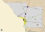
List of highways in Webb County, Texas
Encyclopedia
The following is a list of all state highways in Webb County, Texas maintained by the Texas Department of Transportation
. All state highways in Texas are paved. In the future Webb County will be the United States
terminus of the North American Supercorridor
(NASCO) , Interstate 69 , and The Ports to Plains Trade Corridor
. The Texas Department of Transportation Laredo District is preparing for future growth by turning Loop 20
into a freeway by building overpasses at major intersections and on / off ramps..
Texas Department of Transportation
The Texas Department of Transportation is a governmental agency in the U.S. state of Texas. Its stated mission is to "work cooperatively to provide safe, effective and efficient movement of people and goods" throughout the state...
. All state highways in Texas are paved. In the future Webb County will be the United States
United States
The United States of America is a federal constitutional republic comprising fifty states and a federal district...
terminus of the North American Supercorridor
North American SuperCorridor Coalition
150px|right|"NASCO project logo depicting the three associated countries' flag iconography as a singular element."The North America's Corridor Coalition is a non-profit organization that seeks to develop an international multi-modal transportation system along the International Mid-Continent Trade...
(NASCO) , Interstate 69 , and The Ports to Plains Trade Corridor
Ports to Plains Corridor
The Ports-To-Plains Corridor is an existing highway corridor between the United States Mexico border at Laredo, Texas and Denver, Colorado. The reason for proposed improvements to this corridor is to expedite the transportation of goods and services from Mexico in the United States and vice versa...
. The Texas Department of Transportation Laredo District is preparing for future growth by turning Loop 20
Texas State Highway Loop 20
Loop 20, also known as the Bob Bullock Loop and Cuatro Vientos Road, is a highway loop that runs to the north and east of the city of Laredo, Texas. Loop 20 extends from the World Trade International Bridge at its northern point to Mangana-Hein Road at its southern point...
into a freeway by building overpasses at major intersections and on / off ramps..
Interstates
| Route Name | Direction | Termini | Junctions | Length | Population Area | Remarks |
|---|---|---|---|---|---|---|
 BUS I-35 |
South North |
Gateway to the Americas International Bridge Gateway to the Americas International Bridge The Gateway to the Americas International Bridge is one of four vehicular international bridges located in the cities of Laredo, Texas, and Nuevo Laredo, Tamaulipas, that connect the United States and Mexico over the Rio Grande... I-35 |
I-35 US 83 |
3.4 miles (5.5 km) | Laredo Laredo, Texas Laredo is the county seat of Webb County, Texas, United States, located on the north bank of the Rio Grande in South Texas, across from Nuevo Laredo, Tamaulipas, Mexico. According to the 2010 census, the city population was 236,091 making it the 3rd largest on the United States-Mexican border,... |
|
 I-35 Interstate 35 in Texas Interstate 35 in Texas is a major north–south Interstate Highway running from Laredo near the United States-Mexico border to the Red River north of Gainesville where it crosses into Oklahoma. Along its route, it passes through the cities of San Antonio, Austin, and Waco before it splits into two... |
South North |
Juarez-Lincoln International Bridge Juárez-Lincoln International Bridge The Juárez–Lincoln International Bridge is one of four vehicular international bridges located in the cities of Laredo, Texas, and Nuevo Laredo, Tamaulipas, that connect the United States and Mexico over the Rio Grande... La Salle County |
US 83 Spur 400 Texas State Highway Spur 400 Spur 400 is the state highway designation for the eastern portion of Clark Boulevard, from Arkansas Blvd to Loop 20, in Laredo, Texas. Spur 400 is a four-lane roadway, and is long.-Route description:... US 59 UR 1472 LP 20 Texas State Highway Loop 20 Loop 20, also known as the Bob Bullock Loop and Cuatro Vientos Road, is a highway loop that runs to the north and east of the city of Laredo, Texas. Loop 20 extends from the World Trade International Bridge at its northern point to Mangana-Hein Road at its southern point... SH 255 Texas State Highway 255 State Highway 255 toll road owned by the state of Texas that has operated since 2000 that allows international traffic to bypass Laredo. The route stretches from the Colombia Solidarity International Bridge to Interstate 35 at exit #24... |
37.5 miles (60.4 km) | Laredo Laredo, Texas Laredo is the county seat of Webb County, Texas, United States, located on the north bank of the Rio Grande in South Texas, across from Nuevo Laredo, Tamaulipas, Mexico. According to the 2010 census, the city population was 236,091 making it the 3rd largest on the United States-Mexican border,... Botines Botines, Texas Botines is a census-designated place in Webb County, Texas, United States. The population was 132 at the 2000 census. Botines is located 5 miles north of Laredo... Webb Webb, Texas Webb is a rural unincorporated community in Webb County, Texas, United States, located 20 miles north of Laredo. According to the 1990 census it had a population of 40.-History:... |
Texas Travel Center 27.759583°N 99.4371861°W ICE Checkpoint U.S. Immigration and Customs Enforcement U.S. Immigration and Customs Enforcement is a federal law enforcement agency under the United States Department of Homeland Security , responsible for identifying, investigating, and dismantling vulnerabilities regarding the nation's border, economic, transportation, and infrastructure security... 27.9051384°N 99.3938577°W |
U.S. Routes
| Route Name | Direction | Termini | Junctions | Length | Population Area | Remarks |
|---|---|---|---|---|---|---|
 US 59 |
East West |
Duval County I-35 |
FM 2050 FM 2895 LP 20 Texas State Highway Loop 20 Loop 20, also known as the Bob Bullock Loop and Cuatro Vientos Road, is a highway loop that runs to the north and east of the city of Laredo, Texas. Loop 20 extends from the World Trade International Bridge at its northern point to Mangana-Hein Road at its southern point... I-35 US 83 |
49.4 miles (79.5 km) | Laredo Laredo, Texas Laredo is the county seat of Webb County, Texas, United States, located on the north bank of the Rio Grande in South Texas, across from Nuevo Laredo, Tamaulipas, Mexico. According to the 2010 census, the city population was 236,091 making it the 3rd largest on the United States-Mexican border,... Las Lomas Ranchitos Las Lomas, Texas Ranchitos Las Lomas is a census-designated place in Webb County, Texas, United States. The population was 334 at the 2000 census. Las Lomas means "the hills" in Spanish... |
ICE Checkpoint U.S. Immigration and Customs Enforcement U.S. Immigration and Customs Enforcement is a federal law enforcement agency under the United States Department of Homeland Security , responsible for identifying, investigating, and dismantling vulnerabilities regarding the nation's border, economic, transportation, and infrastructure security... 27.7742408°N 98.8455096°W |
 US 83 |
South North |
Zapata County Dimmit County |
LP 20 Texas State Highway Loop 20 Loop 20, also known as the Bob Bullock Loop and Cuatro Vientos Road, is a highway loop that runs to the north and east of the city of Laredo, Texas. Loop 20 extends from the World Trade International Bridge at its northern point to Mangana-Hein Road at its southern point... SH 359 Texas State Highway 359 State Highway 359 or SH 359 is a state highway that runs from Skidmore in southeastern Texas, near Corpus Christi, southwest and west to Laredo at the international border with Mexico.-History:... I-35 Spur 400 Texas State Highway Spur 400 Spur 400 is the state highway designation for the eastern portion of Clark Boulevard, from Arkansas Blvd to Loop 20, in Laredo, Texas. Spur 400 is a four-lane roadway, and is long.-Route description:... US 59 UR 1472 SH 44 |
66 miles (106.2 km) | El Cenizo El Cenizo, Texas El Cenizo is a city in Webb County, Texas, United States. The population was 3,545 at the 2000 census. El Cenizo is the third largest city in Webb County.... Rio Bravo Rio Bravo, Texas Rio Bravo is a city in Webb County, Texas, United States. The population was 5,553 at the 2000 census. The city is the second largest in Webb County.-Geography:Rio Bravo is located at .... La Presa La Presa, Texas La Presa is a census-designated place in Webb County, Texas, United States. The population was 508 at the 2000 census.-Geography:La Presa is located at .... Laredo Laredo, Texas Laredo is the county seat of Webb County, Texas, United States, located on the north bank of the Rio Grande in South Texas, across from Nuevo Laredo, Tamaulipas, Mexico. According to the 2010 census, the city population was 236,091 making it the 3rd largest on the United States-Mexican border,... Botines Botines, Texas Botines is a census-designated place in Webb County, Texas, United States. The population was 132 at the 2000 census. Botines is located 5 miles north of Laredo... |
ICE Checkpoint U.S. Immigration and Customs Enforcement U.S. Immigration and Customs Enforcement is a federal law enforcement agency under the United States Department of Homeland Security , responsible for identifying, investigating, and dismantling vulnerabilities regarding the nation's border, economic, transportation, and infrastructure security... 28.0056932°N 99.5344645°W |
Texas State Highways
| Route Name | Direction | Termini | Junctions | Length | Population Area | Remarks |
|---|---|---|---|---|---|---|
 SH 44 |
East West |
Duval County US 83 |
US 83 | 40 miles (64.4 km) | None | |
 SH 255 Texas State Highway 255 State Highway 255 toll road owned by the state of Texas that has operated since 2000 that allows international traffic to bypass Laredo. The route stretches from the Colombia Solidarity International Bridge to Interstate 35 at exit #24... |
East West |
I-35 Colombia-Solidarity Bridge Colombia-Solidarity International Bridge Colombia–Solidarity International Bridge is one of four vehicular international bridges located on the U.S.-Mexico border in the city of Laredo, Texas; it connects Laredo over the Rio Grande with Colombia, Nuevo León... |
I-35 US 83 UR 1472 |
21.508 miles (34.6 km) | Laredo Laredo, Texas Laredo is the county seat of Webb County, Texas, United States, located on the north bank of the Rio Grande in South Texas, across from Nuevo Laredo, Tamaulipas, Mexico. According to the 2010 census, the city population was 236,091 making it the 3rd largest on the United States-Mexican border,... |
Toll Collection 27.7356079°N 99.6841881°W |
 SH 359 Texas State Highway 359 State Highway 359 or SH 359 is a state highway that runs from Skidmore in southeastern Texas, near Corpus Christi, southwest and west to Laredo at the international border with Mexico.-History:... |
East West |
Duval County US 83 |
US 83 LP 20 Texas State Highway Loop 20 Loop 20, also known as the Bob Bullock Loop and Cuatro Vientos Road, is a highway loop that runs to the north and east of the city of Laredo, Texas. Loop 20 extends from the World Trade International Bridge at its northern point to Mangana-Hein Road at its southern point... FM 2895 FM 649 FM 2050 |
50 miles (80.5 km) | Bruni Bruni, Texas Bruni is a census-designated place in Webb County, Texas, United States. The population was 412 at the 2000 census. Bruni was named after Antonio Mateo Bruni , a local Italian immigrant who owned a ranch and a general store. In 1937, Canadian aviators seeking to be the first to fly from Hudson Bay... Oilton Oilton, Texas Oilton is a census-designated place in Webb County, Texas, United States. The population was 310 at the 2000 census. The community is within the boundary of Webb Consolidated Independent School District and it is home to the Oilton Elementary School.... Aguilares Aguilares, Texas Aguilares is an unincorporated community in Webb County, Texas, United States.-History:Aguilares dates back from 1870, it was named after first settlers and ranchers José, Locario, Francisco, Próspero, and Librado Aguilar. It became a stop on the Texas-Mexican railroad in 1881 and was granted a... Laredo Ranchettes Laredo Ranchettes, Texas Laredo Ranchettes is a census-designated place in Webb County, Texas, United States. The population was 1,845 at the 2000 census.-Geography:Laredo Ranchettes is located at .... Larga Vista Larga Vista, Texas Larga Vista is a former census-designated place in Webb County, Texas, United States. The population was 742 at the 2000 census. Larga Vista lost its census-designated place status in 2010 because it became surrounded by Laredo, Texas. A CDP may not be located, either partially or entirely, within... |
ICE Checkpoint U.S. Immigration and Customs Enforcement U.S. Immigration and Customs Enforcement is a federal law enforcement agency under the United States Department of Homeland Security , responsible for identifying, investigating, and dismantling vulnerabilities regarding the nation's border, economic, transportation, and infrastructure security... 27.4434016°N 98.8873494°W |
State Highway Loops and Spurs
| Route Name | Direction | Termini | Junctions | Length | Population Area | Remarks |
|---|---|---|---|---|---|---|
 LP 20 Texas State Highway Loop 20 Loop 20, also known as the Bob Bullock Loop and Cuatro Vientos Road, is a highway loop that runs to the north and east of the city of Laredo, Texas. Loop 20 extends from the World Trade International Bridge at its northern point to Mangana-Hein Road at its southern point... |
South North |
US 83 World Trade International Bridge World Trade International Bridge The World Trade International Bridge is one of 4 international bridges located in the cities of Laredo, Texas, and Nuevo Laredo, Tamaulipas, that connect the United States and Mexico over the Rio Grande . It is owned and operated by City of Laredo and the Secretaría de Comunicaciones y... |
US 83 SH 359 Texas State Highway 359 State Highway 359 or SH 359 is a state highway that runs from Skidmore in southeastern Texas, near Corpus Christi, southwest and west to Laredo at the international border with Mexico.-History:... Spur 400 Texas State Highway Spur 400 Spur 400 is the state highway designation for the eastern portion of Clark Boulevard, from Arkansas Blvd to Loop 20, in Laredo, Texas. Spur 400 is a four-lane roadway, and is long.-Route description:... US 59 I-35 UR 1472 |
16.6 miles (26.7 km) | Laredo Laredo, Texas Laredo is the county seat of Webb County, Texas, United States, located on the north bank of the Rio Grande in South Texas, across from Nuevo Laredo, Tamaulipas, Mexico. According to the 2010 census, the city population was 236,091 making it the 3rd largest on the United States-Mexican border,... |
|
 Spur 260 Texas State Highway Spur 260 Texas Spur 260, also known as Bob Bullock Loop, is a state highway in southeastern Laredo, Texas connecting U.S. Route 83 and Texas State Highway 359. The route was designated in 2008 but continued to be signed as part of Texas State Highway Loop 20 until the opening of Cuatro Vientos Road in July... |
South North |
US 83 LP 20 Texas State Highway Loop 20 Loop 20, also known as the Bob Bullock Loop and Cuatro Vientos Road, is a highway loop that runs to the north and east of the city of Laredo, Texas. Loop 20 extends from the World Trade International Bridge at its northern point to Mangana-Hein Road at its southern point... |
US 83 SH 359 Texas State Highway 359 State Highway 359 or SH 359 is a state highway that runs from Skidmore in southeastern Texas, near Corpus Christi, southwest and west to Laredo at the international border with Mexico.-History:... LP 20 Texas State Highway Loop 20 Loop 20, also known as the Bob Bullock Loop and Cuatro Vientos Road, is a highway loop that runs to the north and east of the city of Laredo, Texas. Loop 20 extends from the World Trade International Bridge at its northern point to Mangana-Hein Road at its southern point... |
11.43 miles (18.4 km) | Laredo Laredo, Texas Laredo is the county seat of Webb County, Texas, United States, located on the north bank of the Rio Grande in South Texas, across from Nuevo Laredo, Tamaulipas, Mexico. According to the 2010 census, the city population was 236,091 making it the 3rd largest on the United States-Mexican border,... |
Under construction 50% complete; designation not yet official |
 Spur 400 Texas State Highway Spur 400 Spur 400 is the state highway designation for the eastern portion of Clark Boulevard, from Arkansas Blvd to Loop 20, in Laredo, Texas. Spur 400 is a four-lane roadway, and is long.-Route description:... |
East West |
LP 20 Texas State Highway Loop 20 Loop 20, also known as the Bob Bullock Loop and Cuatro Vientos Road, is a highway loop that runs to the north and east of the city of Laredo, Texas. Loop 20 extends from the World Trade International Bridge at its northern point to Mangana-Hein Road at its southern point... I-35 |
LP 20 Texas State Highway Loop 20 Loop 20, also known as the Bob Bullock Loop and Cuatro Vientos Road, is a highway loop that runs to the north and east of the city of Laredo, Texas. Loop 20 extends from the World Trade International Bridge at its northern point to Mangana-Hein Road at its southern point... I-35 |
1.174 miles (1.9 km) | Laredo Laredo, Texas Laredo is the county seat of Webb County, Texas, United States, located on the north bank of the Rio Grande in South Texas, across from Nuevo Laredo, Tamaulipas, Mexico. According to the 2010 census, the city population was 236,091 making it the 3rd largest on the United States-Mexican border,... |
Farm to Market Roads
| Route Name | Direction | Termini | Junctions | Length | Population Area | Remarks |
|---|---|---|---|---|---|---|
 FM 649 Farm to Market Road 649 -Route description:FM 649 begins in the Rio Grande Valley at a junction with in Garceno. The route travels northward through sparsely populated sections of Starr County before entering Jim Hogg County. In the vicinity of the unincorporated community of Randado, FM 649 has a brief concurrency with ... |
South North |
Zapata County SH 359 Texas State Highway 359 State Highway 359 or SH 359 is a state highway that runs from Skidmore in southeastern Texas, near Corpus Christi, southwest and west to Laredo at the international border with Mexico.-History:... |
SH 359 Texas State Highway 359 State Highway 359 or SH 359 is a state highway that runs from Skidmore in southeastern Texas, near Corpus Christi, southwest and west to Laredo at the international border with Mexico.-History:... |
15 miles (24.1 km) | Mirando City Mirando City, Texas Mirando City is a census-designated place in Webb County, Texas, United States. The population was 493 at the 2000 census. The town gets its name from Nicolás Mirando, a Spanish land grantee. The population of Mirando City was highest in 1929, at an estimated 1500... |
|
 FM 1472 Farm to Market Road 1472 Farm to Market Road 1472 is a farm-to-market road that connects the Laredo, Texas Industrial Area to the Colombia – Solidarity International Bridge, then running roughly parallel to the Rio Grande into rural Webb County... |
South North |
I-35 A point 14.7 miles (23.7 km) northwest of SH 255 Texas State Highway 255 State Highway 255 toll road owned by the state of Texas that has operated since 2000 that allows international traffic to bypass Laredo. The route stretches from the Colombia Solidarity International Bridge to Interstate 35 at exit #24... |
I-35 FM 3338 SH 255 Texas State Highway 255 State Highway 255 toll road owned by the state of Texas that has operated since 2000 that allows international traffic to bypass Laredo. The route stretches from the Colombia Solidarity International Bridge to Interstate 35 at exit #24... |
33.425 miles (53.8 km) | Laredo Laredo, Texas Laredo is the county seat of Webb County, Texas, United States, located on the north bank of the Rio Grande in South Texas, across from Nuevo Laredo, Tamaulipas, Mexico. According to the 2010 census, the city population was 236,091 making it the 3rd largest on the United States-Mexican border,... |
Urban Road 1472 |
 FM 2050 Farm to Market Road 2050 Farm to Market 2050 or FM 2050 is a road that connects State Highway 359 in Bruni, Texas in Webb County with U.S. Highway 59.... |
South North |
Bruni, Texas Bruni, Texas Bruni is a census-designated place in Webb County, Texas, United States. The population was 412 at the 2000 census. Bruni was named after Antonio Mateo Bruni , a local Italian immigrant who owned a ranch and a general store. In 1937, Canadian aviators seeking to be the first to fly from Hudson Bay... US 59 |
SH 359 Texas State Highway 359 State Highway 359 or SH 359 is a state highway that runs from Skidmore in southeastern Texas, near Corpus Christi, southwest and west to Laredo at the international border with Mexico.-History:... US 59 |
24.572 miles (39.5 km) | Bruni Bruni, Texas Bruni is a census-designated place in Webb County, Texas, United States. The population was 412 at the 2000 census. Bruni was named after Antonio Mateo Bruni , a local Italian immigrant who owned a ranch and a general store. In 1937, Canadian aviators seeking to be the first to fly from Hudson Bay... |
|
 FM 2895 Farm to Market Road 2895 Farm to Market 2895 or FM 2895 is a road that connects State Highway 359 in Aguilares, Texas in Webb County with U.S. Highway 59.... |
South North |
Aguilares, Texas Aguilares, Texas Aguilares is an unincorporated community in Webb County, Texas, United States.-History:Aguilares dates back from 1870, it was named after first settlers and ranchers José, Locario, Francisco, Próspero, and Librado Aguilar. It became a stop on the Texas-Mexican railroad in 1881 and was granted a... US 59 |
SH 359 Texas State Highway 359 State Highway 359 or SH 359 is a state highway that runs from Skidmore in southeastern Texas, near Corpus Christi, southwest and west to Laredo at the international border with Mexico.-History:... US 59 |
17.44 miles (28.1 km) | Aguilares Aguilares, Texas Aguilares is an unincorporated community in Webb County, Texas, United States.-History:Aguilares dates back from 1870, it was named after first settlers and ranchers José, Locario, Francisco, Próspero, and Librado Aguilar. It became a stop on the Texas-Mexican railroad in 1881 and was granted a... |
|
 FM 3338 Farm to Market Road 3338 Farm to Market Road 3338 is a Farm to Market Road that connects the Laredo, Texas Industrial Area with rural Webb County. Its intersects State Highway 255 then turns into a gravel road.-Route description:... |
South North |
FM 1472 SH 255 Texas State Highway 255 State Highway 255 toll road owned by the state of Texas that has operated since 2000 that allows international traffic to bypass Laredo. The route stretches from the Colombia Solidarity International Bridge to Interstate 35 at exit #24... |
UR 1472 SH 255 Texas State Highway 255 State Highway 255 toll road owned by the state of Texas that has operated since 2000 that allows international traffic to bypass Laredo. The route stretches from the Colombia Solidarity International Bridge to Interstate 35 at exit #24... |
7.831 miles (12.6 km) | Laredo Laredo, Texas Laredo is the county seat of Webb County, Texas, United States, located on the north bank of the Rio Grande in South Texas, across from Nuevo Laredo, Tamaulipas, Mexico. According to the 2010 census, the city population was 236,091 making it the 3rd largest on the United States-Mexican border,... Ranchos Penitas West Ranchos Penitas West, Texas Ranchos Penitas West is a census-designated place in Webb County, Texas, United States. The population was 520 at the 2000 census.-Geography:Ranchos Penitas West is located at .... |
|
Decommissioned Highways
| Route Name | Direction | Termini | Junctions | Length | Population Area | Remarks |
|---|---|---|---|---|---|---|
 SH 2 |
South North |
Laredo, Texas Laredo, Texas Laredo is the county seat of Webb County, Texas, United States, located on the north bank of the Rio Grande in South Texas, across from Nuevo Laredo, Tamaulipas, Mexico. According to the 2010 census, the city population was 236,091 making it the 3rd largest on the United States-Mexican border,... La Salle County |
none | 37.5 miles (60.4 km) | Laredo Laredo, Texas Laredo is the county seat of Webb County, Texas, United States, located on the north bank of the Rio Grande in South Texas, across from Nuevo Laredo, Tamaulipas, Mexico. According to the 2010 census, the city population was 236,091 making it the 3rd largest on the United States-Mexican border,... Webb Webb, Texas Webb is a rural unincorporated community in Webb County, Texas, United States, located 20 miles north of Laredo. According to the 1990 census it had a population of 40.-History:... |
Replaced by US 81 |
 SH 4 |
South North |
Zapata County Dimmit County |
none | 66 miles (106.2 km) | Laredo Laredo, Texas Laredo is the county seat of Webb County, Texas, United States, located on the north bank of the Rio Grande in South Texas, across from Nuevo Laredo, Tamaulipas, Mexico. According to the 2010 census, the city population was 236,091 making it the 3rd largest on the United States-Mexican border,... Webb Webb, Texas Webb is a rural unincorporated community in Webb County, Texas, United States, located 20 miles north of Laredo. According to the 1990 census it had a population of 40.-History:... |
Replaced by US 83 |
 US 81 |
South North |
Laredo, Texas Laredo, Texas Laredo is the county seat of Webb County, Texas, United States, located on the north bank of the Rio Grande in South Texas, across from Nuevo Laredo, Tamaulipas, Mexico. According to the 2010 census, the city population was 236,091 making it the 3rd largest on the United States-Mexican border,... La Salle County |
none | 37.5 miles (60.4 km) | Laredo Laredo, Texas Laredo is the county seat of Webb County, Texas, United States, located on the north bank of the Rio Grande in South Texas, across from Nuevo Laredo, Tamaulipas, Mexico. According to the 2010 census, the city population was 236,091 making it the 3rd largest on the United States-Mexican border,... Webb Webb, Texas Webb is a rural unincorporated community in Webb County, Texas, United States, located 20 miles north of Laredo. According to the 1990 census it had a population of 40.-History:... |
Replaced by I-35 |
 US 83 Bus. |
South North |
Gateway to the Americas Int'l Bridge Gateway to the Americas International Bridge The Gateway to the Americas International Bridge is one of four vehicular international bridges located in the cities of Laredo, Texas, and Nuevo Laredo, Tamaulipas, that connect the United States and Mexico over the Rio Grande... I-35 |
I-35 US 83 |
3.4 miles (5.5 km) | Laredo Laredo, Texas Laredo is the county seat of Webb County, Texas, United States, located on the north bank of the Rio Grande in South Texas, across from Nuevo Laredo, Tamaulipas, Mexico. According to the 2010 census, the city population was 236,091 making it the 3rd largest on the United States-Mexican border,... |
Replaced by BSI-35 |
 SH 96 |
East West |
Duval County Laredo Laredo, Texas Laredo is the county seat of Webb County, Texas, United States, located on the north bank of the Rio Grande in South Texas, across from Nuevo Laredo, Tamaulipas, Mexico. According to the 2010 census, the city population was 236,091 making it the 3rd largest on the United States-Mexican border,... |
none | 49.4 miles (79.5 km) | Las Lomas Ranchitos Las Lomas, Texas Ranchitos Las Lomas is a census-designated place in Webb County, Texas, United States. The population was 334 at the 2000 census. Las Lomas means "the hills" in Spanish... Laredo Laredo, Texas Laredo is the county seat of Webb County, Texas, United States, located on the north bank of the Rio Grande in South Texas, across from Nuevo Laredo, Tamaulipas, Mexico. According to the 2010 census, the city population was 236,091 making it the 3rd largest on the United States-Mexican border,... |
Replaced by US 59 |
 SH 202 Texas State Highway 202 State Highway 202 or SH 202 is a Texas state highway between Beeville and Refugio. The route was designated by 1936 from George West to Beeville. It was extended in 1939 west to Laredo as a renumbering of SH 257, which was cancelled, and east to Refugio. In 1954, the section from Laredo to... |
East West |
Duval County Laredo Laredo, Texas Laredo is the county seat of Webb County, Texas, United States, located on the north bank of the Rio Grande in South Texas, across from Nuevo Laredo, Tamaulipas, Mexico. According to the 2010 census, the city population was 236,091 making it the 3rd largest on the United States-Mexican border,... |
none | 49.4 miles (79.5 km) | Las Lomas Ranchitos Las Lomas, Texas Ranchitos Las Lomas is a census-designated place in Webb County, Texas, United States. The population was 334 at the 2000 census. Las Lomas means "the hills" in Spanish... Laredo Laredo, Texas Laredo is the county seat of Webb County, Texas, United States, located on the north bank of the Rio Grande in South Texas, across from Nuevo Laredo, Tamaulipas, Mexico. According to the 2010 census, the city population was 236,091 making it the 3rd largest on the United States-Mexican border,... |
Replaced by US 96 |
 LP 420 |
South North |
Gateway to the Americas Int'l Bridge Gateway to the Americas International Bridge The Gateway to the Americas International Bridge is one of four vehicular international bridges located in the cities of Laredo, Texas, and Nuevo Laredo, Tamaulipas, that connect the United States and Mexico over the Rio Grande... I-35 |
I-35 US 83 |
3.4 miles (5.5 km) | Laredo Laredo, Texas Laredo is the county seat of Webb County, Texas, United States, located on the north bank of the Rio Grande in South Texas, across from Nuevo Laredo, Tamaulipas, Mexico. According to the 2010 census, the city population was 236,091 making it the 3rd largest on the United States-Mexican border,... |
Replaced by US 83 Bus. |
 FM 863 |
East West |
Duval County US 83 |
US 83 | 40 miles (64.4 km) | None | Replaced by SH 44 |
 FM 3464 |
East West |
I-35 UR 1472 |
I-35 UR 1472 |
1.594 miles (2.6 km) | Laredo Laredo, Texas Laredo is the county seat of Webb County, Texas, United States, located on the north bank of the Rio Grande in South Texas, across from Nuevo Laredo, Tamaulipas, Mexico. According to the 2010 census, the city population was 236,091 making it the 3rd largest on the United States-Mexican border,... |
Replaced by LP 20 Texas State Highway Loop 20 Loop 20, also known as the Bob Bullock Loop and Cuatro Vientos Road, is a highway loop that runs to the north and east of the city of Laredo, Texas. Loop 20 extends from the World Trade International Bridge at its northern point to Mangana-Hein Road at its southern point... |
Adjacent counties
- Maverick County (northwest)
- Dimmit County (northnorthwest)
- La Salle County (north)
- McMullen County (northeast)
- Duval County (east)
- Jim Hogg County (southeast)
- Zapata County (south)
Adjacent Mexican States
- Coahuila, MexicoCoahuilaCoahuila, formally Coahuila de Zaragoza , officially Estado Libre y Soberano de Coahuila de Zaragoza is one of the 31 states which, with the Federal District, comprise the 32 Federal Entities of Mexico...
(northwest) - Nuevo Leon, MexicoNuevo LeónNuevo León It is located in Northeastern Mexico. It is bordered by the states of Tamaulipas to the north and east, San Luis Potosí to the south, and Coahuila to the west. To the north, Nuevo León has a 15 kilometer stretch of the U.S.-Mexico border adjacent to the U.S...
(west) - Tamaulipas, MexicoTamaulipasTamaulipas officially Estado Libre y Soberano de Tamaulipas is one of the 31 states which, with the Federal District, comprise the 32 Federal Entities of Mexico. It is divided in 43 municipalities and its capital city is Ciudad Victoria. The capital city was named after Guadalupe Victoria, the...
(southwest)