
List of Ottawa neighbourhoods
Encyclopedia

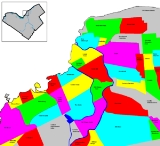
The city is now organized into 23 Wards (map). This is a list of neighbourhood
Neighbourhood
A neighbourhood or neighborhood is a geographically localised community within a larger city, town or suburb. Neighbourhoods are often social communities with considerable face-to-face interaction among members. "Researchers have not agreed on an exact definition...
s and outlying communities within the City of Ottawa
Ottawa
Ottawa is the capital of Canada, the second largest city in the Province of Ontario, and the fourth largest city in the country. The city is located on the south bank of the Ottawa River in the eastern portion of Southern Ontario...
, Ontario
Ontario
Ontario is a province of Canada, located in east-central Canada. It is Canada's most populous province and second largest in total area. It is home to the nation's most populous city, Toronto, and the nation's capital, Ottawa....
, Canada
Canada
Canada is a North American country consisting of ten provinces and three territories. Located in the northern part of the continent, it extends from the Atlantic Ocean in the east to the Pacific Ocean in the west, and northward into the Arctic Ocean...
.
Old city of Ottawa
Central Ottawa
| Byward Market Byward Market ByWard Market is a district in Lower Town located east of the government & business district, surrounding the market buildings and open-air market on George, York, ByWard and William Streets.The district is bordered on the west by Sussex Drive, on the... |
Centretown Centretown Centretown is a neighbourhood in Ottawa, Canada defined by the city as "the area bounded on the north by Gloucester Street and Lisgar Street, on the east by the Rideau Canal, on the south by the Queensway Freeway and on the west by Bronson Avenue." Traditionally it was all of Ottawa west of the... |
Golden Triangle | Centretown West Centretown West Centretown West is a neighbourhood in Ottawa, Canada. It lies to the west of Bronson Avenue, east of the O-Train tracks, north of Carling Avenue, and south of "Nanny Goat Hill", which is an escarpment to the north of Somerset Street West. To the east lies Centretown, to the north lies Lebreton... |
Downtown Downtown Ottawa Downtown Ottawa is the central area of Ottawa, Ontario, Canada. Like other downtowns it is the commercial and economic centre of the city. It is sometimes referred to as the Central Business District and contains Ottawa's financial district. It is bordered by the Ottawa River to the north, the... |
| The Glebe The Glebe The Glebe is a neighbourhood in Ottawa, Ontario, Canada. It is located just south of Ottawa's downtown area, with its northern border being demarcated by the Queensway highway. It is bounded by the Rideau Canal to the south and east. Many maps show the western edge as Bronson Avenue, but some also... |
Lebreton Flats Lebreton Flats LeBreton Flats is a neighbourhood in Ottawa, Canada. It lies to the west of Centretown neighbourhood, and to the north of Centretown West with "Nanny Goat Hill" as the dividing line... |
Lower Town Lower Town Lowertown is a district in the central area of Ottawa, Ontario, Canada to the east of downtown. It is bounded roughly by Rideau Street to the south, Sussex Drive and Ottawa River to the north, the Rideau Canal to the west, and the Rideau River to the east... |
Old Ottawa East Old Ottawa East Old Ottawa East or just Ottawa East is a neighbourhood of Ottawa, Canada. It is located south of Nicholas Street and between the Rideau Canal and the Rideau River. The southern border is generally defined by Main Street and Riverdale Avenue. To the south is the neighbourhood of Old Ottawa South... |
|
| Old Ottawa South Old Ottawa South Old Ottawa South is an older urban neighbourhood in Ottawa, Canada. As of the Canada 2006 Census, 8,168 people lived in Old Ottawa South, a relatively small and compact neighbourhood, located between the Rideau Canal and the Rideau River . The eastern boundary is defined by Riverdale Avenue and... |
Sandy Hill |
East End
| Castle Heights Castle heights Castle Heights is a small residential neighborhood in Northwest Geneva, New York. It is known for its architecturally diverse homes and plots of land larger than those in other neighborhoods in the city. Formerly referred to as "Maxwell Highland," Castle Heights displays characteristics of the... |
Robillard Quarries | Finter Quarries | Forbes Forbes, Ottawa Forbes is a neighbourhood in the east end of Ottawa, Canada.It is defined by the city as being bounded on the North by Montreal Road, on the east by the Aviation Parkway, on the west and south by the former municipal boundary of the city, and on the southwest by McArthur Avenue.The neighbourhood is... |
| Lees Avenue | Lindenlea | Manor Park Manor Park (Ottawa) thumb|Map of Ottawa with a dot indicating the location of Manor ParkManor Park is a neighbourhood in the East End of Ottawa, Ontario, in the area of Rockcliffe Park.... |
New Edinburgh |
| Overbrook Overbrook (Ottawa) Overbrook is a community located in the east end of Ottawa, Ontario, Canada. It is across the Rideau River, from the neighbourhoods of Lower Town and Sandy Hill and just to the south of Vanier, Rockcliffe Park and New Edinburgh. To the east of Overbrook are the suburbs of Gloucester.Overbrook has a... |
Rockcliffe Park Rockcliffe Park, Ontario Rockcliffe Park is one of the wealthiest neighbourhoods in Ottawa, Ontario, and is one of the most prosperous enclaves in Canada. From 1926 until 2001 it was an independent village, but was amalgamated with the rest of the city January 1, 2001... |
Vanier Vanier, Ontario -External links:**... |
Viscount Alexander Park Viscount Alexander Park Viscount Alexander Park is a neighbourhood in the northeastern corner of Ottawa, Canada. At its maximum extent, the neighbourhood has a population of 5,686 according to the Canada 2006 Census.... |
South End
| Airport-Uplands | Alta Vista Alta Vista (Ottawa) Alta Vista is a neighbourhood in Ottawa, Ontario, Canada. Its boundaries can be broadly described as: Smyth Road in the north, St. Laurent Boulevard in the east, Walkley Road and Heron Road in the south, and Bank Street and Riverside Drive in the west... |
Billings Bridge Billings Bridge Billings Bridge is a bridge over the Rideau River in Ottawa. Bank Street passes over the river by way of this bridge. The bridge was named after Braddish Billings, who settled in this area and established a farm nearby in 1812. The first bridge, originally called Farmers Bridge, was built over the... |
Confederation Heights Confederation Heights Confederation Heights is an area in south Ottawa, Canada, made up of mostly government buildings. It is bounded on the east by Data Centre Road, on the north and west by the Rideau River and on the south by Brookfield Road.... |
| Ellwood Ellwood (Ottawa) Ellwood is a neighbourhood bounded by Walkley Road on the north, the O-Train corridor on the west, Albion Road on the east and the Walkley Railway Yards on the south.... |
Elmvale Acres Elmvale Acres Elmvale Acres is a neighbourhood in Alta Vista . It was built in the late 1950s by the contractor and property developer, Robert Campeau.... |
Greenboro | Hawthorne Meadows |
| Heron Gate Heron Gate Heron Gate is the name given to the neighbourhood in South-East Ottawa.The boundaries are Heron Road from the north, Alta Vista Drive on the west, the angle of Heron and Walkley on the east and Walkley Road in the south.... |
Heron Park Heron Park Heron Park is located south of Old Ottawa South. Its boundaries are the Rideau River to the north, the Sawmill Creek to the west, Bank Street to the east, Walkley Road to the south.... |
Hunt Club Hunt Club Hunt Club is a large suburban neighbourhood in the southern part of Ottawa, Canada. The area is named after the Ottawa Hunt and Golf Club, which used to own much of the land where the community is now situated and is still a major presence... |
Hunt Club Chase |
| Hunt Club Estate | Hunt Club Park | Riverside South | Riverview Riverview (Ottawa) Riverview also known as Riverview Park is a neighbourhood in Ottawa, Ontario, Canada. It is southeast of the downtown adjacent to the Rideau River, its location on which is its namesake... |
| Hunt Club Woods | Mooney's Bay | Sheffield Glen Sheffield Glen Sheffield Glen is a neighbourhood in Ottawa, Canada. It is located in the southeast part of the old city of Ottawa. It is bounded on the west by Russell Road, on the south by Walkley Road and on the north and east by Lancaster Road. The neighbourhood is more commonly referred to as Southvale by... |
South Keys |
West End
| Bel-Air Heights | Bel-Air Park | Braemar Park | Britannia Britannia (Ottawa) Britannia is a neighbourhood and also a street in the west end of Ottawa, on the Ottawa River across from Aylmer.It was once a small cottage town to the west of Ottawa, but rapid growth in all directions during the 20th century meant that it was soon surrounded by the western suburb of Nepean. ... |
| Britannia Bay | Carlington Carlington Carlington is a residential neighbourhood in the city of Ottawa, Ontario, Canada. It had a population of 12,585 in 2001, which dropped to 10,107 in 2006... |
Carleton Heights Carleton Heights Carleton Heights is a neighbourhood located in Ottawa, Canada. It is bounded on the north by the Central Experimental Farm, on the east by the Rideau River, on the south by the junction of Prince of Wales Drive and Fisher Avenue and on the west by Fisher Avenue. The northern part of the... |
Central Park Central Park, Ottawa Central Park is the name of a neighbourhood in west Ottawa, Canada. It is bounded on the east by Merivale Road, on the south by Baseline Road, on the west by Clyde Avenue and on the north by the Carlington neighbourhood. The population of the neighbourhood is 3,403 in an area of 0.91 km2... |
| Civic Hospital Civic Hospital Civic Hospital is a neighbourhood in Ottawa, Canada. It is named after the Ottawa Civic Hospital, which is located in the neighbourhood.Civic Hospital is bounded on the west by Island Park Drive, on the north by Queensway, on the east by the O-Train and on the south by Carling Avenue.The... |
Copeland Park | Courtland Park Courtland Park Courtland Park is a neighbourhood located in southwest Ottawa, Canada. It is bounded on the north by Baseline Road, on the east by the Rideau River, on the south by Dynes Road and on the west by Fisher Avenue.-Features:... |
Glabar Park Glabar Park Glabar Park is a neighbourhood in Ottawa, Ontario, Canada's west end. It is bounded on the west by Woodroffe Avenue, north by Carling Avenue, south by The Queensway and on the east by McKellar Heights. Its population is about 1,700.... |
| Hampton Park | Highland Park | Hintonburg Hintonburg Hintonburg is a neighbourhood of Ottawa, Ontario, Canada. It is a historically working-class, predominately residential neighbourhood, with a commercial strip located along Wellington Street West, located to the west of downtown... |
Kenson Park |
| Island Park Island Park, Ottawa Island Park is a neighbourhood in west Ottawa, Canada. It is bounded on the north by Scott Street, on the west by its namesake, Island Park Drive, on the south by The Queensway and on the east by Parkdale Avenue. The Island Park Community Association just covers homes on Island Park Drive.The... |
McKellar Heights | McKellar Park McKellar Park McKellar Park is a park and sub-neighbourhood of Westboro, in the City of Ottawa, in the province of Ontario that lies to the North of the Queensway. It is considered a trendy and expensive area, being close to the Westboro Village.... |
Mechanicsville Mechanicsville (Ottawa) Mechanicsville is a neighbourhood of Ottawa, Ontario, Canada. It is located to the west of downtown and bordered by the Ottawa River to the north, the transitway railway to the east, Scott Street to the south, and Parkdale Avenue to the west... |
| Lincoln Heights Lincoln Heights (Ottawa) Lincoln Heights is a neighbourhood in western Ottawa, bounded to the south by Carling Avenue, to the north by the Ottawa River, to the west by Pinecrest Avenue, and to the east by Woodroffe Avenue.... |
Ottawa West | Queensway Terrace North | Queensway |
| Michelle Heights | Rideau View Rideau View Rideau View is a neighbourhood of the City of Ottawa, Ontario, Canada, located along the Rideau River. It is part of Ward 16, River. It is bordered by Meadowlands Drive to the south, Claymore Street to the west and Dynes Road to the north. Debra Avenue is the main road that runs through the... |
Tunney's Pasture Tunney's Pasture Tunney's Pasture is an area within the City of Ottawa, Ontario, that is exclusively developed for Canada's federal government buildings. It is bordered by Scott Street to the south, Parkdale Avenue to the east, the Ottawa River Parkway to the north and Northwestern Avenue to the west... |
Westboro |
| Redwood | Woodlawn Woodlawn (Ottawa) Woodlawn is a small area in western Ottawa. It is bounded in the north by Richmond Road, to the East by Woodroffe Avenue north, in the South by Carling Avenue and in the West by the Ottawa River Parkway.... |
Woodroffe North Woodroffe North Woodroffe North is a neighbourhood in Ottawa, Ontario. It is bounded on the south by the former CPR right-of-way, on the north by the Ottawa River Parkway and on the east and west by National Capital Commission property which is part of or adjacent to the Ottawa River Parkway... |
|
| Whitehaven Whitehaven (Ottawa) Whitehaven is a neighbourhood about 10 kilometres west of downtown Ottawa. It is bounded by Carling Avenue to the north, Woodroffe Avenue to the east, the OC Transpo Transitway to the west and highway 417 to the south.... |
| Neighbourhood | Population (2006) | Area (sq. km.) | Density (per sq. km.) |
|---|---|---|---|
| Alta Vista | 23,456 | 9.36 | 2506.0 |
| Bel-Air-Copeland Park | 8,613 | 2.62 | 3287.4 |
| Britannia | 11,435 | 2.81 | 4069.4 |
| Carleton Heights Carleton Heights Carleton Heights is a neighbourhood located in Ottawa, Canada. It is bounded on the north by the Central Experimental Farm, on the east by the Rideau River, on the south by the junction of Prince of Wales Drive and Fisher Avenue and on the west by Fisher Avenue. The northern part of the... |
2,365 | 1.52 | 1551.1 |
| Carlington Carlington Carlington is a residential neighbourhood in the city of Ottawa, Ontario, Canada. It had a population of 12,585 in 2001, which dropped to 10,107 in 2006... |
11,512 | 3.85 | 2990.1 |
| Carson Grove | 5,638 | 1.84 | 3066.1 |
| Carlingwood | 8,641 | 1.89 | 4572.0 |
| Central Park Central Park, Ottawa Central Park is the name of a neighbourhood in west Ottawa, Canada. It is bounded on the east by Merivale Road, on the south by Baseline Road, on the west by Clyde Avenue and on the north by the Carlington neighbourhood. The population of the neighbourhood is 3,403 in an area of 0.91 km2... |
3,403 | 0.91 | 3745.3 |
| Centretown Centretown Centretown is a neighbourhood in Ottawa, Canada defined by the city as "the area bounded on the north by Gloucester Street and Lisgar Street, on the east by the Rideau Canal, on the south by the Queensway Freeway and on the west by Bronson Avenue." Traditionally it was all of Ottawa west of the... |
20,513 | 2.10 | 9768.1 |
| Centretown West Centretown West Centretown West is a neighbourhood in Ottawa, Canada. It lies to the west of Bronson Avenue, east of the O-Train tracks, north of Carling Avenue, and south of "Nanny Goat Hill", which is an escarpment to the north of Somerset Street West. To the east lies Centretown, to the north lies Lebreton... |
11,915 | 1.93 | 6173.6 |
| Civic Hospital Civic Hospital Civic Hospital is a neighbourhood in Ottawa, Canada. It is named after the Ottawa Civic Hospital, which is located in the neighbourhood.Civic Hospital is bounded on the west by Island Park Drive, on the north by Queensway, on the east by the O-Train and on the south by Carling Avenue.The... |
3,440 | 1.28 | 2695.3 |
| Downtown Downtown Ottawa Downtown Ottawa is the central area of Ottawa, Ontario, Canada. Like other downtowns it is the commercial and economic centre of the city. It is sometimes referred to as the Central Business District and contains Ottawa's financial district. It is bordered by the Ottawa River to the north, the... |
3,718 | 1.25 | 2977.5 |
| Forbes Forbes, Ottawa Forbes is a neighbourhood in the east end of Ottawa, Canada.It is defined by the city as being bounded on the North by Montreal Road, on the east by the Aviation Parkway, on the west and south by the former municipal boundary of the city, and on the southwest by McArthur Avenue.The neighbourhood is... |
5,283 | 1.35 | 3904.7 |
| The Glebe The Glebe The Glebe is a neighbourhood in Ottawa, Ontario, Canada. It is located just south of Ottawa's downtown area, with its northern border being demarcated by the Queensway highway. It is bounded by the Rideau Canal to the south and east. Many maps show the western edge as Bronson Avenue, but some also... |
10,886 | 2.54 | 4285.8 |
| Greenboro | 11,314 | 3.92 | 2886.2 |
| Hampton Park Hampton Park, Ottawa Hampton Park is a park and neighbourhood in the City of Ottawa, in the Canadian province of Ontario. It is directly north of the Queensway at Island Park Drive. It is considered a sub-neighbourhood of the Westboro area. It was first developed in 1910 by J.C. Brennan who shares his name with Brennan... |
2,782 | 1.03 | 2709.1 |
| Hawthorne Meadows | 3,938 | 0.63 | 6224.1 |
| Heron Gate Heron Gate Heron Gate is the name given to the neighbourhood in South-East Ottawa.The boundaries are Heron Road from the north, Alta Vista Drive on the west, the angle of Heron and Walkley on the east and Walkley Road in the south.... -Ellwood |
12,203 | 2.46 | 4960.6 |
| Heron Park Heron Park Heron Park is located south of Old Ottawa South. Its boundaries are the Rideau River to the north, the Sawmill Creek to the west, Bank Street to the east, Walkley Road to the south.... |
3,891 | 1.90 | 2053.1 |
| Highland Park Highland Park, Ottawa Highland Park is a sub-neighbourhood of Westboro, in the City of Ottawa, in the Canadian province of Ontario, located between Dovercourt Avenue and Richmond Road, Churchill Avenue and McKellar Park... -McKellar Park McKellar Park McKellar Park is a park and sub-neighbourhood of Westboro, in the City of Ottawa, in the province of Ontario that lies to the North of the Queensway. It is considered a trendy and expensive area, being close to the Westboro Village.... -Woodroffe |
9,873 | 2.88 | 3428.1 |
| Hintonburg Hintonburg Hintonburg is a neighbourhood of Ottawa, Ontario, Canada. It is a historically working-class, predominately residential neighbourhood, with a commercial strip located along Wellington Street West, located to the west of downtown... -Mechanicsville |
8,908 | 1.72 | 5179.1 |
| Hunt Club Chase | 3,575 | 1.51 | 2360.0 |
| Hunt Club Estate | 4,982 | 1.37 | 3633.3 |
| Hunt Club Park | 8,903 | 5.62 | 1584.2 |
| Hunt Club Woods-Uplands | 2,781 | 4.48 | 620.5 |
| Island Park Island Park, Ottawa Island Park is a neighbourhood in west Ottawa, Canada. It is bounded on the north by Scott Street, on the west by its namesake, Island Park Drive, on the south by The Queensway and on the east by Parkdale Avenue. The Island Park Community Association just covers homes on Island Park Drive.The... |
2,409 | 0.68 | 3530.7 |
| LeBreton Flats Lebreton Flats LeBreton Flats is a neighbourhood in Ottawa, Canada. It lies to the west of Centretown neighbourhood, and to the north of Centretown West with "Nanny Goat Hill" as the dividing line... |
57 | 0.84 | 68.1 |
| Lindenlea Lindenlea Lindenlea is a neighbourhood in Ottawa, Ontario, Canada, one of its smallest. It is bordered by Maple Lane to the north, Acacia Avenue to the east, Beechwood Avenue to the south and Springfield Road to the west... |
1,832 | 0.27 | 6843.5 |
| Lower Town Lower Town Lowertown is a district in the central area of Ottawa, Ontario, Canada to the east of downtown. It is bounded roughly by Rideau Street to the south, Sussex Drive and Ottawa River to the north, the Rideau Canal to the west, and the Rideau River to the east... |
11,377 | 2.06 | 5522.8 |
| Manor Park | 3,367 | 1.56 | 2158.5 |
| New Edinburgh New Edinburgh New Edinburgh is a small neighbourhood in Ottawa, Canada. It is located to the east of the downtown core. It is bordered on the west by the Rideau River, to the north by the Ottawa River, to the south by Beechwood Avenue, to the east the border is less regular but is marked in part by Springfield... |
3,627 | 1.14 | 3173.0 |
| Ottawa East Old Ottawa East Old Ottawa East or just Ottawa East is a neighbourhood of Ottawa, Canada. It is located south of Nicholas Street and between the Rideau Canal and the Rideau River. The southern border is generally defined by Main Street and Riverdale Avenue. To the south is the neighbourhood of Old Ottawa South... |
4,907 | 1.12 | 4393.4 |
| Ottawa South Old Ottawa South Old Ottawa South is an older urban neighbourhood in Ottawa, Canada. As of the Canada 2006 Census, 8,168 people lived in Old Ottawa South, a relatively small and compact neighbourhood, located between the Rideau Canal and the Rideau River . The eastern boundary is defined by Riverdale Avenue and... |
8,168 | 2.05 | 3984.4 |
| Overbrook | 9,437 | 3.06 | 3084.0 |
| Queensway | 12,248 | 4.17 | 2937.2 |
| Quinterra | 1,104 | 1.17 | 940.0 |
| Redwood | 4,095 | 0.73 | 5578.3 |
| Rideauview-Courtland Park Courtland Park Courtland Park is a neighbourhood located in southwest Ottawa, Canada. It is bounded on the north by Baseline Road, on the east by the Rideau River, on the south by Dynes Road and on the west by Fisher Avenue.-Features:... |
5,792 | 5.73 | 1011.2 |
| Riverside Park Riverside Park, Ottawa Riverside Park is a neighbourhood in the south end of Ottawa, Canada.It is bounded on the north by Brookfield Road, on the east by the Airport Parkway, on the south by Walkley Road and on the west by the Rideau River.... |
7,504 | 5.78 | 1298.3 |
| Riverview-Sheffield Glen Sheffield Glen Sheffield Glen is a neighbourhood in Ottawa, Canada. It is located in the southeast part of the old city of Ottawa. It is bounded on the west by Russell Road, on the south by Walkley Road and on the north and east by Lancaster Road. The neighbourhood is more commonly referred to as Southvale by... |
15,177 | 11.04 | 1374.7 |
| Sandy Hill Sandy Hill Sandy Hill is a bilingual neighbourhood in Ottawa, Ontario located just east of downtown. The neighbourhood is bordered on the west by the Rideau Canal and on the east by the Rideau River. To the north it stretches to Rideau Street and the Byward Market area while to the south it is bordered by... |
12,078 | 2.06 | 5863.1 |
| South Keys | 2,777 | 1.37 | 2031.3 |
| Viscount Alexander Park Viscount Alexander Park Viscount Alexander Park is a neighbourhood in the northeastern corner of Ottawa, Canada. At its maximum extent, the neighbourhood has a population of 5,686 according to the Canada 2006 Census.... |
6,354 | 6.07 | 1046.8 |
| Westboro Village-Ottawa West | 7,396 | 3.26 | 2265.7 |
| Whitehaven-Glabar Park Glabar Park Glabar Park is a neighbourhood in Ottawa, Ontario, Canada's west end. It is bounded on the west by Woodroffe Avenue, north by Carling Avenue, south by The Queensway and on the east by McKellar Heights. Its population is about 1,700.... -McKellar Heights |
5,506 | 2.49 | 2207.2 |
GloucesterGloucester, OntarioGloucester is a suburb of and within the City of Ottawa. Gloucester Township was established in 1792 and originally included lands east of the Rideau River from the Ottawa River south to Manotick. It was incorporated as a township in 1850 and became a city in 1981...
| Beacon Heights | Beacon Hill North | Beacon Hill Beacon Hill (Gloucester) Beacon Hill is a neighbourhood located in the north-east section of Ottawa, Ontario, Canada. Beacon Hill was a part of Gloucester until it was amalgamated with the new city of Ottawa. It is sometimes colloquially referred to as "The Beaks","Beacon","The Hill" or "The BH".Beacon Hill is a primarily... |
Blackburn Hamlet Blackburn Hamlet, Ontario Blackburn Hamlet is a community in eastern Ontario, Canada in the city of Ottawa. It is considered an outer-suburb of Ottawa, and before the 2001 amalgamation of the city of Ottawa, it was in the city of Gloucester. It is still a partially rural area, but with several older and newer areas of... |
| Blossom Park Blossom Park, Ontario Blossom Park is a suburban community located in the south-end of the city of Ottawa, Ontario. It is considered an outer-suburb of the city. Before the 2001 city of Ottawa amalgamation it was a suburb of the city of Gloucester.Population : 12,361.... |
Carlsbad Springs Carlsbad Springs, Ontario Carlsbad Springs is a community on Bear Brook in eastern Ontario, Canada; it is currently a part of the city of Ottawa.-Mineral Spa-Hotel Era: 1870–1930:This community outside of Canada's capital city of Ottawa was first known as Eastman's Springs... |
Carson Grove | Cedardale |
| Chapel Hill Chapel Hill (Gloucester) Chapel Hill is a community in eastern Ontario, Canada in the city of Ottawa. It is considered an outer-suburb of Ottawa, and before the 2001 amalgamation of the city of Ottawa, it was part of the former City of Gloucester... |
Chateau Neuf | Convent Glen | Convent Glen South |
| Cyrville | Edwards Edwards, Ontario Edwards is a village at the headwaters of Bear Brook in eastern Ontario, Canada. Edwards is within the City of Ottawa jurisdiction. Population: 531... |
Elizabeth Park | Ficko Ficko, Ontario Ficko is a community in eastern Ontario, Canada. Its location encompasses the former City of Gloucester within the City of Ottawa. The community is located on Bowesville Road halfway between Amstrong Road and Rideau Road.... |
| Gloucester Glen Gloucester Glen, Ontario Gloucester Glen is a community on the Rideau River in eastern Ontario, Canada. It is located in the former City of Gloucester in the City of Ottawa. It is between the communities of Cedardale to the north and Honey Gables to the south, and bound by the Rideau River to the west and River Road to the... |
Hiawatha Park | Honey Gables | Johnston Corners |
| Kempark Kempark, Ontario Kempark is the name of a community in eastern Ontario, Canada. Once part of the City of Gloucester, it was annexed by the City of Ottawa in 2001. The community is located at the south end of Conroy Road when it meets with Bank Street. It is located right next to the village of Leitrim, Ontario. It... |
Leitrim Leitrim, Ontario Leitrim is a suburban community and a developing neighbourhood, to Ottawa's rural south in Ontario, Canada, named after the Irish County Leitrim.... |
Limebank | Manotick Station |
| Orleans Orléans, Ontario Orleans , also written Orléans, is a suburban area within the city of Ottawa, Ontario, Canada. It is located in the eastern part of the city along the Ottawa River, about from downtown Ottawa. The Canada 2006 Census gave Orleans a population of 95,491. It became a ward of the City of Ottawa in 2001... |
Orléans Village | Orléans Wood | Pineview Pineview Pineview is a neighbourhood in the east end of Ottawa, Ontario, Canada, and was formerly a part of the City of Gloucester.... |
| Piperville | Ramsayville Ramsayville, Ontario Ramsayville is a community in Ontario.Notable residents include the Nicholson family.... |
Riverglen | Riverside South |
| Rothwell Heights | South Gloucester | Victory Hill | Windsor Park Village |
KanataKanata, OntarioSituated in the Ottawa Valley, Kanata is located about west-southwest of Downtown Ottawa along Highway 417 at a latitude of 45°18' North and a longitude of 75°55' West, with an area of . Its northern end is just to the west of the Ottawa River....
| Beaverbrook | Bridlewood | Glen Cairn Glen Cairn, Ontario Glen Cairn is a neighbourhood in Ottawa, Ontario, Canada in the community of Kanata, Ontario. It is located in South Kanata, about west of Downtown Ottawa. It was one of the original neighbourhoods in Kanata.... |
Harwood Plains |
| Kanata Kanata, Ontario Situated in the Ottawa Valley, Kanata is located about west-southwest of Downtown Ottawa along Highway 417 at a latitude of 45°18' North and a longitude of 75°55' West, with an area of . Its northern end is just to the west of the Ottawa River.... |
Kanata Lakes Kanata Lakes Kanata Lakes is a neighbourhood officially referred to as Marchwood-Lakeside within the northern section of Kanata and is part of Ward 4 of the City of Ottawa, also called Kanata North. It is located north of highway 417, west of Beaverbrook, east of Terry Fox Drive, and south of Morgan's Grant... |
Katimavik | Katimavik-Hazeldean Katimavik-Hazeldean Katimavik-Hazeldean is a neighbourhood in Ottawa, Ontario, Canada, in the community of Kanata. It is located in south-central Kanata, bounded by Eagleson Road to the east, Hazeldean Road to the south, the Carp River to the west, and Highway 417 to the north.... |
| Lakeside | Malwood | Marchhurst | Marchwood |
| Morgan's Grant Morgan's Grant Morgan's Grant is a suburban neighbourhood located in Kanata, north of the Kanata North Business Park. It is found west of March Road, and north of Terry Fox Drive... |
South March South March, Ontario South March is a community in Ontario.... |
South March Station | Strathearn |
| Town Centre (Kanata) |
NepeanNepean, Ontario- Recent quantity of snow :- History :Nepean Township, originally known as Township D, was established in 1792 and originally included what is now the central area of Ottawa west of the Rideau River. Jehiel Collins, from Vermont, is believed to have been the first person to settle in Nepean...
| Arbeatha Park | Arlington Woods Arlington Woods Arlington Woods is a quiet neighbourhood in southwestern Ottawa, Ontario, in the former town of Nepean. It is located west of Greenbank Road, east of Highway 416, north of West Hunt Club Road and south of the Redwood Park neighbourhood... |
Barrhaven Barrhaven, Ontario Barrhaven is a rapidly growing suburban neighbourhood in the southwest of the urban area of the city of Ottawa, Ontario, Canada, about southwest of downtown Ottawa. Prior to amalgamation with Ottawa in 2001, Barrhaven was part of the City of Nepean. Its population as of the Canada 2006 Census was... |
Bayshore |
| Bell's Corners Bells Corners, Ontario Bells Corners is a suburban community in the city of Ottawa, Canada. As of the Canada 2006 Census, it had a population of 9,799.-History:... |
Borden Farm Borden Farm Borden Farm isa neighbourhood in Nepean, Ontario built on the site of the former Borden Dairy Farm. The Borden farm community was built in 1969 and features single family homes with parks and bikeways placed behind the houses, instead of on the streets... |
Boyce | Briargreen |
| Cedarhill Estates | Central Park | Centrepointe Centrepointe Centrepointe is a neighbourhood in Ottawa, Canada and part of the former city of Nepean. The population of Centrepointe is between 4,000 and 4,500 people... |
City View |
| Clearview | Country Place | Craig Henry Craig Henry Craig Henry is a residential neighbourhood in Ottawa, Canada and part of the former city of Nepean. It is a mature residential subdivision in the west/central part of Ottawa, developed from 1971 onwards... |
Crestview |
| Crystal Bay | Crystal Beach Crystal Beach (Nepean) For other uses, see Crystal Beach Crystal Beach is a community located on the west side of Ottawa, Ontario, Canada. Its boundaries can broadly be described as Carling Avenue to the North, Moodie Drive to the West, and Corkstown Road to the South and East. Crystal Beach was established in the late... |
Davidson Heights | Fallowfield |
| Fisher Glen | Fisher Heights Fisher Heights Fisher Heights is the name of a neighbourhood in the Nepean sector of Ottawa, Canada.Fisher Heights is bounded on the north by Baseline Road, on the east by Fisher Avenue, on the south by Meadowlands Drive and on the west by the Skyline neighbourhood... |
Fraservale | Graham Park |
| Grenfell Glen Grenfell Glen Grenfell Glen is an upscale neighborhood located in the south end of Ottawa in Ontario, Canada. Grenfell Glen is a small community of about 150 houses surrounded by woods that are part of the National Capital Commission's Greenbelt.Pinhey Forest, named after Charles H. Pinhey, is located... |
Hearts Desire | Hillsdale | Jockvale Jockvale, Ontario Jockvale is a community in the Canadian province of Ontario, located within the municipal boundaries of Ottawa.... |
| Knollsbrook | Leslie Park Leslie Park Leslie Park is a neighbourhood in the Nepean sector of Ottawa, Canada. It has a population of 2,833 .Leslie Park is bounded on the north by Baseline Road, on the east by Greenbank Road, on the west by Cedarview Road and on the south by the OCRR.Leslie Park contains two parks... |
Longfields Longfields Longfields is a community located in Ottawa, Ontario. This recent neighbourhood is located within the growing suburb of Barrhaven in the city's southwest and bordered by Longfields Drive, Strandherd Drive and Woodroffe Avenue.... |
Lynwood Village |
| Manordale | Meadowlands | The Meadows | Merivale Gardens |
| Navaho | Nepean Nepean, Ontario - Recent quantity of snow :- History :Nepean Township, originally known as Township D, was established in 1792 and originally included what is now the central area of Ottawa west of the Rideau River. Jehiel Collins, from Vermont, is believed to have been the first person to settle in Nepean... |
Orchard Estates | Parkwood Hills Parkwood Hills Parkwood Hills is a neighbourhood in River Ward and Knoxdale-Merivale Ward, located in Nepean, Ontario. It is notable for the thriller Parkwood Hills which was filmed on location in the area by Kolin Casagrande, and for being a typical and illustrative example of town planning and development by... |
| Pheasant Run | Pineglen | Qualicum | Rideau Glen |
| Rocky Point | Ryan Farm | Shirleys Bay | Skyline |
| Tanglewood | Trend Village | Twin Elm | Westcliffe Estates Westcliffe Estates Westcliffe Estates , founded in 1969, a growing community of over 2000 homes in the village of Bell’s Corners. Most of the older homes in this area were built by Assaly Construction and later the Thomas C. Assaly Corporation. The Westcliffe community is characterized by significantly higher... |
Cumberland TownshipCumberland, OntarioCumberland was a township in eastern Ontario, Canada, that existed from 1800 to 1999, when it was incorporated as the City of Cumberland. It ceased to be a separate municipality in 2001, when it was amalgamated into the city of Ottawa.-History:...
| Avalon | Bearbrook | Beckett Creek | Bella Vista |
| Burromee | Canaan | Chaperal Chaperal, Ottawa Chaperal is a neighbourhood located in the suburban Orléans area, in the east-end of the city of Ottawa, Ontario.Part of the city's Cumberland Ward, the residential development is bordered to the north by Innes Road, to the west by Mer Bleue Road, the east by Tenth Line Road and to the south by... |
Chartrand |
| Chatelaine Village | Cumberland Cumberland, Ottawa, Ontario (community) Cumberland is a large village on the Ottawa River in eastern Ontario, Canada, in the city of Ottawa. It was part of the historic Township of Cumberland, and was originally part of Russell County, joining the Region of Ottawa-Carleton in the 1960s. In 1999, the township became the short lived City... |
Cumberland Estates | Fallingbrook Fallingbrook (Cumberland) Fallingbrook is a neighbourhood in the community of Orléans, Ontario in the city of Ottawa. It is located on the east edge of Orléans and is bounded by Tenth Line Road in the west, St... |
| French Hill | Leonard | Martins Corners | Notre-Dame-des-Champs Notre-Dame-des-Champs, Ontario Notre-Dame-des-Champs is a community in Ontario, located within the municipal boundaries of Ottawa in the Cumberland district of the city.... |
| Navan Navan, Ontario Navan is a village within the city limits of Ottawa in eastern Ontario, Canada, located south-east of Orleans. Prior to its amalgamation with the city in 2001, Navan was located within the City of Cumberland.... |
River Walk | Rockland | Sarsfield Sarsfield, Ontario Sarsfield, Ontario is a village in the east portion of the City of Ottawa in the former township of Cumberland.The first residents of Sarsfield were mostly French-Canadians from Lower Canada. In 1854, families began to establish in the Sarsfield region, such as the Potvin's, the St-Denis', the... |
| Town Centre (Orleans) | Queenswood Heights | Queenswood South | Queenswood Village |
| Vars Vars, Ontario Vars is a small village in eastern Ontario, Canada, located within the municipal boundaries of Ottawa. Vars has a French elementary school called St-Guillaume, two churches , and an outdoor skating rink located in the "Alcide Trudeau Park". There are few businesses, but there is a corner store, a... |
Goulbourn TownshipGoulbourn Township, OntarioGoulbourn Township, Ontario was formed in 1818, roughly 20 km southwest of downtown Ottawa, with the first major settlement occurring in Richmond. Other communities in the township include Stittsville, Munster, and Ashton. Stittsville is the largest community in the township, owing in part to its...
| Amberwood Village | Ashton Ashton, Ontario The small village of Ashton is located about west of Ottawa, Ontario, Canada, at the intersection of Ashton Station Road and Flewellyn Road. Ashton Station Road runs through the centre of the community, and serves as the south-western boundary line for the City of Ottawa, thus making the eastern... |
Bryanston Gate | Dwyer Hill |
| Fringewood | Healey's Heath | Mansfield | Munster Munster, Ontario Munster, Ontario is a large village situated south-west of Stittsville, west of Richmond and north of North Gower. The Ottawa Carleton School Board offers an Elementary school named "Munster Elementary School".... |
| Old Stittsville Old Stittsville, Ontario Old Stittsville is a community in Ontario. It is the old part of the suburban community of Stittsville in Ottawa.... |
Red Pine Estates | Richmond Richmond, Ontario Richmond is a Canadian village. Founded in 1818, it spans the Jock River, a tributary of the Rideau River. Like many communities in eastern Ontario, Richmond houses several unique populations. Some residents have historic and economic roots in the immediate area. Richmond operates as a small core... |
Stanley Corners |
| Stapledon | Stittsville Stittsville, Ontario Stittsville is a suburban community in the western part of Ottawa, Ontario, Canada. A part of the National Capital Region, Stittsville is located immediately to the south-west of Kanata, and about from downtown Ottawa.-History:... |
Woodside Acres |
Osgoode TownshipOsgoode Township, OntarioOsgoode Township is a former township that is now a part of the city of Ottawa, Ontario, Canada. It encompassed the same area that is currently Osgoode Ward. The township along the Rideau River was established in 1798 and incorporated in 1850. It was an independent township in Carleton County until...
| Belmeade | Dalmeny Dalmeny, Ontario Dalmeny is a community in the Canadian province of Ontario, located within the Osgoode area of Ottawa.... |
Greely Greely, Ontario Greely is a quickly growing rural village in the southern end of Ottawa, formerly a part of the Township of Osgoode. It has been a part of the City of Ottawa since amalgamation in 2001. Greely is currently the largest rural village in terms of land area and the third largest in terms of population... |
Herbert Corners |
| Kenmore Kenmore, Ontario Kenmore is a village in eastern Ontario, Canada. Located in Osgoode Ward, it is now part of the city of Ottawa, and consists of a small commercial centre flanked by two small residential neighbourhoods and farmland... |
Marionville Marionville, Ontario Marionville is a small village with a majority of french speaking in Russell County with 900 citizens Marionville is the third largest community in Russell County... |
Marvelville | Metcalfe Metcalfe, Ontario Metcalfe is a large village in the Osgoode Ward of the city of Ottawa, Ontario, Canada. The local agricultural fair, the Metcalfe Fair, has been held each fall since 1856.... |
| Osgoode Osgoode, Ontario Osgoode is a large village within the city of Ottawa, Canada, located just south of the city proper, near the Rideau River.It was originally part of Osgoode Township but it became part of Ottawa in 2001... |
Pana | Reids Mills | Spring Hill |
| Vernon Vernon, Ontario Vernon is a small village with a population of 597 people in the Osgoode Ward of the city of Ottawa, Ontario, Canada.- Library :The Vernon branch of the Ottawa Public Library makes its home in an 1882 heritage building that was the community's one-room schoolhouse. It was recently renovated to have... |
West Osgoode |
MarlboroughMarlborough Township, OntarioMarlborough Township is a historical township in eastern Ontario, Canada.Marlborough was located in the southern part of Carleton County. It was bounded to the south by Oxford Township, to the southwest by Montague Township, to the northwest by Goulbourn Township and to the northeast by North Gower...
| Baxters Corners | Becketts Landing | Burritts Rapids Burritts Rapids, Ontario Burritt's Rapids is a small village located on the Rideau River in eastern Ontario.The hamlet was named after Stephen Burritt, whose family was the first to settle in this area. At one time, the hamlet prospered due to its location on the Rideau Canal... |
Goodstown |
| Malakoff Malakoff, Ontario Malakoff is a community in Ontario.... |
Mills Corners | Moores Corners | Pierces Corners |
North GowerNorth Gower Township, OntarioNorth Gower Township is a historical township in eastern Ontario, Canada.North Gower was located in the southern part of Carleton County, bordered to the northwest by Goulbourn Township, to the north by Nepean, to the east by Osgoode and to the south by South Gower Township...
| Carsonby | Kars Kars, Ontario Kars is a small village on the Rideau River within the rural section of the city of Ottawa, Ontario. Prior to amalgamation in 2000 it was part of Rideau Township.... |
Manotick Manotick, Ontario Manotick, Ontario is an exurb in Eastern Ontario on the Rideau River, located on the south edge of Ottawa's urban area. Manotick is located immediately south of the booming suburbs Barrhaven and Riverside South and is about from downtown Ottawa. It has been part of the City of Ottawa since... |
Reevecraig |
| North Gower North Gower, Ontario North Gower is a large village in eastern Ontario, originally part of North Gower Township, now part of the city of Ottawa. Surrounding communities include Richmond, Kemptville, Kars and Manotick... |
Watterson Corners |
FitzroyFitzroy Township, OntarioFitzroy is an historic township originally part of Carleton County in eastern Ontario, Canada.Fitzroy was located in the western part of the county, bordered to the northeast by Torbolton Township, to the southeast by Huntley Township, to the southwest by Pakenham Township and to the northwest by...
| Antrim | Fitzroy Harbour Fitzroy Harbour, Ontario Fitzroy Harbour is a small village within the city of Ottawa in eastern Ontario, Canada. It is located on the Ottawa River at the mouth of the Carp River. A branch of the Mississippi River, known as the Snye, also empties into the Ottawa to the west of the village.The town was founded by Charles... |
Galetta Galetta, Ontario Galetta is a village in eastern Ontario, Canada, located on the Mississippi River near its mouth in the Ottawa River. Once part of Fitzroy Township and later West Carleton, it is now part of the city of Ottawa.The area was first settled in 1823... |
Kinburn |
| Marathon | Marathon Village | Marshall Bay | Mohr Corners |
| Panmure | Quyon Ferry Landing | Smith's Corners | Vydon Acres |
| Willola Beach | Woodridge |
HuntleyHuntley Township, OntarioHuntley is an historic township originally part of Carleton County in eastern Ontario, Canada.Huntley was located in the western part of the county, bordered to the northwest by Fitzroy Township, to the northeast by March Township, to the southwest by Ramsay Township and to the southeast by...
| Carp Carp, Ontario Carp is a large village west of urban Ottawa, Ontario, Canada.The village takes its name from the Carp River which runs through the village.The main street was formerly a section of the Trans-Canada Highway and carried much of the traffic coming from the west into Ottawa... |
Corkery Corkery, Ontario A small Canadian village located outside Carp, Ontario, Corkery was founded by approximately 100 Irish families from County Cork immigrating to the region in the early 19th century, locally known as the "Peter Robinson settlers".... |
Huntley | Huntley Manor Estates |
| Manion Corners | Westmont Estates | Westwood |
TorboltonTorbolton Township, OntarioTorbolton is a geographic township and former municipality that was originally part of Carleton County in eastern Ontario, Canada.Torbolton is located in the north-western part of the county, bordered to the southwest by Fitzroy Township, to the southeast by March Township and to the north by the...
| Baskin's Beach | Buckhams Bay | Constance Bay Constance Bay, Ontario Constance Bay, Ontario is a village of approximately 3,000, part of the municipality of Ottawa and is situated 20 minutes from Kanata. As of 2005, the village consisted of 30% cottage/seasonal housing; 70% year round... |
Crown Point |
| Dirleton | Dunrobin Dunrobin, Ontario Dunrobin is a rural village located about 22 miles north west of Downtown Ottawa, Canada. Dunrobin lies within a valley, nestled between the Ottawa River and the Carp escarpment, and is located at 45.18° latitude and 75.55° longitude. As a part of West Carleton Township, Dunrobin was amalgamated... |
Dunrobin Heights | Dunrobin Shore |
| Kilmaurs | MacLarens | McKay's Waterfront | Torwood Estates |
| Woodlawn |
Business Improvement Areas
- Bank StreetBank Street (Ottawa)Bank Street is the major north-south road in Ottawa, Ontario, Canada. It runs south from Wellington Street in downtown Ottawa, south through the neighbourhoods of Centretown, The Glebe, Old Ottawa South, Alta Vista, Hunt Club, and then through the villages of Blossom Park, Leitrim, South...
Promenade - Barrhaven
- Bells Corners
- Byward MarketByward MarketByWard Market is a district in Lower Town located east of the government & business district, surrounding the market buildings and open-air market on George, York, ByWard and William Streets.The district is bordered on the west by Sussex Drive, on the...
- CarpCarp, OntarioCarp is a large village west of urban Ottawa, Ontario, Canada.The village takes its name from the Carp River which runs through the village.The main street was formerly a section of the Trans-Canada Highway and carried much of the traffic coming from the west into Ottawa...
- Downtown RideauRideau StreetRideau Street is a major street in downtown Ottawa, Ontario, Canada and one of Ottawa's oldest and most famous streets running from Wellington Street in the west to Montreal Road in the east where it connects to the Vanier district...
- The GlebeThe GlebeThe Glebe is a neighbourhood in Ottawa, Ontario, Canada. It is located just south of Ottawa's downtown area, with its northern border being demarcated by the Queensway highway. It is bounded by the Rideau Canal to the south and east. Many maps show the western edge as Bronson Avenue, but some also...
- Heart of OrleansOrléans, OntarioOrleans , also written Orléans, is a suburban area within the city of Ottawa, Ontario, Canada. It is located in the eastern part of the city along the Ottawa River, about from downtown Ottawa. The Canada 2006 Census gave Orleans a population of 95,491. It became a ward of the City of Ottawa in 2001...
- Manotick
- Preston StreetPreston Street (Ottawa)Preston Street is a street in Ottawa, Ontario, Canada, running between Wellington Street and Carling Avenue. It is the main commercial district in Little Italy, home to numerous small business and Italian restaurants, and is synonymous with "Little Italy" to many Ottawa residents when referring to...
- Somerset Street ChinatownChinatown, OttawaOttawa's Chinatown is located along Somerset Street in downtown Ottawa. It runs from Bay Street in the east to Rochester St in the west...
- Somerset Village
- Sparks StreetSparks StreetSparks Street is a street in downtown Ottawa, Canada that was converted into an outdoor pedestrian street in 1966, making it the earliest such street or mall in North America....
- VanierVanier, Ontario-External links:**...
- Wellington Street WestWellington Street WestWellington Street West is a 4-lane arterial road west of downtown Ottawa, Ontario and is not to be confused with the principal Wellington Street in downtown Ottawa. It begins at Bayview Road as a westbound one-way street until it merges with Somerset Street to attain its full right-of-way...
- Westboro Village
Historical neighbourhoods
- Ashburnham - Residential area downtown, bordered by Wellington St, Lyon St., Laurier Ave. and the Lebreton Aqueduct.
- Bayswater - today part of the HintonburgHintonburgHintonburg is a neighbourhood of Ottawa, Ontario, Canada. It is a historically working-class, predominately residential neighbourhood, with a commercial strip located along Wellington Street West, located to the west of downtown...
neighbourhood - Baytown - today part of the Westboro neighbourhood
- Birchton - today part of the Westboro neighbourhood.
- Britanniaville - included what is today the neighbourhoods of BritanniaBritannia (Ottawa)Britannia is a neighbourhood and also a street in the west end of Ottawa, on the Ottawa River across from Aylmer.It was once a small cottage town to the west of Ottawa, but rapid growth in all directions during the 20th century meant that it was soon surrounded by the western suburb of Nepean. ...
and Britannia Bay. - Cathartic - also known as Eastman's Springs. See Carlsbad SpringsCarlsbad Springs, OntarioCarlsbad Springs is a community on Bear Brook in eastern Ontario, Canada; it is currently a part of the city of Ottawa.-Mineral Spa-Hotel Era: 1870–1930:This community outside of Canada's capital city of Ottawa was first known as Eastman's Springs...
. - Clandeboye - today part of VanierVanier, Ontario-External links:**...
. - Evansville - today located in the neighbourhood of CarlingtonCarlingtonCarlington is a residential neighbourhood in the city of Ottawa, Ontario, Canada. It had a population of 12,585 in 2001, which dropped to 10,107 in 2006...
. - Gateville - located just south of Billings BridgeBillings BridgeBillings Bridge is a bridge over the Rideau River in Ottawa. Bank Street passes over the river by way of this bridge. The bridge was named after Braddish Billings, who settled in this area and established a farm nearby in 1812. The first bridge, originally called Farmers Bridge, was built over the...
. - Village of Gloucester - today part of the LindenleaLindenleaLindenlea is a neighbourhood in Ottawa, Ontario, Canada, one of its smallest. It is bordered by Maple Lane to the north, Acacia Avenue to the east, Beechwood Avenue to the south and Springfield Road to the west...
neighbourhood south of New EdinburghNew EdinburghNew Edinburgh is a small neighbourhood in Ottawa, Canada. It is located to the east of the downtown core. It is bordered on the west by the Rideau River, to the north by the Ottawa River, to the south by Beechwood Avenue, to the east the border is less regular but is marked in part by Springfield...
. - Janeville - see VanierVanier, Ontario-External links:**...
- Long Island Village - located opposite the north end of Long Island near the community of ManotickManotick, OntarioManotick, Ontario is an exurb in Eastern Ontario on the Rideau River, located on the south edge of Ottawa's urban area. Manotick is located immediately south of the booming suburbs Barrhaven and Riverside South and is about from downtown Ottawa. It has been part of the City of Ottawa since...
. - McLeansville - today part of Tunney's PastureTunney's PastureTunney's Pasture is an area within the City of Ottawa, Ontario, that is exclusively developed for Canada's federal government buildings. It is bordered by Scott Street to the south, Parkdale Avenue to the east, the Ottawa River Parkway to the north and Northwestern Avenue to the west...
. - Merivale Village - today part of CarlingtonCarlingtonCarlington is a residential neighbourhood in the city of Ottawa, Ontario, Canada. It had a population of 12,585 in 2001, which dropped to 10,107 in 2006...
. - Mount Sherwood - 19th century community located around where the Adult High School on Gladstone is today
- Nanny Goat Hill - 19th century community today part of the LeBreton Flats, located at the foot of the eponymous Nanny Goat Hill
- Nepeanville - located where the Central Experimental FarmCentral Experimental FarmThe Central Experimental Farm is an agricultural facility, working farm, and research centre of the Research Branch of Agriculture and Agri-Food Canada. As the name indicates, this farm is centrally located in and completely surrounded by the City of Ottawa, Ontario, Canada...
is today. - Parkview - today part of the GlebeThe GlebeThe Glebe is a neighbourhood in Ottawa, Ontario, Canada. It is located just south of Ottawa's downtown area, with its northern border being demarcated by the Queensway highway. It is bounded by the Rideau Canal to the south and east. Many maps show the western edge as Bronson Avenue, but some also...
. - Rideauville - today part of Old Ottawa SouthOld Ottawa SouthOld Ottawa South is an older urban neighbourhood in Ottawa, Canada. As of the Canada 2006 Census, 8,168 people lived in Old Ottawa South, a relatively small and compact neighbourhood, located between the Rideau Canal and the Rideau River . The eastern boundary is defined by Riverdale Avenue and...
. - Rochesterville - today makes up Centretown WestCentretown WestCentretown West is a neighbourhood in Ottawa, Canada. It lies to the west of Bronson Avenue, east of the O-Train tracks, north of Carling Avenue, and south of "Nanny Goat Hill", which is an escarpment to the north of Somerset Street West. To the east lies Centretown, to the north lies Lebreton...
- Rockville - also known as Rock Village, this neighbourhood developed around Gloucester Quarries opened by Antoine Robillard on Montreal Road.
- Stewarton - today makes up The GlebeThe GlebeThe Glebe is a neighbourhood in Ottawa, Ontario, Canada. It is located just south of Ottawa's downtown area, with its northern border being demarcated by the Queensway highway. It is bounded by the Rideau Canal to the south and east. Many maps show the western edge as Bronson Avenue, but some also...
and CentretownCentretownCentretown is a neighbourhood in Ottawa, Canada defined by the city as "the area bounded on the north by Gloucester Street and Lisgar Street, on the east by the Rideau Canal, on the south by the Queensway Freeway and on the west by Bronson Avenue." Traditionally it was all of Ottawa west of the... - St. Joseph - See OrléansOrléans, OntarioOrleans , also written Orléans, is a suburban area within the city of Ottawa, Ontario, Canada. It is located in the eastern part of the city along the Ottawa River, about from downtown Ottawa. The Canada 2006 Census gave Orleans a population of 95,491. It became a ward of the City of Ottawa in 2001...
. - Wellington - See KarsKars, OntarioKars is a small village on the Rideau River within the rural section of the city of Ottawa, Ontario. Prior to amalgamation in 2000 it was part of Rideau Township....
. - Willowdale - today part of the Eastway Gardens neighboruhood.
Main Communities
This is a list of the main communities in the Ottawa area along with population numbers.Greater areas and CMAs
- Greater OttawaOttawaOttawa is the capital of Canada, the second largest city in the Province of Ontario, and the fourth largest city in the country. The city is located on the south bank of the Ottawa River in the eastern portion of Southern Ontario...
-GatineauGatineauGatineau is a city in western Quebec, Canada. It is the fourth largest city in the province. It is located on the northern banks of the Ottawa River, immediately across from Ottawa, Ontario, and together they form Canada's National Capital Region. Ottawa and Gatineau comprise a single Census...
Area population, year-end 2006: (pop. 1,316,830) - OttawaOttawaOttawa is the capital of Canada, the second largest city in the Province of Ontario, and the fourth largest city in the country. The city is located on the south bank of the Ottawa River in the eastern portion of Southern Ontario...
-GatineauGatineauGatineau is a city in western Quebec, Canada. It is the fourth largest city in the province. It is located on the northern banks of the Ottawa River, immediately across from Ottawa, Ontario, and together they form Canada's National Capital Region. Ottawa and Gatineau comprise a single Census...
CMA, mid-2006: (pop. 1,158,314)
Former Cities
- OttawaOttawaOttawa is the capital of Canada, the second largest city in the Province of Ontario, and the fourth largest city in the country. The city is located on the south bank of the Ottawa River in the eastern portion of Southern Ontario...
- (pop. 382,076) (Downtown OttawaDowntown OttawaDowntown Ottawa is the central area of Ottawa, Ontario, Canada. Like other downtowns it is the commercial and economic centre of the city. It is sometimes referred to as the Central Business District and contains Ottawa's financial district. It is bordered by the Ottawa River to the north, the...
, The GlebeThe GlebeThe Glebe is a neighbourhood in Ottawa, Ontario, Canada. It is located just south of Ottawa's downtown area, with its northern border being demarcated by the Queensway highway. It is bounded by the Rideau Canal to the south and east. Many maps show the western edge as Bronson Avenue, but some also...
, CentretownCentretownCentretown is a neighbourhood in Ottawa, Canada defined by the city as "the area bounded on the north by Gloucester Street and Lisgar Street, on the east by the Rideau Canal, on the south by the Queensway Freeway and on the west by Bronson Avenue." Traditionally it was all of Ottawa west of the...
, Lower TownLower TownLowertown is a district in the central area of Ottawa, Ontario, Canada to the east of downtown. It is bounded roughly by Rideau Street to the south, Sussex Drive and Ottawa River to the north, the Rideau Canal to the west, and the Rideau River to the east...
, Sandy HillSandy HillSandy Hill is a bilingual neighbourhood in Ottawa, Ontario located just east of downtown. The neighbourhood is bordered on the west by the Rideau Canal and on the east by the Rideau River. To the north it stretches to Rideau Street and the Byward Market area while to the south it is bordered by...
, Billings BridgeBillings BridgeBillings Bridge is a bridge over the Rideau River in Ottawa. Bank Street passes over the river by way of this bridge. The bridge was named after Braddish Billings, who settled in this area and established a farm nearby in 1812. The first bridge, originally called Farmers Bridge, was built over the...
) - Cumberland - (pop. 52,430) (Former township, became city in 1999)
- GloucesterGloucester, OntarioGloucester is a suburb of and within the City of Ottawa. Gloucester Township was established in 1792 and originally included lands east of the Rideau River from the Ottawa River south to Manotick. It was incorporated as a township in 1850 and became a city in 1981...
- (pop. 110,264) - KanataKanata, OntarioSituated in the Ottawa Valley, Kanata is located about west-southwest of Downtown Ottawa along Highway 417 at a latitude of 45°18' North and a longitude of 75°55' West, with an area of . Its northern end is just to the west of the Ottawa River....
- (pop. 90,000) - NepeanNepean, Ontario- Recent quantity of snow :- History :Nepean Township, originally known as Township D, was established in 1792 and originally included what is now the central area of Ottawa west of the Rideau River. Jehiel Collins, from Vermont, is believed to have been the first person to settle in Nepean...
- (pop. 124,878) - VanierVanier, Ontario-External links:**...
- (pop. 17,632)
Former Townships
- Goulbourn
- OsgoodeOsgoode, OntarioOsgoode is a large village within the city of Ottawa, Canada, located just south of the city proper, near the Rideau River.It was originally part of Osgoode Township but it became part of Ottawa in 2001...
- Rideau
- West Carleton
Other main Suburban Areas
- OrleansOrléans, OntarioOrleans , also written Orléans, is a suburban area within the city of Ottawa, Ontario, Canada. It is located in the eastern part of the city along the Ottawa River, about from downtown Ottawa. The Canada 2006 Census gave Orleans a population of 95,491. It became a ward of the City of Ottawa in 2001...
- (pop. 100,000) (Located in the former cities of Cumberland and Gloucester) - BarrhavenBarrhaven, OntarioBarrhaven is a rapidly growing suburban neighbourhood in the southwest of the urban area of the city of Ottawa, Ontario, Canada, about southwest of downtown Ottawa. Prior to amalgamation with Ottawa in 2001, Barrhaven was part of the City of Nepean. Its population as of the Canada 2006 Census was...
- (pop. 70,000) (Located in the former city of Nepean) - StittsvilleStittsville, OntarioStittsville is a suburban community in the western part of Ottawa, Ontario, Canada. A part of the National Capital Region, Stittsville is located immediately to the south-west of Kanata, and about from downtown Ottawa.-History:...
- (pop. 18,913) (Located in the former township of Goulbourn) - Bells CornersBells Corners, OntarioBells Corners is a suburban community in the city of Ottawa, Canada. As of the Canada 2006 Census, it had a population of 9,799.-History:...
- (pop. 9,720) - Blackburn HamletBlackburn Hamlet, OntarioBlackburn Hamlet is a community in eastern Ontario, Canada in the city of Ottawa. It is considered an outer-suburb of Ottawa, and before the 2001 amalgamation of the city of Ottawa, it was in the city of Gloucester. It is still a partially rural area, but with several older and newer areas of...
- (pop. 8,955) - Hunt ClubHunt ClubHunt Club is a large suburban neighbourhood in the southern part of Ottawa, Canada. The area is named after the Ottawa Hunt and Golf Club, which used to own much of the land where the community is now situated and is still a major presence...
- (pop. 13,000) - Morgan's GrantMorgan's GrantMorgan's Grant is a suburban neighbourhood located in Kanata, north of the Kanata North Business Park. It is found west of March Road, and north of Terry Fox Drive...
- (pop. 8,000) - Riverside South - (pop. 8,000)
- RiverviewRiverview (Ottawa)Riverview also known as Riverview Park is a neighbourhood in Ottawa, Ontario, Canada. It is southeast of the downtown adjacent to the Rideau River, its location on which is its namesake...
- (pop. 11,704)
RuralRuralRural areas or the country or countryside are areas that are not urbanized, though when large areas are described, country towns and smaller cities will be included. They have a low population density, and typically much of the land is devoted to agriculture...
villageVillageA village is a clustered human settlement or community, larger than a hamlet with the population ranging from a few hundred to a few thousand , Though often located in rural areas, the term urban village is also applied to certain urban neighbourhoods, such as the West Village in Manhattan, New...
s & hamletsHamlet (place)A hamlet is usually a rural settlement which is too small to be considered a village, though sometimes the word is used for a different sort of community. Historically, when a hamlet became large enough to justify building a church, it was then classified as a village...
- I - Isolated Community
- H - Hamlet
- VM - Mid-sized village
- VL - Large village
- VLV - Very large village
- S - Suburban fringe
- Dalmeny, OntarioDalmeny, OntarioDalmeny is a community in the Canadian province of Ontario, located within the Osgoode area of Ottawa....
- I - (pop. unknown) - Pana, Ontario - I - (pop. unknown)
- Antrim - I (pop. unknown)
- CorkeryCorkery, OntarioA small Canadian village located outside Carp, Ontario, Corkery was founded by approximately 100 Irish families from County Cork immigrating to the region in the early 19th century, locally known as the "Peter Robinson settlers"....
- I - (pop. unknown) - Dwyer HillDwyer Hill, OttawaDwyer Hill is a Canadian farming community within the City of Ottawa, Ontario, Canada.Located approximately 50 km southwest of downtown Ottawa and 30 km northwest of Smiths Falls, the community is centred on the intersection of Dwyer Hill Road and Franktown Road .Kings Creek joins the Jock River...
- I - (pop. unknown) - Burritts RapidsBurritts Rapids, OntarioBurritt's Rapids is a small village located on the Rideau River in eastern Ontario.The hamlet was named after Stephen Burritt, whose family was the first to settle in this area. At one time, the hamlet prospered due to its location on the Rideau Canal...
- H - (pop. 100) - AshtonAshton, OntarioThe small village of Ashton is located about west of Ottawa, Ontario, Canada, at the intersection of Ashton Station Road and Flewellyn Road. Ashton Station Road runs through the centre of the community, and serves as the south-western boundary line for the City of Ottawa, thus making the eastern...
- H - (pop. 108) - GalettaGaletta, OntarioGaletta is a village in eastern Ontario, Canada, located on the Mississippi River near its mouth in the Ottawa River. Once part of Fitzroy Township and later West Carleton, it is now part of the city of Ottawa.The area was first settled in 1823...
- H - (pop. 177) - DunrobinDunrobin, OntarioDunrobin is a rural village located about 22 miles north west of Downtown Ottawa, Canada. Dunrobin lies within a valley, nestled between the Ottawa River and the Carp escarpment, and is located at 45.18° latitude and 75.55° longitude. As a part of West Carleton Township, Dunrobin was amalgamated...
- H - (pop. 288) - Kinburn - H - (pop. 288)
- KenmoreKenmore, OntarioKenmore is a village in eastern Ontario, Canada. Located in Osgoode Ward, it is now part of the city of Ottawa, and consists of a small commercial centre flanked by two small residential neighbourhoods and farmland...
- H - (pop. 321) - Fallowfield - H - (pop. 366)
- EdwardsEdwards, OntarioEdwards is a village at the headwaters of Bear Brook in eastern Ontario, Canada. Edwards is within the City of Ottawa jurisdiction. Population: 531...
- H - (pop. 402) - SarsfieldSarsfield, OntarioSarsfield, Ontario is a village in the east portion of the City of Ottawa in the former township of Cumberland.The first residents of Sarsfield were mostly French-Canadians from Lower Canada. In 1854, families began to establish in the Sarsfield region, such as the Potvin's, the St-Denis', the...
- H - (pop. 474) - VernonVernon, OntarioVernon is a small village with a population of 597 people in the Osgoode Ward of the city of Ottawa, Ontario, Canada.- Library :The Vernon branch of the Ottawa Public Library makes its home in an 1882 heritage building that was the community's one-room schoolhouse. It was recently renovated to have...
- VM - (pop. 597) - KarsKars, OntarioKars is a small village on the Rideau River within the rural section of the city of Ottawa, Ontario. Prior to amalgamation in 2000 it was part of Rideau Township....
- VM - (pop. 648) - Fitzroy HarbourFitzroy Harbour, OntarioFitzroy Harbour is a small village within the city of Ottawa in eastern Ontario, Canada. It is located on the Ottawa River at the mouth of the Carp River. A branch of the Mississippi River, known as the Snye, also empties into the Ottawa to the west of the village.The town was founded by Charles...
- VM - (pop. 654) - MarionvilleMarionville, OntarioMarionville is a small village with a majority of french speaking in Russell County with 900 citizens Marionville is the third largest community in Russell County...
- VM - (pop est. 900) - VarsVars, OntarioVars is a small village in eastern Ontario, Canada, located within the municipal boundaries of Ottawa. Vars has a French elementary school called St-Guillaume, two churches , and an outdoor skating rink located in the "Alcide Trudeau Park". There are few businesses, but there is a corner store, a...
- VM - (pop. 981) - MunsterMunster, OntarioMunster, Ontario is a large village situated south-west of Stittsville, west of Richmond and north of North Gower. The Ottawa Carleton School Board offers an Elementary school named "Munster Elementary School"....
- VL - (pop. 1,320) - CarpCarp, OntarioCarp is a large village west of urban Ottawa, Ontario, Canada.The village takes its name from the Carp River which runs through the village.The main street was formerly a section of the Trans-Canada Highway and carried much of the traffic coming from the west into Ottawa...
- VL - (pop. 1,416) - NavanNavan, OntarioNavan is a village within the city limits of Ottawa in eastern Ontario, Canada, located south-east of Orleans. Prior to its amalgamation with the city in 2001, Navan was located within the City of Cumberland....
- VL - (pop. 1,593) - North GowerNorth Gower, OntarioNorth Gower is a large village in eastern Ontario, originally part of North Gower Township, now part of the city of Ottawa. Surrounding communities include Richmond, Kemptville, Kars and Manotick...
- VL - (pop. 1,749) - CumberlandCumberland, Ottawa, Ontario (community)Cumberland is a large village on the Ottawa River in eastern Ontario, Canada, in the city of Ottawa. It was part of the historic Township of Cumberland, and was originally part of Russell County, joining the Region of Ottawa-Carleton in the 1960s. In 1999, the township became the short lived City...
- VL - (pop. 1,884) - MetcalfeMetcalfe, OntarioMetcalfe is a large village in the Osgoode Ward of the city of Ottawa, Ontario, Canada. The local agricultural fair, the Metcalfe Fair, has been held each fall since 1856....
- VL - (pop. 2,070) - Constance BayConstance Bay, OntarioConstance Bay, Ontario is a village of approximately 3,000, part of the municipality of Ottawa and is situated 20 minutes from Kanata. As of 2005, the village consisted of 30% cottage/seasonal housing; 70% year round...
- VL - (pop. 2,619) - OsgoodeOsgoode, OntarioOsgoode is a large village within the city of Ottawa, Canada, located just south of the city proper, near the Rideau River.It was originally part of Osgoode Township but it became part of Ottawa in 2001...
- VL - (pop. 2,784) - RichmondRichmond, OntarioRichmond is a Canadian village. Founded in 1818, it spans the Jock River, a tributary of the Rideau River. Like many communities in eastern Ontario, Richmond houses several unique populations. Some residents have historic and economic roots in the immediate area. Richmond operates as a small core...
- VLV - (pop. 3,301) - GreelyGreely, OntarioGreely is a quickly growing rural village in the southern end of Ottawa, formerly a part of the Township of Osgoode. It has been a part of the City of Ottawa since amalgamation in 2001. Greely is currently the largest rural village in terms of land area and the third largest in terms of population...
- VLV - S - (pop. 4,395) (suburbSuburbThe word suburb mostly refers to a residential area, either existing as part of a city or as a separate residential community within commuting distance of a city . Some suburbs have a degree of administrative autonomy, and most have lower population density than inner city neighborhoods...
an community) - ManotickManotick, OntarioManotick, Ontario is an exurb in Eastern Ontario on the Rideau River, located on the south edge of Ottawa's urban area. Manotick is located immediately south of the booming suburbs Barrhaven and Riverside South and is about from downtown Ottawa. It has been part of the City of Ottawa since...
- VLV - S - (pop. 7,545) (suburbSuburbThe word suburb mostly refers to a residential area, either existing as part of a city or as a separate residential community within commuting distance of a city . Some suburbs have a degree of administrative autonomy, and most have lower population density than inner city neighborhoods...
an community)