
Lake Ellesmere
Encyclopedia

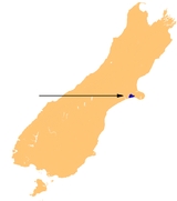
South Island
The South Island is the larger of the two major islands of New Zealand, the other being the more populous North Island. It is bordered to the north by Cook Strait, to the west by the Tasman Sea, to the south and east by the Pacific Ocean...
of New Zealand. It is actually a broad, shallow lagoon
Lagoon
A lagoon is a body of shallow sea water or brackish water separated from the sea by some form of barrier. The EU's habitat directive defines lagoons as "expanses of shallow coastal salt water, of varying salinity or water volume, wholly or partially separated from the sea by sand banks or shingle,...
located directly to the west of Banks Peninsula
Banks Peninsula
Banks Peninsula is a peninsula of volcanic origin on the east coast of the South Island of New Zealand. It has an area of approximately and encompasses two large harbours and many smaller bays and coves...
, separated from the Pacific Ocean
Pacific Ocean
The Pacific Ocean is the largest of the Earth's oceanic divisions. It extends from the Arctic in the north to the Southern Ocean in the south, bounded by Asia and Australia in the west, and the Americas in the east.At 165.2 million square kilometres in area, this largest division of the World...
by a long narrow sandy spit called Kaitorete Spit
Kaitorete Spit
Kaitorete Spit is a long finger of land which extends along the coast of Canterbury in the South Island of New Zealand. it runs southwest from Banks Peninsula for 25 kilometres, and separates the shallow Lake Ellesmere from the Pacific Ocean...
, or more correctly Kaitorete Barrier. It lies partially in extreme southeastern Selwyn District
Selwyn District
The Selwyn District is a predominantly rural area in central Canterbury, on the east coast of New Zealand's South Island. It is named after the Selwyn River, which is in turn named after Bishop George Selwyn, the first Anglican bishop of New Zealand who, in 1843 and 1844, travelled the length of...
and partially in the southwestern extension of the former Banks Peninsula
Banks Peninsula
Banks Peninsula is a peninsula of volcanic origin on the east coast of the South Island of New Zealand. It has an area of approximately and encompasses two large harbours and many smaller bays and coves...
District, which now (since 2006) is a ward in the city of Christchurch
Christchurch
Christchurch is the largest city in the South Island of New Zealand, and the country's second-largest urban area after Auckland. It lies one third of the way down the South Island's east coast, just north of Banks Peninsula which itself, since 2006, lies within the formal limits of...
. The lake holds high historical and cultural significance to the indigenous Māori
Maori language
Māori or te reo Māori , commonly te reo , is the language of the indigenous population of New Zealand, the Māori. It has the status of an official language in New Zealand...
population and the traditional Māori name Te Waihora, means spreading waters. It has officially had a dual English/Māori name since at least 1938.
Geography and hydrology
Currently Lake Ellesmere / Te Waihora is a brackishBrackish water
Brackish water is water that has more salinity than fresh water, but not as much as seawater. It may result from mixing of seawater with fresh water, as in estuaries, or it may occur in brackish fossil aquifers. The word comes from the Middle Dutch root "brak," meaning "salty"...
bar-type lagoon
Lagoon
A lagoon is a body of shallow sea water or brackish water separated from the sea by some form of barrier. The EU's habitat directive defines lagoons as "expanses of shallow coastal salt water, of varying salinity or water volume, wholly or partially separated from the sea by sand banks or shingle,...
. The lake covers an area of 198 square kilometres (76.4 sq mi), and is New Zealand's 5th largest lake (by area).
Lagoons of this type form an interlinked chain of habitats or corridor
Habitat corridor
A habitat corridor is a strip of land that aids in the movement of species between disconnected areas of their natural habitat. An animal’s natural habitat would typically include a number of areas necessary to thrive, such as wetlands, burrowing sites, food, and breeding grounds...
, which run the length of the east coast of the South Island
South Island
The South Island is the larger of the two major islands of New Zealand, the other being the more populous North Island. It is bordered to the north by Cook Strait, to the west by the Tasman Sea, to the south and east by the Pacific Ocean...
, from Wairau Lagoon and Lake Grassmere
Lake Grassmere
Lake Grassmere is close to Cook Strait in the northeastern South Island of New Zealand.- Geography :Lake Grassmere, south of Blenheim and south of the mouth of the Awatere River, is a shallow lagoon protected from the open sea by a single barrier beach covered by sand dunes...
in Marlborough, through Lake Ellesmere / Te Waihora and Coopers Lagoon in Central Canterbury, Washdyke
Washdyke Lagoon
Washdyke Lagoon is a brackish shallow coastal lagoon approximately 1 kilometre north of Timaru, South Canterbury, New Zealand. The lagoon has drastically reduced in size since 1881 when it was approximately 253 hectares, now it is less than 48 hectares in area...
and Wainono Lagoons
Wainono Lagoon
Wainono Lagoon is a shallow lake in the southern Canterbury region of New Zealand's South Island. A number of rivers flow into the lagoon, including the Hook River from the north and the Waihao River from the south...
in South Canterbury, to Waituna Lagoon in Southland
Southland Region
Southland is New Zealand's southernmost region and is also a district within that region. It consists mainly of the southwestern portion of the South Island and Stewart Island / Rakiura...
.
Catchment
Nearly all of the water entering Lake Ellesmere / Te Waihora is derived from the groundwater system that underlies the gravel-dominated strata of the Central Canterbury PlainsCanterbury Plains
The Canterbury Plains are an area in New Zealand centred to the south of the city of Christchurch in the Canterbury Region. Their northern extremes are at the foot of the Hundalee Hills in the Hurunui District, and in the south they merge into the plains of North Otago beyond the Waitaki...
. The groundwater system is fed from two sources of recharge: rainfall incident on the plains and subterranean seepage from the Rakaia
Rakaia River
The Rakaia River is in the Canterbury Plains in New Zealand's South Island. The Rakaia River is one of the largest braided rivers in New Zealand...
and Waimakariri River
Waimakariri River
The Waimakariri River is the largest of the North Canterbury rivers, in the South Island of New Zealand. It flows for 151 kilometres in a generally southeastward direction from the Southern Alps across the Canterbury Plains to the Pacific Ocean....
s. The exception to this is periods of persistent rainfall, usually during winter when discharge into Lake Ellesmere / Te Waihora is supplemented by surface flow derived from the foothills from the Rakaia Gorge
Rakaia Gorge
The Rakaia Gorge is located on the Rakaia River in inland Canterbury in New Zealand's South Island.Like its neighbour, the Waimakariri River, the Rakaia runs through wide shingle beds for much of its length, but is forced through a narrow canyon as it approaches the Canterbury Plains.In the 1870s,...
to Darfield
Darfield, New Zealand
Darfield is a town in the Selwyn District of the South Island of New Zealand. It is located 35 kilometres west from the outskirts of Christchurch, New Zealand on State Highway 73 and the town is on the Midland railway line, route of the famous TranzAlpine train service...
. This illustrates why Lake Ellesmere / Te Waihora has undergone significant ecological transformation in recent years as land use practices in the catchment area have changed. Little detail is known about water level regimes, internal circulation or sedimentation regimes of such lagoons, however it is known that they are significantly vulnerable to human use of the surrounding land and contributing catchments through changes to their hydrological regimes, as well as their sediment and chemical input loads.
History
Although Lake Ellesmere / Te Waihora is less than 5000 years old it has undergone many dramatic changes over that short period of time. The lake is a dynamic feature, it has been up to twice its present depth and area in the past, and it has progressed through various stages as it has developed into the brackish bar-type lagoonLagoon
A lagoon is a body of shallow sea water or brackish water separated from the sea by some form of barrier. The EU's habitat directive defines lagoons as "expanses of shallow coastal salt water, of varying salinity or water volume, wholly or partially separated from the sea by sand banks or shingle,...
that we see today. In Chronological order these stages began with the lake as part of Canterbury plains, which were then flooded, forming a bay, then an estuary and finally a lake/ lagoon (Waituna type lagoon).
The original formation of Lake Ellesmere / Te Waihora was primarily a function of formation of Kaitorete Barrier. Kaitorete Barrier is often incorrectly referred to as a spit. However by definition this is incorrect as a spit is widest at the updrift end and tapers to a narrow tip at the downdrift end, but the Kaitorete Barrier is narrower at the southern (updrift) end and widest at the northern (downdrift) end. Kaitorete is also attached to the land at both ends (although somewhat tenuously in south) and therefore technically classed as a Barrier beach.
The formation of Kaitorete Barrier began at the end of the Last Glacial Maximum
Last Glacial Maximum
The Last Glacial Maximum refers to a period in the Earth's climate history when ice sheets were at their maximum extension, between 26,500 and 19,000–20,000 years ago, marking the peak of the last glacial period. During this time, vast ice sheets covered much of North America, northern Europe and...
20,000 years ago valley glaciers advanced in Canterbury and subsequent glacial outwash rivers delivered vast quantities of sand, gravel and silt to the coast. Sea level in Canterbury was 130 meters lower than the present day due to glaciation and the coast was as far as 50 km east of its present day position, meaning the Canterbury plains were double their present width. Subsequent rapid sea-level rise then drowned what is now the continental shelf, causing rapid westward migration of the coast. 10,000 years ago the Canterbury coast was approaching the area presently occupied by Lake Ellesmere / Te Waihora. The coast consisted then, as it does now of the unconsolidated sands and gravels of the fans of major rivers in the area such as the Rakaia and Waimakariri. The Canterbury Bight
Canterbury Bight
Canterbury Bight is a 135 km stretch of coastline between Dashing Rocks and the southern side of Banks Peninsula on the eastern side of the South Island, New Zealand. The bight faces southeast, which exposes it to high-energy storm waves originating in the Pacific Ocean...
was exposed to powerful southerly waves. The combination of weakly resistant unconsolidated sands and gravels and high energy wave action caused rapid coastal erosion and strong net northward transport of the resulting load of sands and gravels fed to the shore.
This completes the sequence of events leading up to the formation of Lake Ellesmere / Te Waihora; with rapid sea-level rise drowning the seaward edge of plains, rapid erosion of coast to south changing its position and providing, in addition to direct river-borne sediments, a massive supply of sea borne sediments and strong net northwards longshore drift
Longshore drift
Longshore drift consists of the transportation of sediments along a coast at an angle to the shoreline, which is dependent on prevailing wind direction, swash and backwash. This process occurs in the littoral zone, and in or within close proximity to the surf zone...
by waves, moving the sediments towards Banks Peninsula
Banks Peninsula
Banks Peninsula is a peninsula of volcanic origin on the east coast of the South Island of New Zealand. It has an area of approximately and encompasses two large harbours and many smaller bays and coves...
and providing the materials to construct Kaitorete Barrier
Kaitorete Spit
Kaitorete Spit is a long finger of land which extends along the coast of Canterbury in the South Island of New Zealand. it runs southwest from Banks Peninsula for 25 kilometres, and separates the shallow Lake Ellesmere from the Pacific Ocean...
, that now encloses the lake.
If left to develop naturally Lake Ellesmere / Te Waihora will once again become a saltwater estuary over the next few centuries.
Cultural significance
Lake Ellesmere / Te Waihora has been a revered mahinga kai (site of traditional significance for food and other natural resources) for Māori since ancient times and remains central to the lives of many Māori who now live in the area. Under the Ngāi TahuNgāi Tahu
Ngāi Tahu, or Kāi Tahu, is the principal Māori iwi of the southern region of New Zealand, with the tribal authority, Te Rūnanga o Ngāi Tahu, being based in Christchurch and Invercargill. The iwi combines three groups, Kāi Tahu itself, and Waitaha and Kāti Mamoe who lived in the South Island prior...
Claims Settlement 1998, ownership of the lake bed of Lake Ellesmere / Te Waihora was returned to Te Rūnanga O Ngāi Tahu, who are now able to reassert their rangatiratanga (ownership) over this significant site through direct control of its management.
The traditional name for the lake was Te Kete Ika o Rākaihautū meaning "the food basket of Rākaihautū". The food sources of Lake Ellesmere / Te Waihora were once abundant and included tuna (eels), pātiki (flounder) and aua (mullet). Lake Ellesmere / Te Waihora was a famed mahinga manu wai māori (place for taking waterfowl). However, today the richness of Lake Ellesmere / Te Waihora as a mahinga kai has been largely lost to farmland. While it remains a mahinga kai, its yields have been significantly reduced due to the periodic drainage of the lake in order to maintain reclaimed land and pasture. In the pre-Pākehā past however, the control of the lake’s level was retained at an optimum water level for the birdlife that lived there and provided kai (food) for many people. The lake was only drained when its level exceeded the normal maximum. Kōrari (flax
Flax
Flax is a member of the genus Linum in the family Linaceae. It is native to the region extending from the eastern Mediterranean to India and was probably first domesticated in the Fertile Crescent...
stalks) were dragged across the sand to make the initial opening of the water to the sea. Such carefully monitored drainage of the lake took place for several hundred years, consistently maintaining Lake Ellesmere / Te Waihora's abundant supply of kai.
In 2007 an assessment of the cultural health of Lake Ellesmere / Te Waihora was undertaken as a combined effort by Ngai Tahu and the National Institute of Water and Atmospheric Research
National Institute of Water and Atmospheric Research
The National Institute of Water and Atmospheric Research or NIWA , is a Crown Research Institute of New Zealand. Established in 1992, NIWA conducts commercial and non-commercial research across a broad range of disciplines in the environmental sciences...
(NIWA). Preliminary findings showed that the lake, and in particular the lake edge still holds significant mahinga kai values, despite obvious water quality, modification, pressure and native vegetation issues.
As a result of the study, and in particular the interviews with Tāngata whenua
Tangata Whenua
Tāngata whenua is a Māori term of the indigenous peoples of New Zealand and literally means "people of the land", from tāngata, 'people' and whenua land.-Meanings:...
, a number of unique themes and health indicators for Lake Ellesmere / Te Waihora were identified. Drivers of change were identified as: catchment land use modification and intensification; drainage, management and reclamation of wetlands; decline in quality; and access to mahinga kai and a decline in inflow and lake water quality and quantity. Major changes over time were identified as: the loss of mahinga kai habitat; loss of matauranga Ngai Tahu (the knowledge of the local iwi); domination of the fishery by commercial operators; declining access and use of the lake and mahinga kai; and degradation of mauri (life force) of the lake and mana
Mana
Mana is an indigenous Pacific islander concept of an impersonal force or quality that resides in people, animals, and inanimate objects. The word is a cognate in many Oceanic languages, including Melanesian, Polynesian, and Micronesian....
. For the indigenous population desirable outcomes for the future include regeneration and restoration of native habitat; higher and fluctuating lake levels; an increase in the native bird population; reduced sedimentation and erosion; integrated management action; more Ngai Tahu and community use; mahinga kai activity rejuvenated; and Te Kete Ika o Rakaihautu/The Fish Basket of Rakaihautu restored.
Recreation
As well as holding high cultural significance to the indigenous population Lake Ellesmere / Te Waihora is also rated as a nationally significant site for recreation. The lake is currently used for a wide range of water and land based activities. It has been identified as nationally significant for waterfowl hunting, and regionally significant for fishing and cycling on the rail trail.A wide range of both water and land based activities are currently undertaken in the area including fishing, waterfowl hunting, bird-watching, picnicking, camping, cycling, trail biking, scenic driving and water sports such as kayaking and water-skiing. Many of these activities are reliant on a healthy natural ecosystem, especially fish and wildlife habitat, and a decrease in the number of people participating in trout fishing and other activities has been recorded since 1996 .
State of the lake and future management
In a 2010 report on lake water quality Lake Ellesmere / Te Waihora was deemed the second most polluted lake in New ZealandNew Zealand
New Zealand is an island country in the south-western Pacific Ocean comprising two main landmasses and numerous smaller islands. The country is situated some east of Australia across the Tasman Sea, and roughly south of the Pacific island nations of New Caledonia, Fiji, and Tonga...
in terms of nutrient content and algal growth. Algal blooms are a regular summer occurrence and toxic algae bloomed in the lake in 2009. Furthermore most tributaries to the lake exceed the contact recreation guidelines for faecal coliforms and levels of faecal coliforms in Boggy Creek and Doyleston Drain frequently exceed the stock-drinking water guideline value.
Results for Ecoli levels are also poor with 42% of sites associated with the lake failing national recreational guide standards for water quality. No sites achieved the shellfish/food gathering standard or were fit for drinking. However there is some debate over the definition of the trophic status of Lake Ellesmere / Te Waihora. Although the lake has high nutrient and phytoplankton values that place it in the category of hypertrophic (extremely enriched) the lake does not exhibit many of the characteristics of such a classification. For example it does not regularly undergo severe oxygen depletion, nor does it produce unsightly toxic algal blooms or fish kills, unlike other lakes in the area with the same trophic status. Furthermore it supports abundant fish and bird communities.
Recently it has been recognised that the combination of abstraction and climate was causing adverse effects on groundwater levels that in turn adversely affected the spring fed stream discharge into Lake Ellesmere / Te Waihora. The dependency of lake on the ground water system in its catchment cannot be reduced, but it is to be hoped that by managing groundwater abstractions during times when the inputs to the aquifer system are low the output system to the lake will be maintained at a level that ensures the protection of Lake Ellesmere / Te Waihora. Being a low land lake Lake Ellesmere / Te Waihora not only receives inputs within the immediate vicinity of the lake but also from the wider catchment across the plains to the foothills. The quality of lake tributaries reflects the intensive land use surrounding them, with elevated nutrients and bacteria found in many sites. This has implications for the scale of management issues. The dependency of Lake Ellesmere / Te Waihora on groundwater sourced input has resulted in local authority Environment Canterbury
Canterbury Regional Council
Canterbury Regional Council is the regional council for Canterbury, the largest region in the South Island of New Zealand. It is part of New Zealand's structure of local government...
implementing a restorative programme for lowland streams. Riparian protection around the lake margin and tributaries will greatly help reduce some contaminant inputs such as sediment and phosphorus, but catchment wide nutrient and water allocation management will be needed to reduce nitrates and improve freshwater inflows to the lake.
Further reading
Originally from An Encyclopaedia of New Zealand, edited by A. H. McLintock, published in 1966.External links
- Avenues Magazine - Ellesmere Swansong: the end of a lake?
- Public Address - The End of Lake Ellesmere
- Waihora Ellesmere Trust - set up to educate people about Lake Ellesmere
- Map of Banks Peninsula ward, Christchurch
- Map of Selwyn District