
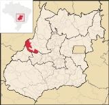
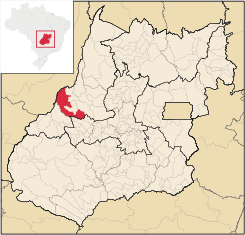
Jussara
Encyclopedia
| Jussara | |
|---|---|
| State | Goiás Goiás Goiás is a state of Brazil, located in the central part of the country. The name Goiás comes from the name of an indigenous community... |
| Area: | 4,092.4 km² |
| Population: | 18,814 (IBGE 2007) |
| Elevation: | 317m above sea level |
| Postcode (CEP): | 76270-000 |
| IBGE statistical microregion: | Rio Vermelho Microregion Rio Vermelho Microregion The Rio Vermelho Microregion is a geographical region in central Goiás state, Brazil. The most important city is Goiás, also known as Goiás Velho. The Rio Vermelho, a tributary of the Araguaia River flows through the region... |
| Became a city: | 1958 |
| Distance to Goiânia Goiânia -Climate:The city has a tropical wet and dry climate with an average temperature of . There's a wet season, from October to April, and a dry one, from May to September. Annual rainfall is around 1,520 mm.... : |
222 km. |
| Website: | none |
| Coordinates: | 15°51′51"S 50°51′08"W |
Municipality
A municipality is essentially an urban administrative division having corporate status and usually powers of self-government. It can also be used to mean the governing body of a municipality. A municipality is a general-purpose administrative subdivision, as opposed to a special-purpose district...
in Goiás
Goiás
Goiás is a state of Brazil, located in the central part of the country. The name Goiás comes from the name of an indigenous community...
state, Brazil
Brazil
Brazil , officially the Federative Republic of Brazil , is the largest country in South America. It is the world's fifth largest country, both by geographical area and by population with over 192 million people...
. Jussara is a major producer of cattle for the beef market.
Location and history
Jussara is located in the region of the Vale do Araguaia, 222 kilometers from the state capital of GoiâniaGoiânia
-Climate:The city has a tropical wet and dry climate with an average temperature of . There's a wet season, from October to April, and a dry one, from May to September. Annual rainfall is around 1,520 mm....
. Highway communications are made with Goiânia
Goiânia
-Climate:The city has a tropical wet and dry climate with an average temperature of . There's a wet season, from October to April, and a dry one, from May to September. Annual rainfall is around 1,520 mm....
by GO-060 / Trindade, Goiás
Trindade, Goiás
Trindade is a city and municipality in Goiás state, Brazil. It is famous for the religious celebrations held there in July and is now the third most important pilgrimage site in Brazil....
/ Claudinápolis / GO-326 / Anicuns
Anicuns
Anicuns is a small city and municipality in central Goiás state, Brazil.-Geographical Facts:Anicuns is located in the Anicuns Microregion, which includes 13 cities with a population of 103276 inhabitants in a total area of 5483.10 km²....
/ Sanclerlândia
Sanclerlândia
Sanclerlândia is a small town and municipality in western Goiás state, Brazil. The population was 7,641 in 2005 and the total area of the municipality was 496.8 km².-Location:...
/ Novo Brasil
Novo Brasil
Novo Brasil is a small town and municipality in eastern Goiás state, Brazil.-Location:Novo Brasil is located east of the capital near Iporá and São Luís de Montes Belos.*Distance to the state capital: 200 km....
/ GO-324. Sepin
The town began as the Agricultural Colony of Água Limpa, belonging to the city of Goiás. In 1950 the name was changed to Jussara in tribute to Jussara Amorim, the first woman from Goiás
Goiás, Goiás
Goiás is a small city and municipality in the state of Goiás in Brazil. The population was 24,072 in a total area of 3,108 km² . It is the former capital of the state and preserves much of its colonial heritage...
to be elected Miss Brasil
Miss Brasil
The Miss Brasil Pageant is a beauty contest that has been held almost every year since 1954 between winners of the Brazilian state pageants.It is one of the most important beauty contest of the world, with USA and Venezuela...
. In 1958 it was dismembered from Goiás and elevated to a municipality.
Today it borders the municipalities of Britânia
Britânia
Britânia is a small town and municipality in northwestern Goiás state, Brazil. The population was 5,073 in a total area of 1461.2 km².-Municipal Boundaries:Municipal boundaries:*North: Aruanã*South: Jussara*East: Itapirapuã and Aruanã...
, Montes Claros de Goiás
Montes Claros de Goiás
Montes Claros de Goiás is a small town and municipality in western Goiás state, Brazil-Location and connections:Montes Claros is located in the extreme west of the state, about 70 km east of the Araguaia River. It is east of Aragarças and west of Jussara.Montes Claros is connected by poor...
, Fazenda Nova
Fazenda Nova
Fazenda Nova is a small town and municipality in central-west Goiás state, Brazil.-Location:Fazenda Nova is located northwest of the state capital, Goiânia, which is 206 km. away taking highways GO-418 and GO-060...
, Santa Fé de Goiás
Santa Fé de Goiás
Santa Fé de Goiás is a small town and municipality in west-central Goiás state, Brazil.-Location:Santa Fé is located almost directly west of Brasília and northwest of Goiânia. The nearest town of any size is Jussara, which lies 34 km...
, Novo Brasil
Novo Brasil
Novo Brasil is a small town and municipality in eastern Goiás state, Brazil.-Location:Novo Brasil is located east of the capital near Iporá and São Luís de Montes Belos.*Distance to the state capital: 200 km....
and Itapirapuã
Itapirapuã
Itapirapuã is a small town and municipality in the state of Goiás in Brazil. The population was 8,208 in 2007 in a total area of 2,043.7 km² . Itapirapuã is a large producer of cattle.-Location and Boundaries:...
and is crossed by highways BR-070 and by GOs 324 and 418.
Climate and geography
The climate is typically tropical with high temperatures, between 35 and 38 degrees. The city forms part of the Amazon basin, being made up of the Samambaia, Água Limpa, Araguaia, Molha Biscoito and Palmeira rivers. Its vegetation is characterized by forest and cerrado. The tourist area takes in the vast area of the Araguaia RiverAraguaia River
The Araguaia River or, in Portuguese, Rio Araguaia is one of the major rivers of Brazil, and the principal tributary of the Tocantins. It has a total length of approximately 2,627 km. Araguaia means "river of macaws" in the Tupi language....
, with its natural beauty and extensive beaches rich in flora and fauna.
Political data
- Mayor: Joaquim Alves de Castro Neto (January 2005)
- Vice-mayor: Ismael Caetano Martins
- Number of councilmembers: 9
Demographic data
- Population density: 4.60 inhab/km² (2007)
- Population in 1980: 22,520
- Population in 1991: 20,917
- Population in 2007: 18,814 (14,995 urban and 3,819 rural)
- Population growth rate 1991/1996: -0.65.%
- Population growth rate 1991/2000: -0.48.%
- Population growth rate 2000/2007: -0.89.%
Economy
The economy is based on modest commerce, public employment, small transformation industries, cattle raising, and agriculture. There is an industrial district and a dairy.The soil is very fertile and lends itself to agriculture with emphasis on the planting of rice, beans, corn, manioc, sweet potato, cotton, and soybeans, among others. The subsoil is rich in minerals like cassiterite, nickel, and chrome. Cattle raising is also practiced with one of the largest herds in the state (388,000). Cheese and milk products are manufactured locally. There are also brick factories producing both floor tiles, bricks and roof tiles.
Economic data
- Number of Industrial Establishments: 42 (06/2007)
- Industrial District: Distrito Agroindustrial - DAIJU (June/2006)
- Dairies: Laticínios Morrinhos Indústria e Comércio Ltda (05/2006)
- Banking Establishments: - Banco do Brasil S.A. - BRADESCO S.A. - Banco Itaú S.A. - CEF.
- Number of Retail Commercial Establishments: 287 (August/2007)
Main crops in planted area (2006)
- Cotton: 1,600 hectares
- Beans: 3,200 hectares
- Soybeans: 4,650 hectares
- Modest production of manioc, sesame, oranges, sugarcane, and rubber
Education (2006)
- Schools in activity: 27 with 5,470 students (a decline in enrollment of around 1,500 students since 2000)
- Higher education: UEG - Faculdade de Educação, Ciências e Letras de Jussara, Faculdade de Jussara
- Literacy Rate: 84.9%
Health (2007)
- Hospitals: 1 with 92 beds
- Infant mortality rate: 26.34 (in 1,000 live births)
- MHDI: 0.740
- State ranking: 104 (out of 242 municipalities in 2000)
- National ranking: 2,145 (out of 5,507 municipalities in 2000)