
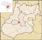
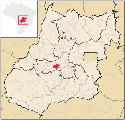
Anicuns
Encyclopedia
| Anicuns | |
|---|---|
| State | Goiás Goiás Goiás is a state of Brazil, located in the central part of the country. The name Goiás comes from the name of an indigenous community... |
| Area: | 1,750.0 km² |
| Population: | 17,705 (IBGE 2007 estimate) |
| Elevation: | 692 m above sea level |
| Postcode (CEP): | 76170-000 |
| IBGE statistical microregion: | Anicuns Microregion Anicuns Microregion The Anicuns Microregion is a geographical division in the state of Goiás, Brazil. It is made up of 13 municipalities located near Anicuns, a small city and municipality west of Goiânia... |
| Became a city: | 1911 |
| Distance to Goiânia Goiânia -Climate:The city has a tropical wet and dry climate with an average temperature of . There's a wet season, from October to April, and a dry one, from May to September. Annual rainfall is around 1,520 mm.... : |
86 km |
| Website: | Câmara Municipal de Anicuns no information given |
| Coordinates | 16°27′46"S 49°57′38"W |
City
A city is a relatively large and permanent settlement. Although there is no agreement on how a city is distinguished from a town within general English language meanings, many cities have a particular administrative, legal, or historical status based on local law.For example, in the U.S...
and municipality
Municipality
A municipality is essentially an urban administrative division having corporate status and usually powers of self-government. It can also be used to mean the governing body of a municipality. A municipality is a general-purpose administrative subdivision, as opposed to a special-purpose district...
in central Goiás
Goiás
Goiás is a state of Brazil, located in the central part of the country. The name Goiás comes from the name of an indigenous community...
state, Brazil
Brazil
Brazil , officially the Federative Republic of Brazil , is the largest country in South America. It is the world's fifth largest country, both by geographical area and by population with over 192 million people...
.
Geographical Facts
Anicuns is located in the Anicuns MicroregionAnicuns Microregion
The Anicuns Microregion is a geographical division in the state of Goiás, Brazil. It is made up of 13 municipalities located near Anicuns, a small city and municipality west of Goiânia...
, which includes 13 cities with a population of 103276 inhabitants in a total area of 5483.10 km².
It forms boundaries with the following the municipalities:
- North and Northeast: ItaberaíItaberaíItaberaí is a small city and municipality in central Goiás state, Brazil. Itaberaí is a large producer of agricultural products including corn, rice, soybeans, tomatoes, and sugarcane.-Location:...
, MossâmedesMossâmedesMossâmedes is a small town and municipality in western Goiás state, Brazil.-Location:Mossâmedes is located northwest of the state capital, Goiânia in the Anicuns Microregion. It is connected by paved roads with Itaberaí to the north and Anicuns to the south. The distance to the state capital is...
and AurilândiaAurilândiaAurilândia is a small town and municipality in eastern Goiás state, Brazil.-Location:The distance to the state capital is 146 km. while the distance to the main regional center São Luís de Montes Belos is 23 km.... - South: NazárioNazárioNazário is a small town and municipality in eastern Goiás state, Brazil.-Location:Nazário is located 74 km. west of the state capital, Goiânia a few kilometers west of the Rio dos Bois, a major tributary of the Paranaíba River. The regional center, Anicuns, is 21 km to the northwest...
and Palmeiras de GoiásPalmeiras de GoiásPalmeiras de Goiás is a small city and municipality in southestern Goiás state, Brazil.-Location:Palmeiras de Goiás is located in the statistical micro-region of Vale do Rio dos Bois at a distance of 88 kilometers from the state capital, Goiânia. It is 26 kilometers from Cezarina and the important... - East: InhumasInhumasInhumas is a small city and municipality in central Goiás state, Brazil. The population was 47,361 in a total area of 613.3 km²...
and TrindadeTrindade-Transportation:Trindade are linked with São Tomé and Príncipe's only highways linking to the capital city of São Tomé, another linking Neves and Santana and another linking to Guadalupe as well.... - West: São Luís de Montes BelosSão Luís de Montes BelosSão Luís de Montes Belos is a small city and municipality in the State of Goiás, Brazil.-Location:It is located in the Anicuns Microregion, 123 kilometers from the state capital, Goiânia, to which it is connected by highway GO-060...
The distance to Goiânia
Goiânia
-Climate:The city has a tropical wet and dry climate with an average temperature of . There's a wet season, from October to April, and a dry one, from May to September. Annual rainfall is around 1,520 mm....
is 86 km. Highway connections are made by GO-060 / Trindade
Trindade, Goiás
Trindade is a city and municipality in Goiás state, Brazil. It is famous for the religious celebrations held there in July and is now the third most important pilgrimage site in Brazil....
/ Claudinápolis de Goiás / GO-326. See Seplan
Anicuns is situated on the right bank of the Rio dos Bois, the main river in the region and a tributary of the Paranaíba River
Paranaíba River
The Paranaíba River is a Brazilian river whose source lies in the state of Minas Gerais in the Mata da Corda mountains, municipality of Rio Paranaíba, at an altitude of 1,148 meters; on the other face of this mountain chain are the sources of the Abaeté river, tributary of the São Francisco River...
. The important Rio Turvo also has its source in the municipality. The average elevation is 600 meters. The climate is tropical humid and the average annual temperature is 23°C.
Districts, Villages and Hamlets
- Districts: Capelinha and Choupana.
- Village: Poncionário.
- Hamlet: Boa Vista.
Demographics
- Population density: 18.41 hab/km² (2007)
- Population growth rate: -0.13%
- Population in 1980: 23,150
- Population in 2007: 17,705
- Urban population: 15,228
The economy
Economically, Anicuns has a variety of industrial activities. It produces bricks and tiles (six brickworks)and has 16 small shoe factories, specializing in leather boots. There is also cattle raising, both for meat and dairy, together with growing of sugarcane, coffee, and corn. There were three financial institutions in 2004: Banco do Brasil, Bradesco, and Itaú S.A. There was also an alcohol distillery using the availability of sugarcane. Most of the workers were engaged in transformation industries, public administration, and commerce. (IBGE 2005)- Industrial establishments: 39
- Retail commercial establishments: 185
- Dairy: LEE Laticínios Ltda. (22/05/2006)
- Distillery: Anicuns S/A Álcool e Derivados (July/2007)
- Industrial park: Distrito Agroindustrial de Anicuns (June/2006)
Agricultural Data
- Number of farms: 1,237
- Total farming area: 52,201 ha.
- Planted area: 13,100 ha.
- Area of natural pasture: 33,078
- Persons working in agriculture: 4,500
- Number of cattle (head): 115.400
- Area of corn: 4,200 ha.
- Area of rice: 800 ha.
- Area of sugarcane: 7,000 ha.
- Area of soybeans: 400 ha.
- Area of banana: 150 ha.
- Area of coffee: 230 ha.
Health and education
In the health sector there were 6 hospitals with 142 hospital beds. The infant mortality rate was 38.99 in 2000.(IBGE 2002). In the educational sector there were 17 primary schools and 4 secondary schools. There was a campus of the state university. The literacy rate was 85.8% in 2000. (IBGE)
Municipal Human Development Index
Human Development Index
The Human Development Index is a composite statistic used to rank countries by level of "human development" and separate "very high human development", "high human development", "medium human development", and "low human development" countries...
- MHDI: 0.720
- State ranking: 173 (out of 242 municipalities)
- National ranking: 2,616 (out of 5,507 municipalities)
All data are from 2000
Origin of the name
The name of the city comes from the Guanicuns Indians, who would hunt a bird with the same name (extinct). The anicuns bird was known for its beautiful feathers and song. The Indians made adornments from the feathers and ate the bird's tongue believing that it would allow them to imitate its beautiful singing.History
Anicuns had its beginnings with the search for gold in the rivers. After the gold had run out the settlers stayed to raise cattle and grow crops. In 1841 Anicuns was already a district of the municipality of Palmeiras, becoming a municipality in 1911. In 1931 the name was changed from Anicuns to Novo Horizonte. In 1933 the district of NazárioNazário
Nazário is a small town and municipality in eastern Goiás state, Brazil.-Location:Nazário is located 74 km. west of the state capital, Goiânia a few kilometers west of the Rio dos Bois, a major tributary of the Paranaíba River. The regional center, Anicuns, is 21 km to the northwest...
was created to become part of Novo Horizonte. In 1938 the name was changed back to Anicuns. In 1952 Nazário separated to become a municipality.
Tourism
Anicuns has taken advantage of the Rio dos Bois to put on a canoe championship called Copa Brasil de Canoagem, which is accompanied by parades, cultural activities and regional musical shows. The competition, lasting three days, is one of the most important in the country.Tourist sites: · Poço do Boi de Ouro: craters wita a depth of 30 meters. · Serra do Felipe: much used in hang gliding. · Morro do Chapéu: highest point in the region. · Morro de Monte Castelo: 7 km from the center of town, still has native forest on the top of the mountain. · Serra da Canjica: only 3 km from the town, is next to the São José Jica waterfall, with a rocky wall and a free fall of more than 70 meters · Cachoeira São José: 2 km from the town, the place is made up of rapids and small waterfalls.
See also
- List of municipalities in Goiás
- Microregions of Goiás