
Fazenda Nova
Encyclopedia
| Fazenda Nova | |
|---|---|
| State | Goiás Goiás Goiás is a state of Brazil, located in the central part of the country. The name Goiás comes from the name of an indigenous community... |
| Area: | 1,281.3 km² (10/10/2002) |
| Population: | 6,373 (IBGE 2007) |
| Population density: | 4.97 inhab/km² (2007) |
| Elevation: | 476m above sea level |
| Postcode (CEP): | 76220-000 |
| Became a city: | 1953 |
| Mayor: | João Batista de Medeiros (2005) |
| IBGE statistical Microregion: | Iporá Microregion Iporá Microregion The Iporá Microregion is a geographical region in central-western Goiás state, Brazil. The most important city is Iporá. For a map see -Important Data :*Population: 58,845 *Cities: 10*Total Area: 7,096.60 km²... |
| Distance to Goiânia Goiânia -Climate:The city has a tropical wet and dry climate with an average temperature of . There's a wet season, from October to April, and a dry one, from May to September. Annual rainfall is around 1,520 mm.... : |
206 km. |
| Website: | none (March 2008) |
| Coordinates: | 16°11′12"S 50°46′29"W |
Municipality
A municipality is essentially an urban administrative division having corporate status and usually powers of self-government. It can also be used to mean the governing body of a municipality. A municipality is a general-purpose administrative subdivision, as opposed to a special-purpose district...
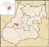
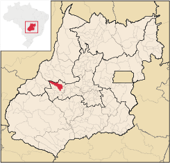
in central-west Goiás
Goiás
Goiás is a state of Brazil, located in the central part of the country. The name Goiás comes from the name of an indigenous community...
state, Brazil
Brazil
Brazil , officially the Federative Republic of Brazil , is the largest country in South America. It is the world's fifth largest country, both by geographical area and by population with over 192 million people...
.
Location
Fazenda Nova is located northwest of the state capital, GoiâniaGoiânia
-Climate:The city has a tropical wet and dry climate with an average temperature of . There's a wet season, from October to April, and a dry one, from May to September. Annual rainfall is around 1,520 mm....
, which is 206 km. away taking highways GO-418 and GO-060. Fazenda Nova belongs to the Iporá Microregion
Iporá Microregion
The Iporá Microregion is a geographical region in central-western Goiás state, Brazil. The most important city is Iporá. For a map see -Important Data :*Population: 58,845 *Cities: 10*Total Area: 7,096.60 km²...
.
Municipal boundaries are with:
Buriti de Goiás
Buriti de Goiás
Buriti de Goiás is a small town and municipality in eastern Goiás state, Brazil.-Location and Communications:*Distance to regional center : 58 km....
, Córrego do Ouro
Córrego do Ouro
Córrego do Ouro is a small town and municipality in eastern Goiás state, Brazil.-Location and Highway Connections:Córrego do Ouro is located in the Iporá Microregion west of the state capital, Goiânia. It is 45 km. northwest of São Luís de Montes Belos, the largest town in the region. ...
, Israelândia
Israelândia
Israelândia is a small town and municipality in eastern Goiás state, Brazil.-Location:Israelândia is located in the Iporá Microregion, 28 km. northeast of regional center Iporá. State capital Goiânia is 199 km. to the east...
, Jaupaci
Jaupaci
Jaupaci is a small town and municipality in eastern Goiás state, Brazil. The population was 2,998 in a total area of 527.2 km² .-Location:*Distance to regional center : 46 km....
, Jussara
Jussara
Jussara is a small town and municipality in Goiás state, Brazil. Jussara is a major producer of cattle for the beef market.-Location and history:Jussara is located in the region of the Vale do Araguaia, 222 kilometers from the state capital of Goiânia...
, Montes Claros de Goiás
Montes Claros de Goiás
Montes Claros de Goiás is a small town and municipality in western Goiás state, Brazil-Location and connections:Montes Claros is located in the extreme west of the state, about 70 km east of the Araguaia River. It is east of Aragarças and west of Jussara.Montes Claros is connected by poor...
and Novo Brasil
Novo Brasil
Novo Brasil is a small town and municipality in eastern Goiás state, Brazil.-Location:Novo Brasil is located east of the capital near Iporá and São Luís de Montes Belos.*Distance to the state capital: 200 km....
.
Districts, villages, and hamlets
- Districts: Bacilândia and Serra Dourada.
- Villages: Iapiruara e São Sebastião do Indaia.
- Hamlet: Três Marcos.
Demographics
- Population in 1980: 9.887
- Population in 2007: 6.373
- Urban population: 4.257
- Rural population: 2.116
- Population growth rate: -1.50% 1996/2007
The economy
The main economic activities were agriculture, cattle raising, and milk production. There was one banking institution—Banco do Brasil S.A (08/2007) and one dairy—Laticínios Morrinhos Ind. e Com. Ltda.; - Coop. Prod. de Leite da Regional de Fazenda Nova (2007). In 2006 there were 116,000 head of cattle. Agricultural production was modest with main crops being corn, soybeans,manioc, hearts of palm, and bananas.- GDP (PIB) (R$ 1,000.00): 54,904 (2005)
- GDP per capita (R$ 1.00): 7,790 (2005)
Motor vehicles
- Automobiles: 414
- Pickup trucks: 90
- Number of inhabitants per motor vehicle: 13
Agricultural data 2006
- Farms: 873
- Total area: 116,273 ha.
- Area of permanent crops: 189 ha.
- Area of perennial crops: 1,379 ha.
- Area of natural pasture: 87,951 ha.
- Area of woodland and forests: 26,811 ha.
- Persons dependent on farming: 2,500
- Farms with tractors: 62
- Number of tractors: 78
- Cattle herd: 116,000 head
Health and education
In 2000 the literacy rate was 84.1% while the infant mortality rate was 18.35 in 1,000 live births. There were 11 schools with 1,610 students in 2006, while there was one hospital with 28 beds in 2007. The Municipal Human Development IndexHuman Development Index
The Human Development Index is a composite statistic used to rank countries by level of "human development" and separate "very high human development", "high human development", "medium human development", and "low human development" countries...
was 0.746, which was ranked 89 in the state.