

History of Belize (1502-1862)
Encyclopedia
Belize
, on the east coast of Central America, southeast of Mexico, was settled by Spaniards in the 17th century, became a British crown colony from 1862 through 1964, and is now independent.
were still in Belize when the Europeans came in the 16th and 17th centuries. Archaeological and ethnohistorical research confirms that several groups of Mayan peoples lived in the area now known as Belize in the 16th century.
The political geography of that period does not coincide with present-day boundaries, so several Mayan provinces lay across the frontiers of modern Belize, Mexico, and Guatemala. The Mayan province of Chetumal
, for example, consisted of the northern part of present-day Belize and the southern coast of the Mexican state Quintana Roo
. In the south, crossing the present-day frontier between Belize and Guatemala, were the Mopán
Maya, and still farther south, the Ch'ol-speaking Manche groups. In central Belize lay the province of Dzuluinicob, meaning "land of foreigners" or "foreign people." This province stretched from New River
in the north to Sittee River
in the south, and from close to the present-day Guatemalan border in the west to the sea. The apparent political center of this province was Tipu
, located east of modern Benque Viejo del Carmen
. Lamanai
, several towns on New River and on Belize River
, and Xibún
on Sibun River
, were included in this province.
In the first decade of the 16th century, Juan De Solís sailed northward along the coast of Belize to Yucatán
. In 1519 Hernán Cortés
conquered Mexico, and Pedro Arias Dávila founded Panama City
. Spain soon sent expeditions to Guatemala and Honduras, and the conquest of Yucatán began in 1527.
When Cortés passed through the southwestern corner of present-day Belize in 1525, there were settlements of Ch'ol-speaking Manche in that area. When the Spanish "pacified" the region in the 17th century, they forcibly displaced these settlements to the Guatemalan highlands. The Spanish launched their main incursions into the area from Yucatán, however, and encountered stiff resistance from the Mayan provinces of Chetumal and Dzuluinicob. The region became a place of refuge from the Spanish invasion, but the escaping Maya brought with them diseases that they had contracted from the Spanish. Subsequent epidemics of smallpox
and yellow fever
, along with endemic
malaria
, devastated the indigenous population.
In the 17th century, Spanish missionaries from Yucatán traveled up New River and established churches in Mayan settlements with the intention of converting and controlling these people. One such settlement was Tipu, which was excavated in the 1980s. People occupied the site during preclassic, classic, and postclassic times, and through the conquest period until 1707.
Though conquered by the Spanish in 1544, Tipu was too far from the colonial centers of power to be effectively controlled for long. Thousands of Maya fled south from Yucatán in the second half of the 16th century, and the people of Tipu rebelled against Spanish authority. Tipu was apparently too important to ignore because of its proximity to the Itzá
of the Lago Petén Itzá region of present-day Guatemala. In 1618 and 1619, two Franciscans, attempting to convert the people built a church in Tipu. In 1638 a period of resistance began in Tipu, and by 1642, the entire province of Dzuluinicob was in a state of rebellion. The Maya abandoned eight towns at this time, and some 300 families relocated in Tipu, the center of rebellion. In the 1640s, Tipu's population totaled more than 1,000.
Piracy
along the coast increased during this period. In 1642, and again in 1648, pirates sacked Salamanca de Bacalar, the seat of Spanish government in southern Yucatán. The abandonment of Bacalar ended Spanish control over the Mayan provinces of Chetumal and Dzuluinicob.
Between 1638 and 1695, the Maya living in the area of Tipu enjoyed autonomy from Spanish rule. But in 1696, Spanish soldiers used Tipu as a base from which they subdued the area and supported missionary activities. In 1697 the Spanish conquered the Itzá, and in 1707, the Spanish forcibly resettled the inhabitants of Tipu to the area near Lago Petén Itzá. The political center of the Mayan province of Dzuluinicob ceased to exist at the time that British colonists were becoming increasingly interested in settling the area.
, English
, and French
encroached in areas where Spain was weak: the small islands of the Lesser Antilles
, the no-man's-land of the Guianas between the Spanish and Portuguese dominions, and the uncharted coasts of Yucatán and Central America. Later in the 17th century, England effectively challenged Spain in the western Caribbean
, capturing Jamaica
in 1655 and subsequently using this base to support settlements all the along the Caribbean coast from the Yucatán to Nicaragua
.
Early in the 17th century, on the shores of the Bay of Campeche
in southeastern Mexico and on the Yucatán Peninsula, English buccaneer
s began cutting logwood
, which was used in the production of a dye needed by the woollen industry. According to legend, one of these buccaneers, Peter Wallace, called "Ballis" by the Spanish, settled near and gave his name to the Belize River as early as 1638. English buccaneers began using the tortuous coastline of the area as a base from which to attack Spanish ships. Some of the buccaneers may have been refugees expelled by the Spanish in 1641-42 from settlements on islands off the coasts of Nicaragua and Honduras. Buccaneers stopped plundering Spanish logwood ships and started cutting their own wood in the 1650s and 1660s. Logwood extraction then became the main reason for the English settlement for more than a century.
A 1667 treaty, in which the European powers agreed to suppress piracy, encouraged the shift from buccaneering to cutting logwood and led to more permanent settlement. The 1670 Godolphin Treaty between Spain and England confirmed English possession of countries and islands in the Western Hemisphere that England already occupied. Unfortunately, those colonies were not named and ownership of the coastal area between Yucatán and Nicaragua remained unclear. Conflict continued between Britain and Spain, over the right of the British to cut logwood and to settle in the region. In 1717 Spain expelled British logwood cutters from the Bay of Campeche west of the Yucatán. This action had the unintended effect of enhancing the significance of the growing British settlement near the Belize River.
The first British settlers lived a rough and disorderly life. According to Captain Nathaniel Uring, who was shipwrecked and forced to live with the logwood cutters for several months in 1720, the British were "generally a rude drunken Crew, some of which have been Pirates." He said he had "but little Comfort living among these Crew of ungovernable Wretches, where was little else to be heard but Blasphemy, Cursing and Swearing."
During the 18th century, the Spanish attacked the British settlers repeatedly. In 1717, 1730, 1754, and 1779 the Spanish forced the British to leave the area. The Spanish never settled in the region, however, and the British always returned to expand their trade and settlement. At the end of the Seven Years' War
in 1763, the Treaty of Paris
conceded to Britain the right to cut and export logwood but asserted Spanish sovereignty over the territory. Still, there was never an agreement on the precise area in which logwood cutters could operate. The Spanish frontier town of Bacalar
in the Yucatán, refounded in 1730 after having been deserted for almost a century, became a base for operations against the British. When war broke out again in 1779, the commandant of Bacalar led a successful expedition against the British settlement, which was abandoned until the Treaty of Versailles in 1783 allowed the British to cut logwood in the area between the Hondo and Belize rivers. By that time, however, the logwood trade had declined and mahogany
had become the chief export, so the settlers petitioned for a new agreement.
s to establish common law
for the settlement as early as 1738. In 1765 Rear Admiral Sir William Burnaby
, commander in chief of Jamaica, arrived in the settlement and codified and expanded their regulations into a document known as Burnaby's Code. When the settlers began returning to the area in 1784, the governor of Jamaica named Colonel Edward Marcus Despard
as superintendent to oversee the Settlement of Belize in the Bay of Honduras.
The Convention of London
, signed in 1786, allowed the British settlers, known as Baymen
, to cut and export logwood and mahogany from the Hondo River in the north southward to the Sibun River
. The convention, however, did not allow the Baymen to build fortifications, establish any form of government, military or civil, or develop plantation
agriculture. Spain retained sovereignty over the area and asserted the right to inspect the settlement twice a year.
The Convention also required Britain to evacuate its settlement on the Mosquito Coast
(Costa de Mosquitos) in eastern Nicaragua and western Honduras. Over 2,000 of these settlers and their slaves arrived in 1787 in the settlement of Belize, reinforcing the British presence. The new settlers greatly increased the population, and moreover soon found themselves in considerable tension with the older settlers over the question of land rights and status.
The last Spanish attack on the British settlement, the Battle of St. George's Caye
, occurred two years after the outbreak of war in 1796. The governor general of Yucatán commanded a Spanish flotilla
of some thirty vessels with some 500 sailors and 2,000 troops and attacked the British colonists in 1798. During several brief engagements culminating in a two-and-a-half-hour battle on September 10, the British drove off the Spanish. The attack marked Spain's last attempt to control the territory or dislodge the British.
Despite treaties banning local government and plantation agriculture, both activities flourished. In the late 18th century, an oligarchy
of relatively wealthy settlers controlled the political economy of the British settlement. These settlers claimed about four-fifths of the land available under the Convention of London, through resolutions, called location laws, which they passed in the Public Meeting, the name given to the first legislature. These same men also owned about half of all the slaves in the settlement; controlled imports, exports, and the wholesale and retail trades; and determined taxation. A group of magistrates, whom they elected from among themselves, had executive as well as judicial functions, despite a prohibition on executive action.
 The landowners resisted any challenge to their growing political power. Colonel Edward Marcus Despard, the first superintendent appointed by the governor of Jamaica in 1784, was suspended in 1789 when the wealthy cutters challenged his authority. When Superintendent George Arthur
attacked what he called the "monopoly on the part of the monied cutters" in 1816, he was only partially successful in breaking their monopoly on landholding. He proclaimed that all unclaimed land was henceforth crown land
that could be granted only by the crown's representative but continued to allow the existing monopoly of landownership.
. In the second half of the eighteenth century the slave population hovered around 3,000, making up about three quarters of the total population. Most slaves, even if they were brought through West Indian markets, were born in Africa, probably from around the Bight of Benin
, the Congo
, and Angola
—the principal sources of British slaves in the late 18th century. The Eboe or Ibo
seem to have been particularly numerous; one section of Belize Town was known as Eboe Town in the first half of the 19th century. At first, many slaves maintained African ethnic identifications and cultural practices. Gradually, however, the process of assimilation was creating a new, synthetic Creole
culture.
The whites, although a minority in the settlement, monopolized power and wealth by dominating the chief economic activities of trade and cutting timber. They also controlled the first legislature and the judicial and administrative institutions. As a result, the British settlers had a disproportionate influence on the development of the Creole culture. Anglican, Baptist
, and Methodist missionaries helped devalue and suppress African cultural heritage.
Cutting wood was seasonal work that required workers to spend several months isolated in temporary makeshift camps in the forest, away from families in Belize Town. Settlers needed only one or two slaves to cut logwood, a small tree that grows in clumps near the coast. But as the trade shifted to mahogany in the last quarter of the 18th century, the settlers needed more money, land, and slaves for larger-scale operations. After 1770 about 80 percent of all male slaves aged ten years or more cut timber. Huntsmen found the trees, which were then cut, trimmed, and hauled to the riverside. During the rainy season, settlers and slaves floated rafts of untrimmed logs downriver, where the wood was processed for shipment. Huntsmen were highly skilled and valued slaves, as were the axmen who cut the trees while standing on a springy platform four to five meters high. Another group of slaves cared for the oxen that pulled the huge logs to the river. Others trimmed the trees and cleared the tracks. The use of small gangs of slaves for cutting wood reduced the need for close supervision; whip-wielding drivers, who were ubiquitous on large plantations elsewhere, were unknown in the settlement.
The colonial masters used domestic slaves, mostly women and children, to clean their houses, sew, wash and iron their clothes, prepare and serve their food, and raise their children. Some slaves cultivated provisions that would either be sold or used to save their owners some of the cost of importing food. Other slaves worked as sailors, blacksmiths, nurses, and bakers. Few slaves, however held jobs requiring a high level of skill. Young people started work by waiting on their masters' tables, where they were taught to obey, then most of the young women continued in domestic work while the young men became woodcutters. This rigid division of labor and the narrow range of work experience of most slaves limited their opportunities after legal emancipation in 1838.
The slaves' experience, though different from that on plantations in other colonies in the region, was nevertheless oppressive. They were frequently the objects of "extreme inhumanity," as a report published in 1820 stated. The settlement's chaplain reported "instances, many instances, of horrible barbarity" against the slaves. The slaves' own actions, including suicide, abortion, murder, escape, and revolt, suggest how they viewed their situation. Slaves who lived in small, scattered, and remote groups could escape with relative ease if they were willing to leave their families. In the 18th century, many escaped to Yucatán, and in the early 19th century a steady flow of runaways went to Guatemala and down the coast to Honduras. Some runaways established communities, such as one near Sibun River, that offered refuge to others. When freedom could be attained by slipping into the bush, revolt was not such a pressing option. Nevertheless, numerous slave revolts took place. The last revolt in 1820, led by two black slaves, Will and Sharper, involved a considerable number of well-armed individuals who "had been treated with very unnecessary harshness by their Owner, and had certainly good grounds for complaint."
One way the settler minority maintained its control was by dividing the slaves from the growing population of free Creole people who were given limited privileges. Though some Creoles were legally free, they could neither hold commissions in the military nor act as jurors or magistrates, and their economic activities were restricted. They could vote in elections only if they had owned more property and lived in the area longer than whites. Privileges, however, led many free blacks to stress their loyalty and acculturation to British ways. When officials in other colonies of the British West Indies
began giving free blacks expanded legal rights, the Colonial Office
threatened to dissolve the Baymen's Public Meeting unless it followed suit. The "Coloured Subjects of Free Condition" were granted civil rights on July 5, 1831, a few years before the abolition of slavery was completed.
The essence of society, a rigidly hierarchical system in which people were ranked according to race and class was well established by the time of full emancipation in 1838. The act to abolish slavery throughout the British colonies, passed in 1833, was intended to avoid drastic social changes by effecting emancipation over a five-year transition period. The act included two generous measures for slave owners: a system of "apprenticeship
" calculated to extend their control over the former slaves who were to continue to work for their masters without pay, and compensation for the former slave owners for their loss of property. These measures helped ensure that the majority of the population, even when it was legally freed after apprenticeship ended in 1838, depended on their former owners for work. These owners still monopolized the land. Before 1838, a handful of the inhabitants controlled the settlement and owned most of the people. After 1838, the masters of the settlement, a tiny elite, continued to control the country for over a century by denying access to land, and by promoting economic dependency of the freed slaves through a combination of wage advances and company stores.
and of Africans who had escaped from slavery, arrived in the settlement. The Garifuna had resisted British and French colonialism in the Lesser Antilles until they were defeated by the British in 1796. After putting down a violent Garifuna rebellion on Saint Vincent
, the British moved between 1,700 and 5,000 of the Garifuna across the Caribbean to the Bay Islands (present-day Islas de la Bahía) off the north coast of Honduras. From there they migrated to the Caribbean coasts of Nicaragua, Honduras, Guatemala, and the southern part of present-day Belize. By 1802 about 150 Garifuna had settled in the Stann Creek
(present-day Dangriga
) area and were engaged in fishing and farming.
Other Garifuna later came to the British settlement of Belize after finding themselves on the wrong side in a civil war in Honduras in 1832. Many Garifuna men soon found wage work alongside slaves as mahogany cutters. In 1841 Dangriga, the Garifuna's largest settlement, was a flourishing village. The American traveler John Stephens described the Garifuna village of Punta Gorda
as having 500 inhabitants and producing a wide variety of fruits and vegetables.
The British treated Garifuna as squatters. In 1857 the British told the Garifuna that they must obtain leases from the crown or risk losing their lands, dwellings, and other buildings. The 1872 Crown Lands Ordinance established reservations for the Garifuna as well as the Maya. The British prevented both groups from owning land and treated them as a source of valuable labor.
of 1850, Britain and the United States agreed to promote the construction of a canal across Central America and to refrain from colonizing any part of Central America. The British government interpreted the colonization clause as applying only to any future occupation. But the United States government claimed that Britain was obliged to evacuate the area, particularly after 1853, when President Franklin Pierce
's expansionist administration stressed the Monroe Doctrine
. Britain yielded on the Bay Islands and the Mosquito Coast in eastern Nicaragua. But in 1854, Britain produced a formal constitution establishing a legislative for its possession of the settlement in present-day Belize.
 The Legislative Assembly
of 1854 was to have eighteen elected members, each of whom was to have at least £
400 sterling worth of property. The assembly was also to have three official members appointed by the superintendent. The fact that voters had to have property yielding an income of £7 a year or a salary of a £100 a year reinforced the restrictive nature of this legislature. The superintendent could defer or dissolve the assembly at any time, originate legislation, and give or withhold consent to bills. This situation suggested that the legislature was more a chamber of debate than a place where decisions were made. The Colonial Office
in London
became, therefore, the real political-administrative power in the settlement. This shift in power was reinforced when in 1862, the Settlement of Belize in the Bay of Honduras was declared a British colony called British Honduras
, and the crown's representative was elevated to a lieutenant governor
, subordinate to the governor of Jamaica.
Belize
Belize is a constitutional monarchy and the northernmost country in Central America. Belize has a diverse society, comprising many cultures and languages. Even though Kriol and Spanish are spoken among the population, Belize is the only country in Central America where English is the official...
, on the east coast of Central America, southeast of Mexico, was settled by Spaniards in the 17th century, became a British crown colony from 1862 through 1964, and is now independent.
Pre-Columbian societies and the conquest
Many MayaMaya peoples
The Maya people constitute a diverse range of the Native American people of southern Mexico and northern Central America. The overarching term "Maya" is a collective designation to include the peoples of the region who share some degree of cultural and linguistic heritage; however, the term...
were still in Belize when the Europeans came in the 16th and 17th centuries. Archaeological and ethnohistorical research confirms that several groups of Mayan peoples lived in the area now known as Belize in the 16th century.
The political geography of that period does not coincide with present-day boundaries, so several Mayan provinces lay across the frontiers of modern Belize, Mexico, and Guatemala. The Mayan province of Chetumal
Chetumal
Chetumal is a city on the east coast of the Yucatán Peninsula in Mexico. It is the capital of the state of Quintana Roo and the municipal seat of the Municipality of Othón P. Blanco...
, for example, consisted of the northern part of present-day Belize and the southern coast of the Mexican state Quintana Roo
Quintana Roo
Quintana Roo officially Estado Libre y Soberano de Quintana Roo is one of the 31 states which, with the Federal District, comprise the 32 Federal Entities of Mexico. It is divided in 10 municipalities and its capital city is Chetumal....
. In the south, crossing the present-day frontier between Belize and Guatemala, were the Mopán
Mopan people
Mopan are one of the Maya peoples in Belize and Guatemala. Their indigenous language is also called Mopan and is one of the Yucatec Maya languages....
Maya, and still farther south, the Ch'ol-speaking Manche groups. In central Belize lay the province of Dzuluinicob, meaning "land of foreigners" or "foreign people." This province stretched from New River
New River (Belize)
The New River, also Rio Nuevo, is a river in northern Belize. As the longest river that is entirely confined to Belize, it drains primarily the eastern part of the Orange Walk District during its north-northeasterly course and empties into the Chetumal Bay...
in the north to Sittee River
Sittee River
The Sittee River is a river in Belize.Located in central Belize, the mangroves located at the mouth of this river are the tallest ever reported for the Caribbean region and among the tallest anywhere in the entire Neotropics. The mouth of the Sittee River represents the optimal conditions for...
in the south, and from close to the present-day Guatemalan border in the west to the sea. The apparent political center of this province was Tipu
Tipu
Tipu may refer to:*Tipu Sultan, person in Indian history*Tipu, Belize, Mayan archaeological site near the Belize–Guatemala border*Tipu, Estonia, village in Kõpu Parish, Viljandi County, Estonia...
, located east of modern Benque Viejo del Carmen
Benque Viejo del Carmen
Benque Viejo del Carmen is a town in the Cayo District in the country of Belize.-History:The town was established in the 19th century, mostly by immigrants from Guatemala. During the first years of the 21st century, the town experienced a rapid boom in population...
. Lamanai
Lamanai
Lamanai is a Mesoamerican archaeological site, and was once a considerably sized city of the Maya civilization, located in the north of Belize, in Orange Walk District...
, several towns on New River and on Belize River
Belize River
Belize River is a 180-mile river in Belize that drains more than one-quarter of the country as it winds along the northern edge of the Maya Mountains across the center of the country to the sea just north of Belize City . However, the Belize River/Mopan River Catchment contains over 45 percent of...
, and Xibún
Xibun
Xibun is an alternate Mayan spelling of Sibun that appears on some Spanish colonial-period maps of the region, and is sometimes used to refer to:*the Sibun River located in central Belize*ancient or historic Maya settlers in the Sibun River valley...
on Sibun River
Sibun River
The Sibun River is a river in Belize which drains a large central portion of the country. Xibun is an alternate Mayan spelling of Sibun that appears on some Spanish colonial-period maps of the region and is sometimes used to refer to the ancient Maya people who inhabited the region.The river...
, were included in this province.
In the first decade of the 16th century, Juan De Solís sailed northward along the coast of Belize to Yucatán
Yucatán
Yucatán officially Estado Libre y Soberano de Yucatán is one of the 31 states which, with the Federal District, comprise the 32 Federal Entities of Mexico. It is divided in 106 municipalities and its capital city is Mérida....
. In 1519 Hernán Cortés
Hernán Cortés
Hernán Cortés de Monroy y Pizarro, 1st Marquis of the Valley of Oaxaca was a Spanish Conquistador who led an expedition that caused the fall of the Aztec Empire and brought large portions of mainland Mexico under the rule of the King of Castile in the early 16th century...
conquered Mexico, and Pedro Arias Dávila founded Panama City
Panama City
Panama is the capital and largest city of the Republic of Panama. It has a population of 880,691, with a total metro population of 1,272,672, and it is located at the Pacific entrance of the Panama Canal, in the province of the same name. The city is the political and administrative center of the...
. Spain soon sent expeditions to Guatemala and Honduras, and the conquest of Yucatán began in 1527.
When Cortés passed through the southwestern corner of present-day Belize in 1525, there were settlements of Ch'ol-speaking Manche in that area. When the Spanish "pacified" the region in the 17th century, they forcibly displaced these settlements to the Guatemalan highlands. The Spanish launched their main incursions into the area from Yucatán, however, and encountered stiff resistance from the Mayan provinces of Chetumal and Dzuluinicob. The region became a place of refuge from the Spanish invasion, but the escaping Maya brought with them diseases that they had contracted from the Spanish. Subsequent epidemics of smallpox
Smallpox
Smallpox was an infectious disease unique to humans, caused by either of two virus variants, Variola major and Variola minor. The disease is also known by the Latin names Variola or Variola vera, which is a derivative of the Latin varius, meaning "spotted", or varus, meaning "pimple"...
and yellow fever
Yellow fever
Yellow fever is an acute viral hemorrhagic disease. The virus is a 40 to 50 nm enveloped RNA virus with positive sense of the Flaviviridae family....
, along with endemic
Endemic (epidemiology)
In epidemiology, an infection is said to be endemic in a population when that infection is maintained in the population without the need for external inputs. For example, chickenpox is endemic in the UK, but malaria is not...
malaria
Malaria
Malaria is a mosquito-borne infectious disease of humans and other animals caused by eukaryotic protists of the genus Plasmodium. The disease results from the multiplication of Plasmodium parasites within red blood cells, causing symptoms that typically include fever and headache, in severe cases...
, devastated the indigenous population.
In the 17th century, Spanish missionaries from Yucatán traveled up New River and established churches in Mayan settlements with the intention of converting and controlling these people. One such settlement was Tipu, which was excavated in the 1980s. People occupied the site during preclassic, classic, and postclassic times, and through the conquest period until 1707.
Though conquered by the Spanish in 1544, Tipu was too far from the colonial centers of power to be effectively controlled for long. Thousands of Maya fled south from Yucatán in the second half of the 16th century, and the people of Tipu rebelled against Spanish authority. Tipu was apparently too important to ignore because of its proximity to the Itzá
Itza
The Itza are a Guatemalan ethnic group of Maya affiliation speaking the Itza' language. They inhabit the Petén department of Guatemala in and around the city of Flores on the Lake Petén Itzá.- Numbers of ethnic group members and Itza speakers :...
of the Lago Petén Itzá region of present-day Guatemala. In 1618 and 1619, two Franciscans, attempting to convert the people built a church in Tipu. In 1638 a period of resistance began in Tipu, and by 1642, the entire province of Dzuluinicob was in a state of rebellion. The Maya abandoned eight towns at this time, and some 300 families relocated in Tipu, the center of rebellion. In the 1640s, Tipu's population totaled more than 1,000.
Piracy
Piracy
Piracy is an act of robbery or criminal violence at sea. The term can include acts committed on land, in the air, or in other major bodies of water or on a shore. It does not normally include crimes committed against persons traveling on the same vessel as the perpetrator...
along the coast increased during this period. In 1642, and again in 1648, pirates sacked Salamanca de Bacalar, the seat of Spanish government in southern Yucatán. The abandonment of Bacalar ended Spanish control over the Mayan provinces of Chetumal and Dzuluinicob.
Between 1638 and 1695, the Maya living in the area of Tipu enjoyed autonomy from Spanish rule. But in 1696, Spanish soldiers used Tipu as a base from which they subdued the area and supported missionary activities. In 1697 the Spanish conquered the Itzá, and in 1707, the Spanish forcibly resettled the inhabitants of Tipu to the area near Lago Petén Itzá. The political center of the Mayan province of Dzuluinicob ceased to exist at the time that British colonists were becoming increasingly interested in settling the area.
Colonial rivalry between Spain and Britain
In the 16th and 17th centuries, Spain tried to maintain a monopoly on trade and colonization in its New World colonies, but northern European powers were increasingly attracted to the region by the potential for trade and settlement. These powers resorted to smuggling, piracy, and war in their efforts to challenge and then destroy Spain's monopoly. Early in the 17th century, the DutchNetherlands
The Netherlands is a constituent country of the Kingdom of the Netherlands, located mainly in North-West Europe and with several islands in the Caribbean. Mainland Netherlands borders the North Sea to the north and west, Belgium to the south, and Germany to the east, and shares maritime borders...
, English
Great Britain
Great Britain or Britain is an island situated to the northwest of Continental Europe. It is the ninth largest island in the world, and the largest European island, as well as the largest of the British Isles...
, and French
France
The French Republic , The French Republic , The French Republic , (commonly known as France , is a unitary semi-presidential republic in Western Europe with several overseas territories and islands located on other continents and in the Indian, Pacific, and Atlantic oceans. Metropolitan France...
encroached in areas where Spain was weak: the small islands of the Lesser Antilles
Lesser Antilles
The Lesser Antilles are a long, partly volcanic island arc in the Western Hemisphere. Most of its islands form the eastern boundary of the Caribbean Sea with the Atlantic Ocean, with the remainder located in the southern Caribbean just north of South America...
, the no-man's-land of the Guianas between the Spanish and Portuguese dominions, and the uncharted coasts of Yucatán and Central America. Later in the 17th century, England effectively challenged Spain in the western Caribbean
Caribbean
The Caribbean is a crescent-shaped group of islands more than 2,000 miles long separating the Gulf of Mexico and the Caribbean Sea, to the west and south, from the Atlantic Ocean, to the east and north...
, capturing Jamaica
Jamaica
Jamaica is an island nation of the Greater Antilles, in length, up to in width and 10,990 square kilometres in area. It is situated in the Caribbean Sea, about south of Cuba, and west of Hispaniola, the island harbouring the nation-states Haiti and the Dominican Republic...
in 1655 and subsequently using this base to support settlements all the along the Caribbean coast from the Yucatán to Nicaragua
Nicaragua
Nicaragua is the largest country in the Central American American isthmus, bordered by Honduras to the north and Costa Rica to the south. The country is situated between 11 and 14 degrees north of the Equator in the Northern Hemisphere, which places it entirely within the tropics. The Pacific Ocean...
.
Early in the 17th century, on the shores of the Bay of Campeche
Bay of Campeche
The Bay of Campeche is the southern bight of the Gulf of Mexico. It is surrounded on three sides by the Mexican states of Campeche, Tabasco and Veracruz. It was named by Francisco Hernández de Córdoba and Antonio de Alaminos during their expedition in 1517...
in southeastern Mexico and on the Yucatán Peninsula, English buccaneer
Buccaneer
The buccaneers were privateers who attacked Spanish shipping in the Caribbean Sea during the late 17th century.The term buccaneer is now used generally as a synonym for pirate...
s began cutting logwood
Logwood
Haematoxylum campechianum is a species of flowering tree in the legume family, Fabaceae, that is native to southern Mexico and northern Central America. It has been and to a lesser extent remains of great economic importance. The modern nation of Belize grew from 17th century English logwood...
, which was used in the production of a dye needed by the woollen industry. According to legend, one of these buccaneers, Peter Wallace, called "Ballis" by the Spanish, settled near and gave his name to the Belize River as early as 1638. English buccaneers began using the tortuous coastline of the area as a base from which to attack Spanish ships. Some of the buccaneers may have been refugees expelled by the Spanish in 1641-42 from settlements on islands off the coasts of Nicaragua and Honduras. Buccaneers stopped plundering Spanish logwood ships and started cutting their own wood in the 1650s and 1660s. Logwood extraction then became the main reason for the English settlement for more than a century.
A 1667 treaty, in which the European powers agreed to suppress piracy, encouraged the shift from buccaneering to cutting logwood and led to more permanent settlement. The 1670 Godolphin Treaty between Spain and England confirmed English possession of countries and islands in the Western Hemisphere that England already occupied. Unfortunately, those colonies were not named and ownership of the coastal area between Yucatán and Nicaragua remained unclear. Conflict continued between Britain and Spain, over the right of the British to cut logwood and to settle in the region. In 1717 Spain expelled British logwood cutters from the Bay of Campeche west of the Yucatán. This action had the unintended effect of enhancing the significance of the growing British settlement near the Belize River.
The first British settlers lived a rough and disorderly life. According to Captain Nathaniel Uring, who was shipwrecked and forced to live with the logwood cutters for several months in 1720, the British were "generally a rude drunken Crew, some of which have been Pirates." He said he had "but little Comfort living among these Crew of ungovernable Wretches, where was little else to be heard but Blasphemy, Cursing and Swearing."
During the 18th century, the Spanish attacked the British settlers repeatedly. In 1717, 1730, 1754, and 1779 the Spanish forced the British to leave the area. The Spanish never settled in the region, however, and the British always returned to expand their trade and settlement. At the end of the Seven Years' War
Seven Years' War
The Seven Years' War was a global military war between 1756 and 1763, involving most of the great powers of the time and affecting Europe, North America, Central America, the West African coast, India, and the Philippines...
in 1763, the Treaty of Paris
Treaty of Paris (1763)
The Treaty of Paris, often called the Peace of Paris, or the Treaty of 1763, was signed on 10 February 1763, by the kingdoms of Great Britain, France and Spain, with Portugal in agreement. It ended the French and Indian War/Seven Years' War...
conceded to Britain the right to cut and export logwood but asserted Spanish sovereignty over the territory. Still, there was never an agreement on the precise area in which logwood cutters could operate. The Spanish frontier town of Bacalar
Bacalar
Bacalar is the municipal seat and largest city in Bacalar Municipality in the Mexican state of Quintana Roo, about north of Chetumal, at 18° 40' 37" N, 88° 23' 43" W. In the 2010 census the city had a population of 11,084 people. At that time it was still a part of Othón P...
in the Yucatán, refounded in 1730 after having been deserted for almost a century, became a base for operations against the British. When war broke out again in 1779, the commandant of Bacalar led a successful expedition against the British settlement, which was abandoned until the Treaty of Versailles in 1783 allowed the British to cut logwood in the area between the Hondo and Belize rivers. By that time, however, the logwood trade had declined and mahogany
Mahogany
The name mahogany is used when referring to numerous varieties of dark-colored hardwood. It is a native American word originally used for the wood of the species Swietenia mahagoni, known as West Indian or Cuban mahogany....
had become the chief export, so the settlers petitioned for a new agreement.
Beginnings of self-government and the plantocracy
The British were reluctant to set up any formal government for the settlement for fear of provoking the Spanish. On their own initiative and without recognition by the British government, the settlers had begun annual elections of magistrateMagistrate
A magistrate is an officer of the state; in modern usage the term usually refers to a judge or prosecutor. This was not always the case; in ancient Rome, a magistratus was one of the highest government officers and possessed both judicial and executive powers. Today, in common law systems, a...
s to establish common law
Common law
Common law is law developed by judges through decisions of courts and similar tribunals rather than through legislative statutes or executive branch action...
for the settlement as early as 1738. In 1765 Rear Admiral Sir William Burnaby
Sir William Burnaby, 1st Baronet
Sir Wiiliam Burnaby, 1st Baronet was a British naval officer.He was the son of John Burnaby of Kensington.He entered the navy and was promoted to lieutenant in 1732. In August 1741 he was given command of the bomb-ketch Thunder and posted to Admiral Vernon's squadron in the West Indies...
, commander in chief of Jamaica, arrived in the settlement and codified and expanded their regulations into a document known as Burnaby's Code. When the settlers began returning to the area in 1784, the governor of Jamaica named Colonel Edward Marcus Despard
Edward Marcus Despard
Edward Marcus Despard was an Irish soldier who served in the British Army. During the American War of Independence. Despard led a force to victory at the Battle of the Black River, securing the British presence on the Mosquito Coast. Following the war Despard was appointed Superintendent of what...
as superintendent to oversee the Settlement of Belize in the Bay of Honduras.
The Convention of London
Convention of London (1786)
The Convention of London, also known as the Anglo-Spanish Convention, was an agreement negotiated between the Kingdom of Great Britain and the Kingdom of Spain concerning the status of British settlements on the Mosquito Coast of Central America...
, signed in 1786, allowed the British settlers, known as Baymen
Baymen
The Baymen are the earliest European settlers of the eventual colony of British Honduras, modern day Belize.- Settlement :The first Baymen settled in the Belize City area in the 1650s. They were buccaneers and pirates trying to outrun the Spanish rulers in Mexico and Central America. They found...
, to cut and export logwood and mahogany from the Hondo River in the north southward to the Sibun River
Sibun River
The Sibun River is a river in Belize which drains a large central portion of the country. Xibun is an alternate Mayan spelling of Sibun that appears on some Spanish colonial-period maps of the region and is sometimes used to refer to the ancient Maya people who inhabited the region.The river...
. The convention, however, did not allow the Baymen to build fortifications, establish any form of government, military or civil, or develop plantation
Plantation
A plantation is a long artificially established forest, farm or estate, where crops are grown for sale, often in distant markets rather than for local on-site consumption...
agriculture. Spain retained sovereignty over the area and asserted the right to inspect the settlement twice a year.
The Convention also required Britain to evacuate its settlement on the Mosquito Coast
Mosquito Coast
The Caribbean Mosquito Coast historically consisted of an area along the Atlantic coast of present-day Nicaragua and Honduras, and part of the Western Caribbean Zone. It was named after the local Miskito Indians and long dominated by British interests...
(Costa de Mosquitos) in eastern Nicaragua and western Honduras. Over 2,000 of these settlers and their slaves arrived in 1787 in the settlement of Belize, reinforcing the British presence. The new settlers greatly increased the population, and moreover soon found themselves in considerable tension with the older settlers over the question of land rights and status.
The last Spanish attack on the British settlement, the Battle of St. George's Caye
Battle of St. George's Caye
The Battle of St. George's Caye was a short military engagement that lasted from 3 to 10 September 1798, off the coast of what is now Belize...
, occurred two years after the outbreak of war in 1796. The governor general of Yucatán commanded a Spanish flotilla
Flotilla
A flotilla , or naval flotilla, is a formation of small warships that may be part of a larger fleet. A flotilla is usually composed of a homogeneous group of the same class of warship, such as frigates, destroyers, torpedo boats, submarines, gunboats, or minesweepers...
of some thirty vessels with some 500 sailors and 2,000 troops and attacked the British colonists in 1798. During several brief engagements culminating in a two-and-a-half-hour battle on September 10, the British drove off the Spanish. The attack marked Spain's last attempt to control the territory or dislodge the British.
Despite treaties banning local government and plantation agriculture, both activities flourished. In the late 18th century, an oligarchy
Oligarchy
Oligarchy is a form of power structure in which power effectively rests with an elite class distinguished by royalty, wealth, family ties, commercial, and/or military legitimacy...
of relatively wealthy settlers controlled the political economy of the British settlement. These settlers claimed about four-fifths of the land available under the Convention of London, through resolutions, called location laws, which they passed in the Public Meeting, the name given to the first legislature. These same men also owned about half of all the slaves in the settlement; controlled imports, exports, and the wholesale and retail trades; and determined taxation. A group of magistrates, whom they elected from among themselves, had executive as well as judicial functions, despite a prohibition on executive action.
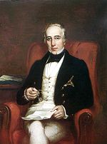
George Arthur
Lieutenant-General Sir George Arthur, 1st Baronet KCH PC was Lieutenant Governor of British Honduras , Van Diemen's Land and Upper Canada . He also served as Governor of Bombay .-Early life:George Arthur was born in Plymouth, England...
attacked what he called the "monopoly on the part of the monied cutters" in 1816, he was only partially successful in breaking their monopoly on landholding. He proclaimed that all unclaimed land was henceforth crown land
Crown land
In Commonwealth realms, Crown land is an area belonging to the monarch , the equivalent of an entailed estate that passed with the monarchy and could not be alienated from it....
that could be granted only by the crown's representative but continued to allow the existing monopoly of landownership.
Slavery in the settlement, 1724-1838
Cutting logwood was a simple, small-scale operation, but the settlers imported slaves to help with the work. Slavery in the settlement was associated with the extraction of timber, first logwood and then mahogany, as treaties forbade the production of plantation crops. This difference in economic function gave rise to variations in the organization, conditions, and treatment of slaves. The earliest reference to African slaves in the British settlement appeared in a 1724 Spanish missionary's account, which stated that the British recently had been importing them from Jamaica and BermudaBermuda
Bermuda is a British overseas territory in the North Atlantic Ocean. Located off the east coast of the United States, its nearest landmass is Cape Hatteras, North Carolina, about to the west-northwest. It is about south of Halifax, Nova Scotia, Canada, and northeast of Miami, Florida...
. In the second half of the eighteenth century the slave population hovered around 3,000, making up about three quarters of the total population. Most slaves, even if they were brought through West Indian markets, were born in Africa, probably from around the Bight of Benin
Bight of Benin
The Bight of Benin is a bight on the western African coast that extends eastward for about 400 miles from Cape St. Paul to the Nun outlet of the Niger River. To the east it is continued by the Bight of Bonny . The bight is part of the Gulf of Guinea...
, the Congo
Congo Basin
The Congo Basin is the sedimentary basin that is the drainage of the Congo River of west equatorial Africa. The basin begins in the highlands of the East African Rift system with input from the Chambeshi River, the Uele and Ubangi Rivers in the upper reaches and the Lualaba River draining wetlands...
, and Angola
Angola
Angola, officially the Republic of Angola , is a country in south-central Africa bordered by Namibia on the south, the Democratic Republic of the Congo on the north, and Zambia on the east; its west coast is on the Atlantic Ocean with Luanda as its capital city...
—the principal sources of British slaves in the late 18th century. The Eboe or Ibo
Ibo
-Alternate spelling:*Ibo or Igbo people, an ethnic group based in West Africa*Ibo or Igbo language, the language of the Igbo people-Abbreviation:IBO can stand for:* Intellectual Property Business Organization...
seem to have been particularly numerous; one section of Belize Town was known as Eboe Town in the first half of the 19th century. At first, many slaves maintained African ethnic identifications and cultural practices. Gradually, however, the process of assimilation was creating a new, synthetic Creole
Belizean Kriol people
The Belizean Creoles, locally known as Kriols, are Creole descendants of English and Scottish log cutters, as well as Black African slaves brought to Belize. Other small minorities include Creoles and the Miskito from Nicaragua, Jamaicans, and other West Indians who assisted in the logging...
culture.
The whites, although a minority in the settlement, monopolized power and wealth by dominating the chief economic activities of trade and cutting timber. They also controlled the first legislature and the judicial and administrative institutions. As a result, the British settlers had a disproportionate influence on the development of the Creole culture. Anglican, Baptist
Baptist
Baptists comprise a group of Christian denominations and churches that subscribe to a doctrine that baptism should be performed only for professing believers , and that it must be done by immersion...
, and Methodist missionaries helped devalue and suppress African cultural heritage.
Cutting wood was seasonal work that required workers to spend several months isolated in temporary makeshift camps in the forest, away from families in Belize Town. Settlers needed only one or two slaves to cut logwood, a small tree that grows in clumps near the coast. But as the trade shifted to mahogany in the last quarter of the 18th century, the settlers needed more money, land, and slaves for larger-scale operations. After 1770 about 80 percent of all male slaves aged ten years or more cut timber. Huntsmen found the trees, which were then cut, trimmed, and hauled to the riverside. During the rainy season, settlers and slaves floated rafts of untrimmed logs downriver, where the wood was processed for shipment. Huntsmen were highly skilled and valued slaves, as were the axmen who cut the trees while standing on a springy platform four to five meters high. Another group of slaves cared for the oxen that pulled the huge logs to the river. Others trimmed the trees and cleared the tracks. The use of small gangs of slaves for cutting wood reduced the need for close supervision; whip-wielding drivers, who were ubiquitous on large plantations elsewhere, were unknown in the settlement.
The colonial masters used domestic slaves, mostly women and children, to clean their houses, sew, wash and iron their clothes, prepare and serve their food, and raise their children. Some slaves cultivated provisions that would either be sold or used to save their owners some of the cost of importing food. Other slaves worked as sailors, blacksmiths, nurses, and bakers. Few slaves, however held jobs requiring a high level of skill. Young people started work by waiting on their masters' tables, where they were taught to obey, then most of the young women continued in domestic work while the young men became woodcutters. This rigid division of labor and the narrow range of work experience of most slaves limited their opportunities after legal emancipation in 1838.
The slaves' experience, though different from that on plantations in other colonies in the region, was nevertheless oppressive. They were frequently the objects of "extreme inhumanity," as a report published in 1820 stated. The settlement's chaplain reported "instances, many instances, of horrible barbarity" against the slaves. The slaves' own actions, including suicide, abortion, murder, escape, and revolt, suggest how they viewed their situation. Slaves who lived in small, scattered, and remote groups could escape with relative ease if they were willing to leave their families. In the 18th century, many escaped to Yucatán, and in the early 19th century a steady flow of runaways went to Guatemala and down the coast to Honduras. Some runaways established communities, such as one near Sibun River, that offered refuge to others. When freedom could be attained by slipping into the bush, revolt was not such a pressing option. Nevertheless, numerous slave revolts took place. The last revolt in 1820, led by two black slaves, Will and Sharper, involved a considerable number of well-armed individuals who "had been treated with very unnecessary harshness by their Owner, and had certainly good grounds for complaint."
One way the settler minority maintained its control was by dividing the slaves from the growing population of free Creole people who were given limited privileges. Though some Creoles were legally free, they could neither hold commissions in the military nor act as jurors or magistrates, and their economic activities were restricted. They could vote in elections only if they had owned more property and lived in the area longer than whites. Privileges, however, led many free blacks to stress their loyalty and acculturation to British ways. When officials in other colonies of the British West Indies
British West Indies
The British West Indies was a term used to describe the islands in and around the Caribbean that were part of the British Empire The term was sometimes used to include British Honduras and British Guiana, even though these territories are not geographically part of the Caribbean...
began giving free blacks expanded legal rights, the Colonial Office
Colonial Office
Colonial Office is the government agency which serves to oversee and supervise their colony* Colonial Office - The British Government department* Office of Insular Affairs - the American government agency* Reichskolonialamt - the German Colonial Office...
threatened to dissolve the Baymen's Public Meeting unless it followed suit. The "Coloured Subjects of Free Condition" were granted civil rights on July 5, 1831, a few years before the abolition of slavery was completed.
The essence of society, a rigidly hierarchical system in which people were ranked according to race and class was well established by the time of full emancipation in 1838. The act to abolish slavery throughout the British colonies, passed in 1833, was intended to avoid drastic social changes by effecting emancipation over a five-year transition period. The act included two generous measures for slave owners: a system of "apprenticeship
Apprenticeship
Apprenticeship is a system of training a new generation of practitioners of a skill. Apprentices or protégés build their careers from apprenticeships...
" calculated to extend their control over the former slaves who were to continue to work for their masters without pay, and compensation for the former slave owners for their loss of property. These measures helped ensure that the majority of the population, even when it was legally freed after apprenticeship ended in 1838, depended on their former owners for work. These owners still monopolized the land. Before 1838, a handful of the inhabitants controlled the settlement and owned most of the people. After 1838, the masters of the settlement, a tiny elite, continued to control the country for over a century by denying access to land, and by promoting economic dependency of the freed slaves through a combination of wage advances and company stores.
Emigration of the Garifuna
At the same time that the settlement was grappling with the ramifications of the end of slavery, a new ethnic group—the Garifuna—appeared. In the early 19th century, the Garifuna, descendants of Carib peoples of the Lesser AntillesLesser Antilles
The Lesser Antilles are a long, partly volcanic island arc in the Western Hemisphere. Most of its islands form the eastern boundary of the Caribbean Sea with the Atlantic Ocean, with the remainder located in the southern Caribbean just north of South America...
and of Africans who had escaped from slavery, arrived in the settlement. The Garifuna had resisted British and French colonialism in the Lesser Antilles until they were defeated by the British in 1796. After putting down a violent Garifuna rebellion on Saint Vincent
Saint Vincent (island)
Saint Vincent is a volcanic island in the Caribbean. It is the largest island of the chain called Saint Vincent and the Grenadines. It is located in the Caribbean Sea, between Saint Lucia and Grenada. It is composed of partially submerged volcanic mountains...
, the British moved between 1,700 and 5,000 of the Garifuna across the Caribbean to the Bay Islands (present-day Islas de la Bahía) off the north coast of Honduras. From there they migrated to the Caribbean coasts of Nicaragua, Honduras, Guatemala, and the southern part of present-day Belize. By 1802 about 150 Garifuna had settled in the Stann Creek
Stann Creek
Stann Creek is a watercourse in southeastern Belize. The administrative division, Stann Creek District, is named after the river. South Stann Creek rises in the foothills of the eastern slopes of the Maya Mountains within the Cockscomb Basin Wildlife Sanctuary; the South Stann Creek drains the...
(present-day Dangriga
Dangriga
Dangriga, formerly known as Stann Creek Town, is a town in southern Belize, located on the Caribbean coast at the mouth of Stann Creek. It is the capital of Belize's Stann Creek District and also the largest town in southern Belize...
) area and were engaged in fishing and farming.
Other Garifuna later came to the British settlement of Belize after finding themselves on the wrong side in a civil war in Honduras in 1832. Many Garifuna men soon found wage work alongside slaves as mahogany cutters. In 1841 Dangriga, the Garifuna's largest settlement, was a flourishing village. The American traveler John Stephens described the Garifuna village of Punta Gorda
Punta Gorda
Punta Gorda may refer to:*Punta Gorda, Belize*Punta Gorda, Florida*Punta Gorda Light, Humboldt County, California, USA*Punta Gorda, Montevideo, in Uruguay....
as having 500 inhabitants and producing a wide variety of fruits and vegetables.
The British treated Garifuna as squatters. In 1857 the British told the Garifuna that they must obtain leases from the crown or risk losing their lands, dwellings, and other buildings. The 1872 Crown Lands Ordinance established reservations for the Garifuna as well as the Maya. The British prevented both groups from owning land and treated them as a source of valuable labor.
Constitutional developments, 1850-62
In the 1850s, the power struggle between the superintendent and the planters coincided with events in international diplomacy to produce major constitutional changes. In the Clayton-Bulwer TreatyClayton-Bulwer Treaty
The Clayton–Bulwer Treaty was a treaty between the United States and the United Kingdom, negotiated in 1850 by John M. Clayton and Sir Henry Lytton Bulwer, later Lord Dalling...
of 1850, Britain and the United States agreed to promote the construction of a canal across Central America and to refrain from colonizing any part of Central America. The British government interpreted the colonization clause as applying only to any future occupation. But the United States government claimed that Britain was obliged to evacuate the area, particularly after 1853, when President Franklin Pierce
Franklin Pierce
Franklin Pierce was the 14th President of the United States and is the only President from New Hampshire. Pierce was a Democrat and a "doughface" who served in the U.S. House of Representatives and the Senate. Pierce took part in the Mexican-American War and became a brigadier general in the Army...
's expansionist administration stressed the Monroe Doctrine
Monroe Doctrine
The Monroe Doctrine is a policy of the United States introduced on December 2, 1823. It stated that further efforts by European nations to colonize land or interfere with states in North or South America would be viewed as acts of aggression requiring U.S. intervention...
. Britain yielded on the Bay Islands and the Mosquito Coast in eastern Nicaragua. But in 1854, Britain produced a formal constitution establishing a legislative for its possession of the settlement in present-day Belize.
Legislative Assembly
Legislative Assembly is the name given in some countries to either a legislature, or to one of its branch.The name is used by a number of member-states of the Commonwealth of Nations, as well as a number of Latin American countries....
of 1854 was to have eighteen elected members, each of whom was to have at least £
Pound sterling
The pound sterling , commonly called the pound, is the official currency of the United Kingdom, its Crown Dependencies and the British Overseas Territories of South Georgia and the South Sandwich Islands, British Antarctic Territory and Tristan da Cunha. It is subdivided into 100 pence...
400 sterling worth of property. The assembly was also to have three official members appointed by the superintendent. The fact that voters had to have property yielding an income of £7 a year or a salary of a £100 a year reinforced the restrictive nature of this legislature. The superintendent could defer or dissolve the assembly at any time, originate legislation, and give or withhold consent to bills. This situation suggested that the legislature was more a chamber of debate than a place where decisions were made. The Colonial Office
Colonial Office
Colonial Office is the government agency which serves to oversee and supervise their colony* Colonial Office - The British Government department* Office of Insular Affairs - the American government agency* Reichskolonialamt - the German Colonial Office...
in London
London
London is the capital city of :England and the :United Kingdom, the largest metropolitan area in the United Kingdom, and the largest urban zone in the European Union by most measures. Located on the River Thames, London has been a major settlement for two millennia, its history going back to its...
became, therefore, the real political-administrative power in the settlement. This shift in power was reinforced when in 1862, the Settlement of Belize in the Bay of Honduras was declared a British colony called British Honduras
British Honduras
British Honduras was a British colony that is now the independent nation of Belize.First colonised by Spaniards in the 17th century, the territory on the east coast of Central America, south of Mexico, became a British crown colony from 1862 until 1964, when it became self-governing. Belize became...
, and the crown's representative was elevated to a lieutenant governor
Lieutenant governor
A lieutenant governor or lieutenant-governor is a high officer of state, whose precise role and rank vary by jurisdiction, but is often the deputy or lieutenant to or ranking under a governor — a "second-in-command"...
, subordinate to the governor of Jamaica.