

Harris Wash
Encyclopedia
Escalante River
right|Location of the Escalante River within UtahThe Escalante River is a tributary of the Colorado River. It is formed by the confluence of North and Birch Creeks near the town of Escalante in south-central Utah, and from there flows southeast for approximately before joining Lake Powell...
located in Garfield County
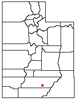
Garfield County, Utah
Garfield County is a county located in the U.S. state of Utah. As of 2000 the population was 4,735. It was named for James A. Garfield, President of the United States in 1881. Its county seat and largest city is Panguitch.-Geography:...
in southern Utah
Utah
Utah is a state in the Western United States. It was the 45th state to join the Union, on January 4, 1896. Approximately 80% of Utah's 2,763,885 people live along the Wasatch Front, centering on Salt Lake City. This leaves vast expanses of the state nearly uninhabited, making the population the...
, in the western United States
United States
The United States of America is a federal constitutional republic comprising fifty states and a federal district...
. Over 40 miles (60 km) long, it exhibits many of the geologic features found in the Canyons of the Escalante
Canyons of the Escalante
The Canyons of the Escalante is a collective name for the erosional landforms created by the Escalante River and its tributaries, the Escalante River Basin. Located in southern Utah in the western United States, these sandstone features include high vertical canyon walls, water pockets, narrow...
, including high vertical canyon
Canyon
A canyon or gorge is a deep ravine between cliffs often carved from the landscape by a river. Rivers have a natural tendency to reach a baseline elevation, which is the same elevation as the body of water it will eventually drain into. This forms a canyon. Most canyons were formed by a process of...
walls and narrow slot canyon
Slot canyon
A slot canyon is a narrow canyon, formed by the wear of water rushing through rock. A slot canyon is significantly deeper than it is wide. Some slot canyons can measure less than one metre across at the top but drop more than 30 m to the floor of the canyon.Most slot canyons are formed in...
s. A popular recreational destination and a historic transportation route, it is located within the Grand Staircase-Escalante National Monument
Grand Staircase-Escalante National Monument
The Grand Staircase-Escalante National Monument contains 1.9 million acres of land in southern Utah, the United States. There are three main regions: the Grand Staircase, the Kaiparowits Plateau, and the Canyons of the Escalante. President Bill Clinton designated the area as a U.S. National...
.
The headwaters of Harris Wash have their origins on top of the Kaiparowits Plateau
Kaiparowits Plateau
right|Location of the Kaiparowits Plateau within UtahThe Kaiparowits Plateau is a large, elevated landform located in southern Utah, in the southwestern United States. Along with the Grand Staircase and the Canyons of the Escalante, it makes up a significant portion of the Grand...
, southwest of the town of Escalante
Escalante, Utah
Escalante is a city in Garfield County, Utah, United States, along Utah Scenic Byway 12. As of the 2000 census, the city population was 818.The town was named after Silvestre Vélez de Escalante, a Franciscan missionary and the first European explorer in the region...
. Several intermittent streams merge to form Alvey Wash, which has carved a deep canyon into the plateau. Along this canyon are the largest coal mines in the area. Exiting the plateau near its northern end, Alvey Wash comes within a quarter mile of the town before turning to the south. After passing under the Hole-in-the-Rock Road
Hole in the Rock Road
The Hole in the Rock Trail is a historic road running west of the Escalante River in southern Utah in the western United States. Running almost from near Escalante to Bluff, it travels within the borders of the Grand Staircase-Escalante National Monument and the adjacent Glen Canyon National...
it becomes known as Harris Wash, and begins to carve itself into the colorful sandstone
Sandstone
Sandstone is a sedimentary rock composed mainly of sand-sized minerals or rock grains.Most sandstone is composed of quartz and/or feldspar because these are the most common minerals in the Earth's crust. Like sand, sandstone may be any colour, but the most common colours are tan, brown, yellow,...
layers. By the time it reaches the Escalante River its streambed is over 400 feet (120 m) below the surrounding terrain.
Harris Wash is a popular recreational destination, due both to its scenic canyon walls and its proximity to the town of Escalante. It is typically accessed via a trailhead at the end of a side road. Just below this point, the canyon walls rise and the stream flow becomes permanent, allowing hikers to wade all the way down to the junction with the main river. The lack of major obstacles into and along the wash also accounts for its historic role as a transportation route. In the fall of 1879 the San Juan Expedition
San Juan Expedition
right|Route of the San Juan Expedition through UtahThe San Juan Expedition was a group of Mormon settlers intent on establishing a colony in what is now southeastern Utah, in the western United States...
had developed the Hole-in-the-Rock route on their way to founding a colony in southeastern Utah. They then used it as a supply route from Escalante for about a year before deciding that it was too perilous. In 1881 they replaced it with a route that led down Harris Wash, across the Escalante River, up Silver Falls Creek, through the Circle Cliffs, and eventually across the Colorado River
Colorado River
The Colorado River , is a river in the Southwestern United States and northwestern Mexico, approximately long, draining a part of the arid regions on the western slope of the Rocky Mountains. The watershed of the Colorado River covers in parts of seven U.S. states and two Mexican states...
at Halls Crossing
Halls Crossing, Utah
Halls Crossing is a census-designated place in San Juan County, Utah, United States. The population was six at the 2010 Census. State Route 276 crosses the Colorado River at Halls Crossing using the Charles Hall Ferry.-Geography:...
.