
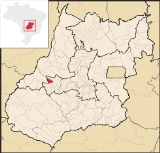
Jaupaci
Encyclopedia
| Jaupaci | |
|---|---|
| State | Goiás Goiás Goiás is a state of Brazil, located in the central part of the country. The name Goiás comes from the name of an indigenous community... |
| Area: | 527.2 km² (10/10/2002) |
| Population: | 2,998 (IBGE 2007) |
| Urban population: | 2,376 (2007) |
| Population density: | 5.69 inhab/km² (2007) |
| Elevation: | 354m above sea level |
| Postcode (CEP): | 76210-000 |
| Became a city: | 1958 |
| Mayor: | Antônio José Guimarães (January 2005) |
| IBGE statistical Microregion: | Iporá Microregion Iporá Microregion The Iporá Microregion is a geographical region in central-western Goiás state, Brazil. The most important city is Iporá. For a map see -Important Data :*Population: 58,845 *Cities: 10*Total Area: 7,096.60 km²... |
| Distance to Goiânia Goiânia -Climate:The city has a tropical wet and dry climate with an average temperature of . There's a wet season, from October to April, and a dry one, from May to September. Annual rainfall is around 1,520 mm.... : |
215 km. |
| Website: | none (March 2008) |
| Coordinates: | 16°11′54"S 50°55′37"W |

Town
A town is a human settlement larger than a village but smaller than a city. The size a settlement must be in order to be called a "town" varies considerably in different parts of the world, so that, for example, many American "small towns" seem to British people to be no more than villages, while...
and municipality
Municipality
A municipality is essentially an urban administrative division having corporate status and usually powers of self-government. It can also be used to mean the governing body of a municipality. A municipality is a general-purpose administrative subdivision, as opposed to a special-purpose district...
in eastern Goiás
Goiás
Goiás is a state of Brazil, located in the central part of the country. The name Goiás comes from the name of an indigenous community...
state, Brazil
Brazil
Brazil , officially the Federative Republic of Brazil , is the largest country in South America. It is the world's fifth largest country, both by geographical area and by population with over 192 million people...
. The population was 2,998 (2007) in a total area of 527.2 km² (10/10/2002).
Location
- Distance to regional center (IporáIporáIporá is a small city and municipality in west-central Goiás state, Brazil. The population was 31,060 in a total area of 1,026.4 km² . It is known as the City of the Clear Waters because of its many streams and rivers.-Location:...
): 46 km. - Highway connections: state highway BR-069 west from GoiâniaGoiânia-Climate:The city has a tropical wet and dry climate with an average temperature of . There's a wet season, from October to April, and a dry one, from May to September. Annual rainfall is around 1,520 mm....
, through TrindadeTrindade, GoiásTrindade is a city and municipality in Goiás state, Brazil. It is famous for the religious celebrations held there in July and is now the third most important pilgrimage site in Brazil....
, São Luís de Montes BelosSão Luís de Montes BelosSão Luís de Montes Belos is a small city and municipality in the State of Goiás, Brazil.-Location:It is located in the Anicuns Microregion, 123 kilometers from the state capital, Goiânia, to which it is connected by highway GO-060...
, IsraelândiaIsraelândiaIsraelândia is a small town and municipality in eastern Goiás state, Brazil.-Location:Israelândia is located in the Iporá Microregion, 28 km. northeast of regional center Iporá. State capital Goiânia is 199 km. to the east...
, and then GO-173 for 18 kilometers northeast.
Neighboring municipalities: Iporá
Iporá
Iporá is a small city and municipality in west-central Goiás state, Brazil. The population was 31,060 in a total area of 1,026.4 km² . It is known as the City of the Clear Waters because of its many streams and rivers.-Location:...
, Fazenda Nova
Fazenda Nova
Fazenda Nova is a small town and municipality in central-west Goiás state, Brazil.-Location:Fazenda Nova is located northwest of the state capital, Goiânia, which is 206 km. away taking highways GO-418 and GO-060...
, Diorama
Diorama, Goiás
Diorama is a small town and municipality in eastern Goiás state, Brazil.-Location and Connections:Diorama is 254 kilometers west of the state capital, Goiânia, and is 30 kilometers west of the regional center, Iporá...
, Montes Claros de Goiás
Montes Claros de Goiás
Montes Claros de Goiás is a small town and municipality in western Goiás state, Brazil-Location and connections:Montes Claros is located in the extreme west of the state, about 70 km east of the Araguaia River. It is east of Aragarças and west of Jussara.Montes Claros is connected by poor...
, and Israelândia
Israelândia
Israelândia is a small town and municipality in eastern Goiás state, Brazil.-Location:Israelândia is located in the Iporá Microregion, 28 km. northeast of regional center Iporá. State capital Goiânia is 199 km. to the east...
.
The economy
The economy is based on modest commerce, public employment, modest transformation industries, cattle raising, and agriculture. There is one dairy—JAU - Indústria de Laticínios Ltda. (22/05/2006). There were 35,400 head of cattle in 2006. The main crops were rice, corn, manioc, soybeans, and tomatoes. Most of the land is occupied by pasture for cattle raising.- GDP (PIB) (R$ 1,000.00): 16,548 (2005)
- GDP per capita (R$ 1.00): 5,247 (2005)
Agricultural data 2006
- Farms: 169
- Total area: 32,407 ha.
- Area of permanent crops: 92 ha.
- Area of perennial crops: 333 ha.
- Area of natural pasture: 24,079 ha.
- Area of woodland and forests: 7,226 ha.
- Persons dependent on farming: 630
- Farms with tractors: 42
- Number of tractors: 49
- Cattle herd: 35,400 head IBGE
Education (2006) and Health (2007)
- Schools in activity: 5
- Classrooms: 31
- Teachers: 56
- Total Students: 976
- Hospitals: 1
- Beds: 20
- Public health clinic: 1
- Infant mortality rate: 35.47 (in 1,000 live births)
- Life expectancy: 65.0
- Adult literacy rate: 0.823
- School attendance rate: 0.855
- Municipal Human Development IndexHuman Development IndexThe Human Development Index is a composite statistic used to rank countries by level of "human development" and separate "very high human development", "high human development", "medium human development", and "low human development" countries...
: 0.710 (2000)
For the complete list see Frigoletto.com.br