

Dome C
Encyclopedia
Dome C, also known as Dome Circe or Dome Charlie, located at Antarctica at an altitude of 3,233 m or 10,607 ft above sea level, is one of several summits or "domes" of the Antarctic Ice Sheet
. Dome C is located on the Antarctic Plateau
, 1,100 km inland from the French research station at Dumont D'Urville
, 1,100 km inland from the Australian Casey Station
and 1,200 km inland from the Italian Zucchelli station at Terra Nova Bay
. Russia's Vostok Station
is 560 km away. Dome C is the site of the Concordia Research Station, jointly operated by France and Italy
.
code for the letter C) by the U.S. Naval Support Force, Antarctica, and its Squadron VXE-6
, which provided logistical support to the field teams. In January and November 1975, three LC-130 Hercules aircraft suffered severe damage during attempted takeoffs from Dome Charlie. In November 1975 and November 1976, the U.S. Navy established field camps on Dome Charlie to recover the aircraft. Following major structural repairs and replacement of engines in the field, the three LC-130's were flown to McMurdo Station
on December 26, 1975, January 14, 1976, and December 25, 1976.
From November 1977 to March 1978 a French party of 13 settled down in the existing camp left by the aircraft rescuers. They brought several tons of equipment—thanks to the VXE-6 airplanes—and achieved the planned ice-coring campaign down to 980 m bringing to surface, and later on in their labs for study, ice samples 45,000 to 50,000 years old.
During the austral summer of 1979, the camp was re-occupied by Americans and French, under the auspices of the US Antarctic Research Program, sponsored by the National Science Foundation. Deep ice core drilling, meteorology and seismic studies were conducted. The camp, with a maximum summer population of 18, was operated and maintained by four employees of ITT Antarctic Services and one US Navy medical corpsman. When the camp was shut down for the season in about January, 1980, it was left mostly intact, with a radio-isotope powered remote weather station operational.
In 1992, France decided to build a new station on the Antarctic Plateau. The program was later joined by Italy. In 1996, a French-Italian team established a summer camp at Dome C. The two main objectives of the camp were the provision of logistical support for the European Project for Ice Coring in Antarctica (EPICA)
and the construction of a permanent research station. The new all-year facility, Concordia Station
, became operational in 2005.
The Advisory Committee on Antarctic Names
(US-ACAN) considers "Dome Charlie" to be superior to the informal name, "Dome C," and that it has precedence over "Dome Circe", a name suggested from Greek mythology by members of the SPRI airborne radio echo sounding team in 1982.
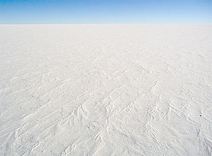 Dome C is one of the coldest places on Earth. Temperatures hardly rise above −25°C in summer and can fall below −80°C in winter. The annual average air temperature is −54.5°C. Humidity is low and it is also very dry, with very little precipitation throughout the year.
Dome C does not experience the katabatic winds typical of the coastal regions of Antarctica because of its elevated location and its relative distance from the edges of the Antarctic Plateau. Typical wind speed in winter is 2.8 m/s (6 mph).
Dome C is situated on top of the Antarctic Plateau, the world's largest desert. No animals or plants live at a distance of more than a few tenths of a kilometre from the Southern Ocean
. However, skua
s have been spotted overflying the station, 1,200 km away from their nearest food sources. It is believed that these birds have learned to cross the continent instead of circumnavigating it.
observation site; the transparency of the Antarctic atmosphere allows stars to be observed, even when the Sun
is at its highest possible elevation angle of 38°. The good viewing is due to very low infrared
sky emission, extremely low humidity
, a high percentage of cloud
-free time, low atmospheric aerosol and dust
content, and an absence of light pollution
other than auroras and moonlight. This location is a serious candidate for the ESO
's E-ELT project (a telescope of 30–60m mirror diameter). However, sky coverage is less than at lower latitude locations as northern celestial hemisphere objects never rise or are too low above the horizon.
Writing in the Proceedings of the Astronomical Society of the Pacific in 2005, Karim Agabi et al. discuss the suitability of the site for astronomy in terms of the seeing
. They determined the median
seeing (measured with a Differential Image Motion Monitor placed on top of an 8.5 m high tower) to be 1.3±0.8 arcseconds. This is significantly worse than most major observatory sites, but similar to other observatories in Antarctica. However, they found (using balloon
s) that 87% of turbulence was below 36 meters. A telescope built on a tower could rise above this "boundary layer
" and achieve excellent seeing. The boundary layer is 200 meters at the South Pole
and may be as low as 20 meters at Dome A
.
In an earlier (2004) paper, Lawrence et al. considered the site and concluded that "Dome C is the best ground-based site to develop a new astronomical observatory". This team measured superior seeing of 0.27 arcseconds, twice as small as at Mauna Kea Observatory
. This figure was taken with an instrument insensitive to near-ground turbulence and so it is comparable to the 0.35 arcseconds Agabi et al. measured for "free atmospheric seeing".
The 2004 experiments to measure the astronomical conditions at the site were unattended, controlled by a computer system that had to supervise the generation of its own electricity using a jet-fuel powered stirling engine
. The computer, running Linux
, communicated with the outside world using an Iridium phone.
Antarctic ice sheet
The Antarctic ice sheet is one of the two polar ice caps of the Earth. It covers about 98% of the Antarctic continent and is the largest single mass of ice on Earth. It covers an area of almost 14 million square km and contains 30 million cubic km of ice...
. Dome C is located on the Antarctic Plateau
Antarctic Plateau
The Antarctic Plateau is a large area of Central Antarctica, which extends over a diameter of about , and which includes the region of the South Pole and the Amundsen-Scott Station...
, 1,100 km inland from the French research station at Dumont D'Urville
Dumont d'Urville Station
The Dumont d'Urville Station is a French scientific station located in Antarctica on Île des Pétrels, archipelago of Pointe Géologie in Adélie Land. It is named after explorer Jules Dumont d'Urville...
, 1,100 km inland from the Australian Casey Station
Casey Station
Casey Station is a permanent base in Antarctica managed by the Australian Antarctic Division located on Vincennes Bay in the Australian Antarctic Territory.- History :...
and 1,200 km inland from the Italian Zucchelli station at Terra Nova Bay
Terra Nova Bay
Terra Nova Bay is a bay which is often ice free, about long, lying between Cape Washington and the Drygalski Ice Tongue along the coast of Victoria Land, Antarctica....
. Russia's Vostok Station
Vostok Station
Vostok Station was a Russian Antarctic research station. It was at the southern Pole of Cold, with the lowest reliably measured natural temperature on Earth of −89.2 °C . Research includes ice core drilling and magnetometry...
is 560 km away. Dome C is the site of the Concordia Research Station, jointly operated by France and Italy
Italy
Italy , officially the Italian Republic languages]] under the European Charter for Regional or Minority Languages. In each of these, Italy's official name is as follows:;;;;;;;;), is a unitary parliamentary republic in South-Central Europe. To the north it borders France, Switzerland, Austria and...
.
History
In the 1970s, Dome C was the site of ice core drilling by field teams of several nations. It was called Dome Charlie (NATO Phonetic AlphabetNATO phonetic alphabet
The NATO phonetic alphabet, more accurately known as the NATO spelling alphabet and also called the ICAO phonetic or spelling alphabet, the ITU phonetic alphabet, and the international radiotelephony spelling alphabet, is the most widely used spelling alphabet...
code for the letter C) by the U.S. Naval Support Force, Antarctica, and its Squadron VXE-6
VXE-6
VXE-6, Antarctic Development Squadron 6 , commonly referred to by its nickname, The Puckered Penguins was a United States Navy Air Test and Evaluation Squadron based at McMurdo Station, Antarctica...
, which provided logistical support to the field teams. In January and November 1975, three LC-130 Hercules aircraft suffered severe damage during attempted takeoffs from Dome Charlie. In November 1975 and November 1976, the U.S. Navy established field camps on Dome Charlie to recover the aircraft. Following major structural repairs and replacement of engines in the field, the three LC-130's were flown to McMurdo Station
McMurdo Station
McMurdo Station is a U.S. Antarctic research center located on the southern tip of Ross Island, which is in the New Zealand-claimed Ross Dependency on the shore of McMurdo Sound in Antarctica. It is operated by the United States through the United States Antarctic Program, a branch of the National...
on December 26, 1975, January 14, 1976, and December 25, 1976.
From November 1977 to March 1978 a French party of 13 settled down in the existing camp left by the aircraft rescuers. They brought several tons of equipment—thanks to the VXE-6 airplanes—and achieved the planned ice-coring campaign down to 980 m bringing to surface, and later on in their labs for study, ice samples 45,000 to 50,000 years old.
During the austral summer of 1979, the camp was re-occupied by Americans and French, under the auspices of the US Antarctic Research Program, sponsored by the National Science Foundation. Deep ice core drilling, meteorology and seismic studies were conducted. The camp, with a maximum summer population of 18, was operated and maintained by four employees of ITT Antarctic Services and one US Navy medical corpsman. When the camp was shut down for the season in about January, 1980, it was left mostly intact, with a radio-isotope powered remote weather station operational.
In 1992, France decided to build a new station on the Antarctic Plateau. The program was later joined by Italy. In 1996, a French-Italian team established a summer camp at Dome C. The two main objectives of the camp were the provision of logistical support for the European Project for Ice Coring in Antarctica (EPICA)
EPICA
The European Project for Ice Coring in Antarctica is a multinational European project for deep ice core drilling in Antarctica. Its main objective is to obtain full documentation of the climatic and atmospheric record archived in Antarctic ice by drilling and analyzing two ice cores and comparing...
and the construction of a permanent research station. The new all-year facility, Concordia Station
Concordia Station
Concordia Research Station, which opened in 2005, is a research facility that was built 3,233 m above sea level at a location called Dome C on the Antarctic Plateau, Antarctica...
, became operational in 2005.
The Advisory Committee on Antarctic Names
Advisory Committee on Antarctic Names
The Advisory Committee on Antarctic Names is an advisory committee of the United States Board on Geographic Names responsible for recommending names for features in Antarctica...
(US-ACAN) considers "Dome Charlie" to be superior to the informal name, "Dome C," and that it has precedence over "Dome Circe", a name suggested from Greek mythology by members of the SPRI airborne radio echo sounding team in 1982.
Environment
Dome C does not experience the katabatic winds typical of the coastal regions of Antarctica because of its elevated location and its relative distance from the edges of the Antarctic Plateau. Typical wind speed in winter is 2.8 m/s (6 mph).
Dome C is situated on top of the Antarctic Plateau, the world's largest desert. No animals or plants live at a distance of more than a few tenths of a kilometre from the Southern Ocean
Southern Ocean
The Southern Ocean comprises the southernmost waters of the World Ocean, generally taken to be south of 60°S latitude and encircling Antarctica. It is usually regarded as the fourth-largest of the five principal oceanic divisions...
. However, skua
Skua
The skuas are a group of seabirds with about seven species forming the family Stercorariidae and the genus Stercorarius. The three smaller skuas are called jaegers in North America....
s have been spotted overflying the station, 1,200 km away from their nearest food sources. It is believed that these birds have learned to cross the continent instead of circumnavigating it.
Astronomical observatory
Dome C is notable for its potential to be an extremely good astronomicalAstronomy
Astronomy is a natural science that deals with the study of celestial objects and phenomena that originate outside the atmosphere of Earth...
observation site; the transparency of the Antarctic atmosphere allows stars to be observed, even when the Sun
Sun
The Sun is the star at the center of the Solar System. It is almost perfectly spherical and consists of hot plasma interwoven with magnetic fields...
is at its highest possible elevation angle of 38°. The good viewing is due to very low infrared
Infrared
Infrared light is electromagnetic radiation with a wavelength longer than that of visible light, measured from the nominal edge of visible red light at 0.74 micrometres , and extending conventionally to 300 µm...
sky emission, extremely low humidity
Humidity
Humidity is a term for the amount of water vapor in the air, and can refer to any one of several measurements of humidity. Formally, humid air is not "moist air" but a mixture of water vapor and other constituents of air, and humidity is defined in terms of the water content of this mixture,...
, a high percentage of cloud
Cloud
A cloud is a visible mass of liquid droplets or frozen crystals made of water and/or various chemicals suspended in the atmosphere above the surface of a planetary body. They are also known as aerosols. Clouds in Earth's atmosphere are studied in the cloud physics branch of meteorology...
-free time, low atmospheric aerosol and dust
Dust
Dust consists of particles in the atmosphere that arise from various sources such as soil dust lifted up by wind , volcanic eruptions, and pollution...
content, and an absence of light pollution
Light pollution
Light pollution, also known as photopollution or luminous pollution, is excessive or obtrusive artificial light.The International Dark-Sky Association defines light pollution as:...
other than auroras and moonlight. This location is a serious candidate for the ESO
European Southern Observatory
The European Southern Observatory is an intergovernmental research organisation for astronomy, supported by fifteen countries...
's E-ELT project (a telescope of 30–60m mirror diameter). However, sky coverage is less than at lower latitude locations as northern celestial hemisphere objects never rise or are too low above the horizon.
Writing in the Proceedings of the Astronomical Society of the Pacific in 2005, Karim Agabi et al. discuss the suitability of the site for astronomy in terms of the seeing
Astronomical seeing
Astronomical seeing refers to the blurring and twinkling of astronomical objects such as stars caused by turbulent mixing in the Earth's atmosphere varying the optical refractive index...
. They determined the median
Median
In probability theory and statistics, a median is described as the numerical value separating the higher half of a sample, a population, or a probability distribution, from the lower half. The median of a finite list of numbers can be found by arranging all the observations from lowest value to...
seeing (measured with a Differential Image Motion Monitor placed on top of an 8.5 m high tower) to be 1.3±0.8 arcseconds. This is significantly worse than most major observatory sites, but similar to other observatories in Antarctica. However, they found (using balloon
Balloon
A balloon is an inflatable flexible bag filled with a gas, such as helium, hydrogen, nitrous oxide, oxygen, or air. Modern balloons can be made from materials such as rubber, latex, polychloroprene, or a nylon fabric, while some early balloons were made of dried animal bladders, such as the pig...
s) that 87% of turbulence was below 36 meters. A telescope built on a tower could rise above this "boundary layer
Boundary layer
In physics and fluid mechanics, a boundary layer is that layer of fluid in the immediate vicinity of a bounding surface where effects of viscosity of the fluid are considered in detail. In the Earth's atmosphere, the planetary boundary layer is the air layer near the ground affected by diurnal...
" and achieve excellent seeing. The boundary layer is 200 meters at the South Pole
South Pole
The South Pole, also known as the Geographic South Pole or Terrestrial South Pole, is one of the two points where the Earth's axis of rotation intersects its surface. It is the southernmost point on the surface of the Earth and lies on the opposite side of the Earth from the North Pole...
and may be as low as 20 meters at Dome A
Dome A
Dome A or Dome Argus is an Antarctican plateau located 1200 kilometres inland. It is thought to be one of the coldest naturally occurring places on Earth, with temperatures believed to get close to . It is the highest ice feature in Antarctica, comprising a dome or eminence of 4,093 meters...
.
In an earlier (2004) paper, Lawrence et al. considered the site and concluded that "Dome C is the best ground-based site to develop a new astronomical observatory". This team measured superior seeing of 0.27 arcseconds, twice as small as at Mauna Kea Observatory
Mauna Kea Observatory
The Observatories at Mauna Kea, , are an independent collection of astronomical research facilities located on the summit of Mauna Kea on the Big Island of Hawai'i, USA. The facilities are located in a special land use zone known as the "Astronomy Precinct," which is located in the Mauna Kea...
. This figure was taken with an instrument insensitive to near-ground turbulence and so it is comparable to the 0.35 arcseconds Agabi et al. measured for "free atmospheric seeing".
The 2004 experiments to measure the astronomical conditions at the site were unattended, controlled by a computer system that had to supervise the generation of its own electricity using a jet-fuel powered stirling engine
Stirling engine
A Stirling engine is a heat engine operating by cyclic compression and expansion of air or other gas, the working fluid, at different temperature levels such that there is a net conversion of heat energy to mechanical work....
. The computer, running Linux
Linux
Linux is a Unix-like computer operating system assembled under the model of free and open source software development and distribution. The defining component of any Linux system is the Linux kernel, an operating system kernel first released October 5, 1991 by Linus Torvalds...
, communicated with the outside world using an Iridium phone.
See also
- Concordia Station
- Dome ADome ADome A or Dome Argus is an Antarctican plateau located 1200 kilometres inland. It is thought to be one of the coldest naturally occurring places on Earth, with temperatures believed to get close to . It is the highest ice feature in Antarctica, comprising a dome or eminence of 4,093 meters...
(or Dome Argus) - Dome FDome FDome F, also known as Dome Fuji , Valkyrie Dome, or Valkyrjedomen, is located in east Queen Maud Land at . With an altitude of 3,810 m or 12,500 ft above sea level, it is the second-highest summit or ice dome of the East Antarctic ice sheet and represents an ice divide...
(or Dome Fuji) - Law DomeLaw DomeLaw Dome is a large ice dome which rises to 1,395 m directly south of Cape Poinsett, Antarctica. The feature was roughly mapped by the United States Geological Survey from aerial photographs taken by USN Operation Highjump, 1946-47...
- EPICAEPICAThe European Project for Ice Coring in Antarctica is a multinational European project for deep ice core drilling in Antarctica. Its main objective is to obtain full documentation of the climatic and atmospheric record archived in Antarctic ice by drilling and analyzing two ice cores and comparing...
- Pole of ColdPole of ColdThe Poles of Cold are the places in the Northern and Southern hemispheres where the lowest air temperatures have been recorded.- Northern hemisphere :...
- Inaccessibility PolePole of inaccessibilityA pole of inaccessibility marks a location that is the most challenging to reach owing to its remoteness from geographical features that could provide access...
- Climate of AntarcticaClimate of AntarcticaThe climate of Antarctica is the coldest on the whole of Earth. Antarctica has the lowest naturally occurring temperature ever recorded on the ground on Earth: −89.2 °C at Vostok Station. It is also extremely dry , averaging 166 mm of precipitation per year...
- East Antarctica RangesEast Antarctica RangesThe East Antarctica Ranges are one of the three largest mountain ranges in Antarctica, the others are the Transantarctic Mountains and West Antarctica Ranges. The East Antarctica Ranges, located on the East Antarctic Ice Sheet, have 29 known peaks whose summits reach or exceed 2000 meters above sea...
- East Antarctic two-thousandersEast Antarctic two-thousandersThe three largest mountain ranges in Antarctica are the Transantarctic Mountains, the West Antarctica Ranges, and the East Antarctica Ranges. The East Antarctica Ranges, located on the East Antarctic Ice Sheet, have 29 known peaks whose summits reach or exceed 2000 meters above sea level. These...
- List of East Antarctic two-thousanders
- Ledoyom (Ice body)
External links
- Another Dome C FAQ (Guillaume Dargaud)
- First Winterover at Concordia Station (2005) blog by Guillaume Dargaud
- 2nd Winterover at Concordia Station (2006) blog by Eric Aristidi, LUAN (Laboratoire Universitaire d'Astrophysique de Nice)
- Official website of Concordia Station Institut Polaire Français - Paule Emile Victor (IPEV) and Programma Nazionale di Ricerche in Antartide (PNRA)
- Dome C seeing, Nature Letter Frequently Asked Questions about seeing at Dome C.
- International Large Optical Telescope, is proposed as a 2m optical-quality telescope for Dome C
- Michael C. B. Ashley
- Site evaluation of E-ELT of ESO including thiks location.
- OpenStreetMap
- Alexei Rudoy. Прошлогодний снег. - Climate, ice, water, landscapes