
Dielheim
Encyclopedia
Dielheim is a municipality
in the Rhein-Neckar district
of Baden-Württemberg
, Germany
.
and the upper Rhine valley. The Leimbach
flows East to West through the center of Dielheim and its boroughs Horrenberg and Balzfeld. The Leimbach rises in Balzfeld.
The nearest cities are:
 Dielheim was first mentioned in the Lorsch codex
in 767. Next to Diedelsheim and Schluchtern
, Dielheim is one of the three oldest communities in the Kraichgau
. The area was settled by the Romans
, so one can assume the village was founded in the 6th century. The name used in the Lorsch Codex, diuuelenheim, may be the result of a reading or writing error made in the 12th century. The letters u and v were often confused, so one can assume the name was divvelenheim. The geminate vv stands for w, which was not commonly used at that time. Therefore we theorize that the name has an origin in the name of a Frankish
founder named Diwelo. After going through many changes, the spelling we see today, Dielheim, first appears in the 17th century. The rulers of town can first be identified after late in the 13th century.
By 1272 the prince-bishops of Speyer
had won half of Dielheim. Prince-bishop Adolf, who was in desperate need of money, pawned his half of Dielheim to Conz Mönch of Rosenberg in 1380. Conz Mönch took the other half of the village in the following years, thereby putting Dielheim in the possession of a noble for the first time. Conz Mönch, to ensure his control of the area, had a simple castle built on the Teufelskopf. This castle was probably more like a fortified farm than a proper castle. The isolated fortification could not be maintained for long and was quickly described as abandoned. Less than 200 years later, the castle appears as a place name. After multiple changes in ownership and having been pawned many times (noble families documented in this period include von Sickingen, von Rosenberg, von Menzingen, von Neipberg, von Gemmingen as well as the prince-bishops of Speyer), Dielheim finally came as a whole into the ownership of the prince-bishops of Speyer in 1512. The administrative seat of Dielheim for the prince-bishop was in Rotenberg. In the German Peasants' War
in 1525, many farmers from Dielheim fought on the side of the so called Mob of Malsch (Malscher Haufens) against the oppression of the rule of the prince-bishops. After the defeat of the revolt, the village had to suffer harsh penalties. In the Thirty Years' War
, Dielheim was almost completely destroyed by the troops of the Palatinate of the Rhine, the Holy Roman Empire
, and Sweden
. The region recovered only slowly from the loss of people and buildings.
Hardly had the essentials of the village been rebuilt when the War of the Palatinian Succession (a.k.a. War of the Grand Alliance
) broke out. In 1689 the French
general Mélac
reduced Dielheim to ashes. For this reason no building from the time of this catastrophe remains today. From the middle of the 18th century the population of the region boomed. The overpopulation of the region led to property being split into ever smaller pieces due to inheritance. The fields were divided into ever smaller plots that could no longer support or feed the people on the land. Hundreds attempted to find their fortune by emigrating to Hungary
, Russia
, Romania
, Serbia
, Algeria
, South America
, Switzerland
, and above all, the United States of America. In the end, emigration was not enough to ensure that everyone remaining in Dielheim had work and enough to eat.
The tobacco
industry took advantage of this situation in 1850. The oversupply of labor and the low cost of that labor in the rural parts of Baden helped the cigar
industry to boom. For about 100 years many people of Dielham made their living in the numerous cigar factories of the village, after which the tobacco industry went into rapid decline. From about 800 jobs suddenly only 10 remained.
Workers had to reorient themselves and take on new unfamiliar jobs. This changed Dielheim in the 50s and 60s of the 20th century to a commuter town
. Only the creation of Dielheim's industrial and commercial district led to the creation of its own companies, so that workers could once again find jobs in town. Today's Dielheim is known as a wine-growing region with 77 hectares of surrounding grape fields. Dielheimer Teufelskopf is known by wine lovers throughout Germany. In 1972 Horrenberg joined the municipality of Dielheim.
 Horrenberg lies on a road between Speyer, Bad Wimpfen
, and Nuremberg
that has been in use since Roman times. This road, named an imperial highway (Reichstrasse) in 1433, was one of the most important thoroughfares in Germany up until the late Middle Ages. In medieval documents, the road is often referred to as the Kaiserstraße, the emperor's highway, because over the centuries many high ranking personalities used the imperial highway. The Roman general Julian
(359), the king of the Huns Attila
(451), king Conrad III
(1150), king Philipp of Swabia (1199), emperor Frederick II
(1205), and king Henry VII
(1224) all sojourned past the place where Horrenberg stands today. A valuable glass fragment from the 11th or 12th century found at castle Horrenberg indicates the passing of royal parties. This kind of purple-red and white glass has otherwise only been found at St. Denis
in Paris
, in Italian
Pavia
, and in Birka
near Stockholm
.
Around the year 1220, the then reigning lord of the region erected a fortified tower in order to protect the imperial highway at the toll station in Horrenberg. For the location of the fort, they chose a hill next to the highway which loomed a swampy low-lying section of the Leimbach
. Horrenberg comes from HOR- swamp or mud and BERG mountain or hill. Around the castle a small village developed over time. The first noble recorded in association with Horrenberg is Dieter von Horrenberg in 1238. He was most likely named after the new castle. Before 1272, bishop Henry of Speyer
took over the upper Bruhrain to which the village Horrenberg and castle belonged. This purchase related document is the first definitive mention of Horrenberg. Older documents cannot be fully relied upon because of the similar way Castle Hornberg on the Neckar
was written at that time. In 1366 emperor Charles IV
confirmed the right of bishop Lamprecht of Speyer to collect the toll income of Horrenberg.
By the middle of the 15th century the minor noble family of Horrenberg had died out. The prince-bishop of Speyer had to relinquish the authority of Rotenberg, to which Horrenberg belonged, to the Palatinate of the Rhine from 1462 to 1498. At this time the Horrenberg fell into ruin as the lords of the Horrenberg had no need of the castle and left the community to fend for itself. In the sources of the 15th and 16th century continuously refer to the former castle.
During the Thirty Years War, Horrenberg suffered the same fate as the surrounding villages. From 1618 to 1648 the village was plundered again and again by the imperial, palatine, Swedish, Bavaria
n, and French troops. By the end of the war, only three families still lived in Horrenberg. All houses were destroyed. 20 years after the Thirty Years War, there were 12 inhabited homes. However, the village never regained the importance it had before the war. The toll station was never rebuilt. The important sheep farms and the great Hubhof of the prince-bishop only served a role as rentable goods. Only in the late 18th century had the number of residents increased to the point where the arable land available was no longer sufficient. Many young people and whole families emigrated overseas. The tobacco industry in contrast to the other communities in the area were very late in erecting cigar factories in the community Horrenberg-Balzfeld.
In 1932 Oberhof and Unterhof were incorporated into Horrenberg. After WW II
the population of Horrenberg soared due to the influx of refugees. Today the once tiny village has been replaced with a modern residential community. In the center of the village, the former city hall (built in 1845) still dominates the character of the village. Since Horrenberg-Balzfeld was incorporated in Dielheim in 1972, the city hall has lost its original function. The castle hill, which is accessible again, shows little sign that it once hosted a castle. Today it serves as a place of recreation and vantage point.
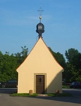
 The Thirty Years' War reduced the population of Balzfeld to 3 families. Thanks to its location off the imperial highway, the village did not remain largely undisturbed compared to the neighboring villages. The impractical access meant that Balzfeld fell behind in development compared to Horrenberg since the Thirty Years' War. Not just because of this, there have been seven unsuccessful attempts between 1705 and 1966 to grant the people of Balzfeld political independence from Horrenberg. In the old core of the village stands the 14th century Holy Cross (Heilig Kreuz) church. In contrast to Dielheim and Horrenberg, Balzfeld has been able to maintain its old character in the core of the village. Through recent village renovation measures Balzfeld has tried to profit from this.
 Oberhof, as the smallest village in the municipality of Dielheim, has preserved its traditional look the best. The village was first mentioned in documents in 1341 as superiore curia (upper or superior farm). The village has retained its larger size over Unterhof into the 20th century. Because of the larger area and better soil, the prince-bishops of Speyer allowed the construction of 5 inheritable farms. Already in 1401 the tenant farms of Oberhof were considered well off. Since the end of the 19th century, the poor transportation connections to Oberhof began to have a negative effect. The number of residents sank continuously in contrast to the other villages. Today the village attempts to preserve its well preserved facade as much as possible.
The flag is white and blue and together with the coat of arms was awarded by the Rhein-Neckar district administration office in 1985.
Municipality
A municipality is essentially an urban administrative division having corporate status and usually powers of self-government. It can also be used to mean the governing body of a municipality. A municipality is a general-purpose administrative subdivision, as opposed to a special-purpose district...
in the Rhein-Neckar district
Rhein-Neckar-Kreis
Rhein-Neckar-Kreis is a district in the northwest of Baden-Württemberg, Germany. Neighboring districts are Bergstraße, Odenwaldkreis, Neckar-Odenwald, Heilbronn, Karlsruhe, district-free Speyer, the Rhein-Pfalz-Kreis, and district-free Mannheim and Heidelberg.-History:The district was created in...
of Baden-Württemberg
Baden-Württemberg
Baden-Württemberg is one of the 16 states of Germany. Baden-Württemberg is in the southwestern part of the country to the east of the Upper Rhine, and is the third largest in both area and population of Germany's sixteen states, with an area of and 10.7 million inhabitants...
, Germany
Germany
Germany , officially the Federal Republic of Germany , is a federal parliamentary republic in Europe. The country consists of 16 states while the capital and largest city is Berlin. Germany covers an area of 357,021 km2 and has a largely temperate seasonal climate...
.
Location
Dielheim lies on the western edge of the KraichgauKraichgau
The Kraichgau is a hilly region in Baden-Württemberg, southwestern Germany. It is bordered by the Odenwald and the Neckar to the North, the Black Forest to the South, and the Upper Rhine Plain to the West. To the east, its boundary is considered to be the Stromberg, the Hardt, and the...
and the upper Rhine valley. The Leimbach
Leimbach
Leimbach can refer to the following places:* Leimbach, Haut-Rhin, commune in Haut-Rhin, France* Leimbach, Aargau, municipality in Switzerland* Leimbach , quarter of the city Zürich in Switzerland* in Germany:...
flows East to West through the center of Dielheim and its boroughs Horrenberg and Balzfeld. The Leimbach rises in Balzfeld.
Boroughs
Dielheim includes the following boroughs in order of the number of residents:- Dielheim
- Horrenberg
- Balzfeld
- Unterhof
- Oberhof
Neighboring communities
Clockwise from the north around Dielheim are the following communities:- MauerMauer-Places:*Mauer, Vienna, a former village of Lower Austria that since 1938 has been part of Vienna*Mauer bei Amstetten, a village in the municipality of Amstetten, in Lower Austria...
- MeckesheimMeckesheimMeckesheim is a village in south western Germany. It is located between Heidelberg and Sinsheim in the Rhein-Neckar district in the state of Baden-Württemberg.-History:...
- SinsheimSinsheimSinsheim is a town in southwestern Germany, in the Rhine Neckar Area of the state Baden-Württemberg about 22 kilometers southeast of Heidelberg and about 28 kilometers northwest of Heilbronn in the district Rhein-Neckar. It consists of a city center and 11 suburbs with a total population of 35,605...
- MühlhausenMühlhausenMühlhausen is a city in the federal state of Thuringia, Germany. It is the capital of the Unstrut-Hainich district, and lies along the river Unstrut. Mühlhausen had c. 37,000 inhabitants in 2006.-History:...
- Rauenberg
- WieslochWieslochWiesloch is a city in Germany, in northern Baden-Württemberg. It is situated 13 kilometres south of Heidelberg.After Weinheim, Sinsheim and Leimen it is the fourth largest city of the Rhein-Neckar-Kreis and is in the north-central area near Heidelberg with its neighbouring town Walldorf...
The nearest cities are:
- WieslochWieslochWiesloch is a city in Germany, in northern Baden-Württemberg. It is situated 13 kilometres south of Heidelberg.After Weinheim, Sinsheim and Leimen it is the fourth largest city of the Rhein-Neckar-Kreis and is in the north-central area near Heidelberg with its neighbouring town Walldorf...
4 km - SinsheimSinsheimSinsheim is a town in southwestern Germany, in the Rhine Neckar Area of the state Baden-Württemberg about 22 kilometers southeast of Heidelberg and about 28 kilometers northwest of Heilbronn in the district Rhein-Neckar. It consists of a city center and 11 suburbs with a total population of 35,605...
15 km - HeidelbergHeidelberg-Early history:Between 600,000 and 200,000 years ago, "Heidelberg Man" died at nearby Mauer. His jaw bone was discovered in 1907; with scientific dating, his remains were determined to be the earliest evidence of human life in Europe. In the 5th century BC, a Celtic fortress of refuge and place of...
20 km
Dielheim
Lorsch codex
The Lorsch Codex is an important historical document created between about 1175 to 1195 AD in the Monastery of Saint Nazarius in Lorsch, Germany. It consists of 460 pages in large format containing more than 3800 entries...
in 767. Next to Diedelsheim and Schluchtern
Schlüchtern
Schlüchtern is a town in the Main-Kinzig district, in Hessen, Germany. It is located on the river Kinzig at the southwest of a hill called Landrücken, approx. 30 km southwest of Fulda.-History:...
, Dielheim is one of the three oldest communities in the Kraichgau
Kraichgau
The Kraichgau is a hilly region in Baden-Württemberg, southwestern Germany. It is bordered by the Odenwald and the Neckar to the North, the Black Forest to the South, and the Upper Rhine Plain to the West. To the east, its boundary is considered to be the Stromberg, the Hardt, and the...
. The area was settled by the Romans
Ancient Rome
Ancient Rome was a thriving civilization that grew on the Italian Peninsula as early as the 8th century BC. Located along the Mediterranean Sea and centered on the city of Rome, it expanded to one of the largest empires in the ancient world....
, so one can assume the village was founded in the 6th century. The name used in the Lorsch Codex, diuuelenheim, may be the result of a reading or writing error made in the 12th century. The letters u and v were often confused, so one can assume the name was divvelenheim. The geminate vv stands for w, which was not commonly used at that time. Therefore we theorize that the name has an origin in the name of a Frankish
Franks
The Franks were a confederation of Germanic tribes first attested in the third century AD as living north and east of the Lower Rhine River. From the third to fifth centuries some Franks raided Roman territory while other Franks joined the Roman troops in Gaul. Only the Salian Franks formed a...
founder named Diwelo. After going through many changes, the spelling we see today, Dielheim, first appears in the 17th century. The rulers of town can first be identified after late in the 13th century.
By 1272 the prince-bishops of Speyer
Speyer
Speyer is a city of Rhineland-Palatinate, Germany with approximately 50,000 inhabitants. Located beside the river Rhine, Speyer is 25 km south of Ludwigshafen and Mannheim. Founded by the Romans, it is one of Germany's oldest cities...
had won half of Dielheim. Prince-bishop Adolf, who was in desperate need of money, pawned his half of Dielheim to Conz Mönch of Rosenberg in 1380. Conz Mönch took the other half of the village in the following years, thereby putting Dielheim in the possession of a noble for the first time. Conz Mönch, to ensure his control of the area, had a simple castle built on the Teufelskopf. This castle was probably more like a fortified farm than a proper castle. The isolated fortification could not be maintained for long and was quickly described as abandoned. Less than 200 years later, the castle appears as a place name. After multiple changes in ownership and having been pawned many times (noble families documented in this period include von Sickingen, von Rosenberg, von Menzingen, von Neipberg, von Gemmingen as well as the prince-bishops of Speyer), Dielheim finally came as a whole into the ownership of the prince-bishops of Speyer in 1512. The administrative seat of Dielheim for the prince-bishop was in Rotenberg. In the German Peasants' War
German Peasants' War
The German Peasants' War or Great Peasants' Revolt was a widespread popular revolt in the German-speaking areas of Central Europe, 1524–1526. At its height in the spring and summer of 1525, the conflict involved an estimated 300,000 peasants: contemporary estimates put the dead at 100,000...
in 1525, many farmers from Dielheim fought on the side of the so called Mob of Malsch (Malscher Haufens) against the oppression of the rule of the prince-bishops. After the defeat of the revolt, the village had to suffer harsh penalties. In the Thirty Years' War
Thirty Years' War
The Thirty Years' War was fought primarily in what is now Germany, and at various points involved most countries in Europe. It was one of the most destructive conflicts in European history....
, Dielheim was almost completely destroyed by the troops of the Palatinate of the Rhine, the Holy Roman Empire
Holy Roman Empire
The Holy Roman Empire was a realm that existed from 962 to 1806 in Central Europe.It was ruled by the Holy Roman Emperor. Its character changed during the Middle Ages and the Early Modern period, when the power of the emperor gradually weakened in favour of the princes...
, and Sweden
Sweden
Sweden , officially the Kingdom of Sweden , is a Nordic country on the Scandinavian Peninsula in Northern Europe. Sweden borders with Norway and Finland and is connected to Denmark by a bridge-tunnel across the Öresund....
. The region recovered only slowly from the loss of people and buildings.
Hardly had the essentials of the village been rebuilt when the War of the Palatinian Succession (a.k.a. War of the Grand Alliance
War of the Grand Alliance
The Nine Years' War – often called the War of the Grand Alliance, the War of the Palatine Succession, or the War of the League of Augsburg – was a major war of the late 17th century fought between King Louis XIV of France, and a European-wide coalition, the Grand Alliance, led by the Anglo-Dutch...
) broke out. In 1689 the French
France
The French Republic , The French Republic , The French Republic , (commonly known as France , is a unitary semi-presidential republic in Western Europe with several overseas territories and islands located on other continents and in the Indian, Pacific, and Atlantic oceans. Metropolitan France...
general Mélac
Ezechiel du Mas, Comte de Melac
Ezéchiel du Mas, Comte de Mélac was a career soldier in the French army under King Louis XIV and war minister Louvois....
reduced Dielheim to ashes. For this reason no building from the time of this catastrophe remains today. From the middle of the 18th century the population of the region boomed. The overpopulation of the region led to property being split into ever smaller pieces due to inheritance. The fields were divided into ever smaller plots that could no longer support or feed the people on the land. Hundreds attempted to find their fortune by emigrating to Hungary
Hungary
Hungary , officially the Republic of Hungary , is a landlocked country in Central Europe. It is situated in the Carpathian Basin and is bordered by Slovakia to the north, Ukraine and Romania to the east, Serbia and Croatia to the south, Slovenia to the southwest and Austria to the west. The...
, Russia
Russia
Russia or , officially known as both Russia and the Russian Federation , is a country in northern Eurasia. It is a federal semi-presidential republic, comprising 83 federal subjects...
, Romania
Romania
Romania is a country located at the crossroads of Central and Southeastern Europe, on the Lower Danube, within and outside the Carpathian arch, bordering on the Black Sea...
, Serbia
Serbia
Serbia , officially the Republic of Serbia , is a landlocked country located at the crossroads of Central and Southeast Europe, covering the southern part of the Carpathian basin and the central part of the Balkans...
, Algeria
Algeria
Algeria , officially the People's Democratic Republic of Algeria , also formally referred to as the Democratic and Popular Republic of Algeria, is a country in the Maghreb region of Northwest Africa with Algiers as its capital.In terms of land area, it is the largest country in Africa and the Arab...
, South America
South America
South America is a continent situated in the Western Hemisphere, mostly in the Southern Hemisphere, with a relatively small portion in the Northern Hemisphere. The continent is also considered a subcontinent of the Americas. It is bordered on the west by the Pacific Ocean and on the north and east...
, Switzerland
Switzerland
Switzerland name of one of the Swiss cantons. ; ; ; or ), in its full name the Swiss Confederation , is a federal republic consisting of 26 cantons, with Bern as the seat of the federal authorities. The country is situated in Western Europe,Or Central Europe depending on the definition....
, and above all, the United States of America. In the end, emigration was not enough to ensure that everyone remaining in Dielheim had work and enough to eat.
The tobacco
Tobacco
Tobacco is an agricultural product processed from the leaves of plants in the genus Nicotiana. It can be consumed, used as a pesticide and, in the form of nicotine tartrate, used in some medicines...
industry took advantage of this situation in 1850. The oversupply of labor and the low cost of that labor in the rural parts of Baden helped the cigar
Cigar
A cigar is a tightly-rolled bundle of dried and fermented tobacco that is ignited so that its smoke may be drawn into the mouth. Cigar tobacco is grown in significant quantities in Brazil, Cameroon, Cuba, the Dominican Republic, Honduras, Indonesia, Mexico, Nicaragua, Philippines, and the Eastern...
industry to boom. For about 100 years many people of Dielham made their living in the numerous cigar factories of the village, after which the tobacco industry went into rapid decline. From about 800 jobs suddenly only 10 remained.
Workers had to reorient themselves and take on new unfamiliar jobs. This changed Dielheim in the 50s and 60s of the 20th century to a commuter town
Commuter town
A commuter town is an urban community that is primarily residential, from which most of the workforce commutes out to earn their livelihood. Many commuter towns act as suburbs of a nearby metropolis that workers travel to daily, and many suburbs are commuter towns...
. Only the creation of Dielheim's industrial and commercial district led to the creation of its own companies, so that workers could once again find jobs in town. Today's Dielheim is known as a wine-growing region with 77 hectares of surrounding grape fields. Dielheimer Teufelskopf is known by wine lovers throughout Germany. In 1972 Horrenberg joined the municipality of Dielheim.
Horrenberg
Bad Wimpfen
Bad Wimpfen is an historic spa town in the district of Heilbronn in the Baden-Württemberg region of southern Germany. It lies north of the city of Heilbronn, on the river Neckar.-Geography:...
, and Nuremberg
Nuremberg
Nuremberg[p] is a city in the German state of Bavaria, in the administrative region of Middle Franconia. Situated on the Pegnitz river and the Rhine–Main–Danube Canal, it is located about north of Munich and is Franconia's largest city. The population is 505,664...
that has been in use since Roman times. This road, named an imperial highway (Reichstrasse) in 1433, was one of the most important thoroughfares in Germany up until the late Middle Ages. In medieval documents, the road is often referred to as the Kaiserstraße, the emperor's highway, because over the centuries many high ranking personalities used the imperial highway. The Roman general Julian
Julian the Apostate
Julian "the Apostate" , commonly known as Julian, or also Julian the Philosopher, was Roman Emperor from 361 to 363 and a noted philosopher and Greek writer....
(359), the king of the Huns Attila
Attila the Hun
Attila , more frequently referred to as Attila the Hun, was the ruler of the Huns from 434 until his death in 453. He was leader of the Hunnic Empire, which stretched from the Ural River to the Rhine River and from the Danube River to the Baltic Sea. During his reign he was one of the most feared...
(451), king Conrad III
Conrad III of Germany
Conrad III was the first King of Germany of the Hohenstaufen dynasty. He was the son of Frederick I, Duke of Swabia, and Agnes, a daughter of the Salian Emperor Henry IV.-Life and reign:...
(1150), king Philipp of Swabia (1199), emperor Frederick II
Frederick II, Holy Roman Emperor
Frederick II , was one of the most powerful Holy Roman Emperors of the Middle Ages and head of the House of Hohenstaufen. His political and cultural ambitions, based in Sicily and stretching through Italy to Germany, and even to Jerusalem, were enormous...
(1205), and king Henry VII
Henry VII, Holy Roman Emperor
Henry VII was the King of Germany from 1308 and Holy Roman Emperor from 1312. He was the first emperor of the House of Luxembourg...
(1224) all sojourned past the place where Horrenberg stands today. A valuable glass fragment from the 11th or 12th century found at castle Horrenberg indicates the passing of royal parties. This kind of purple-red and white glass has otherwise only been found at St. Denis
Saint Denis Basilica
The Cathedral Basilica of Saint Denis is a large medieval abbey church in the commune of Saint-Denis, now a northern suburb of Paris. The abbey church was created a cathedral in 1966 and is the seat of the Bishop of Saint-Denis, Pascal Michel Ghislain Delannoy...
in Paris
Paris
Paris is the capital and largest city in France, situated on the river Seine, in northern France, at the heart of the Île-de-France region...
, in Italian
Italy
Italy , officially the Italian Republic languages]] under the European Charter for Regional or Minority Languages. In each of these, Italy's official name is as follows:;;;;;;;;), is a unitary parliamentary republic in South-Central Europe. To the north it borders France, Switzerland, Austria and...
Pavia
Pavia
Pavia , the ancient Ticinum, is a town and comune of south-western Lombardy, northern Italy, 35 km south of Milan on the lower Ticino river near its confluence with the Po. It is the capital of the province of Pavia. It has a population of c. 71,000...
, and in Birka
Birka
During the Viking Age, Birka , on the island of Björkö in Sweden, was an important trading center which handled goods from Scandinavia as well as Central and Eastern Europe and the Orient. Björkö is located in Lake Mälaren, 30 kilometers west of contemporary Stockholm, in the municipality of Ekerö...
near Stockholm
Stockholm
Stockholm is the capital and the largest city of Sweden and constitutes the most populated urban area in Scandinavia. Stockholm is the most populous city in Sweden, with a population of 851,155 in the municipality , 1.37 million in the urban area , and around 2.1 million in the metropolitan area...
.
Around the year 1220, the then reigning lord of the region erected a fortified tower in order to protect the imperial highway at the toll station in Horrenberg. For the location of the fort, they chose a hill next to the highway which loomed a swampy low-lying section of the Leimbach
Leimbach
Leimbach can refer to the following places:* Leimbach, Haut-Rhin, commune in Haut-Rhin, France* Leimbach, Aargau, municipality in Switzerland* Leimbach , quarter of the city Zürich in Switzerland* in Germany:...
. Horrenberg comes from HOR- swamp or mud and BERG mountain or hill. Around the castle a small village developed over time. The first noble recorded in association with Horrenberg is Dieter von Horrenberg in 1238. He was most likely named after the new castle. Before 1272, bishop Henry of Speyer
Henry of Speyer
Henry of Speyer or Heinrich von Speyer, also called Graf im Wormsgau was the father of the Holy Roman Emperor Conrad II....
took over the upper Bruhrain to which the village Horrenberg and castle belonged. This purchase related document is the first definitive mention of Horrenberg. Older documents cannot be fully relied upon because of the similar way Castle Hornberg on the Neckar
Neckar
The Neckar is a long river, mainly flowing through the southwestern state of Baden-Württemberg, but also a short section through Hesse, in Germany. The Neckar is a major right tributary of the River Rhine...
was written at that time. In 1366 emperor Charles IV
Charles IV, Holy Roman Emperor
Charles IV , born Wenceslaus , was the second king of Bohemia from the House of Luxembourg, and the first king of Bohemia to also become Holy Roman Emperor....
confirmed the right of bishop Lamprecht of Speyer to collect the toll income of Horrenberg.
By the middle of the 15th century the minor noble family of Horrenberg had died out. The prince-bishop of Speyer had to relinquish the authority of Rotenberg, to which Horrenberg belonged, to the Palatinate of the Rhine from 1462 to 1498. At this time the Horrenberg fell into ruin as the lords of the Horrenberg had no need of the castle and left the community to fend for itself. In the sources of the 15th and 16th century continuously refer to the former castle.
During the Thirty Years War, Horrenberg suffered the same fate as the surrounding villages. From 1618 to 1648 the village was plundered again and again by the imperial, palatine, Swedish, Bavaria
Bavaria
Bavaria, formally the Free State of Bavaria is a state of Germany, located in the southeast of Germany. With an area of , it is the largest state by area, forming almost 20% of the total land area of Germany...
n, and French troops. By the end of the war, only three families still lived in Horrenberg. All houses were destroyed. 20 years after the Thirty Years War, there were 12 inhabited homes. However, the village never regained the importance it had before the war. The toll station was never rebuilt. The important sheep farms and the great Hubhof of the prince-bishop only served a role as rentable goods. Only in the late 18th century had the number of residents increased to the point where the arable land available was no longer sufficient. Many young people and whole families emigrated overseas. The tobacco industry in contrast to the other communities in the area were very late in erecting cigar factories in the community Horrenberg-Balzfeld.
In 1932 Oberhof and Unterhof were incorporated into Horrenberg. After WW II
World War II
World War II, or the Second World War , was a global conflict lasting from 1939 to 1945, involving most of the world's nations—including all of the great powers—eventually forming two opposing military alliances: the Allies and the Axis...
the population of Horrenberg soared due to the influx of refugees. Today the once tiny village has been replaced with a modern residential community. In the center of the village, the former city hall (built in 1845) still dominates the character of the village. Since Horrenberg-Balzfeld was incorporated in Dielheim in 1972, the city hall has lost its original function. The castle hill, which is accessible again, shows little sign that it once hosted a castle. Today it serves as a place of recreation and vantage point.
Balzfeld
Since the Middle Ages, Balzfeld has belonged politically to it much younger neighbor, Horrenberg. Balzfeld was supposedly founded around the year 1000. A group of hill graves from the early stone age (around 2000 BC) indicates the early settlement of the fruitful hills of Kraichgau. In the year 1306 Balzfeld was first documented as Balgesuelt (balg = hollow or ditch). At this time, the village had already lost its political independence to Horrenberg. At the same time, Horrenberg was always indicated as belonging to Balzfeld in the church hierarchy. "The city hall is in Horrenberg and the church in Balzfeld," appears again and again in records and documents. In 1559 both villages were expressly unified as a single community by the decree of the local ruler after fighting between the residents. Ownership was handled completely differently in free Balzfeld compared with castle village Horrenberg ruled by nobility. The burghers of Balzfeld owned their own fields and had enough access to commons, fields, and forest, unlike the residents of Horrenberg. The Horrenberger farmers owed fealty to their lords and had little land of their own. They were tenants to their lord.Unterhof
Unterhof like Oberhof was originally founded as a feudal settlement for a local lord. Possibly this is the hamlet mentioned under around the year 860 together with Dielheim in the Lorsch codex named Hiltibrandeshusen. In 1341 Unterhof was named for the first time in documents inferiori curia (lesser or lower farm) in rent books of the Speyer office of Rotenberg. In 1401 under the name zum Nydernhofe is the first appearance of the name in the German language. For centuries the prince-bishops of Speyer limited the number of farms to three. During the Thirty Years' War the residents fled their farms and Unterhof lay deserted and overgrown for decades. After resettlement, Unterhof and Oberhof, as tenant farms of the local lords, were occasionally self-administrated. First since 1932 after a drawn out fight for their independence, the settlements belong to Horrenberg. In recent years, Unterhof has transformed itself into a residential community that is still strongly influenced by agriculture.Oberhof
Municipal council
| Municipal Council 2004 | |||||
| Party | Votes | Seats | |||
| CDU Christian Democratic Union (Germany) The Christian Democratic Union of Germany is a Christian democratic and conservative political party in Germany. It is regarded as on the centre-right of the German political spectrum... |
62.9% | 14 | |||
| SPD Social Democratic Party of Germany The Social Democratic Party of Germany is a social-democratic political party in Germany... |
17.8% | 3 | |||
| Women for the Community (Bürgerinnen für die Gemeinde) | 12.7% | 2 | |||
| Green Alliance '90/The Greens Alliance '90/The Greens is a green political party in Germany, formed from the merger of the German Green Party and Alliance 90 in 1993. Its leaders are Claudia Roth and Cem Özdemir... |
6.6% | 1 | |||
| Voter Participation: 59,0% | |||||
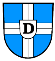
Coat of arms
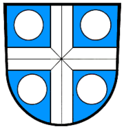
The coat of arms was put together from the old coat of arms of Dielheim and Horrenberg. Both included the silver cross on a field of blue from the Prince-bishoprics of Speyer.The flag is white and blue and together with the coat of arms was awarded by the Rhein-Neckar district administration office in 1985.
Sister cities
 St. Nicolas-de-Port, FranceFranceThe French Republic , The French Republic , The French Republic , (commonly known as France , is a unitary semi-presidential republic in Western Europe with several overseas territories and islands located on other continents and in the Indian, Pacific, and Atlantic oceans. Metropolitan France...
, May 1985 LengyeltótiLengyeltóti-Settings:The town can be found south from Fonyód, along the highway to Somogyvár, the old seat of the county. The highway went from the Lake Balaton to the southern part of the vountry. The town sits on the top of a hill. Its name: Tóti, meant slavonic people in the ancient times, so probably the...
, HungaryHungaryHungary , officially the Republic of Hungary , is a landlocked country in Central Europe. It is situated in the Carpathian Basin and is bordered by Slovakia to the north, Ukraine and Romania to the east, Serbia and Croatia to the south, Slovenia to the southwest and Austria to the west. The...
, June 1994