
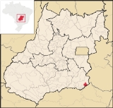
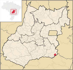
Davinópolis
Encyclopedia
| Davinópolis | |
|---|---|
| State | Goiás Goiás Goiás is a state of Brazil, located in the central part of the country. The name Goiás comes from the name of an indigenous community... |
| Coordinates: | 18°09′01"S 47°33′13"W |
| Area: | 520.0 km² (10/10/2002) |
| Population: | 2,013 (IBGE 2007) |
| Elevation: | 771m above sea level |
| Postcode (CEP): | 75420-000 |
| IBGE statistical microregion: | 017 Catalão Catalão Microregion The Catalão Microregion is a statistical microregion created by IBGE in south-eastern Goiás state, Brazil.*Population: 131.741 inhabitants *Cities: 11*Total Area: 15,238.60 km²... |
| Became a city: | 1958 |
| Mayor: | Gomides Ferreira Gomes (2005-2009) |
| Distance to Goiânia Goiânia -Climate:The city has a tropical wet and dry climate with an average temperature of . There's a wet season, from October to April, and a dry one, from May to September. Annual rainfall is around 1,520 mm.... : |
304 km. |
| Website: | none |
Town
A town is a human settlement larger than a village but smaller than a city. The size a settlement must be in order to be called a "town" varies considerably in different parts of the world, so that, for example, many American "small towns" seem to British people to be no more than villages, while...
and municipality
Municipality
A municipality is essentially an urban administrative division having corporate status and usually powers of self-government. It can also be used to mean the governing body of a municipality. A municipality is a general-purpose administrative subdivision, as opposed to a special-purpose district...
in southeastern Goiás
Goiás
Goiás is a state of Brazil, located in the central part of the country. The name Goiás comes from the name of an indigenous community...
state, Brazil
Brazil
Brazil , officially the Federative Republic of Brazil , is the largest country in South America. It is the world's fifth largest country, both by geographical area and by population with over 192 million people...
. The population was 2,013 (2007) in a total area of 520.0 km².
Location and Highway Connections
The municipality is located in the statistical micro-region of CatalãoCatalão Microregion
The Catalão Microregion is a statistical microregion created by IBGE in south-eastern Goiás state, Brazil.*Population: 131.741 inhabitants *Cities: 11*Total Area: 15,238.60 km²...
, 28 kilometers southeast of interstate BR-060, which connects Uberlândia
Uberlândia
Uberlândia is the main town in the Triangle region, west of the state of Minas Gerais, Brazil. With a population of 604,013 inhabitants, according to 2010 estimates, the city is the second largest in the state second only to Belo Horizonte...
to Cristalina
Cristalina
Cristalina is a small city located in the southeast of the state of Goiás, Brazil.-Location:Cristalina is located directly south of the federal capital, Brasília, and is connected to that city by BR-040...
. Catalão
Catalão
Catalão is a small city and municipality located in the south of the state of Goiás, in Brazil. It is a large producer of grains, cattle, and phosphates and has a John Deere and Mitsubishi factory.-Demographics:*Population density: 17.85 inhab/km²...
is 53 kilometers away. The municipality of Catalão
Catalão
Catalão is a small city and municipality located in the south of the state of Goiás, in Brazil. It is a large producer of grains, cattle, and phosphates and has a John Deere and Mitsubishi factory.-Demographics:*Population density: 17.85 inhab/km²...
lies to the north and Ouvidor
Ouvidor
Ouvidor is a small town and municipality in southeast Goiás state, Brazil.-Location:Located 267 kilometers from the state capital, Goiânia, Ouvidor is connected by BR-352 / Bela Vista de Goiás / Cristianópolis / GO-020 / Pires do Rio / BR-352 / GO-330 / Ipameri / Catalão / GO-330 / BR-352...
to the southwest. The state boundary with Minas Gerais
Minas Gerais
Minas Gerais is one of the 26 states of Brazil, of which it is the second most populous, the third richest, and the fourth largest in area. Minas Gerais is the Brazilian state with the largest number of Presidents of Brazil, the current one, Dilma Rousseff, being one of them. The capital is the...
is formed by the Paranaíba
Paranaíba River
The Paranaíba River is a Brazilian river whose source lies in the state of Minas Gerais in the Mata da Corda mountains, municipality of Rio Paranaíba, at an altitude of 1,148 meters; on the other face of this mountain chain are the sources of the Abaeté river, tributary of the São Francisco River...
to the south.
The distance to the state capital, Goiânia
Goiânia
-Climate:The city has a tropical wet and dry climate with an average temperature of . There's a wet season, from October to April, and a dry one, from May to September. Annual rainfall is around 1,520 mm....
, is 304 km. Highway connections from Goiânia
Goiânia
-Climate:The city has a tropical wet and dry climate with an average temperature of . There's a wet season, from October to April, and a dry one, from May to September. Annual rainfall is around 1,520 mm....
are made by BR-352 / Bela Vista de Goiás
Bela Vista de Goiás
Bela Vista de Goiás is a small city located in central Goiás state in Brazil.-Location:It is 45 kilometers from the state capital of Goiânia...
/ Cristianópolis
Cristianópolis
This article is about Cristianópolis, Goiás. For Cristianópolis, Mato Grosso see Cristianópolis, Mato GrossoCristianópolis is a small town and municipality in south-eastern Goiás state, Brazil.-Geographical Information:...
/ GO-020 / BR-352 / Pires do Rio
Pires do Rio
Pires do Rio is a small city and municipality in Goiás state, Brazil. It is a prosperous town and a major producer of poultry.-Location:It is located in the Pires do Rio Microregion. . It is located 144 kilometers from the state capital and is served by highways GO-020, 330 and 414, as well as...
/ GO-330 / Ipameri
Ipameri
Ipameri is a small city and municipality in southeastern Goiás state, in Brazil. The population was 23,114 in a total area of 4,368.6 km² . It is a major producer of soybeans, corn, and livestock.-Location and connections:...
/ Catalão
Catalão
Catalão is a small city and municipality located in the south of the state of Goiás, in Brazil. It is a large producer of grains, cattle, and phosphates and has a John Deere and Mitsubishi factory.-Demographics:*Population density: 17.85 inhab/km²...
/ BR-050.
Political data in 2007
- Eligible voters: 1,886 (12/2007)
- Mayor: Gomides Ferreira Gomes
- Vice-mayor: Dileno Machado Rodrigues
- Councilmembers: 09
Demographics
- Population growth rate 2000/2007: -0.66.%
- Urban population in 2007: 1,356
- Rural population in 2007: 657
The economy
The basis of the economy is cattle raising with 26,000 head in the region. There is some poultry raising and also limited production of agricultural products.Economic data
- Industrial units: 04
- Retail units: 27
- Banking institutions: none (01/06/2007)
- Dairies: Laticínios Davinópolis Ltda. (07/06/2007)
- Automobiles: 235 in 2007
Farm data
- In agriculture there was modest production of rice, sugarcane, beans, manioc, corn, and soybeans. (no crop had over 1,000 hectares planted)
There were 276 farms with a total area of 35,067 ha., of which 26,363 ha. were pasture, 25 ha. were permanent crops, 1,341 were perennial crops, and 6,571 ha. were woodland. There were 590 persons dependent on agriculture. There were 331 tractors on 105 farms.
Health and education
- Literacy rate: 82.8%
- Infant mortality rate: 24.59 in 1,000 live births
- Schools: 03 (2006)
- Students: 541
- Hospitals: 0 (2007
Geography and history
There are three main rivers in the region: the Paranaíba, São Marcos and São Bento, which all have great potential for tourism.The origin of the town is connected to the donation of lands made by José David de Souza, in 1948, to the city government of Catalão
Catalão
Catalão is a small city and municipality located in the south of the state of Goiás, in Brazil. It is a large producer of grains, cattle, and phosphates and has a John Deere and Mitsubishi factory.-Demographics:*Population density: 17.85 inhab/km²...
, so that a school could be built. In the same decade houses began to appear around the school, forming the settlement that received the name of Grupo because it had a "grupo escolar". Soon the school began to attract residents to the region. In 1963 the district became a municipality with the name Davinópolis, named after David de Souza, the man who had donated the first lands for the school.
Ranking on the municipal Human Development Index
Human Development Index
The Human Development Index is a composite statistic used to rank countries by level of "human development" and separate "very high human development", "high human development", "medium human development", and "low human development" countries...
- MHDI: 0.732
- State ranking: 136 (out of 242 municipalities in 2000)
- National ranking: 2,373 (out of 5,507 municipalities in 2000)
See also
- List of municipalities in Goiás
- Microregions of Goiás
- Catalão MicroregionCatalão MicroregionThe Catalão Microregion is a statistical microregion created by IBGE in south-eastern Goiás state, Brazil.*Population: 131.741 inhabitants *Cities: 11*Total Area: 15,238.60 km²...