
Craven
Encyclopedia
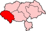
Craven is a local government district
in North Yorkshire
, England
that came into being in 1974
, centred on the market town of Skipton
. In the changes to British local government of that year this district was formed as the merger of Skipton
urban district, Settle Rural District and most of Skipton Rural District
, all in the West Riding of Yorkshire
. It comprises the upper reaches of Airedale
, Wharfedale
, Ribblesdale and Lonsdale
and includes most of the Aire Gap
and Craven Basin.
cravona, meaning stony region.
Or from the Celtic (Cumbric), related to the Welsh
word craf meaning garlic
. In the Middle Ages, the area was known for its wild garlic
.
nomadic hunters are the flint
barbs they set into shafts. Extensive finds of these microliths lie around Malham Tarn
and Semerwater. Flint does not occur in the Dales, the nearest outcrop is in East Yorkshire. On higher ground microliths are found near springs at the tree line at 500 m (1,640.4 ft) indicating campsites close to the open hunting grounds. The valley woodlands were inhabited by deer, boar and aurochs
, the higher ground was open grassland that fed herds of reindeer, elk and horse. No permanent settlements have been found of that age, hunting here was seasonal, returning to the plains in winter.
After 5000BC Neolithic
long-distance trade is indicated by the distribution of stone axes many of which were of hard volcanic rock with a cutting edge made by polishing. Lithic analysis
can identify their quarry source. Axes found in Yorkshire originate in the central Cumbria
and are found as far as eastern Yorkshire suggesting they were traded for the flint there. But most finds are in Ribblesdale and Airedale indicating that Craven was their trade route through the Pennines. Farmers permanently settled in Craven, bringing domesticated
livestock and used those stone axes to clear woodlands, probably by slash-and-burn, to increase areas for grazing and crops.
in 991–1016 the Anglo-Saxons divided their territory into tax districts. The Wapentakes of Staincliffe
and Ewcross covered the region we call Craven but also areas beyond it such as the Forest of Bowland in Lancashire; and Sedburgh in Cumbria to the North.The Chuch was still using these areas in 16th century.
of 1086 curiously digressed from the Wapentake districts by using the celtic Craven district instead. In the west this included Burrow, Melling, Wennington and Hornby in Lonsdale
, reaching further west than any later descriptions. Archives show that the Melling-with-Wrayton and Hornby-with-Farleton
farmlands were in the districts of Ergune (Arkholme) and Ghersinctune (Gressingham), but there was another layer of districts between those and West coast. However some propose Mellinge could even mean Melling near .
Although it suggests the length, the Domesday Book does not tell us the width of the boundaries of Craven, for in it only arable land
was noted and ploughing was at that date a minor part of Craven agriculture, although cultivators had probably been reduced in numbers by the Harrying of the North
. The valley bottoms are usually boggy, shady frost-hollows, with soils of glacial boulder clay very heavy to cultivate. So farms were limited to the well-drained slopes, but not too far up for that is unusable moorland. The band of useful soil in between is so full of rocks that grazing oxen was the living in Craven, with some sheep marginal. Because grazing land was not tallied in the Domesday Book the full areas of the estates of the manors can only be induced, for example no ploughed land at all was recorded between Cononley and Wennington.
and Ewcross do cover the region of Craven but also areas beyond it such as Sedburgh to the North.
Young King Richard II commanded a poll tax to pay off the debts he'd inherited from the Hundred Years' War
. Its first application in 1377 was a flat rate and the second of 1379 was a sliding scale from 1 groat (4p pence) to 4 marks. But the third of 1381, 4 groats (1 shilling) and up, was applied corruptly and led to the Great Rising of 1381
and, in 1399, the House of Lancaster taking the throne from York.
However the records of the 1379 tax are full of valuable statistics for we can compare the income brackets of various occupations, and the relative worth of villages.
es, Michaelmas (29 September) and Lady Day (25 March). The Yorkshire records of all three ridings are now completely transcribed, analyzed and available free online
s and slopes of Craven are greatly involved in the history of sheep
particularly in the history of wool.
After 5000 BC the Neolothic farming movement introduced domesticated sheep, but the Roman occupation of Britain introduced advanced sheep husbandry
to Britain and made wool into a national industry. Craven was made accessable by major roads from Lancaster
through Ingleton
and from York
through Gargrave
. The extent of a Roman villa
farm excavated at Gargrave implies it practiced grazing on nearby moorland.
By 1000 AD England and Spain were recognized as the pinacles of European sheep wool production.
About 1200 AD scientific treatises on agricultural estate management began to circulate amongst the Cistercian monasteries in the Yorkshire dales. These indicated the way to greatest profit was to produce wool for export.
Fountains Abbey
strongly affected Craven in upper Wharfedale, Airedale and Littondale
. In 1200 the Abbey owned 15,000 sheep in various locations and traded directly with Italian merchants. On the limestone fells it held extensive sheep runs managed by granges located at valley heads to access both the moors and the rough pasture
of valley sides. Many granges developed into hamlets
. The Fountains’ sheep administrative centre was at Outgang Hill, Kilnsey
.
By 1320 Bolton Priory’s flock at Malham
was about 2,750 and it built extensive sheep farm buildings there. Accounts show that a quarter of its cheese was sheep’s cheese, and that most of the Priory’s came from wool sales. It also developed fulling
, sorting and grading into industries.
Feudal Lords began to imitate monastic management methods for their own estates and in 1350 when the Black Death
killed-off half the rent-paying farmers they had the bailiffs substitute sheep-pasture for tillage. The export of wool to the Flanders looms, and the concurrent growth of cloth manufacture in England, aided by Edward III
's importation of Flemish weavers to teach his people the higher skill of the craft, made demand for all the wool that English flocks could supply. As the profitability of wool further increased some landowners converted all arable land into sheep pasture by evicting whole villages. Over 370 deserted medieval villages have been unearthed in Yorkshire.
Henry VIII in 1539 suppressed the Monasteries
and sold Littondale and the Bolton Priory's estates in lower Wharefedale and Airedale to Henry Clifford, 1st Earl of Cumberland
and Lord of Skipton.
By 1600 the wool trade was the primary source of tax revenue for Queen Elizabeth I. Britain’s success made it a major influence in the development and spread of sheep husbandry worldwide.
In more modern times the Industrial Revolution
brought factory production of wool cloth to towns further down Airedale and many Craven families, made redundant by agricultural machinery, moved south to work in the worsted
mills.
However in 1966 the price of wool fell by 40% due to the increased popularity of synthetic fiber
s. Farmers complain it now costs more to shear a sheep than you can get for its wool and the result is reduced flocks. Although the tough wool of hill sheep is still used for carpet weaving, sheep breeding is now mostly for lambs to sell on for fattening for meat in low patures.
Woodland is an important component of the landscape and are crucial to scenic beauty. The small surviving areas of ancient woodland have high biodiversity
value. However the Pennines are now notably lacking in trees despite archaeological evidence showing 90% was woodlands before human settlement. Palynology
indicates a coincident decline in trees and increase in grasses. The dramatic shortage of natural woodlands is due to overgrazing and direct clearance for pasture.
Since sheep are grazers
not browsers they do not affect mature trees however they devour all their seedlings. With a much narrower face than cattle they crop plants very close to the ground and with continuous grazing can overgraze land rapidly.
Ancient Common
Grazing rights
made it impossible to actively grow trees, even for fuel, because coppicing
requires enclosure to protect re-growth from sheep.
Since 2002 The Yorkshire Dales National Park has encouraged sheep farmers to switch uplands livestock to cattle since they do not graze so intensively. Traditional breeds such as Blue Greys and Belted Galloways can survive the harsh winters and live off the rough grasses just as well a sheep. Since 1968 some moorland has been afforested
by the Forestry Commission
.
Since 2005 the collection of indigenous
seeds and propagation by the Dales National Park produced saplings for planting schemes that began in 2010.
prevailed in Craven. Good quality bulls were bought communally
to improve the livestock on the common land
beside each village. In the 18th century they crossbred
with Shorthorn
s: fully grown crossbreeds weighed 420-560 pounds. Some graziers
of the Craven highlands also visited Scotland
, for example Oban
, Lanark
and Stirling
, to purchased stock to be brought down the drove roads to the cattle-rearing district. In the summer of 1745 the celebrated Mr Birtwhistle brought 20,000 head from the northernmost parts of Scotland to Great Close near Malham
.
In modern times dairy farming has predominated. After the 1970s Holstein Friesians became the most popular breed.
records the Danish Viking settlers “were engaged in ploughing and making a living for themselves.”
Cultivation lynchet terraces and ridge-and-furrow fields of the Middle Ages are visible alongside many villages particularily in Wharfedale and Malhamdale and tithe records show they grew crops of oat
s, barley and wheat and in rotation, beans and peas.
But the wool boom of the 16th century caused most arable land to be turned into pasture. In the 18th century miller’s records show they had to import wheat to grind and sell as flour but the farmers still grew oats for it formed the principle article of their subsistence, some made into bread and puddings but mostly cooked as oatcake
s.
that make up the district.
For representation on North Yorkshire County Council Craven is divided into seven divisions and returns one councillor per division.
On a national level Craven forms part of the Skipton and Ripon constituency which is currently represented by the Conservative
Member of Parliament
Julian Smith
.
Craven District Council allies with other organizations:
. Other major population centres in the region include High Bentham
, Settle
, Grassington
. Due to expansion the villages of Sutton-in-Craven
, Cross Hills
and Glusburn
now make one an urban conglomerate.
In the 1974 government reorganization of the shire districts
some towns were lost to Lancashire but because of cultural history their area is known as West Craven
. These are Barnoldswick
, Earby
, Sough
, Kelbrook
, Salterforth
and Bracewell and Brogden
.
The Anglican Church Archdeaconry 542 is named Craven and has four Deaneries: Ewecross, Bowland, Skipton and South Craven. Ecclesiastic Craven is much larger than the civic District of Craven; in particular the north of Ewecross is in Cumbria county, the lower part of South Craven is in West Yorkshire, and south-west Bowland is in Lancashire county.
The Church of England is considering charging their boundary of Bowland to match that of civic Lancashire, but this is unlikely to happen before July 2013.
The Deanery of South Craven comprises 20 parishes: Cononley, Cowling, Cross Roads cum Lees, Cullingworth, Denholme, East Morton, Harden, Haworth, Ingrow, Kilkdwick, Newsholme, Oakworth, Oxenhope, Riddlesden, Sildsden, Steeton with Eastburn, Sutton-in-craven, Thwaites Brow, Utley, Wilsden. Civic boundaries further contrast in that only Bradley, Cowling, Kilkdwick and Sutton-in-craven are in North Yorkshire, the rest are in West Yorkshire.
, Wharfedale
, Ribblesdale and the river Wenning of Lonsdale
.
significance for the historic North of England for it provides a low-altitude pass
through "the backbone of England"
. It was the Pennine transport corridor from Cumbria
and Strathclyde
to the Vale of York
. Even Neolithic
long-distance trade is proved by many finds of stone axes from central Cumbria
.
To the route’s north stand limestone
mountains of up to 736 m (2,415 ft) above mean sea level
and to its south lie bleak sandstone
moors, that above 275 m (902 ft) grow little but bracken.
The treeless moorland gives no shelter from storms. Even modern Pennine transport can find it a formidable barrier for roads can be blocked by snow for several days. But the Craven route is a welcoming sheltered passageway, and also inhabited along its length.
The railway-builders sought the lowest course through the valleys of Craven and found that to be 166 m (545 ft) near Giggleswick
scar at 54.074167°N 2.318056°W, and 160 m (525 ft) just East of Hellifield
at 54.00000°N 2.16667°W a point labeled Aire Gap on maps.
The nearest alternative pass through the Pennines is Stainmore Gap (Eden-Tees) to the North, but that is not in Craven’s league for it climbs to 409 m (1,342 ft) and its climate is classed as sub-arctic in places. The nearest low-level routes across the country are the 228 m (748 ft) Tyne Gap
over 100 km (62 mi) to the north, or the Midlands just as far to the south.
glacial sheets
retreated from Craven ca 11,500 BC plants returned to the bare earth and archaeological palynology
can identify their species. The first trees to settle were willow, birch and juniper, followed later by alder and pine. By 6500 BC temperatures were warmer and woodlands covered 90% of the dales with mostly pine, elm, lime and oak. On the limestone soils the oak was slower to colonize and pine and birch predominated. Around 3000 BC a noticeable decline in tree pollen indicates that neolithic farmers were clearing woodland to increase grazing for domestic livestock, and studies at Linton Mires
and Eshton Tarn
find an increase in grassland species in Craven.
On poorly drained impermeable areas of millstone grit, shale or clays the topsoil gets waterlogged in Winter and Spring. Here tree suppression combined with the heavier rainfall results in blanket bog
up to 2 m (7 ft) thick. The erosion of peat ca 2010 still exposes stumps of ancient trees.
Vegetation in the Pennines is adapted to subarctic climates, but altitude and acidity are also factors. For example on Sutton
Moor the millstone grit’s topsoil below 275 m (902 ft) has a soil ph
that is almost neutral, ph 6 to 7, and so grows good grazing. But above 275 m (902 ft) it is acidic, ph 2 to 4, and so can grow only bracken
, heather
, sphagnum
, and coarse grasses such as cottongrass, purple moor grass and heath rush
. Dressing it with lime produces better quality grass for sheep grazing - such is named marginal upland grazing.This points to the advantage of Pastoral farming
near Craven Fault
where the lime is so available.
Economic forecasts for 2010 show that the Craven District's diverse economy, measured in Gross Value Added (GVA), is worth £1.14 billion ($1.87 billion) Since 1998 the value of the District’s economy has grown by 45%. Craven hosts a variety of small businesses - 72% employ less than four people. Businesses that employ above 50 employees (2.2%) are mostly in the south of the District.
AHDB, the national Agriculture and Horticulture Development Board, issues regional reports with constant updates on agricultural output:
Two thirds of Craven lie within the Yorkshire Dales
National Park where traditional landscape preservation is required
Sandstone
(Millstone Grit
) is quarried along the North Craven Fault
line where the Askrig block outcrops above Ingleton and Settle. Cove and Goredale Limestone
s are also quarried in those areas; and near Grassington
.
In 2008 there were 26,591 employed; 22% were self-employed. In 2010 each Full Time Equivalent (FTE) employee contributed £40,311 to the District’s economy, representing an increase in productivity of 21.9% since 1998; an annual increase of 1.8%. The value of output per capita (estimated to be £19,703) has increased by 32% since 1998.
Also Lantra's Landskills offers workshops in efficiency and profitability in agriculture, horticulture and forestry with up to 70% funding. Caven is covered in Farm Business Support and Development and Yorkshire Rural Training Network.
Yet from 2004 to 2009 there was generally a decline in attainment of about 12% and the number of people in the District with no qualifications increased by 1.8%. Such people have reduced employment options, however Craven College in Skipton is one of the largest Further Education Colleges in North Yorkshire and provides an outreach service to rural areas.
Following the success of a Renaissance Partnerships funding application to MLA Museums Libraries and Archives Craven Museum has helped both the Museum of North Craven Life in Settle and the Upper Wharfedale Folk Museum in Grassington.
, born in a modest family, went to London and rose rapidly to became its Lord Mayor. He is sometimes referred to as "Aptrick's Dick Whittington" suggesting the story of Dick Whittington is based on his life.
William was born c1518 in Appletreewick
near Skipton. At age 14 was sent to London to apprentice to a Watling Street Tailor. He qualified in 1569 and made such a fine impression that in 1600 he was made Alderman of Bishopgate; in 1601 he was chosen Lord Mayor of London and in 1603 was knighted by James I.
He made benefactions to Craven Yorkshire, founding the school in Burnsall
.
William’s son John founded the famous Craven Scholarships at Oxford and Cambridge Universities and in 1647 left many large charitable bequests to North Yorkshire towns including Burnsall and Skipton in Craven.
After 1660 William’s first son William Craven was made the first Earl of Craven
by Charles II. However that title was eponym
inous for the estate was Uffington Berkshire; he was in no sense a lord of Craven Yorkshire.
Non-metropolitan district
Non-metropolitan districts, or colloquially shire districts, are a type of local government district in England. As created, they are sub-divisions of non-metropolitan counties in a so-called "two-tier" arrangement...
in North Yorkshire
North Yorkshire
North Yorkshire is a non-metropolitan or shire county located in the Yorkshire and the Humber region of England, and a ceremonial county primarily in that region but partly in North East England. Created in 1974 by the Local Government Act 1972 it covers an area of , making it the largest...
, England
England
England is a country that is part of the United Kingdom. It shares land borders with Scotland to the north and Wales to the west; the Irish Sea is to the north west, the Celtic Sea to the south west, with the North Sea to the east and the English Channel to the south separating it from continental...
that came into being in 1974
Local Government Act 1972
The Local Government Act 1972 is an Act of Parliament in the United Kingdom that reformed local government in England and Wales on 1 April 1974....
, centred on the market town of Skipton
Skipton
Skipton is a market town and civil parish within the Craven district of North Yorkshire, England. It is located along the course of both the Leeds and Liverpool Canal and the River Aire, on the south side of the Yorkshire Dales, northwest of Bradford and west of York...
. In the changes to British local government of that year this district was formed as the merger of Skipton
Skipton
Skipton is a market town and civil parish within the Craven district of North Yorkshire, England. It is located along the course of both the Leeds and Liverpool Canal and the River Aire, on the south side of the Yorkshire Dales, northwest of Bradford and west of York...
urban district, Settle Rural District and most of Skipton Rural District
Skipton Rural District
Skipton was a rural district in the West Riding of Yorkshire from 1894 to 1974. It was named after Skipton, which constituted an urban district on its southern border....
, all in the West Riding of Yorkshire
West Riding of Yorkshire
The West Riding of Yorkshire is one of the three historic subdivisions of Yorkshire, England. From 1889 to 1974 the administrative county, County of York, West Riding , was based closely on the historic boundaries...
. It comprises the upper reaches of Airedale
Airedale
Airedale is a geographic area in Yorkshire, England, corresponding to the river valley of the River Aire . The valley stretches from the river's origin in Malham which is in the Yorkshire Dales, down past Keighley and Bingley, through Leeds and Castleford and on to join the Humber...
, Wharfedale
Wharfedale
Wharfedale is one of the Yorkshire Dales in England. It is the valley of the River Wharfe. Towns and villages in Wharfedale include Buckden, Kettlewell, Conistone, Grassington, Hebden, Ilkley, Burley-in-Wharfedale, Otley, Pool-in-Wharfedale, Arthington, Collingham, and Wetherby...
, Ribblesdale and Lonsdale
Lonsdale (hundred)
Lonsdale was a hundred of Lancashire, England. For many decades, it covered most of the northwestern part of Lancashire around Morecambe Bay, including the detached part around Furness, and the city of Lancaster....
and includes most of the Aire Gap
Aire Gap
Aire Gap is a mountain pass through the backbone of England formed by geologic faults and carved out by glaciers. The term is used in various senses: a vast geological division, a travel route, or a location that is an entry into the Aire river valley....
and Craven Basin.
History
In recorded history Craven has been the name of this district but it was never defined until 1974; its boundaries differed according to whether considering administration, taxation or religion.Etymology
The name Craven may be derived from the pre-CelticPre-Celtic
The term pre-Celtic refers to the period in the prehistory of Central and Western Europe postdating the emergence of Proto-Celtic and predating the expansion of the Celts, or Celtic culture, in the course of the earlier Iron Age . The area involved is that of the maximum extent of Celtic languages...
cravona, meaning stony region.
Or from the Celtic (Cumbric), related to the Welsh
Welsh language
Welsh is a member of the Brythonic branch of the Celtic languages spoken natively in Wales, by some along the Welsh border in England, and in Y Wladfa...
word craf meaning garlic
Garlic
Allium sativum, commonly known as garlic, is a species in the onion genus, Allium. Its close relatives include the onion, shallot, leek, chive, and rakkyo. Dating back over 6,000 years, garlic is native to central Asia, and has long been a staple in the Mediterranean region, as well as a frequent...
. In the Middle Ages, the area was known for its wild garlic
Ramsons
Ramsons — also known as buckrams, wild garlic, broad-leaved garlic, wood garlic, bear leek, and bear's garlic — is a wild relative of chives native to Europe and Asia...
.
Prehistory
The first datable evidence of human life in Craven is ca 9000 BC: a hunters harpoon point carved out of an antler found in Victoria Cave. Most traces of the mesolithicMesolithic
The Mesolithic is an archaeological concept used to refer to certain groups of archaeological cultures defined as falling between the Paleolithic and the Neolithic....
nomadic hunters are the flint
Flint
Flint is a hard, sedimentary cryptocrystalline form of the mineral quartz, categorized as a variety of chert. It occurs chiefly as nodules and masses in sedimentary rocks, such as chalks and limestones. Inside the nodule, flint is usually dark grey, black, green, white, or brown in colour, and...
barbs they set into shafts. Extensive finds of these microliths lie around Malham Tarn
Malham Tarn
-External links:****...
and Semerwater. Flint does not occur in the Dales, the nearest outcrop is in East Yorkshire. On higher ground microliths are found near springs at the tree line at 500 m (1,640.4 ft) indicating campsites close to the open hunting grounds. The valley woodlands were inhabited by deer, boar and aurochs
Aurochs
The aurochs , the ancestor of domestic cattle, were a type of large wild cattle which inhabited Europe, Asia and North Africa, but is now extinct; it survived in Europe until 1627....
, the higher ground was open grassland that fed herds of reindeer, elk and horse. No permanent settlements have been found of that age, hunting here was seasonal, returning to the plains in winter.
After 5000BC Neolithic
Neolithic
The Neolithic Age, Era, or Period, or New Stone Age, was a period in the development of human technology, beginning about 9500 BC in some parts of the Middle East, and later in other parts of the world. It is traditionally considered as the last part of the Stone Age...
long-distance trade is indicated by the distribution of stone axes many of which were of hard volcanic rock with a cutting edge made by polishing. Lithic analysis
Lithic analysis
In archaeology, lithic analysis is the analysis of stone tools and other chipped stone artifacts using basic scientific techniques. At its most basic level, lithic analyses involve an analysis of the artifact’s morphology, the measurement of various physical attributes, and examining other visible...
can identify their quarry source. Axes found in Yorkshire originate in the central Cumbria
Langdale axe industry
The Langdale axe industry is the name given by archaeologists to the centre of a specialised stone tool manufacturing at Great Langdale in England's Lake District during the Neolithic period .The area has outcrops of fine-grained greenstone suitable for making polished axes which have been...
and are found as far as eastern Yorkshire suggesting they were traded for the flint there. But most finds are in Ribblesdale and Airedale indicating that Craven was their trade route through the Pennines. Farmers permanently settled in Craven, bringing domesticated
Domestication
Domestication or taming is the process whereby a population of animals or plants, through a process of selection, becomes accustomed to human provision and control. In the Convention on Biological Diversity a domesticated species is defined as a 'species in which the evolutionary process has been...
livestock and used those stone axes to clear woodlands, probably by slash-and-burn, to increase areas for grazing and crops.
Anglo-Saxon
To collect the DanegeldDanegeld
The Danegeld was a tax raised to pay tribute to the Viking raiders to save a land from being ravaged. It was called the geld or gafol in eleventh-century sources; the term Danegeld did not appear until the early twelfth century...
in 991–1016 the Anglo-Saxons divided their territory into tax districts. The Wapentakes of Staincliffe
Staincliffe (wapentake)
Staincliffe, also known as Staincliff, was a wapentake of the West Riding of Yorkshire. It should not be confused with the hamlet Staincliffe.It was split into two divisions...
and Ewcross covered the region we call Craven but also areas beyond it such as the Forest of Bowland in Lancashire; and Sedburgh in Cumbria to the North.The Chuch was still using these areas in 16th century.
Norman Conquest
The Great Domesday BookDomesday Book
Domesday Book , now held at The National Archives, Kew, Richmond upon Thames in South West London, is the record of the great survey of much of England and parts of Wales completed in 1086...
of 1086 curiously digressed from the Wapentake districts by using the celtic Craven district instead. In the west this included Burrow, Melling, Wennington and Hornby in Lonsdale
Lonsdale (hundred)
Lonsdale was a hundred of Lancashire, England. For many decades, it covered most of the northwestern part of Lancashire around Morecambe Bay, including the detached part around Furness, and the city of Lancaster....
, reaching further west than any later descriptions. Archives show that the Melling-with-Wrayton and Hornby-with-Farleton
Hornby-with-Farleton
Hornby-with-Farleton is a civil parish in the City of Lancaster in Lancashire, England. It had a population of 729 recorded in the 2001 census,. The parish is north east of Lancaster and consists of two villages: Hornby and Farleton, both on the A683 road...
farmlands were in the districts of Ergune (Arkholme) and Ghersinctune (Gressingham), but there was another layer of districts between those and West coast. However some propose Mellinge could even mean Melling near .
Although it suggests the length, the Domesday Book does not tell us the width of the boundaries of Craven, for in it only arable land
Arable land
In geography and agriculture, arable land is land that can be used for growing crops. It includes all land under temporary crops , temporary meadows for mowing or pasture, land under market and kitchen gardens and land temporarily fallow...
was noted and ploughing was at that date a minor part of Craven agriculture, although cultivators had probably been reduced in numbers by the Harrying of the North
Harrying of the North
The Harrying of the North was a series of campaigns waged by William the Conqueror in the winter of 1069–1070 to subjugate Northern England, and is part of the Norman conquest of England...
. The valley bottoms are usually boggy, shady frost-hollows, with soils of glacial boulder clay very heavy to cultivate. So farms were limited to the well-drained slopes, but not too far up for that is unusable moorland. The band of useful soil in between is so full of rocks that grazing oxen was the living in Craven, with some sheep marginal. Because grazing land was not tallied in the Domesday Book the full areas of the estates of the manors can only be induced, for example no ploughed land at all was recorded between Cononley and Wennington.
| Location | Modern name | Acres, approx | Hectares, approx | Taxpayer/s |
|---|---|---|---|---|
| Chersintone | Grassington Grassington Grassington is a market town and civil parish in the Craven district of North Yorkshire, England.The town is situated in Wharfedale around from Bolton Abbey and is surrounded by limestone scenery... |
360 | 150 | Gamel Bern |
| Freschefelt | Threshfield Threshfield Threshfield is a small village and civil parish in the Craven district of North Yorkshire, England with a population of 980 residents. It borders Grassington, Linton Falls and Skirethorns... |
480 | 195 | Gamel Bern |
| Cutnelai | Cononley Cononley Cononley is a village and civil parish in the Craven district of North Yorkshire, England. In the Aire Valley 3 miles south of Skipton and with an estimated population of 1,080 . It is situated near the A629 creating easy access to Skipton, Keighley and other nearby settlements... |
240 | 100 | Thorkil |
| Bradlei | Bradleys Both Bradley, North Yorkshire Bradley is a village in North Yorkshire, England, situated between Skipton and Keighley. It is around half a mile from the A629 and only 2 miles from the nearby town of Skipton. Bradley is divided into 2 parts; High Bradley and Low Bradley, known collectively as Bradleys Both although traditionally... |
840 | 350 | Arnkeld, Thorkil, Gamel |
| Fernehil | Farnhill Farnhill Farnhill is a village and civil parish in the Craven district of North Yorkshire, England. It is situated near Sutton-in-Craven and about south-east of Skipton. Farnhill is also across the canal from Kildwick and there is a church in Kildwick. There is a primary school next to the church and... |
240 | 100 | Gamel |
| Childeuuic | Kildwick Kildwick Kildwick, or Kildwick-in-Craven, is a village and civil parish of the District of Craven in North Yorkshire, England. It is situated between Skipton and Keighley and has a population of 191... |
240 | 100 | Arnkeld |
| Esebrune | Eastburn | 270 | 120 | Gamel Bern |
| Utelai | Utley Utley, West Yorkshire Utley is a village within the county of West Yorkshire, England, approximately 1.5 miles from Keighley town centre.-Facilities:Utley consists of upper and lower Utley, divided by Skipton Road.... |
120 | 50 | Vilts |
| Chichelai | Keighley Keighley Keighley is a town and civil parish within the metropolitan borough of the City of Bradford in West Yorkshire, England. It is situated northwest of Bradford and is at the confluence of the River Aire and the River Worth... |
720 | 290 | Ulfkeld, Thole, Ravensvartr |
| Wilsedene | Wilsden Wilsden Wilsden is a village and civil parish to the west of Bradford, in West Yorkshire, England. Wilsden is close to the Aire Valley and the nearby villages of Cullingworth, Harden, Cottingley and Allerton. Wilsden re-acquired civil parish status in 2004... |
360 | 150 | Gamel Bern |
| Acurde | Oakworth Oakworth Oakworth is a village in West Yorkshire, England, near Keighley, by the River Worth. The name "Oakworth" indicates that the village was first established in a heavily wooded area.... |
120 | 50 | Gamel Bern, Vilts |
| Neuhuse | Newsholme | 120 | 50 | Vilts |
| Lacoc | Laycock | 240 | 100 | Ravensvartr |
| Sutun | Sutton-in-Craven Sutton-in-Craven Sutton-in-Craven is a village and civil parish in the Craven district of North Yorkshire, England that is situated in the Aire Valley between Skipton and Keighley... |
240 | 100 | Ravenkeld |
| Mellinge, Hornebi, Wermigetun | Melling-with-Wrayton, Hornby-with-Farleton Hornby-with-Farleton Hornby-with-Farleton is a civil parish in the City of Lancaster in Lancashire, England. It had a population of 729 recorded in the 2001 census,. The parish is north east of Lancaster and consists of two villages: Hornby and Farleton, both on the A683 road... , Wennington Wennington, Lancashire Wennington is a civil parish in the City of Lancaster district in Lancashire, England. The parish of Wennington had a population of 102 recorded in the 2001 census,.... |
1080 | 440 | Ulf |
| In de hb (in the same places as Ulf) | Melling-with-Wrayton, Hornby-with-Farleton Hornby-with-Farleton Hornby-with-Farleton is a civil parish in the City of Lancaster in Lancashire, England. It had a population of 729 recorded in the 2001 census,. The parish is north east of Lancaster and consists of two villages: Hornby and Farleton, both on the A683 road... , Wennington Wennington, Lancashire Wennington is a civil parish in the City of Lancaster district in Lancashire, England. The parish of Wennington had a population of 102 recorded in the 2001 census,.... |
180 | 73 | Orm |
| Tornetun, Borch. | Thornton in Lonsdale Thornton in Lonsdale Thornton-in-Lonsdale is a village and civil parish in the District of Craven and ceremonial county of North Yorkshire in England. It is very close to the border with Cumbria and is north of Ingleton and south east of Kirkby Lonsdale, and has a population of 308... , Burrow-with-Burrow Burrow-with-Burrow Burrow-with-Burrow is a civil parish in the English county of Lancashire.The parish of Burrow-with-Burrow had a population of 191 recorded in the 2001 census,It is on the River Lune south of the Cumbrian town Kirkby Lonsdale... |
720 | 290 | Orm |
14th century
The Poll Tax records list every hamlet and village, but had reverted to using the wapentake system. The Wapentakes of StaincliffeStaincliffe (wapentake)
Staincliffe, also known as Staincliff, was a wapentake of the West Riding of Yorkshire. It should not be confused with the hamlet Staincliffe.It was split into two divisions...
and Ewcross do cover the region of Craven but also areas beyond it such as Sedburgh to the North.
Young King Richard II commanded a poll tax to pay off the debts he'd inherited from the Hundred Years' War
Hundred Years' War
The Hundred Years' War was a series of separate wars waged from 1337 to 1453 by the House of Valois and the House of Plantagenet, also known as the House of Anjou, for the French throne, which had become vacant upon the extinction of the senior Capetian line of French kings...
. Its first application in 1377 was a flat rate and the second of 1379 was a sliding scale from 1 groat (4p pence) to 4 marks. But the third of 1381, 4 groats (1 shilling) and up, was applied corruptly and led to the Great Rising of 1381
Peasants' Revolt
The Peasants' Revolt, Wat Tyler's Rebellion, or the Great Rising of 1381 was one of a number of popular revolts in late medieval Europe and is a major event in the history of England. Tyler's Rebellion was not only the most extreme and widespread insurrection in English history but also the...
and, in 1399, the House of Lancaster taking the throne from York.
However the records of the 1379 tax are full of valuable statistics for we can compare the income brackets of various occupations, and the relative worth of villages.
16th century
The Deanery of Craven was made close to the Wapentake of Staincliffe, and so included the following areas which are not in the modern secular district of Craven:- A large part of what is now the City of BradfordCity of BradfordThe City of Bradford is a local government district of West Yorkshire, England with the status of a city and metropolitan borough. It is named after its largest settlement, Bradford, but covers a far larger area which includes the towns of Keighley, Shipley, Bingley, Ilkley, Haworth, Silsden and...
, namely the parishes KeighleyKeighleyKeighley is a town and civil parish within the metropolitan borough of the City of Bradford in West Yorkshire, England. It is situated northwest of Bradford and is at the confluence of the River Aire and the River Worth...
, AddinghamAddinghamAddingham is a village and civil parish in the English county of West Yorkshire. It is situated on the A65, west of Ilkley, north west of Bradford and around north west of Leeds. It is located in the valley of the River Wharfe and is only from the Yorkshire Dales National Park...
, and the SilsdenSilsdenSilsden is a town and civil parish situated in West Yorkshire, England. It lies on the northern slope of the Aire Valley between Keighley and Skipton. It is about from the river. Along the lower edge of the town is the Leeds and Liverpool Canal...
and Steeton with EastburnSteeton with EastburnSteeton with Eastburn is a civil parish within the City of Bradford Metropolitan District, West Yorkshire, England. According to the 2001 census the parish had a population of 4,277. The parish includes the villages of Steeton and Eastburn....
parts of the parish of KildwickKildwickKildwick, or Kildwick-in-Craven, is a village and civil parish of the District of Craven in North Yorkshire, England. It is situated between Skipton and Keighley and has a population of 191...
. However all of BingleyBingleyBingley is a market town in the metropolitan borough of the City of Bradford, in West Yorkshire, England. It is situated on the River Aire and the Leeds and Liverpool Canal...
and part of IlkleyIlkleyIlkley is a spa town and civil parish in West Yorkshire, in the north of England. Ilkley civil parish includes the adjacent village of Ben Rhydding and is a ward within the metropolitan borough of Bradford. Approximately north of Bradford, the town lies mainly on the south bank of the River Wharfe...
, though never part of Staincliffe Wapentake, were within Craven and are also now within Bradford. (They were in the upper division of the Wapentake of Skyrack.) - The northern section of the modern LancashireLancashireLancashire is a non-metropolitan county of historic origin in the North West of England. It takes its name from the city of Lancaster, and is sometimes known as the County of Lancaster. Although Lancaster is still considered to be the county town, Lancashire County Council is based in Preston...
District of Ribble ValleyRibble ValleyRibble Valley is a local government district with borough status within the non-metropolitan county of Lancashire, England. Its council is based in Clitheroe. Other places include Whalley, Longridge and Ribchester. The area is so called due to the River Ribble which flows in its final stages...
, including GisburnGisburnGisburn is a village, civil parish and ward within the Ribble Valley borough of Lancashire, England. It lies northeast of Clitheroe. The parish of Gisburn had a population of 506, and the ward had 1287, recorded in the 2001 census....
in Craven, and the Bowland Forest parishes of Bolton by Bowland, SlaidburnSlaidburnSlaidburn is a village and civil parish within the Ribble Valley district of Lancashire, England. With a population in 2001 of just under 300, it covers just over 5000 acres of the Forest of Bowland...
and Great MittonGreat MittonGreat Mitton is a village and a civil parish in the Ribble Valley, Lancashire, England. It is separated from the civil parish of Little Mitton by the River Ribble, both lie about 3 miles from the town of Clitheroe...
, the latter including WaddingtonWaddington, LancashireWaddington is a small village, 2 miles north-west of Clitheroe, within the Ribble Valley district of Lancashire, England. It is also a civil parish. Prior to the 1974 county boundary changes, Waddington just fell within the boundary of Bowland Rural District of the West Riding of Yorkshire...
, West BradfordWest Bradford, LancashireWest Bradford is a village and civil parish Lancashire, England, 27 miles west of the larger city of Bradford, West Yorkshire and 2.5 miles north of Clitheroe. It covers some 2000 acres of the Forest of Bowland. In Domesday, it is recorded as Bradeford and in the thirteenth century,...
, and Grindleton. (SawleySawley, LancashireSawley is a village and civil parish in the Borough of Ribble Valley in Lancashire, England. It is situated north-east of Clitheroe, on the River Ribble. It is historically part of the West Riding of Yorkshire....
, while not technically in the old Deanery, is also in this geographical area.) - The northeastern section of the modern LancashireLancashireLancashire is a non-metropolitan county of historic origin in the North West of England. It takes its name from the city of Lancaster, and is sometimes known as the County of Lancaster. Although Lancaster is still considered to be the county town, Lancashire County Council is based in Preston...
District of PendlePendlePendle is a local government district and borough of Lancashire, England. It adjoins the Lancashire boroughs of Burnley and Ribble Valley, the North Yorkshire district of Craven and the West Yorkshire districts of Calderdale and the City of Bradford...
, including BarnoldswickBarnoldswickBarnoldswick is a town and civil parish within the West Craven area of the Borough of Pendle in Lancashire, England just outside the Yorkshire Dales National Park and the Forest of Bowland Area of Outstanding Natural Beauty. The town is built in the shadow of Weets Hill, and Stock Beck, a...
, Bracewell, and the part of the old parishParishA parish is a territorial unit historically under the pastoral care and clerical jurisdiction of one parish priest, who might be assisted in his pastoral duties by a curate or curates - also priests but not the parish priest - from a more or less central parish church with its associated organization...
of Thornton in CravenThornton in CravenThornton-in-Craven is a village and civil parish in the Craven district of North Yorkshire, England. It is approx from the border with Lancashire and north of Earby. Barnoldswick is nearby. The Pennine Way passes through the village, as does the A56 road...
which includes EarbyEarbyEarby is a small town and civil parish within the Borough of Pendle in Lancashire, England. It is north of Colne, from Skipton, and from Burnley. The parish had a population of 4,348 recorded in the 2001 census,...
and KelbrookKelbrookKelbrook is a village in the Borough of Pendle, in Lancashire, England. It lies on the A56 road between Colne and Earby. It has a population of 1,026....
17th century Hearth Tax
These valuable records also define the area by wapentakes. This tax was introduced by the government of Charles II at a time of serious fiscal emergency, and collection continued until repealed by William and Mary in 1689. Under its terms each liable householder was to pay one shilling for each hearth within their property, due twice annually at the equinoxEquinox
An equinox occurs twice a year, when the tilt of the Earth's axis is inclined neither away from nor towards the Sun, the center of the Sun being in the same plane as the Earth's equator...
es, Michaelmas (29 September) and Lady Day (25 March). The Yorkshire records of all three ridings are now completely transcribed, analyzed and available free online
Sheep
The hillHill
A hill is a landform that extends above the surrounding terrain. Hills often have a distinct summit, although in areas with scarp/dip topography a hill may refer to a particular section of flat terrain without a massive summit A hill is a landform that extends above the surrounding terrain. Hills...
s and slopes of Craven are greatly involved in the history of sheep
History of sheep
Sheep were among the first animals to be domesticated by humankind; sources provide a domestication date between nine and eleven thousand years ago in Mesopotamia...
particularly in the history of wool.
After 5000 BC the Neolothic farming movement introduced domesticated sheep, but the Roman occupation of Britain introduced advanced sheep husbandry
Sheep husbandry
Sheep husbandry is a subcategory of animal husbandry specifically dealing with the raising and breeding of domestic sheep. Sheep farming is primarily based on raising lambs for meat, or raising sheep for wool. Sheep may also be raised for milk or to sell to other farmers.-Shelter and...
to Britain and made wool into a national industry. Craven was made accessable by major roads from Lancaster
Lancaster, Lancashire
Lancaster is the county town of Lancashire, England. It is situated on the River Lune and has a population of 45,952. Lancaster is a constituent settlement of the wider City of Lancaster, local government district which has a population of 133,914 and encompasses several outlying towns, including...
through Ingleton
Ingleton, North Yorkshire
Ingleton is a village and civil parish in the Yorkshire Dales in North Yorkshire, England. It is famous for walking, hiking and caving. Favourite walks are the Ingleton Waterfalls Trail and the climb up Ingleborough which is one of the famous Three Peaks. Directly from the village visitors can...
and from York
York
York is a walled city, situated at the confluence of the Rivers Ouse and Foss in North Yorkshire, England. The city has a rich heritage and has provided the backdrop to major political events throughout much of its two millennia of existence...
through Gargrave
Gargrave
Gargrave is a small village and civil parish in the Craven district located along the A65, northwest of Skipton in North Yorkshire, England.It is situated on the very edge of the Yorkshire Dales. The River Aire and the Leeds and Liverpool Canal pass through the village...
. The extent of a Roman villa
Roman villa
A Roman villa is a villa that was built or lived in during the Roman republic and the Roman Empire. A villa was originally a Roman country house built for the upper class...
farm excavated at Gargrave implies it practiced grazing on nearby moorland.
By 1000 AD England and Spain were recognized as the pinacles of European sheep wool production.
About 1200 AD scientific treatises on agricultural estate management began to circulate amongst the Cistercian monasteries in the Yorkshire dales. These indicated the way to greatest profit was to produce wool for export.
Fountains Abbey
Fountains Abbey
Fountains Abbey is near to Aldfield, approximately two miles southwest of Ripon in North Yorkshire, England. It is a ruined Cistercian monastery, founded in 1132. Fountains Abbey is one of the largest and best preserved Cistercian houses in England. It is a Grade I listed building and owned by the...
strongly affected Craven in upper Wharfedale, Airedale and Littondale
Littondale
Littondale is a dale in the Craven district of the non-metropolitan county of North Yorkshire, England. It comprises the main settlements of Hawkswick, Arncliffe, Litton, Foxup and Halton Gill, and farmhouses that date from the 17th century...
. In 1200 the Abbey owned 15,000 sheep in various locations and traded directly with Italian merchants. On the limestone fells it held extensive sheep runs managed by granges located at valley heads to access both the moors and the rough pasture
Rough pasture
Rough pasture is non-intensive grazing pasture, commonly found on poor soils, especially in hilly areas, throughout the world.-External links:*, Macaulay Institute, Aberdeen, Scotland...
of valley sides. Many granges developed into hamlets
Hamlet (place)
A hamlet is usually a rural settlement which is too small to be considered a village, though sometimes the word is used for a different sort of community. Historically, when a hamlet became large enough to justify building a church, it was then classified as a village...
. The Fountains’ sheep administrative centre was at Outgang Hill, Kilnsey
Kilnsey
Kilnsey is a small village in Wharfedale, North Yorkshire, England. It lies on the B6160 road, between the villages of Grassington and Kettlewell, near Arncliffe and just across the River Wharfe from Conistone....
.
By 1320 Bolton Priory’s flock at Malham
Malham
Malham is a village and civil parish in the Craven district of North Yorkshire, England. Situated in the Yorkshire Dales with a population of approximately 150. The surrounding countryside is well known for its limestone pavements and other examples of limestone scenery...
was about 2,750 and it built extensive sheep farm buildings there. Accounts show that a quarter of its cheese was sheep’s cheese, and that most of the Priory’s came from wool sales. It also developed fulling
Fulling
Fulling or tucking or walking is a step in woolen clothmaking which involves the cleansing of cloth to eliminate oils, dirt, and other impurities, and making it thicker. The worker who does the job is a fuller, tucker, or walker...
, sorting and grading into industries.
Feudal Lords began to imitate monastic management methods for their own estates and in 1350 when the Black Death
Black Death
The Black Death was one of the most devastating pandemics in human history, peaking in Europe between 1348 and 1350. Of several competing theories, the dominant explanation for the Black Death is the plague theory, which attributes the outbreak to the bacterium Yersinia pestis. Thought to have...
killed-off half the rent-paying farmers they had the bailiffs substitute sheep-pasture for tillage. The export of wool to the Flanders looms, and the concurrent growth of cloth manufacture in England, aided by Edward III
Edward III of England
Edward III was King of England from 1327 until his death and is noted for his military success. Restoring royal authority after the disastrous reign of his father, Edward II, Edward III went on to transform the Kingdom of England into one of the most formidable military powers in Europe...
's importation of Flemish weavers to teach his people the higher skill of the craft, made demand for all the wool that English flocks could supply. As the profitability of wool further increased some landowners converted all arable land into sheep pasture by evicting whole villages. Over 370 deserted medieval villages have been unearthed in Yorkshire.
Henry VIII in 1539 suppressed the Monasteries
Dissolution of the Monasteries
The Dissolution of the Monasteries, sometimes referred to as the Suppression of the Monasteries, was the set of administrative and legal processes between 1536 and 1541 by which Henry VIII disbanded monasteries, priories, convents and friaries in England, Wales and Ireland; appropriated their...
and sold Littondale and the Bolton Priory's estates in lower Wharefedale and Airedale to Henry Clifford, 1st Earl of Cumberland
Henry Clifford, 1st Earl of Cumberland
Henry Clifford, 1st Earl of Cumberland KG was a member of the Clifford family which held the seat of Skipton from 1310 to 1676. He was a close friend of Henry VIII and his son Henry married the King's niece Lady Eleanor Brandon. He was created Earl of Cumberland on June 18, 1525 and made a Knight...
and Lord of Skipton.
By 1600 the wool trade was the primary source of tax revenue for Queen Elizabeth I. Britain’s success made it a major influence in the development and spread of sheep husbandry worldwide.
In more modern times the Industrial Revolution
Industrial Revolution
The Industrial Revolution was a period from the 18th to the 19th century where major changes in agriculture, manufacturing, mining, transportation, and technology had a profound effect on the social, economic and cultural conditions of the times...
brought factory production of wool cloth to towns further down Airedale and many Craven families, made redundant by agricultural machinery, moved south to work in the worsted
Worsted
Worsted , is the name of a yarn, the cloth made from this yarn, and a yarn weight category. The name derives from the village of Worstead in the English county of Norfolk...
mills.
However in 1966 the price of wool fell by 40% due to the increased popularity of synthetic fiber
Synthetic fiber
Synthetic fibers are the result of extensive research by scientists to improve on naturally occurring animal and plant fibers. In general, synthetic fibers are created by forcing, usually through extrusion, fiber forming materials through holes into the air, forming a thread...
s. Farmers complain it now costs more to shear a sheep than you can get for its wool and the result is reduced flocks. Although the tough wool of hill sheep is still used for carpet weaving, sheep breeding is now mostly for lambs to sell on for fattening for meat in low patures.
Woodland is an important component of the landscape and are crucial to scenic beauty. The small surviving areas of ancient woodland have high biodiversity
Biodiversity
Biodiversity is the degree of variation of life forms within a given ecosystem, biome, or an entire planet. Biodiversity is a measure of the health of ecosystems. Biodiversity is in part a function of climate. In terrestrial habitats, tropical regions are typically rich whereas polar regions...
value. However the Pennines are now notably lacking in trees despite archaeological evidence showing 90% was woodlands before human settlement. Palynology
Palynology
Palynology is the science that studies contemporary and fossil palynomorphs, including pollen, spores, orbicules, dinoflagellate cysts, acritarchs, chitinozoans and scolecodonts, together with particulate organic matter and kerogen found in sedimentary rocks and sediments...
indicates a coincident decline in trees and increase in grasses. The dramatic shortage of natural woodlands is due to overgrazing and direct clearance for pasture.
Since sheep are grazers
Grazing
Grazing generally describes a type of feeding, in which a herbivore feeds on plants , and also on other multicellular autotrophs...
not browsers they do not affect mature trees however they devour all their seedlings. With a much narrower face than cattle they crop plants very close to the ground and with continuous grazing can overgraze land rapidly.
Ancient Common
Common land
Common land is land owned collectively or by one person, but over which other people have certain traditional rights, such as to allow their livestock to graze upon it, to collect firewood, or to cut turf for fuel...
Grazing rights
Grazing rights
Grazing rights is a legal term referring to the right of a user to allow their livestock to feed in a given area.- United States :...
made it impossible to actively grow trees, even for fuel, because coppicing
Coppicing
Coppicing is a traditional method of woodland management which takes advantage of the fact that many trees make new growth from the stump or roots if cut down. In a coppiced wood, young tree stems are repeatedly cut down to near ground level...
requires enclosure to protect re-growth from sheep.
Since 2002 The Yorkshire Dales National Park has encouraged sheep farmers to switch uplands livestock to cattle since they do not graze so intensively. Traditional breeds such as Blue Greys and Belted Galloways can survive the harsh winters and live off the rough grasses just as well a sheep. Since 1968 some moorland has been afforested
Afforestation
Afforestation is the establishment of a forest or stand of trees in an area where there was no forest. Reforestation is the reestablishment of forest cover, either naturally or artificially...
by the Forestry Commission
Forestry Commission
The Forestry Commission is a non-ministerial government department responsible for forestry in Great Britain. Its mission is to protect and expand Britain's forests and woodlands and increase their value to society and the environment....
.
Since 2005 the collection of indigenous
Indigenous (ecology)
In biogeography, a species is defined as native to a given region or ecosystem if its presence in that region is the result of only natural processes, with no human intervention. Every natural organism has its own natural range of distribution in which it is regarded as native...
seeds and propagation by the Dales National Park produced saplings for planting schemes that began in 2010.
Cattle
In the 16th and 17th centuries Longhorn cattleLonghorn cattle
Longhorn cattle are a long-horned brown and white breed of beef cattle originating from Craven in the north of England. They have a white patch along the line of their spine and under their bellies....
prevailed in Craven. Good quality bulls were bought communally
Communitas
Communitas is a Latin noun commonly referring either to an unstructured community in which people are equal, or to the very spirit of community. It also has special significance as a loanword in cultural anthropology and the social sciences....
to improve the livestock on the common land
Common land
Common land is land owned collectively or by one person, but over which other people have certain traditional rights, such as to allow their livestock to graze upon it, to collect firewood, or to cut turf for fuel...
beside each village. In the 18th century they crossbred
Crossbreed
A crossbreed or crossbred usually refers to an animal with purebred parents of two different breeds, varieties, or populations. Crossbreeding refers to the process of breeding such an animal, often with the intention to create offspring that share the traits of both parent lineages, or producing...
with Shorthorn
Shorthorn
The Shorthorn breed of cattle originated in the North East of England in the late 18th century. The breed was developed as dual purpose, suitable for both dairy and beef production; however there were always certain blood lines within the breed which emphasised one quality or the other...
s: fully grown crossbreeds weighed 420-560 pounds. Some graziers
Pastoral farming
Pastoral farming is farming aimed at producing livestock, rather than growing crops. Examples include dairy farming, raising beef cattle, and raising sheep for wool. In contrast, mixed farming is growing of both crops and livestock on the same farm. Pastoral farmers are also known as graziers...
of the Craven highlands also visited Scotland
Scotland
Scotland is a country that is part of the United Kingdom. Occupying the northern third of the island of Great Britain, it shares a border with England to the south and is bounded by the North Sea to the east, the Atlantic Ocean to the north and west, and the North Channel and Irish Sea to the...
, for example Oban
Oban
Oban Oban Oban ( is a resort town within the Argyll and Bute council area of Scotland. It has a total resident population of 8,120. Despite its small size, it is the largest town between Helensburgh and Fort William and during the tourist season the town can be crowded by up to 25,000 people. Oban...
, Lanark
Lanark
Lanark is a small town in the central belt of Scotland. Its population of 8,253 makes it the 100th largest settlement in Scotland. The name is believed to come from the Cumbric Lanerc meaning "clear space, glade"....
and Stirling
Stirling
Stirling is a city and former ancient burgh in Scotland, and is at the heart of the wider Stirling council area. The city is clustered around a large fortress and medieval old-town beside the River Forth...
, to purchased stock to be brought down the drove roads to the cattle-rearing district. In the summer of 1745 the celebrated Mr Birtwhistle brought 20,000 head from the northernmost parts of Scotland to Great Close near Malham
Malham
Malham is a village and civil parish in the Craven district of North Yorkshire, England. Situated in the Yorkshire Dales with a population of approximately 150. The surrounding countryside is well known for its limestone pavements and other examples of limestone scenery...
.
In modern times dairy farming has predominated. After the 1970s Holstein Friesians became the most popular breed.
Crops
Pollen analysis shows that the peak of arable agriculture in Craven was 320-410 AD. But outbreaks of pestilence in the 6th century and in the 7-8th century resulted in a shift away from ploughing to grazing. However the Anglo-Saxon ChronicleAnglo-Saxon Chronicle
The Anglo-Saxon Chronicle is a collection of annals in Old English chronicling the history of the Anglo-Saxons. The original manuscript of the Chronicle was created late in the 9th century, probably in Wessex, during the reign of Alfred the Great...
records the Danish Viking settlers “were engaged in ploughing and making a living for themselves.”
Cultivation lynchet terraces and ridge-and-furrow fields of the Middle Ages are visible alongside many villages particularily in Wharfedale and Malhamdale and tithe records show they grew crops of oat
Oat
The common oat is a species of cereal grain grown for its seed, which is known by the same name . While oats are suitable for human consumption as oatmeal and rolled oats, one of the most common uses is as livestock feed...
s, barley and wheat and in rotation, beans and peas.
But the wool boom of the 16th century caused most arable land to be turned into pasture. In the 18th century miller’s records show they had to import wheat to grind and sell as flour but the farmers still grew oats for it formed the principle article of their subsistence, some made into bread and puddings but mostly cooked as oatcake
Oatcake
An oatcake is a type of cracker or pancake, made from oatmeal, and sometimes flour as well. Oatcakes are cooked on a griddle or baked in an oven.- Scottish oatcakes :...
s.
Government
Craven is administered by the Craven District Council which is made up of 30 councillors who represent the 19 wardsWards of the United Kingdom
A ward in the United Kingdom is an electoral district at sub-national level represented by one or more councillors. It is the primary unit of British administrative and electoral geography .-England:...
that make up the district.
For representation on North Yorkshire County Council Craven is divided into seven divisions and returns one councillor per division.
On a national level Craven forms part of the Skipton and Ripon constituency which is currently represented by the Conservative
Conservative Party (UK)
The Conservative Party, formally the Conservative and Unionist Party, is a centre-right political party in the United Kingdom that adheres to the philosophies of conservatism and British unionism. It is the largest political party in the UK, and is currently the largest single party in the House...
Member of Parliament
Member of Parliament
A Member of Parliament is a representative of the voters to a :parliament. In many countries with bicameral parliaments, the term applies specifically to members of the lower house, as upper houses often have a different title, such as senate, and thus also have different titles for its members,...
Julian Smith
Julian Smith (politician)
Julian Richard Smith is the Conservative Member of Parliament for the constituency of Skipton and Ripon. He was elected at the general election of 2010 with 27,685 votes , giving him a majority of 9,950....
.
Craven District Council allies with other organizations:
- North Yorkshire County is a two tier local authority area, with NYCC being the top and Craven District Council the bottom tier. Whilst CDC is responsible for providing some services NYCC is responsible for others.
- The Leeds City Region is the economic area comprising Craven, Harrogate, York, Bradford, Leeds, Selby, Calderdale, Kirklees, Wakefield and Barnsley. LCR members work together in fields such as transport, housing and spatial planning.
- North Yorkshire Strategic Partnership is a partnership of public sector, private sector and voluntary organizations in Craven working together to meet the needs of the communities.
- North Yorkshire Children's Trust, part of the NYSP, represents all those agencies that working with children and young people across the county. NYCT promotes the five national Every Child Matters outcomes for children.
- York and North Yorkshire Cultural Partnership brings together a number of Yorkshire agencies that bring the benefits of culture to quality of life and economic regeneration. This partnership is working together to deliver the York and North Yorkshire Cultural Strategy 2009-2014.
- Welcome to Yorkshire works to improves what the region has to offer tourists.
Towns
The largest town in Craven is SkiptonSkipton
Skipton is a market town and civil parish within the Craven district of North Yorkshire, England. It is located along the course of both the Leeds and Liverpool Canal and the River Aire, on the south side of the Yorkshire Dales, northwest of Bradford and west of York...
. Other major population centres in the region include High Bentham
High Bentham
Bentham is a small town and civil parish in the Craven district of North Yorkshire, England, with a population of 2,994. The town includes High Bentham, sometimes known as Higher Bentham, and Low Bentham...
, Settle
Settle
Settle is a small market town and civil parish within the Craven district of North Yorkshire, England. It is served by the Settle railway station, which is located near the town centre, and Giggleswick railway station which is a mile away. It is from Leeds Bradford Airport...
, Grassington
Grassington
Grassington is a market town and civil parish in the Craven district of North Yorkshire, England.The town is situated in Wharfedale around from Bolton Abbey and is surrounded by limestone scenery...
. Due to expansion the villages of Sutton-in-Craven
Sutton-in-Craven
Sutton-in-Craven is a village and civil parish in the Craven district of North Yorkshire, England that is situated in the Aire Valley between Skipton and Keighley...
, Cross Hills
Cross Hills
Cross Hills is a village in the Craven district of North Yorkshire, England that is situated halfway between Skipton and Keighley.-Location:...
and Glusburn
Glusburn
Glusburn is a village and civil parish situated in Craven in North Yorkshire, England, with a population of 3,902. It is located on the edge of the Yorkshire Dales. Glusburn is the name of the old parish, but the newer part of the village is known as Cross Hills.- History :The village most likely...
now make one an urban conglomerate.
West Craven
In the 1974 government reorganization of the shire districts
Non-metropolitan district
Non-metropolitan districts, or colloquially shire districts, are a type of local government district in England. As created, they are sub-divisions of non-metropolitan counties in a so-called "two-tier" arrangement...
some towns were lost to Lancashire but because of cultural history their area is known as West Craven
West Craven
West Craven is an area in the east of Lancashire, England in the far northern part of the borough of Pendle. Historically the area has lain within the ancient county boundaries of Yorkshire and was administered as part of the Skipton Rural District of the West Riding of Yorkshire until 1974.After...
. These are Barnoldswick
Barnoldswick
Barnoldswick is a town and civil parish within the West Craven area of the Borough of Pendle in Lancashire, England just outside the Yorkshire Dales National Park and the Forest of Bowland Area of Outstanding Natural Beauty. The town is built in the shadow of Weets Hill, and Stock Beck, a...
, Earby
Earby
Earby is a small town and civil parish within the Borough of Pendle in Lancashire, England. It is north of Colne, from Skipton, and from Burnley. The parish had a population of 4,348 recorded in the 2001 census,...
, Sough
Sough
A sough is an underground channel for draining water out of a mine. Its ability to drain a mine depends on the bottom of the mine being higher than a neighbouring valley...
, Kelbrook
Kelbrook
Kelbrook is a village in the Borough of Pendle, in Lancashire, England. It lies on the A56 road between Colne and Earby. It has a population of 1,026....
, Salterforth
Salterforth
Salterforth is a village and civil parish within the Borough of Pendle in Lancashire, England. It lies on the B6383 road that connects Barnoldswick to the A56 road at Kelbrook. The Leeds and Liverpool Canal cuts through the village and there are several narrowboat moorings at Salterforth...
and Bracewell and Brogden
Bracewell and Brogden
Bracewell and Brogden is a civil parish in the Borough of Pendle in Lancashire, England. According to the 2001 census it had a population of 238. The parish includes Bracewell and Brogden Bracewell and Brogden is a civil parish in the Borough of Pendle in Lancashire, England. According to the...
.
Archdeaconry of Craven
The Anglican Church Archdeaconry 542 is named Craven and has four Deaneries: Ewecross, Bowland, Skipton and South Craven. Ecclesiastic Craven is much larger than the civic District of Craven; in particular the north of Ewecross is in Cumbria county, the lower part of South Craven is in West Yorkshire, and south-west Bowland is in Lancashire county.
The Church of England is considering charging their boundary of Bowland to match that of civic Lancashire, but this is unlikely to happen before July 2013.
South Craven
The Deanery of South Craven comprises 20 parishes: Cononley, Cowling, Cross Roads cum Lees, Cullingworth, Denholme, East Morton, Harden, Haworth, Ingrow, Kilkdwick, Newsholme, Oakworth, Oxenhope, Riddlesden, Sildsden, Steeton with Eastburn, Sutton-in-craven, Thwaites Brow, Utley, Wilsden. Civic boundaries further contrast in that only Bradley, Cowling, Kilkdwick and Sutton-in-craven are in North Yorkshire, the rest are in West Yorkshire.
Geography
Craven comprises the upper reaches of AiredaleAiredale
Airedale is a geographic area in Yorkshire, England, corresponding to the river valley of the River Aire . The valley stretches from the river's origin in Malham which is in the Yorkshire Dales, down past Keighley and Bingley, through Leeds and Castleford and on to join the Humber...
, Wharfedale
Wharfedale
Wharfedale is one of the Yorkshire Dales in England. It is the valley of the River Wharfe. Towns and villages in Wharfedale include Buckden, Kettlewell, Conistone, Grassington, Hebden, Ilkley, Burley-in-Wharfedale, Otley, Pool-in-Wharfedale, Arthington, Collingham, and Wetherby...
, Ribblesdale and the river Wenning of Lonsdale
Lonsdale (hundred)
Lonsdale was a hundred of Lancashire, England. For many decades, it covered most of the northwestern part of Lancashire around Morecambe Bay, including the detached part around Furness, and the city of Lancaster....
.
Topography
Craven was of great topographicTopography
Topography is the study of Earth's surface shape and features or those ofplanets, moons, and asteroids...
significance for the historic North of England for it provides a low-altitude pass
Mountain pass
A mountain pass is a route through a mountain range or over a ridge. If following the lowest possible route, a pass is locally the highest point on that route...
through "the backbone of England"
Pennines
The Pennines are a low-rising mountain range, separating the North West of England from Yorkshire and the North East.Often described as the "backbone of England", they form a more-or-less continuous range stretching from the Peak District in Derbyshire, around the northern and eastern edges of...
. It was the Pennine transport corridor from Cumbria
Cumbria
Cumbria , is a non-metropolitan county in North West England. The county and Cumbria County Council, its local authority, came into existence in 1974 after the passage of the Local Government Act 1972. Cumbria's largest settlement and county town is Carlisle. It consists of six districts, and in...
and Strathclyde
Kingdom of Strathclyde
Strathclyde , originally Brythonic Ystrad Clud, was one of the early medieval kingdoms of the celtic people called the Britons in the Hen Ogledd, the Brythonic-speaking parts of what is now southern Scotland and northern England. The kingdom developed during the post-Roman period...
to the Vale of York
Vale of York
The Vale of York is an area of flat land in the north-east of England. The vale is a major agricultural area and serves as the main north-south transport corridor for northern England....
. Even Neolithic
Neolithic
The Neolithic Age, Era, or Period, or New Stone Age, was a period in the development of human technology, beginning about 9500 BC in some parts of the Middle East, and later in other parts of the world. It is traditionally considered as the last part of the Stone Age...
long-distance trade is proved by many finds of stone axes from central Cumbria
Langdale axe industry
The Langdale axe industry is the name given by archaeologists to the centre of a specialised stone tool manufacturing at Great Langdale in England's Lake District during the Neolithic period .The area has outcrops of fine-grained greenstone suitable for making polished axes which have been...
.
To the route’s north stand limestone
Carboniferous limestone
Carboniferous Limestone is a term used to describe a variety of different types of limestone occurring widely across Great Britain and Ireland which were deposited during the Dinantian epoch of the Carboniferous period. They were formed between 363 and 325 million years ago...
mountains of up to 736 m (2,415 ft) above mean sea level
Above mean sea level
The term above mean sea level refers to the elevation or altitude of any object, relative to the average sea level datum. AMSL is used extensively in radio by engineers to determine the coverage area a station will be able to reach...
and to its south lie bleak sandstone
Millstone Grit
Millstone Grit is the name given to any of a number of coarse-grained sandstones of Carboniferous age which occur in the Northern England. The name derives from its use in earlier times as a source of millstones for use principally in watermills...
moors, that above 275 m (902 ft) grow little but bracken.
The treeless moorland gives no shelter from storms. Even modern Pennine transport can find it a formidable barrier for roads can be blocked by snow for several days. But the Craven route is a welcoming sheltered passageway, and also inhabited along its length.
The railway-builders sought the lowest course through the valleys of Craven and found that to be 166 m (545 ft) near Giggleswick
Giggleswick
Giggleswick is a village and civil parish in the Craven district of North Yorkshire, England near the town of Settle. It is the site of Giggleswick School.-Origin of name:A Dictionary of British Place Names contains the entry:...
scar at 54.074167°N 2.318056°W, and 160 m (525 ft) just East of Hellifield
Hellifield
Hellifield is a village and civil parish in the Craven district of North Yorkshire, England . The village once was an important railway junction on the Settle-Carlisle Railway between the Midland Railway and the Lancashire and Yorkshire Railway, but Hellifield railway station is now a shadow of...
at 54.00000°N 2.16667°W a point labeled Aire Gap on maps.
The nearest alternative pass through the Pennines is Stainmore Gap (Eden-Tees) to the North, but that is not in Craven’s league for it climbs to 409 m (1,342 ft) and its climate is classed as sub-arctic in places. The nearest low-level routes across the country are the 228 m (748 ft) Tyne Gap
River Tyne
The River Tyne is a river in North East England in Great Britain. It is formed by the confluence of two rivers: the North Tyne and the South Tyne. These two rivers converge at Warden Rock near Hexham in Northumberland at a place dubbed 'The Meeting of the Waters'.The North Tyne rises on the...
over 100 km (62 mi) to the north, or the Midlands just as far to the south.
Natural Vegetation
As the Ice ageIce age
An ice age or, more precisely, glacial age, is a generic geological period of long-term reduction in the temperature of the Earth's surface and atmosphere, resulting in the presence or expansion of continental ice sheets, polar ice sheets and alpine glaciers...
glacial sheets
Ice sheet
An ice sheet is a mass of glacier ice that covers surrounding terrain and is greater than 50,000 km² , thus also known as continental glacier...
retreated from Craven ca 11,500 BC plants returned to the bare earth and archaeological palynology
Palynology
Palynology is the science that studies contemporary and fossil palynomorphs, including pollen, spores, orbicules, dinoflagellate cysts, acritarchs, chitinozoans and scolecodonts, together with particulate organic matter and kerogen found in sedimentary rocks and sediments...
can identify their species. The first trees to settle were willow, birch and juniper, followed later by alder and pine. By 6500 BC temperatures were warmer and woodlands covered 90% of the dales with mostly pine, elm, lime and oak. On the limestone soils the oak was slower to colonize and pine and birch predominated. Around 3000 BC a noticeable decline in tree pollen indicates that neolithic farmers were clearing woodland to increase grazing for domestic livestock, and studies at Linton Mires
Linton, North Yorkshire
Linton is a village and civil parish in the Craven district of North Yorkshire, England. It is to the immediate south, and across the River Wharfe, from Grassington, near Threshfield and eight miles north of the market town Skipton. The green of this small, picturesque village is set among a fine...
and Eshton Tarn
Eshton
Eshton is a small village and civil parish in the Craven district of North Yorkshire, England. It is in the Yorkshire Dales and about 6 miles south of Grassington.-External links:*...
find an increase in grassland species in Craven.
On poorly drained impermeable areas of millstone grit, shale or clays the topsoil gets waterlogged in Winter and Spring. Here tree suppression combined with the heavier rainfall results in blanket bog
Blanket bog
Blanket bog or blanket mire is an area of peatland, forming where there is a climate of high rainfall and a low level of evapotranspiration, allowing peat to develop not only in wet hollows but over large expanses of undulating ground. The blanketing of the ground with a variable depth of peat...
up to 2 m (7 ft) thick. The erosion of peat ca 2010 still exposes stumps of ancient trees.
Vegetation in the Pennines is adapted to subarctic climates, but altitude and acidity are also factors. For example on Sutton
Sutton-in-Craven
Sutton-in-Craven is a village and civil parish in the Craven district of North Yorkshire, England that is situated in the Aire Valley between Skipton and Keighley...
Moor the millstone grit’s topsoil below 275 m (902 ft) has a soil ph
Soil pH
The soil pH is a measure of the acidity or basicity in soils. pH is defined as the negative logarithm of the activity of hydrogen ions in solution. It ranges from 0 to 14, with 7 being neutral. A pH below 7 is acidic and above 7 is basic. Soil pH is considered a master variable in soils as it...
that is almost neutral, ph 6 to 7, and so grows good grazing. But above 275 m (902 ft) it is acidic, ph 2 to 4, and so can grow only bracken
Bracken
Bracken are several species of large, coarse ferns of the genus Pteridium. Ferns are vascular plants that have alternating generations, large plants that produce spores and small plants that produce sex cells . Brackens are in the family Dennstaedtiaceae, which are noted for their large, highly...
, heather
Ericaceae
The Ericaceae, commonly known as the heath or heather family, is a group of mostly calcifuge flowering plants. The family is large, with roughly 4000 species spread across 126 genera, making it the 14th most speciose family of flowering plants...
, sphagnum
Sphagnum
Sphagnum is a genus of between 151 and 350 species of mosses commonly called peat moss, due to its prevalence in peat bogs and mires. A distinction is made between sphagnum moss, the live moss growing on top of a peat bog on one hand, and sphagnum peat moss or sphagnum peat on the other, the...
, and coarse grasses such as cottongrass, purple moor grass and heath rush
Juncus
Juncus is a genus in the plant family Juncaceae. It consists of some 200 to 300 or more species of grassy plants commonly called rushes...
. Dressing it with lime produces better quality grass for sheep grazing - such is named marginal upland grazing.This points to the advantage of Pastoral farming
Pastoral farming
Pastoral farming is farming aimed at producing livestock, rather than growing crops. Examples include dairy farming, raising beef cattle, and raising sheep for wool. In contrast, mixed farming is growing of both crops and livestock on the same farm. Pastoral farmers are also known as graziers...
near Craven Fault
Craven Fault
The Craven Fault is the name applied by geologists to the group of crustal faults in the Pennines that form the south edge of the Askrigg Block. It is evident at the surface in the contrast of limestone with millstone grit. It is coincident with the south edge of the Yorkshire Dales National Park...
where the lime is so available.
Demography
- The population is increasing and growing older. By 2020 Craven’s population is projected at 63,400, an increase of 14.2% (2006 based sub-national population projections ONS).
- 95.6% of the Districts population is white British, with ethnic minority (BME) groups making up 4.4% ( Mid Year 2006 Population Estimates, Experimental Statistics ONS).
- Young people aged 19 and under make up 22% of the population, those aged 20 to 64 make up 56%, and those aged 65 and over 22% (Mid Year 2008 Population Estimates, ONS)
- 17.23% of the population consider themselves to have a long-term limiting illness or disability (2001 Census Statistics ONS).
Economy
| Sector | Quantity | % |
|---|---|---|
| Manufacturing | 213 | 7.2 |
| Construction | 369 | 12.5 |
| Distribution, Hotels and Restaurants | 972 | 32.8 |
| Transport and Communications | 157 | 5.3 |
| Banking, Finance and Insurance | 760 | 25.6 |
| Public Admin, Education and Health | 271 | 9.1 |
| Other | 221 | 7.5 |
Economic forecasts for 2010 show that the Craven District's diverse economy, measured in Gross Value Added (GVA), is worth £1.14 billion ($1.87 billion) Since 1998 the value of the District’s economy has grown by 45%. Craven hosts a variety of small businesses - 72% employ less than four people. Businesses that employ above 50 employees (2.2%) are mostly in the south of the District.
- The visitor economy sector has the largest number of businesses.
- The banking, finance and insurance sector has experienced significant growth since 2003 mainly through the Skipton Building Society group.
- Agriculture and land-based industries form a significant part of the District’s economy, particularly within the remoter areas.
- Manufacturing has declined since 2003 but is still a key sector: Major manufacturers are Johnson & Johnson Wound Management and Angus Fire & Transtechnology.
Agriculture
The business of agriculture revolves around the Market towns of Craven:| Market town | Street market | Farmers | Crops auction | Cattle auction | Other livestock |
|---|---|---|---|---|---|
| Bentham | Wed | 1st Sat | - | Wed: primestock | 1st Tues: dairy, sheep, seasonals |
| Ingleton Ingleton, North Yorkshire Ingleton is a village and civil parish in the Yorkshire Dales in North Yorkshire, England. It is famous for walking, hiking and caving. Favourite walks are the Ingleton Waterfalls Trail and the climb up Ingleborough which is one of the famous Three Peaks. Directly from the village visitors can... |
Fri | inactive | - | - | - |
| Settle Settle Settle is a small market town and civil parish within the Craven district of North Yorkshire, England. It is served by the Settle railway station, which is located near the town centre, and Giggleswick railway station which is a mile away. It is from Leeds Bradford Airport... |
Tues | 2nd Sun | - | - | - |
| Gisburn Gisburn Gisburn is a village, civil parish and ward within the Ribble Valley borough of Lancashire, England. It lies northeast of Clitheroe. The parish of Gisburn had a population of 506, and the ward had 1287, recorded in the 2001 census.... |
- | - | Thur: hay and straw | Thur: prime, dairy, sheep | 1st and 3rd Sat: breeding, store |
| Grassington Grassington Grassington is a market town and civil parish in the Craven district of North Yorkshire, England.The town is situated in Wharfedale around from Bolton Abbey and is surrounded by limestone scenery... |
inactive | 3rd Sun | inactive | inactive | inactive |
| Skipton Skipton Skipton is a market town and civil parish within the Craven district of North Yorkshire, England. It is located along the course of both the Leeds and Liverpool Canal and the River Aire, on the south side of the Yorkshire Dales, northwest of Bradford and west of York... |
Mon Wed Fri Sat | 1st Sat | Mon: crops and produce | Mon: prime, dairy, sheep | 1st and 3rd Wed : store, pedigree |
AHDB, the national Agriculture and Horticulture Development Board, issues regional reports with constant updates on agricultural output:
- CATTLE: For example on 18 July 2011 at Skipton 108 cattle were sold including 55 prime steers@ave £123 ($202); 53 heifers@ave £157; 2 young bulls@ £120; 21 older heifers@ £147.
- SHEEP: For example at Skipton 18 July 2011 price average for 985 lambs was £188; and for 278 ewes/rams £156. Sheep dogs auctions are held seasonally at Skipton and Bentham - the world record price was broken February 2011 with £6,300 ($10,270) for Dewi Fan - previous record £5,145 ($8,390)
- DAIRY: Traditionally mostly sold as cheese. North Yorkshire in 2008 had 649 holdings with 71,518 dairy cows aged over 2 years. Average annual milk yield is 7,406 litres/cow. Wholesale production of milk for all of North Yorkshire 2009/10 was 488,894,588 litres.
Two thirds of Craven lie within the Yorkshire Dales
Yorkshire Dales
The Yorkshire Dales is the name given to an upland area in Northern England.The area lies within the historic county boundaries of Yorkshire, though it spans the ceremonial counties of North Yorkshire, West Yorkshire and Cumbria...
National Park where traditional landscape preservation is required
Quarrying
TurbiditeTurbidite
Turbidite geological formations have their origins in turbidity current deposits, which are deposits from a form of underwater avalanche that are responsible for distributing vast amounts of clastic sediment into the deep ocean.-The ideal turbidite sequence:...
Sandstone
Sandstone
Sandstone is a sedimentary rock composed mainly of sand-sized minerals or rock grains.Most sandstone is composed of quartz and/or feldspar because these are the most common minerals in the Earth's crust. Like sand, sandstone may be any colour, but the most common colours are tan, brown, yellow,...
(Millstone Grit
Millstone Grit
Millstone Grit is the name given to any of a number of coarse-grained sandstones of Carboniferous age which occur in the Northern England. The name derives from its use in earlier times as a source of millstones for use principally in watermills...
) is quarried along the North Craven Fault
Craven Fault
The Craven Fault is the name applied by geologists to the group of crustal faults in the Pennines that form the south edge of the Askrigg Block. It is evident at the surface in the contrast of limestone with millstone grit. It is coincident with the south edge of the Yorkshire Dales National Park...
line where the Askrig block outcrops above Ingleton and Settle. Cove and Goredale Limestone
Limestone
Limestone is a sedimentary rock composed largely of the minerals calcite and aragonite, which are different crystal forms of calcium carbonate . Many limestones are composed from skeletal fragments of marine organisms such as coral or foraminifera....
s are also quarried in those areas; and near Grassington
Grassington
Grassington is a market town and civil parish in the Craven district of North Yorkshire, England.The town is situated in Wharfedale around from Bolton Abbey and is surrounded by limestone scenery...
.
Employment
| Occupation | % |
|---|---|
| Sales and customer service | 6 |
| Personnel services | 7 |
| Process: Plant | 8 |
| Administration | 10 |
| Elementary | 12 |
| Professional occupations | 12 |
| Associate Professionals | 12 |
| Skilled Trades | 16 |
| Managers and senior officials | 17 |
| Sector | Quantity | % |
|---|---|---|
| Agriculture | 362 | 1.4 |
| Manufacturing | 2,602 | 9.8 |
| Construction | 1,759 | 6.6 |
| Distribution, Hotels and Restaurants | 7,383 | 27.8 |
| Transport and Communications | 781 | 2.9 |
| Banking, Finance and Insurance | 7,522 | 28.3 |
| Public Administration, Education and Health | 5,357 | 20.1 |
| Other | 825 | 3.1 |
In 2008 there were 26,591 employed; 22% were self-employed. In 2010 each Full Time Equivalent (FTE) employee contributed £40,311 to the District’s economy, representing an increase in productivity of 21.9% since 1998; an annual increase of 1.8%. The value of output per capita (estimated to be £19,703) has increased by 32% since 1998.
Jobskills
The proportion of the working age population with high levels educational attainment is above the national average, and 40% of the District’s residents have managerial and professional occupations.Also Lantra's Landskills offers workshops in efficiency and profitability in agriculture, horticulture and forestry with up to 70% funding. Caven is covered in Farm Business Support and Development and Yorkshire Rural Training Network.
Yet from 2004 to 2009 there was generally a decline in attainment of about 12% and the number of people in the District with no qualifications increased by 1.8%. Such people have reduced employment options, however Craven College in Skipton is one of the largest Further Education Colleges in North Yorkshire and provides an outreach service to rural areas.
Museums
Craven’s central Museum in Skipton has obtained funding to deliver various projects:- The Craven Phoenix Project; delivered in partnership with three other museums in Craven increased accessibility of collections.
- The Archaeology in the Landscape project, targeting young people, families and the disadvantaged, delivers events, workshops, demonstrations and education programmes to 3,460 young people and over 17,000 adults.
- The Young Archaeologists Club program delivered museum education to approx 3,000 students 2009 - 2010.
Following the success of a Renaissance Partnerships funding application to MLA Museums Libraries and Archives Craven Museum has helped both the Museum of North Craven Life in Settle and the Upper Wharfedale Folk Museum in Grassington.
Arts
Craven District supports arts through music, theatre, dance, literature, visual arts and festivals. Funding from the Arts Council England (Yorkshire) alone totaled £435,811 between 2006 and 2009. Grants from other sources including the Gulbenkian Fund and Esme Fairburn Trust totaling well over an additional £160,000. A new art gallery was opened in 2005 at Craven Museum and Gallery, Skipton.Sport
Craven Council opened the Craven Pool and Fitness Centre in 2003 and extended it in 2007. The Centre reached the semi-finals in the Best Semi Best Sports Project category of The National Lottery Awards. The Craven Active Sports Network develops opportunities for participation in sport and active recreation, sourcing funding for a variety of projects throughout the District, totaling over £14.5 million in 2001-2011. The National Sport Unlimited Scheme, delivering a programme of sporting activity to 1205 young people and teenagers, brought in £45,000 of external funding.Notable People
William Craven of AppletreewickWilliam Craven (Lord Mayor of London)
Sir William Craven was an English merchant, Lord Mayor of London in 1610 . It has been suggested that the story of Dick Whittington is based on Craven's career, and he is sometime referred to as "Aptrick's Dick Whittington".-Life:He was the second son of William Craven and Beatrix, daughter of...
, born in a modest family, went to London and rose rapidly to became its Lord Mayor. He is sometimes referred to as "Aptrick's Dick Whittington" suggesting the story of Dick Whittington is based on his life.
William was born c1518 in Appletreewick
Appletreewick
Appletreewick is a small village and civil parish in the Craven district of North Yorkshire, England; situated north-east of Skipton. The local travel links are located from the village to Skipton railway station and from Leeds Bradford International Airport...
near Skipton. At age 14 was sent to London to apprentice to a Watling Street Tailor. He qualified in 1569 and made such a fine impression that in 1600 he was made Alderman of Bishopgate; in 1601 he was chosen Lord Mayor of London and in 1603 was knighted by James I.
He made benefactions to Craven Yorkshire, founding the school in Burnsall
Burnsall
Burnsall is a village and civil parish in the Craven district of North Yorkshire, England. It is situated on the River Wharfe in Wharfedale, with a five-arched bridge over which the Dalesway passes, and is in the Yorkshire Dales National Park. It is southeast of Hebden, along a river path dated...
.
William’s son John founded the famous Craven Scholarships at Oxford and Cambridge Universities and in 1647 left many large charitable bequests to North Yorkshire towns including Burnsall and Skipton in Craven.
After 1660 William’s first son William Craven was made the first Earl of Craven
Earl of Craven
Earl of Craven, in the County of York, is a title that has been created twice, once in the Peerage of England and once in the Peerage of the United Kingdom. The first creation came in the Peerage of England in 1664 in favour of the soldier William Craven, the eldest son of Sir William Craven, Lord...
by Charles II. However that title was eponym
Eponym
An eponym is the name of a person or thing, whether real or fictitious, after which a particular place, tribe, era, discovery, or other item is named or thought to be named...
inous for the estate was Uffington Berkshire; he was in no sense a lord of Craven Yorkshire.