
Chenango County, New York
Encyclopedia
- For other places named "Chenango," see Chenango (disambiguation).
Chenango County is a county located in the U.S. state
U.S. state
A U.S. state is any one of the 50 federated states of the United States of America that share sovereignty with the federal government. Because of this shared sovereignty, an American is a citizen both of the federal entity and of his or her state of domicile. Four states use the official title of...
of New York
New York
New York is a state in the Northeastern region of the United States. It is the nation's third most populous state. New York is bordered by New Jersey and Pennsylvania to the south, and by Connecticut, Massachusetts and Vermont to the east...
. As of the 2010 census, the population was 50,477. The county's name originates from an Oneida
Oneida language
Oneida is an Iroquoian language spoken primarily by the Oneida people in the U.S. states of New York and Wisconsin, and the Canadian province of Ontario. There are an estimated 160 native speakers left. Language revitalization efforts are in progress...
word meaning "large bull-thistle." Its county seat
County seat
A county seat is an administrative center, or seat of government, for a county or civil parish. The term is primarily used in the United States....
is Norwich
Norwich (city), New York
Norwich is a city in Chenango County, New York, United States. Surrounded on all sides by the Town of Norwich, the city is the county seat of Chenango County. The name is taken from Norwich, Connecticut. Its population was 7,355 at the 2000 census.Lt...
.
History
When counties were established in what is now the American state of New York in 1683, the present Chenango County was part of Albany CountyAlbany County, New York
Albany County is a county located in the U.S. state of New York, and is part of the Albany-Schenectady-Troy Metropolitan Statistical Area. The name is from the title of the Duke of York and Albany, who became James II of England . As of the 2010 census, the population was 304,204...
. This was an enormous county, including the northern part of New York State as well as all of the present State of Vermont
Vermont
Vermont is a state in the New England region of the northeastern United States of America. The state ranks 43rd in land area, , and 45th in total area. Its population according to the 2010 census, 630,337, is the second smallest in the country, larger only than Wyoming. It is the only New England...
and, in theory, extending westward to the Pacific Ocean
Pacific Ocean
The Pacific Ocean is the largest of the Earth's oceanic divisions. It extends from the Arctic in the north to the Southern Ocean in the south, bounded by Asia and Australia in the west, and the Americas in the east.At 165.2 million square kilometres in area, this largest division of the World...
even though territories located to the west of present-day Pennsylvania
Pennsylvania
The Commonwealth of Pennsylvania is a U.S. state that is located in the Northeastern and Mid-Atlantic regions of the United States. The state borders Delaware and Maryland to the south, West Virginia to the southwest, Ohio to the west, New York and Ontario, Canada, to the north, and New Jersey to...
were under effective French control as part of New France
New France
New France was the area colonized by France in North America during a period beginning with the exploration of the Saint Lawrence River by Jacques Cartier in 1534 and ending with the cession of New France to Spain and Great Britain in 1763...
. This county was reduced in size on July 3, 1766, by the creation of Cumberland County
Cumberland County, New York
Cumberland County, New York was a county in the Province of New York that became part of the state of Vermont. It was divided out of Albany County in New York in 1766, but eventually became part of Vermont in 1777...
, and further on March 16, 1770, by the creation of Gloucester County
Gloucester County, New York
Gloucester County, New York is a former county in New York that became part of the state of Vermont. It was a part of Albany County in the Province of New York until 1770 and was lost to Vermont in 1777. At that time, Vermont was holding itself out as the Republic of Vermont and did not become a...
, both containing territory now in Vermont.
On March 12, 1772, what was left of Albany County was split into three parts, one remaining under the name Albany County. One of the other pieces, Tryon County
Tryon County, New York
Tryon County, New York was a county in the colonial Province of New York in the British American colonies. It was created from Albany County on March 24, 1772. It was named for William Tryon, the last provincial governor of New York. Its boundaries extended far further than any current county...
, contained the western portion (and thus, since no western boundary was specified, theoretically still extended west to the Pacific). The eastern boundary of Tryon County was approximately five miles west of the present city of Schenectady
Schenectady, New York
Schenectady is a city in Schenectady County, New York, United States, of which it is the county seat. As of the 2010 census, the city had a population of 66,135...
, and the county included the western part of the Adirondack Mountains
Adirondack Mountains
The Adirondack Mountains are a mountain range located in the northeastern part of New York, that runs through Clinton, Essex, Franklin, Fulton, Hamilton, Herkimer, Lewis, Saint Lawrence, Saratoga, Warren, and Washington counties....
and the area west of the West Branch of the Delaware River
Delaware River
The Delaware River is a major river on the Atlantic coast of the United States.A Dutch expedition led by Henry Hudson in 1609 first mapped the river. The river was christened the South River in the New Netherland colony that followed, in contrast to the North River, as the Hudson River was then...
. The area then designated as Tryon County now includes 37 counties of New York State. The county was named for William Tryon
William Tryon
William Tryon was a British soldier and colonial administrator who served as governor of the Province of North Carolina and the Province of New York .-Early life and career:...
, colonial governor of New York.
In the years prior to 1776, most of the Loyalists in Tryon County fled to Canada
Canada
Canada is a North American country consisting of ten provinces and three territories. Located in the northern part of the continent, it extends from the Atlantic Ocean in the east to the Pacific Ocean in the west, and northward into the Arctic Ocean...
. In 1784, following the peace treaty that ended the American Revolutionary War
American Revolutionary War
The American Revolutionary War , the American War of Independence, or simply the Revolutionary War, began as a war between the Kingdom of Great Britain and thirteen British colonies in North America, and ended in a global war between several European great powers.The war was the result of the...
, the name of Tryon County was changed to Montgomery County
Montgomery County, New York
As of the census of 2000, there were 49,708 people, 20,038 households, and 13,104 families residing in the county. The population density was 123 people per square mile . There were 22,522 housing units at an average density of 56 per square mile...
in honor of the general, Richard Montgomery
Richard Montgomery
Richard Montgomery was an Irish-born soldier who first served in the British Army. He later became a brigadier-general in the Continental Army during the American Revolutionary War and he is most famous for leading the failed 1775 invasion of Canada.Montgomery was born and raised in Ireland...
, who had captured several places in Canada and died attempting to capture the city of Quebec
Quebec
Quebec or is a province in east-central Canada. It is the only Canadian province with a predominantly French-speaking population and the only one whose sole official language is French at the provincial level....
, replacing the name of the hated British governor.
In 1789, Montgomery County was reduced in size by the splitting off of Ontario County
Ontario County, New York
As of the census of 2000, there were 100,224 people, 38,370 households, and 26,360 families residing in the county. The population density was 156 people per square mile . There were 42,647 housing units at an average density of 66 per square mile...
. The actual area split off from Montgomery County was much larger than the present county, also including the present Allegany
Allegany County, New York
Allegany County is a county located in the U.S. state of New York. As of the 2010 census, the population was 48,946. Its name derives from a Delaware Indian word, applied by settlers of Western New York State to a trail that followed the Allegheny River. Its county seat is...
, Cattaraugus
Cattaraugus County, New York
Cattaraugus County is a county located in the U.S. state of New York. As of the 2010 census, the population was 80,317. The county seat is Little Valley.-History:...
, Chautauqua
Chautauqua County, New York
-Major highways:* Interstate 86/New York State Route 17 * Interstate 90 * U.S. Route 20* U.S. Route 62* New York State Route 5* New York State Route 39* New York State Route 60* New York State Route 394...
, Erie
Erie County, New York
Erie County is a county located in the U.S. state of New York. As of the 2010 census, the population was 919,040. The county seat is Buffalo. The county's name comes from Lake Erie, which in turn comes from the Erie tribe of American Indians who lived south and east of the lake before 1654.Erie...
, Genesee
Genesee County, New York
Genesee County is a county located in Western New York, United States. As of the 2010 census, the population was 60,079. Its name is from the Seneca Indian word Gen-nis'-hee-yo meaning "The Beautiful Valley." Its county seat is Batavia.- History :...
, Livingston
Livingston County, New York
As of the census of 2000, there were 64,328 people, 22,150 households, and 15,349 families residing in the county. The population density was 102 people per square mile . There were 24,023 housing units at an average density of 38 per square mile...
, Monroe
Monroe County, New York
Monroe County is a county located in the U.S. state of New York. As of the 2010 census, the population was 744,344. It is named after James Monroe, fifth President of the United States of America. Its county seat is the city of Rochester....
, Niagara
Niagara County, New York
Niagara County is a county located in the U.S. state of New York. As of the 2010 census, the population was 216,469. The county seat is Lockport. The county name is from the Iroquois word Onguiaahra; meaning the strait or thunder of waters. It is the location of Niagara Falls and Fort Niagara, and...
, Orleans
Orleans County, New York
As of the census of 2000, there were 44,171 people, 15,363 households, and 10,846 families residing in the county. The population density was 113 people per square mile . There were 17,347 housing units at an average density of 44 per square mile...
, Steuben
Steuben County, New York
Steuben County is a county located in the U.S. state of New York. As of the 2010 census, the population was 98,990. Its name is in honor of Baron von Steuben, a German general who fought on the American side in the American Revolutionary War, though it is not pronounced the same...
, Wyoming
Wyoming County, New York
Wyoming County is a county located in the U.S. state of New York. At the 2010 census, the population was 42,155. The county seat is Warsaw. The name is from a modified Delaware Indian word meaning "broad bottom lands"...
, Yates
Yates County, New York
Yates County is a county located in the U.S. state of New York. As of the 2010 census, the population was 25,348. The county seat is Penn Yan. The name is in honor of Joseph C. Yates, who as Governor of New York signed the act establishing the county....
, and part of Schuyler
Schuyler County, New York
As of the census of 2000, there were 19,224 people, 7,374 households, and 5,191 families residing in the county. The population density was 58 people per square mile . There were 9,181 housing units at an average density of 28 per square mile...
and Wayne Counties
Wayne County, New York
Wayne County is a county located in the US state of New York. It is part of the Rochester, New York Metropolitan Statistical Area and lies on the south shore of Lake Ontario, forming part of the northern border of the United States with Canada. The name honors General Anthony Wayne, an American...
.
Herkimer
Herkimer County, New York
Herkimer County is a county located in the U.S. state of New York. It was created in 1791 north of the Mohawk River out of part of Montgomery County. As of the 2010 census, the population was 64,519. It is named after General Nicholas Herkimer, who died from battle wounds in 1777 after taking part...
and Tioga Counties
Tioga County, New York
As of the census of 2010, there were 51,125 people residing in the county, with 22,203 housing units, of these 20,350 occupied, 1,853 vacant. The population density was 98 people per square mile...
were two of three counties split off from Montgomery County (the other being Otsego County
Otsego County, New York
Otsego County is a county located in the U.S. state of New York. The 2010 population was 62,259. The county seat is Cooperstown. The name Otsego is from a Mohawk word meaning "place of the rock."-History:...
) in 1791.
Chenango County was formed on March 15, 1798 from 1610 square miles (4,169.9 km²) of Tioga and Herkimer Counties.
On April 4, 1804, 70 square miles (181.3 km²) of Chenango County was partitioned to expand Oneida County
Oneida County, New York
Oneida County is a county located in the U.S. state of New York. As of the 2010 census, the population was 234,878. The county seat is Utica. The name is in honor of the Oneida, an Iroquoian tribe that formerly occupied the region....
, including the communities of Waterville
Waterville, New York
Waterville is a village in Oneida County, New York, United States. According to the 2000 census, its population was 1,721.-Geography:Waterville is located at ....
, and Sangerfield
Sangerfield, New York
Sangerfield is a town in Oneida County, New York, United States. The population was 2,610 at the 2000 census. The town is named after Jedediah Sanger, an early settler.The Town of Sangerfield is on the county's south border.-Geography:...
.
On March 21, 1806, 650 square miles (1,683.5 km²) of Chenango County was partitioned to produce Madison County
Madison County, New York
Madison County is a county located in the U.S. state of New York. As of the 2010 census, the population was 73,442. It is named after James Madison, fourth President of the United States of America...
. This produced Chenango County as it exists today.
Government and politics
Chenango County is considered a red county. In 2004 Republican George Bush won by a 11% margin over Democrat John Kerry. In 2006 it, surprisingly, choose both Eliot Spitzer and Hillary Clinton carried it winning 57% and 54% of the vote. In 2008 John McCainJohn McCain
John Sidney McCain III is the senior United States Senator from Arizona. He was the Republican nominee for president in the 2008 United States election....
carried Chenango County over Barack Obama
Barack Obama
Barack Hussein Obama II is the 44th and current President of the United States. He is the first African American to hold the office. Obama previously served as a United States Senator from Illinois, from January 2005 until he resigned following his victory in the 2008 presidential election.Born in...
by a surprisingly close margin of 49.59%-48.45% or a difference of 237 votes.http://uselectionatlas.org/RESULTS/statesub.php?year=2008&fips=36017&f=0&off=0&elect=0 In 2010 Andrew Cuomo
Andrew Cuomo
Andrew Mark Cuomo is the 56th and current Governor of New York, having assumed office on January 1, 2011. A member of the Democratic Party, he was the 64th New York State Attorney General, and was the 11th United States Secretary of Housing and Urban Development...
, Chuck Schumer and Kirsten Gillibrand
Kirsten Gillibrand
Kirsten Elizabeth Rutnik Gillibrand is an attorney and the junior United States Senator from the state of New York and a member of the Democratic Party...
each carried it.
Geography
Chenango County is in the approximate center of the state, west of AlbanyAlbany, New York
Albany is the capital city of the U.S. state of New York, the seat of Albany County, and the central city of New York's Capital District. Roughly north of New York City, Albany sits on the west bank of the Hudson River, about south of its confluence with the Mohawk River...
, north of Binghamton
Binghamton, New York
Binghamton is a city in the Southern Tier of New York in the United States. It is near the Pennsylvania border, in a bowl-shaped valley at the confluence of the Susquehanna and Chenango Rivers...
, and southeast of Syracuse
Syracuse, New York
Syracuse is a city in and the county seat of Onondaga County, New York, United States, the largest U.S. city with the name "Syracuse", and the fifth most populous city in the state. At the 2010 census, the city population was 145,170, and its metropolitan area had a population of 742,603...
. The county is considered to be in the Southern Tier
Southern Tier
The Southern Tier is a geographical term that refers to the counties of New York State west of the Catskill Mountains along the northern border of Pennsylvania. It is a loosely defined term that generally includes the counties that border Pennsylvania west of Delaware County inclusive...
region of New York State.
According to the U.S. Census Bureau
United States Census Bureau
The United States Census Bureau is the government agency that is responsible for the United States Census. It also gathers other national demographic and economic data...
, the county has a total area of 899 square miles (2,328.4 km²), of which 894 square miles (2,315.4 km²) is land and 4 square miles (10.4 km²) (0.48%) is water.
The Chenango River
Chenango River
The Chenango River is a tributary of the Susquehanna River in central New York in the United States. It drains a dissected plateau area in upstate New York at the northern end of the Susquehanna watershed....
, a tributary of the Susquehanna River
Susquehanna River
The Susquehanna River is a river located in the northeastern United States. At long, it is the longest river on the American east coast that drains into the Atlantic Ocean, and with its watershed it is the 16th largest river in the United States, and the longest river in the continental United...
flows southward through the county.
Adjacent counties
- Madison CountyMadison County, New YorkMadison County is a county located in the U.S. state of New York. As of the 2010 census, the population was 73,442. It is named after James Madison, fourth President of the United States of America...
, New YorkNew YorkNew York is a state in the Northeastern region of the United States. It is the nation's third most populous state. New York is bordered by New Jersey and Pennsylvania to the south, and by Connecticut, Massachusetts and Vermont to the east...
- north - Otsego CountyOtsego County, New YorkOtsego County is a county located in the U.S. state of New York. The 2010 population was 62,259. The county seat is Cooperstown. The name Otsego is from a Mohawk word meaning "place of the rock."-History:...
, New YorkNew YorkNew York is a state in the Northeastern region of the United States. It is the nation's third most populous state. New York is bordered by New Jersey and Pennsylvania to the south, and by Connecticut, Massachusetts and Vermont to the east...
- northeast - Delaware CountyDelaware County, New YorkDelaware County is a county located in the U.S. state of New York. As of 2010 the population was 47,980. The county seat is Delhi. It is named after the Delaware River, which was named in honor of Thomas West, 3rd Baron De La Warr, appointed governor of Virginia in 1609.-History:When counties...
, New YorkNew YorkNew York is a state in the Northeastern region of the United States. It is the nation's third most populous state. New York is bordered by New Jersey and Pennsylvania to the south, and by Connecticut, Massachusetts and Vermont to the east...
- southeast - Broome CountyBroome County, New YorkBroome County is a county located in the U.S. state of New York. As of the 2010 census, the population was 200,600. It was named in honor of John Broome, who was lieutenant governor in 1806 when Broome County was established. Its county seat is Binghamton, which is also its major city. The current...
, New YorkNew YorkNew York is a state in the Northeastern region of the United States. It is the nation's third most populous state. New York is bordered by New Jersey and Pennsylvania to the south, and by Connecticut, Massachusetts and Vermont to the east...
- south - Cortland CountyCortland County, New YorkCortland County is a county located in the U.S. state of New York, named after Federico Van Cortlandt, president of the convention at Kingston that wrote the first New York State Constitution in 1777, and first lieutenant governor of the state. The county seat is Cortland...
, New YorkNew YorkNew York is a state in the Northeastern region of the United States. It is the nation's third most populous state. New York is bordered by New Jersey and Pennsylvania to the south, and by Connecticut, Massachusetts and Vermont to the east...
- west
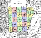
Cities, towns, and villages
NorwichNorwich (city), New York
Norwich is a city in Chenango County, New York, United States. Surrounded on all sides by the Town of Norwich, the city is the county seat of Chenango County. The name is taken from Norwich, Connecticut. Its population was 7,355 at the 2000 census.Lt...
, the county seat, is the only city in Chenango County. Other settlements in the county are designated villages or hamlets.
In New York, a "town" is a political subdivision (synonymous with township
Township
The word township is used to refer to different kinds of settlements in different countries. Township is generally associated with an urban area. However there are many exceptions to this rule. In Australia, the United States, and Canada, they may be settlements too small to be considered urban...
). The towns in northern Chenango County originated from the Twenty Townships
Twenty Townships
The Twenty Townships are an area in central New York than now is largely a part of Madison and Chenango counties. The area was also known as Clinton's Purchase....
ceded by the Oneida tribe
Oneida tribe
The Oneida are a Native American/First Nations people and are one of the five founding nations of the Iroquois Confederacy in the area of upstate New York...
to the State of New York.
In addition to the city of Norwich, the county has the following named towns and villages:
- AftonAfton (village), New YorkAfton is a village in Chenango County, New York, USA. The population was 836 at the 2000 census. The village is named after a location in Scotland.The Village of Afton is located in the Town of Afton and is northeast of Binghamton, New York....
(village)* - AftonAfton (town), New YorkAfton is a town in Chenango County, New York, United States. The population was 2,977 at the 2000 census. Afton is situated on the south-east corner of the county and lies wholly within the original township of Clinton...
(town) - BainbridgeBainbridge (town), New YorkBainbridge is a town in Chenango County, New York, United States. The population was 3,401 at the 2000 census.The Town of Bainbridge has a village of Bainbridge located within it...
(town) - BainbridgeBainbridge (village), New YorkBainbridge is a village in Chenango County, New York, USA. The population was 1,365 at the 2000 census.The Village of Bainbridge is near the center of the Town of Bainbridge and lies between Binghamton and Oneonta.- History :...
(village) - ColumbusColumbus, New YorkColumbus is a town in Chenango County, New York, United States. The population was 931 at the 2000 census. The town of Columbus is in the northeast corner of the county and is northeast of Norwich.- History :...
(town) - CoventryCoventry, New YorkCoventry is a town in Chenango County, New York, United States. The population was 1,589 at the 2000 census. The town is named after Coventry, Connecticut by settlers from New England....
(town) - EarlvilleEarlville, New YorkEarlville is a village in New York, United States. The population was 791 at the 2000 census. The village is named after Jonas Earl, a canal commissioner....
(village) - GermanGerman, New YorkGerman is a town in Chenango County, New York, United States. The population was 378 at the 2000 census. The town is named after General Obediah German, the original land owner....
(town) - GreeneGreene (town), New YorkGreene is a town in Chenango County, New York, United States. The population was 5,729 at the 2000 census. The town is named after General Nathanael Greene. It is located in the southwest corner of the county and contains a village, also called Greene...
(town) - GreeneGreene (village), New YorkGreene is a village in Chenango County, New York, USA. The population was 1,701 at the 2000 census. The village is named after General Nathanael Greene.The Village of Greene is within the Town of Greene and is northeast of Binghamton, New York....
(village) - GuilfordGuilford, New YorkGuilford is a town in Chenango County, New York, United States. The town is on the east border of the county. The population was 3,046 at the 2000 census.- History :The land was purchased from the Oneida tribe in 1785.The town was first settled around 1787...
(town) - LincklaenLincklaen, New YorkLincklaen is a town in Chenango County, New York, United States. The population was 416 at the 2000 census. The town was named after Colonel John Lincklaen, an agent of the Holland Land Company and a land owner....
(town) - McDonoughMcDonough, New YorkMcDonough is a town in Chenango County, New York, United States. The population was 870 at the 2000 census. The town is named after Thomas McDonough, a naval officer who served on Lake Champlain and other locations....
(town) - New BerlinNew Berlin (town), New YorkNew Berlin is a town in Chenango County, New York, United States. The population was 2,803 at the 2000 census.The Town of New Berlin contains a village named New Berlin...
(town) - New BerlinNew Berlin (village), New YorkNew Berlin is a village in Chenango County, New York, USA. The population was 1,129 at the 2000 census.The Village of New Berlin is by the east town line of the Town of New Berlin. The village is east of Norwich....
(village) - North NorwichNorth Norwich, New YorkNorth Norwich is a town in Chenango County, New York, United States. The population was 1,966 at the 2000 census.The Town of North Norwich, which is directly north of the City of Norwich, is in the eastern half of the county.- History :...
(town) - NorwichNorwich (town), New YorkNorwich is a town in Chenango County, New York, United States. The population was 3,836 at the 2000 census. The town was named after Norwich, Connecticut.The Town of Norwich is located near the center of the county...
(town) - OtselicOtselic, New YorkOtselic is a town in Chenango County, New York, United States. The population was 1,001 at the 2000 census. The town is named after a river flowing through it, the Otselic, which is an Oneida word for "place of wild plums."...
(town) - Oxford (town)
- OxfordOxford (village), New YorkOxford is a village in Chenango County, New York, USA. The population was 1,584 at the 2000 census. The village is named after Oxford, Massachusetts, the hometown of the landowner....
(village) - PharsaliaPharsalia, New YorkPharsalia is a town in Chenango County, New York, United States. The population was 542 at the 2000 census. Pharsalia is a name related to the location of Julius Caesar's victory over Pompey....
(town) - PitcherPitcher, New YorkPitcher is a town in Chenango County, New York, United States. The population was 848 at the 2000 census. The town is named after Nathaniel Pitcher, a Lt...
(town) - PlymouthPlymouth, New York----Plymouth is a town in Chenango County, New York, United States. The population was 2,049 at the 2000 census.The Town of Plymouth is an interior town in the northern part of the county...
(town) - PrestonPreston, New YorkPreston is a town in Chenango County, New York, United States. The population was 928 at the 2000 census.The Town of Preston is an interior town of Chenango County. The town is west of the City of Norwich.- History :...
(town) - RockdaleRockdale, New YorkRockdale is a hamlet in the town of Guilford, Chenango County, New York. It is located on the Unadilla River.It is at latitude 42.378N, longitude 75.408W....
(hamlet) - SherburneSherburne (town), New YorkSherburne is a town in Chenango County, New York, United States. United States. The population was 3,979 at the 2000 census. The town contains two villages: one also named Sherburne and the other named Earlville...
(town) - SherburneSherburne (village), New YorkSherburne is a village in Chenango County, New York, USA. The population was 1,455 at the 2000 census.The Village of Sherburne is in the Town of Sherburne, north of the City of Norwich.- History :...
(village) - SmithvilleSmithville, New YorkSmithville is a town in Chenango County, New York, United States. The population was 1,347 at the 2000 census.The Town of Smithville is at the west border of Chenango County, west of the City of Norwich.- History :...
(town) - SmyrnaSmyrna (town), New YorkSmyrna is a town in Chenango County, New York, United States. The population was 1,418 at the 2000 census. Smyrna is named after a coastal city in ancient Greece.The Town of Smyrna contains a village named Smyrna...
(town) - SmyrnaSmyrna (village), New YorkSmyrna is a village in Chenango County, New York, USA. The population was 241 at the 2000 census.The Village of Smyrna is located in the Town of Smyrna and is near the north border of Chenango County.-Geography:...
(village) - South Otselic (town)
Demographics
As of the censusCensus
A census is the procedure of systematically acquiring and recording information about the members of a given population. It is a regularly occurring and official count of a particular population. The term is used mostly in connection with national population and housing censuses; other common...
of 2000, there were 51,401 people, 19,926 households, and 13,549 families residing in the county. The population density
Population density
Population density is a measurement of population per unit area or unit volume. It is frequently applied to living organisms, and particularly to humans...
was 58 people per square mile (22/km²). There were 23,890 housing units at an average density of 27 per square mile (10/km²). The racial makeup of the county was 97.65% White
Race (United States Census)
Race and ethnicity in the United States Census, as defined by the Federal Office of Management and Budget and the United States Census Bureau, are self-identification data items in which residents choose the race or races with which they most closely identify, and indicate whether or not they are...
, 0.82% Black
Race (United States Census)
Race and ethnicity in the United States Census, as defined by the Federal Office of Management and Budget and the United States Census Bureau, are self-identification data items in which residents choose the race or races with which they most closely identify, and indicate whether or not they are...
or African American
Race (United States Census)
Race and ethnicity in the United States Census, as defined by the Federal Office of Management and Budget and the United States Census Bureau, are self-identification data items in which residents choose the race or races with which they most closely identify, and indicate whether or not they are...
, 0.27% Native American
Race (United States Census)
Race and ethnicity in the United States Census, as defined by the Federal Office of Management and Budget and the United States Census Bureau, are self-identification data items in which residents choose the race or races with which they most closely identify, and indicate whether or not they are...
, 0.28% Asian
Race (United States Census)
Race and ethnicity in the United States Census, as defined by the Federal Office of Management and Budget and the United States Census Bureau, are self-identification data items in which residents choose the race or races with which they most closely identify, and indicate whether or not they are...
, 0.02% Pacific Islander
Race (United States Census)
Race and ethnicity in the United States Census, as defined by the Federal Office of Management and Budget and the United States Census Bureau, are self-identification data items in which residents choose the race or races with which they most closely identify, and indicate whether or not they are...
, 0.22% from other races
Race (United States Census)
Race and ethnicity in the United States Census, as defined by the Federal Office of Management and Budget and the United States Census Bureau, are self-identification data items in which residents choose the race or races with which they most closely identify, and indicate whether or not they are...
, and 0.74% from two or more races. 1.07% of the population were Hispanic or Latino
Race (United States Census)
Race and ethnicity in the United States Census, as defined by the Federal Office of Management and Budget and the United States Census Bureau, are self-identification data items in which residents choose the race or races with which they most closely identify, and indicate whether or not they are...
of any race. 20.2% were of English
English people
The English are a nation and ethnic group native to England, who speak English. The English identity is of early mediaeval origin, when they were known in Old English as the Anglecynn. England is now a country of the United Kingdom, and the majority of English people in England are British Citizens...
, 14.5% German
Germans
The Germans are a Germanic ethnic group native to Central Europe. The English term Germans has referred to the German-speaking population of the Holy Roman Empire since the Late Middle Ages....
, 13.8% Irish
Irish people
The Irish people are an ethnic group who originate in Ireland, an island in northwestern Europe. Ireland has been populated for around 9,000 years , with the Irish people's earliest ancestors recorded having legends of being descended from groups such as the Nemedians, Fomorians, Fir Bolg, Tuatha...
, 12.3% American
United States
The United States of America is a federal constitutional republic comprising fifty states and a federal district...
and 8.9% Italian
Italian people
The Italian people are an ethnic group that share a common Italian culture, ancestry and speak the Italian language as a mother tongue. Within Italy, Italians are defined by citizenship, regardless of ancestry or country of residence , and are distinguished from people...
ancestry according to Census 2000 http://factfinder.census.gov/servlet/DTTable?_bm=y&-context=dt&-ds_name=DEC_2000_SF3_U&-mt_name=DEC_2000_SF3_U_PCT016&-CONTEXT=dt&-tree_id=. 96.7% spoke English
English language
English is a West Germanic language that arose in the Anglo-Saxon kingdoms of England and spread into what was to become south-east Scotland under the influence of the Anglian medieval kingdom of Northumbria...
and 1.3% Spanish
Spanish language
Spanish , also known as Castilian , is a Romance language in the Ibero-Romance group that evolved from several languages and dialects in central-northern Iberia around the 9th century and gradually spread with the expansion of the Kingdom of Castile into central and southern Iberia during the...
as their first language.
There were 19,926 households out of which 32.50% had children under the age of 18 living with them, 53.10% were married couples
Marriage
Marriage is a social union or legal contract between people that creates kinship. It is an institution in which interpersonal relationships, usually intimate and sexual, are acknowledged in a variety of ways, depending on the culture or subculture in which it is found...
living together, 9.80% had a female householder with no husband present, and 32.00% were non-families. 26.10% of all households were made up of individuals and 11.40% had someone living alone who was 65 years of age or older. The average household size was 2.52 and the average family size was 3.01.
In the county the population was spread out with 26.20% under the age of 18, 7.00% from 18 to 24, 27.50% from 25 to 44, 24.40% from 45 to 64, and 14.90% who were 65 years of age or older. The median age was 38 years. For every 100 females there were 97.00 males. For every 100 females age 18 and over, there were 94.70 males.
The median income for a household in the county was $33,679, and the median income for a family was $39,711. Males had a median income of $30,363 versus $22,429 for females. The per capita income
Per capita income
Per capita income or income per person is a measure of mean income within an economic aggregate, such as a country or city. It is calculated by taking a measure of all sources of income in the aggregate and dividing it by the total population...
for the county was $16,427. About 10.70% of families and 14.40% of the population were below the poverty line, including 19.50% of those under age 18 and 8.70% of those age 65 or over.
Education
Morrisville State College has a branch in Norwich.See also
- List of counties in New York
- National Register of Historic Places listings in Chenango County, New York
Sources
- NEW YORK: Atlas of Historical County Boundaries; Compiled by Kathryn Ford Thorne; Edited by John H. Long.