
California State Route 168
Encyclopedia
State Route 168 is a state highway
in California
, USA, which is separated into three distinct segments, in part by the Sierra Nevada mountains.
This route is part of the California Freeway and Expressway System
and is eligible for the State Scenic Highway System
.
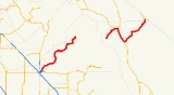
 The westernmost segment of SR 168 begins in southeast Fresno
at the interchange with State Route 180
, where it is known as the Sierra Freeway until it becomes Tollhouse Road near the northeast edge of Clovis
. Tollhouse Road is a 4-lane expressway
from the end of the freeway to Shepherd Avenue, east of which the highway is mostly an undivided 2-lane road. This segment continues east up into the Sierra Nevada, ending at Huntington Lake
along the western slope of the range
.
Before the reconstruction of urban Route 168 as a freeway, the route started at SR 41
and Shaw Avenue in Fresno. SR 168 ran along Shaw Avenue, Clovis Avenue, Third Street (Clovis), and Tollhouse Road to the current end of the freeway.
SR 168 cannot be used to cross the Sierra Nevada. The closest crossings of the Sierra Nevada are SR 120
via Tioga Pass
to the north (warmer months only) and SR 178
via Walker Pass
to the south.
The middle segment of SR 168 has its western terminus at Lake Sabrina
on the eastern slope of the Sierra Nevada. This rural
mountain road runs east to US Highway 395 in Bishop
.
The easternmost segment of SR 168 begins in Big Pine
at US 395
, and climbs into the White Mountains
through Westgard Pass
, passing the Ancient Bristlecone Pine Forest
. From here it traverses Deep Springs Valley
, home of Deep Springs College
, before crossing into Fish Lake Valley
, where the segment ends at State Route 266
, just west of the Nevada
Border.
{| class=wikitable
|-
!County
!Location
!Postmile
!Exit
!Destinations
!Notes
|-
|rowspan=15|Fresno
FRE R0.29-65.84
|rowspan=5|Fresno
|R0.29
|1
|
|Westbound exit and eastbound entrance; signed as exits 1A (west) and 1B (east)
|-
|R0.99
|1C
|McKinley Avenue
|Signed as exit 1 eastbound
|-
|R2.02
|2
|Shields Avenue
|
|-
|R3.04
|3
|Ashlan Avenue
|
|-
|R4.26
|4
|Shaw Avenue
|Former SR 168
|-
|rowspan=5|Clovis
|R5.63
|6
|Bullard Avenue
|
|-
|R6.87
|7
|Herndon Avenue
|
|-
|R8.04
|8
|Fowler Avenue
|
|-
|R9.15
|9
|Temperance Avenue
|
|-
| colspan="4" style="text-align:center;"|East end of freeway
|-
|
|
|
|Shepherd Avenue
|
|-
|
|15.47
|
|Academy Avenue – Sanger
, Kingsburg
|
|-
|
|T24.70
|
|Millerton Road – Friant
|
|-
|Prather
|T30.20
|
|Auberry Road – Millerton Lake
|
|-
|Huntington Lake
|65.84
|
|Kaiser Pass Road – Mono Hot Springs
, Edison Lake, Florence Lake
|
|-
| colspan="6" style="text-align:center;"|Gap in SR 168
|-
|rowspan=4|Inyo
INY R0.00-54.70
|
|R0.00
|
|Lake Sabrina
|
|-
|Bishop
| style="background:#dfd;"|18.31
115.40Indicates that the postmile represents the distance along US 395
rather than SR 168.
| style="background:#dfd;"|
| style="background:#dfd;"|, Reno
| style="background:#dfd;"|West end of US 395 overlap; former US 6
north; East Line Street serves Eastern Sierra Regional Airport
|-
|Big Pine
| style="background:#dfd;"|100.83
18.32
| style="background:#dfd;"|
| style="background:#dfd;"|
| style="background:#dfd;"|East end of US 395 overlap; former US 6
south
|-
|
|20.81
|
|Death Valley Road – Saline Valley
, Eureka Valley, Scotty's Castle
|
|-
|Mono
MNO 0.00-1.45
|Oasis
|1.45
|
| – Fish Lake Valley
|SR 266 north was former SR 168 east
State highway
State highway, state road or state route can refer to one of three related concepts, two of them related to a state or provincial government in a country that is divided into states or provinces :#A...
in California
California
California is a state located on the West Coast of the United States. It is by far the most populous U.S. state, and the third-largest by land area...
, USA, which is separated into three distinct segments, in part by the Sierra Nevada mountains.
This route is part of the California Freeway and Expressway System
California Freeway and Expressway System
The California Freeway and Expressway System is a system of existing or planned freeways and expressways in the U.S. state of California. It is defined by the Streets and Highways Code.-List of roads in the system:*State Route 1 *State Route 2...
and is eligible for the State Scenic Highway System
State Scenic Highway System (California)
The State Scenic Highway System is a list of highways, mainly state highways, that have been designated by the California Department of Transportation as scenic highways. The California State Legislature, primarily through Section 263 of the Streets and Highways Code, makes highways eligible for...
.
Route description
Fresno, California
Fresno is a city in central California, United States, the county seat of Fresno County. As of the 2010 census, the city's population was 510,365, making it the fifth largest city in California, the largest inland city in California, and the 34th largest in the nation...
at the interchange with State Route 180
California State Route 180
State Route 180 is a state highway in California, United States, which runs through the heart of the San Joaquin Valley from Mendota through Fresno to Kings Canyon National Park, with an unbuilt segment defined west to Paicines....
, where it is known as the Sierra Freeway until it becomes Tollhouse Road near the northeast edge of Clovis
Clovis, California
Clovis is a city in Fresno County, California, United States, northeast of Fresno. The population is estimated to be 97,218 as of September, 2011. Clovis is located northeast of downtown Fresno, at an elevation of 361 feet .-History:...
. Tollhouse Road is a 4-lane expressway
Limited-access road
A limited-access road known by various terms worldwide, including limited-access highway, dual-carriageway and expressway, is a highway or arterial road for high-speed traffic which has many or most characteristics of a controlled-access highway , including limited or no access to adjacent...
from the end of the freeway to Shepherd Avenue, east of which the highway is mostly an undivided 2-lane road. This segment continues east up into the Sierra Nevada, ending at Huntington Lake
Huntington Lake
Huntington Lake is a reservoir in Fresno County, California on Big Creek, located in the Sierra Nevada at an elevation of 2,130 meters . Several smaller streams also flow into the lake and it receives additional water from the underground tunnels of Southern California Edison's Big Creek...
along the western slope of the range
Mountain range
A mountain range is a single, large mass consisting of a succession of mountains or narrowly spaced mountain ridges, with or without peaks, closely related in position, direction, formation, and age; a component part of a mountain system or of a mountain chain...
.
Before the reconstruction of urban Route 168 as a freeway, the route started at SR 41
California State Route 41
State Route 41 is a state highway in the U.S. state of California, connecting the Cabrillo Highway in Morro Bay with Fresno and Yosemite National Park via the San Joaquin Valley. Except between US 101 in Atascadero and SR 46 near Shandon, SR 41 is part of the California Freeway and Expressway...
and Shaw Avenue in Fresno. SR 168 ran along Shaw Avenue, Clovis Avenue, Third Street (Clovis), and Tollhouse Road to the current end of the freeway.
SR 168 cannot be used to cross the Sierra Nevada. The closest crossings of the Sierra Nevada are SR 120
California State Route 120
State Route 120 , in northern California, runs between the Central Valley near Manteca, through Yosemite National Park, and ends at U.S. Route 6 in Mono County.-Route description:...
via Tioga Pass
Tioga Pass
Tioga Pass is a mountain pass in the Sierra Nevada mountains of California. State Route 120 runs through it, and serves as the eastern entry point for Yosemite National Park. It is the highest highway pass in California and in the Sierra Nevada. Mount Dana is to the east of the pass...
to the north (warmer months only) and SR 178
California State Route 178
State Route 178 is a route that exists in two constructed segments. The gap in between segments is connected by various local roads and State Route 190 through Death Valley National Park....
via Walker Pass
Walker Pass
Walker Pass is a mountain pass by Lake Isabella in the southern Sierra Nevada mountains. It is located in northeastern Kern County, approximately 53 mi ENE of Bakersfield and 10 mi WNW of Ridgecrest...
to the south.
The middle segment of SR 168 has its western terminus at Lake Sabrina
Lake Sabrina
Lake Sabrina is a lake created by damming the middle fork of Bishop Creek. It is located south-west of Bishop, California on California State Route 168, in the Inyo National Forest. It has cafe as well as a dock. The dam was built in 1907 to supply a constant flow of water to the hydraulic power...
on the eastern slope of the Sierra Nevada. This rural
Rural
Rural areas or the country or countryside are areas that are not urbanized, though when large areas are described, country towns and smaller cities will be included. They have a low population density, and typically much of the land is devoted to agriculture...
mountain road runs east to US Highway 395 in Bishop
Bishop, California
Bishop is a city in Inyo County, California, United States. Though Bishop is the only city and the largest populated place in Inyo County, the county seat is Independence. Bishop is located near the northern end of the Owens Valley, at an elevation of 4147 feet . The population was 3,879 at the...
.
The easternmost segment of SR 168 begins in Big Pine
Big Pine, California
Big Pine is a census-designated place in Inyo County, California, United States. Big Pine is located south-southeast of Bishop, at an elevation of 3990 feet . The population was 1,756 at the 2010 census, up from 1,350 at the 2000 census...
at US 395
U.S. Route 395 in California
In the U.S. state of California, U.S. Route 395 is a route which traverses from Interstate 15 near the southern city limits of Hesperia, north to the Oregon state line in Modoc County near Goose Lake...
, and climbs into the White Mountains
White Mountains (California)
The White Mountains of California are a triangular fault block mountain range facing the Sierra Nevada across the upper Owens Valley. They extend for approximately as a greatly elevated plateau about wide on the south, narrowing to a point at the north, with elevations generally increasing...
through Westgard Pass
Westgard Pass
Westgard Pass is a narrow gap between the White and Inyo mountain ranges in the Basin and Range Province of California. Westgard Pass lies entirely within the Inyo National Forest, in northern Inyo County, California....
, passing the Ancient Bristlecone Pine Forest
Ancient Bristlecone Pine Forest
The Ancient Bristlecone Pine Forest is high in the White Mountains in Inyo County in eastern California. The Great Basin Bristlecone Pine trees grow between 9,800 and 11,000 feet above sea level, in xeric alpine conditions, protected within the Inyo National Forest...
. From here it traverses Deep Springs Valley
Deep Springs Valley
Deep Springs Valley is a high desert valley in the Inyo-White Mountains of Inyo County, California. It is east of the Owens Valley and the Sierra Nevada mountain range, and south of Fish Lake Valley, Nevada, near the California-Nevada state border....
, home of Deep Springs College
Deep Springs College
Deep Springs is a private, all-male , alternative college in Deep Springs, California, in the United States. A two-year college, the institution currently aims for a student body size of 26, though the number is occasionally lower...
, before crossing into Fish Lake Valley
Fish Lake Valley
The Fish Lake Valley is a 25 mi long endorheic valley in southwest Nevada that is one of the Central Nevada Desert Basins. The alluvial valley lies just northwest of Death Valley and borders the southeast, and central-northeast flank of the massif of the White Mountains of California...
, where the segment ends at State Route 266
California State Route 266
State Route 266 is a state highway in the U.S. state of California. The route is a connector between Nevada State Route 264 and Nevada State Route 266, and it can serve as transportation of agricultural goods between California and Nevada via the route's only junction State Route 168...
, just west of the Nevada
Nevada
Nevada is a state in the western, mountain west, and southwestern regions of the United States. With an area of and a population of about 2.7 million, it is the 7th-largest and 35th-most populous state. Over two-thirds of Nevada's people live in the Las Vegas metropolitan area, which contains its...
Border.
Major intersections
- Note: Except where prefixed with a letter, postmiles were measured in 1964, based on the alignment as it existed at that time, and do not necessarily reflect current mileage. The numbers reset at county lines; the start and end postmiles in each county are given in the county column.
{| class=wikitable
|-
!County
!Location
!Postmile
!Exit
Exit number
An exit number is a number assigned to a road junction, usually an exit from a freeway. It is usually marked on the same sign as the destinations of the exit, as well as a sign in the gore....
!Destinations
!Notes
|-
|rowspan=15|Fresno
Fresno County, California
Fresno County is a county located in the Central Valley of the U.S. state of California, south of Stockton and north of Bakersfield. As of the 2010 census, it is the tenth most populous county in California with a population of 930,450, and the sixth largest in size with an area of . The county...
FRE R0.29-65.84
|rowspan=5|Fresno
Fresno, California
Fresno is a city in central California, United States, the county seat of Fresno County. As of the 2010 census, the city's population was 510,365, making it the fifth largest city in California, the largest inland city in California, and the 34th largest in the nation...
|R0.29
|1
|
|Westbound exit and eastbound entrance; signed as exits 1A (west) and 1B (east)
|-
|R0.99
|1C
|McKinley Avenue
|Signed as exit 1 eastbound
|-
|R2.02
|2
|Shields Avenue
|
|-
|R3.04
|3
|Ashlan Avenue
|
|-
|R4.26
|4
|Shaw Avenue
|Former SR 168
|-
|rowspan=5|Clovis
Clovis, California
Clovis is a city in Fresno County, California, United States, northeast of Fresno. The population is estimated to be 97,218 as of September, 2011. Clovis is located northeast of downtown Fresno, at an elevation of 361 feet .-History:...
|R5.63
|6
|Bullard Avenue
|
|-
|R6.87
|7
|Herndon Avenue
|
|-
|R8.04
|8
|Fowler Avenue
|
|-
|R9.15
|9
|Temperance Avenue
|
|-
| colspan="4" style="text-align:center;"|East end of freeway
|-
|
|
|
|Shepherd Avenue
|
|-
|
|15.47
|
|Academy Avenue – Sanger
Sanger, California
Sanger is a city in Fresno County, California, United States. The population was 24,270 at the 2010 census, up from 18,731 at the 2000 census. Sanger is located east-southeast of Fresno, at an elevation of 371 feet .- Geography :...
, Kingsburg
Kingsburg, California
Kingsburg is a city in Fresno County, California. Kingsburg is located southeast of Selma at an elevation of 302 feet , on the banks of the Kings River. The city is half an hour away from Fresno, and two hours away from the California Central Coast and Sierra Nevada Mountain Range...
|
|-
|
|T24.70
|
|Millerton Road – Friant
Friant, California
Friant is a census-designated place in Fresno County, California, United States. The population was 549 at the 2010 census, down from 778 at the 2000 census. Friant is located north of Clovis, at an elevation of 344 feet .-Geography:Friant is located at...
|
|-
|Prather
Prather, California
Prather is an unincorporated community in Fresno County, California. It is located northeast of Fresno, at an elevation of 1657 feet ....
|T30.20
|
|Auberry Road – Millerton Lake
Millerton Lake
Millerton Lake is an artificial lake near the town of Friant about north of downtown Fresno. The reservoir was created by the construction of Friant Dam on the San Joaquin River which with the lake serves as much of the county line between Fresno County to the south and Madera County to the...
|
|-
|Huntington Lake
Huntington Lake, California
Huntington Lake is an unincorporated community in Fresno County, California. It is located on the west end of Huntington Lake north of Big Creek, at an elevation of 7027 feet ....
|65.84
|
|Kaiser Pass Road – Mono Hot Springs
Mono Hot Springs, California
Mono Hot Springs is an unincorporated community in Fresno County, California. It lies at an elevation of 6562 feet . There are six separate hot springs here, the hottest is ....
, Edison Lake, Florence Lake
|
|-
| colspan="6" style="text-align:center;"|Gap in SR 168
|-
|rowspan=4|Inyo
Inyo County, California
-National protected areas:* Death Valley National Park * Inyo National Forest * Manzanar National Historic Site-Major highways:* U.S. Route 6* U.S. Route 395* State Route 127* State Route 136* State Route 168* State Route 178...
INY R0.00-54.70
|
|R0.00
|
|Lake Sabrina
Lake Sabrina
Lake Sabrina is a lake created by damming the middle fork of Bishop Creek. It is located south-west of Bishop, California on California State Route 168, in the Inyo National Forest. It has cafe as well as a dock. The dam was built in 1907 to supply a constant flow of water to the hydraulic power...
|
|-
|Bishop
Bishop, California
Bishop is a city in Inyo County, California, United States. Though Bishop is the only city and the largest populated place in Inyo County, the county seat is Independence. Bishop is located near the northern end of the Owens Valley, at an elevation of 4147 feet . The population was 3,879 at the...
| style="background:#dfd;"|18.31
115.40Indicates that the postmile represents the distance along US 395
U.S. Route 395 in California
In the U.S. state of California, U.S. Route 395 is a route which traverses from Interstate 15 near the southern city limits of Hesperia, north to the Oregon state line in Modoc County near Goose Lake...
rather than SR 168.
| style="background:#dfd;"|
| style="background:#dfd;"|, Reno
Reno, Nevada
Reno is the county seat of Washoe County, Nevada, United States. The city has a population of about 220,500 and is the most populous Nevada city outside of the Las Vegas metropolitan area...
| style="background:#dfd;"|West end of US 395 overlap; former US 6
U.S. Route 6 in California
U.S. Route 6, or US 6, is a transcontinental highway from the U.S. state of California to Massachusetts. In California, the highway lies in the eastern portion of the state from Bishop in the Owens Valley north to the Nevada state line in Esmeralda County...
north; East Line Street serves Eastern Sierra Regional Airport
Eastern Sierra Regional Airport
Eastern Sierra Regional Airport is a public-use airport located two nautical miles east of the central business district of Bishop, in Inyo County, California, United States...
|-
|Big Pine
Big Pine, California
Big Pine is a census-designated place in Inyo County, California, United States. Big Pine is located south-southeast of Bishop, at an elevation of 3990 feet . The population was 1,756 at the 2010 census, up from 1,350 at the 2000 census...
| style="background:#dfd;"|100.83
18.32
| style="background:#dfd;"|
| style="background:#dfd;"|
| style="background:#dfd;"|East end of US 395 overlap; former US 6
U.S. Route 6 in California
U.S. Route 6, or US 6, is a transcontinental highway from the U.S. state of California to Massachusetts. In California, the highway lies in the eastern portion of the state from Bishop in the Owens Valley north to the Nevada state line in Esmeralda County...
south
|-
|
|20.81
|
|Death Valley Road – Saline Valley
Saline Valley, California
Saline Valley is a large, deep, and arid valley in the northern Mojave Desert of California. Most of it became a part of Death Valley National Park when the park expanded in 1994. This area had previously been administered by the BLM. It is located northwest of Death Valley proper, south of...
, Eureka Valley, Scotty's Castle
Scotty's Castle
Scotty's Castle is a two-story Mission Revival and Spanish Colonial Revival style villa located in the Grapevine Mountains of northern Death Valley in Death Valley National Park, California, U.S.. It is also known as Death Valley Ranch...
|
|-
|Mono
Mono County, California
Mono County is a county located in the east central portion of the U.S. state of California, to the east of the Sierra Nevada between Yosemite National Park and Nevada. As of the 2010 census, the population was 14,202, up from 12,853 at the 2000 census...
MNO 0.00-1.45
|Oasis
Oasis, Mono County, California
Oasis is an unincorporated community in Mono County, California. It is located in Fish Lake Valley east-southeast of Mount Bancroft. Oasis is at the junction of California State Route 266 and California State Route 168. The 2000 Census reports that Oasis had a population of 22.A post office...
|1.45
|
| – Fish Lake Valley
Fish Lake Valley, Nevada
Fish Lake Valley is a ghost town located in Esmeralda County, Nevada and Inyo County, California.It is just east of the White Mountains , the highest range entirely within the Great Basin at...
|SR 266 north was former SR 168 east