

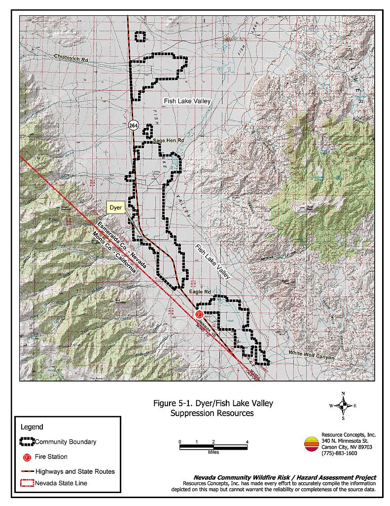
Fish Lake Valley
Encyclopedia
The Fish Lake Valley is a 25 mi (40 km) long endorheic
valley
in southwest Nevada
that is one of the Central Nevada Desert Basins. The alluvial valley lies just northwest of Death Valley
and borders the southeast, and central-northeast flank of the massif
of the White Mountains
of California
. The very south of the valley lies in eastern Inyo County, California
.
mixed salt pan for 10 mi of the valley. A small dry lake
is in the very center, at about 1.5 mi in length, and is fed directly from the White Mountains, and the small subvalley southeastwards. Alluvial fan
s are directly west of the dry lake, with Nevada State Route 264
in the hills to the northwest that also feed southeast and eastwards; to the east and southeast, the Silver Peak Range
borders the valley with no alluvial fans, and is the smaller massif probably block faulted from the White Mountains, and thru block faulting creating the smaller feeder valley on the White Mountains' southeast, (the Furnace Creek Fault Zone
).
The center-north of the valley has very narrow fans, and broken salt flats, that end at the valley's central dry lake. Lower elevation hills and peaks at the north of the Silver Peak Range are the east and northeast border. Coaldale, Nevada
on east-west U.S. Route 6 in Nevada
is here at the northern border of the Fish Lake Valley.
enters the valley's center west at the foothills of the White Mountains and at Dyer
turns southeast at the feeder valley and foothills of the mountains; its terminus point is Oasis, Mono County, California
. Nevada State Route 773
intercepts Route 264 in the hills on the Fish Lake Valley northwest border. U.S. Route 6
at Coaldale, Nevada is in the hills adjacent the valley's north border.
----
Fish Lake Valley, Historical Marker 133
----
Map
Endorheic
An endorheic basin is a closed drainage basin that retains water and allows no outflow to other bodies of water such as rivers or oceans...
valley
Valley
In geology, a valley or dale is a depression with predominant extent in one direction. A very deep river valley may be called a canyon or gorge.The terms U-shaped and V-shaped are descriptive terms of geography to characterize the form of valleys...
in southwest Nevada
Nevada
Nevada is a state in the western, mountain west, and southwestern regions of the United States. With an area of and a population of about 2.7 million, it is the 7th-largest and 35th-most populous state. Over two-thirds of Nevada's people live in the Las Vegas metropolitan area, which contains its...
that is one of the Central Nevada Desert Basins. The alluvial valley lies just northwest of Death Valley
Death Valley
Death Valley is a desert valley located in Eastern California. Situated within the Mojave Desert, it features the lowest, driest, and hottest locations in North America. Badwater, a basin located in Death Valley, is the specific location of the lowest elevation in North America at 282 feet below...
and borders the southeast, and central-northeast flank of the massif
Massif
In geology, a massif is a section of a planet's crust that is demarcated by faults or flexures. In the movement of the crust, a massif tends to retain its internal structure while being displaced as a whole...
of the White Mountains
White Mountains (California)
The White Mountains of California are a triangular fault block mountain range facing the Sierra Nevada across the upper Owens Valley. They extend for approximately as a greatly elevated plateau about wide on the south, narrowing to a point at the north, with elevations generally increasing...
of California
California
California is a state located on the West Coast of the United States. It is by far the most populous U.S. state, and the third-largest by land area...
. The very south of the valley lies in eastern Inyo County, California
Inyo County, California
-National protected areas:* Death Valley National Park * Inyo National Forest * Manzanar National Historic Site-Major highways:* U.S. Route 6* U.S. Route 395* State Route 127* State Route 136* State Route 168* State Route 178...
.
Description
Fish Lake Valley is a slightly southwest-northeast trending valley, in its northern and central section. It borders the White Mountains on the southwest, but the extension of the mountains southeasterly provides a feeder valley with some small dry lakes and salt pans. The major section of the valley contains a boraxBorax
Borax, also known as sodium borate, sodium tetraborate, or disodium tetraborate, is an important boron compound, a mineral, and a salt of boric acid. It is usually a white powder consisting of soft colorless crystals that dissolve easily in water.Borax has a wide variety of uses...
mixed salt pan for 10 mi of the valley. A small dry lake
Dry lake
Dry lakes are ephemeral lakebeds, or a remnant of an endorheic lake. Such flats consist of fine-grained sediments infused with alkali salts. Dry lakes are also referred to as alkali flats, sabkhas, playas or mud flats...
is in the very center, at about 1.5 mi in length, and is fed directly from the White Mountains, and the small subvalley southeastwards. Alluvial fan
Alluvial fan
An alluvial fan is a fan-shaped deposit formed where a fast flowing stream flattens, slows, and spreads typically at the exit of a canyon onto a flatter plain. A convergence of neighboring alluvial fans into a single apron of deposits against a slope is called a bajada, or compound alluvial...
s are directly west of the dry lake, with Nevada State Route 264
Nevada State Route 264
State Route 264 is a state highway in Esmeralda County, Nevada, USA. It connects California State Route 266 to U.S. Route 6 via the town of Dyer, Nevada. The majority of the route is known as Fish Lake Valley Road, with the northern portion referred to as the Dicalite Cutoff...
in the hills to the northwest that also feed southeast and eastwards; to the east and southeast, the Silver Peak Range
Silver Peak Range
The Silver Peak Range is a mountain range in southwest Esmeralda County, Nevada.-Geography:The Range forms the east and southeast side of Fish Lake Valley. The towering White Mountains lie across the valley to the west and southwest. The Palmetto Mountains are to the south.Piper Peak, Red Mountain,...
borders the valley with no alluvial fans, and is the smaller massif probably block faulted from the White Mountains, and thru block faulting creating the smaller feeder valley on the White Mountains' southeast, (the Furnace Creek Fault Zone
Furnace Creek Fault Zone
The Furnace Creek Fault Zone is a right lateral-moving fault which extends for some in eastern California. It runs from a connection with the Death Valley Fault Zone in the Amargosa Valley northward to a termination in the Fish Lake Valley. The northern segment of the FCFZ is also referred to...
).
The center-north of the valley has very narrow fans, and broken salt flats, that end at the valley's central dry lake. Lower elevation hills and peaks at the north of the Silver Peak Range are the east and northeast border. Coaldale, Nevada
Coaldale, Nevada
Coaldale is a ghost town in Esmeralda County, Nevada. There is reportedly also a community with the same name in Nye County, Nevada. Coaldale had a store, cafe, motel, and service station as late as 1993, but is now abandoned.- External links :*...
on east-west U.S. Route 6 in Nevada
U.S. Route 6 in Nevada
In the U.S. state of Nevada, U.S. Route 6 cuts across the middle portion of the state, serving the cities of Tonopah and Ely, en route to Utah and points further east....
is here at the northern border of the Fish Lake Valley.
Route access
Nevada State Route 264Nevada State Route 264
State Route 264 is a state highway in Esmeralda County, Nevada, USA. It connects California State Route 266 to U.S. Route 6 via the town of Dyer, Nevada. The majority of the route is known as Fish Lake Valley Road, with the northern portion referred to as the Dicalite Cutoff...
enters the valley's center west at the foothills of the White Mountains and at Dyer
Dyer, Nevada
Dyer is a small village in Esmeralda County, Nevada with a population of 110 as of the 2000 census. Dyer is located on State Route 264, near Nevada's border with California in the Fish Lake Valley. Air transportation is available at Dyer Airport....
turns southeast at the feeder valley and foothills of the mountains; its terminus point is Oasis, Mono County, California
Oasis, Mono County, California
Oasis is an unincorporated community in Mono County, California. It is located in Fish Lake Valley east-southeast of Mount Bancroft. Oasis is at the junction of California State Route 266 and California State Route 168. The 2000 Census reports that Oasis had a population of 22.A post office...
. Nevada State Route 773
Nevada State Route 773
State Route 773 is a state highway in Esmeralda County, Nevada, USA. Known as Fish Lake Valley Road, the highway was a part of former State Route 3A.-Route description:...
intercepts Route 264 in the hills on the Fish Lake Valley northwest border. U.S. Route 6
U.S. Route 6 in Nevada
In the U.S. state of Nevada, U.S. Route 6 cuts across the middle portion of the state, serving the cities of Tonopah and Ely, en route to Utah and points further east....
at Coaldale, Nevada is in the hills adjacent the valley's north border.
External links
Fish Lake & Fish Lake Marsh- Fish Lake Marsh, Esmeralda County
- Cave Springs Borax Prospect at Fish Lake Marsh
- Fish Lake, at goingoutside.com
----
Fish Lake Valley, Historical Marker 133
----
Map