

Boston Harbor Islands National Recreation Area
Encyclopedia
The Boston Harbor Islands National Recreation Area is a National Recreation Area
situated among the islands of Boston Harbor
of Boston, Massachusetts
. The area is made up of a collection of island
s, together with a former island and a peninsula
, many of which are open for public recreation and some of which are very small and best suited for wildlife. The area is run by the Boston Harbor Islands Partnership. It includes the Boston Harbor Islands State Park, managed by the Commonwealth of Massachusetts. Twenty-one of the 34 islands in the area are also included in the Boston Harbor Islands Archeological District.
Attractions include hiking
trails, beaches, the Civil War
-era Fort Warren
on Georges Island and Boston Light
on Little Brewster Island
, the oldest lighthouse
in the United States. Georges Island and Spectacle Island are served seasonally by ferries to and from Boston and Quincy
, connecting on weekends and summer weekdays with a shuttle boat to several other islands, Hull
, and Hingham
.
In 1996, there was a project proposal by Boston's mayor Tom Menino
and Massachusetts Institute of Technology
professor Clifford A. Goudey to revitalize the aquaculture
and fish population in Boston Harbor. This would have involved using the old tanks and granite canals on Moon Island.
In 2008, Peddocks Island
was used for filming scenes in Martin Scorsese
's Shutter Island, starring Leonardo DiCaprio
.
 The Boston Harbor Islands National Recreation Area is made up of a series of discrete islands and other places on and around Boston Harbor. These include:
Two islands (Castle Island and Spinnaker Island
) in Boston Harbor are not part of the National Recreation Area, and other former islands (e.g. Apple Island
, Governors Island
and Noddle's Island
) were obliterated by the formation of East Boston and the expansion of Logan International Airport
before the area was designated.
In addition, the Partnership includes representation from the Boston Harbor Islands Advisory Council, whose purpose is to make recommendations to the Partnership about park management. There are 13 Partners in total, together with 13 Alternates. Apart from the representative for the Coast Guard, who is appointed by the Secretary of Homeland Security
, all the members of the partnership are appointed by the Secretary of the Interior
after consultation with the appropriate agency or other body.
In practice, day to day management of each individual island or other site is the responsibility of one of the partner agencies or other bodies. The partnership provides a consistency and coordination across the whole park.
state park
comprising 13 islands located in Boston Harbor
, which now forms part of the Boston Harbor Islands National Recreation Area.
The park was developed from the 1970s by the Massachusetts Department of Environmental Management (DEM). In 1996, the Boston Harbor Islands National Recreation Area was created, including the State Park's islands and many others. However, due to the unusual partnership management arrangements of the National Recreation Area, the State Park still exists as a low profile administrative entity. It is now managed by the DEM's successor, the Massachusetts Department of Conservation and Recreation
, from a park headquarters near to the ferry terminal in Hingham
.
The islands of the Boston Harbor Islands State Park are:
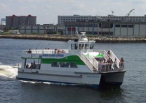 Harbor Islands Express offers ferry service from Long Wharf at Christopher Columbus Park to Georges and Spectacle Islands. Free service is available between Georges and Spectacle via Lovells Island. Summer service is also available from Hingham Shipyard and Hull
to Georges Island via Grape, Bumpkin, and Lovells Islands. (These services are separate from MBTA Boat
harbor ferries.)
Thompson Island is only open to the public on Sundays during the summer. It is served by a ferry leaving from both Spectacle Island and the EDIC dock on Terminal Street in South Boston, operated by the Thompson Island Outward Bound Education Center.
Private boats can dock (with various restrictions) at Spectacle, Grape, Bumpkin, Lovells, and Peddocks Islands. The public dock on Georges Island was recently condemned by engineers, although access is still available by making anchor off shore and using a dinghy to row ashore.
Deer Island, Nut Island, Worlds End, and Webb Memorial are accessible by road from the mainland. Moon Island and Long Island are not open to the public; though they are accessible by road from Quincy, access is controlled by a police guard station at the beginning of the causeway on the Squantum peninsula.
National Recreation Area
National Recreation Area is a designation for a protected area in the United States, often centered on large reservoirs and emphasizing water-based recreation for a large number of people. The first National Recreation Area was the Boulder Dam Recreation Area...
situated among the islands of Boston Harbor
Boston Harbor
Boston Harbor is a natural harbor and estuary of Massachusetts Bay, and is located adjacent to the city of Boston, Massachusetts. It is home to the Port of Boston, a major shipping facility in the northeast.-History:...
of Boston, Massachusetts
Massachusetts
The Commonwealth of Massachusetts is a state in the New England region of the northeastern United States of America. It is bordered by Rhode Island and Connecticut to the south, New York to the west, and Vermont and New Hampshire to the north; at its east lies the Atlantic Ocean. As of the 2010...
. The area is made up of a collection of island
Island
An island or isle is any piece of sub-continental land that is surrounded by water. Very small islands such as emergent land features on atolls can be called islets, cays or keys. An island in a river or lake may be called an eyot , or holm...
s, together with a former island and a peninsula
Peninsula
A peninsula is a piece of land that is bordered by water on three sides but connected to mainland. In many Germanic and Celtic languages and also in Baltic, Slavic and Hungarian, peninsulas are called "half-islands"....
, many of which are open for public recreation and some of which are very small and best suited for wildlife. The area is run by the Boston Harbor Islands Partnership. It includes the Boston Harbor Islands State Park, managed by the Commonwealth of Massachusetts. Twenty-one of the 34 islands in the area are also included in the Boston Harbor Islands Archeological District.
Attractions include hiking
Hiking
Hiking is an outdoor activity which consists of walking in natural environments, often in mountainous or other scenic terrain. People often hike on hiking trails. It is such a popular activity that there are numerous hiking organizations worldwide. The health benefits of different types of hiking...
trails, beaches, the Civil War
American Civil War
The American Civil War was a civil war fought in the United States of America. In response to the election of Abraham Lincoln as President of the United States, 11 southern slave states declared their secession from the United States and formed the Confederate States of America ; the other 25...
-era Fort Warren
Fort Warren (Massachusetts)
Fort Warren is a historic fort on the Georges Island at the entrance to Boston Harbor. The fort is pentagonal, made with stone and granite, and was constructed from 1833–1861, completed shortly after the beginning of the American Civil War...
on Georges Island and Boston Light
Boston Light
Boston Light is a lighthouse located on Little Brewster Island in outer Boston Harbor, Massachusetts. The first lighthouse to be built on the site dates back to 1716, and was the first lighthouse to be built in what is now the United States...
on Little Brewster Island
Little Brewster Island
Little Brewster Island is a rocky outer island in the Boston Harbor Islands National Recreation Area. It is best known as the location of Boston Light, the only remaining Coast Guard-manned lighthouse in the United States, and an important navigation aid for traffic to and from the Port of Boston...
, the oldest lighthouse
Lighthouse
A lighthouse is a tower, building, or other type of structure designed to emit light from a system of lamps and lenses or, in older times, from a fire, and used as an aid to navigation for maritime pilots at sea or on inland waterways....
in the United States. Georges Island and Spectacle Island are served seasonally by ferries to and from Boston and Quincy
Quincy, Massachusetts
Quincy is a city in Norfolk County, Massachusetts, United States. Its nicknames are "City of Presidents", "City of Legends", and "Birthplace of the American Dream". As a major part of Metropolitan Boston, Quincy is a member of Boston's Inner Core Committee for the Metropolitan Area Planning Council...
, connecting on weekends and summer weekdays with a shuttle boat to several other islands, Hull
Hull, Massachusetts
Hull is a peninsula town in Plymouth County, Massachusetts, United States. The population was 10,293 at the 2010 census. Hull is the smallest town by land area in Plymouth County and the fourth smallest in the state...
, and Hingham
Hingham, Massachusetts
Hingham is a town in northern Plymouth County on the South Shore of the U.S. state of Massachusetts and suburb in Greater Boston. The United States Census Bureau 2008 estimated population was 22,561...
.
In 1996, there was a project proposal by Boston's mayor Tom Menino
Thomas Menino
Thomas Michael "Tom" Menino is the mayor of Boston, Massachusetts, United States and the city's first Italian-American mayor...
and Massachusetts Institute of Technology
Massachusetts Institute of Technology
The Massachusetts Institute of Technology is a private research university located in Cambridge, Massachusetts. MIT has five schools and one college, containing a total of 32 academic departments, with a strong emphasis on scientific and technological education and research.Founded in 1861 in...
professor Clifford A. Goudey to revitalize the aquaculture
Aquaculture
Aquaculture, also known as aquafarming, is the farming of aquatic organisms such as fish, crustaceans, molluscs and aquatic plants. Aquaculture involves cultivating freshwater and saltwater populations under controlled conditions, and can be contrasted with commercial fishing, which is the...
and fish population in Boston Harbor. This would have involved using the old tanks and granite canals on Moon Island.
In 2008, Peddocks Island
Peddocks Island
Peddocks Island is one of the largest islands in Boston Harbor. Since 1996 it has formed part of the Boston Harbor Islands National Recreation Area. The island is located at 42° 17' 32.6" North longitude and 70° 56' 21.6" West latitude. The area of the island is . The island is managed by the...
was used for filming scenes in Martin Scorsese
Martin Scorsese
Martin Charles Scorsese is an American film director, screenwriter, producer, actor, and film historian. In 1990 he founded The Film Foundation, a nonprofit organization dedicated to film preservation, and in 2007 he founded the World Cinema Foundation...
's Shutter Island, starring Leonardo DiCaprio
Leonardo DiCaprio
Leonardo Wilhelm DiCaprio is an American actor and film producer. He has received many awards, including a Golden Globe Award for Best Actor for his performance in The Aviator , and has been nominated by the Academy Awards, Screen Actors Guild and the British Academy of Film and Television...
.
List of islands and peninsulas
- Bumpkin IslandBumpkin IslandBumpkin Island, also known as Round Island, Bomkin Island, Bumkin Island or Ward's Island, is an island in the Hingham Bay area of the Boston Harbor. Since 1996 it is part of the Boston Harbor Islands National Recreation Area. The island has an area of , plus an intertidal zone of a further...
(Hingham) - Button IslandButton Island (Massachusetts)Button Island is a small island in the Hingham Bay area of the Boston Harbor Islands National Recreation Area. The island has a permanent size of under , plus an intertidal zone of a further . It is composed of a massing of glacial till which rises to a height of above sea level...
(Hingham) - Calf IslandCalf Island (Massachusetts)Calf Island, also known as Apthorps Island, is a windswept island situated some offshore of downtown Boston in the Boston Harbor Islands National Recreation Area. The island has a permanent size of , plus an intertidal zone of a further , and has a thin layer of soil that supports vegetation...
(Boston) - Deer IslandDeer Island (Massachusetts)Deer Island is a peninsula in Boston Harbor, Massachusetts. Since 1996 it is part of the Boston Harbor Islands National Recreation Area. Although still an island by name, Deer Island has been connected to the mainland since the former Shirley Gut channel, which once separated the island from the...
(Winthrop) - Gallops IslandGallops IslandGallops Island, also known as Gallups Island, is an island in the Boston Harbor Islands National Recreation Area, situated between Georges Island and Long Island and just over from downtown Boston. The island has a permanent size of , plus an intertidal zone of a further , and is composed of one...
(Boston) - Georges Island (Boston)
- Grape IslandGrape Island (Massachusetts)Grape Island is an island in the Hingham Bay area of the Boston Harbor Islands National Recreation Area. The island is part of the territory of the town of Weymouth, Massachusetts. The island has a permanent size of , plus an intertidal zone of a further , and is composed of two drumlins, reaching...
(Weymouth) - Great Brewster IslandGreat Brewster IslandGreat Brewster Island is a one of the outer islands in the Boston Harbor Islands National Recreation Area, situated some offshore of downtown Boston. The island has a permanent size of , plus an intertidal zone of a further...
(Boston) - Green IslandGreen Island (Massachusetts)Green Island, also known as North Brewster Island, is a rocky outer island in the Boston Harbor Islands National Recreation Area, to the north of Calf Island and Hypocrite Channel. The island has a permanent size of , plus an intertidal zone of a further , and is exposed from the east and northeast...
(Boston) - Hangman IslandHangman IslandHangman Island, also known as Hayman's Island, is an island in the Quincy Bay area of the Boston Harbor Islands National Recreation Area. The island is a barren outcrop of bedrock, with a permanent size of half an acre rising to only three feet above sea level, plus an intertidal zone of a further...
(Quincy) - Langlee IslandLanglee IslandLanglee Island or Langley Island is an island in the Hingham Bay area of the Boston Harbor Islands National Recreation Area. The island has a permanent size of , plus an intertidal zone of a further , and is composed of a massing of roxbury puddingstone which rises to a height of above sea level...
(Hingham) - Little Brewster IslandLittle Brewster IslandLittle Brewster Island is a rocky outer island in the Boston Harbor Islands National Recreation Area. It is best known as the location of Boston Light, the only remaining Coast Guard-manned lighthouse in the United States, and an important navigation aid for traffic to and from the Port of Boston...
(Boston) - Little Calf IslandLittle Calf IslandLittle Calf Island is a small rocky island in the Boston Harbor Islands National Recreation Area, some 9 miles offshore from downtown Boston, Massachusetts. The island has no vegetation and no history of human occupation. It is used for nesting by gulls and cormorants which can be aggressive during...
(Boston) - Long IslandLong Island (Massachusetts)This article is about the island Long Island, Boston. For other islands called Long Island, see Long Island .Long Island is situated in the middle of Boston Harbor, Massachusetts. The island is part of the City of Boston, and of the Boston Harbor Islands National Recreation Area...
(Boston) - Lovells IslandLovells IslandLovells Island, or Lovell's Island, is a island in the Boston Harbor Islands National Recreation Area, in Massachusetts. The island is across The Narrows from Georges Island and some offshore of downtown Boston. It is named after Captain William Lovell, who was an early settler of nearby Dorchester...
(Boston) - Middle Brewster IslandMiddle Brewster IslandMiddle Brewster Island is a rugged outer island in the Boston Harbor Islands National Recreation Area, located offshore from downtown Boston. The island has a permanent size of , reaches a height of above sea level, and is bounded by sharp cliffs and sunken crags. It has only sparse vegetation...
(Boston) - Moon Island (Quincy)
- Nixes MateNixes MateNixes Mate, also known as Nixes Island, Nix's Mate and Nick's Mate, is one of the smaller islands in the Boston Harbor Islands National Recreation Area. The island lies about 5 nm from downtown Boston and about 0.6 nm east of Long Island Head Light. The island covers and uncovers with the...
(Boston) - Nut IslandNut IslandNut Island is a former island in Boston Harbor, part of the Boston Harbor Islands National Recreation Area. The island has been connected through a short causeway to the end of Houghs Neck, becoming part of the mainland of Quincy, Massachusetts....
(Quincy) - Outer Brewster IslandOuter Brewster IslandOuter Brewster Island, also known as Outward Island, is a one of the outer islands in the Boston Harbor Islands National Recreation Area and is situated some 10 miles offshore of downtown Boston. The island has a permanent size of 20 acres, and consists of exposed bedrock covered by fertile soil...
(Boston) - Peddocks IslandPeddocks IslandPeddocks Island is one of the largest islands in Boston Harbor. Since 1996 it has formed part of the Boston Harbor Islands National Recreation Area. The island is located at 42° 17' 32.6" North longitude and 70° 56' 21.6" West latitude. The area of the island is . The island is managed by the...
(Hull) - Raccoon Island (Quincy)
- Ragged IslandRagged Island (Massachusetts)Ragged Island is an island in the Hingham Bay area of the Boston Harbor Islands National Recreation Area, in the U.S. state of Massachusetts. The island has a permanent size of , and it is composed of a massing of roxbury puddingstone which rises to a height of above sea level...
(Hingham) - Rainsford IslandRainsford IslandRainsford Island, formerly known Hospital Island, Pest House Island, and Quarantine Island, is a island in the Boston Harbor, situated between Long Island and Peddocks Island. The island is composed of two drumlins, reaching an elevation of above sea level. The shoreline is predominantly rocky...
(Boston) - Sarah IslandSarah Island (Massachusetts)Sarah Island is an island in the Hingham Bay area of the Boston Harbor Islands National Recreation Area. The island has a permanent size of just under , and is composed large outcroppings and ledges of roxbury puddingstone together with glacial till which rises to a height of above sea level...
(Hingham) - Shag RocksShag Rocks (Massachusetts)Shag Rocks are barren rocks situated 8 nautical miles offshore of Custom House Tower in downtown Boston, in the Boston Harbor Islands National Recreation Area and within the city limits of Boston. The rocks are northeast of Little Brewster Island and east of Great Brewster Island and have been the...
(Boston) - Sheep Island (Weymouth)
- Slate Island (Weymouth)
- Snake IslandSnake Island (Massachusetts)Snake Island, also known as Bare Island, is an island in Boston Harbor. The island is part of the Boston Harbor Islands National Recreation Area and is situated in the inner harbor between the town of Winthrop and the reclaimed land that forms Logan International Airport...
(Winthrop) - Spectacle Island (Boston)
- The Graves (Boston)
- Thompson IslandThompson Island (Massachusetts)Thompson Island is an island in the Boston Harbor, some 4 miles offshore from downtown Boston, Massachusetts. The island is managed by the Thompson Island Outward Bound Education Center, a non-profit education organization. The island is open to visitors on summer Sundays; otherwise access is by...
(Boston) - Webb Memorial ParkWebb Memorial State ParkWebb Memorial State Park is a Massachusetts state park located on a peninsula that extends nearly half a mile into the Hingham Bay area of Boston Harbor. It is composed of three connected drumlins and a low marsh area...
(Weymouth) - World's End (Hingham)
Two islands (Castle Island and Spinnaker Island
Spinnaker Island (Massachusetts)
Spinnaker Island is an island in the Hingham Bay area of Boston Harbor in Massachusetts...
) in Boston Harbor are not part of the National Recreation Area, and other former islands (e.g. Apple Island
Apple Island (Massachusetts)
Apple Island was an island in Boston Harbor in Massachusetts. The island has been subsumed into land reclamation for the construction and extension of Boston's Logan International Airport....
, Governors Island
Governors Island (Massachusetts)
Governors Island was an island in Boston Harbor in the U.S. state of Massachusetts. The island was subsumed by land reclamation for the construction and extension of Logan International Airport....
and Noddle's Island
Noddle's Island
Noddle's Island is one of Boston Harbor Islands off East Boston, Massachusetts. In the 1940s the strait separating Noddle's Island from East Boston was filled, thereby connecting the island to Logan International Airport on the mainland.-History:...
) were obliterated by the formation of East Boston and the expansion of Logan International Airport
Logan International Airport
General Edward Lawrence Logan International Airport is located in the East Boston neighborhood of Boston, Massachusetts . It covers , has six runways, and employs an estimated 16,000 people. It is the 19th busiest airport in the United States.Boston serves as a focus city for JetBlue Airways...
before the area was designated.
Management
The Boston Harbor Islands National Recreation Area is managed by the Boston Harbor Islands Partnership, a statutory body established as a federal operating committee by the park enabling legislation. The partnership consists of individual members who represent a range of federal, state, city, and nonprofit agencies, including:- United States National Park ServiceNational Park ServiceThe National Park Service is the U.S. federal agency that manages all national parks, many national monuments, and other conservation and historical properties with various title designations...
- United States Coast GuardUnited States Coast GuardThe United States Coast Guard is a branch of the United States Armed Forces and one of the seven U.S. uniformed services. The Coast Guard is a maritime, military, multi-mission service unique among the military branches for having a maritime law enforcement mission and a federal regulatory agency...
- Massachusetts Department of Conservation and RecreationDepartment of Conservation and Recreation (Massachusetts)The Department of Conservation and Recreation is a state agency of the Commonwealth of Massachusetts, situated in the Executive Office of Energy and Environmental Affairs. It is best known for its parks and parkways. As of May 24, 2011 the Commissioner of the DCR is Edward M. Lambert, Jr...
- Massachusetts Port AuthorityMassachusetts Port AuthorityMassachusetts Port Authority, or Massport, is a port district in the Commonwealth of Massachusetts. It operates seaports and airports in eastern and central Massachusetts, mainly the Port of Boston. Its headquarters is located in the Logan Office Center, adjacent to Logan Airport in East Boston,...
- Massachusetts Water Resources AuthorityMassachusetts Water Resources AuthorityThe Massachusetts Water Resources Authority is a public authority in the Commonwealth of Massachusetts that provides wholesale drinking water and sewage services to certain municipalities and industrial users in the state, primarily in the Boston area.The authority receives water from the Quabbin...
- City of Boston
- Boston Redevelopment AuthorityBoston Redevelopment AuthorityThe Boston Redevelopment Authority is the municipal planning and development agency for Boston, working on both housing and commercial developments.The BRA was established by the Boston city council and the Massachusetts legislature in 1957...
- Boston Harbor Island AllianceBoston Harbor Island AllianceThe Boston Harbor Island Alliance is a 5013 non-profit organization based in Boston, Massachusetts, As one of the many advocacy groups involved with the Boston Harbor Islands, the Island Alliance "promotes the use, enjoyment and awareness of the Boston Harbor Islands national park area".The Island...
- Thompson Island Outward Bound Education Center
- The Trustees of Reservations
In addition, the Partnership includes representation from the Boston Harbor Islands Advisory Council, whose purpose is to make recommendations to the Partnership about park management. There are 13 Partners in total, together with 13 Alternates. Apart from the representative for the Coast Guard, who is appointed by the Secretary of Homeland Security
United States Secretary of Homeland Security
The United States Secretary of Homeland Security is the head of the United States Department of Homeland Security, the body concerned with protecting the American homeland and the safety of American citizens. The Secretary is a member of the President's Cabinet. The position was created by the...
, all the members of the partnership are appointed by the Secretary of the Interior
United States Secretary of the Interior
The United States Secretary of the Interior is the head of the United States Department of the Interior.The US Department of the Interior should not be confused with the concept of Ministries of the Interior as used in other countries...
after consultation with the appropriate agency or other body.
In practice, day to day management of each individual island or other site is the responsibility of one of the partner agencies or other bodies. The partnership provides a consistency and coordination across the whole park.
Boston Harbor Islands State Park
Boston Harbor Islands State Park is a MassachusettsMassachusetts
The Commonwealth of Massachusetts is a state in the New England region of the northeastern United States of America. It is bordered by Rhode Island and Connecticut to the south, New York to the west, and Vermont and New Hampshire to the north; at its east lies the Atlantic Ocean. As of the 2010...
state park
State park
State parks are parks or other protected areas managed at the federated state level within those nations which use "state" as a political subdivision. State parks are typically established by a state to preserve a location on account of its natural beauty, historic interest, or recreational...
comprising 13 islands located in Boston Harbor
Boston Harbor
Boston Harbor is a natural harbor and estuary of Massachusetts Bay, and is located adjacent to the city of Boston, Massachusetts. It is home to the Port of Boston, a major shipping facility in the northeast.-History:...
, which now forms part of the Boston Harbor Islands National Recreation Area.
The park was developed from the 1970s by the Massachusetts Department of Environmental Management (DEM). In 1996, the Boston Harbor Islands National Recreation Area was created, including the State Park's islands and many others. However, due to the unusual partnership management arrangements of the National Recreation Area, the State Park still exists as a low profile administrative entity. It is now managed by the DEM's successor, the Massachusetts Department of Conservation and Recreation
Department of Conservation and Recreation (Massachusetts)
The Department of Conservation and Recreation is a state agency of the Commonwealth of Massachusetts, situated in the Executive Office of Energy and Environmental Affairs. It is best known for its parks and parkways. As of May 24, 2011 the Commissioner of the DCR is Edward M. Lambert, Jr...
, from a park headquarters near to the ferry terminal in Hingham
Hingham, Massachusetts
Hingham is a town in northern Plymouth County on the South Shore of the U.S. state of Massachusetts and suburb in Greater Boston. The United States Census Bureau 2008 estimated population was 22,561...
.
The islands of the Boston Harbor Islands State Park are:
- Bumpkin IslandBumpkin IslandBumpkin Island, also known as Round Island, Bomkin Island, Bumkin Island or Ward's Island, is an island in the Hingham Bay area of the Boston Harbor. Since 1996 it is part of the Boston Harbor Islands National Recreation Area. The island has an area of , plus an intertidal zone of a further...
- Calf IslandCalf Island (Massachusetts)Calf Island, also known as Apthorps Island, is a windswept island situated some offshore of downtown Boston in the Boston Harbor Islands National Recreation Area. The island has a permanent size of , plus an intertidal zone of a further , and has a thin layer of soil that supports vegetation...
- Gallops IslandGallops IslandGallops Island, also known as Gallups Island, is an island in the Boston Harbor Islands National Recreation Area, situated between Georges Island and Long Island and just over from downtown Boston. The island has a permanent size of , plus an intertidal zone of a further , and is composed of one...
- Grape IslandGrape Island (Massachusetts)Grape Island is an island in the Hingham Bay area of the Boston Harbor Islands National Recreation Area. The island is part of the territory of the town of Weymouth, Massachusetts. The island has a permanent size of , plus an intertidal zone of a further , and is composed of two drumlins, reaching...
- Great Brewster IslandGreat Brewster IslandGreat Brewster Island is a one of the outer islands in the Boston Harbor Islands National Recreation Area, situated some offshore of downtown Boston. The island has a permanent size of , plus an intertidal zone of a further...
- Green IslandGreen Island (Massachusetts)Green Island, also known as North Brewster Island, is a rocky outer island in the Boston Harbor Islands National Recreation Area, to the north of Calf Island and Hypocrite Channel. The island has a permanent size of , plus an intertidal zone of a further , and is exposed from the east and northeast...
- Hangman IslandHangman IslandHangman Island, also known as Hayman's Island, is an island in the Quincy Bay area of the Boston Harbor Islands National Recreation Area. The island is a barren outcrop of bedrock, with a permanent size of half an acre rising to only three feet above sea level, plus an intertidal zone of a further...
- Little Calf IslandLittle Calf IslandLittle Calf Island is a small rocky island in the Boston Harbor Islands National Recreation Area, some 9 miles offshore from downtown Boston, Massachusetts. The island has no vegetation and no history of human occupation. It is used for nesting by gulls and cormorants which can be aggressive during...
- Middle Brewster IslandMiddle Brewster IslandMiddle Brewster Island is a rugged outer island in the Boston Harbor Islands National Recreation Area, located offshore from downtown Boston. The island has a permanent size of , reaches a height of above sea level, and is bounded by sharp cliffs and sunken crags. It has only sparse vegetation...
- Outer Brewster IslandOuter Brewster IslandOuter Brewster Island, also known as Outward Island, is a one of the outer islands in the Boston Harbor Islands National Recreation Area and is situated some 10 miles offshore of downtown Boston. The island has a permanent size of 20 acres, and consists of exposed bedrock covered by fertile soil...
- Raccoon Island
- Sheep Island
- Slate Island
Transportation
Hull, Massachusetts
Hull is a peninsula town in Plymouth County, Massachusetts, United States. The population was 10,293 at the 2010 census. Hull is the smallest town by land area in Plymouth County and the fourth smallest in the state...
to Georges Island via Grape, Bumpkin, and Lovells Islands. (These services are separate from MBTA Boat
MBTA boat
The MBTA Boat system is a public boat service providing water transport in the Greater Boston area via Boston Harbor. Both inner harbor and longer distance commuter ferries are operated...
harbor ferries.)
Thompson Island is only open to the public on Sundays during the summer. It is served by a ferry leaving from both Spectacle Island and the EDIC dock on Terminal Street in South Boston, operated by the Thompson Island Outward Bound Education Center.
Private boats can dock (with various restrictions) at Spectacle, Grape, Bumpkin, Lovells, and Peddocks Islands. The public dock on Georges Island was recently condemned by engineers, although access is still available by making anchor off shore and using a dinghy to row ashore.
Deer Island, Nut Island, Worlds End, and Webb Memorial are accessible by road from the mainland. Moon Island and Long Island are not open to the public; though they are accessible by road from Quincy, access is controlled by a police guard station at the beginning of the causeway on the Squantum peninsula.
Further reading
- MetroMetro InternationalMetro International is a Swedish media company based in Luxembourg that publishes the Metro newspapers. Metro International's advertising sales have grown at a compound annual growth rate of 41% since launch of the first newspaper edition in 1995. It is a freesheet, meaning that distribution is...
(Boston edition) newspaper, "Boston Harbor Islands", Boston Neighborhood section, August 1, 2007, p. 14. - "Harbor islands are jewels, but lack resources and accessibility", Boston Globe, OP/ED, Sunday, April 4, 2010
External links
- Boston Harbor Islands National Recreation Area
- Boston Harbor Islands Visitor Guide
- Boston Harbor resources site
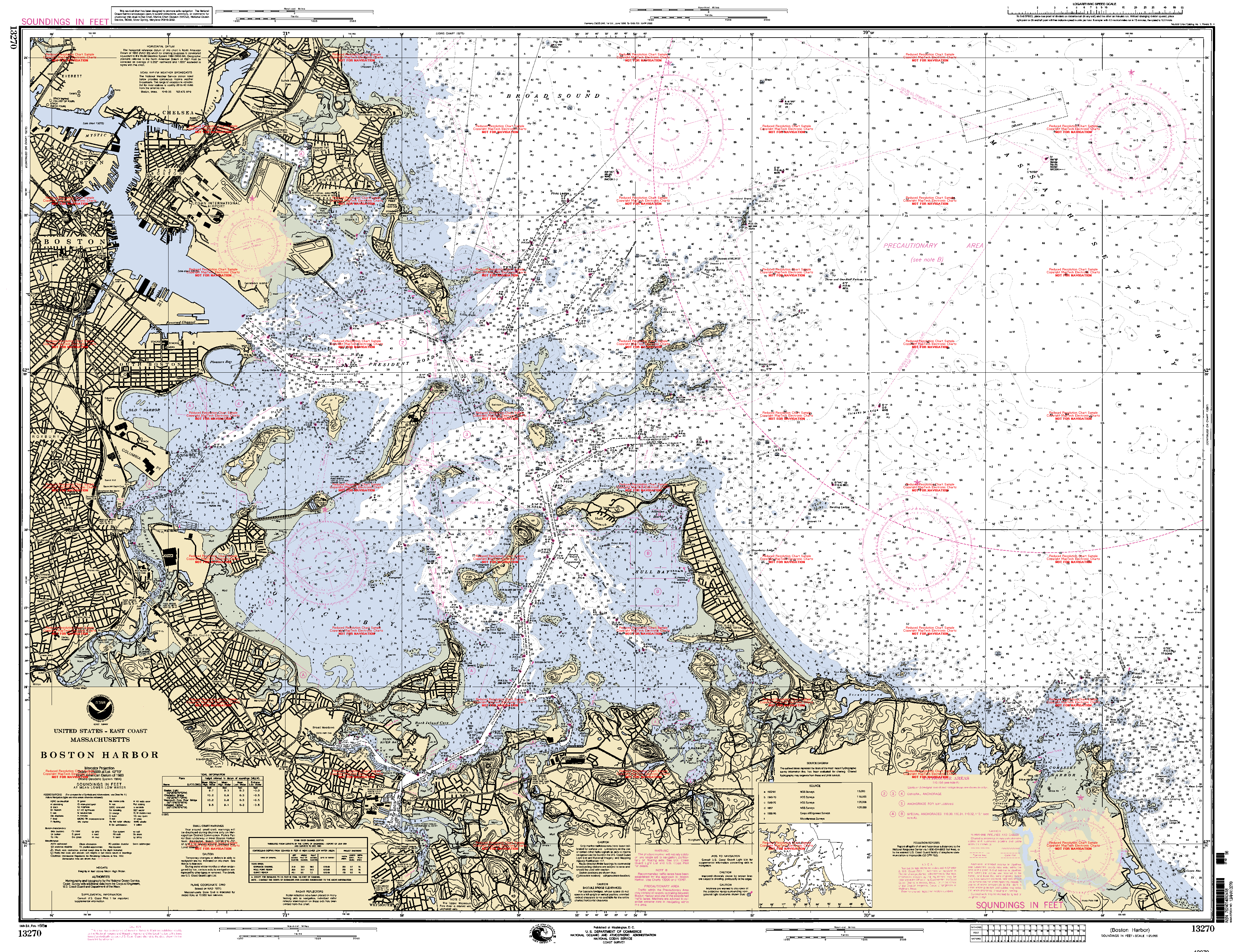
- NOAA Soundings Map of Boston Harbor
- Island Alliance (Boston Harbor)
- Boston Harbor Islands - Massachusetts Department of Conservation & Recreation (DCR)Department of Conservation and Recreation (Massachusetts)The Department of Conservation and Recreation is a state agency of the Commonwealth of Massachusetts, situated in the Executive Office of Energy and Environmental Affairs. It is best known for its parks and parkways. As of May 24, 2011 the Commissioner of the DCR is Edward M. Lambert, Jr...
. - The Boston Harbor Association resources