
.gif)
Department of Conservation and Recreation (Massachusetts)
Encyclopedia
The Department of Conservation and Recreation (DCR) is a state agency of the Commonwealth of Massachusetts, situated in the Executive Office of Energy and Environmental Affairs
. It is best known for its park
s and parkway
s. As of May 24, 2011 the Commissioner of the DCR is Edward M. Lambert, Jr.
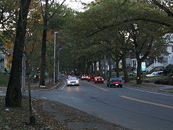
The DCR's mission is "To protect, promote and enhance our common wealth of natural, cultural and recreational resources." The agency is the largest landowner in Massachusetts.
, the MDC and DEM were merged to form the DCR.
Ownership and management for non-pedestrian bridges was transferred to the Massachusetts Department of Transportation in 2009.
.
.
The Bureau operates under the direction of a Chief Engineer and is sub-divided into six operating units:
The Bureau is responsible for the management of the majority of the DCR's annual capital budget which has declined in recent years from a $150–200 Million high to a current $70-80 Million.
A partial listing of notable bridges formerly under the DCR, with the exception of pedestrian bridges still managed by the department and listed here, include:
after the MDC's police department was merged into the State Police in 1992.
Executive Office of Energy and Environmental Affairs (Massachusetts)
The Massachusetts Executive Office of Energy and Environmental Affairsconsists of the Department of Agricultural Resources, the Department of Conservation and Recreation, the Department of Environmental Protection, the Department of Energy Resources, the Department of Fish and Game, the ...
. It is best known for its park
Park
A park is a protected area, in its natural or semi-natural state, or planted, and set aside for human recreation and enjoyment, or for the protection of wildlife or natural habitats. It may consist of rocks, soil, water, flora and fauna and grass areas. Many parks are legally protected by...
s and parkway
Parkway
The term parkway has several distinct principal meanings and numerous synonyms around the world, for either a type of landscaped area or a type of road.Type of landscaped area:...
s. As of May 24, 2011 the Commissioner of the DCR is Edward M. Lambert, Jr.
Edward M. Lambert, Jr.
Edward M. Lambert, Jr. is an American politician and civil servant who is the current Commissioner of the Massachusetts Department of Conservation and Recreation...
The DCR's mission is "To protect, promote and enhance our common wealth of natural, cultural and recreational resources." The agency is the largest landowner in Massachusetts.
History
DCR lands and roads formerly belonged to the Metropolitan District Commission (MDC) and the Department of Environmental Management (DEM). Under Governor Mitt RomneyMitt Romney
Willard Mitt Romney is an American businessman and politician. He was the 70th Governor of Massachusetts from 2003 to 2007 and is a candidate for the 2012 Republican Party presidential nomination.The son of George W...
, the MDC and DEM were merged to form the DCR.
Ownership and management for non-pedestrian bridges was transferred to the Massachusetts Department of Transportation in 2009.
Structure
The DCR is under the general management of the Commissioner of the DCR. The general administration divisions; Human Resources Division, the Financial Division, and External and Legislative Affairs, report directly to the Commissioner. Additionally, five operating units, under the general direction of a Deputy Commissioner of Operations, carry out the day to work and project execution of the agency. The five operating units are:- Bureau of State Parks and Recreation
- Bureau of Urban Parks and Recreation
- Bureau of Water Supply Protection
- Bureau of Engineering
- Bureau of Planning
Bureau of State Parks and Recreation
The Bureau of State Parks and Recreation is responsible for the maintenance and management of over 450000 acres (1,821.1 km²) of privately and state-owned forests and parks, nearly 10% of the Commonwealth's total land mass. Within the lands managed by the Bureau of State Parks and Recreation are some 29 campgrounds, over 2000 miles (3,218.7 km) of trails, 87 beaches, 37 swimming, wading, and spray pools, 62 playgrounds, 55 ballfields, 145 miles (233 km) of paved bike and rail trails and once private homes and estates that are now a part of the DCR's Historic Curatorship ProgramHistoric Curatorship Program
The Massachusetts Historic Curatorship Program is a leasing program within the state of Massachusetts that promotes private investment in historic, public properties that are currently empty and in various states of disrepair....
.
Bureau of Urban Parks and Recreation
The Bureau of Urban Parks and Recreation is responsible for the maintenance and management of a variety of environments within the Greater Boston area, including urban wilds, historic sites, and other naturally aesthetic or significant environmental properties. The origins of the collective environments in the bureau date back to the creation of the Metropolitan Park Commission in 1893, forming the first such regional system in the United States. The jurisdiction of the bureau is referred to by the DCR as the Metropolitan Park System of Greater BostonMetropolitan Park System of Greater Boston
The Metropolitan Park System of Greater Boston is a system of reservations, parks, parkways and roads under the control of the Massachusetts Department of Conservation and Recreation in and around Boston that has been in existence for over a century...
.
Bureau of Water Supply Protection
The Bureau of Water Supply Protection is responsible for the protection and management of drinking supply watersheds for the Greater Boston area. This bureau monitors lakes and ponds, well drillers, and rainfall throughout the Commonwealth.Bureau of Engineering
The Bureau of Engineering provides professional engineering, design, and construction management services in support of DCR properties. In addition to providing engineering services for over 450000 acres (1,821.1 km²) of parks, forests, watersheds, beaches, 340 dams, and numerous recreational facilities, the Bureau of Engineering also manages over 525 lane miles of parkways and nearly 300 bridges and tunnels notable for their landmark stature and importance in the Commonwealth’s transportation system.The Bureau operates under the direction of a Chief Engineer and is sub-divided into six operating units:
- Bridge and Parkway Engineering
- Facilities Engineering
- Dams and Waterways Engineering
- Stormwater and Environmental Engineering
- Construction Permitting
- Construction Services
The Bureau is responsible for the management of the majority of the DCR's annual capital budget which has declined in recent years from a $150–200 Million high to a current $70-80 Million.
List of parkways
The Bureau of Engineering manages and/or operates a number of parkways across the Commonwealth, including:- Alewife Brook ParkwayAlewife Brook ParkwayAlewife Brook Parkway is a short parkway in Cambridge and Somerville, Massachusetts. It is listed on the National Register of Historic Places. It begins at Fresh Pond in Cambridge , and heads north on the east bank of Alewife Brook, crossing into West Somerville and ending at the Mystic River on...
- Arborway
- Birmingham Parkway
- Blue Hills ParkwayBlue Hills ParkwayBlue Hills Parkway is a historic road that runs in a straight line from a crossing of the Neponset River, at the south border of Boston to the north edge of the Blue Hills Reservation in Milton, Massachusetts. It was designed by the noted landscape architect, Charles Eliot, who is perhaps best...
- Blue Hills Reservation ParkwaysBlue Hills Reservation ParkwaysThe Blue Hills Reservation Parkways is a group of historic parkways in the Blue Hills Reservation. The system was founded in 1894 and designed by Charles Eliot...
- Boylston Street (Back Bay sections)
- Breakheart ReservationBreakheart ReservationBreakheart Reservation is a Massachusetts state park located in Saugus and Wakefield. The park is managed by the Department of Conservation and Recreation.-Description:...
Parkways - Cambridge Parkway
- Carey Circle
- Charles River Reservation ParkwaysCharles River Reservation ParkwaysThe Charles River Reservation Parkways are parkways that run along either side of the Charles River in eastern Massachusetts. The roads are contained within the Charles River Reservation and the Upper Charles River Reservation, and fall within a number of communities in the greater Boston...
- Charles Street (Charles Cir. to Leverett Cir.)
- Chestnut Hill Drive
- William J. Day Boulevard
- Fellsway Connector Parkways
- Fellsmere Park Parkways
- Fenway
- Fresh Pond ParkwayFresh Pond ParkwayFresh Pond Parkway is an historic park and parkway, found in the westernmost neighborhoods of Cambridge, Massachusetts. The site was built in 1899 and added to the National Register of Historic Places in 2005....
- Furnace Brook ParkwayFurnace Brook ParkwayFurnace Brook Parkway is a historic parkway in Quincy, Massachusetts. Part of the Metropolitan Park System of Greater Boston, it serves as a connector between the Blue Hills Reservation and Quincy Shore Reservation at Quincy Bay...
- Hammond Pond ParkwayHammond Pond ParkwayHammond Pond Parkway is a historic parkway in Brookline and Newton, Massachusetts. It was built in 1928 and added to the National Register of Historic Places in 2004. The parkway is a northern continuation of West Roxbury Parkway at the Horace James Circle to the Hammond Pond Reservation.-References:...
- Hull Shore Drive
- Jamaicaway
- Land Boulevard
- Lynn Fells ParkwayLynn Fells ParkwayLynn Fells Parkway is a DCR parkway running from the end of Fellsway East in Stoneham, Massachusetts, USA through Melrose and ending in Saugus at US Route 1...
- Lynnway
- Lynn Shore Drive
- Memorial DriveMemorial Drive (Cambridge)Memorial Drive runs along the north bank of the Charles River in Cambridge, Massachusetts. It is designated as U.S. Route 3 or Massachusetts Route 3 for its entire length, and Massachusetts Route 2 over the portion west of the Boston University Bridge....
- Middlesex Fells ReservationMiddlesex Fells ReservationMiddlesex Fells Reservation, often referred to simply as the Fells, is a Massachusetts state park located in Malden, Medford, Melrose, Stoneham, and Winchester...
Parkways - Morrissey BoulevardMorrissey BoulevardMorrissey Boulevard is a six-lane divided coastal road in the Dorchester neighborhood of Boston, Massachusetts. It is owned and maintained by the Massachusetts Department of Conservation and Recreation .- Route description :...
- Mount GreylockMount GreylockMount Greylock is the highest natural point in Massachusetts at . Its peak is located in the northwest corner of the state in the western part of the town of Adams in Berkshire County. Although geologically part of the Taconic Mountains, Mount Greylock is commonly associated with the abutting...
Summit Road - Mount WachusettMount WachusettMount Wachusett is located in the towns of Princeton and Westminster in Worcester County, Massachusetts. It is the highest point in Massachusetts east of the Connecticut River. The mountain is named after a Native American term meaning "near the mountain" or "mountain place". The mountain is a...
Summit Road - Mystic Valley ParkwayMystic Valley ParkwayMystic Valley Parkway is a short parkway in Arlington, Medford, Somerville, and Winchester, Massachusetts. It is listed on the National Register of Historic Places, and forms part of Route 16....
- Nahant Beach Boulevard
- Nantasket Avenue
- Neponset Valley ParkwayNeponset Valley ParkwayNeponset Valley Parkway is a historic parkway in Boston and Milton, Massachusetts, United States. The parkway was constructed from 1898 to 1929 by Charles Eliot and the Olmstead Brothers and added to the National Register of Historic Places in 2005. The parkway serves as a connector between the...
- North Beacon Street (Brighton & Watertown sections)
- Norumbega Road (Weston)
- Old Harbor Reservation Parkways
- Old Colony Parkway
- Park Drive
- Parkman Drive
- Quincy Shore DriveQuincy Shore DriveQuincy Shore Drive is a historic road in Quincy, Massachusetts.It was built in 1903 and added to the National Register of Historic Places in 2003.-References:...
- Recreation Road (Weston)
- Revere Beach Boulevard
- Revere Beach ParkwayRevere Beach ParkwayRevere Beach Parkway is a historic parkway in the northern suburbs of Boston, Massachusetts. It begins at the Fellsway in Medford, where the road leading to the west is the Mystic Valley Parkway, proceeds east, ending at the junction of Revere Beach Boulevard and Winthrop Parkway in Revere. In...
- Riverway
- Stony Brook Reservation ParkwaysStony Brook Reservation ParkwaysThe Stony Brook Reservation Parkways are a group of historic parkways in Boston and Dedham, Massachusetts. The roads consist of the Dedham, Enneking, and Turtle Pond Parkways and West Boundary Road. Two roads within the park, Smithfield Road and Reservation Road are listed as non-contributing...
- Storrow DriveStorrow DriveStorrow Drive is a major cross town expressway in Boston, Massachusetts, running south and west from Leverett Circle along the Charles River. It is a parkway—it is restricted to cars; trucks and buses are not permitted on it...
- Truman ParkwayTruman ParkwayTruman Parkway is a historic parkway in Milton and Boston, Massachusetts. The parkway was built in 1931 and added to the National Register of Historic Places in 2005. It runs along the southern boundary of the Neponset River Reservation and serves as a connection between the Neponset Valley Parkway...
- VFW ParkwayVFW ParkwayVFW Parkway is a historic parkway in Boston, Massachusetts. The parkway begins at Spring Street in West Roxbury at the Charles River and ends at Centre Street at the Arnold Arboretum. The parkway was built in 1931 and added to the National Register of Historic Places in 2005...
- West Roxbury ParkwayWest Roxbury ParkwayWest Roxbury Parkway is a historic parkway running from Washington Street in Boston, Massachusetts, where it continues south as Enneking Parkway, to Horace James Circle in Brookline, where it continues north as Hammond Pond Parkway. The parkway serves as a connector between Stony Brook Reservation...
- Winthrop ParkwayWinthrop ParkwayWinthrop Parkway is a historic parkway in Revere, Massachusetts. The parkway was built in 1909 and added to the National Register of Historic Places in 2004. The parkway is a connector between Winthrop Shore Drive in the south and Revere Beach Parkway and Revere Beach Boulevard in the north. It is...
- Winthrop Shore DriveWinthrop Shore DriveWinthrop Shore Drive is a historic parkway in Winthrop, Massachusetts. The parkway was built in 1899 by Charles Eliot and added to the National Register of Historic Places in 2004. Winthrop Beach is located along this parkway.-References:...
List of bridges
The Bureau of Engineering managed and/or operated a number of bridges across the Commonwealth prior to November 2009. All non-pedestrian bridges were transferred to the Massachusetts Department of Transportation on November 1, 2009 as part of a transportation reform law. Originally, a certain number of bridges listed in the act creating MassDOT were were to be transferred after December 31, 2014 when ongoing construction was completed. However, a Memornadum of Agreement between DCR and MassDOT instead transferred these bridges in 2009 along with all other DCR vehicular bridges.A partial listing of notable bridges formerly under the DCR, with the exception of pedestrian bridges still managed by the department and listed here, include:
- Alewife Brook Parkway Bridge over MBTA
- Anderson Memorial BridgeAnderson Memorial BridgeAnderson Memorial Bridge connects Allston, a neighborhood of Boston, and Cambridge. The bridge stands on the site of the Great Bridge built in 1662, the first structure to span the Charles River...
(aka Larz Anderson Bridge) - Boston University BridgeBoston University BridgeThe Boston University Bridge , and commonly referred to as the BU Bridge, is a steel truss bridge with a suspended deck carrying Route 2 over the Charles River, connecting Boston to Cambridge, Massachusetts. According to the American Association of State Highway and Transportation Officials route...
- Beades Bridge
- Bowker OverpassBowker OverpassThe Bowker Overpass is a steel beam bridge with a suspended deck carrying Charlesgate Street over Commonwealth Avenue, Beacon Street, and Interstate 90. It connects Boylston Street to Storrow Drive. It runs parallel to the Muddy River...
- Bridge 23 Revere Beach Parkway over B & M, Corporation Way
- BU. Pedestrian Bridge
- Casassa Overpass
- Casey Overpass
- Charles Circle 57B
- Cradock Bridge
- Craigie Dam Bridge
- Craigie Drawbridge
- Eliot BridgeEliot BridgeThe Eliot Bridge is a bridge over the Charles River between Cambridge, Massachusetts and Allston, Boston, Massachusetts. It connects Soldiers Field Road in Allston with Gerry's Landing Road, Memorial Drive, Greenough Boulevard, and the Fresh Pond Parkway in Cambridge.The bridge was built in 1950...
- General Edwards Bridge
- General Edwards Electrical Upgrade
- Gilman Street Bridge
- Gilmore Bridge
- Hammond Pond Parkway Bridge/MBTA
- Harvard BridgeHarvard BridgeThe Harvard Bridge carries Massachusetts Avenue from Back Bay, Boston to Cambridge, Massachusetts. It is the longest bridge over the Charles River....
- Lech Walesa Bridge
- Leo Martin Golf Course Pedestrian Bridge
- Leverett Circle Tunnel
- Longfellow BridgeLongfellow BridgeThe Longfellow Bridge, also known to locals as the "Salt-and-Pepper Bridge" or the "Salt-and-Pepper-Shaker Bridge" due to the shape of its central towers, carries Route 3 and the Massachusetts Bay Transportation Authority's Red Line across the Charles River to connect Boston's Beacon Hill...
- McCarthy Overpass
- Mystic Valley Parkway over Alewife Brook
- Neponset River Bridge
- Pleasure Bay Pedestrian Bridges
- Revere Beach Pkwy/State Road
- River Street at Mother Brook
- River Street BridgeRiver Street BridgeThe River Street Bridge is a bridge connecting River Street in Cambridge, MA to Cambridge Street in Allston, Boston, MA. It was built in 1925 by the Commonwealth of Massachusetts Metropolitan District Commission....
- Riverside Park Pedestrian Bridge
- Storrow Drive Tunnel
- Watertown Pedestrian Bridge
- West Roxbury Parkway at Conrail
- Winthrop Avenue Bridge
- Woods Memorial Bridge
List of dams
The Bureau of Engineering owns and manages and/or operates a number of dams and flood control facilities across the Commonwealth, including:- Irish Dam (Grafton)
- Moose Hill Reservoir Dam (Spencer)
- Pontoosuc Lake Dam (Pittsfield)
- Unionville Pond Dam (Holden)
- Charles River DamCharles River DamThe Charles River Dam is a flood control structure on the Charles River in Boston, Massachusetts, located just downstream of the Leonard P. Zakim Bunker Hill Memorial Bridge, near Lovejoy Wharf, on the former location of the Warren Bridge.-History:...
(Boston)
Services
DCR is generally responsible for maintaining its lands and parks, such as emptying trash barrels, cutting grass, and making building improvements. Road repairs are sometimes implemented by the Massachusetts Department of Transportation at the request of DCR. Police protection has been provided by the Massachusetts State PoliceMassachusetts State Police
The Massachusetts State Police is an agency of the Commonwealth of Massachusetts' Executive Office of Public Safety and Security responsible for criminal law enforcement and traffic vehicle regulation across the state...
after the MDC's police department was merged into the State Police in 1992.