
A5 road
Encyclopedia
The A5 is a major road in England and Wales
. It is also the first Roman built road in England hence the name Roman Road. It runs for about 260 mile (including sections concurrent
with other designations) from London
, England
to Holyhead
, Wales
, following in part a section of the Roman
Iter II
route which later took the Anglo-Saxon
name Watling Street
.
, which unified Great Britain
and Ireland
. The government of the new United Kingdom of Great Britain and Ireland
saw a need to improve communication links between London
and Dublin. A Parliamentary committee led to an Act of Parliament
of 1815 that authorised the purchase of existing turnpike
road interests and, where necessary, the construction of new road, to complete the route between the two capitals. This made it the first major civilian state-funded road building project in Britain since Roman
times. Responsibility for establishing the new route was awarded to the famous engineer, Thomas Telford
.
Through England
, the road largely took over existing turnpike
roads, which mainly followed the route of the Anglo-Saxon Wæcelinga Stræt (Watling Street
), much of which had been historically the Roman road
Iter II.
From Shrewsbury
and through Wales
, Telford's work was more extensive. In places he followed existing roads, but he also built new links, including the Menai Suspension Bridge
to connect the mainland with Anglesey
and the Stanley Embankment to Holy Island
.
Telford's road was complete with the opening of the Menai Suspension Bridge
in 1826.
to carry post between London and Holyhead, and thence by mailboat to Ireland
. Therefore throughout its length the gradient never exceeds 1:20 (5%).
The route through Wales retains many of the original features of Telford's road and has, since 1995, been recognised as an historic route worthy of preservation. These features include the following:
in London
, the A5 runs northwest up the Edgware Road through Kilburn and Cricklewood
. The A5 number disappears near Edgware
, but the Roman Road continues as the A5183
through Elstree
, Radlett
, St Albans
and Redbourn
, to junction 9 of the M1
, where it becomes the A5 again. From there on, it passes through Dunstable
, where it crosses and briefly multiplex
es with the A505
. The stretch through Dunstable is mostly single carriageway
with a 30 mph speed limit and at-grade pedestrian crossing
s, and as a result serious traffic jam
s are frequent on this stretch. North of Dunstable, the A5 passes through the village of Hockliffe
before becoming a dual carriageway
and bypassing Little Brickhill
. After a large roundabout
with the A4146
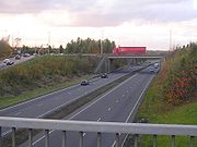
, the road becomes a fully grade-separated
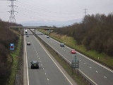
dual carriageway and passes through the town of Milton Keynes
. This stretch, known locally as the 'A5D', was opened in 1980, and enabled the older route to be incorporated into the Milton Keynes grid road system
. The bypass
has four junctions within Milton Keynes, all grade-separated, interchanging with the A4146
, A421
, A509
and A422
.
 After passing Old Stratford
, the dual carriageway ends at a large roundabout with the A508
. The single carriageway then continues to pass through Potterspury
, where a 50 mph speed limit is in force, and then Towcester
. Through Towcester the road is narrow and restricted to 30 mph. The volume of traffic on the A5 causes serious congestion for the town, and vibrations from passing vehicles have fueled support for a bypass. After crossing the A43
at a small roundabout, the road accompanies the Grand Union Canal
and the M1 motorway
through the Watford Gap
. As it passes close to Rugby
, the road is diverted slightly around the DIRFT complex. After this it passes the remains of the Rugby radio station and bridges the M45 motorway
.
The next phase to the Welsh
border takes it through Kilsby
before going under the M6 motorway
and passing close to Lutterworth
. Along this stretch, the road frequently alternates between being a single and a dual carriageway. After meeting the M69 motorway
at a roundabout, with the motorway passing above, the A5 runs through Hinckley
, the northern fringes of Nuneaton
and then Atherstone
. In Atherstone, a dual carriageway bypass takes the route briefly away from its old alignment. After this the road formerly passed straight through Tamworth
, but a dual carriageway bypass has now been provided in a similar vein to the one in Milton Keynes (see above). From this point the road is a high speed, grade separated dual carriageway up until its junction with the A38
and M6 toll
. After this junction it passes through Cannock
and Telford
, where it meets the M54 motorway
. It then runs to Shrewsbury
and Oswestry
before entering Wales
just west of Chirk
. From the Wales-England border, it continues through Llangollen
, Corwen
, Capel Curig
, and Bangor
before arriving at Holyhead
via the Menai Suspension Bridge
between mainland Wales and Anglesey
.
was by-passed by a modern cutting. However, investigation in 2006 revealed that the rock face in the cutting had become unstable, and the A5 was closed from the end of May 2006. Traffic was diverted onto the old A5 route, on a stretch known as the Glyn Bends, whilst the rock face was made safe. This involved the removal of 230,000 tonnes of rock and alluvial deposits. In July 2007, the A5 through the reconstructed cutting was reopened.
north of London
, the M54
through Telford
, the M6
, and the M6 Toll
. The A55
route in North Wales is now the usual way to get from Chirk
to Holyhead
, avoiding the mountainous A5 route through Snowdonia
and instead going via the much gentler Cheshire Plain
and along the coast.
report publish by the Road Safety Foundation.
England and Wales
England and Wales is a jurisdiction within the United Kingdom. It consists of England and Wales, two of the four countries of the United Kingdom...
. It is also the first Roman built road in England hence the name Roman Road. It runs for about 260 mile (including sections concurrent
Concurrency (road)
A concurrency, overlap, or coincidence in a road network is an instance of one physical road bearing two or more different highway, motorway, or other route numbers...
with other designations) from London
London
London is the capital city of :England and the :United Kingdom, the largest metropolitan area in the United Kingdom, and the largest urban zone in the European Union by most measures. Located on the River Thames, London has been a major settlement for two millennia, its history going back to its...
, England
England
England is a country that is part of the United Kingdom. It shares land borders with Scotland to the north and Wales to the west; the Irish Sea is to the north west, the Celtic Sea to the south west, with the North Sea to the east and the English Channel to the south separating it from continental...
to Holyhead
Holyhead
Holyhead is the largest town in the county of Anglesey in the North Wales. It is also a major port adjacent to the Irish Sea serving Ireland....
, Wales
Wales
Wales is a country that is part of the United Kingdom and the island of Great Britain, bordered by England to its east and the Atlantic Ocean and Irish Sea to its west. It has a population of three million, and a total area of 20,779 km²...
, following in part a section of the Roman
Roman Britain
Roman Britain was the part of the island of Great Britain controlled by the Roman Empire from AD 43 until ca. AD 410.The Romans referred to the imperial province as Britannia, which eventually comprised all of the island of Great Britain south of the fluid frontier with Caledonia...
Iter II
Antonine Itinerary
The Antonine Itinerary is a register of the stations and distances along the various roads of the Roman empire, containing directions how to get from one Roman settlement to another...
route which later took the Anglo-Saxon
Anglo-Saxons
Anglo-Saxon is a term used by historians to designate the Germanic tribes who invaded and settled the south and east of Great Britain beginning in the early 5th century AD, and the period from their creation of the English nation to the Norman conquest. The Anglo-Saxon Era denotes the period of...
name Watling Street
Watling Street
Watling Street is the name given to an ancient trackway in England and Wales that was first used by the Britons mainly between the modern cities of Canterbury and St Albans. The Romans later paved the route, part of which is identified on the Antonine Itinerary as Iter III: "Item a Londinio ad...
.
History
The history of the A5 begins with the Act of Union 1800Act of Union 1800
The Acts of Union 1800 describe two complementary Acts, namely:* the Union with Ireland Act 1800 , an Act of the Parliament of Great Britain, and...
, which unified Great Britain
Great Britain
Great Britain or Britain is an island situated to the northwest of Continental Europe. It is the ninth largest island in the world, and the largest European island, as well as the largest of the British Isles...
and Ireland
Ireland
Ireland is an island to the northwest of continental Europe. It is the third-largest island in Europe and the twentieth-largest island on Earth...
. The government of the new United Kingdom of Great Britain and Ireland
United Kingdom of Great Britain and Ireland
The United Kingdom of Great Britain and Ireland was the formal name of the United Kingdom during the period when what is now the Republic of Ireland formed a part of it....
saw a need to improve communication links between London
London
London is the capital city of :England and the :United Kingdom, the largest metropolitan area in the United Kingdom, and the largest urban zone in the European Union by most measures. Located on the River Thames, London has been a major settlement for two millennia, its history going back to its...
and Dublin. A Parliamentary committee led to an Act of Parliament
Act of Parliament
An Act of Parliament is a statute enacted as primary legislation by a national or sub-national parliament. In the Republic of Ireland the term Act of the Oireachtas is used, and in the United States the term Act of Congress is used.In Commonwealth countries, the term is used both in a narrow...
of 1815 that authorised the purchase of existing turnpike
Turnpike trust
Turnpike trusts in the United Kingdom were bodies set up by individual Acts of Parliament, with powers to collect road tolls for maintaining the principal highways in Britain from the 17th but especially during the 18th and 19th centuries...
road interests and, where necessary, the construction of new road, to complete the route between the two capitals. This made it the first major civilian state-funded road building project in Britain since Roman
Roman Britain
Roman Britain was the part of the island of Great Britain controlled by the Roman Empire from AD 43 until ca. AD 410.The Romans referred to the imperial province as Britannia, which eventually comprised all of the island of Great Britain south of the fluid frontier with Caledonia...
times. Responsibility for establishing the new route was awarded to the famous engineer, Thomas Telford
Thomas Telford
Thomas Telford FRS, FRSE was a Scottish civil engineer, architect and stonemason, and a noted road, bridge and canal builder.-Early career:...
.
Through England
England
England is a country that is part of the United Kingdom. It shares land borders with Scotland to the north and Wales to the west; the Irish Sea is to the north west, the Celtic Sea to the south west, with the North Sea to the east and the English Channel to the south separating it from continental...
, the road largely took over existing turnpike
Turnpike trust
Turnpike trusts in the United Kingdom were bodies set up by individual Acts of Parliament, with powers to collect road tolls for maintaining the principal highways in Britain from the 17th but especially during the 18th and 19th centuries...
roads, which mainly followed the route of the Anglo-Saxon Wæcelinga Stræt (Watling Street
Watling Street
Watling Street is the name given to an ancient trackway in England and Wales that was first used by the Britons mainly between the modern cities of Canterbury and St Albans. The Romans later paved the route, part of which is identified on the Antonine Itinerary as Iter III: "Item a Londinio ad...
), much of which had been historically the Roman road
Roman road
The Roman roads were a vital part of the development of the Roman state, from about 500 BC through the expansion during the Roman Republic and the Roman Empire. Roman roads enabled the Romans to move armies and trade goods and to communicate. The Roman road system spanned more than 400,000 km...
Iter II.
From Shrewsbury
Shrewsbury
Shrewsbury is the county town of Shropshire, in the West Midlands region of England. Lying on the River Severn, it is a civil parish home to some 70,000 inhabitants, and is the primary settlement and headquarters of Shropshire Council...
and through Wales
Wales
Wales is a country that is part of the United Kingdom and the island of Great Britain, bordered by England to its east and the Atlantic Ocean and Irish Sea to its west. It has a population of three million, and a total area of 20,779 km²...
, Telford's work was more extensive. In places he followed existing roads, but he also built new links, including the Menai Suspension Bridge
Menai Suspension Bridge
The Menai Suspension Bridge is a suspension bridge between the island of Anglesey and the mainland of Wales. Designed by Thomas Telford and completed in 1826, it was the first modern suspension bridge in the world.-Construction:...
to connect the mainland with Anglesey
Anglesey
Anglesey , also known by its Welsh name Ynys Môn , is an island and, as Isle of Anglesey, a county off the north west coast of Wales...
and the Stanley Embankment to Holy Island
Holy Island, Anglesey
Holy Island Cybi') is an island on the western side of the larger Isle of Anglesey, North Wales, from which it is separated by a narrow, winding channel. It is called "Holy" because of the high concentration of standing stones, burial chambers and other religious sites on the small island. The...
.
Telford's road was complete with the opening of the Menai Suspension Bridge
Menai Suspension Bridge
The Menai Suspension Bridge is a suspension bridge between the island of Anglesey and the mainland of Wales. Designed by Thomas Telford and completed in 1826, it was the first modern suspension bridge in the world.-Construction:...
in 1826.
Notable features for the original design
The road was designed to allow stagecoaches and the Mail coachMail coach
In Great Britain, the mail coach or post coach was a horse-drawn carriage that carried mail deliveries, from 1784. In Ireland, the first mail coach began service from Dublin in 1789. The coach was drawn by four horses and had seating for four passengers inside. Further passengers were later allowed...
to carry post between London and Holyhead, and thence by mailboat to Ireland
Ireland
Ireland is an island to the northwest of continental Europe. It is the third-largest island in Europe and the twentieth-largest island on Earth...
. Therefore throughout its length the gradient never exceeds 1:20 (5%).
The route through Wales retains many of the original features of Telford's road and has, since 1995, been recognised as an historic route worthy of preservation. These features include the following:
- many surviving and distinctive toll housesHistory of toll roads in the United KingdomFor details about the history of Toll roads in the United Kingdom see the articles about Toll roads in each of the individual countries of the United Kingdom:*Toll roads in Great Britain*Toll roads in Northern Ireland...
- 'depots' along the route, being roadside alcoves to store grit and materials
- distinctive milestoneMilestoneA milestone is one of a series of numbered markers placed along a road or boundary at intervals of one mile or occasionally, parts of a mile. They are typically located at the side of the road or in a median. They are alternatively known as mile markers, mileposts or mile posts...
s at each mile - many originals having survived and been restored, others now replaced by replicas - distinctive gates in a 'sunburst' designSunburst (design)A Sunburst is a design or figure commonly used in architectural ornaments and design patterns. It consists of rays or "beams" radiating out from a central disk in the manner of sunbeams. Sometimes part of a sunburst, a semicircular or semi-elliptical shape, is used...
, a few of which have survived - a weighbridge at Lon Isaf, between BangorBangor, GwyneddBangor is a city in Gwynedd, north west Wales, and one of the smallest cities in Britain. It is a university city with a population of 13,725 at the 2001 census, not including around 10,000 students at Bangor University. Including nearby Menai Bridge on Anglesey, which does not however form part of...
and Bethesda
Route
Starting at Marble ArchMarble Arch
Marble Arch is a white Carrara marble monument that now stands on a large traffic island at the junction of Oxford Street, Park Lane, and Edgware Road, almost directly opposite Speakers' Corner in Hyde Park in London, England...
in London
London
London is the capital city of :England and the :United Kingdom, the largest metropolitan area in the United Kingdom, and the largest urban zone in the European Union by most measures. Located on the River Thames, London has been a major settlement for two millennia, its history going back to its...
, the A5 runs northwest up the Edgware Road through Kilburn and Cricklewood
Cricklewood
Cricklewood is a district of North London, England whose northeastern part is in the London Borough of Barnet, western part is the London Borough of Brent and southeastern part is in London Borough of Camden.-History:...
. The A5 number disappears near Edgware
Edgware
Edgware is an area in London, situated north-northwest of Charing Cross. It forms part of both the London Borough of Barnet and the London Borough of Harrow. The area is identified in the London Plan as one of 35 major centres in Greater London....
, but the Roman Road continues as the A5183
A5183 road
The A5183 road is a de-trunked section of the A5. It covers the section between Junction 9 of the M1 motorway and Edgware in north London, largely along Watling Street...
through Elstree
Elstree
Elstree is a village in the Hertsmere borough of Hertfordshire on the A5 road, about 10 miles north of London. In 2001, its population was 4,765, and forms part of the civil parish of Elstree and Borehamwood, originally known simply as Elstree....
, Radlett
Radlett
Radlett is a small town in the county of Hertfordshire between St Albans and Borehamwood on Watling Street with a population of approximately 8,000. It is located in the council district of Hertsmere and is covered by two wards, Aldenham East and Aldenham West...
, St Albans
St Albans
St Albans is a city in southern Hertfordshire, England, around north of central London, which forms the main urban area of the City and District of St Albans. It is a historic market town, and is now a sought-after dormitory town within the London commuter belt...
and Redbourn
Redbourn
Redbourn is a village and civil parish in Hertfordshire, United Kingdom, lying on Watling Street, 3 miles from Harpenden, 4 miles from St Albans and 5 miles from Hemel Hempstead. It has a population of around 6,000.-History:...
, to junction 9 of the M1
M1 motorway
The M1 is a north–south motorway in England primarily connecting London to Leeds, where it joins the A1 near Aberford. While the M1 is considered to be the first inter-urban motorway to be completed in the United Kingdom, the first road to be built to motorway standard in the country was the...
, where it becomes the A5 again. From there on, it passes through Dunstable
Dunstable
Dunstable is a market town and civil parish located in Bedfordshire, England. It lies on the eastward tail spurs of the Chiltern Hills, 30 miles north of London. These geographical features form several steep chalk escarpments most noticeable when approaching Dunstable from the north.-Etymology:In...
, where it crosses and briefly multiplex
Concurrency (road)
A concurrency, overlap, or coincidence in a road network is an instance of one physical road bearing two or more different highway, motorway, or other route numbers...
es with the A505
A505 road
The A505 is an A-class road in the United Kingdom. It follows part of the route of the Icknield Way and the corresponding Icknield Way Path.-Bedfordshire:...
. The stretch through Dunstable is mostly single carriageway
Carriageway
A carriageway consists of a width of road on which a vehicle is not restricted by any physical barriers or separation to move laterally...
with a 30 mph speed limit and at-grade pedestrian crossing
Pedestrian crossing
A pedestrian crossing or crosswalk is a designated point on a road at which some means are employed to assist pedestrians wishing to cross. They are designed to keep pedestrians together where they can be seen by motorists, and where they can cross most safely across the flow of vehicular traffic...
s, and as a result serious traffic jam
Traffic congestion
Traffic congestion is a condition on road networks that occurs as use increases, and is characterized by slower speeds, longer trip times, and increased vehicular queueing. The most common example is the physical use of roads by vehicles. When traffic demand is great enough that the interaction...
s are frequent on this stretch. North of Dunstable, the A5 passes through the village of Hockliffe
Hockliffe
Hockliffe is a village and civil parish in Bedfordshire on the crossroads of the A5 road which lies upon the course of the roman road known as Watling Street and the A4012 road.It is about four miles east of Leighton Buzzard...
before becoming a dual carriageway
Dual carriageway
A dual carriageway is a class of highway with two carriageways for traffic travelling in opposite directions separated by a central reservation...
and bypassing Little Brickhill
Little Brickhill
Little Brickhill is a village and civil parish in the Borough of Milton Keynes and ceremonial county of Buckinghamshire, England. It is just outside and overlooking Milton Keynes itself, two and a half miles west of Woburn in Bedfordshire....
. After a large roundabout
Roundabout
A roundabout is the name for a road junction in which traffic moves in one direction around a central island. The word dates from the early 20th century. Roundabouts are common in many countries around the world...
with the A4146
A4146 road
The A4146 is an A-class road running through south-central England from M1 Junction 14 at Milton Keynes, around Linslade and Leighton Buzzard , and via Dagnall to Hemel Hempstead, where it terminates at a roundabout with the A4251.In Milton Keynes, the road briefly follows the H6 Childs Way from...
, the road becomes a fully grade-separated
Grade separation
Grade separation is the method of aligning a junction of two or more transport axes at different heights so that they will not disrupt the traffic flow on other transit routes when they cross each other. The composition of such transport axes does not have to be uniform; it can consist of a...
dual carriageway and passes through the town of Milton Keynes
Milton Keynes
Milton Keynes , sometimes abbreviated MK, is a large town in Buckinghamshire, in the south east of England, about north-west of London. It is the administrative centre of the Borough of Milton Keynes...
. This stretch, known locally as the 'A5D', was opened in 1980, and enabled the older route to be incorporated into the Milton Keynes grid road system
Milton Keynes grid road system
The Milton Keynes grid road system is a network of national speed limit, fully landscaped routes that form the top layer of the street hierarchy for both for private and public transport in Milton Keynes, Buckinghamshire...
. The bypass
Bypass (road)
A bypass is a road or highway that avoids or "bypasses" a built-up area, town, or village, to let through traffic flow without interference from local traffic, to reduce congestion in the built-up area, and to improve road safety....
has four junctions within Milton Keynes, all grade-separated, interchanging with the A4146
A4146 road
The A4146 is an A-class road running through south-central England from M1 Junction 14 at Milton Keynes, around Linslade and Leighton Buzzard , and via Dagnall to Hemel Hempstead, where it terminates at a roundabout with the A4251.In Milton Keynes, the road briefly follows the H6 Childs Way from...
, A421
A421 road
The A421 is an important road for east/west journeys across England. Together with the A428, the A43 and A34, it forms the route from Cambridge through Milton Keynes to Oxford...
, A509
A509 road
The A509 is a short A-class road for north-south journeys in south central England, forming the route from Kettering in Northamptonshire to the M1 and A5 in Milton Keynes....
and A422
A422 road
The A422 is an "A" road for east-west journeys in south central England, connecting the county towns of Bedford and Worcester by way of Milton Keynes, Buckingham, Banbury and Stratford-upon-Avon. For most of its length, is a narrow single carriageway....
.
Old Stratford
Old Stratford is a village in the south of the English county of Northamptonshire. The river Great Ouse forms the boundary with Buckinghamshire and Milton Keynes.-Location:...
, the dual carriageway ends at a large roundabout with the A508
A508 road
The A508 is a short A-class road for north/south journeys in south central England, forming the route from Market Harborough in Leicestershire, via Northampton, to Old Stratford, north-west of Milton Keynes....
. The single carriageway then continues to pass through Potterspury
Potterspury
Potterspury is a village and civil parish in the district of South Northamptonshire. The nearest main town is Milton Keynes, the centre of which is about 7 miles south-east...
, where a 50 mph speed limit is in force, and then Towcester
Towcester
Towcester , the Roman town of Lactodorum, is a small town in south Northamptonshire, England.-Etymology:Towcester comes from the Old English Tófe-ceaster. Tófe refers to the River Tove; Bosworth and Toller compare it to the "Scandinavian proper names" Tófi and Tófa...
. Through Towcester the road is narrow and restricted to 30 mph. The volume of traffic on the A5 causes serious congestion for the town, and vibrations from passing vehicles have fueled support for a bypass. After crossing the A43
A43 road
The A43 is a primary route in the English Midlands, that runs from the M40 motorway near Ardley in Oxfordshire to Stamford in Lincolnshire. Through Northamptonshire it bypasses the towns of Northampton, Kettering and Corby which are the three principal destinations on the A43 route...
at a small roundabout, the road accompanies the Grand Union Canal
Grand Union Canal
The Grand Union Canal in England is part of the British canal system. Its main line connects London and Birmingham, stretching for 137 miles with 166 locks...
and the M1 motorway
M1 motorway
The M1 is a north–south motorway in England primarily connecting London to Leeds, where it joins the A1 near Aberford. While the M1 is considered to be the first inter-urban motorway to be completed in the United Kingdom, the first road to be built to motorway standard in the country was the...
through the Watford Gap
Watford Gap
The Watford Gap is located at a minor gap between two slight hills in the county of Northamptonshire, England. Engineers from Roman times onwards have found it to be an appropriate route connecting the Midlands with the South East....
. As it passes close to Rugby
Rugby, Warwickshire
Rugby is a market town in Warwickshire, England, located on the River Avon. The town has a population of 61,988 making it the second largest town in the county...
, the road is diverted slightly around the DIRFT complex. After this it passes the remains of the Rugby radio station and bridges the M45 motorway
M45 motorway
The M45 is a motorway in Northamptonshire and Warwickshire, England and is long. It runs from Junction 17 of the M1 motorway south east of Rugby and ends with a junction with the A45 road southwest of Rugby...
.
The next phase to the Welsh
Wales
Wales is a country that is part of the United Kingdom and the island of Great Britain, bordered by England to its east and the Atlantic Ocean and Irish Sea to its west. It has a population of three million, and a total area of 20,779 km²...
border takes it through Kilsby
Kilsby
Kilsby is a village and civil parish in the Daventry district of Northamptonshire, England situated approximately five miles south-east of Rugby....
before going under the M6 motorway
M6 motorway
The M6 motorway runs from junction 19 of the M1 at the Catthorpe Interchange, near Rugby via Birmingham then heads north, passing Stoke-on-Trent, Manchester, Preston, Carlisle and terminating at the Gretna junction . Here, just short of the Scottish border it becomes the A74 which continues to...
and passing close to Lutterworth
Lutterworth
Lutterworth is a market town and civil parish in the Harborough district of Leicestershire, England. The town is located in southern Leicestershire, north of Rugby, in Warwickshire and south of Leicester. It had a population of 8,293 in the 2001 UK census....
. Along this stretch, the road frequently alternates between being a single and a dual carriageway. After meeting the M69 motorway
M69 motorway
The M69 is a lightly used dual three lane dual carriageway motorway in Leicestershire and Warwickshire, England connecting Leicester and Coventry. It opened in 1977.-History:...
at a roundabout, with the motorway passing above, the A5 runs through Hinckley
Hinckley
Hinckley is a town in southwest Leicestershire, England. It has a population of 43,246 . It is administered by Hinckley and Bosworth Borough Council...
, the northern fringes of Nuneaton
Nuneaton
Nuneaton is the largest town in the Borough of Nuneaton and Bedworth and in the English county of Warwickshire.Nuneaton is most famous for its associations with the 19th century author George Eliot, who was born on a farm on the Arbury Estate just outside Nuneaton in 1819 and lived in the town for...
and then Atherstone
Atherstone
Atherstone is a town in Warwickshire, England. The town is located near the northernmost tip of Warwickshire, close to the border with Staffordshire and Leicestershire and is the administrative headquarters of the borough of North Warwickshire.-History:...
. In Atherstone, a dual carriageway bypass takes the route briefly away from its old alignment. After this the road formerly passed straight through Tamworth
Tamworth
Tamworth is a town and local government district in Staffordshire, England, located north-east of Birmingham city centre and north-west of London. The town takes its name from the River Tame, which flows through the town, as does the River Anker...
, but a dual carriageway bypass has now been provided in a similar vein to the one in Milton Keynes (see above). From this point the road is a high speed, grade separated dual carriageway up until its junction with the A38
A38 road
The A38, part of which is also known as the Devon Expressway, is a major A-class trunk road in England.The road runs from Bodmin in Cornwall to Mansfield in Nottinghamshire. It is long, making it one of the longest A-roads in England. It was formerly known as the Leeds — Exeter Trunk Road,...
and M6 toll
M6 Toll
The M6 Toll , connects M6 Junction 4 at the NEC to M6 Junction 11A at Wolverhampton with of six-lane motorway. The weekday cash cost is £5.30 for a car and £10.60 for a HGV...
. After this junction it passes through Cannock
Cannock
Cannock is the most populous of three towns in the district of Cannock Chase in the central southern part of the county of Staffordshire in the West Midlands region of England....
and Telford
Telford
Telford is a large new town in the borough of Telford and Wrekin and ceremonial county of Shropshire, England, approximately east of Shrewsbury, and west of Birmingham...
, where it meets the M54 motorway
M54 motorway
The M54 is a 23 mile east-west motorway in the English counties of Shropshire and Staffordshire. It is also referred to as the Telford Motorway, after the road's primary westbound destination, the new town of Telford...
. It then runs to Shrewsbury
Shrewsbury
Shrewsbury is the county town of Shropshire, in the West Midlands region of England. Lying on the River Severn, it is a civil parish home to some 70,000 inhabitants, and is the primary settlement and headquarters of Shropshire Council...
and Oswestry
Oswestry
Oswestry is a town and civil parish in Shropshire, England, close to the Welsh border. It is at the junction of the A5, A483, and A495 roads....
before entering Wales
Wales
Wales is a country that is part of the United Kingdom and the island of Great Britain, bordered by England to its east and the Atlantic Ocean and Irish Sea to its west. It has a population of three million, and a total area of 20,779 km²...
just west of Chirk
Chirk
Chirk is a small town and local government community, the lowest tier of local government, part of Wrexham County Borough in Wales. It has a population of over 4,000....
. From the Wales-England border, it continues through Llangollen
Llangollen
Llangollen is a small town and community in Denbighshire, north-east Wales, situated on the River Dee and on the edge of the Berwyn mountains. It has a population of 3,412.-History:...
, Corwen
Corwen
Corwen is a town and community in the county of Denbighshire in Wales; it was previously part of the county of Meirionnydd). Corwen stands on the banks of the River Dee beneath the Berwyn mountains. The town is situated west of Llangollen and south of Ruthin...
, Capel Curig
Capel Curig
Capel Curig is a village and community in Conwy County Borough, in Wales. It lies in the heart of Snowdonia, on the River Llugwy, and has a population of 226...
, and Bangor
Bangor, Gwynedd
Bangor is a city in Gwynedd, north west Wales, and one of the smallest cities in Britain. It is a university city with a population of 13,725 at the 2001 census, not including around 10,000 students at Bangor University. Including nearby Menai Bridge on Anglesey, which does not however form part of...
before arriving at Holyhead
Holyhead
Holyhead is the largest town in the county of Anglesey in the North Wales. It is also a major port adjacent to the Irish Sea serving Ireland....
via the Menai Suspension Bridge
Menai Suspension Bridge
The Menai Suspension Bridge is a suspension bridge between the island of Anglesey and the mainland of Wales. Designed by Thomas Telford and completed in 1826, it was the first modern suspension bridge in the world.-Construction:...
between mainland Wales and Anglesey
Anglesey
Anglesey , also known by its Welsh name Ynys Môn , is an island and, as Isle of Anglesey, a county off the north west coast of Wales...
.
Tŷ Nant cutting
In 1997, a section of bends on Telford's road between Tŷ Nant and DinmaelDinmael
Dinmael was a medieval lordship and cwmwd in north Wales which usually formed a part of the patrimony of the kingdom of Powys. The name, of Old Welsh origin, means "the King's Fort" and probably refers to a now forgotten early Welsh fortress.The name survives in the name of a rural community in...
was by-passed by a modern cutting. However, investigation in 2006 revealed that the rock face in the cutting had become unstable, and the A5 was closed from the end of May 2006. Traffic was diverted onto the old A5 route, on a stretch known as the Glyn Bends, whilst the rock face was made safe. This involved the removal of 230,000 tonnes of rock and alluvial deposits. In July 2007, the A5 through the reconstructed cutting was reopened.
Alternative routes
Parts of the A5 have been replaced by sections of the M1M1 motorway
The M1 is a north–south motorway in England primarily connecting London to Leeds, where it joins the A1 near Aberford. While the M1 is considered to be the first inter-urban motorway to be completed in the United Kingdom, the first road to be built to motorway standard in the country was the...
north of London
Greater London
Greater London is the top-level administrative division of England covering London. It was created in 1965 and spans the City of London, including Middle Temple and Inner Temple, and the 32 London boroughs. This territory is coterminate with the London Government Office Region and the London...
, the M54
M54 motorway
The M54 is a 23 mile east-west motorway in the English counties of Shropshire and Staffordshire. It is also referred to as the Telford Motorway, after the road's primary westbound destination, the new town of Telford...
through Telford
Telford
Telford is a large new town in the borough of Telford and Wrekin and ceremonial county of Shropshire, England, approximately east of Shrewsbury, and west of Birmingham...
, the M6
M6 motorway
The M6 motorway runs from junction 19 of the M1 at the Catthorpe Interchange, near Rugby via Birmingham then heads north, passing Stoke-on-Trent, Manchester, Preston, Carlisle and terminating at the Gretna junction . Here, just short of the Scottish border it becomes the A74 which continues to...
, and the M6 Toll
M6 Toll
The M6 Toll , connects M6 Junction 4 at the NEC to M6 Junction 11A at Wolverhampton with of six-lane motorway. The weekday cash cost is £5.30 for a car and £10.60 for a HGV...
. The A55
A55 road
The A55, also known as the North Wales Expressway, is a major road in Britain. Its entire length is a dual carriageway primary route, with the exception of the point where it crosses the Britannia Bridge over the Menai Strait. All junctions are grade separated except for two roundabouts — one...
route in North Wales is now the usual way to get from Chirk
Chirk
Chirk is a small town and local government community, the lowest tier of local government, part of Wrexham County Borough in Wales. It has a population of over 4,000....
to Holyhead
Holyhead
Holyhead is the largest town in the county of Anglesey in the North Wales. It is also a major port adjacent to the Irish Sea serving Ireland....
, avoiding the mountainous A5 route through Snowdonia
Snowdonia
Snowdonia is a region in north Wales and a national park of in area. It was the first to be designated of the three National Parks in Wales, in 1951.-Name and extent:...
and instead going via the much gentler Cheshire Plain
Cheshire Plain
The Cheshire Plain is a relatively flat expanse of lowland situated almost entirely within the county of Cheshire in northwest England. It is bounded by the hills of North Wales to the west, and the Peak District of Derbyshire and North Staffordshire to the east and southeast...
and along the coast.
Road Safety
In June 2008, a 9.9 miles (16 km) stretch of the A5 between Daventry and Rugby was named as the most dangerous road in the East Midlands. This single carriageway stretch had 15 fatal and serious injury collisions between 2004 and 2006, and was rated as Red—the second highest risk band—in the EuroRAPEuroRAP
European Road Assessment Programme is a non-profit road safety organisation which aims to reduce death and serious injury on Europe's roads...
report publish by the Road Safety Foundation.