
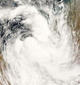
2006-07 Australian region cyclone season
Encyclopedia
The 2006–07 Australian region cyclone season was an event in the ongoing cycle of tropical cyclone
formation. It began on 1 November 2006 and ended on 30 April 2007; however, Tropical Cyclone Pierre formed on 17 May, after the official end date. The regional tropical cyclone operational plan also defines a tropical cyclone year separately from a tropical cyclone season, which runs from 1 July 2006 to 30 June 2007.
Tropical cyclones in this area are monitored by four Tropical Cyclone Warning Centres (TCWCs): the Australian Bureau of Meteorology in Perth
, Darwin
, and Brisbane; and TCWC Port Moresby
in Papua New Guinea
.
activity south of Indonesia
was first spotted on 29 December 2006, when the Bureau of Meteorology (BOM) noted that a weak tropical low could develop in the area. Late on 31 December, the BOM began issuing advisories on the tropical low. The Joint Typhoon Warning Center
issued a Tropical Cyclone Formation Alert
on the system early on 2 January 2007, and the Tropical Cyclone Warning Centre in Perth
upgraded it to a tropical cyclone later that morning, naming it Isobel. The JTWC followed suit and designated the system Tropical Cyclone 07S. Isobel was downgraded to a tropical low shortly after landfall over the Eighty Mile Beach on 3 January and advisories were stopped at 0600 UTC that morning. The remnants of Isobel merged with a deep low pressure system
near the southern coast of Western Australia
, dumping 100 mm of torrential rain, in what was dubbed a "perfect storm
". The extratropical system
halted mining operations and unleashed winds of up to 120 km/h.
After the system dissipated, the BOM de-classified Isobel as a tropical cyclone after it was reanalysed as not having a well-defined enough of a center to qualify as a tropical cyclone.
. It deepened as it moved east just north of the Northern Territory
coastline and a cyclone watch was declared for eastern parts of the Northern Territory on 31 January. Cyclone warnings were issued on 1 February in the same area, while cyclone watches extended to most areas surrounding the Gulf of Carpentaria
. The Joint Typhoon Warning Center
issued a Tropical Cyclone Formation Alert
(TCFA) on the developing low on 1 February. However, this was cancelled on 3 February after the low showed no signs of developing. The low tracked to the southwest and approached the southern coastline of the Gulf of Carpentaria, before moving eastwards towards Queensland
. On 5 February, the JTWC reissued their TCFA on the system, while the Tropical Cyclone Warning Centre in Brisbane
upgraded the system to tropical cyclone
status, naming it Nelson, as well as issuing cyclone warnings for the Queensland coast surrounding the Gulf. The cyclone intensified to a Category 2 on the Australian scale late on 6 February and peaked while crossing the coast with gusts reaching 140 km/h (85 mph). Nelson was once forecast to reintensify in the Coral Sea
and the east Queensland coast faced a cyclone watch for the first time this season. However, Nelson was later declared dissipated over southwestern Cape York Peninsula
while a new low was detected just off Cairns
on 6 February.
issued their last tropical cyclone advice. In that advice they noted that low would gradually intensify over the next 24 to 48 hours, however it was not expected to develop into a tropical cyclone until it was well away from the coast of Australia. On 8 February, the low continued to move to the east southeast but was in an unfavourable environment for intensification. The TCWC in Brisbane stopped issuing ocean wind warnings on the system on 9 February.
, which had formed in a monsoon trough
. With the first advice, a cyclone watch was immediately declared for the Queensland
coast between Ayr
and St Lawrence
, and TCWC Brisbane upgraded the low to Tropical Cyclone Odette on 3 March. Cyclone advices were discontinued later that day when Odette remained near stationary in the Coral Sea
. The Joint Typhoon Warning Center
on that day issued a Tropical Cyclone Formation Alert
on the developing cyclone. Early on 4 March, the JTWC cancelled the TCFA as Odette encountered high vertical wind shear
in the Coral Sea. However, the system was still causing rough seas and swells along the coast of Queensland. Later that day, the BOM reported that there were no more ship observations of gales near the centre of the storm, and downgraded Odette to a tropical low noting that redevelopment was unlikely. On 6 March, the TCWC in Brisbane, Queensland noted the potential for redevelopment, and the remnants of Odette passed into the area of responsibility of RSMC
Nadi
early the next day. However, redevelopment did not occur, and tropical disturbance advisories were discontinued.
Odette was subsequently downgraded below tropical cyclone intensity by the warning agency in Brisbane.
's Top End
since 27 February started showing signs of development, and the Tropical Cyclone Warning Centre in Darwin
initiated tropical cyclone advices on 2 March while the low was still inland. The Joint Typhoon Warning Center
issued a Tropical Cyclone Formation Alert
on the system later that day, and designated it Tropical Cyclone 17S the next day as it emerged into water.
Later on 3 March, TCWC Darwin upgraded the low to a tropical cyclone, naming it George, the first name used from the Darwin list since Fay in March 2004. George continued to strengthen, and was upgraded to a Category 2 tropical cyclone. It made landfall on 4 March in the Kimberley region of Western Australia
on the western coast of the Joseph Bonaparte Gulf
. The tropical cyclone weakened and the BOM downgraded it to a tropical low after it moved over land, but this weakening was short lived however, as it almost immediately reintensified into a Category 1 tropical cyclone when it started to move off the Kimberley coast.
The Tropical Cyclone Warning Centre in Perth
began monitoring the re-developed cyclone as it moved westward. Initially, poor organisation inhibited any strengthening, but George moved into more favorable conditions and quickly reorganised itself, becoming a severe tropical cyclone on 7 March. The severe cyclone turned abruptly to the south later that day, moving closer to the Pilbara coast, while growing significantly in size. As George continued to move southwards towards Bedout Island
on 8 March, George was upgraded a Category 4 cyclone with 10-min sustained winds of 105 knots. Post analysis, however, lifted George's peak intensity to 110 knots just before it made landfall
, and George was upgraded to a Category 5 cyclone. Cyclone George made landfall just east of Port Hedland
at around 10 pm WDT
(1300 UTC) on that day while it was still at its peak intensity and a minimum pressure of 902 hPa
.
The JTWC
issued its final warning on George early the next day as it was barely hanging on to Category 3 tropical cyclone status. George weakened slowly while over land and it was downgraded to a Category 2 late on 9 March. The next day TCWC in Perth
issued its final warning.
Cyclone George was the most powerful cyclone to hit Port Hedland since Cyclone Joan in 1975. Three people were killed and twenty-eight others were injured as a result of the severe cyclone.
off the Kimberley
coast on 2 March and moved slowly in a westerly direction. It intensified slowly and was not expected to develop to a tropical cyclone. However, on early 7 March, convection
improved slightly around the system, and the Tropical Cyclone Warning Centre in Perth
named it Jacob as it intensified to tropical cyclone status. A cyclone watch was immediately issued for Christmas Island
, as Jacob moved to the west northwest closer to the island. The Joint Typhoon Warning Center
designated the system Tropical Cyclone 18S on the same day. Jacob was also upgraded to a Category 2 tropical cyclone by the TCWC in Perth. Jacob continued to strengthen into a Category 3 severe tropical cyclone on 8 March, but weakened shortly after back to a Category 2. Jacob slowed down its movement during the day and began to move eastward away from Christmas Island, therefore, cyclone warnings were cancelled. Jacob restrengthened to a Category 3 on 9 March and accelerated to the southeast towards the Australian mainland. After just being hit by Severe Tropical Cyclone George the night before, TCWC Perth began issuing cyclone watches for Cyclone Jacob for the entire Pilbara coast later that day. The next day, Jacob once again weakened to a Category 2 tropical cyclone. The Bureau of Meteorology forecast Jacob to intensify to a Category 3 cyclone again before landfall, but this did not materialise and Jacob instead weakened further to a Category 1 cyclone on 11 March. Jacob weakened into a tropical low shortly after making landfall east of Port Hedland, Western Australia
on 12 March.
coast. It gained sizable organisation, and the JTWC
issued a Tropical Cyclone Formation Alert
early on 25 March. Several hours later, it was named Tropical Cyclone Kara, with scatterometer
readings of 40 knots to the south of the system. Kara intensified quickly, and the BOM upgraded it to Category 2 on the Australian scale later that day, then to a severe tropical cyclone early on 26 March. It then underwent rapid development, due to its small size and a favourable environment, and reached Category 3 severe tropical cyclone strength.
At this point, the Bureau of Meteorology had high uncertainty regarding the cyclone's future track, which generally pointed Kara to move southwards towards the Western Australia
n coast. Therefore, cyclone watches and warnings were issued for the entire Pilbara coast, extending as far east as Broome
. The cyclone reached peak intensity late on 26 March, and began to rapidly weaken the next day due to increasing wind shear
. The JTWC issued its last advisory on the evening of 27 March, and TCWC Perth followed suit early on 28 March as Kara dissipated near Eighty Mile Beach in Australia.
. The low organised quickly in the Soloman Sea, and the Joint Typhoon Warning Center
issued a Tropical Cyclone Formation Alert
on it several hours later. TCWC Brisbane named the system Tropical Cyclone Pierre early the next day. The JTWC issued its first advisory on Tropical Cyclone 24P several hours later, as the cyclone moved westward. Later that day, Pierre encountered increased wind shear
and dry air, disrupting the system and inhibiting its development. These unfavourable conditions eventually caused the system to lose its convection
and degenerate into a tropical low shortly before making landfall in Papua New Guinea
. After that, Ex-Tropical Cyclone Pierre entered the northern part of the Coral Sea and threatened to produce heavy rainfall and thunderstorms with damaging wind gusts across Cape York Peninsula.
.
Tropical cyclones are named if they are non-frontal low pressure systems of synoptic scale
developing over warm waters, or Dvorak
intensity analysis indicate the presence of gale force
or stronger winds near the centre. Therefore, a tropical system with gales in one or more quadrants, but not near the centre, are not named.
All names assigned in the Australian region are used sequentially, unlike lists used annually by the National Hurricane Centre in the Atlantic Ocean
and east Pacific Ocean
. Only the names used during this cyclone season are listed below. The complete list of names for each basin are found in the World Meteorological Organization
's official list.
, south of the Equator
, and west of 125°E
are assigned names by the Tropical Cyclone Warning Centre in Perth, Western Australia
.
and 141°E
are assigned names by the Tropical Cyclone Warning Centre in Darwin, Northern Territory
.
between 141°E
and 160°E
are assigned names by the Tropical Cyclone Warning Centre in Brisbane, Queensland.
between 141°E
and 160°E
are assigned names by the Tropical Cyclone Warning Centre in Port Moresby
, Papua New Guinea
.
No tropical cyclones developed in this area in the 2006-07 season.
Tropical cyclone
A tropical cyclone is a storm system characterized by a large low-pressure center and numerous thunderstorms that produce strong winds and heavy rain. Tropical cyclones strengthen when water evaporated from the ocean is released as the saturated air rises, resulting in condensation of water vapor...
formation. It began on 1 November 2006 and ended on 30 April 2007; however, Tropical Cyclone Pierre formed on 17 May, after the official end date. The regional tropical cyclone operational plan also defines a tropical cyclone year separately from a tropical cyclone season, which runs from 1 July 2006 to 30 June 2007.
Tropical cyclones in this area are monitored by four Tropical Cyclone Warning Centres (TCWCs): the Australian Bureau of Meteorology in Perth
Perth, Western Australia
Perth is the capital and largest city of the Australian state of Western Australia and the fourth most populous city in Australia. The Perth metropolitan area has an estimated population of almost 1,700,000....
, Darwin
Darwin, Northern Territory
Darwin is the capital city of the Northern Territory, Australia. Situated on the Timor Sea, Darwin has a population of 127,500, making it by far the largest and most populated city in the sparsely populated Northern Territory, but the least populous of all Australia's capital cities...
, and Brisbane; and TCWC Port Moresby
Port Moresby
Port Moresby , or Pot Mosbi in Tok Pisin, is the capital and largest city of Papua New Guinea . It is located on the shores of the Gulf of Papua, on the southeastern coast of the island of New Guinea, which made it a prime objective for conquest by the Imperial Japanese forces during 1942–43...
in Papua New Guinea
Papua New Guinea
Papua New Guinea , officially the Independent State of Papua New Guinea, is a country in Oceania, occupying the eastern half of the island of New Guinea and numerous offshore islands...
.
Tropical Low Isobel
An area of increased thunderstormThunderstorm
A thunderstorm, also known as an electrical storm, a lightning storm, thundershower or simply a storm is a form of weather characterized by the presence of lightning and its acoustic effect on the Earth's atmosphere known as thunder. The meteorologically assigned cloud type associated with the...
activity south of Indonesia
Indonesia
Indonesia , officially the Republic of Indonesia , is a country in Southeast Asia and Oceania. Indonesia is an archipelago comprising approximately 13,000 islands. It has 33 provinces with over 238 million people, and is the world's fourth most populous country. Indonesia is a republic, with an...
was first spotted on 29 December 2006, when the Bureau of Meteorology (BOM) noted that a weak tropical low could develop in the area. Late on 31 December, the BOM began issuing advisories on the tropical low. The Joint Typhoon Warning Center
Joint Typhoon Warning Center
The Joint Typhoon Warning Center is a joint United States Navy – United States Air Force task force located at the Naval Maritime Forecast Center in Pearl Harbor, Hawaii...
issued a Tropical Cyclone Formation Alert
Tropical Cyclone Formation Alert
A Tropical Cyclone Formation Alert is a bulletin released by the U.S. Navy-operated Joint Typhoon Warning Center in Honolulu, Hawaii or the Naval Maritime Forecast Center in Norfolk, Virginia, warning of the possibility of a tropical cyclone forming from a tropical disturbance that has been...
on the system early on 2 January 2007, and the Tropical Cyclone Warning Centre in Perth
Perth, Western Australia
Perth is the capital and largest city of the Australian state of Western Australia and the fourth most populous city in Australia. The Perth metropolitan area has an estimated population of almost 1,700,000....
upgraded it to a tropical cyclone later that morning, naming it Isobel. The JTWC followed suit and designated the system Tropical Cyclone 07S. Isobel was downgraded to a tropical low shortly after landfall over the Eighty Mile Beach on 3 January and advisories were stopped at 0600 UTC that morning. The remnants of Isobel merged with a deep low pressure system
Low pressure area
A low-pressure area, or "low", is a region where the atmospheric pressure at sea level is below that of surrounding locations. Low-pressure systems form under areas of wind divergence which occur in upper levels of the troposphere. The formation process of a low-pressure area is known as...
near the southern coast of Western Australia
Western Australia
Western Australia is a state of Australia, occupying the entire western third of the Australian continent. It is bounded by the Indian Ocean to the north and west, the Great Australian Bight and Indian Ocean to the south, the Northern Territory to the north-east and South Australia to the south-east...
, dumping 100 mm of torrential rain, in what was dubbed a "perfect storm
Perfect storm
A "perfect storm" is an expression that describes an event where a rare combination of circumstances will aggravate a situation drastically. The term is also used to describe an actual phemonenon that happens to occur in such a confluence, resulting in an event of unusual magnitude.-Origin:First ...
". The extratropical system
Extratropical cyclone
Extratropical cyclones, sometimes called mid-latitude cyclones or wave cyclones, are a group of cyclones defined as synoptic scale low pressure weather systems that occur in the middle latitudes of the Earth having neither tropical nor polar characteristics, and are connected with fronts and...
halted mining operations and unleashed winds of up to 120 km/h.
After the system dissipated, the BOM de-classified Isobel as a tropical cyclone after it was reanalysed as not having a well-defined enough of a center to qualify as a tropical cyclone.
Tropical Cyclone Nelson
On 30 January, a tropical low was identified by the Tropical Cyclone Warning Centre in DarwinDarwin, Northern Territory
Darwin is the capital city of the Northern Territory, Australia. Situated on the Timor Sea, Darwin has a population of 127,500, making it by far the largest and most populated city in the sparsely populated Northern Territory, but the least populous of all Australia's capital cities...
. It deepened as it moved east just north of the Northern Territory
Northern Territory
The Northern Territory is a federal territory of Australia, occupying much of the centre of the mainland continent, as well as the central northern regions...
coastline and a cyclone watch was declared for eastern parts of the Northern Territory on 31 January. Cyclone warnings were issued on 1 February in the same area, while cyclone watches extended to most areas surrounding the Gulf of Carpentaria
Gulf of Carpentaria
The Gulf of Carpentaria is a large, shallow sea enclosed on three sides by northern Australia and bounded on the north by the Arafura Sea...
. The Joint Typhoon Warning Center
Joint Typhoon Warning Center
The Joint Typhoon Warning Center is a joint United States Navy – United States Air Force task force located at the Naval Maritime Forecast Center in Pearl Harbor, Hawaii...
issued a Tropical Cyclone Formation Alert
Tropical Cyclone Formation Alert
A Tropical Cyclone Formation Alert is a bulletin released by the U.S. Navy-operated Joint Typhoon Warning Center in Honolulu, Hawaii or the Naval Maritime Forecast Center in Norfolk, Virginia, warning of the possibility of a tropical cyclone forming from a tropical disturbance that has been...
(TCFA) on the developing low on 1 February. However, this was cancelled on 3 February after the low showed no signs of developing. The low tracked to the southwest and approached the southern coastline of the Gulf of Carpentaria, before moving eastwards towards Queensland
Queensland
Queensland is a state of Australia, occupying the north-eastern section of the mainland continent. It is bordered by the Northern Territory, South Australia and New South Wales to the west, south-west and south respectively. To the east, Queensland is bordered by the Coral Sea and Pacific Ocean...
. On 5 February, the JTWC reissued their TCFA on the system, while the Tropical Cyclone Warning Centre in Brisbane
Brisbane
Brisbane is the capital and most populous city in the Australian state of Queensland and the third most populous city in Australia. Brisbane's metropolitan area has a population of over 2 million, and the South East Queensland urban conurbation, centred around Brisbane, encompasses a population of...
upgraded the system to tropical cyclone
Tropical cyclone
A tropical cyclone is a storm system characterized by a large low-pressure center and numerous thunderstorms that produce strong winds and heavy rain. Tropical cyclones strengthen when water evaporated from the ocean is released as the saturated air rises, resulting in condensation of water vapor...
status, naming it Nelson, as well as issuing cyclone warnings for the Queensland coast surrounding the Gulf. The cyclone intensified to a Category 2 on the Australian scale late on 6 February and peaked while crossing the coast with gusts reaching 140 km/h (85 mph). Nelson was once forecast to reintensify in the Coral Sea
Coral Sea
The Coral Sea is a marginal sea off the northeast coast of Australia. It is bounded in the west by the east coast of Queensland, thereby including the Great Barrier Reef, in the east by Vanuatu and by New Caledonia, and in the north approximately by the southern extremity of the Solomon Islands...
and the east Queensland coast faced a cyclone watch for the first time this season. However, Nelson was later declared dissipated over southwestern Cape York Peninsula
Cape York Peninsula
Cape York Peninsula is a large remote peninsula located in Far North Queensland at the tip of the state of Queensland, Australia, the largest unspoilt wilderness in northern Australia and one of the last remaining wilderness areas on Earth...
while a new low was detected just off Cairns
Cairns, Queensland
Cairns is a regional city in Far North Queensland, Australia, founded 1876. The city was named after William Wellington Cairns, then-current Governor of Queensland. It was formed to serve miners heading for the Hodgkinson River goldfield, but experienced a decline when an easier route was...
on 6 February.
TCWC Brisbane Tropical Low
Just east of the remnants of Nelson, a tropical low was detected on 6 February. The low absorbed the moisture from Nelson as it moved slowly away from the coast. On 7 February, the TCWC in BrisbaneBrisbane
Brisbane is the capital and most populous city in the Australian state of Queensland and the third most populous city in Australia. Brisbane's metropolitan area has a population of over 2 million, and the South East Queensland urban conurbation, centred around Brisbane, encompasses a population of...
issued their last tropical cyclone advice. In that advice they noted that low would gradually intensify over the next 24 to 48 hours, however it was not expected to develop into a tropical cyclone until it was well away from the coast of Australia. On 8 February, the low continued to move to the east southeast but was in an unfavourable environment for intensification. The TCWC in Brisbane stopped issuing ocean wind warnings on the system on 9 February.
Tropical Low Odette
On 2 March, the TCWC in Brisbane, Queensland started issuing tropical cyclone advices on a tropical low east of 150°E150th meridian east
The meridian 150° east of Greenwich is a line of longitude that extends from the North Pole across the Arctic Ocean, Asia, the Pacific Ocean, Australasia, the Southern Ocean, and Antarctica to the South Pole....
, which had formed in a monsoon trough
Monsoon trough
The monsoon trough is that portion of the Intertropical Convergence Zone which extends into or through a monsoon circulation, as depicted by a line on a weather map showing the locations of minimum sea level pressure, and as such, is a convergence zone between the wind patterns of the southern and...
. With the first advice, a cyclone watch was immediately declared for the Queensland
Queensland
Queensland is a state of Australia, occupying the north-eastern section of the mainland continent. It is bordered by the Northern Territory, South Australia and New South Wales to the west, south-west and south respectively. To the east, Queensland is bordered by the Coral Sea and Pacific Ocean...
coast between Ayr
Ayr, Queensland
Ayr is a town in Queensland, Australia near the delta of the Burdekin River, named after the Scottish town of Ayr by the settlers from the United Kingdom...
and St Lawrence
St Lawrence, Queensland
St Lawrence is a small town in Queensland, Australia, located north of Brisbane and off the Bruce Highway. It is part of the Isaac Regional Council local government area. At the 2006 census, St Lawrence and the surrounding area had a population of 195....
, and TCWC Brisbane upgraded the low to Tropical Cyclone Odette on 3 March. Cyclone advices were discontinued later that day when Odette remained near stationary in the Coral Sea
Coral Sea
The Coral Sea is a marginal sea off the northeast coast of Australia. It is bounded in the west by the east coast of Queensland, thereby including the Great Barrier Reef, in the east by Vanuatu and by New Caledonia, and in the north approximately by the southern extremity of the Solomon Islands...
. The Joint Typhoon Warning Center
Joint Typhoon Warning Center
The Joint Typhoon Warning Center is a joint United States Navy – United States Air Force task force located at the Naval Maritime Forecast Center in Pearl Harbor, Hawaii...
on that day issued a Tropical Cyclone Formation Alert
Tropical Cyclone Formation Alert
A Tropical Cyclone Formation Alert is a bulletin released by the U.S. Navy-operated Joint Typhoon Warning Center in Honolulu, Hawaii or the Naval Maritime Forecast Center in Norfolk, Virginia, warning of the possibility of a tropical cyclone forming from a tropical disturbance that has been...
on the developing cyclone. Early on 4 March, the JTWC cancelled the TCFA as Odette encountered high vertical wind shear
Wind shear
Wind shear, sometimes referred to as windshear or wind gradient, is a difference in wind speed and direction over a relatively short distance in the atmosphere...
in the Coral Sea. However, the system was still causing rough seas and swells along the coast of Queensland. Later that day, the BOM reported that there were no more ship observations of gales near the centre of the storm, and downgraded Odette to a tropical low noting that redevelopment was unlikely. On 6 March, the TCWC in Brisbane, Queensland noted the potential for redevelopment, and the remnants of Odette passed into the area of responsibility of RSMC
Regional Specialized Meteorological Centre
A Regional Specialized Meteorological Centre is responsible for the distribution of information, advisories, and warnings regarding the specific program they have a part of, agreed by consensus at the World Meteorological Organization as part of the World Weather Watch.-Tropical...
Nadi
Fiji Meteorological Service
The Fiji Meteorological Service is a Department of the government of Fiji responsible for providing weather forecasts and is based in Nadi. Since 1995, FMS has been responsible for naming and tracking tropical cyclones in the Southwest Pacific region...
early the next day. However, redevelopment did not occur, and tropical disturbance advisories were discontinued.
Odette was subsequently downgraded below tropical cyclone intensity by the warning agency in Brisbane.
Severe Tropical Cyclone George
A tropical low that had been centred over land in the Northern TerritoryNorthern Territory
The Northern Territory is a federal territory of Australia, occupying much of the centre of the mainland continent, as well as the central northern regions...
's Top End
Top End
The Top End of northern Australia is the second northernmost point on the continent. It covers a rather vaguely-defined area of perhaps 400,000 square kilometres behind the northern coast from the Northern Territory capital of Darwin across to Arnhem Land with the Indian Ocean on the west, the...
since 27 February started showing signs of development, and the Tropical Cyclone Warning Centre in Darwin
Darwin, Northern Territory
Darwin is the capital city of the Northern Territory, Australia. Situated on the Timor Sea, Darwin has a population of 127,500, making it by far the largest and most populated city in the sparsely populated Northern Territory, but the least populous of all Australia's capital cities...
initiated tropical cyclone advices on 2 March while the low was still inland. The Joint Typhoon Warning Center
Joint Typhoon Warning Center
The Joint Typhoon Warning Center is a joint United States Navy – United States Air Force task force located at the Naval Maritime Forecast Center in Pearl Harbor, Hawaii...
issued a Tropical Cyclone Formation Alert
Tropical Cyclone Formation Alert
A Tropical Cyclone Formation Alert is a bulletin released by the U.S. Navy-operated Joint Typhoon Warning Center in Honolulu, Hawaii or the Naval Maritime Forecast Center in Norfolk, Virginia, warning of the possibility of a tropical cyclone forming from a tropical disturbance that has been...
on the system later that day, and designated it Tropical Cyclone 17S the next day as it emerged into water.
Later on 3 March, TCWC Darwin upgraded the low to a tropical cyclone, naming it George, the first name used from the Darwin list since Fay in March 2004. George continued to strengthen, and was upgraded to a Category 2 tropical cyclone. It made landfall on 4 March in the Kimberley region of Western Australia
Kimberley region of Western Australia
The Kimberley is one of the nine regions of Western Australia. It is located in the northern part of Western Australia, bordered on the west by the Indian Ocean, on the north by the Timor Sea, on the south by the Great Sandy and Tanami Deserts, and on the east by the Northern Territory.The region...
on the western coast of the Joseph Bonaparte Gulf
Joseph Bonaparte Gulf
Joseph Bonaparte Gulf is a large body of water off the coast of the Northern Territory, Australia and Western Australia. It was named after Joseph Bonaparte, brother of Napoleon and King of Naples and then Spain by French explorer and naturalist Nicholas Baudin in 1803...
. The tropical cyclone weakened and the BOM downgraded it to a tropical low after it moved over land, but this weakening was short lived however, as it almost immediately reintensified into a Category 1 tropical cyclone when it started to move off the Kimberley coast.
The Tropical Cyclone Warning Centre in Perth
Perth, Western Australia
Perth is the capital and largest city of the Australian state of Western Australia and the fourth most populous city in Australia. The Perth metropolitan area has an estimated population of almost 1,700,000....
began monitoring the re-developed cyclone as it moved westward. Initially, poor organisation inhibited any strengthening, but George moved into more favorable conditions and quickly reorganised itself, becoming a severe tropical cyclone on 7 March. The severe cyclone turned abruptly to the south later that day, moving closer to the Pilbara coast, while growing significantly in size. As George continued to move southwards towards Bedout Island
Bedout Island
Bedout Island is a small Australian island in the eastern Indian Ocean. It lies 42 km offshore from Larrey Point and the mouth of the De Grey River, and 96 km north-east of Port Hedland, on the Pilbara coast of north-west Western Australia....
on 8 March, George was upgraded a Category 4 cyclone with 10-min sustained winds of 105 knots. Post analysis, however, lifted George's peak intensity to 110 knots just before it made landfall
Landfall (meteorology)
Landfall is the event of a tropical cyclone or a waterspout coming onto land after being over water. When a waterspout makes landfall it is reclassified as a tornado, which can then cause damage inland...
, and George was upgraded to a Category 5 cyclone. Cyclone George made landfall just east of Port Hedland
Port Hedland, Western Australia
Port Hedland is the highest tonnage port in Australia and largest town in the Pilbara region of Western Australia, with a population of approximately 14,000 ....
at around 10 pm WDT
Time in Australia
Australia uses Standard time, i.e: the same well defined time for a region. The proper names of Australia's time zones are Australian Western Standard Time , Australian Central Standard Time , and Australian Eastern Standard Time...
(1300 UTC) on that day while it was still at its peak intensity and a minimum pressure of 902 hPa
Pascal (unit)
The pascal is the SI derived unit of pressure, internal pressure, stress, Young's modulus and tensile strength, named after the French mathematician, physicist, inventor, writer, and philosopher Blaise Pascal. It is a measure of force per unit area, defined as one newton per square metre...
.
The JTWC
Joint Typhoon Warning Center
The Joint Typhoon Warning Center is a joint United States Navy – United States Air Force task force located at the Naval Maritime Forecast Center in Pearl Harbor, Hawaii...
issued its final warning on George early the next day as it was barely hanging on to Category 3 tropical cyclone status. George weakened slowly while over land and it was downgraded to a Category 2 late on 9 March. The next day TCWC in Perth
Perth, Western Australia
Perth is the capital and largest city of the Australian state of Western Australia and the fourth most populous city in Australia. The Perth metropolitan area has an estimated population of almost 1,700,000....
issued its final warning.
Cyclone George was the most powerful cyclone to hit Port Hedland since Cyclone Joan in 1975. Three people were killed and twenty-eight others were injured as a result of the severe cyclone.
Severe Tropical Cyclone Jacob
A tropical low formed in the Timor SeaTimor Sea
The Timor Sea is a relatively shallow sea bounded to the north by the island of Timor, to the east by the Arafura Sea, to the south by Australia and to the west by the Indian Ocean....
off the Kimberley
Kimberley region of Western Australia
The Kimberley is one of the nine regions of Western Australia. It is located in the northern part of Western Australia, bordered on the west by the Indian Ocean, on the north by the Timor Sea, on the south by the Great Sandy and Tanami Deserts, and on the east by the Northern Territory.The region...
coast on 2 March and moved slowly in a westerly direction. It intensified slowly and was not expected to develop to a tropical cyclone. However, on early 7 March, convection
Convection
Convection is the movement of molecules within fluids and rheids. It cannot take place in solids, since neither bulk current flows nor significant diffusion can take place in solids....
improved slightly around the system, and the Tropical Cyclone Warning Centre in Perth
Perth, Western Australia
Perth is the capital and largest city of the Australian state of Western Australia and the fourth most populous city in Australia. The Perth metropolitan area has an estimated population of almost 1,700,000....
named it Jacob as it intensified to tropical cyclone status. A cyclone watch was immediately issued for Christmas Island
Christmas Island
The Territory of Christmas Island is a territory of Australia in the Indian Ocean. It is located northwest of the Western Australian city of Perth, south of the Indonesian capital, Jakarta, and ENE of the Cocos Islands....
, as Jacob moved to the west northwest closer to the island. The Joint Typhoon Warning Center
Joint Typhoon Warning Center
The Joint Typhoon Warning Center is a joint United States Navy – United States Air Force task force located at the Naval Maritime Forecast Center in Pearl Harbor, Hawaii...
designated the system Tropical Cyclone 18S on the same day. Jacob was also upgraded to a Category 2 tropical cyclone by the TCWC in Perth. Jacob continued to strengthen into a Category 3 severe tropical cyclone on 8 March, but weakened shortly after back to a Category 2. Jacob slowed down its movement during the day and began to move eastward away from Christmas Island, therefore, cyclone warnings were cancelled. Jacob restrengthened to a Category 3 on 9 March and accelerated to the southeast towards the Australian mainland. After just being hit by Severe Tropical Cyclone George the night before, TCWC Perth began issuing cyclone watches for Cyclone Jacob for the entire Pilbara coast later that day. The next day, Jacob once again weakened to a Category 2 tropical cyclone. The Bureau of Meteorology forecast Jacob to intensify to a Category 3 cyclone again before landfall, but this did not materialise and Jacob instead weakened further to a Category 1 cyclone on 11 March. Jacob weakened into a tropical low shortly after making landfall east of Port Hedland, Western Australia
Port Hedland, Western Australia
Port Hedland is the highest tonnage port in Australia and largest town in the Pilbara region of Western Australia, with a population of approximately 14,000 ....
on 12 March.
Severe Tropical Cyclone Kara
On 24 March, TCWC Perth started issuing tropical cyclone advices on a developing tropical low that had moved off land into waters off the KimberleyKimberley region of Western Australia
The Kimberley is one of the nine regions of Western Australia. It is located in the northern part of Western Australia, bordered on the west by the Indian Ocean, on the north by the Timor Sea, on the south by the Great Sandy and Tanami Deserts, and on the east by the Northern Territory.The region...
coast. It gained sizable organisation, and the JTWC
Joint Typhoon Warning Center
The Joint Typhoon Warning Center is a joint United States Navy – United States Air Force task force located at the Naval Maritime Forecast Center in Pearl Harbor, Hawaii...
issued a Tropical Cyclone Formation Alert
Tropical Cyclone Formation Alert
A Tropical Cyclone Formation Alert is a bulletin released by the U.S. Navy-operated Joint Typhoon Warning Center in Honolulu, Hawaii or the Naval Maritime Forecast Center in Norfolk, Virginia, warning of the possibility of a tropical cyclone forming from a tropical disturbance that has been...
early on 25 March. Several hours later, it was named Tropical Cyclone Kara, with scatterometer
Scatterometer
A radar scatterometer is designed to determine the normalized radar cross section of the surface. Scatterometers operate by transmitting a pulse of microwave energy towards the Earth's surface and measuring the reflected energy. A separate measurement of the noise-only power is made and...
readings of 40 knots to the south of the system. Kara intensified quickly, and the BOM upgraded it to Category 2 on the Australian scale later that day, then to a severe tropical cyclone early on 26 March. It then underwent rapid development, due to its small size and a favourable environment, and reached Category 3 severe tropical cyclone strength.
At this point, the Bureau of Meteorology had high uncertainty regarding the cyclone's future track, which generally pointed Kara to move southwards towards the Western Australia
Western Australia
Western Australia is a state of Australia, occupying the entire western third of the Australian continent. It is bounded by the Indian Ocean to the north and west, the Great Australian Bight and Indian Ocean to the south, the Northern Territory to the north-east and South Australia to the south-east...
n coast. Therefore, cyclone watches and warnings were issued for the entire Pilbara coast, extending as far east as Broome
Broome, Western Australia
Broome is a pearling and tourist town in the Kimberley region of Western Australia, north of Perth. The year round population is approximately 14,436, growing to more than 45,000 per month during the tourist season...
. The cyclone reached peak intensity late on 26 March, and began to rapidly weaken the next day due to increasing wind shear
Wind shear
Wind shear, sometimes referred to as windshear or wind gradient, is a difference in wind speed and direction over a relatively short distance in the atmosphere...
. The JTWC issued its last advisory on the evening of 27 March, and TCWC Perth followed suit early on 28 March as Kara dissipated near Eighty Mile Beach in Australia.
Tropical Cyclone Pierre
Early on 16 May, slightly more than two weeks after the official end to the Australian cyclone season, the Tropical Cyclone Warning Centre in Brisbane identified a tropical low east-southeast of Papua New GuineaPapua New Guinea
Papua New Guinea , officially the Independent State of Papua New Guinea, is a country in Oceania, occupying the eastern half of the island of New Guinea and numerous offshore islands...
. The low organised quickly in the Soloman Sea, and the Joint Typhoon Warning Center
Joint Typhoon Warning Center
The Joint Typhoon Warning Center is a joint United States Navy – United States Air Force task force located at the Naval Maritime Forecast Center in Pearl Harbor, Hawaii...
issued a Tropical Cyclone Formation Alert
Tropical Cyclone Formation Alert
A Tropical Cyclone Formation Alert is a bulletin released by the U.S. Navy-operated Joint Typhoon Warning Center in Honolulu, Hawaii or the Naval Maritime Forecast Center in Norfolk, Virginia, warning of the possibility of a tropical cyclone forming from a tropical disturbance that has been...
on it several hours later. TCWC Brisbane named the system Tropical Cyclone Pierre early the next day. The JTWC issued its first advisory on Tropical Cyclone 24P several hours later, as the cyclone moved westward. Later that day, Pierre encountered increased wind shear
Wind shear
Wind shear, sometimes referred to as windshear or wind gradient, is a difference in wind speed and direction over a relatively short distance in the atmosphere...
and dry air, disrupting the system and inhibiting its development. These unfavourable conditions eventually caused the system to lose its convection
Convection
Convection is the movement of molecules within fluids and rheids. It cannot take place in solids, since neither bulk current flows nor significant diffusion can take place in solids....
and degenerate into a tropical low shortly before making landfall in Papua New Guinea
Papua New Guinea
Papua New Guinea , officially the Independent State of Papua New Guinea, is a country in Oceania, occupying the eastern half of the island of New Guinea and numerous offshore islands...
. After that, Ex-Tropical Cyclone Pierre entered the northern part of the Coral Sea and threatened to produce heavy rainfall and thunderstorms with damaging wind gusts across Cape York Peninsula.
Storm names
Tropical cyclones are assigned names by the Australian Bureau of Meteorology or Papua New GuineaPapua New Guinea
Papua New Guinea , officially the Independent State of Papua New Guinea, is a country in Oceania, occupying the eastern half of the island of New Guinea and numerous offshore islands...
.
Tropical cyclones are named if they are non-frontal low pressure systems of synoptic scale
Synoptic scale meteorology
The synoptic scale in meteorology is a horizontal length scale of the order of 1000 kilometres or more. This corresponds to a horizontal scale typical of mid-latitude depressions...
developing over warm waters, or Dvorak
Dvorak technique
The Dvorak technique is a widely used system to subjectively estimate tropical cyclone intensity based solely on visible and infrared satellite images. Several agencies issue Dvorak intensity numbers for cyclones of sufficient intensity...
intensity analysis indicate the presence of gale force
Beaufort scale
The Beaufort Scale is an empirical measure that relates wind speed to observed conditions at sea or on land. Its full name is the Beaufort Wind Force Scale.-History:...
or stronger winds near the centre. Therefore, a tropical system with gales in one or more quadrants, but not near the centre, are not named.
All names assigned in the Australian region are used sequentially, unlike lists used annually by the National Hurricane Centre in the Atlantic Ocean
Atlantic Ocean
The Atlantic Ocean is the second-largest of the world's oceanic divisions. With a total area of about , it covers approximately 20% of the Earth's surface and about 26% of its water surface area...
and east Pacific Ocean
Pacific Ocean
The Pacific Ocean is the largest of the Earth's oceanic divisions. It extends from the Arctic in the north to the Southern Ocean in the south, bounded by Asia and Australia in the west, and the Americas in the east.At 165.2 million square kilometres in area, this largest division of the World...
. Only the names used during this cyclone season are listed below. The complete list of names for each basin are found in the World Meteorological Organization
World Meteorological Organization
The World Meteorological Organization is an intergovernmental organization with a membership of 189 Member States and Territories. It originated from the International Meteorological Organization , which was founded in 1873...
's official list.
Southeast Indian Ocean
Tropical cyclones that develop east of 90°E90th meridian east
The meridian 90° east of Greenwich is a line of longitude that extends from the North Pole across the Arctic Ocean, Asia, the Indian Ocean, the Southern Ocean, and Antarctica to the South Pole.The Ninety East Ridge is named after the meridian....
, south of the Equator
Equator
An equator is the intersection of a sphere's surface with the plane perpendicular to the sphere's axis of rotation and containing the sphere's center of mass....
, and west of 125°E
125th meridian east
The meridian 125° east of Greenwich is a line of longitude that extends from the North Pole across the Arctic Ocean, Asia, Australia, the Indian Ocean, the Southern Ocean, and Antarctica to the South Pole....
are assigned names by the Tropical Cyclone Warning Centre in Perth, Western Australia
Perth, Western Australia
Perth is the capital and largest city of the Australian state of Western Australia and the fourth most populous city in Australia. The Perth metropolitan area has an estimated population of almost 1,700,000....
.
|
Arafura Sea and Western Gulf of Carpentaria
Tropical cyclones that develop south of the Equator between 125°E125th meridian east
The meridian 125° east of Greenwich is a line of longitude that extends from the North Pole across the Arctic Ocean, Asia, Australia, the Indian Ocean, the Southern Ocean, and Antarctica to the South Pole....
and 141°E
141st meridian east
The 141st meridian east of Greenwich is a line of longitude that extends extends from the North Pole across the Arctic Ocean, Asia, the Pacific Ocean, Australasia, the Indian Ocean, the Southern Ocean, and Antarctica to the South Pole....
are assigned names by the Tropical Cyclone Warning Centre in Darwin, Northern Territory
Darwin, Northern Territory
Darwin is the capital city of the Northern Territory, Australia. Situated on the Timor Sea, Darwin has a population of 127,500, making it by far the largest and most populated city in the sparsely populated Northern Territory, but the least populous of all Australia's capital cities...
.
|
Coral Sea and Eastern Gulf of Carpentaria
Tropical cyclones that develop south of 10°S10th parallel south
The 10th parallel south is a circle of latitude that is 10 degrees south of the Earth's equatorial plane. It crosses the Atlantic Ocean, Africa, the Indian Ocean, Australasia, the Pacific Ocean and South America....
between 141°E
141st meridian east
The 141st meridian east of Greenwich is a line of longitude that extends extends from the North Pole across the Arctic Ocean, Asia, the Pacific Ocean, Australasia, the Indian Ocean, the Southern Ocean, and Antarctica to the South Pole....
and 160°E
160th meridian east
The meridian 160° east of Greenwich is a line of longitude that extends from the North Pole across the Arctic Ocean, Asia, the Pacific Ocean, the Southern Ocean, and Antarctica to the South Pole....
are assigned names by the Tropical Cyclone Warning Centre in Brisbane, Queensland.
|
Solomon Sea and Gulf of Papua
Tropical cyclones that develop north of 10°S10th parallel south
The 10th parallel south is a circle of latitude that is 10 degrees south of the Earth's equatorial plane. It crosses the Atlantic Ocean, Africa, the Indian Ocean, Australasia, the Pacific Ocean and South America....
between 141°E
141st meridian east
The 141st meridian east of Greenwich is a line of longitude that extends extends from the North Pole across the Arctic Ocean, Asia, the Pacific Ocean, Australasia, the Indian Ocean, the Southern Ocean, and Antarctica to the South Pole....
and 160°E
160th meridian east
The meridian 160° east of Greenwich is a line of longitude that extends from the North Pole across the Arctic Ocean, Asia, the Pacific Ocean, the Southern Ocean, and Antarctica to the South Pole....
are assigned names by the Tropical Cyclone Warning Centre in Port Moresby
Port Moresby
Port Moresby , or Pot Mosbi in Tok Pisin, is the capital and largest city of Papua New Guinea . It is located on the shores of the Gulf of Papua, on the southeastern coast of the island of New Guinea, which made it a prime objective for conquest by the Imperial Japanese forces during 1942–43...
, Papua New Guinea
Papua New Guinea
Papua New Guinea , officially the Independent State of Papua New Guinea, is a country in Oceania, occupying the eastern half of the island of New Guinea and numerous offshore islands...
.
No tropical cyclones developed in this area in the 2006-07 season.
Season impact
See also
- List of Southern Hemisphere tropical cyclone seasons
- Atlantic hurricane seasons: 20062006 Atlantic hurricane seasonThe 2006 Atlantic hurricane season was significantly less active than the record previous season. It marked the first since 2001 in which no hurricanes made landfall in the United States, and was the first since 1994 that no tropical cyclones formed during October. Following the intense activity of...
, 20072007 Atlantic hurricane seasonThe 2007 Atlantic hurricane season was an active Atlantic hurricane season that produced 17 tropical cyclones, 15 tropical storms, six hurricanes, and two major hurricanes. It officially started on June 1 and ended on November 30, dates which conventionally delimit the... - Pacific hurricane seasons: 20062006 Pacific hurricane seasonThe 2006 Pacific hurricane season was the most active Pacific hurricane season since 2000 producing 19 tropical storms or hurricanes. Eighteen developed within the National Hurricane Center area of warning responsibility, which is east of 140ºW, and one storm formed between 140ºW and the...
, 20072007 Pacific hurricane seasonThe 2007 Pacific hurricane season was an event in the annual cycle of tropical cyclone formation. It officially started on May 15, 2007 in the eastern Pacific, designated as the area east of 140°W, and on June 1, 2007 in the central Pacific, which is between the International Date Line and 140°W,... - Pacific typhoon seasons: 20062006 Pacific typhoon seasonThe 2006 Pacific typhoon season had no official bounds; it ran year-round in 2006, but most tropical cyclones tend to form in the northwestern Pacific Ocean between May and November...
, 20072007 Pacific typhoon seasonThe 2007 Pacific typhoon season was a below average season which featured 24 named storms and 14 typhoons, compared to the average of 27 and 17 respectively. had no official bounds; it ran year-round in 2007, but most tropical cyclones tend to form in the northwestern Pacific Ocean between May and... - North Indian Ocean cyclone seasons: 2006, 2007