
2002-03 Australian region cyclone season
Encyclopedia
The 2002–03 Australian region cyclone season was an event in the ongoing cycle of tropical cyclone
formation. It began on 1 November 2002 and ended on 30 April 2003. The regional tropical cyclone operational plan also defines a tropical cyclone year separately from a tropical cyclone season, which runs from 1 July 2002 to 30 June 2003.
Tropical cyclones in this area are monitored by four Tropical Cyclone Warning Centres (TCWCs): the Australian Bureau of Meteorology in Perth
, Darwin
, and Brisbane
; and TCWC Port Moresby
in Papua New Guinea
.
on 5 January 2003. It was operationally recognised as a tropical low, but post-analysis indicated that the system reached tropical cyclone intensity, with winds reaching 50 knots. It remained in the Northern Territory
mainland for many days, until 21 January when it moved into the Timor Sea
. It crossed the Western Australia
n coast near Port Hedland
on 24 January. It again was treated as a tropical low at first, but it again was upgraded to tropical cyclone strength after post-analysis.
where it briefly strengthened to a tropical cyclone off Mackay on 4 February. It finally crossed the Queensland
coast over Seaforth just north of Mackay as a very weak tropical low. Little rain was recorded around the region as Beni had very little storm structure when approaching the coastline, as wind shear was quite high.
, Australia
. The storm then made landfall the next day before dissipating inland on 1 March. The storm killed one person.
.
July 2002 to June 2003 Tropical Cyclones in the South Pacific Ocean
and Queensland
.
organized and was named Inigo on 2 April. In a favourable environment, Inigo rapidly intensified and became a Category-5 equivalent with a central pressure of 900 mb. It moved slowly southwest and started recurving. Shear increased and dry air became entrapped into the cyclone. It weakened quickly, and by the time of its landfall is was of only depression strength. Inigo dissipated on 8 April.
No one was killed by Inigo when it was a named cyclone. However, the precursor disturbance caused heavy rains over parts of Indonesia. There were at least 50 deaths, with 100 people missing. In the Sikka District of Besar Island, the total damage was 3.3 million dollars (USD). Over 1300 homes were destroyed, and 4800 were damaged. In East Flores, there was major damage to infrastructure. In many locations, crops and cattle
were swept away.
's area of responsibility just one year after Cyclone Upia was named in May 2002. Tropical cyclones forming in this region are rare. Since 1993, only two other cyclones were named by Papua New Guinea
.
.
Tropical cyclones are named if they are non-frontal low pressure systems of synoptic scale
developing over warm waters, or Dvorak
intensity analysis indicate the presence of gale force
or stronger winds near the centre. Therefore, a tropical system with gales in one or more quadrants, but not near the centre, are not named.
All names assigned in the Australian region are used sequentially, unlike lists used annually by the National Hurricane Centre in the Atlantic Ocean
and east Pacific Ocean
. Only the names used during this cyclone season are listed below. The complete list of names for each basin are found in the World Meteorological Organization
's official list.
, south of the Equator
, and west of 125°E
are assigned names by the Tropical Cyclone Warning Centre in Perth
, Western Australia
.
and 141°E
are assigned names by the Tropical Cyclone Warning Centre in Darwin
, Northern Territory
.
between 141°E
and 160°E
are assigned names by the Tropical Cyclone Warning Centre in Brisbane
, Queensland
.
between 141°E
and 160°E
are assigned names by the Tropical Cyclone Warning Centre in Port Moresby
, Papua New Guinea
.
Tropical cyclone
A tropical cyclone is a storm system characterized by a large low-pressure center and numerous thunderstorms that produce strong winds and heavy rain. Tropical cyclones strengthen when water evaporated from the ocean is released as the saturated air rises, resulting in condensation of water vapor...
formation. It began on 1 November 2002 and ended on 30 April 2003. The regional tropical cyclone operational plan also defines a tropical cyclone year separately from a tropical cyclone season, which runs from 1 July 2002 to 30 June 2003.
Tropical cyclones in this area are monitored by four Tropical Cyclone Warning Centres (TCWCs): the Australian Bureau of Meteorology in Perth
Perth, Western Australia
Perth is the capital and largest city of the Australian state of Western Australia and the fourth most populous city in Australia. The Perth metropolitan area has an estimated population of almost 1,700,000....
, Darwin
Darwin, Northern Territory
Darwin is the capital city of the Northern Territory, Australia. Situated on the Timor Sea, Darwin has a population of 127,500, making it by far the largest and most populated city in the sparsely populated Northern Territory, but the least populous of all Australia's capital cities...
, and Brisbane
Brisbane
Brisbane is the capital and most populous city in the Australian state of Queensland and the third most populous city in Australia. Brisbane's metropolitan area has a population of over 2 million, and the South East Queensland urban conurbation, centred around Brisbane, encompasses a population of...
; and TCWC Port Moresby
Port Moresby
Port Moresby , or Pot Mosbi in Tok Pisin, is the capital and largest city of Papua New Guinea . It is located on the shores of the Gulf of Papua, on the southeastern coast of the island of New Guinea, which made it a prime objective for conquest by the Imperial Japanese forces during 1942–43...
in Papua New Guinea
Papua New Guinea
Papua New Guinea , officially the Independent State of Papua New Guinea, is a country in Oceania, occupying the eastern half of the island of New Guinea and numerous offshore islands...
.
Unnamed Tropical Cyclone
A strong low pressure system crossed near Elcho IslandElcho Island
Elcho Island is an island off the coast of Arnhem Land, Northern Territory, Australia. It is located at the southern end of the Wessel Islands group located in the East Arnhem Region. The island's largest community is the settlement of Galiwin'ku....
on 5 January 2003. It was operationally recognised as a tropical low, but post-analysis indicated that the system reached tropical cyclone intensity, with winds reaching 50 knots. It remained in the Northern Territory
Northern Territory
The Northern Territory is a federal territory of Australia, occupying much of the centre of the mainland continent, as well as the central northern regions...
mainland for many days, until 21 January when it moved into the Timor Sea
Timor Sea
The Timor Sea is a relatively shallow sea bounded to the north by the island of Timor, to the east by the Arafura Sea, to the south by Australia and to the west by the Indian Ocean....
. It crossed the Western Australia
Western Australia
Western Australia is a state of Australia, occupying the entire western third of the Australian continent. It is bounded by the Indian Ocean to the north and west, the Great Australian Bight and Indian Ocean to the south, the Northern Territory to the north-east and South Australia to the south-east...
n coast near Port Hedland
Port Hedland, Western Australia
Port Hedland is the highest tonnage port in Australia and largest town in the Pilbara region of Western Australia, with a population of approximately 14,000 ....
on 24 January. It again was treated as a tropical low at first, but it again was upgraded to tropical cyclone strength after post-analysis.
Tropical Low Beni
Beni originated from the South Pacific region and its remnants moved into the Coral SeaCoral Sea
The Coral Sea is a marginal sea off the northeast coast of Australia. It is bounded in the west by the east coast of Queensland, thereby including the Great Barrier Reef, in the east by Vanuatu and by New Caledonia, and in the north approximately by the southern extremity of the Solomon Islands...
where it briefly strengthened to a tropical cyclone off Mackay on 4 February. It finally crossed the Queensland
Queensland
Queensland is a state of Australia, occupying the north-eastern section of the mainland continent. It is bordered by the Northern Territory, South Australia and New South Wales to the west, south-west and south respectively. To the east, Queensland is bordered by the Coral Sea and Pacific Ocean...
coast over Seaforth just north of Mackay as a very weak tropical low. Little rain was recorded around the region as Beni had very little storm structure when approaching the coastline, as wind shear was quite high.
Severe Tropical Cyclone Fiona
Formed on 4 February and dissipated on 13 February. It reached a peak intensity of 105 knots (1-min), but it did not affect any land areas.Tropical Cyclone Graham
Graham formed on 27 February 2003 near BroomeBroome, Western Australia
Broome is a pearling and tourist town in the Kimberley region of Western Australia, north of Perth. The year round population is approximately 14,436, growing to more than 45,000 per month during the tourist season...
, Australia
Australia
Australia , officially the Commonwealth of Australia, is a country in the Southern Hemisphere comprising the mainland of the Australian continent, the island of Tasmania, and numerous smaller islands in the Indian and Pacific Oceans. It is the world's sixth-largest country by total area...
. The storm then made landfall the next day before dissipating inland on 1 March. The storm killed one person.
Tropical Cyclone Harriet
Formed on 2 March and became extratropical on 9 March. Perth still tracked its remnants until 11 March.Severe Tropical Cyclone Erica
Formed on 4 March and became extratropical on 15 March and dissipated on 16 March. It formed near Australia, but later moved out of Brisbane's area of responsibility, hitting New CaledoniaNew Caledonia
New Caledonia is a special collectivity of France located in the southwest Pacific Ocean, east of Australia and about from Metropolitan France. The archipelago, part of the Melanesia subregion, includes the main island of Grande Terre, the Loyalty Islands, the Belep archipelago, the Isle of...
.
July 2002 to June 2003 Tropical Cyclones in the South Pacific Ocean
Tropical Cyclone Craig
Formed on 7 March and dissipated on 12 March. Caused minor damage to northern parts of the Northern TerritoryNorthern Territory
The Northern Territory is a federal territory of Australia, occupying much of the centre of the mainland continent, as well as the central northern regions...
and Queensland
Queensland
Queensland is a state of Australia, occupying the north-eastern section of the mainland continent. It is bordered by the Northern Territory, South Australia and New South Wales to the west, south-west and south respectively. To the east, Queensland is bordered by the Coral Sea and Pacific Ocean...
.
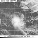
Severe Tropical Cyclone Inigo
A disturbance that had crossed the islands of IndonesiaIndonesia
Indonesia , officially the Republic of Indonesia , is a country in Southeast Asia and Oceania. Indonesia is an archipelago comprising approximately 13,000 islands. It has 33 provinces with over 238 million people, and is the world's fourth most populous country. Indonesia is a republic, with an...
organized and was named Inigo on 2 April. In a favourable environment, Inigo rapidly intensified and became a Category-5 equivalent with a central pressure of 900 mb. It moved slowly southwest and started recurving. Shear increased and dry air became entrapped into the cyclone. It weakened quickly, and by the time of its landfall is was of only depression strength. Inigo dissipated on 8 April.
No one was killed by Inigo when it was a named cyclone. However, the precursor disturbance caused heavy rains over parts of Indonesia. There were at least 50 deaths, with 100 people missing. In the Sikka District of Besar Island, the total damage was 3.3 million dollars (USD). Over 1300 homes were destroyed, and 4800 were damaged. In East Flores, there was major damage to infrastructure. In many locations, crops and cattle
Cattle
Cattle are the most common type of large domesticated ungulates. They are a prominent modern member of the subfamily Bovinae, are the most widespread species of the genus Bos, and are most commonly classified collectively as Bos primigenius...
were swept away.
Tropical Cyclone Epi
Formed on 5 June and dissipated before 7 June. Epi formed within Port MoresbyPort Moresby
Port Moresby , or Pot Mosbi in Tok Pisin, is the capital and largest city of Papua New Guinea . It is located on the shores of the Gulf of Papua, on the southeastern coast of the island of New Guinea, which made it a prime objective for conquest by the Imperial Japanese forces during 1942–43...
's area of responsibility just one year after Cyclone Upia was named in May 2002. Tropical cyclones forming in this region are rare. Since 1993, only two other cyclones were named by Papua New Guinea
Papua New Guinea
Papua New Guinea , officially the Independent State of Papua New Guinea, is a country in Oceania, occupying the eastern half of the island of New Guinea and numerous offshore islands...
.
Storm names
Tropical cyclones are assigned names by the Australian Bureau of Meteorology or Papua New GuineaPapua New Guinea
Papua New Guinea , officially the Independent State of Papua New Guinea, is a country in Oceania, occupying the eastern half of the island of New Guinea and numerous offshore islands...
.
Tropical cyclones are named if they are non-frontal low pressure systems of synoptic scale
Synoptic scale meteorology
The synoptic scale in meteorology is a horizontal length scale of the order of 1000 kilometres or more. This corresponds to a horizontal scale typical of mid-latitude depressions...
developing over warm waters, or Dvorak
Dvorak technique
The Dvorak technique is a widely used system to subjectively estimate tropical cyclone intensity based solely on visible and infrared satellite images. Several agencies issue Dvorak intensity numbers for cyclones of sufficient intensity...
intensity analysis indicate the presence of gale force
Beaufort scale
The Beaufort Scale is an empirical measure that relates wind speed to observed conditions at sea or on land. Its full name is the Beaufort Wind Force Scale.-History:...
or stronger winds near the centre. Therefore, a tropical system with gales in one or more quadrants, but not near the centre, are not named.
All names assigned in the Australian region are used sequentially, unlike lists used annually by the National Hurricane Centre in the Atlantic Ocean
Atlantic Ocean
The Atlantic Ocean is the second-largest of the world's oceanic divisions. With a total area of about , it covers approximately 20% of the Earth's surface and about 26% of its water surface area...
and east Pacific Ocean
Pacific Ocean
The Pacific Ocean is the largest of the Earth's oceanic divisions. It extends from the Arctic in the north to the Southern Ocean in the south, bounded by Asia and Australia in the west, and the Americas in the east.At 165.2 million square kilometres in area, this largest division of the World...
. Only the names used during this cyclone season are listed below. The complete list of names for each basin are found in the World Meteorological Organization
World Meteorological Organization
The World Meteorological Organization is an intergovernmental organization with a membership of 189 Member States and Territories. It originated from the International Meteorological Organization , which was founded in 1873...
's official list.
Southeast Indian Ocean
Tropical cyclones that develop east of 90°E90th meridian east
The meridian 90° east of Greenwich is a line of longitude that extends from the North Pole across the Arctic Ocean, Asia, the Indian Ocean, the Southern Ocean, and Antarctica to the South Pole.The Ninety East Ridge is named after the meridian....
, south of the Equator
Equator
An equator is the intersection of a sphere's surface with the plane perpendicular to the sphere's axis of rotation and containing the sphere's center of mass....
, and west of 125°E
125th meridian east
The meridian 125° east of Greenwich is a line of longitude that extends from the North Pole across the Arctic Ocean, Asia, Australia, the Indian Ocean, the Southern Ocean, and Antarctica to the South Pole....
are assigned names by the Tropical Cyclone Warning Centre in Perth
Perth, Western Australia
Perth is the capital and largest city of the Australian state of Western Australia and the fourth most populous city in Australia. The Perth metropolitan area has an estimated population of almost 1,700,000....
, Western Australia
Western Australia
Western Australia is a state of Australia, occupying the entire western third of the Australian continent. It is bounded by the Indian Ocean to the north and west, the Great Australian Bight and Indian Ocean to the south, the Northern Territory to the north-east and South Australia to the south-east...
.
- Fiona
- Graham
- Harriet
- InigoCyclone InigoCyclone Inigo was tied for the most intense recorded cyclone in the Australian region. It developed from a tropical low that crossed eastern Indonesia in late March 2003. Becoming a named tropical cyclone on 1 April, Inigo rapidly intensified as it tracked southwestward, reaching a minimum central...
Arafura Sea and Western Gulf of Carpentaria
Tropical cyclones that develop south of the Equator between 125°E125th meridian east
The meridian 125° east of Greenwich is a line of longitude that extends from the North Pole across the Arctic Ocean, Asia, Australia, the Indian Ocean, the Southern Ocean, and Antarctica to the South Pole....
and 141°E
141st meridian east
The 141st meridian east of Greenwich is a line of longitude that extends extends from the North Pole across the Arctic Ocean, Asia, the Pacific Ocean, Australasia, the Indian Ocean, the Southern Ocean, and Antarctica to the South Pole....
are assigned names by the Tropical Cyclone Warning Centre in Darwin
Darwin, Northern Territory
Darwin is the capital city of the Northern Territory, Australia. Situated on the Timor Sea, Darwin has a population of 127,500, making it by far the largest and most populated city in the sparsely populated Northern Territory, but the least populous of all Australia's capital cities...
, Northern Territory
Northern Territory
The Northern Territory is a federal territory of Australia, occupying much of the centre of the mainland continent, as well as the central northern regions...
.
- Craig
Coral Sea and Eastern Gulf of Carpentaria
Tropical cyclones that develop south of 10°S10th parallel south
The 10th parallel south is a circle of latitude that is 10 degrees south of the Earth's equatorial plane. It crosses the Atlantic Ocean, Africa, the Indian Ocean, Australasia, the Pacific Ocean and South America....
between 141°E
141st meridian east
The 141st meridian east of Greenwich is a line of longitude that extends extends from the North Pole across the Arctic Ocean, Asia, the Pacific Ocean, Australasia, the Indian Ocean, the Southern Ocean, and Antarctica to the South Pole....
and 160°E
160th meridian east
The meridian 160° east of Greenwich is a line of longitude that extends from the North Pole across the Arctic Ocean, Asia, the Pacific Ocean, the Southern Ocean, and Antarctica to the South Pole....
are assigned names by the Tropical Cyclone Warning Centre in Brisbane
Brisbane
Brisbane is the capital and most populous city in the Australian state of Queensland and the third most populous city in Australia. Brisbane's metropolitan area has a population of over 2 million, and the South East Queensland urban conurbation, centred around Brisbane, encompasses a population of...
, Queensland
Queensland
Queensland is a state of Australia, occupying the north-eastern section of the mainland continent. It is bordered by the Northern Territory, South Australia and New South Wales to the west, south-west and south respectively. To the east, Queensland is bordered by the Coral Sea and Pacific Ocean...
.
- Erica
Solomon Sea and Gulf of Papua
Tropical cyclones that develop north of 10°S10th parallel south
The 10th parallel south is a circle of latitude that is 10 degrees south of the Earth's equatorial plane. It crosses the Atlantic Ocean, Africa, the Indian Ocean, Australasia, the Pacific Ocean and South America....
between 141°E
141st meridian east
The 141st meridian east of Greenwich is a line of longitude that extends extends from the North Pole across the Arctic Ocean, Asia, the Pacific Ocean, Australasia, the Indian Ocean, the Southern Ocean, and Antarctica to the South Pole....
and 160°E
160th meridian east
The meridian 160° east of Greenwich is a line of longitude that extends from the North Pole across the Arctic Ocean, Asia, the Pacific Ocean, the Southern Ocean, and Antarctica to the South Pole....
are assigned names by the Tropical Cyclone Warning Centre in Port Moresby
Port Moresby
Port Moresby , or Pot Mosbi in Tok Pisin, is the capital and largest city of Papua New Guinea . It is located on the shores of the Gulf of Papua, on the southeastern coast of the island of New Guinea, which made it a prime objective for conquest by the Imperial Japanese forces during 1942–43...
, Papua New Guinea
Papua New Guinea
Papua New Guinea , officially the Independent State of Papua New Guinea, is a country in Oceania, occupying the eastern half of the island of New Guinea and numerous offshore islands...
.
- Epi
See also
- List of Southern Hemisphere tropical cyclone seasons
- Atlantic hurricane seasons: 20022002 Atlantic hurricane seasonThe 2002 Atlantic hurricane season was an average Atlantic hurricane season, officially starting on June 1, 2002 and ending on November 30, dates which conventionally limit the period of each year when tropical cyclones in the Atlantic Ocean tend to form...
, 20032003 Atlantic hurricane seasonThe 2003 Atlantic hurricane season was an active Atlantic hurricane season with tropical activity before and after the official bounds of the season – the first such occurrence in 50 years. The season produced 21 tropical cyclones, of which 16 developed into named storms; seven... - Pacific hurricane seasons: 20022002 Pacific hurricane seasonThe 2002 Pacific hurricane season was an event in tropical cyclone meteorology. The most notable storm that year was Hurricane Kenna, which reached Category 5 on the Saffir-Simpson Hurricane Scale. It made landfall near Puerto Vallarta, in the Mexican state of Jalisco, on October 25...
, 20032003 Pacific hurricane seasonThe 2003 Pacific hurricane season produced an unusually large number of tropical cyclones which affected Mexico. The most notable cyclones the year were Hurricanes Ignacio and Marty, which killed 2 and 12 people in Mexico, respectively, and were collectively responsible for about... - Pacific typhoon seasons: 20022002 Pacific typhoon seasonA Tropical Cyclone Formation Alert was issued on July 19 for a Tropical Disturbance that was located east of the international Date Line. The Next day the Disturbance crossed the international date line and was classified as a Tropical Depression by the JMA. The JMA then upgraded the depression to...
, 20032003 Pacific typhoon seasonThe 2003 Pacific typhoon season has no official bounds; it ran year-round in 2003, but most tropical cyclones tend to form in the northwestern Pacific Ocean between May and November... - North Indian Ocean cyclone seasons: 20022002 North Indian Ocean cyclone seasonThe 2002 North Indian Ocean cyclone season had no bounds, but cyclones tend to form between April and December, with peaks in May and November. These dates conventionally delimit the period of each year when most tropical cyclones form in the northern Indian Ocean.-Season summary:Four tropical...
, 20032003 North Indian Ocean cyclone seasonThe 2003 North Indian Ocean cyclone season had no bounds, but cyclones tend to form between April and December, with peaks in May and November. These dates conventionally delimit the period of each year when most tropical cyclones form in the northern Indian Ocean.-Season summary:Three tropical...