
100 Soundscapes of Japan
Encyclopedia
In 1996, as part of its efforts to combat noise pollution
and to protect and promote the environment, the Ministry of the Environment
designated the . 738 submissions were received from all over the country and the 100 'best' were selected after examination by the Japan Soundscape Study Group. These soundscapes
are intended to function as symbols for local people and to promote the rediscovery of the sounds of everyday life. The follow-up Sixth National Assembly on Soundscape Conservation was held in Matsuyama in 2002.
Noise pollution
Noise pollution is excessive, displeasing human, animal or machine-created environmental noise that disrupts the activity or balance of human or animal life...
and to protect and promote the environment, the Ministry of the Environment
Ministry of the Environment (Japan)
The ' of Japan was formed in 2001 from the sub-cabinet level Environmental Agency established in 1971. The minister is a member of the Cabinet and is chosen by the Prime Minister, usually from the Diet., the current is Goshi Hosono...
designated the . 738 submissions were received from all over the country and the 100 'best' were selected after examination by the Japan Soundscape Study Group. These soundscapes
Soundscape
A soundscape is a sound or combination of sounds that forms or arises from an immersive environment. The study of soundscape is the subject of acoustic ecology...
are intended to function as symbols for local people and to promote the rediscovery of the sounds of everyday life. The follow-up Sixth National Assembly on Soundscape Conservation was held in Matsuyama in 2002.
| Soundscape | Category | Location | Prefecture | Image | Sound |
|---|---|---|---|---|---|
| Sea | Sea of Okhotsk Sea of Okhotsk The Sea of Okhotsk is a marginal sea of the western Pacific Ocean, lying between the Kamchatka Peninsula on the east, the Kuril Islands on the southeast, the island of Hokkaidō to the far south, the island of Sakhalin along the west, and a long stretch of eastern Siberian coast along the west and... shore |
Hokkaidō Hokkaido , formerly known as Ezo, Yezo, Yeso, or Yesso, is Japan's second largest island; it is also the largest and northernmost of Japan's 47 prefectural-level subdivisions. The Tsugaru Strait separates Hokkaido from Honshu, although the two islands are connected by the underwater railway Seikan Tunnel... |
|||
| Bells | Sapporo | Hokkaidō Hokkaido , formerly known as Ezo, Yezo, Yeso, or Yesso, is Japan's second largest island; it is also the largest and northernmost of Japan's 47 prefectural-level subdivisions. The Tsugaru Strait separates Hokkaido from Honshu, although the two islands are connected by the underwater railway Seikan Tunnel... |
 |
||
| Bells | Hakodate | Hokkaidō Hokkaido , formerly known as Ezo, Yezo, Yeso, or Yesso, is Japan's second largest island; it is also the largest and northernmost of Japan's 47 prefectural-level subdivisions. The Tsugaru Strait separates Hokkaido from Honshu, although the two islands are connected by the underwater railway Seikan Tunnel... |
|||
| Wildlife | Higashikawa Higashikawa, Hokkaido is a town located in Kamikawa District, Kamikawa, Hokkaidō, Japan.As of 2007, the town has an estimated population of 7,740 and a density of 31.39 persons per km²... |
Hokkaidō Hokkaido , formerly known as Ezo, Yezo, Yeso, or Yesso, is Japan's second largest island; it is also the largest and northernmost of Japan's 47 prefectural-level subdivisions. The Tsugaru Strait separates Hokkaido from Honshu, although the two islands are connected by the underwater railway Seikan Tunnel... |
|||
| Birds | Tsurui Tsurui, Hokkaido is a village located in Akan District, Kushiro Subprefecture, Hokkaidō. As of December 31, 2007 it has an estimated population of 2,596 and an area of 571.84 km².Tsurui is a breeding ground for the Red-crowned Crane, one of the 100 Soundscapes of Japan.... |
Hokkaidō Hokkaido , formerly known as Ezo, Yezo, Yeso, or Yesso, is Japan's second largest island; it is also the largest and northernmost of Japan's 47 prefectural-level subdivisions. The Tsugaru Strait separates Hokkaido from Honshu, although the two islands are connected by the underwater railway Seikan Tunnel... |
|||
| Birds | Hachinohe Hachinohe, Aomori - Neighbouring municipalities :Aomori Prefecture*Sannohe District**Hashikami**Gonohe**Nanbu*Kamikita District**OiraseIwate Prefecture*Karumai-History:... |
Aomori Prefecture Aomori Prefecture is a prefecture of Japan located in the Tōhoku Region. The capital is the city of Aomori.- History :Until the Meiji Restoration, the area of Aomori prefecture was known as Mutsu Province.... |
|||
| Birds | Misawa Misawa, Aomori is a city located in eastern Aomori Prefecture in the Tōhoku region of Japan. As of 2009, the city had an estimated population of 42,399 and a density of 353 persons per km²... |
Aomori Prefecture Aomori Prefecture is a prefecture of Japan located in the Tōhoku Region. The capital is the city of Aomori.- History :Until the Meiji Restoration, the area of Aomori prefecture was known as Mutsu Province.... |
|||
| Water | Towadako Towadako, Aomori was a town located in Kamikita District in central Aomori Prefecture, Japan.Hōosawa Village was founded in 1889 from the merger of the hamlets of Hōryō, Oirase, and Sawada. It changed its name to Towada Village in 1931 and was elevated to town status in 1955. In April 1975, it changed its name to... |
Aomori Prefecture Aomori Prefecture is a prefecture of Japan located in the Tōhoku Region. The capital is the city of Aomori.- History :Until the Meiji Restoration, the area of Aomori prefecture was known as Mutsu Province.... |
|||
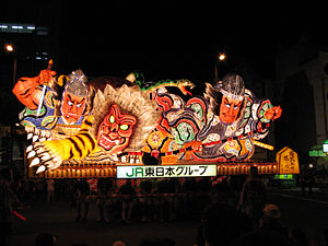
| Matsuri | Aomori Aomori, Aomori is the capital city of Aomori Prefecture, in the northern Tōhoku region of Japan. As of 2009, the city had an estimated population of 302,068 and a density of 366 persons per km². Its total area was 824.52 km².- History :... /Hirosaki Hirosaki, Aomori is a city located in southwest Aomori Prefecture, Japan. It is a castle town and was the Tsugaru clan ruled the 100,000 koku tozama han Hirosaki Domain from Hirosaki Castle during the Edo period. The city is currently a regional commercial center and the largest producer of apples in Japan... |
Aomori Prefecture Aomori Prefecture is a prefecture of Japan located in the Tōhoku Region. The capital is the city of Aomori.- History :Until the Meiji Restoration, the area of Aomori prefecture was known as Mutsu Province.... |
 |
||
| Sea | Ōfunato Ofunato, Iwate is a coastal city located in Iwate, Japan.It was founded on April 1, 1952.On November 15, 2001, the town of Sanriku, from Kesen District, was merged into Ōfunato.... |
Iwate Prefecture Iwate Prefecture is the second largest prefecture of Japan after Hokkaido. It is located in the Tōhoku region of Honshū island and contains the island's easternmost point. The capital is Morioka. Iwate has the lowest population density of any prefecture outside Hokkaido... |
|||
| Local life | Ōshū Oshu, Iwate is the second largest city in Iwate Prefecture, Japan with a population of 127,804.The city was founded on February 20, 2006, as the result of a merger between the cities of Esashi and Mizusawa, the towns of Maesawa and Isawa and the village of Koromogawa from Isawa District... |
Iwate Prefecture Iwate Prefecture is the second largest prefecture of Japan after Hokkaido. It is located in the Tōhoku region of Honshū island and contains the island's easternmost point. The capital is Morioka. Iwate has the lowest population density of any prefecture outside Hokkaido... |
|||
| Matsuri | Takizawa Takizawa, Iwate is a village located in Iwate District, Iwate, Japan., the village has an estimated population of 52,981 and a density of 290.59 persons per km². The total area is 182.32 km².... |
Iwate Prefecture Iwate Prefecture is the second largest prefecture of Japan after Hokkaido. It is located in the Tōhoku region of Honshū island and contains the island's easternmost point. The capital is Morioka. Iwate has the lowest population density of any prefecture outside Hokkaido... |
|||
| Insects | Sendai | Miyagi Prefecture Miyagi Prefecture is a prefecture of Japan in the Tōhoku Region on Honshu island. The capital is Sendai.- History :Miyagi Prefecture was formerly part of the province of Mutsu. Mutsu Province, on northern Honshu, was one of the last provinces to be formed as land was taken from the indigenous Emishi, and became the... |
|||
| Wildlife/Birds | Sendai | Miyagi Prefecture Miyagi Prefecture is a prefecture of Japan in the Tōhoku Region on Honshu island. The capital is Sendai.- History :Miyagi Prefecture was formerly part of the province of Mutsu. Mutsu Province, on northern Honshu, was one of the last provinces to be formed as land was taken from the indigenous Emishi, and became the... |
 |
||
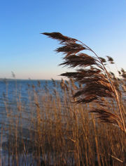
| Vegetation | Ishinomaki Ishinomaki, Miyagi is a city located in Miyagi Prefecture, Japan.As of January 1, 2010, the city had an estimated population of 164,294 and a population density of 295.83 persons per km²... |
Miyagi Prefecture Miyagi Prefecture is a prefecture of Japan in the Tōhoku Region on Honshu island. The capital is Sendai.- History :Miyagi Prefecture was formerly part of the province of Mutsu. Mutsu Province, on northern Honshu, was one of the last provinces to be formed as land was taken from the indigenous Emishi, and became the... |
 |
||
| Birds | Kurikoma Kurikoma, Miyagi was a town in Kurihara District, Miyagi, Japan. Established in 1955 with the consolidation of six municipalities, it was abolished in a merger forming the larger Kurihara City in 2005. The municipal area was 244.36 km² and the population was 13,736 in 2005.... /Wakayanagi Wakayanagi, Miyagi was a town located in Kurihara District, Miyagi, Japan.On April 1, 2005, Wakayanagi was merged with the towns of Ichihasama, Kannari, Kurikoma, Semine, Shiwahime, Takashimizu, Tsukidate and Uguisuzawa, and the village of Hanayama, all from Kurihara District, to form the new city of Kurihara.In... /Hasama |
Miyagi Prefecture Miyagi Prefecture is a prefecture of Japan in the Tōhoku Region on Honshu island. The capital is Sendai.- History :Miyagi Prefecture was formerly part of the province of Mutsu. Mutsu Province, on northern Honshu, was one of the last provinces to be formed as land was taken from the indigenous Emishi, and became the... |
 |
||
| Vegetation | Noshiro Noshiro, Akita is a city located in Akita, Japan.The city is known within Japan for the basketball team of . The city merged with the town of Futatsui on March 21, 2006 to become the new city of Noshiro. Noshiro was the site in 770 AD where Imperial Navies arrived and established Japan's first settlement in Oshu... |
Akita Prefecture Akita Prefecture is a prefecture of Japan located in the Tōhoku Region of northern Honshu, the main island of Japan. The capital is the city of Akita.- History :The area of Akita has been created from the ancient provinces of Dewa and Mutsu.... |
|||
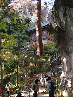
| Insects | Yamagata Yamagata, Yamagata is the capital city of Yamagata Prefecture in Japan.As of July 1, 2011, the city has an estimated population of 253,951 with 97,457 households and a population density of 665.94 persons per km². The total area is 381.34 km². The city was founded on April 1, 1889.-Culture:The , one of Tōhoku's... |
Yamagata Prefecture Yamagata Prefecture -Fruit:Yamagata Prefecture is the largest producer of cherries and pears in Japan. A large quantity of other kinds of fruits such as grapes, apples, peaches, melons, persimmons and watermelons are also produced.- Demographics :... |
 |
||
| Matsuri | Tsuruoka Tsuruoka, Yamagata is a city located in the Shonai region of Yamagata Prefecture, Japan.Tsuruoka is the second largest city in Yamagata Prefecture after Yamagata City... |
Yamagata Prefecture Yamagata Prefecture -Fruit:Yamagata Prefecture is the largest producer of cherries and pears in Japan. A large quantity of other kinds of fruits such as grapes, apples, peaches, melons, persimmons and watermelons are also produced.- Demographics :... |
|||
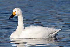
| Birds | Sakata Sakata, Yamagata is a city located in Yamagata Prefecture, Japan.As of 2006, the city has an estimated population of 116,883 and the population density of 193.92 persons per km². The total area is 602.74 km².-History:The city was founded on April 1, 1933... |
Yamagata Prefecture Yamagata Prefecture -Fruit:Yamagata Prefecture is the largest producer of cherries and pears in Japan. A large quantity of other kinds of fruits such as grapes, apples, peaches, melons, persimmons and watermelons are also produced.- Demographics :... |
 |
||
| Birds | Fukushima Fukushima, Fukushima is the capital city of Fukushima Prefecture in the Tōhoku Region of Japan. As of May 2011 the city has an estimated population of 290,064 and an area of 746.43 km².It lies about 250 km north of Tokyo and 80 km south of Sendai.-History:... |
Fukushima Prefecture Fukushima Prefecture is a prefecture of Japan located in the Tōhoku region on the island of Honshu. The capital is the city of Fukushima.-History:Until the Meiji Restoration, the area of Fukushima prefecture was known as Mutsu Province.... |
|||
| Water | Shimogō | Fukushima Prefecture Fukushima Prefecture is a prefecture of Japan located in the Tōhoku region on the island of Honshu. The capital is the city of Fukushima.-History:Until the Meiji Restoration, the area of Fukushima prefecture was known as Mutsu Province.... |
 |
||
| Transport/Industry | Shōwa Showa, Fukushima is a village located in Ōnuma District, Fukushima, Japan.As of 2003, the village has an estimated population of 1,701 and a density of 8.13 persons per km². The total area is 209.34 km².-External links:*... |
Fukushima Prefecture Fukushima Prefecture is a prefecture of Japan located in the Tōhoku region on the island of Honshu. The capital is the city of Fukushima.-History:Until the Meiji Restoration, the area of Fukushima prefecture was known as Mutsu Province.... |
|||
| Sea | Kita-ibaraki | Ibaraki Prefecture Ibaraki Prefecture is a prefecture of Japan, located in the Kantō region on the main island of Honshu. The capital is Mito.-History:Ibaraki Prefecture was previously known as Hitachi Province... |
|||
| Frogs | Tochigi Tochigi, Tochigi is a city located in Tochigi Prefecture, Japan. Despite its name, it is not the capital of Tochigi Prefecture; the capital is Utsunomiya.The city took its current form on March 29, 2010 when the old city of Tochigi merged with the towns of Fujioka, Ōhira and Tsuga from Shimotsuga District to form... |
Tochigi Prefecture Tochigi Prefecture is a prefecture located in the Kantō region on the island of Honshū, Japan. The capital is the city of Utsunomiya.Nikkō, whose ancient Shintō shrines and Buddhist temples UNESCO has recognized by naming them a World Heritage Site, is in this prefecture... |
 |
||
| Daily life | Yoshii Yoshii, Gunma was a town located in Tano District, Gunma, Japan.As of September 1, 2007, the town had an estimated population of 24,758 and a density of 424.30 persons per km². The total area was 58.35 km².-Geography:... |
Gunma Prefecture Gunma Prefecture is a prefecture of Japan located in the northwest corner of the Kantō region on Honshu island. Its capital is Maebashi.- History :The remains of a Paleolithic man were found at Iwajuku, Gunma Prefecture, in the early 20th century and there is a public museum there.Japan was without horses until... |
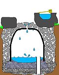 |
||
| Insects | Kawagoe Kawagoe, Saitama is a city located in Saitama Prefecture, Japan, and is about a 30-minute train ride from Ikebukuro in Tokyo.As of July 1, 2011, the city has an estimated population of 343,926... |
Saitama Prefecture Saitama Prefecture is a prefecture of Japan located in the Kantō region of the island of Honshu. The capital is the city of Saitama.This prefecture is part of the Greater Tokyo Area, and most of Saitama's cities can be described as suburbs of Tokyo, to which a large amount of residents commute each day.- History... |
|||
| Insects | Kumagaya Kumagaya, Saitama is a city in Saitama Prefecture, Japan.As of 2010, the city has an estimated population of 203,089 . The total area is 159.88 km². The city is one of the biggest in northern Saitama Prefecture. It is the administrative, business and commercial centre in northern Saitama Prefecture. Eight... (Kōnan Konan, Saitama was a town located in Ōsato District, Saitama, Japan.As of 2003, the town had an estimated population of 13,826 and a density of 605.08 persons per km². The total area is 22.34 km².... ) |
Saitama Prefecture Saitama Prefecture is a prefecture of Japan located in the Kantō region of the island of Honshu. The capital is the city of Saitama.This prefecture is part of the Greater Tokyo Area, and most of Saitama's cities can be described as suburbs of Tokyo, to which a large amount of residents commute each day.- History... |
|||
| Water | Katori Katori, Chiba is a city located in northern Chiba, Japan. As of February 2011, the city had an estimated population of 82,633 and a population density of 315 persons per km². The total area was 262.31 km²... (Sawara Sawara, Chiba was a city located in Katori District, Chiba Prefecture, Japan.Sawara has been settled since prehistoric times, and has numerous remains of Jōmon period shell middens and Kofun period burial mounds... ) |
Chiba Prefecture Chiba Prefecture is a prefecture of Japan located in the Kantō region and the Greater Tokyo Area. Its capital is Chiba City.- History :Chiba Prefecture was established on June 15, 1873 with the merger of Kisarazu Prefecture and Inba Prefecture... |
|||
| Insects | Ōtaki Otaki, Chiba is a town located in Isumi District, Chiba, Japan, occupying the center of the Bōsō Peninsula. The town is known for its association with Edo period general Honda Tadakatsu and its prominent castle. As of 2010, the town had an estimated population of 10,794 and a population density of 83.1 persons... |
Chiba Prefecture Chiba Prefecture is a prefecture of Japan located in the Kantō region and the Greater Tokyo Area. Its capital is Chiba City.- History :Chiba Prefecture was established on June 15, 1873 with the merger of Kisarazu Prefecture and Inba Prefecture... |
|||
| Complex | Matsudo Matsudo, Chiba is a city located in northern Chiba Prefecture, Japan. As of February 2011, the city had an estimated population of 484,578 and a population density of 7900 persons per km²... /Katsushika Katsushika, Tokyo is one of the special wards of Tokyo, Japan. It lies in the northeast of the ward area. The ward calls itself Katsushika City in English.As of 2008, the ward has an estimated population of 429,289 and a density of 12,600 people per km²... |
Chiba Prefecture Chiba Prefecture is a prefecture of Japan located in the Kantō region and the Greater Tokyo Area. Its capital is Chiba City.- History :Chiba Prefecture was established on June 15, 1873 with the merger of Kisarazu Prefecture and Inba Prefecture... /Tokyo Tokyo , ; officially , is one of the 47 prefectures of Japan. Tokyo is the capital of Japan, the center of the Greater Tokyo Area, and the largest metropolitan area of Japan. It is the seat of the Japanese government and the Imperial Palace, and the home of the Japanese Imperial Family... |
|||
| Bells | Taitō Taito, Tokyo is one of the 23 special wards of Tokyo, Japan. In English, it calls itself Taito City.As of April 1, 2011, the ward has an estimated population of 168,909, with 94,908 households, and a population density of 16,745.86 persons per km². The total area is 10.08 km².-History:The ward was founded... |
Tokyo Tokyo , ; officially , is one of the 47 prefectures of Japan. Tokyo is the capital of Japan, the center of the Greater Tokyo Area, and the largest metropolitan area of Japan. It is the seat of the Japanese government and the Imperial Palace, and the home of the Japanese Imperial Family... |
|||
| Birds/Water/Vegetation | Nerima Nerima, Tokyo is one of the 23 special wards of Tokyo, Japan. In English, it calls itself Nerima City.As of August 1, 2007, the ward has an estimated population of 703,005 , and a density of 14,443 persons per km². 12,897 foreign residents are registered in the ward. 18.4% of the ward's population is over the... |
Tokyo Tokyo , ; officially , is one of the 47 prefectures of Japan. Tokyo is the capital of Japan, the center of the Greater Tokyo Area, and the largest metropolitan area of Japan. It is the seat of the Japanese government and the Imperial Palace, and the home of the Japanese Imperial Family... |
|||
| Vegetation | Musashino Musashino, Tokyo is a city located in Tokyo, Japan.As of October 1, 2010, the city has an estimated population of 137,222 and a population density of 12,788.63 persons per km². The total area is 10.73 km².The city was founded on November 3, 1947... |
Tokyo Tokyo , ; officially , is one of the 47 prefectures of Japan. Tokyo is the capital of Japan, the center of the Greater Tokyo Area, and the largest metropolitan area of Japan. It is the seat of the Japanese government and the Imperial Palace, and the home of the Japanese Imperial Family... |
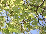 |
||
| Local life | Yokohama Yokohama is the capital city of Kanagawa Prefecture and the second largest city in Japan by population after Tokyo and most populous municipality of Japan. It lies on Tokyo Bay, south of Tokyo, in the Kantō region of the main island of Honshu... |
Kanagawa Prefecture Kanagawa Prefecture is a prefecture located in the southern Kantō region of Japan. The capital is Yokohama. Kanagawa is part of the Greater Tokyo Area.-History:The prefecture has some archaeological sites going back to the Jōmon period... |
|||
| Local life | Kawasaki Kawasaki, Kanagawa is a city located in Kanagawa Prefecture, Japan, between Tokyo and Yokohama. It is the 9th most populated city in Japan and one of the main cities forming the Greater Tokyo Area and Keihin Industrial Area.... |
Kanagawa Prefecture Kanagawa Prefecture is a prefecture located in the southern Kantō region of Japan. The capital is Yokohama. Kanagawa is part of the Greater Tokyo Area.-History:The prefecture has some archaeological sites going back to the Jōmon period... |
|||
| Water/Birds | Sagamihara | Kanagawa Prefecture Kanagawa Prefecture is a prefecture located in the southern Kantō region of Japan. The capital is Yokohama. Kanagawa is part of the Greater Tokyo Area.-History:The prefecture has some archaeological sites going back to the Jōmon period... |
|||
| Birds | Niigata (Toyosaka Toyosaka, Niigata Toyosaka was a city located in Niigata, Japan.As of 2003, the city had an estimated population of 49,159 and the density of 639.67 persons per km². The total area was 76.85 km².The city was founded on November 1, 1970... ) |
Niigata Prefecture Niigata Prefecture is a prefecture of Japan located on the island of Honshū on the coast of the Sea of Japan. The capital is the city of Niigata. The name "Niigata" literally means "new lagoon".- History :... |
|||
| Insects | Itoigawa Itoigawa, Niigata is a city located in rustic southern Niigata Prefecture, Japan.As of 2008, the city has an estimated population of 48,653 and the density of 65.2 persons per km². The total area is 746.24 km².The city was founded on June 1, 1954... (Nō) |
Niigata Prefecture Niigata Prefecture is a prefecture of Japan located on the island of Honshū on the coast of the Sea of Japan. The capital is the city of Niigata. The name "Niigata" literally means "new lagoon".- History :... |
|||
| Waterfalls | Tateyama Tateyama, Toyama is a town located in Nakaniikawa District, Toyama, Japan.As of 2003, the town has an estimated population of 28,123 and a density of 91.51 persons per km². The total area is 307.31 km².-External links:*... |
Toyama Prefecture Toyama Prefecture is a prefecture of Japan located in the Hokuriku region on Honshū island. The capital is the city of Toyama.Toyama is the leading industrial prefecture on the Japan Sea coast, and has the industrial advantage of cheap electricity due to abundant water resources.... |
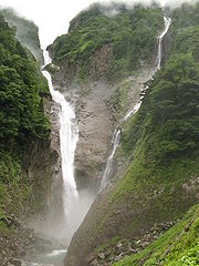 |
||
| Matsuri | Toyama Toyama, Toyama is the capital city of Toyama Prefecture, Japan, located on the coast of the Sea of Japan in the Chūbu region on central Honshū, about 200 km north of the city of Nagoya and 300 km northwest of Tokyo.... (Yatsuo Yatsuo, Toyama was a town located in Nei District, Toyama, Japan. It is famous for Owara Kaze no bon festival.On April 1, 2005 Yatsuo, along with the towns of Ōsawano and Ōyama, both from Kaminiikawa District, the town of Fuchū, and the villages of Hosoiri and Yamada, all from Nei District, was merged into the... ) |
Toyama Prefecture Toyama Prefecture is a prefecture of Japan located in the Hokuriku region on Honshū island. The capital is the city of Toyama.Toyama is the leading industrial prefecture on the Japan Sea coast, and has the industrial advantage of cheap electricity due to abundant water resources.... |
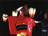 |
||
| Crafts | Nanto Nanto, Toyama is a city located in Toyama Prefecture, Japan.-History:As of 2000, 8 municipalities that merged into the city had an estimated total population of 60,182 with an average population density of 89.98 persons per km². The total area is 668.86 km²... (Inami Inami, Toyama Inami was a town located in Higashitonami District, Toyama, Japan.On November 1, 2004 Inami was merged with the towns of Fukuno and Jōhana, the villages of Inokuchi, Kamitaira, Taira and Toga, all from Higashitonami District, and the town of Fukumitsu, from Nishitonami District, to form the new... ) |
Toyama Prefecture Toyama Prefecture is a prefecture of Japan located in the Hokuriku region on Honshū island. The capital is the city of Toyama.Toyama is the leading industrial prefecture on the Japan Sea coast, and has the industrial advantage of cheap electricity due to abundant water resources.... |
|||
| Insects | Kanazawa Kanazawa, Ishikawa is the capital city of Ishikawa Prefecture, Japan.-Geography, climate, and population:Kanazawa sits on the Sea of Japan, bordered by the Japan Alps, Hakusan National Park and Noto Peninsula National Park. The city sits between the Sai and Asano rivers. Its total area is 467.77 km².Kanazawa's... |
Ishikawa Prefecture Ishikawa Prefecture is a prefecture of Japan located in the Chūbu region on Honshū island. The capital is Kanazawa.- History :Ishikawa was formed from the merger of Kaga Province and the smaller Noto Province.- Geography :Ishikawa is on the Sea of Japan coast... |
|||
| Bells | Kanazawa Kanazawa, Ishikawa is the capital city of Ishikawa Prefecture, Japan.-Geography, climate, and population:Kanazawa sits on the Sea of Japan, bordered by the Japan Alps, Hakusan National Park and Noto Peninsula National Park. The city sits between the Sai and Asano rivers. Its total area is 467.77 km².Kanazawa's... |
Ishikawa Prefecture Ishikawa Prefecture is a prefecture of Japan located in the Chūbu region on Honshū island. The capital is Kanazawa.- History :Ishikawa was formed from the merger of Kaga Province and the smaller Noto Province.- Geography :Ishikawa is on the Sea of Japan coast... |
|||
| Water | Echizen Echizen, Fukui is a city in Fukui, Japan.Echizen took its present form on October 1, 2005, when the city of Takefu and the town of Imadate merged to form the new city, although the Echizen Basin has been an important regional center for over 1,500 years. It has many former castle sites and prehistoric... (Takefu Takefu, Fukui was a city located in Fukui, Japan. The city was established on April 1, 1948.On October 1, 2005 Takefu was merged with the town of Imadate, from Imadate District, to form the new city of Echizen.... ) |
Fukui Prefecture Fukui Prefecture is a prefecture of Japan located in the Chūbu region on Honshū island. The capital is the city of Fukui.- Prehistory :The Kitadani Dinosaur Quarry, on the Sugiyama River within the city limits of Katsuyama, has yielded the Fukuiraptor kitadaniensis and Fukuisaurus tetoriensis as well as an unnamed... |
|||
| Birds | Fujikawaguchiko Fujikawaguchiko, Yamanashi is a town located in Minamitsuru District, Yamanashi Prefecture, Japan.As of September 1, 2011 the town has an estimated population of 26,084. The total area is 158.51 km².Lake Kawaguchi , one of the Fuji Five Lakes, features prominently.... |
Yamanashi Prefecture Yamanashi Prefecture is a prefecture of Japan located in the Chūbu region of the island of Honshū. The capital is the city of Kōfu.-Pre-history to the 14th century:People have been living in the Yamanashi area for about 30,000 years... |
|||
| Bells | Nagano Nagano, Nagano , the capital city of Nagano Prefecture, is located in the northern part of the prefecture near the confluence of the Chikuma and the Sai rivers, on the main Japanese island of Honshū.As of April 1, 2011 the city has a population of 387,146... |
Nagano Prefecture Nagano Prefecture is a prefecture of Japan located in the Chūbu region of the island of Honshū. The capital is the city of Nagano.- History :Nagano was formerly known as the province of Shinano... |
|||
| Birds | Okaya Okaya, Nagano is a city located in Nagano, Japan. It was founded on 1 April 1936.As of May 1, 2011, the city has an estimated population of 52,556, with 19,536 households and a population density of 616.93 persons per km²... /Shiojiri Shiojiri, Nagano is a city located in Nagano, Japan. Its name literally means "the end of salt".-History:Municipal Area Changes* April 1, 1927-The village of Shiojiri gained town status.... |
Nagano Prefecture Nagano Prefecture is a prefecture of Japan located in the Chūbu region of the island of Honshū. The capital is the city of Nagano.- History :Nagano was formerly known as the province of Shinano... |
|||
| Wildlife | Shimosuwa Shimosuwa, Nagano is a town located in Suwa District, Nagano, Japan. It is located on Lake Suwa, a large, natural lake surrounded by mountains.As of 2006, the town has an estimated population of 22,421. The total area is 66.90 km².... /Suwa Suwa, Nagano is a city located in Nagano, Japan.As of October 1, 2010, the city had an estimated population of 51,084 and a density of 468.40 persons per km². The total area of the city is 109.06 km².... |
Nagano Prefecture Nagano Prefecture is a prefecture of Japan located in the Chūbu region of the island of Honshū. The capital is the city of Nagano.- History :Nagano was formerly known as the province of Shinano... |
|||
| Local life | Mino Mino, Gifu is a city located in the Gifu Prefecture of central Japan.Founded on 1 April 1954, Mino covers a total area of 117.05 km². As of July 2011 the city had an estimated population of 22,447 inhabitants.... |
Gifu Prefecture Gifu Prefecture is a prefecture located in the Chūbu region of central Japan. Its capital is the city of Gifu.Located in the center of Japan, it has long played an important part as the crossroads of Japan, connecting the east to the west through such routes as the Nakasendō... |
|||
| Local life | Gujō Gujo, Gifu is a city in Gifu Prefecture, Japan.As of July 2011, the city has an estimated population of 43,960. The total area is 1,030.79 km².-History:... (Hachiman Hachiman, Gifu was a town located in Gifu Prefecture, Japan. The town belonged to Gujō District.The town is known as "Gujō Hachiman".- History :The town was established as a town in 1889, and Hachiman was merged with the towns of Shirotori and Yamato, and the villages of Meihō, Minami, Takasu and Wara to create... ) |
Gifu Prefecture Gifu Prefecture is a prefecture located in the Chūbu region of central Japan. Its capital is the city of Gifu.Located in the center of Japan, it has long played an important part as the crossroads of Japan, connecting the east to the west through such routes as the Nakasendō... |
|||
| Local life | Gifu Gifu, Gifu is a city located in the south-central portion of Gifu Prefecture, Japan, and serves as the prefectural capital. The city has played an important role in Japan's history because of its location in the middle of the country. During the Sengoku period, various warlords, including Oda Nobunaga, used... /Seki Seki, Gifu is a city located in Gifu, Japan.The city was founded on October 15, 1950.On February 7, 2005, the municipalities of Horado, Itadori, Kaminoho, Mugegawa and Mugi, all part of Mugi District, were merged into the present-day city... |
Gifu Prefecture Gifu Prefecture is a prefecture located in the Chūbu region of central Japan. Its capital is the city of Gifu.Located in the center of Japan, it has long played an important part as the crossroads of Japan, connecting the east to the west through such routes as the Nakasendō... |
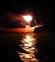 |
||
| Water | Enshunada Sea | Shizuoka Prefecture Shizuoka Prefecture is a prefecture of Japan located in the Chūbu region on Honshu island. The capital is the city of Shizuoka.- History :Shizuoka prefecture was formed from the former Tōtōmi, Suruga and Izu provinces.The area was the home of the first Tokugawa Shogun... |
|||
| Transport/Industry | Kawanehon Kawanehon, Shizuoka is a town located in Haibara District, Shizuoka, Japan. As of February 2010, the town has an estimated population of 8,253 and a density of 16.8persons per km². The total area was 496.72 km².-Geography:... (Honkawane Honkawane, Shizuoka was a town located in Haibara District, Shizuoka Prefecture, Japan.Kamikawane and Higashikawane were two of a series of villages established in Haibara District on October 1, 1889... ) |
Shizuoka Prefecture Shizuoka Prefecture is a prefecture of Japan located in the Chūbu region on Honshu island. The capital is the city of Shizuoka.- History :Shizuoka prefecture was formed from the former Tōtōmi, Suruga and Izu provinces.The area was the home of the first Tokugawa Shogun... |
|||
| Birds | Nagoya | Aichi Prefecture Aichi Prefecture is a prefecture of Japan located in the Chūbu region. The region of Aichi is also known as the Tōkai region. The capital is Nagoya. It is the focus of the Chūkyō Metropolitan Area.- History :... |
|||
| Sea | Tahara Tahara, Aichi is a city located in Aichi Prefecture, Japan. As of August 2011, the city had an estimated population of 63,886 and a population density of 338 persons per km². The total area was 188.81 km².-Geography:... (Atsumi Atsumi, Aichi is a former town located in Atsumi District, Aichi Prefecture, Japan. As of July 31, 2005, the town had an estimated population of 22,472 and a population density of 436.77 persons per km². Its total area was 82.18 km².-Geography:... ) |
Aichi Prefecture Aichi Prefecture is a prefecture of Japan located in the Chūbu region. The region of Aichi is also known as the Tōkai region. The capital is Nagoya. It is the focus of the Chūkyō Metropolitan Area.- History :... |
|||
| Local life | Toba Toba, Mie is a city in Mie, Japan.Toba is the site of the Toba Aquarium, which houses such animals as dugongs, African manatees, porpoises, and a wide-variety of aquatic life.... /Shima Shima, Mie is a city located in Mie Prefecture, on the island of Honshu, Japan.The city was formed on October 1, 2004, by the merger of all five towns from Shima District, which was dissolved by the merger.... |
Mie Prefecture Mie Prefecture is a prefecture of Japan which is part of the Kansai regions on Honshū island. The capital is the city of Tsu.- History :Until the Meiji Restoration, Mie prefecture was known as Ise Province and Iga Province.... |
 |
||
| Bells | Ōtsu Otsu, Shiga is the capital city of Shiga, Japan. The city was founded on October 1, 1898. As of October 1, 2010, the city has an estimated population of 338,629 with an average age of 40.7 years and a population density of 905.28 persons per km²... |
Shiga Prefecture Shiga Prefecture is a prefecture of Japan, which forms part of the Kansai region on Honshu Island. The capital is the city of Ōtsu.- History :Shiga was known as Ōmi Province or Gōshū before the prefectural system was established... |
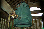 |
||
| Bells/Insects | Hikone Hikone, Shiga is a city located in Shiga, Japan. The city was incorporated on February 11, 1937.Hikone's most famous historical site is Hikone Castle. Its construction was begun in 1603, by Ii Naokatsu, son of the former lord, Ii Naomasa, but was not completed until 1622... |
Shiga Prefecture Shiga Prefecture is a prefecture of Japan, which forms part of the Kansai region on Honshu Island. The capital is the city of Ōtsu.- History :Shiga was known as Ōmi Province or Gōshū before the prefectural system was established... |
 |
||
| Vegetation | Kyoto Kyoto is a city in the central part of the island of Honshū, Japan. It has a population close to 1.5 million. Formerly the imperial capital of Japan, it is now the capital of Kyoto Prefecture, as well as a major part of the Osaka-Kobe-Kyoto metropolitan area.-History:... |
Kyoto Prefecture Kyoto Prefecture is a prefecture of Japan located in the Kansai region of the island of Honshu. The capital is the city of Kyoto.- History :Until the Meiji Restoration, the area of Kyoto prefecture was known as Yamashiro.... |
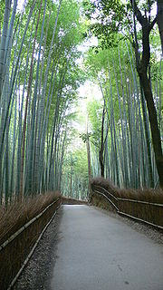 |
||
| Water | Nantan Nantan, Kyoto is a city located in Kyoto, Japan.As of May 1, 2008, the city has an estimated population of 35,424. The total area is 616.31 km².The city was founded on January 1, 2006 by the merger of the former towns of Sonobe, Yagi, Hiyoshi, and Miyama... (Sonobe Sonobe, Kyoto was a town located in Funai District, Kyoto, Japan.As of 2003, the town had an estimated population of 16,958 and a density of 164.99 persons per km². The total area was 102.78 km²... ) |
Kyoto Prefecture Kyoto Prefecture is a prefecture of Japan located in the Kansai region of the island of Honshu. The capital is the city of Kyoto.- History :Until the Meiji Restoration, the area of Kyoto prefecture was known as Yamashiro.... |
|||
| Singing sand Singing sand Singing sand, whistling sand or barking sand is sand that produces sound. The sound emission may be caused by wind passing over dunes or by walking on the sand.Certain conditions have to come together to create singing sand:... |
Kyōtango Kyotango, Kyoto is a city in Kyoto Prefecture, Japan. It was formed on April 1, 2004 by the merger of the towns of Mineyama and Omiya, both from Naka District,the towns of Amino, Tango and Yasaka, all from Takeno District, and the town of Kumihama, from Kumano District... (Amino) |
Kyoto Prefecture Kyoto Prefecture is a prefecture of Japan located in the Kansai region of the island of Honshu. The capital is the city of Kyoto.- History :Until the Meiji Restoration, the area of Kyoto prefecture was known as Yamashiro.... |
|||
| Insects | Osaka Osaka is a city in the Kansai region of Japan's main island of Honshu, a designated city under the Local Autonomy Law, the capital city of Osaka Prefecture and also the biggest part of Keihanshin area, which is represented by three major cities of Japan, Kyoto, Osaka and Kobe... |
Osaka Prefecture Osaka Prefecture is a prefecture located in the Kansai region on Honshū, the main island of Japan. The capital is the city of Osaka. It is the center of Osaka-Kobe-Kyoto area.- History :... |
|||
| Matsuri | Yao Yao, Osaka is a city in Osaka, Japan.As of 2009, the city has an estimated population of 271,454 and the density of 6,510 persons per km². The total area is 41.71 km².Yao is home to a general aviation airport, Yao Airport.The city was founded on April 1, 1948.... |
Osaka Prefecture Osaka Prefecture is a prefecture located in the Kansai region on Honshū, the main island of Japan. The capital is the city of Osaka. It is the center of Osaka-Kobe-Kyoto area.- History :... |
|||
| Local life | Kobe Kobe , pronounced , is the fifth-largest city in Japan and is the capital city of Hyōgo Prefecture on the southern side of the main island of Honshū, approximately west of Osaka... |
Hyōgo Prefecture Hyogo Prefecture is a prefecture of Japan located in the Kansai region on Honshū island. The capital is Kobe.The prefecture's name was previously alternately spelled as Hiogo.- History :... |
|||
| Matsuri | Himeji | Hyōgo Prefecture Hyogo Prefecture is a prefecture of Japan located in the Kansai region on Honshū island. The capital is Kobe.The prefecture's name was previously alternately spelled as Hiogo.- History :... |
|||
| Wildlife/Bells | Nara Nara, Nara is the capital city of Nara Prefecture in the Kansai region of Japan. The city occupies the northern part of Nara Prefecture, directly bordering Kyoto Prefecture... |
Nara Prefecture Nara Prefecture is a prefecture in the Kansai region on Honshū Island, Japan. The capital is the city of Nara.-History:The present-day Nara Prefecture was created in 1887, making it independent of Osaka Prefecture.... |
 |
||
| Water | Hashimoto Hashimoto, Wakayama is a city located in Wakayama Prefecture, Japan.The city was founded on January 1, 1955.On March 1, 2006 the town of Kōyaguchi, from Ito District, was merged into Hashimoto.... |
Wakayama Prefecture Wakayama Prefecture is a prefecture of Japan located on the Kii Peninsula in the Kansai region on Honshū island. The capital is the city of Wakayama.- History :Present-day Wakayama is mostly the western part of the province of Kii.- 1953 Wakayama Prefecture flood disaster :... |
|||
| Waterfalls | Nachikatsuura Nachikatsuura, Wakayama is a town located in Higashimuro District, Wakayama, Japan.As of 2003, the town has an estimated population of 18,795 and a density of 102.45 persons per km². The total area is 183.45 km².... |
Wakayama Prefecture Wakayama Prefecture is a prefecture of Japan located on the Kii Peninsula in the Kansai region on Honshū island. The capital is the city of Wakayama.- History :Present-day Wakayama is mostly the western part of the province of Kii.- 1953 Wakayama Prefecture flood disaster :... |
|||
| Birds | Yonago Yonago, Tottori is a city located in the northwest of Tottori Prefecture, Japan, facing the Sea of Japan, and adjacent to Shimane. It is the prefecture's second largest city after Tottori and therefore a commercial center of the western part of this prefecture.... |
Tottori Prefecture Tottori Prefecture is a prefecture of Japan located in the Chūgoku region. The capital is the city of Tottori. It is the least populous prefecture in Japan.- History :Before the Meiji Restoration, Tottori encompassed the old provinces of Hōki and Inaba... |
|||
| Wildlife | Misasa Misasa, Tottori is a town located in Tōhaku District, Tottori, Japan. It is also home to the official treasure of Sanbutsuji and the Okayama Hospital.The name "Misasa" originates from the belief that one who stays to enjoy three mornings in the town's famous hot springs will find all of his ailments cured.As of... |
Tottori Prefecture Tottori Prefecture is a prefecture of Japan located in the Chūgoku region. The capital is the city of Tottori. It is the least populous prefecture in Japan.- History :Before the Meiji Restoration, Tottori encompassed the old provinces of Hōki and Inaba... |
 |
||
| Crafts | Tottori Tottori, Tottori is the capital city of Tottori Prefecture in the Chūgoku region of Japan.As of 2006, the city has an estimated population of 200,974 and a density of 262.48 persons per km². The total area is 765.66 km².... (Aoya Aoya, Tottori was a town located in Ketaka District, Tottori, Japan.On November 1, 2004 Aoya, along with the town of Kokufu, the village of Fukube, both from Iwami District, the towns of Ketaka and Shikano, all from Ketaka District, the towns of Kawahara and Mochigase, and the village of Saji, all from Yazu... /Saji Saji, Tottori is a village located in Yazu District, Tottori, Japan.On November 1, 2004 Saji, along with the town of Kokufu, the village of Fukube, both from Iwami District, the towns of Aoya, Ketaka and Shikano, all from Ketaka District, and the towns of Kawahara and Mochigase, all from Yazu District, was... ) |
Tottori Prefecture Tottori Prefecture is a prefecture of Japan located in the Chūgoku region. The capital is the city of Tottori. It is the least populous prefecture in Japan.- History :Before the Meiji Restoration, Tottori encompassed the old provinces of Hōki and Inaba... |
|||
| Singing sand Singing sand Singing sand, whistling sand or barking sand is sand that produces sound. The sound emission may be caused by wind passing over dunes or by walking on the sand.Certain conditions have to come together to create singing sand:... |
Ōda Oda, Shimane is a city located in Shimane, Japan.As of April 1, 2008, the city has an estimated population of 40,614 and the density of 90.2 persons per km². The total area is 436.11 km²... |
Shimane Prefecture Shimane Prefecture is a prefecture of Japan located in the Chūgoku region on Honshū island. The capital is Matsue. It is the second least populous prefecture in Japan, after its eastern neighbor Tottori. The prefecture has an area elongated from east to west facing the Chūgoku Mountain Range on the south side and to... |
|||
| Water | Maniwa Maniwa, Okayama is a city in Okayama Prefecture, Japan.On 31 March 2005, the town of Hokubō ; the towns of Katsuyama, Ochiai, Yubara, and Kuse and the villages of Mikamo, Kawakami, Yatsuka, and Chūka merged to form the new city of Maniwa.On September 1, 2011, Maniwa had an area of 828.43 km², the largest area of... (Hokubō Hokubo, Okayama was a town located in Jōbō District, Okayama, Japan.On March 31, 2005 Hokubō was merged with the towns of Katsuyama, Ochiai, Yubara and Kuse, and the villages of Mikamo, Kawakami, Yatsuka and Chūka, all from Maniwa District, to form the new city of Maniwa.... ) |
Okayama Prefecture Okayama Prefecture is a prefecture of Japan located in the Chūgoku region on Honshū island. The capital is the city of Okayama.- History :During the Meiji Restoration, the area of Okayama Prefecture was known as Bitchū Province, Bizen Province and Mimasaka Province.- Geography :... |
|||
| Water | Shinjō Shinjo, Okayama is a village located in Maniwa District, Okayama, Japan.In 2003 the village had an estimated population of 1,047 and a density of 15.6 persons per km². The total area is 67.1 km².This village is known for the cherry trees along its main street, which is called... |
Okayama Prefecture Okayama Prefecture is a prefecture of Japan located in the Chūgoku region on Honshū island. The capital is the city of Okayama.- History :During the Meiji Restoration, the area of Okayama Prefecture was known as Bitchū Province, Bizen Province and Mimasaka Province.- Geography :... |
|||
| Bells | Hiroshima Hiroshima is the capital of Hiroshima Prefecture, and the largest city in the Chūgoku region of western Honshu, the largest island of Japan. It became best known as the first city in history to be destroyed by a nuclear weapon when the United States Army Air Forces dropped an atomic bomb on it at 8:15 A.M... |
Hiroshima Prefecture Hiroshima Prefecture is a prefecture of Japan located in the Chūgoku region on Honshu island. The capital is the city of Hiroshima.- History :The area around Hiroshima was formerly divided into Bingo Province and Aki Province. This location has been a center of trade and culture since the beginning of Japan's recorded... |
|||
| Bells | Onomichi Onomichi, Hiroshima is a city located in Hiroshima Prefecture, Japan, facing the Inland Sea.As of January 1, 2008, the city has an estimated population of 148,085 and a population density of 520 persons per km². The total area is 284.85 km²... |
Hiroshima Prefecture Hiroshima Prefecture is a prefecture of Japan located in the Chūgoku region on Honshu island. The capital is the city of Hiroshima.- History :The area around Hiroshima was formerly divided into Bingo Province and Aki Province. This location has been a center of trade and culture since the beginning of Japan's recorded... |
|||
| Transport/Industry | Ogōri Ogori, Yamaguchi was a town located in Yoshiki District, Yamaguchi, Japan.On October 1, 2005 Ogōri, along with the town of Tokuji, from Saba District, and the towns of Aio and Ajisu, all from Yoshiki District, was merged into the expanded city of Yamaguchi.... /Tsuwano Tsuwano, Shimane is a town in Kanoashi District, Shimane Prefecture, Japan. As of 2003, the town has an estimated population of 8,878 and a density of 28.9 persons per km². The total area is 307.09 km².... |
Yamaguchi Yamaguchi Prefecture is a prefecture of Japan in the Chūgoku region on Honshū island. The capital is the city of Yamaguchi, in the center of the prefecture. The largest city, however, is Shimonoseki.- History :... /Shimane Prefecture Shimane Prefecture is a prefecture of Japan located in the Chūgoku region on Honshū island. The capital is Matsue. It is the second least populous prefecture in Japan, after its eastern neighbor Tottori. The prefecture has an area elongated from east to west facing the Chūgoku Mountain Range on the south side and to... |
|||
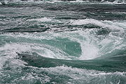
| Sea | Naruto Naruto, Tokushima is a city in Tokushima Prefecture, Japan.In the quinquennial census of 2010, the city had a population of 61,522 . With a total area of the population density is 454 persons per km².The city was founded on March 15, 1947.... |
Tokushima Prefecture Tokushima Prefecture is a prefecture of Japan located on Shikoku island. The capital is the city of Tokushima.- Tokushima Prefecture and Myodo Prefecture :Long ago, Tokushima City belonged to a region known as Myōdō-gun... |
 |
||
| Matsuri | Tokushima Tokushima, Tokushima is the capital city of Tokushima Prefecture on Shikoku island in Japan.As of May 1, 2011, the city had an estimated population of 263,372, with 114,325 households, and a population density of 1,377.25 persons per km². Its total area is 191.23 km².... |
Tokushima Prefecture Tokushima Prefecture is a prefecture of Japan located on Shikoku island. The capital is the city of Tokushima.- Tokushima Prefecture and Myodo Prefecture :Long ago, Tokushima City belonged to a region known as Myōdō-gun... |
|||
| Bells | Sanuki Sanuki, Kagawa is a city located in Kagawa, Japan.As of March 31, 2011, the city has an estimated population of 53,865, with 20,237 households and the density of 339.01 persons per km²... (Nagao Nagao, Kagawa was a town in Ōkawa District, Kagawa Prefecture, Japan.On April 1, 2002 Nagao was merged with the towns of Ōkawa, Sangawa, Shido and Tsuda, all from Ōkawa District, to form the new city of Sanuki.-History:... ) |
Kagawa Prefecture Kagawa Prefecture is a prefecture of Japan located on Shikoku island. The capital is Takamatsu.- History :Kagawa was formerly known as Sanuki Province.For a brief period between August 1876 and December 1888, Kagawa was made a part of Ehime Prefecture.-Battle of Yashima:... |
|||
| Water | Mannō Manno, Kagawa is a town located in Nakatado District, Kagawa, Japan.As of September 2011, the town has an estimated population of 19,933. The total area is 194.33 km².... |
Kagawa Prefecture Kagawa Prefecture is a prefecture of Japan located on Shikoku island. The capital is Takamatsu.- History :Kagawa was formerly known as Sanuki Province.For a brief period between August 1876 and December 1888, Kagawa was made a part of Ehime Prefecture.-Battle of Yashima:... |
|||
| Drums | Matsuyama Matsuyama, Ehime is the capital city of Ehime Prefecture on the Shikoku island of Japan. It is located on the northeastern portion of the Dōgo Plain. Its name means "pine mountain." The city was founded on December 15, 1889.... |
Ehime Prefecture Ehime Prefecture is a prefecture in northwestern Shikoku, Japan. The capital is Matsuyama.-History:Until the Meiji Restoration, Ehime prefecture was known as Iyo Province... |
|||
| Sea | Muroto Muroto, Kochi is a city located in Kōchi, Japan.As of 2008, the city has an estimated population of 17,388 and the density of 70 persons per km². The total area is 248.25 km².The city was founded on March 1, 1951.-External links:* in Japanese* in English*... |
Kōchi Prefecture Kochi Prefecture is a prefecture of Japan located on the south coast of Shikoku. The capital is the city of Kōchi.- History :Prior to the Meiji Restoration, Kōchi was known as Tosa Province and was controlled by the Chosokabe clan in the Sengoku period and the Yamauchi family during the Edo period.- Geography... |
|||
| Matsuri | Fukuoka Fukuoka Fukuoka most often refers to the capital city of Fukuoka Prefecture.It can also refer to:-Locations:* Fukuoka, Gifu, a town in Gifu Prefecture, Japan* Fukuoka, Toyama, a town in Toyama Prefecture, Japan... |
Fukuoka Prefecture Fukuoka Prefecture is a prefecture of Japan located on Kyūshū Island. The capital is the city of Fukuoka.- History :Fukuoka Prefecture includes the former provinces of Chikugo, Chikuzen, and Buzen.... |
 |
||
| Bells | Dazaifu Dazaifu, Fukuoka is a city located in Fukuoka Prefecture, Japan. Nearby cities include Ōnojō and Chikushino. Although mostly urban, it does have arable land used for paddy fields and market gardening.... |
Fukuoka Prefecture Fukuoka Prefecture is a prefecture of Japan located on Kyūshū Island. The capital is the city of Fukuoka.- History :Fukuoka Prefecture includes the former provinces of Chikugo, Chikuzen, and Buzen.... |
|||
| Sea | Kitakyūshū/Shimonoseki | Fukuoka Fukuoka Prefecture is a prefecture of Japan located on Kyūshū Island. The capital is the city of Fukuoka.- History :Fukuoka Prefecture includes the former provinces of Chikugo, Chikuzen, and Buzen.... /Yamaguchi Prefecture Yamaguchi Prefecture is a prefecture of Japan in the Chūgoku region on Honshū island. The capital is the city of Yamaguchi, in the center of the prefecture. The largest city, however, is Shimonoseki.- History :... |
 |
||
| Matsuri | Karatsu Karatsu, Saga is a city located in Saga Prefecture on the island of Kyūshū, Japan. Its name, formed from the Japanese word roots 唐 kara , and 津 tsu , signifies its historical importance as an ancient trading port between Japan with China and Korea... |
Saga Prefecture Saga Prefecture is located in the northwest part of the island of Kyūshū, Japan. It touches both the Sea of Japan and the Ariake Sea. The western part of the prefecture is a region famous for producing ceramics and porcelain, particularly the towns of Karatsu, Imari, and Arita... |
|||
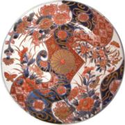
| Crafts | Imari Imari, Saga is a city located in Saga Prefecture on the island of Kyūshū, Japan. Imari is most notable because of Imari porcelain, which is the European collectors' name for Japanese porcelain wares made in the town of Arita, Saga Prefecture. The porcelain was exported from the port of Imari specifically for... |
Saga Prefecture Saga Prefecture is located in the northwest part of the island of Kyūshū, Japan. It touches both the Sea of Japan and the Ariake Sea. The western part of the prefecture is a region famous for producing ceramics and porcelain, particularly the towns of Karatsu, Imari, and Arita... |
 |
||
| Vegetation | Nagasaki | Nagasaki Prefecture Nagasaki Prefecture is a prefecture of Japan located on the island of Kyūshū. The capital is the city of Nagasaki.- History :Nagasaki Prefecture was created by merging of the western half of the former province of Hizen with the island provinces of Tsushima and Iki... |
 |
||
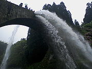
| Water | Yamato Yamato, Kumamoto is a town located in Kamimashiki District, Kumamoto, Japan.The town was formed on February 11, 2005 from the merger of the municipalities of Yabe and Seiwa with the town of Soyō from Aso District.... (Yabe Yabe, Kumamoto was a town located in Kamimashiki District, Kumamoto, Japan.On February 11, 2005 Yabe was merged with the village of Seiwa, also from Kamimashiki District, and the town of Soyō, from Aso District, to form the new town of Yamato and no longer exists as an independent municipality.As of 2003, the... ) |
Kumamoto Prefecture Kumamoto Prefecture is a prefecture of Japan located on Kyushu Island. The capital is the city of Kumamoto.- History :Historically the area was called Higo Province; and the province was renamed Kumamoto during the Meiji Restoration. The creation of prefectures was part of the abolition of the feudal system... |
 |
||
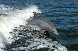
| Wildlife | Amakusa Amakusa, Kumamoto was a town located in Amakusa District, Kumamoto, Japan.Amakusa-machi consists of five villages, four spread along the west coast of Shimo-shima and one located in the mountains between the coast and Hondo, the administrative capital of Amakusa city. They are, in order of geographic location... (Itsuwa Itsuwa, Kumamoto was a town located in Amakusa District, Kumamoto, Japan.On March 27, 2006 Itsuwa was merged with the towns of Amakusa, Ariake, Goshoura, Kawaura, Kuratake, Shinwa and Sumoto, all from Amakusa District, and the old cities of Hondo and Ushibuka, to become the new city of Amakusa and no longer exists... ) |
Kumamoto Prefecture Kumamoto Prefecture is a prefecture of Japan located on Kyushu Island. The capital is the city of Kumamoto.- History :Historically the area was called Higo Province; and the province was renamed Kumamoto during the Meiji Restoration. The creation of prefectures was part of the abolition of the feudal system... |
 |
||
| Water/Crafts | Hita Hita, Oita is a city in Ōita Prefecture, Japan, that was founded on December 11, 1940. It is an agricultural and industrial centre that primarily produces lumber, furniture, and pottery... |
Ōita Prefecture Oita Prefecture is a prefecture of Japan on Kyūshū Island. The prefectural capital is the city of Ōita.- History :Around the 6th century Kyushu consisted of four regions: Tsukushi-no-kuni 筑紫国, Hi-no-kuni 肥国, and Toyo no kuni... |
|||
| Vegetation | Taketa Taketa, Oita is a city located in Ōita Prefecture, Japan.As of 2003, the city has an estimated population of 16,807 and a density of 83.69 persons per km². The total area is 200.83 km².... |
Ōita Prefecture Oita Prefecture is a prefecture of Japan on Kyūshū Island. The prefectural capital is the city of Ōita.- History :Around the 6th century Kyushu consisted of four regions: Tsukushi-no-kuni 筑紫国, Hi-no-kuni 肥国, and Toyo no kuni... |
|||
| Waterfalls | Kobayashi Kobayashi, Miyazaki is a city located in Miyazaki, Japan.As of May 1, 2011, the city has an estimated population of 47,328, with a household number of 19,924 and a density of 80.45 persons per km²... |
Miyazaki Prefecture Miyazaki Prefecture is a prefecture of Japan located on the island of Kyushu. The capital is the city of Miyazaki.- History :Historically, after the Meiji Restoration, Hyūga Province was renamed Miyazaki Prefecture.... |
|||
| Wildlife | Ebino Ebino, Miyazaki is a city located in Miyazaki Prefecture, Japan. Ebino shares borders with Kagoshima Prefecture, Kumamoto Prefecture and Kobayashi, Miyazaki.-History:The town of Ebino was created through the administrative merging of the towns of Masaki, Kakutō, and Īno in 1966... |
Miyazaki Prefecture Miyazaki Prefecture is a prefecture of Japan located on the island of Kyushu. The capital is the city of Miyazaki.- History :Historically, after the Meiji Restoration, Hyūga Province was renamed Miyazaki Prefecture.... |
|||
| Birds | Izumi Izumi, Kagoshima is a city located in Kagoshima Prefecture in Japan.On March 13, 2006, the towns of Noda and Takaono from Izumi District merged into the city. As of 2008, the city has an estimated population of 56,205 and a density of 170 persons per km². The total area is 330.06 km².The city was founded on April... |
Kagoshima Prefecture Kagoshima Prefecture is a prefecture of Japan located on the island of Kyushu. The capital is the city of Kagoshima.- Geography :Kagoshima Prefecture is located at the southwest tip of Kyushu and includes a chain of islands stretching further to the southwest for a few hundred kilometers... |
|||
| Water/Local life | Yakushima Yakushima , one of the Ōsumi Islands, is an island of about 500 km² and roughly 15,000 islanders to the south of Kyūshū in Kagoshima Prefecture, Japan. The Vincennes Strait separates it from Tanegashima. The highest point on the island is Miyanoura-dake at 1,935 metres... |
Kagoshima Prefecture Kagoshima Prefecture is a prefecture of Japan located on the island of Kyushu. The capital is the city of Kagoshima.- Geography :Kagoshima Prefecture is located at the southwest tip of Kyushu and includes a chain of islands stretching further to the southwest for a few hundred kilometers... |
|||
| Wildlife | Taketomi Taketomi, Okinawa is a town located in Yaeyama District, Okinawa, Japan. The town includes all of the islands in the Yaeyama District excluding Ishigaki, Yonaguni, and the Senkaku Islands. This includes the islands of Iriomote, Taketomi, Kohama, Kuroshima, Hateruma, and Hatoma... (Iriomote Iriomote Iriomote is the largest of the Yaeyama Islands and the second largest in Okinawa Prefecture after Okinawa Island itself.... ) |
Okinawa Prefecture Okinawa Prefecture is one of Japan's southern prefectures. It consists of hundreds of the Ryukyu Islands in a chain over long, which extends southwest from Kyūshū to Taiwan. Okinawa's capital, Naha, is located in the southern part of Okinawa Island... |
|||
| Matsuri | Yonashiro Yonashiro, Okinawa was a town located in Nakagami District, Okinawa, Japan.Originally it was . It was promoted to town status and renamed to Yonashiro in 1994.On April 1, 2005 Yonashiro was merged with the town of Katsuren, also from Nakagami District, and the old cities of Gushikawa and Ishikawa, to form the new... /Katsuren Katsuren, Okinawa was a town located in Nakagami District, Okinawa, Japan.On April 1, 2005 Katsuren was merged with the town of Yonashiro, also from Nakagami District, and the old cities of Gushikawa and Ishikawa, to form the new city of Uruma.... |
Okinawa Prefecture Okinawa Prefecture is one of Japan's southern prefectures. It consists of hundreds of the Ryukyu Islands in a chain over long, which extends southwest from Kyūshū to Taiwan. Okinawa's capital, Naha, is located in the southern part of Okinawa Island... |
See also
- Soundscape ecologySoundscape ecologySoundscape ecology has sometimes been considered interchangeable with acoustic ecology, but it has a different and distinctive meaning, according to a small group of researchers at Purdue. The term has been use for decades in acoustic ecology, and comes from the founding work of Barry Truax and R....
- EcoacousticsEcoacousticsEcoacoustics is a relatively new cross-diciplinary science that involves ecology and acoustics. It differs from the closely related field of bioacoustics, measuring the acoustic properties of a whole environment in order to better understand the complex dynamics of an ecosystem...
- BiophonyBiophonyBiophony is the collective sound vocal non-human animals create in each given environment. The term, which refers to one of three components of the soundscape , was coined by Dr. Bernie Krause...
- World Soundscape ProjectWorld Soundscape ProjectThe World Soundscape Project or WSP is an international research project founded by Canadian composer R. Murray Schafer in the late 1960s at Simon Fraser University. The project initiated the modern study of Acoustic Ecology...
- 100 Landscapes of Japan (Heisei era)100 Landscapes of Japan (Heisei era)In 2009, in celebration of its 135th anniversary, the Yomiuri Shimbun formed a selection committee and, together with its readers, selected the . Three hundred sites were nominated and more than 640,000 votes were collected during the selection process...

