
Wapiti River
Encyclopedia
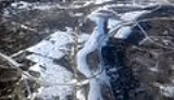
Wapiti River is a river in eastern British Columbia
and western Alberta
, Canada
. It is a major tributary of the Smoky River
, located in the southern area of the Peace River
Basin.
Wapiti is named after the Cree
word for elk
(waapiti).
 Wapiti River originates as the outflow of Tuck Lake, east of Wapiti Pass
, in Wapiti Lake Provincial Park
, west-central British Columbia
, in the Canadian Rockies
. It then runs in a north-eastern direction, crosses into Alberta, where it becomes more meander
ed as it continues through Grande Prairie County
. It merges into the Smoky River
30 km (18.6 mi) east of Grande Prairie
.
From west to east, Wapiti River flows through the alpine environment of the Rocky Mountains
, the rolling foothills, then farmlands and aspen parkland
in western Alberta. Wapiti Lake Provincial Park
, Bear River Park, O'Brien Provincial Park
and Pipestone Creek Park are protected areas along the river.
Close to its mouth, Wapiti has an average discharge of 100 m³/s.
British Columbia
British Columbia is the westernmost of Canada's provinces and is known for its natural beauty, as reflected in its Latin motto, Splendor sine occasu . Its name was chosen by Queen Victoria in 1858...
and western Alberta
Alberta
Alberta is a province of Canada. It had an estimated population of 3.7 million in 2010 making it the most populous of Canada's three prairie provinces...
, Canada
Canada
Canada is a North American country consisting of ten provinces and three territories. Located in the northern part of the continent, it extends from the Atlantic Ocean in the east to the Pacific Ocean in the west, and northward into the Arctic Ocean...
. It is a major tributary of the Smoky River
Smoky River
Smoky River is a river in western Alberta, Canada. It is a major tributary of the Peace River. The descriptive name refers to the presence of "smouldering beds of coal in the riverbank" noted by the Cree Indians....
, located in the southern area of the Peace River
Peace River (Canada)
The Peace River is a river in Canada that originates in the Rocky Mountains of northern British Columbia and flows to the northeast through northern Alberta. The Peace River flows into the Slave River, a tributary of the Mackenzie River. The Mackenzie is the 12th longest river in the world,...
Basin.
Wapiti is named after the Cree
Cree language
Cree is an Algonquian language spoken by approximately 117,000 people across Canada, from the Northwest Territories and Alberta to Labrador, making it the aboriginal language with the highest number of speakers in Canada. It is also spoken in the U.S. state of Montana...
word for elk
Elk
The Elk is the large deer, also called Cervus canadensis or wapiti, of North America and eastern Asia.Elk may also refer to:Other antlered mammals:...
(waapiti).
Course
Wapiti Pass
Wapiti Pass is a mountain pass in the Northern Rocky Mountains of British Columbia, Canada. It located immediately east of Wapiti Lake Provincial Park, at the headwaters of the Wapiti River, northeast of Prince George and west of Monkman Provincial Park....
, in Wapiti Lake Provincial Park
Wapiti Lake Provincial Park
Wapiti Lake Provincial Park is a 16,837 ha provincial park in British Columbia, Canada. It is located 60 km south of Tumbler Ridge, at the headwaters of Wapiti River, including its watershed from the Wapiti Pass to Wapiti Lake in the Canadian Rockies. The area contains significant amounts of...
, west-central British Columbia
British Columbia
British Columbia is the westernmost of Canada's provinces and is known for its natural beauty, as reflected in its Latin motto, Splendor sine occasu . Its name was chosen by Queen Victoria in 1858...
, in the Canadian Rockies
Canadian Rockies
The Canadian Rockies comprise the Canadian segment of the North American Rocky Mountains range. They are the eastern part of the Canadian Cordillera, extending from the Interior Plains of Alberta to the Rocky Mountain Trench of British Columbia. The southern end borders Idaho and Montana of the USA...
. It then runs in a north-eastern direction, crosses into Alberta, where it becomes more meander
Meander
A meander in general is a bend in a sinuous watercourse. A meander is formed when the moving water in a stream erodes the outer banks and widens its valley. A stream of any volume may assume a meandering course, alternately eroding sediments from the outside of a bend and depositing them on the...
ed as it continues through Grande Prairie County
Grande Prairie County No. 1, Alberta
The County of Grande Prairie No. 1 is a municipal district in northwestern Alberta, Canada in Census Division No. 19.It is bounded on the south by the Wapiti River, on the east by the Smoky River and on the west by the province of British Columbia....
. It merges into the Smoky River
Smoky River
Smoky River is a river in western Alberta, Canada. It is a major tributary of the Peace River. The descriptive name refers to the presence of "smouldering beds of coal in the riverbank" noted by the Cree Indians....
30 km (18.6 mi) east of Grande Prairie
Grande Prairie, Alberta
Grande Prairie is a city in the northwestern part of the province of Alberta in Western Canada. It is located on the southern edge of the Peace River Country . The city is surrounded by the County of Grande Prairie No...
.
From west to east, Wapiti River flows through the alpine environment of the Rocky Mountains
Rocky Mountains
The Rocky Mountains are a major mountain range in western North America. The Rocky Mountains stretch more than from the northernmost part of British Columbia, in western Canada, to New Mexico, in the southwestern United States...
, the rolling foothills, then farmlands and aspen parkland
Aspen parkland
Aspen parkland refers to a very large area of transitional biome between prairie and boreal forest in two sections; the Peace River Country of northwestern Alberta crossing the border into British Columbia, and a much larger area stretching from central Alberta, all across central Saskatchewan to...
in western Alberta. Wapiti Lake Provincial Park
Wapiti Lake Provincial Park
Wapiti Lake Provincial Park is a 16,837 ha provincial park in British Columbia, Canada. It is located 60 km south of Tumbler Ridge, at the headwaters of Wapiti River, including its watershed from the Wapiti Pass to Wapiti Lake in the Canadian Rockies. The area contains significant amounts of...
, Bear River Park, O'Brien Provincial Park
O'Brien Provincial Park
O'Brien Provincial Park is a provincial park in Alberta, Canada, located south from Grande Prairie, on Highway 666.The park is situated in the Wapiti River valley, at an elevation of and has a surface of...
and Pipestone Creek Park are protected areas along the river.
Close to its mouth, Wapiti has an average discharge of 100 m³/s.
Tributaries and crossings
| Tributary/Crossing | Location | Remarks |
|---|---|---|
| Tuck Lake | 54.44069°N 120.79021°W | Originates from Tuck Lake in Wapiti Pass Wapiti Pass Wapiti Pass is a mountain pass in the Northern Rocky Mountains of British Columbia, Canada. It located immediately east of Wapiti Lake Provincial Park, at the headwaters of the Wapiti River, northeast of Prince George and west of Monkman Provincial Park.... |
| Wapiti Lake | 54.56148°N 120.77831°W | Flows into Wapiti Lake |
| Wapiti Lake | 54.58420°N 120.75794°W | Flows from Wapiti Lake |
| Wapiti Lake Provincial Park Wapiti Lake Provincial Park Wapiti Lake Provincial Park is a 16,837 ha provincial park in British Columbia, Canada. It is located 60 km south of Tumbler Ridge, at the headwaters of Wapiti River, including its watershed from the Wapiti Pass to Wapiti Lake in the Canadian Rockies. The area contains significant amounts of... |
54.59638°N 120.73880°W | Leaves Park |
| 54.60651°N 120.64053°W | Right tributary | |
| Fearless Creek | 54.73646°N 120.51058°W | Left tributary, also waters of Dokken Creek |
| Calliou Creek | 54.74127°N 120.45839°W | Left tributary |
| Red Deer Creek | 54.68386°N 120.24966°W | Right tributary |
| Belcourt Creek | 54.68479°N 120.10373°W | Right tributary |
| Mistanusk Creek | 54.70038°N 120.06016°W | Right tributary, from Boundary Lake |
| Alberta Alberta Alberta is a province of Canada. It had an estimated population of 3.7 million in 2010 making it the most populous of Canada's three prairie provinces... /British Columbia British Columbia British Columbia is the westernmost of Canada's provinces and is known for its natural beauty, as reflected in its Latin motto, Splendor sine occasu . Its name was chosen by Queen Victoria in 1858... |
54.73684°N 120.00109°W | Crosses into the province of Alberta |
| Chinook Creek | 54.72715°N 119.94752°W | Right tributary, from Chinook Ridge |
| Narraway River | 54.73503°N 119.92292°W | Right tributary |
| Lingrell Creek | 54.77732°N 119.84333°W | Right tributary, from Lingrell Lake |
| Nose Creek | 54.86847°N 119.63802°W | Right tributary |
| Calahoo Creek | 54.91894°N 119.68454°W | Left tributary |
| Smith Creek | 54.95758°N 119.60497°W | Left tributary |
| Pinto Creek | 54.97542°N 119.45228°W | Right tributary |
| West Iroquois Creek | 55.00271°N 119.37504°W | Right tributary |
| Iroquois Creek | 55.02108°N 119.31770°W | Right tributary |
| Redwillow River Redwillow River Redwillow River is a river in northern Alberta and north-eastern British Columbia, Canada. It flows through the Pouce Coupe Prairie, in the south of Peace River Country and is a tributary of the Wapiti River.-Course:... |
55.03241°N 119.30971°W | Left tributary, carries waters from Beaverlodge River as well |
| Pipestone Creek | 55.04614°N 119.10261°W | Left tributary |
| Spring Creek | 55.07790°N 118.94005°W | Left tributary |
| Highway 40 | 55.07206°N 118.80483°W | Crossed by road bridge |
| Big Mountain Creek | 55.05953°N 118.66093°W | Right tributary |
| Grande Prairie-Grande Cache Railway | 55.07215°N 118.62247°W | Crossed by railway bridge |
| Bear River | 55.10725°N 118.48549°W | Left tributary |
| Smoky River Smoky River Smoky River is a river in western Alberta, Canada. It is a major tributary of the Peace River. The descriptive name refers to the presence of "smouldering beds of coal in the riverbank" noted by the Cree Indians.... |
55.13784°N 118.30152°W | Empties into the Smoky River as left tributary |