

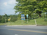
U.S. Route 22 in New Jersey
Encyclopedia
U.S. Route 22 is a U.S. highway stretching from Cincinnati
, Ohio
in the west to Newark
, New Jersey
in the east. In New Jersey, the route runs for 60.53 mi (97.41 km) from the Easton-Phillipsburg Toll Bridge
over the Delaware River
in Phillipsburg
, Warren County
to Interstate 78
(I-78), US 1/9
, and Route 21 at the Newark Airport Interchange
in Newark, Essex County
. The road first heads through the Phillipsburg-Alpha
area as a surface divided highway
before running concurrent
with I-78 through mountainous and agricultural sections of western New Jersey between Alpha and east of Clinton
in Hunterdon County
. For the remainder of the route, US 22 runs to the south of I-78 through mostly suburban areas as a four- to six-lane surface divided highway, passing through Hunterdon, Somerset
, Union
, and Essex counties. Along this portion, it intersects US 202
and US 206
in Somerville
, I-287
in Bridgewater Township
, and the Garden State Parkway
in Union
.
What became US 22 in 1926 was first designated as pre-1927 Route 9 in 1916, a route running from Phillipsburg to Elizabeth
. In 1927, pre-1927 Route 9 west of Elizabeth became Route 28 while the portion within Elizabeth became Route 27-28 Link. By 1941, US 22 was moved to its current alignment in the Phillipsburg area, following Route 24 and Route 24-28 Link; Route 28 in Phillipsburg became US 22 Alternate (now Route 122). Also, US 22 was moved off Route 28 east of Bridgewater Township to follow Route 28-29 Link and Route 29 to Newark. In 1953, the long concurrencies with the state highways were removed. In the 1960s, I-78 was constructed close to the US 22 corridor throughout New Jersey. US 22 was moved onto the new interstate between Alpha and Clinton in 1969 with most of the old route becoming Route 173.
from Easton, Pennsylvania
on the Easton-Phillipsburg Toll Bridge
over the Delaware River
. It heads into Phillipsburg
, Warren County
as a four-lane undivided road maintained by the Delaware River Joint Toll Bridge Commission
, eventually becoming a divided highway
. East of the bridge, the westbound lanes pass through the bridge toll plaza, and the route has an eastbound exit and westbound entrance for Broad and Main Streets. From the previous exit, US 22 runs eastward as a brief limited-access road maintained by the New Jersey Department of Transportation
that ends in an interchange with Morris Street and Hillcrest Boulevard. At this point, the route becomes at-grade Memorial Boulevard; a commercial four to six-lane divided thoroughfare with a wide median consisting of U-turn ramps and jughandles. The median narrows as the road forms the border between Lopatcong Township
to the north and Phillipsburg to the south. The route fully enters Lopatcong Township and comes to an interchange with Route 57, with an eastbound exit and a westbound entrance. After passing the Route 57 junction, US 22 takes a southeasterly turn and enters an agricultural area. The route forms the border between Pohatcong Township
to the west and Greenwich Township
to the east as it passes to the east of the Phillipsburg Mall
. A short distance later, US 22 intersects CR 519
before heading back into a business district and meeting CR 638. East of Alpha
, the route intersects Route 122, which is the final junction of the at-grade section of US 22.
 Past the Route 122 intersection, US 22 has an interchange with exit 3 of I-78
and the western endpoint of Route 173. From there, US 22 is concurrent
with I-78 through a mountainous and rural area of western New Jersey. I-78/US 22 follow a six-lane freeway east through Greenwich Township, coming to a westbound exit and eastbound entrance with CR 637. The road turns southeast and has an eastbound exit and westbound entrance with CR 632 in Franklin Township
. Within the ramps for this interchange, there are weigh station
s in both directions. A short distance after this interchange, I-78/US 22 crosses the Musconetcong River
into Bloomsbury
, Hunterdon County
. In Bloomsbury, the road has an interchange with Route 173. After this interchange, the freeway enters Bethlehem Township
, with Route 173 closely running to the north of I-78/US 22. The road has rest area
s in both directions before turning southeast and crossing the Musconetcong Mountains.
The freeway turns east again and enters Union Township
, coming to an interchange with CR 614 and Route 173. From here, I-78/US 22 continue east directly to the south of Route 173, coming to another interchange with that route as well as CR 625. Entering more commercial areas, Route 173 merges onto I-78/US 22 at exit 13. At exit 15, the highway meets an interchange with CR 513
, and Route 173 splits from I-78/US 22 by heading north on CR 513. At this point, the freeway runs along the border of Franklin Township
to the south and Clinton
to the north before entirely entering Clinton and crossing the South Branch Raritan River
. I-78/US 22 turns northeast and leaves Clinton for Clinton Township
, where it has an eastbound exit and westbound entrance for Route 173 that also provides access to Route 31. Immediately after is the interchange with Route 31. At the next interchange near the community of Annandale
, US 22 splits from I-78, heading closely to the south of that route.
’s Raritan Valley Line
. It enters Lebanon
, passing to the north of the town center. Upon leaving Lebanon, the route heads back into Clinton Township. In the community of Potterstown, US 22 enters Readington Township
and takes a southeasterly turn away from I-78. Here, the road passes to the southwest of the Merck headquarters
before reaching the community of Whitehouse Station, where it has a short concurrency with CR 523
. Past Whitehouse Station, US 22 continues through a mix of residential and commercial areas.
US 22 continues into Branchburg Township
, Somerset County
, where development near the road increases. CR 614 parallels US 22 to the north to pass through the community of North Branch
before US 22 intersects CR 637 and crosses the North Branch Raritan River
into Bridgewater Township
. In Bridgewater Township, the route comes to an interchange with the eastern terminus of CR 614 and the western terminus of Route 28. Past this interchange, US 22 passes business parks and the Raritan Valley Country Club, widening to six lanes prior to an interchange with US 202
and US 206
. At this point, US 22 heads east along the border of Somerville
to the south and Bridgewater Township to the north, passing through suburban areas near the Bridgewater Commons
shopping mall. The median of the route widens as it runs immediately to the south of I-287
, fully entering Bridgewater Township again as it comes to an interchange with I-287 at exits 14A and 14B.
. US 22 crosses over the former Middle Brook Railroad which the Central Railroad of New Jersey
built in 1900 to connect the Central Division main line at Bound Brook Junction on the south of US 22 with the Chimney Rock Quarry on the immediate north side of US 22. The route then has an interchange with CR 525
, where the wide grassy median narrows to a Jersey barrier
. The road continues through wooded surroundings and passes through a portion of Bound Brook
, widening back to six lanes before meeting CR 527
at an interchange. From here, the route takes a northeasterly course, entering Bridgewater Township again and narrowing to four lanes before crossing into Green Brook Township
while designated a short distance north of the Middlesex
-Somerset County border. US 22 continues through business areas as a highway with jughandles, crossing CR 529
. In North Plainfield
, the route widens to six lanes and has an interchange with CR 531
. Past this interchange, the road continues along the border of Watchung
to the west and North Plainfield to the southeast before crossing Green Brook.
At this crossing, US 22 heads north-northeast into Scotch Plains
, Union County
, coming to an interchange with CR 655. The route continues northeast as a four- to five-lane highway, passing near Bowcraft Amusement Park
. The road continues east through Mountainside
, turning northeast before entering Springfield
, where it has an interchange with CR 509 Spur (signed as CR 577
). Past this interchange, US 22 has a wide median that contains numerous U-turn ramps. In this area, the road comes to a level crossing
with the abandoned Rahway Valley Railroad
. It crosses the Rahway River
into Union
, where the wide median continues. The route briefly forms the northern border of Kenilworth
before the median narrows back into a Jersey barrier. US 22 splits into two carriageways at the intersection with exits 140 and 140A of the Garden State Parkway
and Route 82.
into Hillside
, where it heads east through more urban areas. The road has an interchange at Bloy Street before passing over CR 509
. After an interchange with Broad Street, US 22 turns northeast as a limited-access roadway. It heads into Newark
in Essex County
, where the highway passes through wooded Weequahic Park
. Past the park, US 22 turns to the east into urban areas and closely runs to the south of I-78, where it comes to an eastbound exit and westbound entrance for Empire Street, which provides access to Route 27. A short distance later, the freeway has a direct westbound exit and eastbound entrance with Route 27. Past this interchange, US 22 continues parallel to I-78, passing over Amtrak
’s Northeast Corridor
before reaching the Newark Airport Interchange
; south of downtown Newark
and northwest of Newark Liberty International Airport
. US 22 eastbound merges with US 1-9, with one southbound ramp and two northbound ramps (one for local and another for express lanes). The main line follows the US 1-9 local northbound ramp for another 0.4 mile (0.643736 km), with an intermediate exit for Route 21. The official eastern terminus of US 22 is at the ramp split for I-78 and northbound US 1-9.
. When the U.S. Highway System was established in 1926, US 22 was designated through New Jersey from the Northampton Street Bridge
in Phillpsburg and followed Route 9 east to US 1/9 in Elizabeth. A year later, in the 1927 New Jersey state highway renumbering
, Route 9 was replaced by Route 28, which itself was rerouted to continue to the Goethals Bridge
. As a result, the alignment of US 22 in Elizabeth was designated Route 27-28 Link. By 1941, US 22 underwent two significant realignments within the state. In Phillipsburg, the route was moved from Route 28 to follow its current alignment on what was Route 24 between the Easton-Phillipsburg Toll Bridge and present-day Route 57 (then a part of Route 24) and Route 24-28 Link between there and Route 28. The approach to the Easton-Phillipsburg Toll Bridge, which opened in 1938, had been planned to be designated Route 24N, but instead became a part of Route 24. With the realignment of US 22 in Phillipsburg, the old alignment was designated as US 22 Alternate (now Route 122). In addition, US 22 was moved off from Route 28 east of Bridgewater Township to follow Route 28-29 Link and Route 29 to Newark; Route 29 had been legislated in the 1927 renumbering while Route 28-29 Link was legislated in 1938.
In the 1953 New Jersey state highway renumbering
, the state highways running concurrent with US 22 were removed. With the planning of the Interstate Highway System
in the 1950s, an Interstate Highway connecting the Harrisburg, Pennsylvania
area to New York City
was planned to run roughly along the US 22 corridor in New Jersey. This interstate was designated as I-78 in the final plans in 1958. The new interstate roughly followed the alignment of the unconstructed Route 11, which had been legislated in 1927 to run from US 22 between White House and Warrenville. Between the Alpha area and Annandale, I-78 was to directly follow US 22; the portion between exits 11 and 13 involved the creation of new eastbound lanes for I-78 and conversion of the eastbound lanes of US 22 into the westbound lanes of I-78. The westbound lanes of US 22 were turned into a two-lane frontage road. This construction took place during the 1960s. US 22 was moved to the I-78 alignment between these two points. The former alignment between Alpha and Clinton became Route 173 while the portion east of there became county-maintained Beaver Avenue (currently designated CR 626). Originally, I-78 had been planned to use the Easton-Phillipsburg Toll Bridge across the Delaware River and follow US 22 through Phillipsburg and along the Lehigh Valley Thruway west through the Lehigh Valley
of Pennsylvania. However, opposition within Phillipsburg led to the cancellation of this routing, and I-78 was rerouted to head to the south of the Lehigh Valley. In addition to the construction of I-78 along the US 22 corridor, US 22 itself evolved into a multilane divided highway from a two-lane road.
!County
!Location
!Mile
!Exit
!Roads
!Notes
|-
|colspan=6 align="center"|Easton-Phillipsburg Toll Bridge
over Delaware River
|-
|rowspan=8|Warren
|Phillipsburg
|0.64
|
|Main Street/Broad Street
|Eastbound exit, westbound entrance
|-
|Lopatcong Township
|2.07
|
|
|Eastbound exit, westbound entrance
|-
|rowspan=4|Pohatcong Township
|3.66
|
|
|
|-
|4.36
|
|
|
|-
|colspan=6 align="center"|West end of freeway
|-
|4.69-5.07
|
| - Pennsylvania
, Bloomsbury
|Interchange, west end of I-78 overlap, I-78 exit 3
|-
|Greenwich Township
|6.39
|4
|Warren Glen, Stewartsville
|Westbound exit and eastbound entrance
|-
|Franklin Township
|7.94
|6
|Warren Glen, Asbury
|Eastbound exit and westbound entrance
|-
|rowspan=10|Hunterdon
|Bloomsbury
|8.37
|7
|
|
|-
|rowspan=3|Union Township
|12.67
|11
|
|-
|14.33
|12
|
|
|-
|15.92-15.98
|13
|
|West end of NJ 173 overlap; westbound exit and eastbound entrance
|-
|Franklin Township
|16.97
|15
|
|East end of NJ 173 overlap
|-
|rowspan=3|Clinton Township
|18.23-18.78
|17
|
|Signed as exits 16 (north) and 17 (south) eastbound
|-
|19.25
|
| - New York City
|Interchange, east end of I-78 overlap, I-78 exit 18
|-
|colspan=6 align="center"|East end of freeway
|-
|rowspan=2|Readington Township
|25.61
|
|
|West end of CR 523 overlap
|-
|25.80
|
|
|East end of CR 523 overlap
|-
|rowspan=13|Somerset
|Branchburg Township
|30.87
|
|
|Interchange
|-
|rowspan=8|Bridgewater Township
|31.59
|
|
|Interchange
|-
|33.88
|
|
|Interchange
|-
|34.07
|
|
|Eastbound exit and entrance
|-
|34.37
|
|Commons Way
|Interchange, no eastbound exit
|-
|34.72
|
|
|Westbound exit and entrance
|-
|36.30
|
|
|Westbound exit and entrance
|-
|36.68-36.82
|
|
|I-287 exit 14
|-
|37.57
|
|
|Interchange
|-
|Bound Brook
/Bridgewater Township
|39.01
|
|, VA Hospital
|Interchange
|-
|Green Brook Township
|42.16
|
|
|
|-
|rowspan=2|North Plainfield
|44.73
|
|
|Interchange
|-
|44.87
|
|, VA Hospital
|Interchange
|-
|rowspan=7|Union
|Scotch Plains
|47.41
|
|
|Interchange
|-
|Mountainside
|51.58
|
|
|Interchange
|-
|Springfield Township
|52.04
|
|, Springfield
|Interchange
|-
|rowspan=2|Union Township
|55.34-55.71
|
|
|Interchange, GSP exit 140
|-
|56.16
|
|
|Interchange
|-
|rowspan=2|Hillside
|56.93
|
|
|Interchange
|-
|58.04
|
|
|Interchange
|-
|rowspan=6|Essex
|rowspan=6|Newark
|colspan=6 align="center"|West end of freeway
|-
|59.46-59.64
|
|
|
|-
|59.90
|
|
|
|-
|60.22
|
|
|
|-
|rowspan=2|60.53
|
|
|
|-
|
|
Cincinnati, Ohio
Cincinnati is a city in the U.S. state of Ohio. Cincinnati is the county seat of Hamilton County. Settled in 1788, the city is located to north of the Ohio River at the Ohio-Kentucky border, near Indiana. The population within city limits is 296,943 according to the 2010 census, making it Ohio's...
, Ohio
Ohio
Ohio is a Midwestern state in the United States. The 34th largest state by area in the U.S.,it is the 7th‑most populous with over 11.5 million residents, containing several major American cities and seven metropolitan areas with populations of 500,000 or more.The state's capital is Columbus...
in the west to Newark
Newark, New Jersey
Newark is the largest city in the American state of New Jersey, and the seat of Essex County. As of the 2010 United States Census, Newark had a population of 277,140, maintaining its status as the largest municipality in New Jersey. It is the 68th largest city in the U.S...
, New Jersey
New Jersey
New Jersey is a state in the Northeastern and Middle Atlantic regions of the United States. , its population was 8,791,894. It is bordered on the north and east by the state of New York, on the southeast and south by the Atlantic Ocean, on the west by Pennsylvania and on the southwest by Delaware...
in the east. In New Jersey, the route runs for 60.53 mi (97.41 km) from the Easton-Phillipsburg Toll Bridge
Easton-Phillipsburg Toll Bridge
The Easton–Phillipsburg Toll Bridge is a bridge that carries U.S. Route 22 over the Delaware River. The bridge is between Easton, PA and Phillipsburg, NJ. The bridge opened on January 14, 1938 and it's operated by the Delaware River Joint Toll Bridge Commission...
over the Delaware River
Delaware River
The Delaware River is a major river on the Atlantic coast of the United States.A Dutch expedition led by Henry Hudson in 1609 first mapped the river. The river was christened the South River in the New Netherland colony that followed, in contrast to the North River, as the Hudson River was then...
in Phillipsburg
Phillipsburg, New Jersey
Phillipsburg, known locally as P'burg, is a town in Warren County, New Jersey, in the United States. As of 2010 United States Census, the town's population was 14,950....
, Warren County
Warren County, New Jersey
Warren County is a county located in the U.S. state of New Jersey. As of the 2010 Census, the population was 108,692. Its county seat is Belvidere...
to Interstate 78
Interstate 78 in New Jersey
Interstate 78 is an east–west route stretching from Union Township, Lebanon County, Pennsylvania to New York City. In New Jersey, I-78 is called the Phillipsburg–Newark Expressway and the Newark Bay Extension of the New Jersey Turnpike...
(I-78), US 1/9
U.S. Route 1/9
U.S. Route 9 is a U.S. highway in the northeast United States, running from Laurel, Delaware north to the Canadian border near Champlain, New York...
, and Route 21 at the Newark Airport Interchange
Newark Airport Interchange
The Newark Airport Interchange is a massive interchange of Interstate 78, U.S. Route 1/9, U.S. Route 22, Route 21, and Interstate 95 at the northern edge of Newark Airport in Newark, New Jersey.-Description:...
in Newark, Essex County
Essex County, New Jersey
Essex County is a county located in the northeastern part of the U.S. state of New Jersey. As of the United States 2010 Census, the population was 783,969, ranking it third in the state after Bergen County and Middlesex County; Essex County's population has declined from 786,147 as of the bureau's...
. The road first heads through the Phillipsburg-Alpha
Alpha, New Jersey
Alpha is a borough in Warren County, New Jersey, United States. As of the United States 2010 Census, the borough population was 2,369.Alpha was incorporated as a borough by an Act of the New Jersey Legislature and signed by Governor Woodrow Wilson on June 26, 1911, from portions of Pohatcong...
area as a surface divided highway
Divided Highway
Divided Highway is a compilation album by American rock band The Doobie Brothers, released in 2003. . All tracks are taken from the albums Cycles and Brotherhood .-Track listing:...
before running concurrent
Concurrency (road)
A concurrency, overlap, or coincidence in a road network is an instance of one physical road bearing two or more different highway, motorway, or other route numbers...
with I-78 through mountainous and agricultural sections of western New Jersey between Alpha and east of Clinton
Clinton, New Jersey
Clinton is a Town in Hunterdon County, New Jersey on the South Branch of the Raritan River. As of the 2010 United States Census, the town population was 2,719....
in Hunterdon County
Hunterdon County, New Jersey
Hunterdon County is a county located in the western section of the U.S. state of New Jersey. As of the 2010 United States Census, the population was 128,349. It is part of the New York Metropolitan Area. Its county seat is Flemington....
. For the remainder of the route, US 22 runs to the south of I-78 through mostly suburban areas as a four- to six-lane surface divided highway, passing through Hunterdon, Somerset
Somerset County, New Jersey
Somerset County is a county located in the U.S. state of New Jersey. In 2010, the population was 323,444. It is part of the New York Metropolitan Area. Its county seat is Somerville....
, Union
Union County, New Jersey
Union County is a county located in the U.S. state of New Jersey. As of the 2010 Census, the population was 536,499. It is part of the New York Metropolitan Area. Its county seat is Elizabeth. Union County ranks 93rd among the highest-income counties in the United States. It also ranks 74th in...
, and Essex counties. Along this portion, it intersects US 202
U.S. Route 202 in New Jersey
U.S. Route 202 is a U.S. Highway running from New Castle, Delaware northeast to Bangor, Maine. In the U.S. state of New Jersey, the route runs from the New Hope-Lambertville Toll Bridge over the Delaware River at the Pennsylvania border in Delaware Township, Hunterdon County near Lambertville...
and US 206
U.S. Route 206
U.S. Route 206 is a long north–south United States highway in New Jersey and Pennsylvania, United States. Only about a half a mile of its length is in Pennsylvania; the Milford-Montague Toll Bridge carries it over the Delaware River into New Jersey, where it is the remainder of the route...
in Somerville
Somerville, New Jersey
Somerville is a borough in Somerset County, New Jersey, United States. As of the 2010 United States Census, the borough population was 12,098. It is the county seat of Somerset County....
, I-287
Interstate 287
Interstate 287 is an auxiliary Interstate Highway in the U.S. states of New Jersey and New York. It is a partial beltway around New York City, serving the northern half of New Jersey and the counties of Rockland and Westchester in New York...
in Bridgewater Township
Bridgewater Township, New Jersey
Bridgewater Township is a township in Somerset County, New Jersey, United States. , the township population was 44,464.Bridgewater Township was originally created by Royal Charter on April 4, 1749, from portions of the Northern precinct, and was incorporated as one of New Jersey's initial group of...
, and the Garden State Parkway
Garden State Parkway
The Garden State Parkway is a 172.4-mile limited-access toll parkway that stretches the length of New Jersey from the New York line at Montvale, New Jersey, to Cape May at New Jersey's southernmost tip. Its name refers to New Jersey's nickname, the "Garden State." Most New Jersey residents refer...
in Union
Union Township, Union County, New Jersey
Union is a Township in Union County, New Jersey, United States. In the 18th century, the area that is now Union was then called Connecticut Farms...
.
What became US 22 in 1926 was first designated as pre-1927 Route 9 in 1916, a route running from Phillipsburg to Elizabeth
Elizabeth, New Jersey
Elizabeth is a city in Union County, New Jersey, United States. As of the 2010 United States Census, the city had a total population of 124,969, retaining its ranking as New Jersey's fourth largest city with an increase of 4,401 residents from its 2000 Census population of 120,568...
. In 1927, pre-1927 Route 9 west of Elizabeth became Route 28 while the portion within Elizabeth became Route 27-28 Link. By 1941, US 22 was moved to its current alignment in the Phillipsburg area, following Route 24 and Route 24-28 Link; Route 28 in Phillipsburg became US 22 Alternate (now Route 122). Also, US 22 was moved off Route 28 east of Bridgewater Township to follow Route 28-29 Link and Route 29 to Newark. In 1953, the long concurrencies with the state highways were removed. In the 1960s, I-78 was constructed close to the US 22 corridor throughout New Jersey. US 22 was moved onto the new interstate between Alpha and Clinton in 1969 with most of the old route becoming Route 173.
Phillipsburg-Alpha area
US 22 enters New JerseyNew Jersey
New Jersey is a state in the Northeastern and Middle Atlantic regions of the United States. , its population was 8,791,894. It is bordered on the north and east by the state of New York, on the southeast and south by the Atlantic Ocean, on the west by Pennsylvania and on the southwest by Delaware...
from Easton, Pennsylvania
Easton, Pennsylvania
Easton is a city in Northampton County, Pennsylvania, United States. The population was 26,800 as of the 2010 census. It is the county seat of Northampton County....
on the Easton-Phillipsburg Toll Bridge
Easton-Phillipsburg Toll Bridge
The Easton–Phillipsburg Toll Bridge is a bridge that carries U.S. Route 22 over the Delaware River. The bridge is between Easton, PA and Phillipsburg, NJ. The bridge opened on January 14, 1938 and it's operated by the Delaware River Joint Toll Bridge Commission...
over the Delaware River
Delaware River
The Delaware River is a major river on the Atlantic coast of the United States.A Dutch expedition led by Henry Hudson in 1609 first mapped the river. The river was christened the South River in the New Netherland colony that followed, in contrast to the North River, as the Hudson River was then...
. It heads into Phillipsburg
Phillipsburg, New Jersey
Phillipsburg, known locally as P'burg, is a town in Warren County, New Jersey, in the United States. As of 2010 United States Census, the town's population was 14,950....
, Warren County
Warren County, New Jersey
Warren County is a county located in the U.S. state of New Jersey. As of the 2010 Census, the population was 108,692. Its county seat is Belvidere...
as a four-lane undivided road maintained by the Delaware River Joint Toll Bridge Commission
Delaware River Joint Toll Bridge Commission
The Delaware River Joint Toll Bridge Commission is a bistate, public agency charged with providing safe, dependable and efficient river crossings between Pennsylvania and New Jersey. The DRJTBC was established under legislation enacted in the two states in 1934. The federal Compact for the...
, eventually becoming a divided highway
Divided Highway
Divided Highway is a compilation album by American rock band The Doobie Brothers, released in 2003. . All tracks are taken from the albums Cycles and Brotherhood .-Track listing:...
. East of the bridge, the westbound lanes pass through the bridge toll plaza, and the route has an eastbound exit and westbound entrance for Broad and Main Streets. From the previous exit, US 22 runs eastward as a brief limited-access road maintained by the New Jersey Department of Transportation
New Jersey Department of Transportation
The New Jersey Department of Transportation is the agency responsible for transportation issues and policy in New Jersey. It is headed by the Commissioner of Transportation...
that ends in an interchange with Morris Street and Hillcrest Boulevard. At this point, the route becomes at-grade Memorial Boulevard; a commercial four to six-lane divided thoroughfare with a wide median consisting of U-turn ramps and jughandles. The median narrows as the road forms the border between Lopatcong Township
Lopatcong Township, New Jersey
Lopatcong Township is a Township in Warren County, New Jersey, United States. As of the United States 2010 Census, the township population was 8,014...
to the north and Phillipsburg to the south. The route fully enters Lopatcong Township and comes to an interchange with Route 57, with an eastbound exit and a westbound entrance. After passing the Route 57 junction, US 22 takes a southeasterly turn and enters an agricultural area. The route forms the border between Pohatcong Township
Pohatcong Township, New Jersey
Pohatcong Township is a Township in Warren County, New Jersey, United States, located in the easternmost region of the Lehigh Valley. As of the 2010 United States Census, the township's population was 3,339....
to the west and Greenwich Township
Greenwich Township, Warren County, New Jersey
Greenwich Township is a Township in Warren County, New Jersey, United States. As of the United States 2010 Census, the township population was 5,712. The township is located in the far eastern region of the Lehigh Valley....
to the east as it passes to the east of the Phillipsburg Mall
Phillipsburg Mall
Phillipsburg Mall is an indoor shopping mall located along U.S. Route 22. Despite its name, the mall is actually located on the border of Lopatcong Township and Pohatcong Township in Warren County, New Jersey, just east of Phillipsburg...
. A short distance later, US 22 intersects CR 519
County Route 519 (New Jersey)
County Route 519 is a county highway in the U.S. state of New Jersey. The highway extends from Daniel Bray Highway in Delaware Township to the New York state line in Wantage Township...
before heading back into a business district and meeting CR 638. East of Alpha
Alpha, New Jersey
Alpha is a borough in Warren County, New Jersey, United States. As of the United States 2010 Census, the borough population was 2,369.Alpha was incorporated as a borough by an Act of the New Jersey Legislature and signed by Governor Woodrow Wilson on June 26, 1911, from portions of Pohatcong...
, the route intersects Route 122, which is the final junction of the at-grade section of US 22.
I-78/US 22 concurrency
Interstate 78 in New Jersey
Interstate 78 is an east–west route stretching from Union Township, Lebanon County, Pennsylvania to New York City. In New Jersey, I-78 is called the Phillipsburg–Newark Expressway and the Newark Bay Extension of the New Jersey Turnpike...
and the western endpoint of Route 173. From there, US 22 is concurrent
Concurrency (road)
A concurrency, overlap, or coincidence in a road network is an instance of one physical road bearing two or more different highway, motorway, or other route numbers...
with I-78 through a mountainous and rural area of western New Jersey. I-78/US 22 follow a six-lane freeway east through Greenwich Township, coming to a westbound exit and eastbound entrance with CR 637. The road turns southeast and has an eastbound exit and westbound entrance with CR 632 in Franklin Township
Franklin Township, Warren County, New Jersey
- Local government :Franklin Township is governed under the Township form of government with a five-member Township Committee. The Township Committee is elected directly by the voters in partisan elections to serve three-year terms of office on a staggered basis, with one or two seats coming up for...
. Within the ramps for this interchange, there are weigh station
Weigh station
A weigh station is a checkpoint along a highway to inspect vehicular weights. Usually, trucks and commercial vehicles are subject to the inspection....
s in both directions. A short distance after this interchange, I-78/US 22 crosses the Musconetcong River
Musconetcong River
The Musconetcong River is a tributary of the Delaware River in northwestern New Jersey in the United States. It flows through the rural mountainous country of northwestern New Jersey. Part of it is a National Wild and Scenic River....
into Bloomsbury
Bloomsbury, New Jersey
Bloomsbury is a Borough in Hunterdon County, New Jersey, United States. As of the 2010 United States Census, the borough population was 870.Bloomsbury was incorporated as a borough by an Act of the New Jersey Legislature on March 30, 1905, from portions of Bethlehem Township.The Borough of...
, Hunterdon County
Hunterdon County, New Jersey
Hunterdon County is a county located in the western section of the U.S. state of New Jersey. As of the 2010 United States Census, the population was 128,349. It is part of the New York Metropolitan Area. Its county seat is Flemington....
. In Bloomsbury, the road has an interchange with Route 173. After this interchange, the freeway enters Bethlehem Township
Bethlehem Township, New Jersey
Bethlehem Township falls under the 'Northern New Jersey' climate zone. According to the Office of the New Jersey State Climatologist at Rutgers University, the Northern climate zone covers about one-quarter of New Jersey and consists mainly of elevated highlands and valleys which are part of the...
, with Route 173 closely running to the north of I-78/US 22. The road has rest area
Rest area
A rest area, travel plaza, rest stop, or service area is a public facility, located next to a large thoroughfare such as a highway, expressway, or freeway at which drivers and passengers can rest, eat, or refuel without exiting on to secondary roads...
s in both directions before turning southeast and crossing the Musconetcong Mountains.
The freeway turns east again and enters Union Township
Union Township, Hunterdon County, New Jersey
-Demographics:As of the census of 2000, there were 6,160 people, 1,666 households, and 1,162 families residing in the township. The population density was 324.8 people per square mile . There were 1,725 housing units at an average density of 90.9 per square mile...
, coming to an interchange with CR 614 and Route 173. From here, I-78/US 22 continue east directly to the south of Route 173, coming to another interchange with that route as well as CR 625. Entering more commercial areas, Route 173 merges onto I-78/US 22 at exit 13. At exit 15, the highway meets an interchange with CR 513
County Route 513 (New Jersey)
County Route 513 is a county highway in the U.S. state of New Jersey. The highway extends from Kingwood Avenue in Frenchtown to Lakeside Road in West Milford...
, and Route 173 splits from I-78/US 22 by heading north on CR 513. At this point, the freeway runs along the border of Franklin Township
Franklin Township, Hunterdon County, New Jersey
-Demographics:As of the census of 2000, there were 2,990 people, 1,091 households, and 890 families residing in the township. The population density was 130.7 people per square mile . There were 1,125 housing units at an average density of 49.2 per square mile...
to the south and Clinton
Clinton, New Jersey
Clinton is a Town in Hunterdon County, New Jersey on the South Branch of the Raritan River. As of the 2010 United States Census, the town population was 2,719....
to the north before entirely entering Clinton and crossing the South Branch Raritan River
South Branch Raritan River
The South Branch Raritan River is a tributary of the Raritan River in central New Jersey in the United States.The source of the South Branch is the outflow from Budd Lake, a glacial remnant located a few miles northeast of Hackettstown...
. I-78/US 22 turns northeast and leaves Clinton for Clinton Township
Clinton Township, New Jersey
Clinton Township is a Township in Hunterdon County, New Jersey, United States. As of the United States 2010 Census, the township population was 13,478....
, where it has an eastbound exit and westbound entrance for Route 173 that also provides access to Route 31. Immediately after is the interchange with Route 31. At the next interchange near the community of Annandale
Annandale, New Jersey
Annandale is a census-designated place and unincorporated area located within Clinton Township, in Hunterdon County, New Jersey. As of the United States 2000 Census, the CDP population was 1,276...
, US 22 splits from I-78, heading closely to the south of that route.
Annandale to Somerville
Upon splitting from I-78, US 22 becomes a four-lane at-grade divided highway that runs through rural areas with some development and crosses New Jersey TransitNew Jersey Transit
The New Jersey Transit Corporation is a statewide public transportation system serving the United States state of New Jersey, and New York, Orange, and Rockland counties in New York State...
’s Raritan Valley Line
Raritan Valley Line
The Raritan Valley Line is a diesel-engine-powered commuter rail service operated by New Jersey Transit , originating out of Pennsylvania Station, located in Newark, New Jersey, with most trains terminating at the Raritan station, located in Raritan, New Jersey.Some weekday trains continue further...
. It enters Lebanon
Lebanon, New Jersey
Lebanon is a Borough in Hunterdon County, New Jersey, United States. As of the United States 2010 Census, the borough population was 1,358.Lebanon was incorporated as a borough by an Act of the New Jersey Legislature on March 26, 1926, from portions of Clinton Township, based on the results of a...
, passing to the north of the town center. Upon leaving Lebanon, the route heads back into Clinton Township. In the community of Potterstown, US 22 enters Readington Township
Readington Township, New Jersey
Readington Township is a Township located in the easternmost portion of Hunterdon County, New Jersey. As of the 2010 United States Census, the township population was 16,126...
and takes a southeasterly turn away from I-78. Here, the road passes to the southwest of the Merck headquarters
Merck headquarters
The Merck headquarters building is a modernist office building located in Whitehouse Station, New Jersey. It was designed by Kevin Roche John Dinkeloo and Associates, LLC in the late 1980s for the Merck pharmaceutical company...
before reaching the community of Whitehouse Station, where it has a short concurrency with CR 523
County Route 523 (New Jersey)
County Route 523 is a county highway in the U.S. state of New Jersey. The highway extends from Main Street in Stockton to Hillside Avenue in Bedminster Township.-Hunterdon County:...
. Past Whitehouse Station, US 22 continues through a mix of residential and commercial areas.
US 22 continues into Branchburg Township
Branchburg Township, New Jersey
Branchburg Township is a township in Somerset County, New Jersey, United States. As of the 2010 United States Census, the township population was 14,459....
, Somerset County
Somerset County, New Jersey
Somerset County is a county located in the U.S. state of New Jersey. In 2010, the population was 323,444. It is part of the New York Metropolitan Area. Its county seat is Somerville....
, where development near the road increases. CR 614 parallels US 22 to the north to pass through the community of North Branch
North Branch, New Jersey
North Branch is an unincorporated area and hamlet located mostly within Branchburg Township, in Somerset County, New Jersey. A portion of North Branch is located in Bridgewater Township...
before US 22 intersects CR 637 and crosses the North Branch Raritan River
North Branch Raritan River
The North Branch Raritan River is a tributary of the Raritan River in central New Jersey in the United States.The North Branch Raritan River rises in central Morris County south of Dover and flows generally southward into Somerset County, around the southern end of the Watchung Mountains...
into Bridgewater Township
Bridgewater Township, New Jersey
Bridgewater Township is a township in Somerset County, New Jersey, United States. , the township population was 44,464.Bridgewater Township was originally created by Royal Charter on April 4, 1749, from portions of the Northern precinct, and was incorporated as one of New Jersey's initial group of...
. In Bridgewater Township, the route comes to an interchange with the eastern terminus of CR 614 and the western terminus of Route 28. Past this interchange, US 22 passes business parks and the Raritan Valley Country Club, widening to six lanes prior to an interchange with US 202
U.S. Route 202 in New Jersey
U.S. Route 202 is a U.S. Highway running from New Castle, Delaware northeast to Bangor, Maine. In the U.S. state of New Jersey, the route runs from the New Hope-Lambertville Toll Bridge over the Delaware River at the Pennsylvania border in Delaware Township, Hunterdon County near Lambertville...
and US 206
U.S. Route 206
U.S. Route 206 is a long north–south United States highway in New Jersey and Pennsylvania, United States. Only about a half a mile of its length is in Pennsylvania; the Milford-Montague Toll Bridge carries it over the Delaware River into New Jersey, where it is the remainder of the route...
. At this point, US 22 heads east along the border of Somerville
Somerville, New Jersey
Somerville is a borough in Somerset County, New Jersey, United States. As of the 2010 United States Census, the borough population was 12,098. It is the county seat of Somerset County....
to the south and Bridgewater Township to the north, passing through suburban areas near the Bridgewater Commons
Bridgewater Commons
Bridgewater Commons is a fully enclosed mall located in Bridgewater Township, New Jersey. The mall is located at the intersection of U.S. Route 22 and U.S. Route 202/U.S. Route 206 and borders Interstate 287. The mall opened in 1989 and has a gross leasable area of...
shopping mall. The median of the route widens as it runs immediately to the south of I-287
Interstate 287
Interstate 287 is an auxiliary Interstate Highway in the U.S. states of New Jersey and New York. It is a partial beltway around New York City, serving the northern half of New Jersey and the counties of Rockland and Westchester in New York...
, fully entering Bridgewater Township again as it comes to an interchange with I-287 at exits 14A and 14B.
I-287 to Garden State Parkway
East of I-287, US 22 continues east as a four-lane divided highway passing to the south of the Watchung MountainsWatchung Mountains
The Watchung Mountains are a group of three long low ridges of volcanic origin, between 400 ft. and 500 ft. high, lying parallel to each other in northern New Jersey in the United States...
. US 22 crosses over the former Middle Brook Railroad which the Central Railroad of New Jersey
Central Railroad of New Jersey
The Central Railroad of New Jersey , commonly known as the Jersey Central Lines or CNJ, was a Class I railroad with origins in the 1830s, lasting until 1976 when it was absorbed into Conrail with the other bankrupt railroads of the Northeastern United States...
built in 1900 to connect the Central Division main line at Bound Brook Junction on the south of US 22 with the Chimney Rock Quarry on the immediate north side of US 22. The route then has an interchange with CR 525
County Route 525 (New Jersey)
County Route 525 is a county highway in the U.S. state of New Jersey. The highway extends from Union Avenue in Bound Brook to Main Street in Mendham Borough....
, where the wide grassy median narrows to a Jersey barrier
Jersey barrier
A Jersey barrier or Jersey wall is a modular concrete barrier employed to separate lanes of traffic. It is designed to both minimize vehicle damage in cases of incidental contact while still preventing crossover in the case of head-on accidents....
. The road continues through wooded surroundings and passes through a portion of Bound Brook
Bound Brook, New Jersey
Bound Brook is a borough in Somerset County, New Jersey, United States. At the United States 2010 Census, the population was 10,402.Bound Brook was originally incorporated as a town by an Act of the New Jersey Legislature on March 24, 1869, within portions of Bridgewater Township...
, widening back to six lanes before meeting CR 527
County Route 527 (New Jersey)
County Route 527 is a county highway in the U.S. state of New Jersey. The highway extends from Main Street in Toms River Township to Pompton Avenue in Cedar Grove. It is the second longest county highway in New Jersey after Route 519. It was first given the number 527 in 1954...
at an interchange. From here, the route takes a northeasterly course, entering Bridgewater Township again and narrowing to four lanes before crossing into Green Brook Township
Green Brook Township, New Jersey
Green Brook Township is a township in Somerset County, New Jersey, United States. As of the 2010 United States Census, the township population was 7,203....
while designated a short distance north of the Middlesex
Middlesex County, New Jersey
-Demographics:As of the census of 2000, there were 750,162 people, 265,815 households, and 190,855 families residing in the county. The population density was 2,422 people per square mile . There were 273,637 housing units at an average density of 884 per square mile...
-Somerset County border. US 22 continues through business areas as a highway with jughandles, crossing CR 529
County Route 529 (New Jersey)
County Route 529 is a county highway in the U.S. state of New Jersey. The highway extends from Woodbridge Avenue in Edison to Mountain Boulevard in Watchung.-Route description:...
. In North Plainfield
North Plainfield, New Jersey
North Plainfield is a Borough in Somerset County, New Jersey, United States. As of the 2010 United States Census, the borough population was 21,936....
, the route widens to six lanes and has an interchange with CR 531
County Route 531 (New Jersey)
County Route 531 is a county highway in the U.S. state of New Jersey. The highway extends 13.61 miles from Woodbridge Avenue in Edison, Middlesex County, through Somerset County to Passaic Valley Road in Long Hill Township, Morris County.-Route description:Route 531 begins at CR 514 in Edison...
. Past this interchange, the road continues along the border of Watchung
Watchung, New Jersey
Watchung is a Borough in Somerset County, New Jersey, United States. As of the 2010 United States Census, the borough population was 5,801.Watchung was incorporated as a borough by an Act of the New Jersey Legislature on May 23, 1826, from portions of North Plainfield Township based on the results...
to the west and North Plainfield to the southeast before crossing Green Brook.
At this crossing, US 22 heads north-northeast into Scotch Plains
Scotch Plains, New Jersey
Scotch Plains is a township in Union County, New Jersey, United States. As of the 2010 Census, the township population increased to a record high of 23,510.-History:...
, Union County
Union County, New Jersey
Union County is a county located in the U.S. state of New Jersey. As of the 2010 Census, the population was 536,499. It is part of the New York Metropolitan Area. Its county seat is Elizabeth. Union County ranks 93rd among the highest-income counties in the United States. It also ranks 74th in...
, coming to an interchange with CR 655. The route continues northeast as a four- to five-lane highway, passing near Bowcraft Amusement Park
Bowcraft Amusement Park
Bowcraft Amusement Park or Bowcraft Playland is located on U.S. Route 22 West in Scotch Plains, New Jersey, owned and operated by Nicole Kimler. It is a medium size family amusement park with a large selection of rides for children and teens, including two roller coasters. Bowcraft Amusement Park...
. The road continues east through Mountainside
Mountainside, New Jersey
If you are looking for the community in Ontario, see Mountainside, Ontario.Mountainside is a borough in Union County, New Jersey, United States...
, turning northeast before entering Springfield
Springfield Township, Union County, New Jersey
Township of Springfield is a township in Union County, New Jersey, United States. As of the 2010 United States Census, the township population increased to a record high of 15,817....
, where it has an interchange with CR 509 Spur (signed as CR 577
County Route 577 (New Jersey)
County Route 577, abbreviated CR 577, is a county highway in the U.S. state of New Jersey. The highway extends from Springfield Avenue in Springfield Township to Bloomfield Avenue in Verona.-Route description:...
). Past this interchange, US 22 has a wide median that contains numerous U-turn ramps. In this area, the road comes to a level crossing
Level crossing
A level crossing occurs where a railway line is intersected by a road or path onone level, without recourse to a bridge or tunnel. It is a type of at-grade intersection. The term also applies when a light rail line with separate right-of-way or reserved track crosses a road in the same fashion...
with the abandoned Rahway Valley Railroad
Rahway Valley Railroad
The Rahway Valley Railroad was a shortline railroad in the Northeastern United States which connected the Lehigh Valley Railroad in Roselle Park and the Central Railroad of New Jersey in Cranford with the Delaware, Lackawanna & Western in Summit...
. It crosses the Rahway River
Rahway River
The Rahway River is a river, approximately 24 mi long, in northeastern New Jersey in the United States. The river drains part of the suburban and urbanized area of New Jersey west of New York City. Part of the extended area of New York Harbor, the river empties into the Arthur Kill. In its...
into Union
Union Township, Union County, New Jersey
Union is a Township in Union County, New Jersey, United States. In the 18th century, the area that is now Union was then called Connecticut Farms...
, where the wide median continues. The route briefly forms the northern border of Kenilworth
Kenilworth, New Jersey
Kenilworth is a Borough in Union County, New Jersey, United States. As of the 2010 United States Census, the borough population was 7,914.Kenilworth was incorporated as a borough by an Act of the New Jersey Legislature on May 13, 1907, from portions of Cranford and Union Township, based on the...
before the median narrows back into a Jersey barrier. US 22 splits into two carriageways at the intersection with exits 140 and 140A of the Garden State Parkway
Garden State Parkway
The Garden State Parkway is a 172.4-mile limited-access toll parkway that stretches the length of New Jersey from the New York line at Montvale, New Jersey, to Cape May at New Jersey's southernmost tip. Its name refers to New Jersey's nickname, the "Garden State." Most New Jersey residents refer...
and Route 82.
Hillside to Newark Airport Interchange
Past this interchange, the route comes to an exit for CR 630 before crossing the Elizabeth RiverElizabeth River (New Jersey)
The Elizabeth River is a tributary of the Arthur Kill in Union County, New Jersey in the United States.The Elizabeth River begins at the border between the Union and Essex counties near exit 142/142 A on the Garden State Parkway in Hillside, and near Beech Spring Road...
into Hillside
Hillside, New Jersey
Hillside is a township in Union County, New Jersey, United States. As of the 2010 United States Census, the township population was 21,404.Hillside was incorporated as a township on April 3, 1913, from portions of Union Township, based on the results of a referendum held on April 29, 1913.The town...
, where it heads east through more urban areas. The road has an interchange at Bloy Street before passing over CR 509
County Route 509 (New Jersey)
County Route 509 is a county highway in the U.S. state of New Jersey. The highway extends 25.78 miles from North Avenue in Westfield to Straight Street in Paterson....
. After an interchange with Broad Street, US 22 turns northeast as a limited-access roadway. It heads into Newark
Newark, New Jersey
Newark is the largest city in the American state of New Jersey, and the seat of Essex County. As of the 2010 United States Census, Newark had a population of 277,140, maintaining its status as the largest municipality in New Jersey. It is the 68th largest city in the U.S...
in Essex County
Essex County, New Jersey
Essex County is a county located in the northeastern part of the U.S. state of New Jersey. As of the United States 2010 Census, the population was 783,969, ranking it third in the state after Bergen County and Middlesex County; Essex County's population has declined from 786,147 as of the bureau's...
, where the highway passes through wooded Weequahic Park
Weequahic Park
Weequahic Park is a park located in the south ward of Newark, New Jersey. Designed by the Olmsted Brothers firm, Weequahic Park has the largest lake in Essex County. The park opened on what had been the Waverly Fairgrounds. The word "Weequahic" in the name of the park is from the Lenni-Lenape...
. Past the park, US 22 turns to the east into urban areas and closely runs to the south of I-78, where it comes to an eastbound exit and westbound entrance for Empire Street, which provides access to Route 27. A short distance later, the freeway has a direct westbound exit and eastbound entrance with Route 27. Past this interchange, US 22 continues parallel to I-78, passing over Amtrak
Amtrak
The National Railroad Passenger Corporation, doing business as Amtrak , is a government-owned corporation that was organized on May 1, 1971, to provide intercity passenger train service in the United States. "Amtrak" is a portmanteau of the words "America" and "track". It is headquartered at Union...
’s Northeast Corridor
Northeast Corridor
The Northeast Corridor is a fully electrified railway line owned primarily by Amtrak serving the Northeast megalopolis of the United States from Boston in the north, via New York to Washington, D.C. in the south, with branches serving other cities...
before reaching the Newark Airport Interchange
Newark Airport Interchange
The Newark Airport Interchange is a massive interchange of Interstate 78, U.S. Route 1/9, U.S. Route 22, Route 21, and Interstate 95 at the northern edge of Newark Airport in Newark, New Jersey.-Description:...
; south of downtown Newark
Downtown Newark
Downtown Newark is Newark, New Jersey's major central business, retail, and cultural district. It is located at a bend in the Passaic River.Downtown is the site of the original Puritan settlement of Newark. The first settlers, led by Robert Treat, landed not far from the present site of the New...
and northwest of Newark Liberty International Airport
Newark Liberty International Airport
Newark Liberty International Airport , first named Newark Metropolitan Airport and later Newark International Airport, is an international airport within the city limits of both Newark and Elizabeth, New Jersey, United States...
. US 22 eastbound merges with US 1-9, with one southbound ramp and two northbound ramps (one for local and another for express lanes). The main line follows the US 1-9 local northbound ramp for another 0.4 mile (0.643736 km), with an intermediate exit for Route 21. The official eastern terminus of US 22 is at the ramp split for I-78 and northbound US 1-9.
History
The portion of US 22 between Phillipsburg and Somerville roughly follows the alignment of the Jersey Turnpike, which was chartered in 1806. What became US 22 across New Jersey was originally designated as pre-1927 Route 9 in 1916, a route that ran from Phillipsburg east to ElizabethElizabeth, New Jersey
Elizabeth is a city in Union County, New Jersey, United States. As of the 2010 United States Census, the city had a total population of 124,969, retaining its ranking as New Jersey's fourth largest city with an increase of 4,401 residents from its 2000 Census population of 120,568...
. When the U.S. Highway System was established in 1926, US 22 was designated through New Jersey from the Northampton Street Bridge
Northampton Street Bridge
The Northampton Street Bridge is a bridge connecting Easton, PA and Phillipsburg, NJ that crosses the Delaware River. It is maintained by the Delaware River Joint Toll Bridge Commission despite not being a toll bridge. It is known locally as the "Free Bridge" thus distinguishing it from the...
in Phillpsburg and followed Route 9 east to US 1/9 in Elizabeth. A year later, in the 1927 New Jersey state highway renumbering
1927 New Jersey state highway renumbering
In 1927, New Jersey's state highways were renumbered. The old system, which had been defined in sequence by the legislature, was growing badly, as several routes shared the same number, and many unnumbered state highways had been defined...
, Route 9 was replaced by Route 28, which itself was rerouted to continue to the Goethals Bridge
Goethals Bridge
The Goethals Bridge connects Elizabeth, New Jersey to Staten Island , near the Howland Hook Marine Terminal, Staten Island, New York over the Arthur Kill. Operated by the Port Authority of New York and New Jersey, the span was one of the first structures built by the authority...
. As a result, the alignment of US 22 in Elizabeth was designated Route 27-28 Link. By 1941, US 22 underwent two significant realignments within the state. In Phillipsburg, the route was moved from Route 28 to follow its current alignment on what was Route 24 between the Easton-Phillipsburg Toll Bridge and present-day Route 57 (then a part of Route 24) and Route 24-28 Link between there and Route 28. The approach to the Easton-Phillipsburg Toll Bridge, which opened in 1938, had been planned to be designated Route 24N, but instead became a part of Route 24. With the realignment of US 22 in Phillipsburg, the old alignment was designated as US 22 Alternate (now Route 122). In addition, US 22 was moved off from Route 28 east of Bridgewater Township to follow Route 28-29 Link and Route 29 to Newark; Route 29 had been legislated in the 1927 renumbering while Route 28-29 Link was legislated in 1938.
In the 1953 New Jersey state highway renumbering
1953 New Jersey state highway renumbering
On January 1, 1953, the New Jersey Department of Transportation renumbered many of the State Routes. A few rules were followed in deciding what to renumber:...
, the state highways running concurrent with US 22 were removed. With the planning of the Interstate Highway System
Interstate Highway System
The Dwight D. Eisenhower National System of Interstate and Defense Highways, , is a network of limited-access roads including freeways, highways, and expressways forming part of the National Highway System of the United States of America...
in the 1950s, an Interstate Highway connecting the Harrisburg, Pennsylvania
Harrisburg, Pennsylvania
Harrisburg is the capital of Pennsylvania. As of the 2010 census, the city had a population of 49,528, making it the ninth largest city in Pennsylvania...
area to New York City
New York City
New York is the most populous city in the United States and the center of the New York Metropolitan Area, one of the most populous metropolitan areas in the world. New York exerts a significant impact upon global commerce, finance, media, art, fashion, research, technology, education, and...
was planned to run roughly along the US 22 corridor in New Jersey. This interstate was designated as I-78 in the final plans in 1958. The new interstate roughly followed the alignment of the unconstructed Route 11, which had been legislated in 1927 to run from US 22 between White House and Warrenville. Between the Alpha area and Annandale, I-78 was to directly follow US 22; the portion between exits 11 and 13 involved the creation of new eastbound lanes for I-78 and conversion of the eastbound lanes of US 22 into the westbound lanes of I-78. The westbound lanes of US 22 were turned into a two-lane frontage road. This construction took place during the 1960s. US 22 was moved to the I-78 alignment between these two points. The former alignment between Alpha and Clinton became Route 173 while the portion east of there became county-maintained Beaver Avenue (currently designated CR 626). Originally, I-78 had been planned to use the Easton-Phillipsburg Toll Bridge across the Delaware River and follow US 22 through Phillipsburg and along the Lehigh Valley Thruway west through the Lehigh Valley
Lehigh Valley
The Lehigh Valley, known officially by the United States Census Bureau as the Allentown-Bethlehem-Easton, PA-NJ metropolitan area and referred to locally as The Valley and A-B-E, is a metropolitan region consisting of Lehigh, Northampton, Berks, and Carbon counties in eastern Pennsylvania and...
of Pennsylvania. However, opposition within Phillipsburg led to the cancellation of this routing, and I-78 was rerouted to head to the south of the Lehigh Valley. In addition to the construction of I-78 along the US 22 corridor, US 22 itself evolved into a multilane divided highway from a two-lane road.
Major intersections
{| class=wikitable!County
!Location
!Mile
!Exit
Exit number
An exit number is a number assigned to a road junction, usually an exit from a freeway. It is usually marked on the same sign as the destinations of the exit, as well as a sign in the gore....
!Roads
!Notes
|-
|colspan=6 align="center"|Easton-Phillipsburg Toll Bridge
Easton-Phillipsburg Toll Bridge
The Easton–Phillipsburg Toll Bridge is a bridge that carries U.S. Route 22 over the Delaware River. The bridge is between Easton, PA and Phillipsburg, NJ. The bridge opened on January 14, 1938 and it's operated by the Delaware River Joint Toll Bridge Commission...
over Delaware River
Delaware River
The Delaware River is a major river on the Atlantic coast of the United States.A Dutch expedition led by Henry Hudson in 1609 first mapped the river. The river was christened the South River in the New Netherland colony that followed, in contrast to the North River, as the Hudson River was then...
|-
|rowspan=8|Warren
Warren County, New Jersey
Warren County is a county located in the U.S. state of New Jersey. As of the 2010 Census, the population was 108,692. Its county seat is Belvidere...
|Phillipsburg
Phillipsburg, New Jersey
Phillipsburg, known locally as P'burg, is a town in Warren County, New Jersey, in the United States. As of 2010 United States Census, the town's population was 14,950....
|0.64
|
|Main Street/Broad Street
|Eastbound exit, westbound entrance
|-
|Lopatcong Township
Lopatcong Township, New Jersey
Lopatcong Township is a Township in Warren County, New Jersey, United States. As of the United States 2010 Census, the township population was 8,014...
|2.07
|
|
|Eastbound exit, westbound entrance
|-
|rowspan=4|Pohatcong Township
Pohatcong Township, New Jersey
Pohatcong Township is a Township in Warren County, New Jersey, United States, located in the easternmost region of the Lehigh Valley. As of the 2010 United States Census, the township's population was 3,339....
|3.66
|
|
|
|-
|4.36
|
|
|
|-
|colspan=6 align="center"|West end of freeway
|-
|4.69-5.07
|
| - Pennsylvania
Pennsylvania
The Commonwealth of Pennsylvania is a U.S. state that is located in the Northeastern and Mid-Atlantic regions of the United States. The state borders Delaware and Maryland to the south, West Virginia to the southwest, Ohio to the west, New York and Ontario, Canada, to the north, and New Jersey to...
, Bloomsbury
Bloomsbury, New Jersey
Bloomsbury is a Borough in Hunterdon County, New Jersey, United States. As of the 2010 United States Census, the borough population was 870.Bloomsbury was incorporated as a borough by an Act of the New Jersey Legislature on March 30, 1905, from portions of Bethlehem Township.The Borough of...
|Interchange, west end of I-78 overlap, I-78 exit 3
|-
|Greenwich Township
Greenwich Township, Warren County, New Jersey
Greenwich Township is a Township in Warren County, New Jersey, United States. As of the United States 2010 Census, the township population was 5,712. The township is located in the far eastern region of the Lehigh Valley....
|6.39
|4
|Warren Glen, Stewartsville
Stewartsville, New Jersey
Stewartsville is an unincorporated area within Greenwich Township in Warren County, New Jersey, United States. The area is served as United States Postal Service ZIP code 08886....
|Westbound exit and eastbound entrance
|-
|Franklin Township
Franklin Township, Warren County, New Jersey
- Local government :Franklin Township is governed under the Township form of government with a five-member Township Committee. The Township Committee is elected directly by the voters in partisan elections to serve three-year terms of office on a staggered basis, with one or two seats coming up for...
|7.94
|6
|Warren Glen, Asbury
Asbury, New Jersey
Asbury is a census-designated place located within Franklin Township in Warren County, New Jersey, United States. The area is served as United States Postal Service ZIP code 08802....
|Eastbound exit and westbound entrance
|-
|rowspan=10|Hunterdon
Hunterdon County, New Jersey
Hunterdon County is a county located in the western section of the U.S. state of New Jersey. As of the 2010 United States Census, the population was 128,349. It is part of the New York Metropolitan Area. Its county seat is Flemington....
|Bloomsbury
Bloomsbury, New Jersey
Bloomsbury is a Borough in Hunterdon County, New Jersey, United States. As of the 2010 United States Census, the borough population was 870.Bloomsbury was incorporated as a borough by an Act of the New Jersey Legislature on March 30, 1905, from portions of Bethlehem Township.The Borough of...
|8.37
|7
|
|
|-
|rowspan=3|Union Township
Union Township, Hunterdon County, New Jersey
-Demographics:As of the census of 2000, there were 6,160 people, 1,666 households, and 1,162 families residing in the township. The population density was 324.8 people per square mile . There were 1,725 housing units at an average density of 90.9 per square mile...
|12.67
|11
|
|-
|14.33
|12
|
|
|-
|15.92-15.98
|13
|
|West end of NJ 173 overlap; westbound exit and eastbound entrance
|-
|Franklin Township
Franklin Township, Hunterdon County, New Jersey
-Demographics:As of the census of 2000, there were 2,990 people, 1,091 households, and 890 families residing in the township. The population density was 130.7 people per square mile . There were 1,125 housing units at an average density of 49.2 per square mile...
|16.97
|15
|
|East end of NJ 173 overlap
|-
|rowspan=3|Clinton Township
Clinton Township, New Jersey
Clinton Township is a Township in Hunterdon County, New Jersey, United States. As of the United States 2010 Census, the township population was 13,478....
|18.23-18.78
|17
|
|Signed as exits 16 (north) and 17 (south) eastbound
|-
|19.25
|
| - New York City
New York City
New York is the most populous city in the United States and the center of the New York Metropolitan Area, one of the most populous metropolitan areas in the world. New York exerts a significant impact upon global commerce, finance, media, art, fashion, research, technology, education, and...
|Interchange, east end of I-78 overlap, I-78 exit 18
|-
|colspan=6 align="center"|East end of freeway
|-
|rowspan=2|Readington Township
Readington Township, New Jersey
Readington Township is a Township located in the easternmost portion of Hunterdon County, New Jersey. As of the 2010 United States Census, the township population was 16,126...
|25.61
|
|
|West end of CR 523 overlap
|-
|25.80
|
|
|East end of CR 523 overlap
|-
|rowspan=13|Somerset
Somerset County, New Jersey
Somerset County is a county located in the U.S. state of New Jersey. In 2010, the population was 323,444. It is part of the New York Metropolitan Area. Its county seat is Somerville....
|Branchburg Township
Branchburg Township, New Jersey
Branchburg Township is a township in Somerset County, New Jersey, United States. As of the 2010 United States Census, the township population was 14,459....
|30.87
|
|
|Interchange
|-
|rowspan=8|Bridgewater Township
Bridgewater Township, New Jersey
Bridgewater Township is a township in Somerset County, New Jersey, United States. , the township population was 44,464.Bridgewater Township was originally created by Royal Charter on April 4, 1749, from portions of the Northern precinct, and was incorporated as one of New Jersey's initial group of...
|31.59
|
|
|Interchange
|-
|33.88
|
|
|Interchange
|-
|34.07
|
|
|Eastbound exit and entrance
|-
|34.37
|
|Commons Way
|Interchange, no eastbound exit
|-
|34.72
|
|
|Westbound exit and entrance
|-
|36.30
|
|
|Westbound exit and entrance
|-
|36.68-36.82
|
|
|I-287 exit 14
|-
|37.57
|
|
|Interchange
|-
|Bound Brook
Bound Brook, New Jersey
Bound Brook is a borough in Somerset County, New Jersey, United States. At the United States 2010 Census, the population was 10,402.Bound Brook was originally incorporated as a town by an Act of the New Jersey Legislature on March 24, 1869, within portions of Bridgewater Township...
/Bridgewater Township
Bridgewater Township, New Jersey
Bridgewater Township is a township in Somerset County, New Jersey, United States. , the township population was 44,464.Bridgewater Township was originally created by Royal Charter on April 4, 1749, from portions of the Northern precinct, and was incorporated as one of New Jersey's initial group of...
|39.01
|
|, VA Hospital
|Interchange
|-
|Green Brook Township
Green Brook Township, New Jersey
Green Brook Township is a township in Somerset County, New Jersey, United States. As of the 2010 United States Census, the township population was 7,203....
|42.16
|
|
|
|-
|rowspan=2|North Plainfield
North Plainfield, New Jersey
North Plainfield is a Borough in Somerset County, New Jersey, United States. As of the 2010 United States Census, the borough population was 21,936....
|44.73
|
|
|Interchange
|-
|44.87
|
|, VA Hospital
|Interchange
|-
|rowspan=7|Union
Union County, New Jersey
Union County is a county located in the U.S. state of New Jersey. As of the 2010 Census, the population was 536,499. It is part of the New York Metropolitan Area. Its county seat is Elizabeth. Union County ranks 93rd among the highest-income counties in the United States. It also ranks 74th in...
|Scotch Plains
Scotch Plains, New Jersey
Scotch Plains is a township in Union County, New Jersey, United States. As of the 2010 Census, the township population increased to a record high of 23,510.-History:...
|47.41
|
|
|Interchange
|-
|Mountainside
Mountainside, New Jersey
If you are looking for the community in Ontario, see Mountainside, Ontario.Mountainside is a borough in Union County, New Jersey, United States...
|51.58
|
|
|Interchange
|-
|Springfield Township
Springfield Township, Union County, New Jersey
Township of Springfield is a township in Union County, New Jersey, United States. As of the 2010 United States Census, the township population increased to a record high of 15,817....
|52.04
|
|, Springfield
Springfield Township, Union County, New Jersey
Township of Springfield is a township in Union County, New Jersey, United States. As of the 2010 United States Census, the township population increased to a record high of 15,817....
|Interchange
|-
|rowspan=2|Union Township
Union Township, Union County, New Jersey
Union is a Township in Union County, New Jersey, United States. In the 18th century, the area that is now Union was then called Connecticut Farms...
|55.34-55.71
|
|
|Interchange, GSP exit 140
|-
|56.16
|
|
|Interchange
|-
|rowspan=2|Hillside
Hillside, New Jersey
Hillside is a township in Union County, New Jersey, United States. As of the 2010 United States Census, the township population was 21,404.Hillside was incorporated as a township on April 3, 1913, from portions of Union Township, based on the results of a referendum held on April 29, 1913.The town...
|56.93
|
|
|Interchange
|-
|58.04
|
|
|Interchange
|-
|rowspan=6|Essex
Essex County, New Jersey
Essex County is a county located in the northeastern part of the U.S. state of New Jersey. As of the United States 2010 Census, the population was 783,969, ranking it third in the state after Bergen County and Middlesex County; Essex County's population has declined from 786,147 as of the bureau's...
|rowspan=6|Newark
Newark, New Jersey
Newark is the largest city in the American state of New Jersey, and the seat of Essex County. As of the 2010 United States Census, Newark had a population of 277,140, maintaining its status as the largest municipality in New Jersey. It is the 68th largest city in the U.S...
|colspan=6 align="center"|West end of freeway
|-
|59.46-59.64
|
|
|
|-
|59.90
|
|
|
|-
|60.22
|
|
|
|-
|rowspan=2|60.53
|
|
|
|-
|
|